| Report Type | Full |
| Peak(s) |
Pikes Peak - 14,109 feet |
| Date Posted | 07/03/2024 |
| Date Climbed | 07/02/2024 |
| Author | bagelbattalion |
| Zebulons Revenge |
|---|
|
Pikes Peak via Crags 7/2/24 - 13.92 miles, 4,426 vertical gain, 8 hours car-to-car My 14ers "journey" started in July of 2023. Having graduated college in the spring and completing post-grad trips to the Smokies, Shenandoah, Acadia, Zion and Bryce, I was in full-on "hike everything" mode. My impending move to Chicago was looming nearer and nearer for the beginning of my first full-time job, and while Chicago has as many high-elevation peaks as where I had spent the past 4 years (Columbus, Ohio), the absences of defined university breaks meant it was about to get a whole lot more uncertain on when I'd be able to return home to Eagle County with windows to hike (and, for how long - the PTO game wasn't far off either). Maybe it was time to give some 14ers a go? Holy Cross came first, then I convinced my dad to join me for La Plata and Yale. After that, my brother wanted to get involved on the recently reopened DeCaLiBron. Then it was Quandary and Sherman before concluding July 2023's frenzy with Bierstadt and Blue Sky over the Sawtooth. Suffice it to say, I was kicking myself when August rolled around and I hadn't requested a deferred start date to October (though I will say, that first full-time paycheck numbed the regret). I was fully hooked. That craze and some creative time-off requests got me 9 days back in Colorado this summer, which meant more time to add to the completed list. With most of the Sawatch socked in with rain, I decided it would be worth braving the long-haul down to the Front Range to knock out Pikes Peak via Crags. I gave myself 3 days to acclimate (some foreshadowing here...) and before I knew it, we were heading up from Crags at 5:45am after a very rough night's sleep. 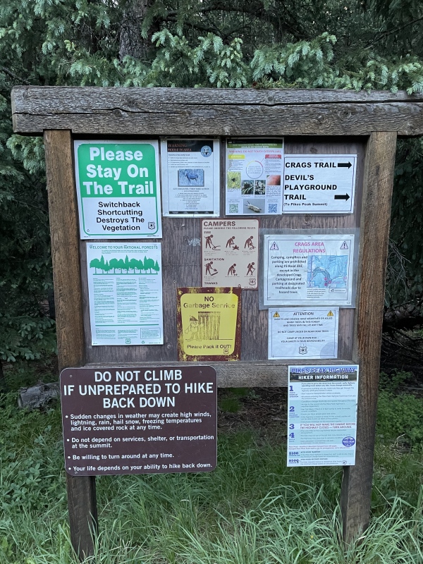

All things considered, for not having been at altitude since a February skiing weekend, I felt pretty strong on the first two miles. Besides seeing a mountain lion scamper across the trail about 60-80 feet ahead of us around the 1.3 mile mark (prompting me to carry a large rock and bring up the volume of conversation with my dad), the first two miles were quick and "easy." In reality, this is because the bulk of the first elevation gain stretch occurs after mile 2.5, and I had clearly chosen not to think about that at the time either. 
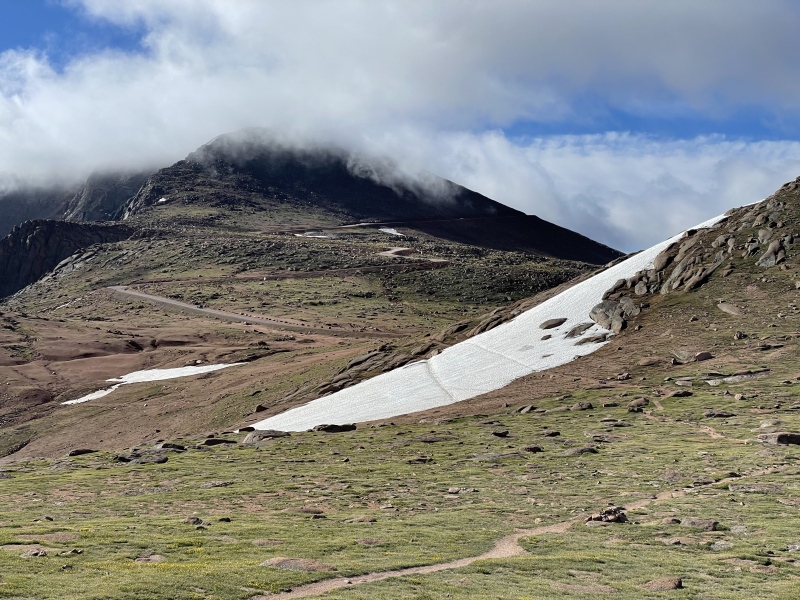
After a long slog (with no more lion sightings) up to Devil's Playground with some excellent views back out towards Divide, we encountered some heavy, heavy winds. That prominence really becomes killer, there's nowhere else for it to go. We crossed over the road and began finally heading in the direction of the summit, with some occasional tailwinds helping us along what is a more or less "flat" stretch of the route to Little Pikes. What was left of the small snowfield was easy to cross and that put us into sight lines with the summit overlook deck - I could almost taste the donuts that the visitor center was going to wring my wallet out for. 
The final summit push was enjoyable, even through the wind and clouds that had rolled in to cut off any hopes of summit views when we arrived. But arrive we did, and that was peak 12 in the book! We took some time to refill on water, enjoy some donuts and coffee, and snap some summit pictures. The last time I had been up Pikes was in 2009 when we drove up with some family from overseas, and my dad was pleased to see they kept the old summit sign up in the visitor center. As everyone who has hiked it knows, it's a "different" kind of summit experience to all the others (even to Blue Sky) but I welcomed that "human touch" to the peak with open arms - I needed that donut. Now, if I ever hear that there's going to be a church built on top of Holy Cross for Eagle County tourism purposes, I hope we all exercise some pushback... 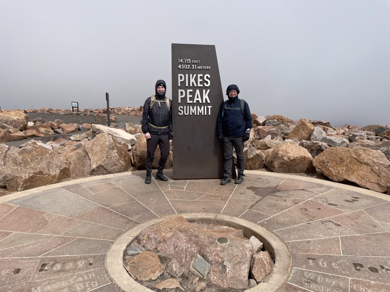

To our delight, the sun was coming out as we began the descent back down - signs of good things to come, right? Another oversight. Maybe I successfully dissociated or turned my brain off, but that stretch is no slouch - up or down. This was the section that really sealed the deal on my legs (and has finally pushed me to purchase trekking poles - what took me so long??), it was beating after beating on my knees. Why was this so tough though? Holy Cross didn't hit me like this, La Plata's loose descent didn't do me in. Hell, even that awful gully down to the willows after Blue Sky didn't have my knees feeling like this. What I had forgotten (or chosen not to consider), was that prior to beginning my tour-de-peaks last summer, I had already completed over 165 miles of hiking with considerable elevation gain, even if most was not above 10,000 feet - my time on trail in 2024 had been zero. I certainly was not laying around doing no strenuous physical activity for the past 10 months, but let's just say walks along Lake Michigan don't quite fit the hiking conditioning bill - this is what my knees were reminding me of on the descent. So the slog really tuned into a bit of a type 2 suffer fest. It seemed like we were always "2 miles away," that I'd seen that tree before, and it meant we were close to the log bridge! (we were not) Suffice it to say my knees and I were ready for the hike to be over. On the bright side, these hikes, no matter how tough, are great times to chat with your hiking partner. I was happy to enjoy some good conversation with my dad today - memories forged through talus and loose dirt stand strong! And then we were finally across that log bridge and back to the car, deciding what the post hike meal would be on the way back to Eagle County - the post-hike PB&Js in the cooler lacked the traits of being both fried and high in sodium which seemed just what was needed. Overall, another great day out in the mountains, even if it was a humbling reminder that the best way to train for altitude is by, well, training at altitude. It has not dulled my excitement for climbing Colorado's peaks one bit though. If anything, I'm even more excited for the next one (with some modified preparation). Thumbnails for uploaded photos (click to open slideshow): ")
")
")
")
")
")
")
|
| Comments or Questions |
|---|
|
|
Caution: The information contained in this report may not be accurate and should not be the only resource used in preparation for your climb. Failure to have the necessary experience, physical conditioning, supplies or equipment can result in injury or death. 14ers.com and the author(s) of this report provide no warranties, either express or implied, that the information provided is accurate or reliable. By using the information provided, you agree to indemnify and hold harmless 14ers.com and the report author(s) with respect to any claims and demands against them, including any attorney fees and expenses. Please read the 14ers.com Safety and Disclaimer pages for more information.
Please respect private property: 14ers.com supports the rights of private landowners to determine how and by whom their land will be used. In Colorado, it is your responsibility to determine if land is private and to obtain the appropriate permission before entering the property.

