| Report Type | Full |
| Peak(s) |
"North Traverse Peak" - 13,085 feet "Grand Traverse Peak" - 13,063 feet "Palomino Point" - 13,101 feet "Mt. Valhalla" - 13,202 feet |
| Date Posted | 07/01/2024 |
| Date Climbed | 06/29/2024 |
| Author | yaktoleft13 |
| The (other) Grand |
|---|
|
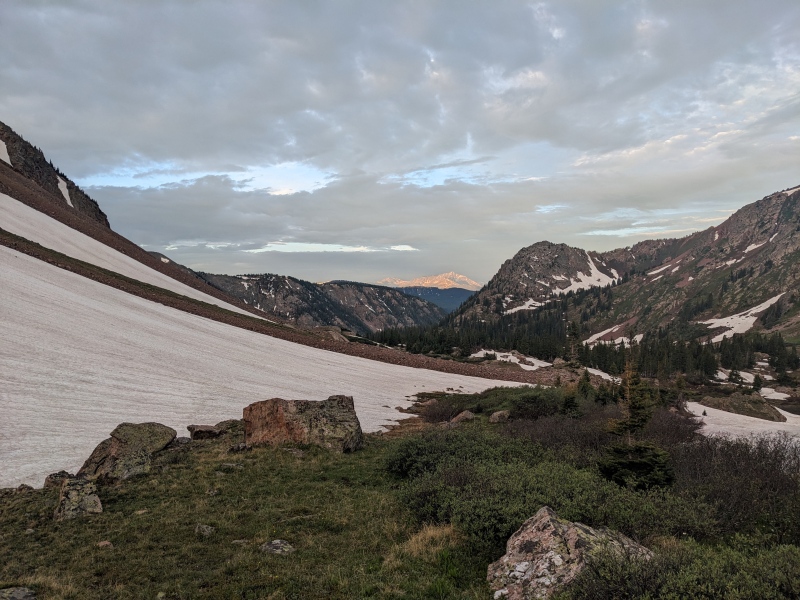
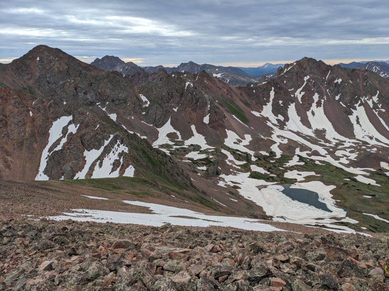
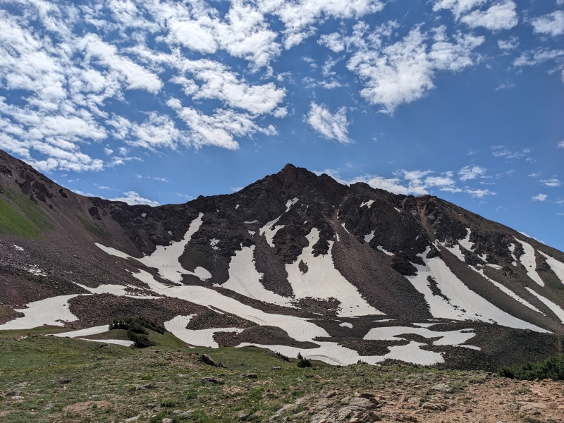
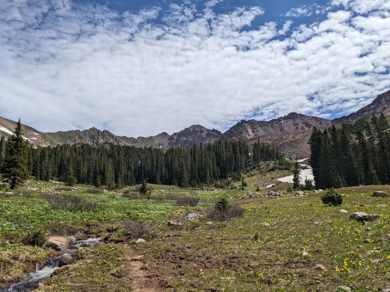
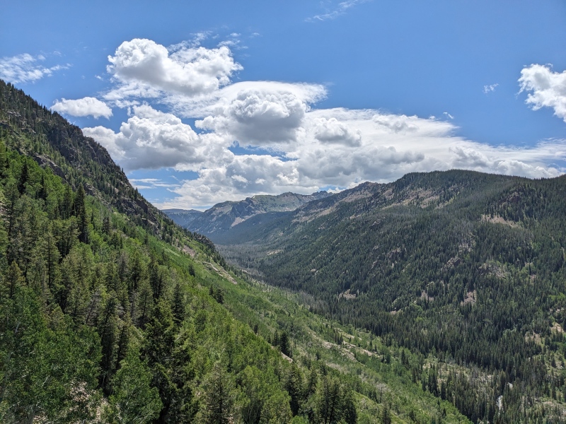
Route: North Traverse north ridge --> Grand Traverse --> ridge to Palomino Pt and Mt Valhalla --> southwest slopes descent Trailhead: Enter at Bighorn Creek, exit at Deluge Lake, paved roads back to Bighorn Distance: 15 1/2 miles Gain: 6,300 Difficulty: 5.easy Time: 9 hours The time had come for a good, long scramble. The last few months had been spent on snowshoes, snow slopes, and rock that tip-toed into the scrambling realm but didn't get the heart racing too much. But summer is upon us, and so is scramble season! I'd made plans with Brandon to do this route fairly last-minute. He and I had this on our radar for some time; in fact, since my wife and I climbed Snow back in 2022 and spied a ridge in the distance that seemed to telescope into itself, thus earning the unofficial name "Intussusception Ridge" (our golden retriever Kingsley suffered an intussusception earlier that summer and had to have 2 feet of intestine removed). At the time, the Gores seemed to be playing a cruel joke on us, reminding us of the close call with Kingsley and our good fortune in having pet insurance. While my wife wanted no part of that climb, Brandon sure did. Unfortunately, at 7PM the night before, Brandon suffered a work emergency and had to be on call all of the next day. I spent the next hour or so trying to find alternative plans for the day, but I settled on keeping plans the same, albeit solo. I have to admit that when the alarm buzzed at 1:30 AM, I wasn't really feeling it. I entered zombie mode and found myself aimlessly going through the motions: clothes on, double check the gear, climb out the window to not alert the dogs and wake up the baby (or worse, the wife), car on, go. I was so mindless that it wasn't until I stopped for gas in Evergreen that I surveyed my gear again, and crap! My helmet was sitting outside the garage on the ground, of no use to me. While the tank was filling, I rapidly scanned for other options to which I could audible, but I talked myself back into the Grand Traverse. Helmets primarily protect one from rockfall, and since I was solo, the risk of that would be low. And I wasn't planning on falling today, so helmet or no helmet, what's the difference? I made it to Bighorn Trailhead around 3:40 and was on the trail by 3:50. Immediately, I felt good. The shift in the mental from the drive to the hike was drastic and for the better. I zoomed up the trail and within 10 minutes was down to just short sleeves. The nice thing about Gore trails is that they usually don't mess around with flat terrain; they gain a lot of elevation right off the bat, which warms the body and the mind. After an hour or so of night hiking, first light revealed the outline of peaks to be climbed. 
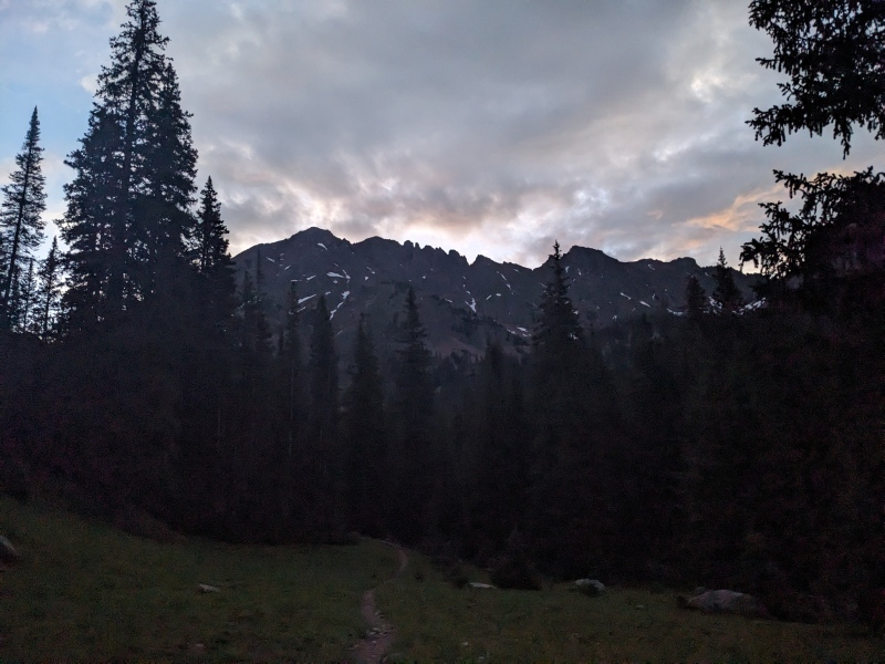
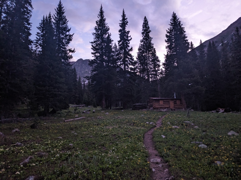
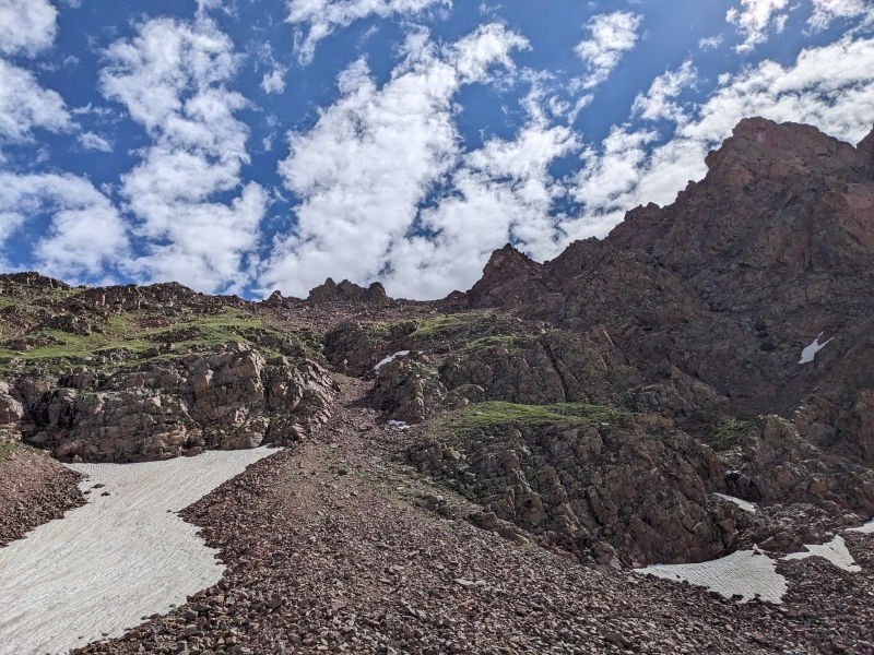
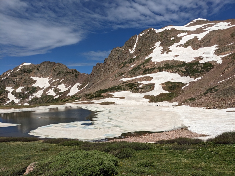
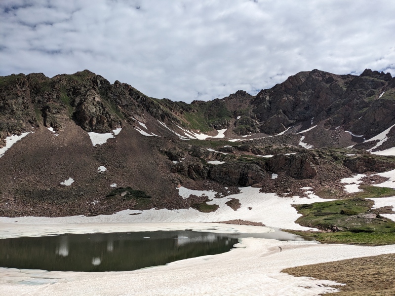
Shortly after passing the cabin, the Vail trail superhighway was lost amid a grassy meadow, heavily trampled by long-melted snow and runoff. No matter though, the route is simple enough: aim for the back of the basin. I veered left through the meadow, around ponds, and through trees, until I aimed back to the right for the line between talus and trees. I followed that edge until I reached the base of the NE slopes of North Traverse, which was to be my ascent route. There were a number of options to take, including a large snow field; but laziness kept the crampons in the bag and I climbed moderately loose scree and talus to the right of the snow for about a thousand feet, until I intersected the N ridge. The ridge held no difficulties, and I soon topped out on North Traverse Peak, just over 3 hours after leaving the car. 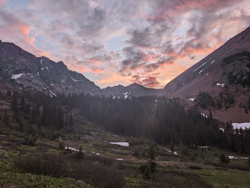
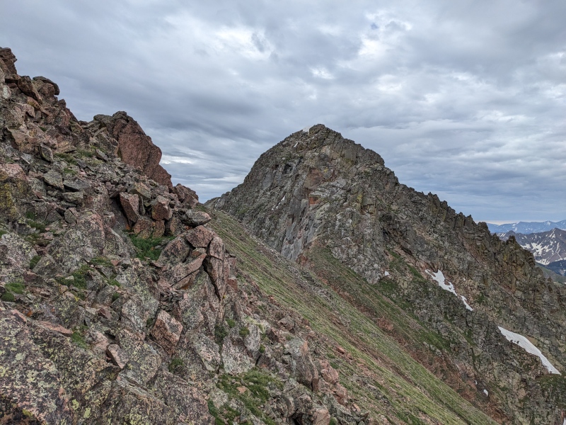
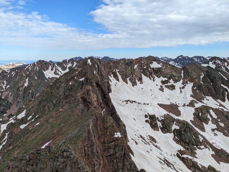
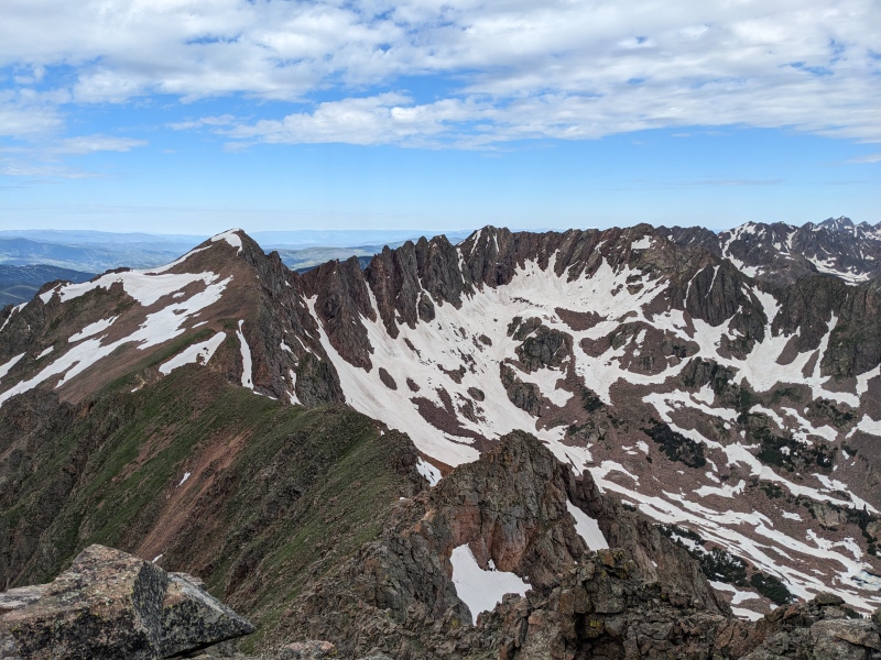
The weather was moody in the morning. The forecast had a clear morning with a decent chance of thunderstorms afternoon, but most of the visible sky was blanketed in a thick layer of low clouds. They weren't particularly ominous, and I figured they'd break once the sun gave them the business, but their presence kept the sun off me on the ridge and forced me to put on the one jacket I'd brought. I paused briefly on the summit to eat a protein bar and a string cheese, then took off for what was going to be the meat (or cauliflower steak, for my veggie friends) of the day. The scrambling began almost immediately, and the dropoff to the east was sheer most of the way. However, the scrambling wasn't difficult yet, and after dispatching a few small knife edges and a few towers, I reached the prominent bump that marks the 1/3ish point of the traverse. As I was able to see later in the day, that first third of the traverse is Intussusception Ridge, which, like Kingsley, I was now past. 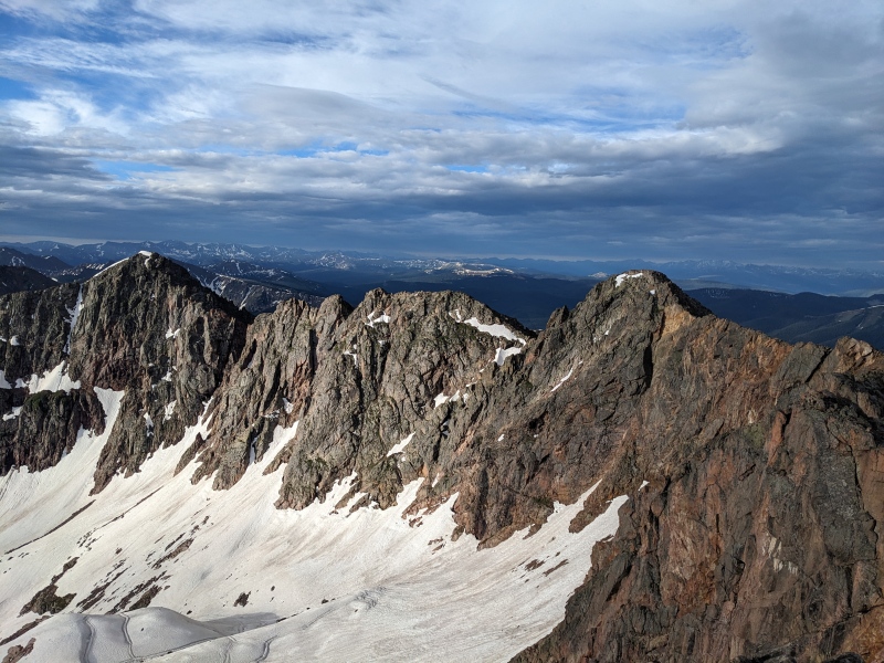

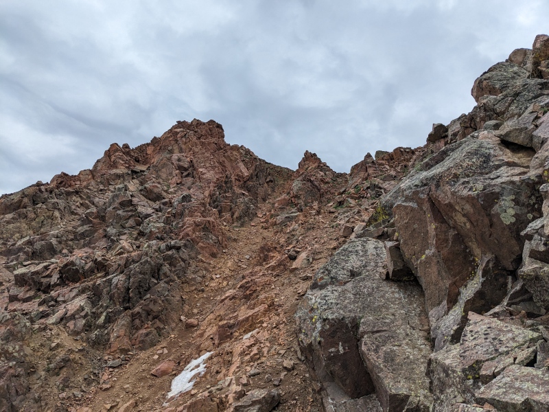
From there, the section of ridge that the sky illuminated so vividly on my hike in began. It starts off with an out-of-character semi-grassy ascent of an easy bump, but the view from the top promised that I was about to be in it. The next section of ridge was a series of jagged towers that offered no clues as to whether the downclimb off the back would be viable or not. My strategy became to climb each tower, look to see if the ridge proper went, and if not, look to the west side for a bypass. Generally, west side bypasses were present and would keep the difficulty to the 3rd class range, but the best terrain was usually on the ridge crest. Of particular note: the second tower does not go ridge proper and to bypass to the west would have required an exposed 5th class step-around onto a steep slab with downsloping hand and foot holds that did not inspire confidence. I backtracked and found a grassy 3rd class ledge system on the east side that went easily. 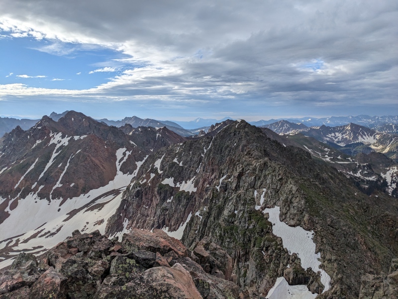
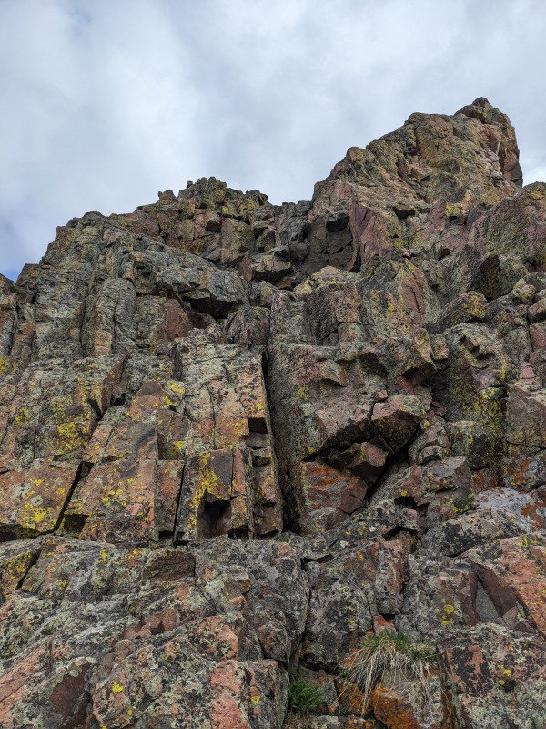
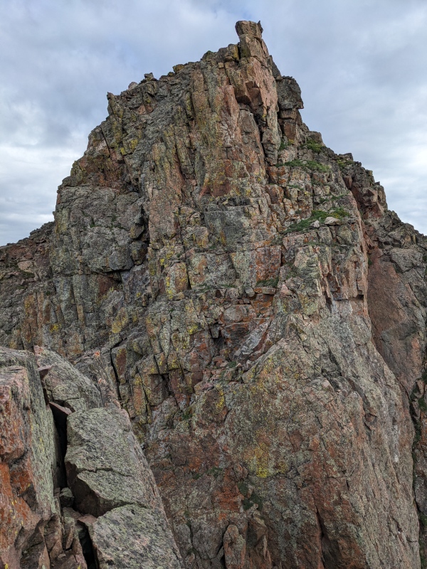
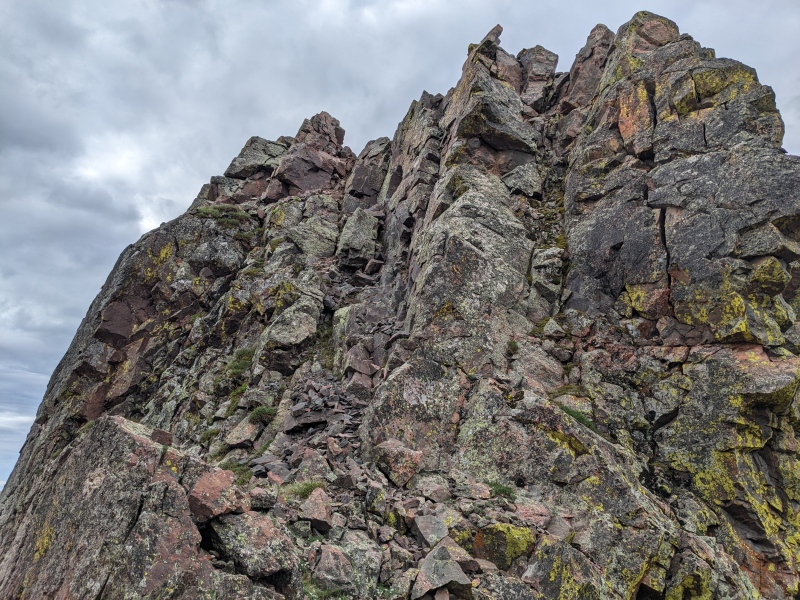
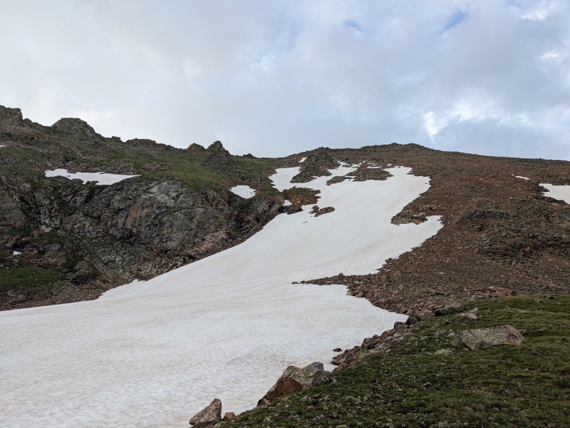
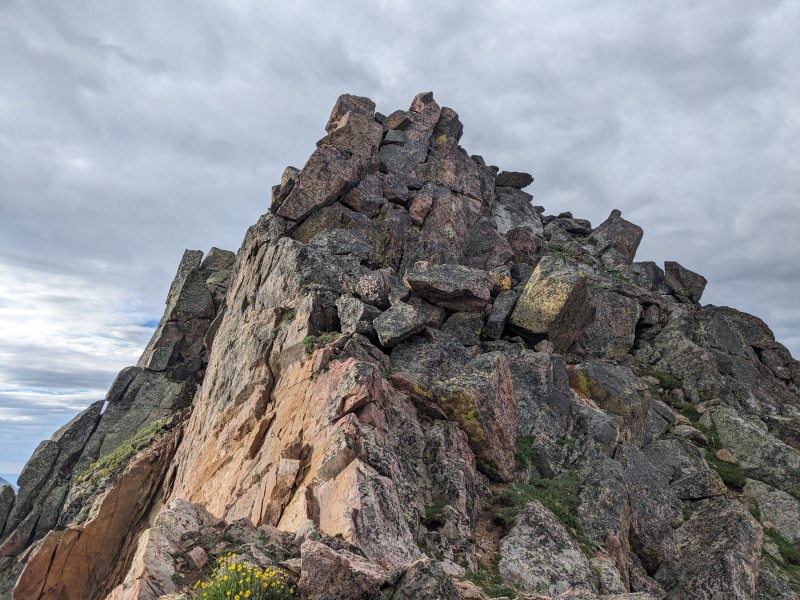
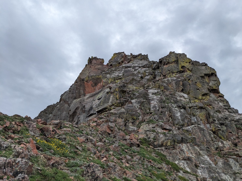
After I climbed to the top of what I believe was the fourth tower, I came across what was certainly the hardest section of climbing on the route. In hindsight, the best move would be to bypass the tower on the right to a small notch, visible in the picture below, and downclimb some 3rd class rock to pass the difficulties. What I did, however, was climb to the top of the tower (as I had every tower), look down, decide "I can probably make this go", and send it. The terrain I found myself in was sketchy, to say the least. The wall towering over me to my left was slightly overhung and all platforms I could use to descend were downsloping and topped with occasionally loose rock. On top of it all, I had brought an ice axe (for training weight, I guess) and had it and my poles stashed on the left side of my backpack, so they kept ramming into the wall and trying to catapult me off the ledges to the right, which....wouldn't have been ideal. I managed to lower myself down most of the way when I encountered a lengthy 5th class drop with the only handholds being a flake a couple of inches disconnected from the wall. I yammed on the flake to ensure it was solid, which it seemed to be, and lowered myself blindly onto a foothold below. A hand jam lower in the flake got me to the next foothold and from there, I was off the worst of it. I breathed a sigh of relief and continued upward. 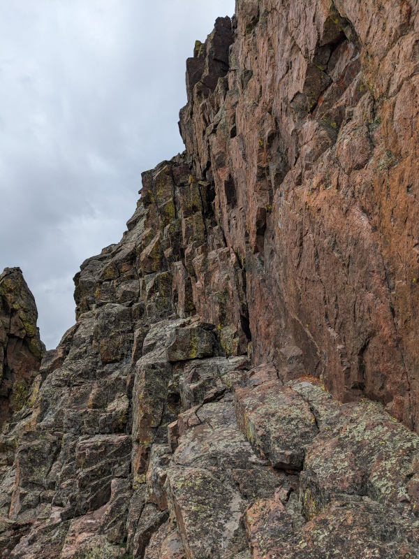
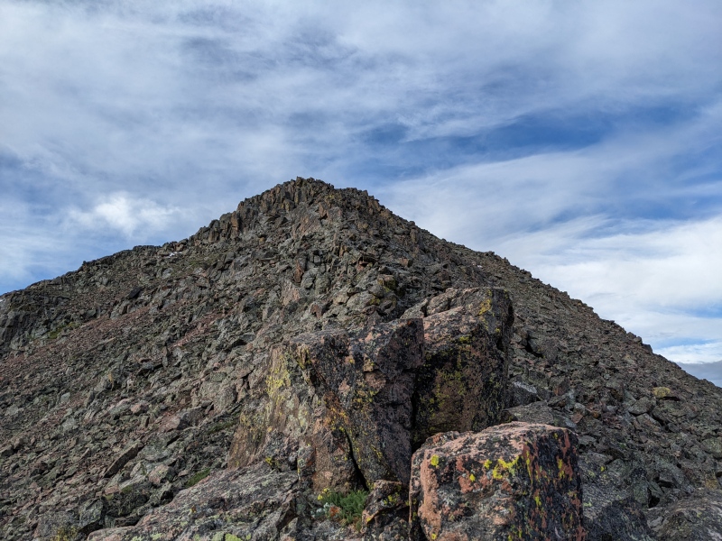
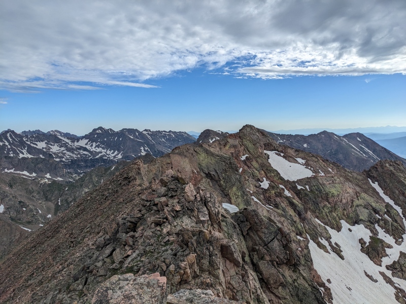
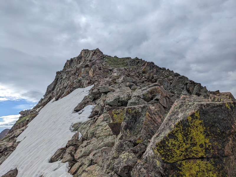
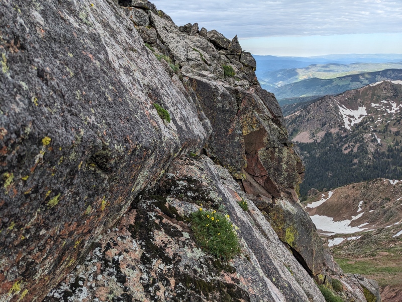
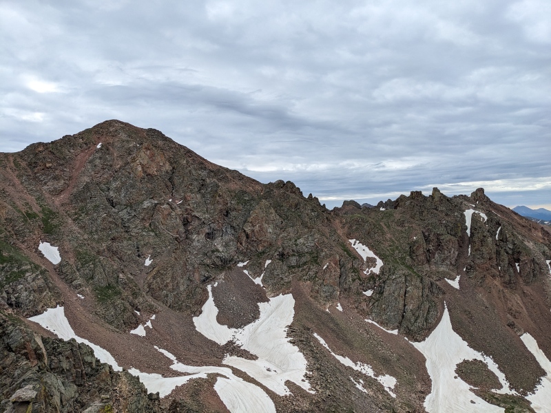
Past that tower, there was a deep notch in the ridge that climbed easier than it looked. I started up it from the saddle, traversed up and right to hit the ridge on the skyline, and followed that up to the top. From there, a grassy sidehill around a point that didn't look worth climbing led to the base of the summit climb. The final pitches were on grey, mossy rock, but climbed well. I found a small ledge traverse that did not rival the Partners Traverse ledge, but still gave some good excitement. Just below the true summit, there was a difficult spot because snow blocked possible alternatives. I attempted a v-slot, but the final move was rather committing, so I backed off. I can't really remember what I ended up doing, but I found a manageable ascent route and topped out on the summit of Grand Traverse! The traverse had taken about an hour and twenty minutes, from summit to summit. 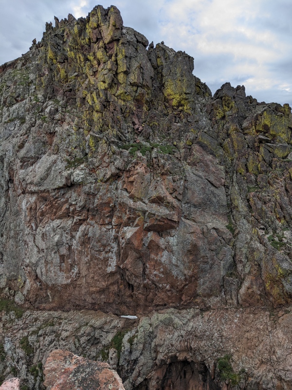
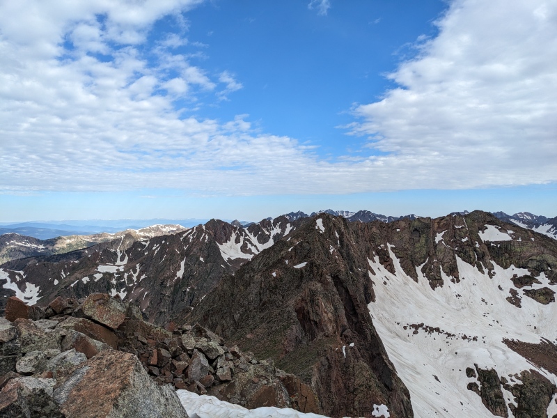
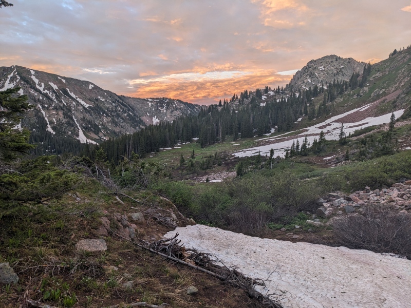
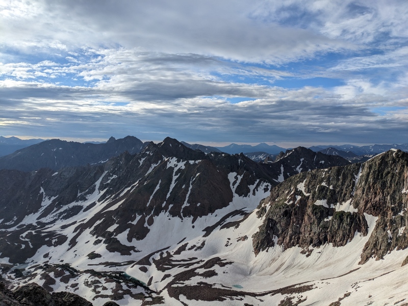
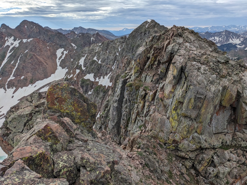
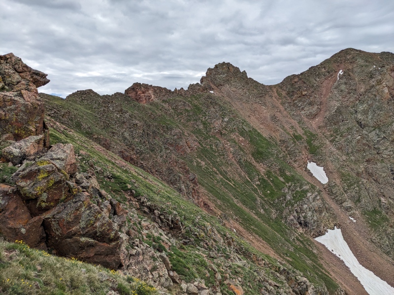
I didn't linger on top of Grand Traverse, as the clouds still hadn't broken and I wasn't done with the day. The descent off of Grand toward the low point between palomino held the only consequential snow of the day. Just below the summit I traversed to the north side of the snow slope, where a strip of rocks were visible. I followed that down until the snow engulfed it and found a place to cross, then descended talus and grass all the way to the low point between the peaks. This was the easiest terrain of the day. The ridge between the saddle and Palomino certainly looked to hold some interesting terrain, and I was keeping my eyes open for a good descent that didn't involve going too far toward Snow. 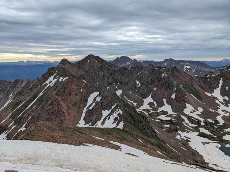
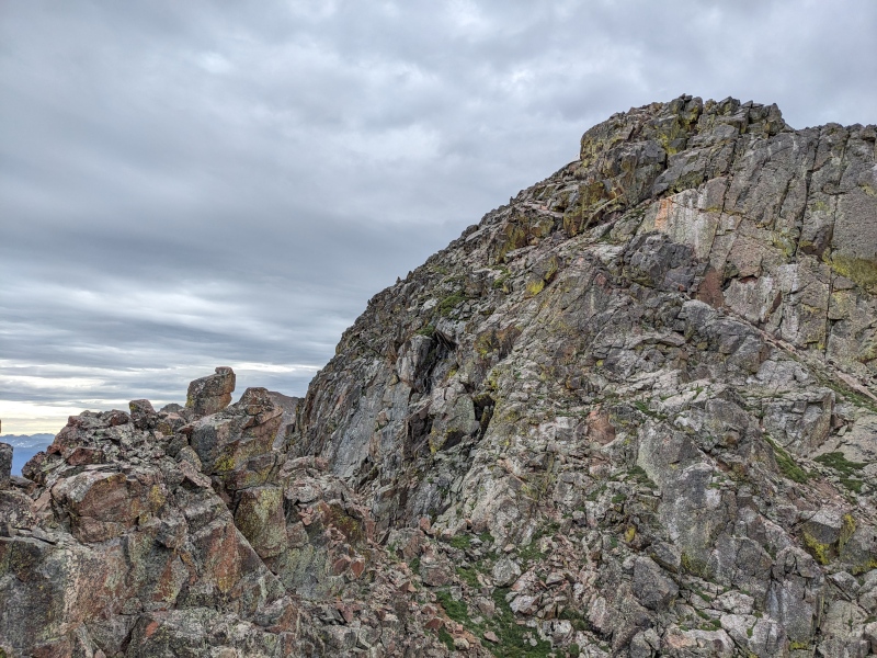
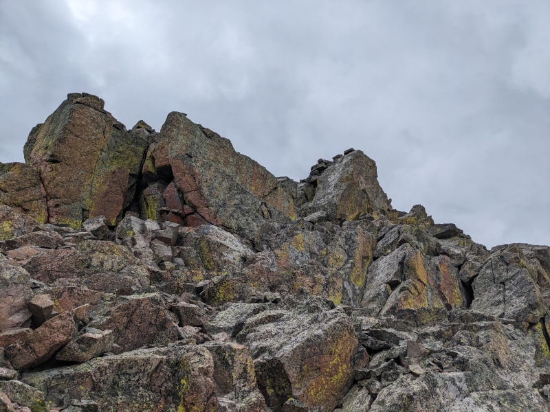
While not a walk-up, the ridge difficulties below Palomino ended up not being a cause for concern. The scrambling was easy and there weren't really any surprises. In fact, a good portion of the ridge was cairned! I ended up following the cairns at one point, and they pointed me toward a nasty orange gully, which I elected to avoid and instead climb up the rib to the right. Before long, I was past the jagged section, with only the summit block of Palomino to go! I also was able to eye a few possible descent routes from Valhalla. One involved descending the ridge toward Snow a bit, then doing a skiier's left descending traverse above some cliffs on a grassy ledge to reach the sea of talus below. The other one involved backtracking to the saddle between Palomino and Valhalla and scree-skiing while avoiding sporadic cliffs to reach the sea of talus below (as you may guess, the sea of talus below was unavoidable). 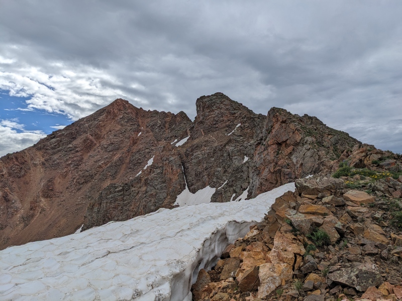
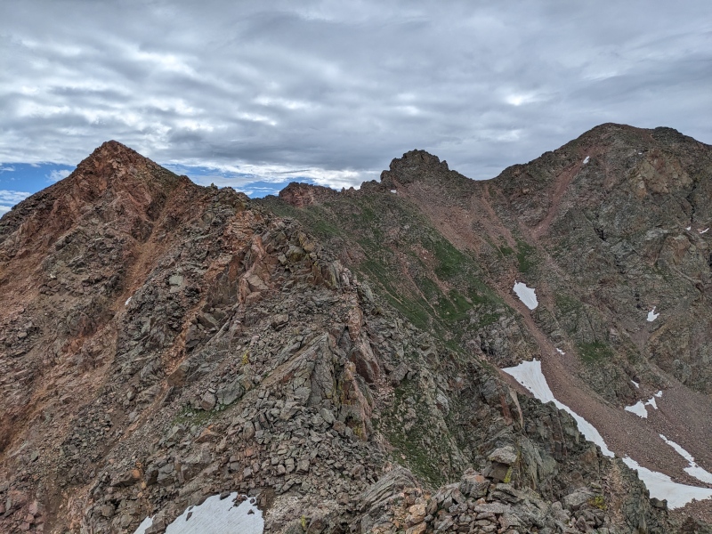
The scramble up Palomino was surprisingly stout. I originally took a direct route up to the summit from the ridge, but ended up traversing partway toward the Valhalla side before finding my route. The view of the Grand Traverse was legendary. 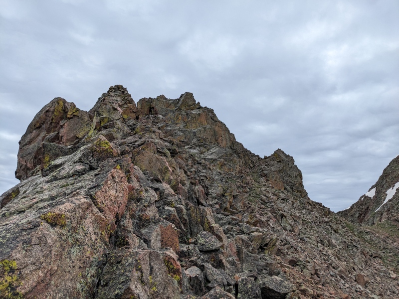
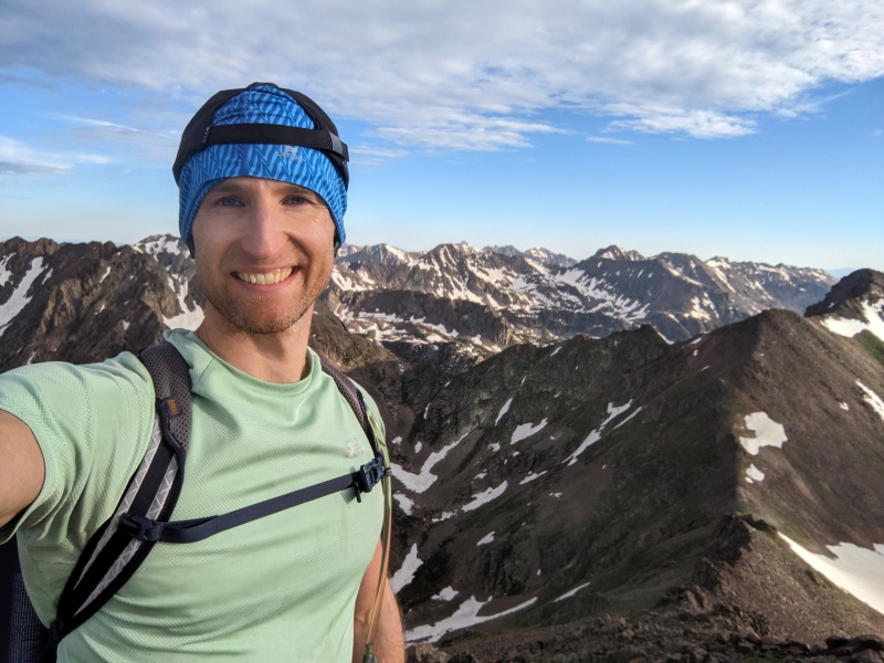
The ascent of Valhalla from Palomino was trivial. After maybe a couple hundred feet I stood on peak number 3 1/2 of the day, full traverse complete! Right as I topped out on Valhalla, the sun finally worked its magic and burned off the cloud cover that had lingered most of the morning. I'd rather have reversed it so it was sunny and warm on the ridge and cooler as I was descending, but can't really complain about such a nice day! 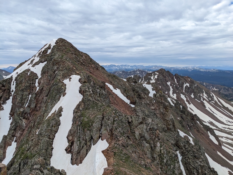
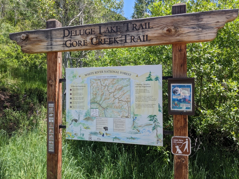
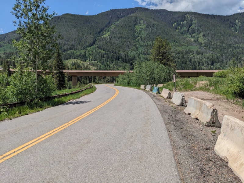
The day's not done until you're at the car, so after a food break downward I went. I elected to take the slopes from the Valhalla/Palomino saddle and just work my way through the cliffs. As it turns out, the cliffs really weren't hard to navigate, and if you pick it right, you can scree/talus surf pretty much the whole way down! Lower down, I trail-runner skiied some lower angle snow slopes and made it back to the lake. I half-jogged my way down, only seeing 4 other groups, until a mildly rolled ankle a half-mile before the Deluge Lake trailhead forced me to slow to a walk. Once at the Deluge Lake Trailhead, I still had to walk the pavement to get back to my car at the Bighorn trailhead. Google maps insisted there was a way to shortcut directly up to the trailhead, but after investigating, Google wanted me to go through a roaring creek culvert and drown myself. Instead, I elected to add a tenth of a mile and walk surface streets all the way back to the car. 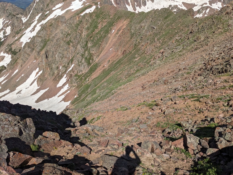
Though it was a little bittersweet to do this one alone, it was still a wonderful day in the mountains. And nothing beats the freedom of being up on a high alpine ridge alone, headphones in, nothing on the mind but where to next place your hands and feet. That was today. And today was perfect! 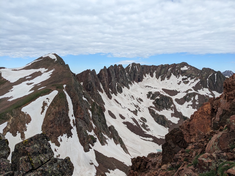
Thumbnails for uploaded photos (click to open slideshow): ")
")
")
")
")
")
")
")
")
")
")
")
")
")
")
")
")
")
")
")
")
")
")
")
")
")
")
")
")
")
")
")
")
")
")
")
")
")
")
")
")
")
")
")
")
")
")
")
")
")
|
| Comments or Questions | ||||||
|---|---|---|---|---|---|---|
|
Caution: The information contained in this report may not be accurate and should not be the only resource used in preparation for your climb. Failure to have the necessary experience, physical conditioning, supplies or equipment can result in injury or death. 14ers.com and the author(s) of this report provide no warranties, either express or implied, that the information provided is accurate or reliable. By using the information provided, you agree to indemnify and hold harmless 14ers.com and the report author(s) with respect to any claims and demands against them, including any attorney fees and expenses. Please read the 14ers.com Safety and Disclaimer pages for more information.
Please respect private property: 14ers.com supports the rights of private landowners to determine how and by whom their land will be used. In Colorado, it is your responsibility to determine if land is private and to obtain the appropriate permission before entering the property.


