| Report Type | Full |
| Peak(s) |
Crestone Needle - 14,196 feet "Obstruction Peak" - 13,812 feet Colony Baldy - 13,692 feet Broken Hand Peak - 13,575 feet |
| Date Posted | 06/28/2024 |
| Date Climbed | 06/22/2024 |
| Author | Camden7 |
| Return to South Colony | |||||||||||||||||||||
|---|---|---|---|---|---|---|---|---|---|---|---|---|---|---|---|---|---|---|---|---|---|
|
Have you ever looked at a map and noticed that a ridgeline does in fact connect Obstruction Peak and Colony Baldy? Well, I certainly did when I was considering how to bag these two orphans, but was surprised to find no information on this site or others regarding the ridge. Google Earth didn't elucidate anything helpful, and Gaia doesn't yet have high-res slope angle for that area. Well, I guess I have to figure it out the old fashioned way: with boots on the ground. Dad and I had both contracted some horrible disease resembling the flu, complete with headaches, fevers, body aches, runny noses, coughing, sore throats, the whole deal. After a full week of sleeping instead of working we figured we would be well rested for a mountain adventure. (False). We considered a number of options in the Elks and the Gores, but became worried about snow blocking vital weaknesses and raging snowmelt-fed streams blocking access to our peaks. So on Thursday night when Dad suggested a visit to the South Colony Lakes, I was all in. We left Golden around 2:30 and languished in C-470 and I-25 traffic for quite a while, picking up food in C Springs before rolling through Westcliff and up to the 4wd TH. It rained for most of the drive. I drove up to the TH and it was the roughest 4x4 driving I have done. The Tacoma ate up the fairly pedestrian road, but I still had fun, and I suppose everyone needs to learn on something easy. Friday, June 21, 2024 - Failed Approach
We quickly saddled up and began walking at 7:30. Within 5 steps from the truck, the rain resumed, light for the time being. We both felt that our sicknesses had redoubled their efforts to kill us, aided by the increase in elevation and cold, damp weather. The old 4x4 road was flowing with rainwater and soon our feet were soaked, then the rest of us as the rain grew heavier. Soon, we needed headlamps, and shortly after turning onto the trail, we concluded that we should have slept in the truck. We were drenched, freezing, moving really slow, still well below the lakes where we intended to camp, it was fully dark, and the rain was only getting stronger. We decided to pitch our tent quickly before the hillside steepened on the climb to the lake. Not reaching our intended camp would surely leave us trying to catch up for the entirety of the weekend, but continuing no longer seemed viable. In the short time it took to set up our tent it was filled with water by the heavy rain. We used our already soaked clothes to absorb the water, then wrung them out outside, repeating until the massive puddles began to disappear. All our gear was soaked through, we were freezing, and we went to bed frustrated that we had started hiking at all, both feeling exhausted and headachy. Saturday, June 22, 2024 - Move Camp then Obstruction Peak to Colony Baldy
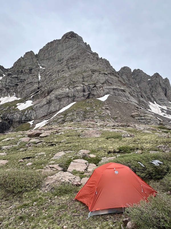
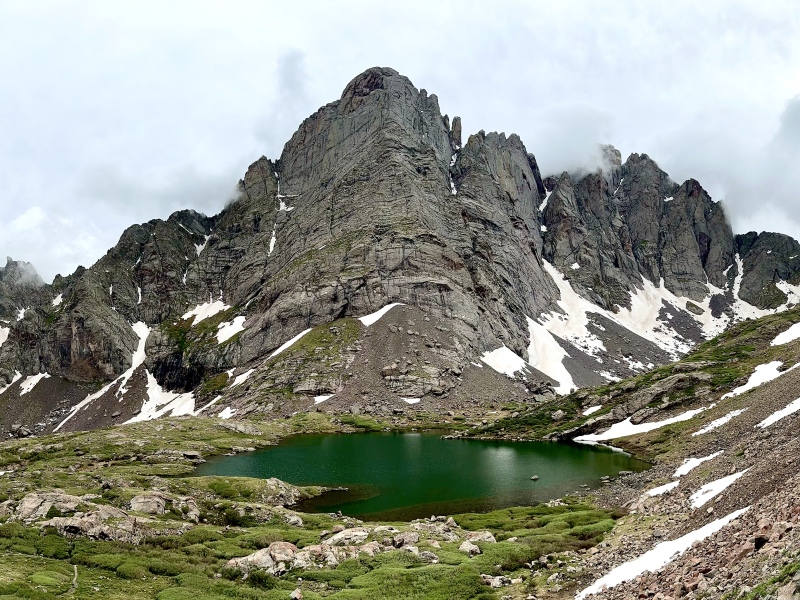
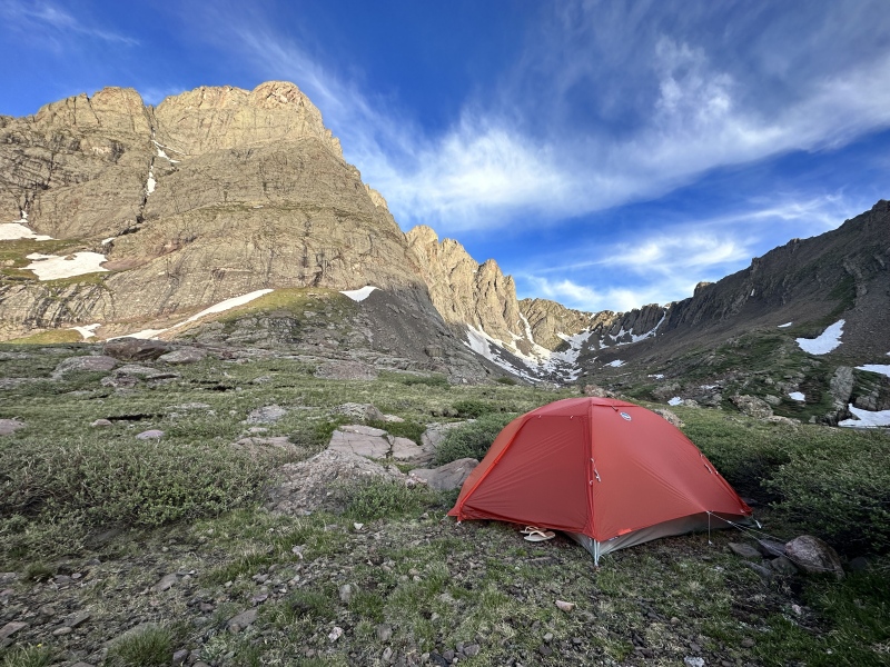
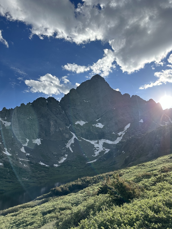
The morning was dreary, with heavy cloud cover, a humid breeze, and droplets of water coating the forest. We packed a wet camp and continued to Upper Colony Lake, where we found a nice campsite overlooking the valley. We set out our wet gear and enjoyed a lazy morning at camp, making two coffees each and basking in the glorious presence of the Needle. Finally, our tent was dry enough to set up and get everything squared away. We filtered some water and did a little light bouldering on the beautiful conglomerate near the lake, before finally moseying out of camp around 10:30 am. 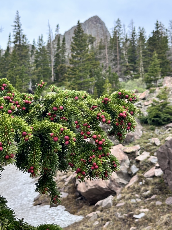
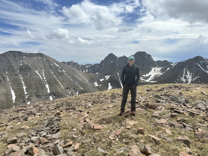
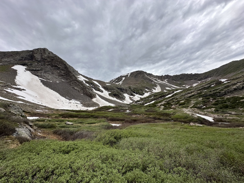
At our diminished pace it took us a little over 15 minutes to get up to Humboldt Pass. The ridge over to the Bears Playground is gradual and short but somewhat rough. We attempted to follow a goat trail around the side but quickly found that the ridge crest was definitely the way to go. Some very fun class 2/2+ leads over what I have heard called "Colony Point" to the vast expanse of the Bear's Playground. I had crossed this ridge when I descended the northwest couloir of Crestone Peak a few years prior, but I hardly remembered it. After taking a lunch break at the Playground, we continued slowly up to the summit of Obstruction Peak. Most of the route is class 1 tundra, but the summit ridge offered some very solid and fun class 2 with great views. Even after a 20 minute lunch break, and a glacial pace up the final 600 vertical ft, it took just under 2 hours to reach the summit from Upper South Colony Lake. Awesome views from up top. The east summit was obviously higher but we tagged the west one too, just in case. At 13,812 Obstruction Peak was my highest left in the Rockies, fun to check it off. 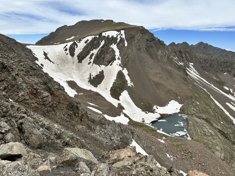
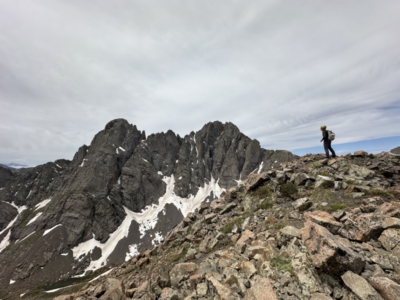
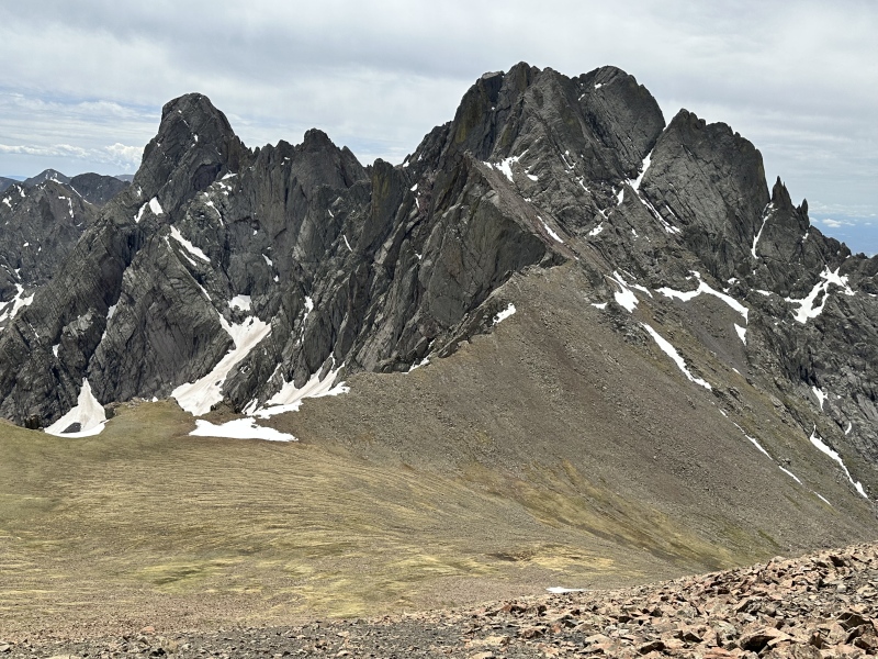
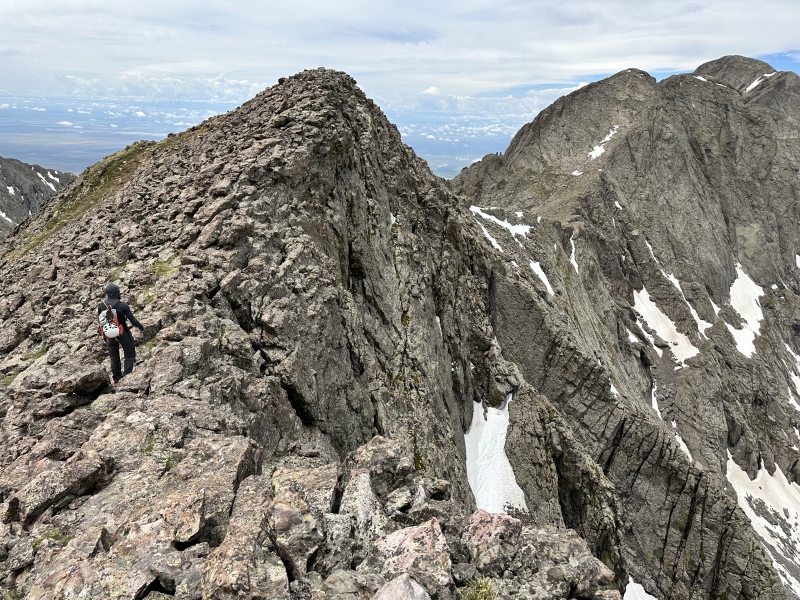
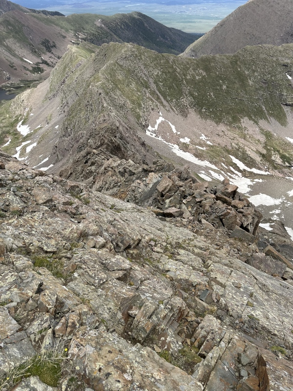
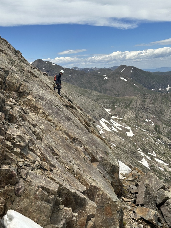
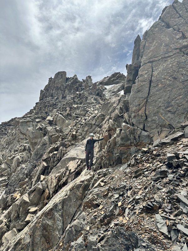
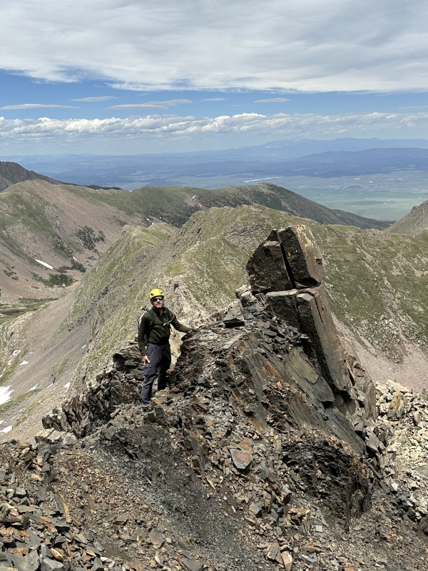
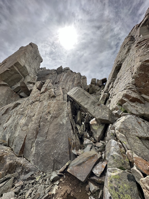
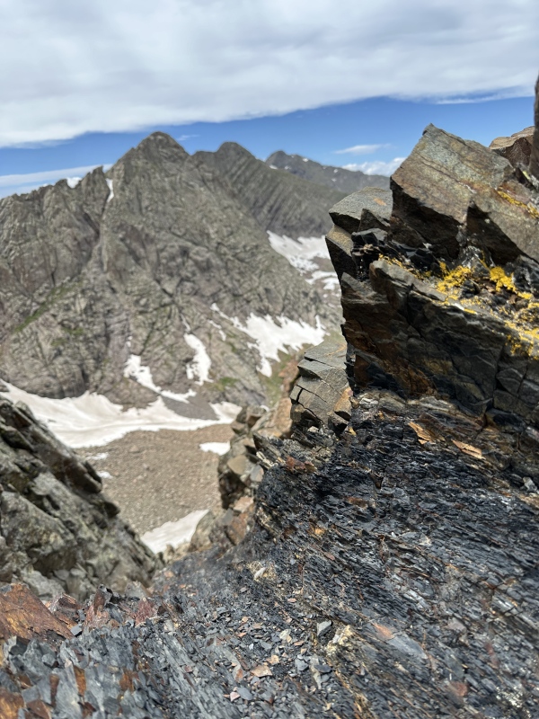
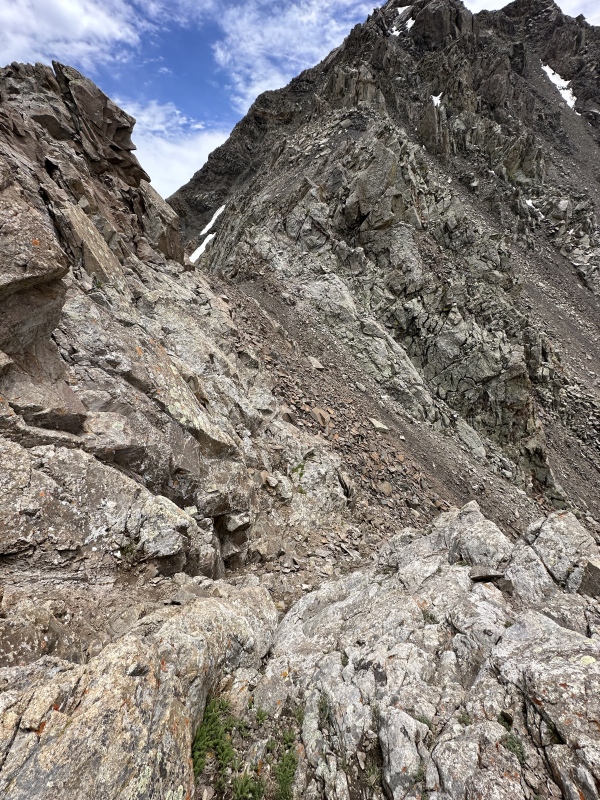
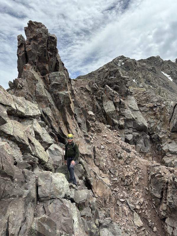
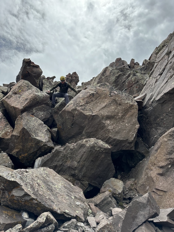
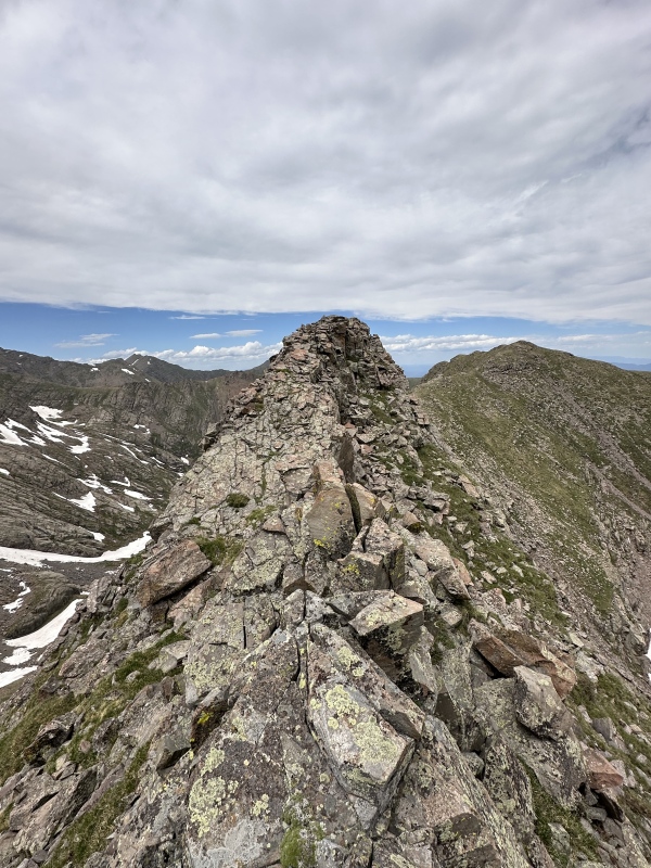
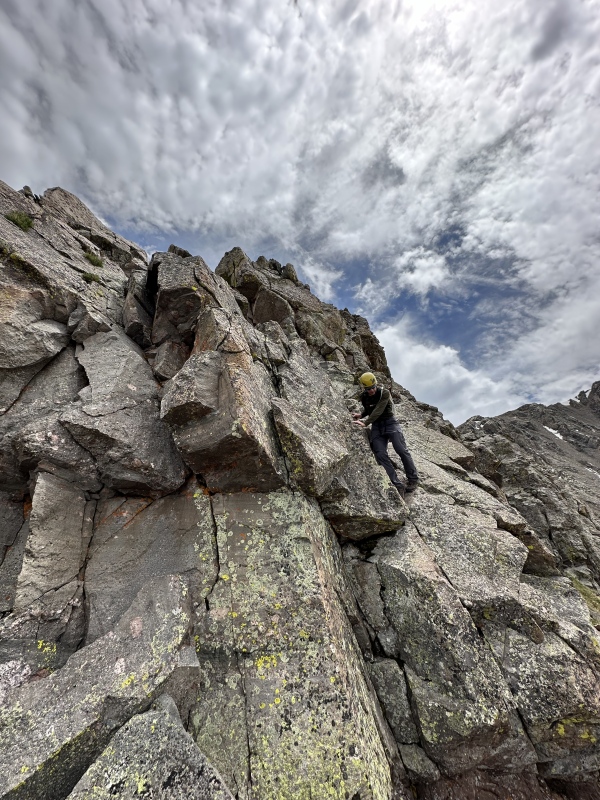
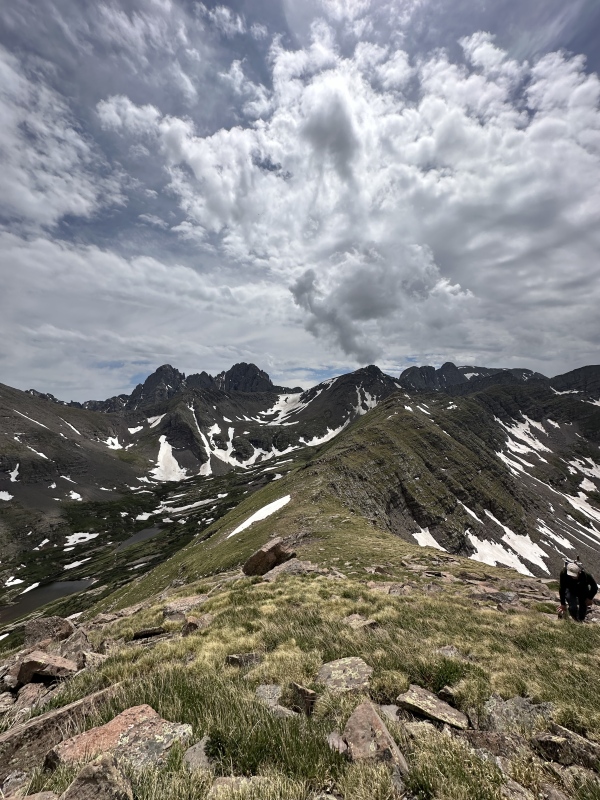
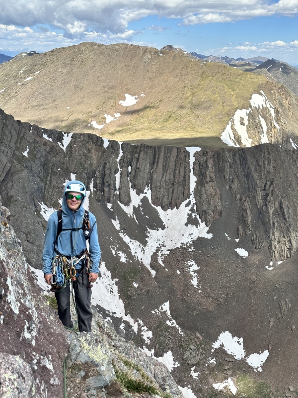
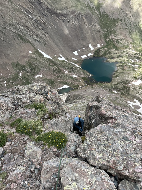
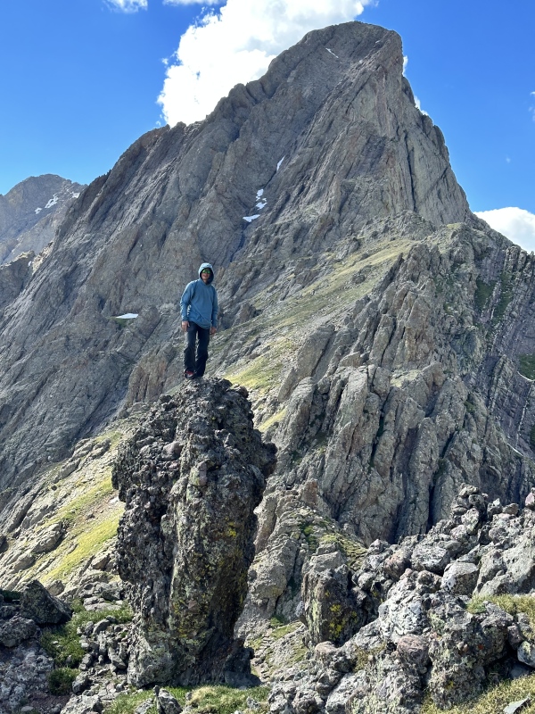
After another long break to enjoy the spectacular views of the Crestones and Willow Lake area, we set off. At the east side of the summit ridge, instead of returning to the Bear's Playground, we dropped north into the unknown. The initial 500 ft descent on the ridge is steep, broken, rotten, and convoluted. The rock is a peculiar mix of different things, from conglomerate to shale, and with many curiosities in between. The rock is very friable in most places, and piles of loose talus adorn the steep-sided ridge. Many fierce towers and dikes make the ridge appear very difficult, and I can imagine why not many people have set out to do it, and no one had written it up. I won't labor over every detail, but the news is that it does go, and was surprisingly fun. I would allot 45-75 minutes from Obstruction Peak to the end of the scrambling portion, depending on your group size and confidence. Some will be much faster. The portion of the ridge that descends steeply is very rotten, and not particularly fun. With a little caution it never exceeds easy class 3, staying near the ridge crest and dodging left or right when an impassible tower or drop is reached. We never strayed more than 30 ft from the ridge crest. There is very little exposure, but the rock cannot be trusted. The position is very beautiful and unique, and the geology quite interesting. Suddenly, the ridge flattens and the rock changes back to Crestone conglomerate. The ridge become more or less level, with a series of gradual sawblades and very steep sides. This is the section I was most worried about shutting us down, but it turned out to be a great scramble. The broad catwalks are easy but unique and cool, and each end in a short down climb. There is very little exposure and despite each one looking fierce upon approach, they are all class 2+ or easy class 3 with solid rock and little in the way of exposure. The final drop to gentle, tundra-covered terrain looks very serious, and is the ridge's crux. Dropping from the tower directly on the ridge crest then slightly left yields the easiest route. The 35 ft down climb is mostly class 3, with the final 7 ft to the ground pushing class 4. The rock is exceptional and the exposure truly zero. You are above a tundra bouldering pad. 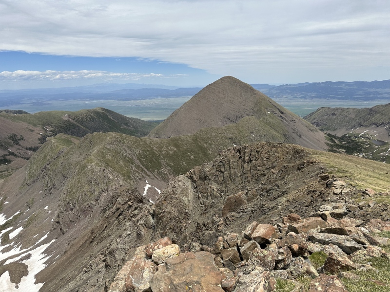
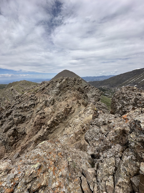

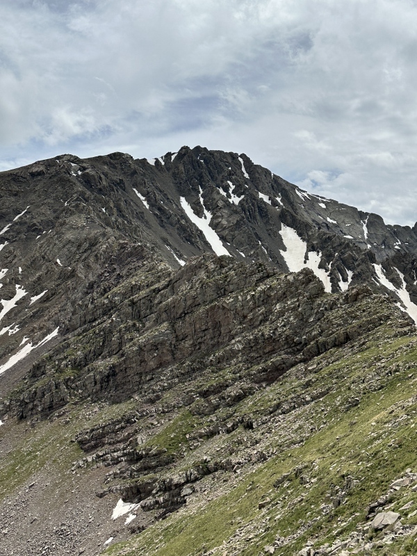
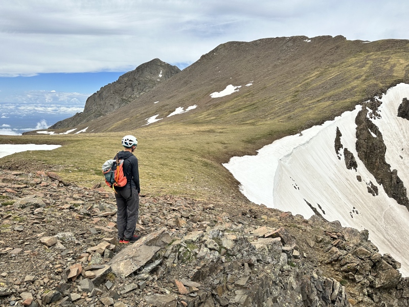
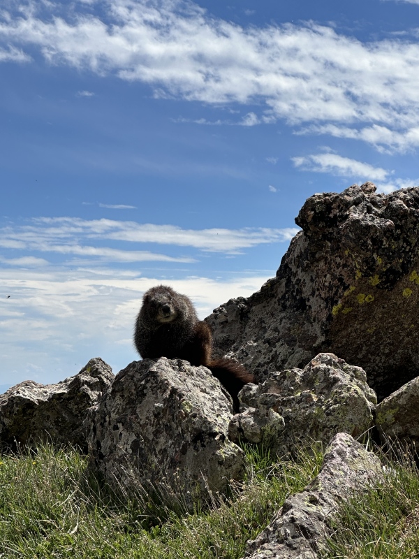
The remainder of the long ridge down to the saddle is fast and easy tundra with a few gratuitous 3rd class moves as the ridge switches layers. We skirted the first bump about 100 ft below the summit on the south side, then stayed on the crest the remainder of the way. We arrived at the saddle about 1.5 hrs after leaving Obstruction Peak. It would be way faster if we weren't so sick, at 13,000 ft we weren't doing more than 2 mph even on tundra. The final approach to the summit of Colony Baldy is via the southwest ridge. From the saddle it is 922 ft up, on mostly class 1 tundra. A number of rock bands cut through the ridge, each offering a short section of class 2 boulders. One is a bit steeper, and can be tackled directly (10 ft of 4th class) or skirted on either side. We hung some gear here, as to keep it safe from the absolute marmot infestation that has taken over the Sangre's. I swear we saw 150 of the little troublemakers across the weekend. Again, no summit register to be seen, but we relaxed for about 30 minutes on top, eating some food and complaining about our headaches, exhaustion, and weakened lungs. The views are just great. 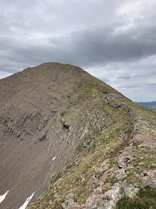
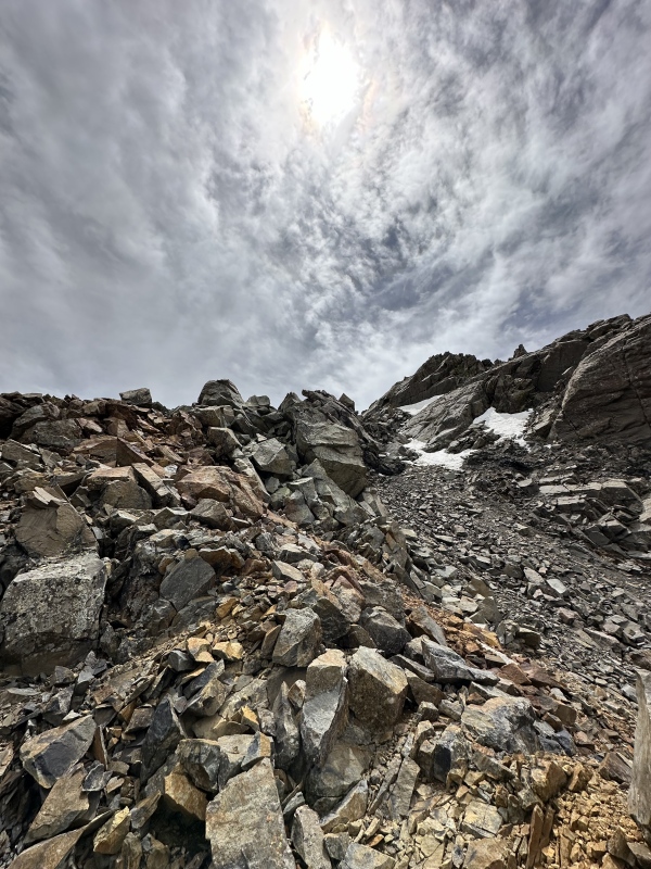
Now for the hard part of the day: getting back into the South Colony Basin. I absolutely recommend following the ridge back up towards Obstruction Peak for a while, until you can drop easily into the upper basin. Not wanting to retrace the ridge, we dropped directly into the valley, then bushwhacked upstream to our exit. This meant 1500 ft of heinous scree gully descending, instead of the shorter, grassier descent found further west. North Colony basin is a very special place, with a vast number of alpine lakes, beaver ponds, and swampy areas. The north wall of Humboldt is decorated with a great many alpine streams making chains of waterfalls 2,000 ft high as they tumble from snow patches near the ridge. A large cascade guards the head of the valley, and extensive fields of wildflowers flourish here. Alongside these lush areas are immense fields of thick willows – and thicker mosquitoes. Once getting far enough back west, we crossed the main creek on a treacherous snow bridge. As I am writing this it may have already collapsed. Crossing it otherwise might involve wet feet, unless you find a really good place to cross. 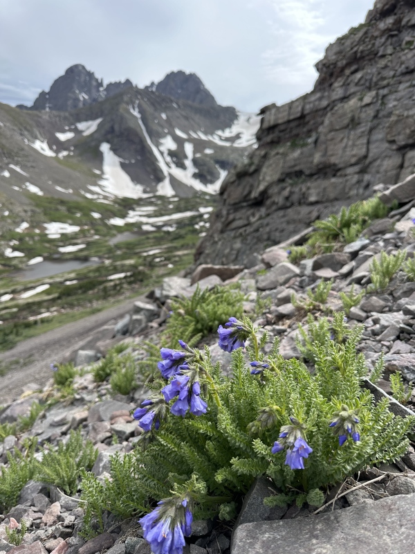
 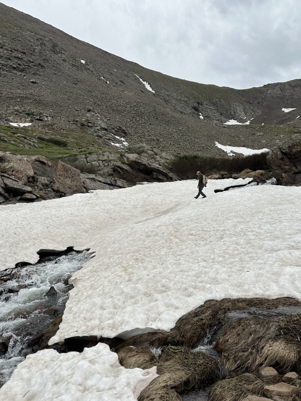
Reascending to Humboldt Pass was easier than we had feared. From the creek at 11,800, a short bit of willow-bashing escapes the lush valley floor. Stable boulders lead quickly up to the small basin at 12,200 below Humboldt. Vast fields of buttercups and a little more talus lead quickly up to the high bench just below the pass. The final 200 ft is very steep and looks improbable. With a little caution and route attention, it can be kept to class 3, but the rock is questionable, and the exposure is probably greater than any found on the actual ridge traverse. We finally reached the pass at 6:18 pm and hurried back down to camp, where we had a quick dinner and went to bed by 8:30. 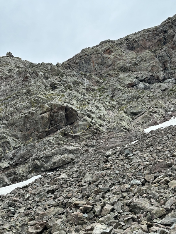
Sunday, June 23, 2024 - Ellingwood Ledges Direct Start + Broken Hand Peak + Exit to TH
We woke up a bit after 6 when the sun began filtering into the tent. We emerged into daylight to see a party moving up the scree to the base of the Direct Start. A few moments later a party of 3 rolled past our camp on the way toward the Ledges Bypass start. We had a relaxing morning, enjoying a warm breakfast, coffee, mostly packing up camp, and racking up for the climb. We figured we would never see either party again, as we started climbing after 8:30, giving the first party a lead of almost 2 hours, and the other party close to 1.5 hours, besides they were skipping half of the technical climbing, we surely wouldn't catch anyone. It took about 20 minutes to walk up to the base of the direct start. There are some fun optional 3rd class slabs that make it more solid, but the last bit is pretty unavoidable scree-bashing. We roped up and Dad set off up the first pitch.
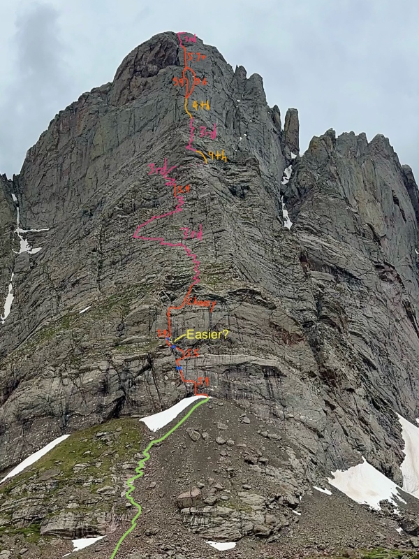
I made the mistake of wearing approach shoes for the direct start. I have climbed (followed) 5.7 routes in the Park in my TX Guides pretty happily but the conglomerate demands climbing shoes, much more slippery than granite. I will agree with the 5.4 rating on the 1st pitch. There is an old piton part way up and a shiny new two-bolt anchor at the top of P1. We simul climbed through, traversing slightly right then back in to avoid a steeper section, to more shiny bolts at the top of P2. We weren't planning on stopping part way up the direct start, but Dad wanted my two cents on route finding. While I was belaying, the party above us (and as we were later told, some very malicious marmots) were knocking seriously unacceptable amounts of debris down the route. We lost half an hour when I requested that Dad bring me up to a belay outside of the corner, but I really didn't want to read the words "we were too lazy to move the belay" in the next Accidents in North America. There was a bolt where we set the belay left of the gully, but I can't imagine that is the easiest way, because the traverse back in to the corner from here was solid 5.9 with a seriously committing karate-kick move. Definitely the hardest of the day. I have to imagine that staying in the gully is much easier, probably the often cited 5.6-5.7. Maybe there is a better exit from the direct start, but we trended up and right across some very brittle rock to the end of the technical terrain on the lower mountain. We packed everything up and unroped for the scrambling portion, traversing first out left then gradually back right to the arete. I definitely found myself on some 4th class moves, but 3rd class lines existed with a little more care. The exposure is pretty significant. With some luck a small ledge might arrest a fall, but you could bounce all the way into the lake. As we neared the arete again, and what I believe some people call the Red Knob, we caught the party of two. They were gingerly scrambling up the steeper band. Once they safely cleared it, we began up. I believe this is the 5.4 ramp some topos reference. The Ledges bypass comes in above this. This 40 ft pitch was definitely 5th class terrain and I haven't done tons of unroped 5th, so I was a little hesitant, mainly for fear of broken holds, but it went alright. A fall would be fatal here, and a rope is not such a bad idea. A few cracks would take gear very nicely. We crossed to the north side of the arete for the only time just behind the Red Knob, and followed easy ledges out until a ramp lead back up to the ridge crest. It was mostly 3rd class terrain but we did one slab move that I would rate 4th. Maybe it can be bypassed with different route choice. More easy and enjoyable 3rd class leads up to a large dirt ledge with a short step in the ridge. We roped up and tackled the 10 ft step directly, I would say about 5.5. We then simulled the rest of the way to the base of the crux headwall on easier terrain. It is possible to traverse north and follow a 4th class weakness around this step, and the remainder of the pitch doesn't exceed sustained class 4, but we felt it was faster and safer with a rope. Somehow the party of 3 was on the 5.6 pitch here, despite having a massive lead and skipping half the climbing, but whatever. We stopped for a snack break, but they hadn't made immense progress, so Dad decided to put up the 5.9 crack. The first half of the pitch is fantastic climbing on incredible rock, with a few stiff moves, while the upper half is easier but more broken and less fun. We weren't quite fast enough to pass the other party here, so we had to wait about a half hour for them to get out of the way. Uggh. During this time the leader of the party of two that we had passed came up the 5.6 route, but we managed to get moving before they had to wait too much. The upper pitch is really fun. I would say most of it is in the 5.2-5.4 range, but the crux bulge is proper 5.7 where a high foot and ring lock are required to pull yourself over the small overhang. When this fantastic pitch ends it is time to unrope and scramble up easy 3rd class to the summit. I choose to climb the more solid 4th to the north of the gully, but both were very reasonable. It took us over 5 hrs to get to the summit, but moving the belay out of rockfall from the one party and waiting for the other to move cost us a lot of time. I guess that is to be expected on one of N. America's 50 crowded climbs... Also, we were still moving very slow and feeling sick. A party of 2 on the direct start should probably take about 4 hours to the summit if they simul all but the last 2 pitches and unrope for the scramble, and don't have any other parties or delays to contend with. For gear, we brought a single set of small stoppers, double set of large stoppers, singles in small cams, and doubles in BD Cams 0.5-2. The big nuts were really useful, the small ones less so. Dad said that next time he would take doubles in stoppers #7-#10 (maybe 1 or 2 smaller nuts, but not required) and a single rack of BD cams from 0.2 to #2 with double #1 and triple 0.5. We agreed that hand-size hexes (as recommended on this site & mtn proj) would be very solid placements in a few spots, especially the 5.9 variation, but not worth the weight because stoppers were always just as good. We brought 18 draws so that we could simul a ways before needing to reconvene.
Starting the 1st pitch
An old piton 
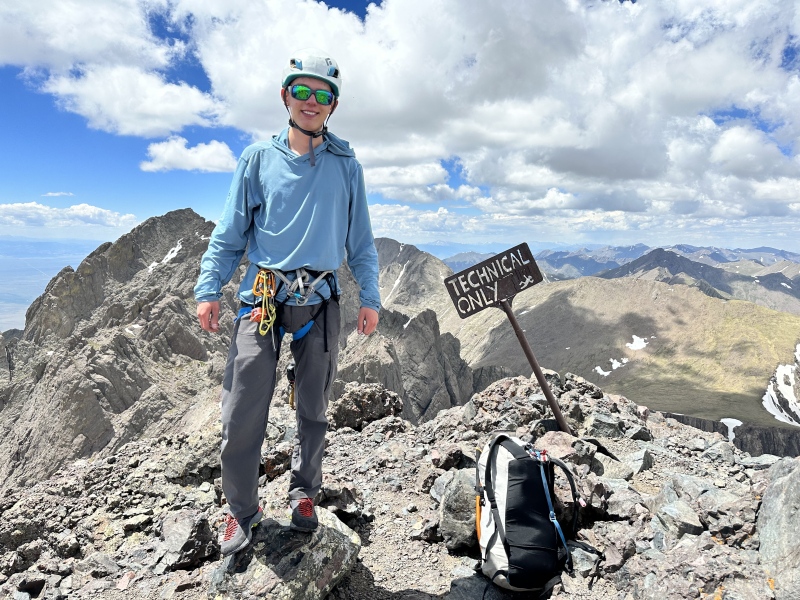
When we topped out the party of 3 was just starting to rig the rappel for the traverse, and Dad heard them say something about the Bag O' Stones linkup. They didn't have ice axes and were moving pretty slow, so I sincerely hope that they made it home safely (Crestone Peak still had snow on all routes and they didn't even leave the summit of the Needle until well after 2, probably less than 1/4 of the Bag O' Stones completed after 7 hours from the upper lake). I first did the standard route on the Needle when I was 12, back when the West Gully was standard, and it was considered class 3. I found it to be a challenging but really fun route. I personally think the the East Gully direct is easier than the old standard route, but still tons of fun (skips the only real climbing, which is the crossover). It makes me sad that so many inexperienced climbers are on the 14ers that we need to lie about the grades of these things now to scare people out of killing themselves on walkups. How is this 4th class? The grade inflation is so bad that the 14ers no longer even use the YDS. Walking down the Needle I was face out the entire time and used my hands for balance in a couple spots. In WY or CA or WA this would be considered class 2+ or maybe easy class 3. I would say class 3 compared to CO 13ers. Tons of fun, no doubt, but far from 4th class. 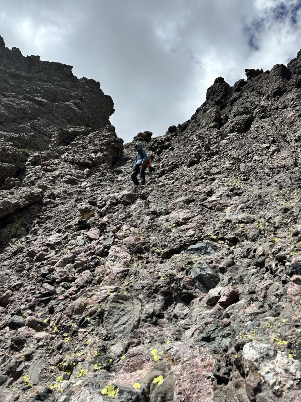
We had hoped to do Broken Hand and Crestolita after the arete, but were both really feeling sick and slow, so when it took us 25 minutes to get up Broken Hand from the pass, we decided to orphan Crestolita as we knew it would get too late if we continued moving so slow. Broken Hand is a beautiful mountain, fun class 2 route with really great views. I highly recommend it. 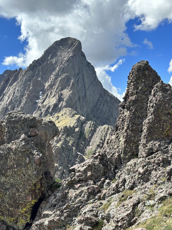

We made our way down the pass, glad to have ice axes for the short but reasonably steep section of snow. We had spikes but chose to skip them because the snow was soft enough to kick the edge of our shoes into. We dragged ourselves back up to camp at the Upper lake and took 15 minutes to get our packs loaded up and start walking. A nice fisherman informed us that a gentleman walking down the trail was badly dehydrated and out of food and water. We filtered an extra liter at one of the small streams, and when we caught him he asked if we could walk out together. We knew it would make the night really late, but he was in no shape to be by himself out there, so we gave him some food and water and guided him out towards the trailhead. Progress was painfully slow, but about 1.5 miles above the trailhead the fisherman caught up and offered to take over our roles. We gladly passed the torch and hurried out to the trailhead. We left the 4x4 TH at 9:18 on a Sunday night, too late to get any food anywhere, so we drove straight through without stopping. We parked at 1:00 am straight up and went to bed hungry. Always a beautiful area, the arete is an incredible climb, and it was fun to check out a new ridge. I haven't spent much time around 14ers for a while now, and it was pretty eye opening. So many people were from out of state and shocked to learn that there was still snow. In June! I keep on waiting to read about the catastrophic fall on Broken Hand Pass when someone attempts it without an axe and slides 400 ft, but so far so good. Be safe out there everyone! Thumbnails for uploaded photos (click to open slideshow): ")
")
")
")
")
")
")
")
")
")
")
")
")
")
")
")
")
")
")
")
")
")
")
")
")
")
")
")
")
")
")
")
")
")
")
")
")
")
")
")
")
")
")
")
")
")
")
")
")
")
|
| Comments or Questions |
|---|
|
|
Caution: The information contained in this report may not be accurate and should not be the only resource used in preparation for your climb. Failure to have the necessary experience, physical conditioning, supplies or equipment can result in injury or death. 14ers.com and the author(s) of this report provide no warranties, either express or implied, that the information provided is accurate or reliable. By using the information provided, you agree to indemnify and hold harmless 14ers.com and the report author(s) with respect to any claims and demands against them, including any attorney fees and expenses. Please read the 14ers.com Safety and Disclaimer pages for more information.
Please respect private property: 14ers.com supports the rights of private landowners to determine how and by whom their land will be used. In Colorado, it is your responsibility to determine if land is private and to obtain the appropriate permission before entering the property.


