| Report Type | Full |
| Peak(s) |
Unnamed 13543 - 13,543 feet Unnamed 13533 - 13,533 feet Unnamed 13543 - 13,543 feet Unnamed 13552 - 13,552 feet |
| Date Posted | 06/16/2024 |
| Date Climbed | 06/15/2024 |
| Author | notidealbutfine |
| Climbing the Sangres Obscure, Unnamed 13ers |
|---|
|
This post is originally from my blog, sub if you like my Sangres reports: https://notidealbutfine.wordpress.com/2024/06/16/climbing-the-sangres-obscure-unnamed-13ers-un-13543-near-obstruction-peak-un-13533-un-13543-near-mount-adams-un-13552/ June 15, 2024 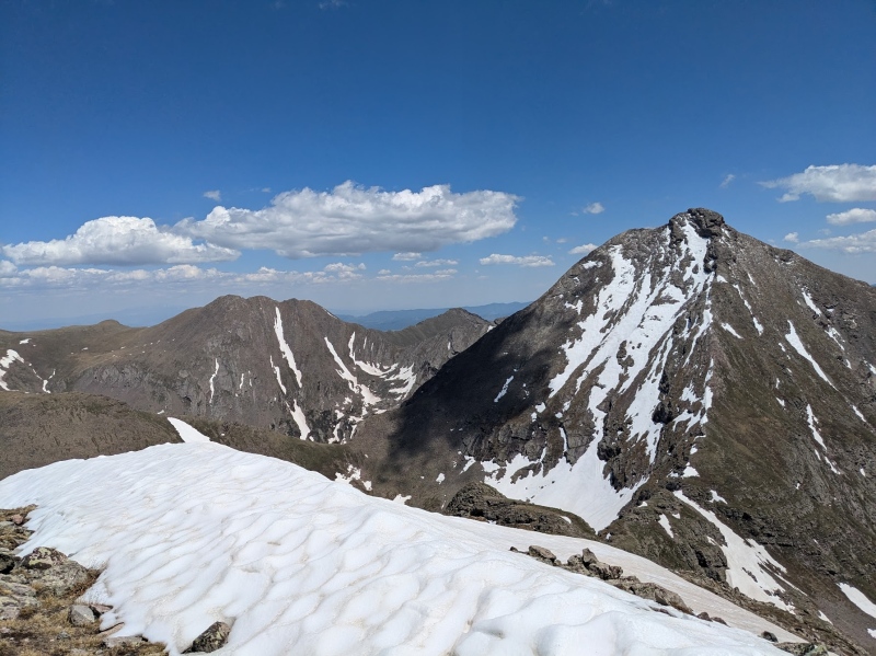
Finally, as the last bits of snow melt off the Sangres, the dregs of spring recede and make way for brighter, summer conditions. Good riddance, I say! I’m not a huge fan of mixed conditions and generally prefer getting into the mountains in either the dead of winter or the height of summer. It had been about 3 months since my last summit on Galena Peak, so I’ve been feeling the urge to get back out there and kick off the summer season with some chill 13ers. I climbed a few peaks in the Adam’s group last September, but never traversed the ridge or peaks south of Mount Adams. I figured these unnamed, obscure 13ers would be perfect for an early season day, as most of climb was on the ridge-direct and would be mostly free of snow. This route is certainly not popular, but has been climbed at least a few dozen or so times according to trip reports on 14ers.com. With a little bit of research, I concluded the ridge would go at about class 3 or 4 and would be perfect for the level of commitment I was ready for. I departed the trailhead around 5:45AM and arrived at the lake about two hours later. Another hour or so of trekking up into the Upper Willow Lake Valley put me at the base of the South Ridge on UN 13543. 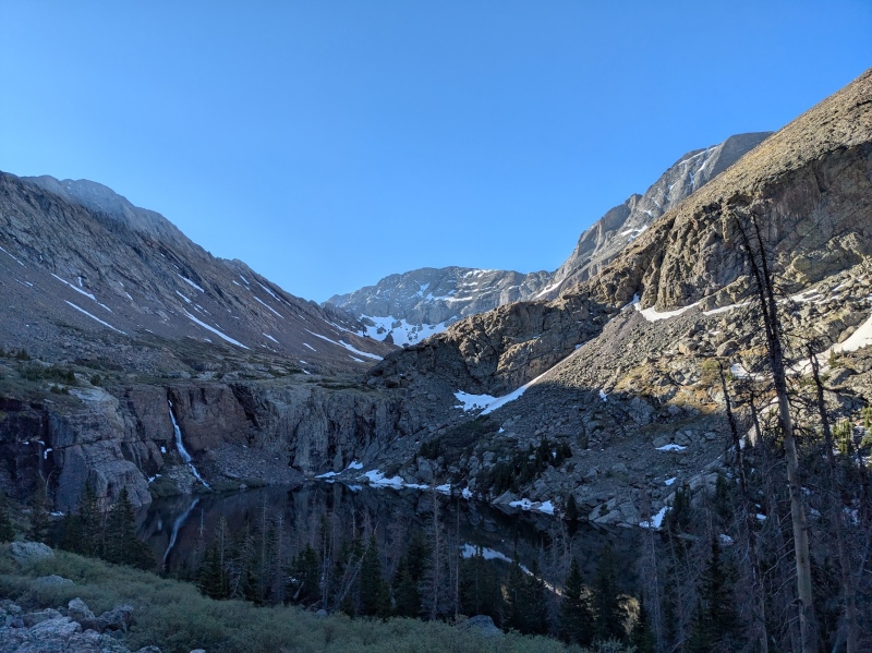
Most of the beta on this route suggests cutting up a grassy ledge a few hundred feet below the ridge crest, then climbing a short, direct line to the summit when you get close. I opted to climb directly to the ridge and stay on the crest to the summit, which provided some nice adventurous class 4 scrambling. The peak had really solid rock and the exposure on the knife edge was pretty heady. Big drops on either side really kept me locked in; it seemed like once I finally looked around to see where I was, I had made it to the summit. A glorious panoramic of the Crestone Group was one to behold. Views of the Willows Lakes and Upper Macey Lake were truly fantastic on a day as clear as this. Huge plumes of clouds arose from the San Luis Valley floor and Crestone, which I actually mistook for smoke clouds. I had to call my partner from the summit just to that verify that the town wasn’t on fire. Luckily it wasn’t! 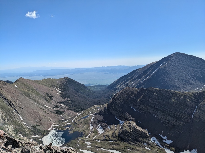
From UN 13543, a short bit of tricky downclimbing brought me to a nice grassy field reminiscent a la Bear’s Playground. From here, an easy and beautiful class 2 hike brought me to the summit of UN 13533 (an unranked 13er). This one was nice and chill and provided some of the best views of the trip. The panoramic of the peaks in the Crestone Group is one of my favorite photos from the trip (see below). 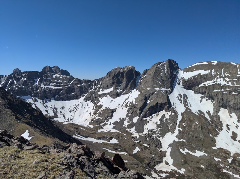
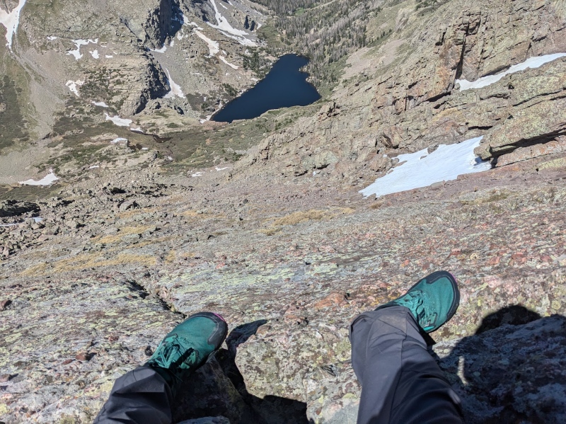
I had read the crux of the day would be downclimbing UN 13533 to the saddle and that, indeed, proved to be true. I could see climbing this section from north to south could be a lot of fun: it’s got massive exposure and steep climbing on really solid, huge holds. Downclimbing it was a little sketchier than I thought it would be, having to reevaluate my line multiple times due to tricky route finding. I ended up spending a little more time on the east side of the ridge than expected. Lowering yourself feet-first over a massive drop certainly never really seems to lose it’s excitement, that’s for sure. The exposure on this section of the ridge was really memorable and it was a real treat to scramble. Another easy tundra walk got me to the summit of UN 13543 at around 11:30AM. Outside of my usual style, I stopped and spent a few minutes enjoying the sunny, windless conditions on the summit and soaked it all up: I’m happy summer is here. 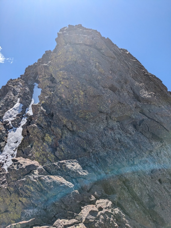
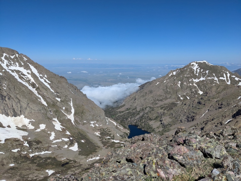
From atop my 3rd summit of the day, it seemed like I had about two or three hours before the clouds over the San Juan Mountains to the west would migrate across the valley to the Sangres and start dumping. From here, I was feeling pretty decent and knew I could bag at least one more. Since I had completed the final two summits in this traverse earlier last September, I had decided to put my sights on climbing UN 13552 today, as it would be my final unclimbed peak in this group. After a big talus descent down to the basin above Willow Lake, I had to decide whether I wanted to climb the East Ridge or Southeast Slopes. The ridge appeared to have a lot more snow than the slopes, so I opted for the slopes and only crossed one single snowfield on my way up. The ascent was generally uneventful, steep grass walking, but the payoff was certainly worth it once I reached the false summit. The views from UN 13552 are very unique and absolutely stunning. This mountain (much like Challenger) puts you really close to the San Luis Valley floor, so the views looking west are truly one-of-a-kind. Looking south to the Upper Willow Lake Valley and overviewing my route on the ridge was also just as breathetaking. 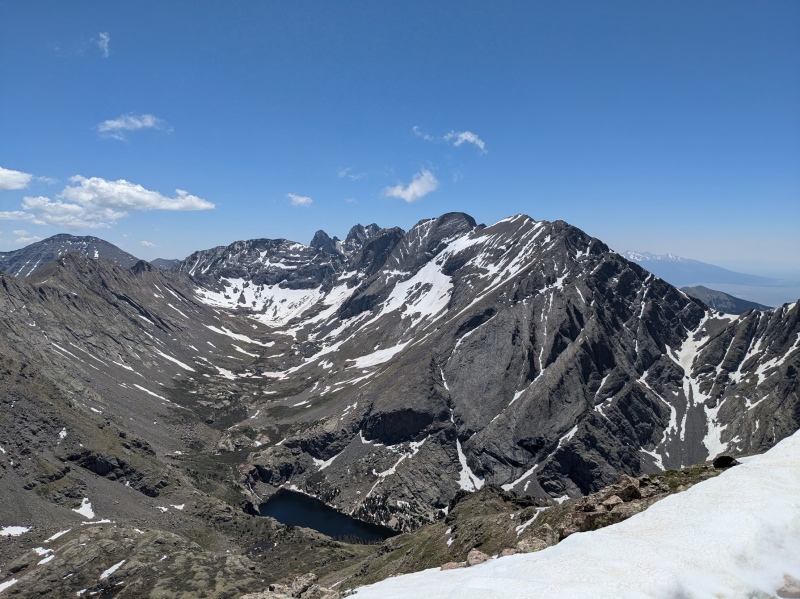
On my way down from UN 13552, I spotted a group of four climbers ascending Mount Adams West Ridge, as well as another climber bagging UN 13543, but not a single party on Challenger Point. My descent down to Willow Lake was generally pretty easy, as I finally managed to find the infamous and rough “Goat Ridge” trail that connects the Willow Lake and South Crestone Lake Basins. The trail is nothing special, but it certainly beats bushwhacking down to the lake. After a brief chat with some folks at the lake, I began my run down the trail and managed to get back to the trailhead in about an hour and fifteen. Now that I’ve bagged all the summits on the Adams ridge, I’ve only got three more peaks remaining to complete the entire Crestone group: Colony Baldy, Obstruction Peak and Broken Hand Peak. I’m planning on these three mountains being one of my many rough goals this summer season. On that note, I’m once again eternally thankful that summer is finally upon us and that this unforgettable realm of alpine splendor continues to open its arms to those of which who are bold enough to navigate its magnificent landscape. Here’s to a great 2024 summer, everybody! Thanks for reading! 
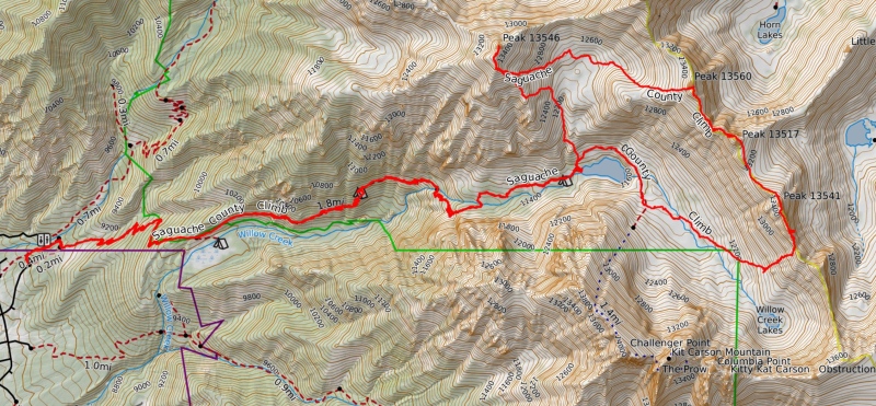
https://caltopo.com/m/T0VG7 Adam’s Group 13er Scramble
P.S. If you were climbing Adams 06/15/24, I got a pic of you on the summit! 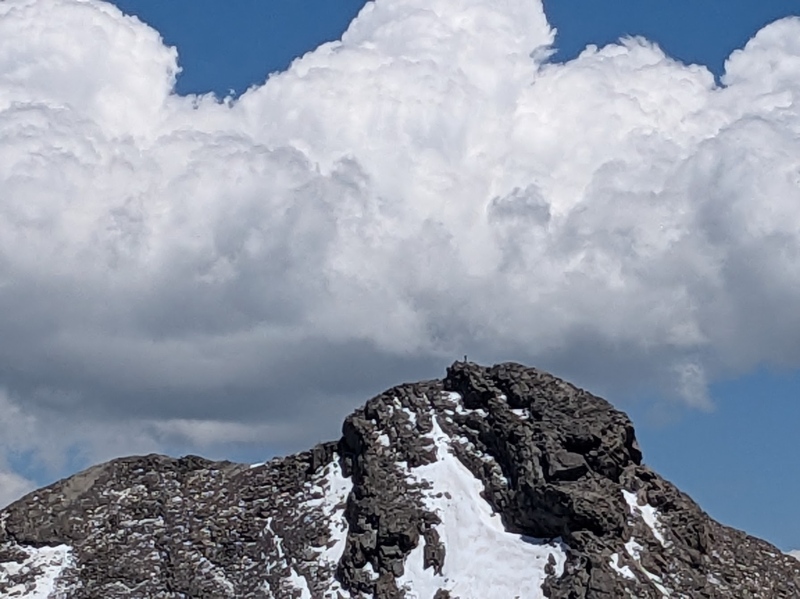
Thumbnails for uploaded photos (click to open slideshow): ")
")
")
")
")
")
")
")
")
")
")
")
")
")
")
")
")
|
| Comments or Questions | ||||||
|---|---|---|---|---|---|---|
|
Caution: The information contained in this report may not be accurate and should not be the only resource used in preparation for your climb. Failure to have the necessary experience, physical conditioning, supplies or equipment can result in injury or death. 14ers.com and the author(s) of this report provide no warranties, either express or implied, that the information provided is accurate or reliable. By using the information provided, you agree to indemnify and hold harmless 14ers.com and the report author(s) with respect to any claims and demands against them, including any attorney fees and expenses. Please read the 14ers.com Safety and Disclaimer pages for more information.
Please respect private property: 14ers.com supports the rights of private landowners to determine how and by whom their land will be used. In Colorado, it is your responsibility to determine if land is private and to obtain the appropriate permission before entering the property.


