| Report Type | Full |
| Peak(s) |
Mt. Emma - 13,592 feet Gilpin Peak - 13,699 feet Cirque Mountain - 13,692 feet |
| Date Posted | 06/14/2024 |
| Modified | 06/15/2024 |
| Date Climbed | 06/12/2024 |
| Author | Dobsons |
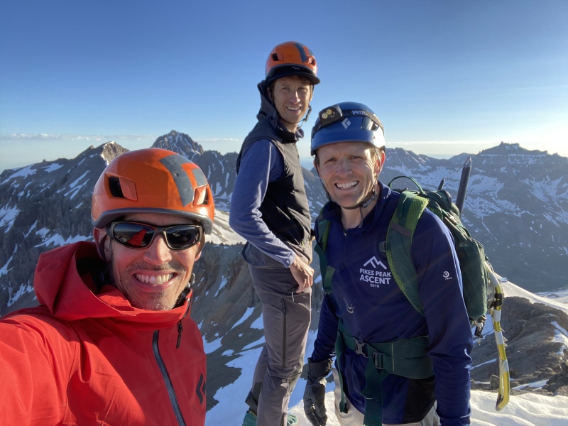
| Additional Members | Jorts |
| Governor/Yankee Boy Basin Bicentennial Loop |
|---|
|
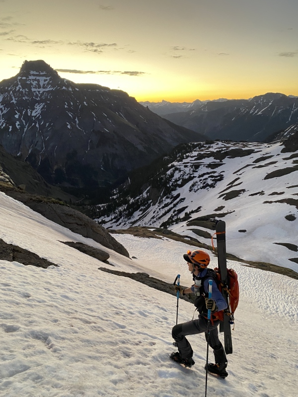
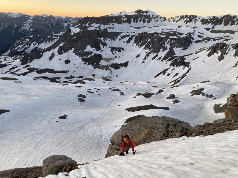
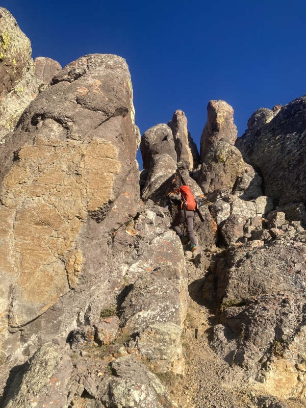
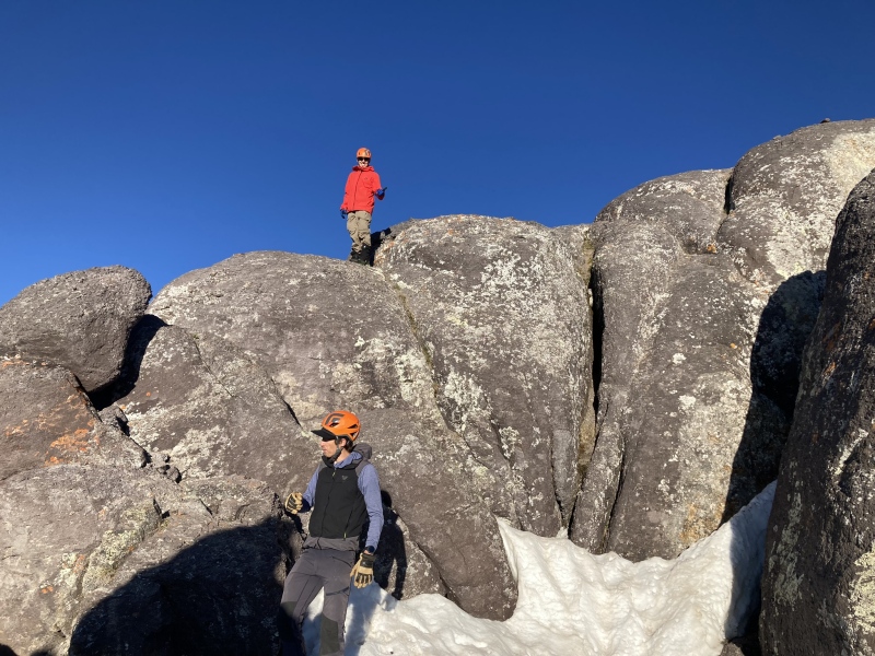
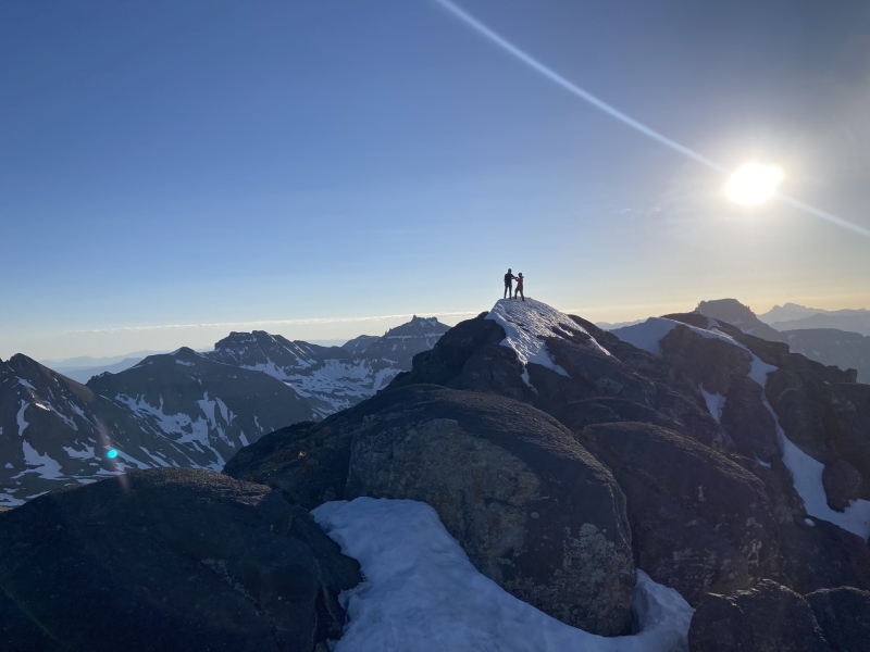
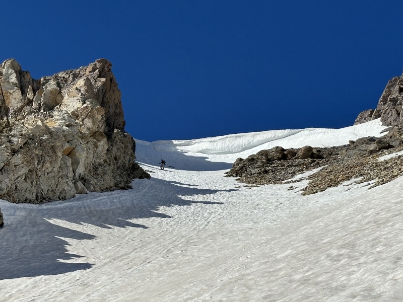
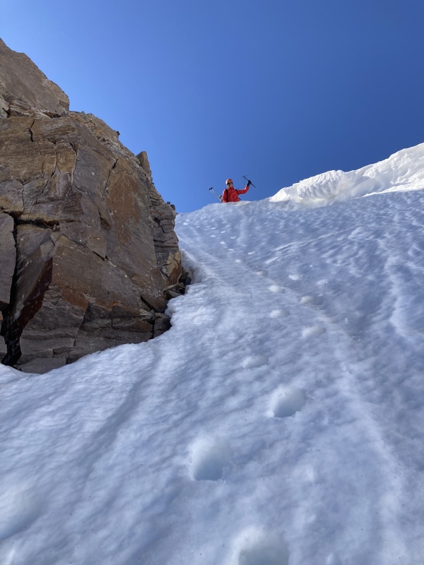
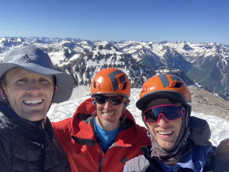
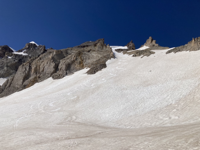
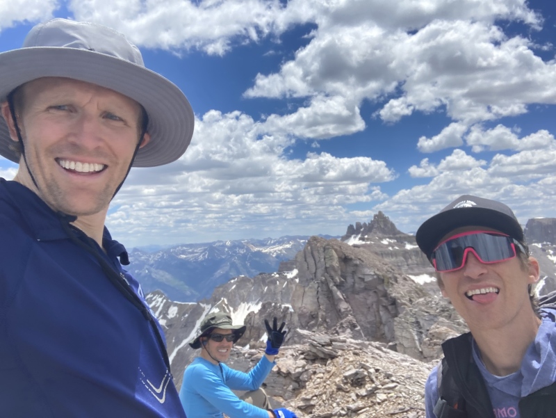
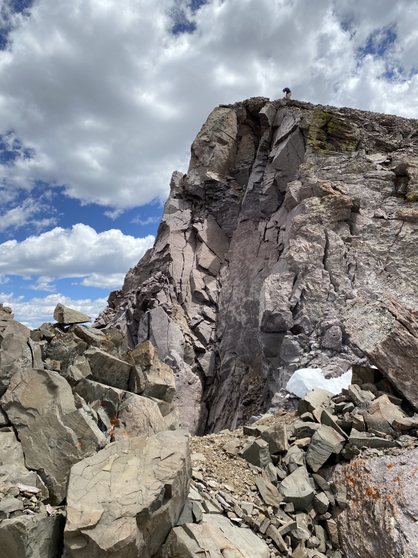
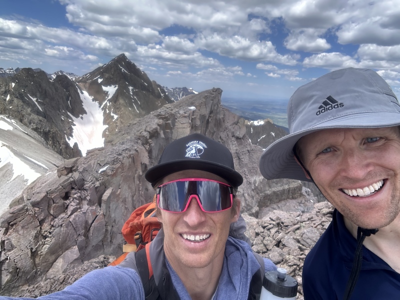
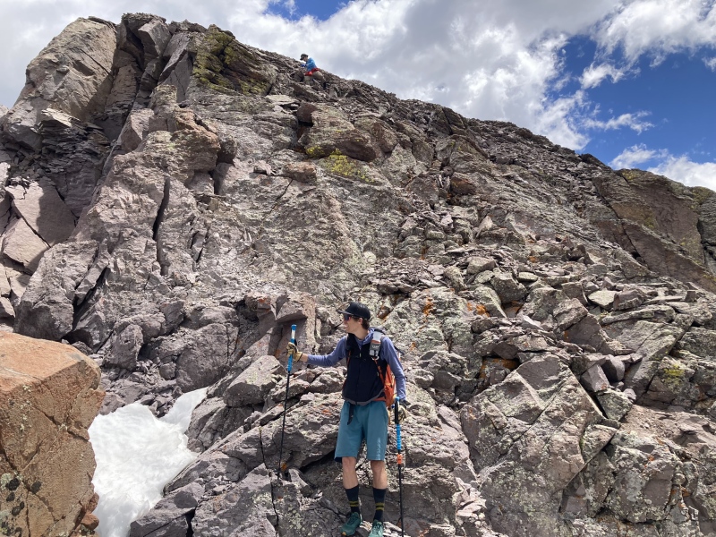
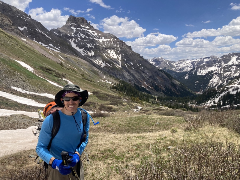
Date of climb - June 12, 2024 Members - The two Brents and I Objectives - Mount Emma, Gilpin Peak, and Cirque Mountain Statistics - 12.5 miles with 5600 feet of gain for all 3 peaks, ~10 hours for the loop Highlights of the Day - Sharing three amazing peaks with two fantastic friends in an amazing setting such as Yankee Boy Basin and a 12,700ft black bear sighting high up in Yankee boy basin beneath Sneffels Background - I had the good fortune of lining up a mid-week outing with two of my better climbing buddies who ironically share the same name, Brent. Brent, from Grand Junction, and I usually do a yearly spring snow climb and we try to pick off a few of the looser peaks for these climbs. Last year we did Lightening Pyramid for our outing which fit the bill nicely. This year we wanted to get to Yankee Boy Basin and try to climb these peaks with snow as I had heard they were more enjoyable as snow climbs. I would, based on our experience, and from reading other reports completely agree that snow on the ground is a great option for these peaks. The steep talus climbs up Emma and Gilpin would be very loose on unstable talus and the talus hop would be relentless linking Emma and Gilpin up high in Yankee Boy Basin. My other Brent climbing buddy (Jorts on this site) recently moved to Durango, so he was able to join which was fantastic as it had been a few years since I had been able to get out with him since his move. He is an avid and talented back country skier so he planned to bring skis and see how much of the loop he could ski. The previous week had been very hot leading to June avalanche advisories by CAIC due to unusual wet slab risk, so we all arrived from our various locations at 11 PM after work near the Governor Basin road with plans for a 4AM start to try to loop the three peaks before the snow degraded too much. We caught some brief shut eye and were starting up the Governor Basin road shortly after 4. The Climbs - We had elected to try to do a clockwise loop going up Govenor basin to get Emma, then hop a high pass in Emma's northeast ridge between it and Stony Mountain and then traverse to the standard climb of Gilpin high in Yankee boy basin beneath the difficulties of the connecting ridge. We then hoped to climb Cirque if time, energy, and weather/snow conditions allowed on the way back to the car. To climb Emma we were able to put on crampons within 1.5 miles of the car and use them for the entirety of the basin climb up to Emma's southeast ridge. We could have climbed to the upper summit pyramid using talus on the higher portion of the peak, but we utilized different snow gullies and faces all the way to the ridge enjoying the snow-covered talus. For being so warm the week before we were pleasantly surprised to find a very good freeze up high from the clear nights sky the night before. From where we accessed the ridge, we had some class 3 traversing on a cool ridge to get to the base of the summit pyramid. At the summit pyramid we took the first gully that looked to make the most sense (I read there were several). Despite the other snow on the climb this gully was dry and we enjoyed some class 3 scrambling to a blocky finish on a wonderful summit. We summitted about 6:30 AM. I found the upper route finding and climbing to be easier than I expected from reading other reports beforehand but the entire climb with the snow and then upper scrambling was very enjoyable and overall I really enjoyed Emma. 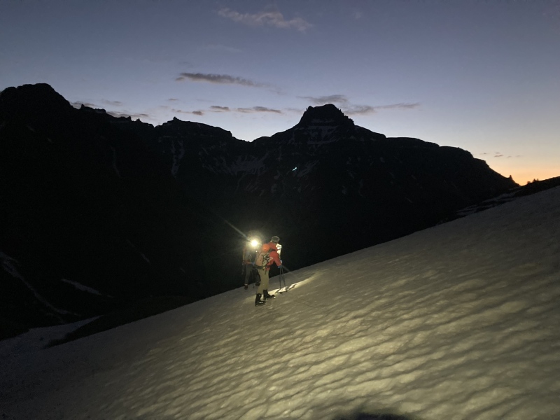
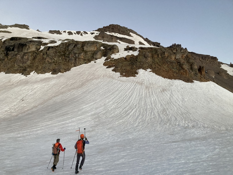
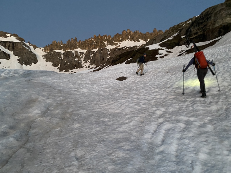
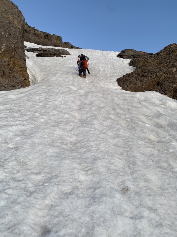
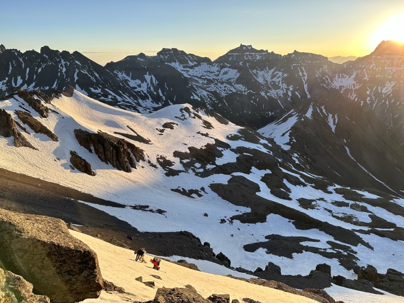
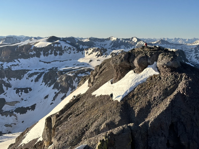
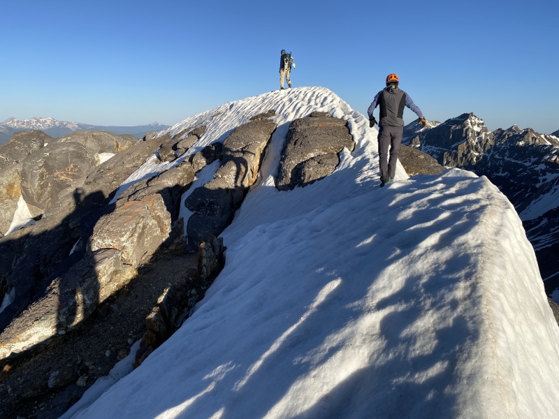
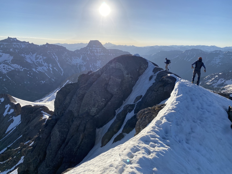
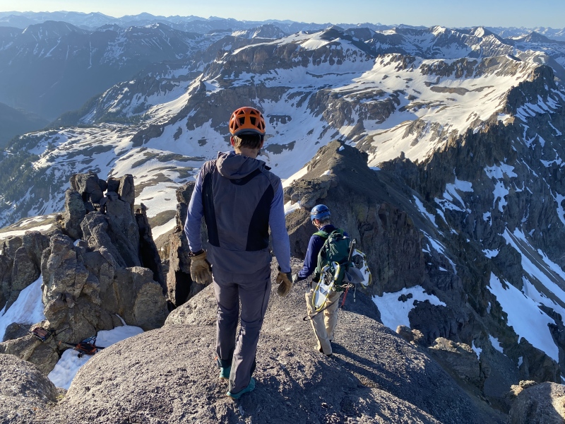
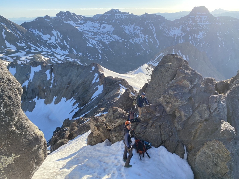

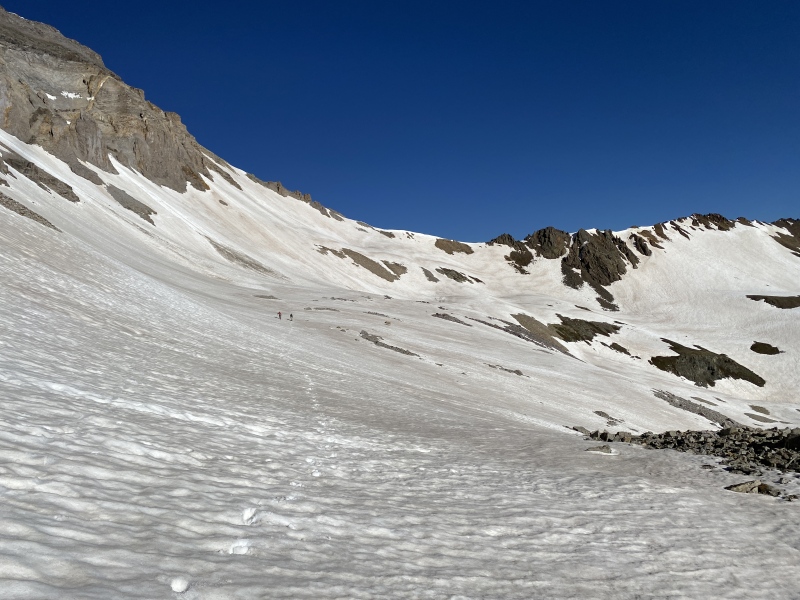
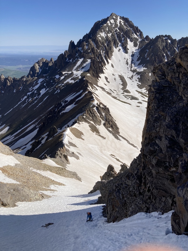
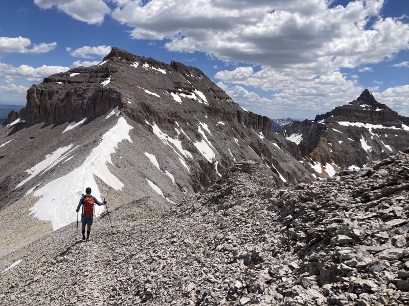
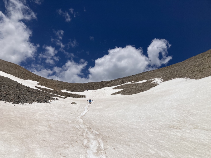
After Emma we down climbed the 3rd class gully we had climbed on the summit pyramid and retreated down a bit into upper Govenor basin before traversing to a high saddle in Emma's northeast ridge connecting it to Stony Mountain. I dropped a bit lower to avoid side sloping the Brents stayed a bit higher but we both ended up at the same pass. From here we were fortunate to have supportive snow covering the talus in upper Yankee Boy Basin. We used this snow to traverse under Gilpin all the way towards our intended snow climb. We climbed Gilpin via the Northwest shoulder/standard route which was a fantastic snow climb. It did have a large cornice at the top we kept our eyes on but there were nice exits on both sides of the cornice to the summit ridge. By now the sun was out in force but the snow remained supportive and in the shade of the couloir the snow was still very firm in spots. In my opinion this snow climb was the highlight of the snow climbing on the day and a real treat. Seeing how much loose talus was on the edges of the couloir made me thankful for not trudging up it in summer conditions. After we finished the snow climb, we headed back southeast to Gilpin's summit on an enjoyable class 2 ridge walk. We summitted Gilpin about 9 AM. 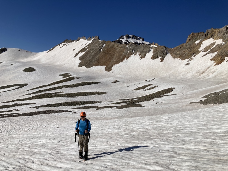
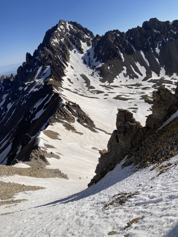
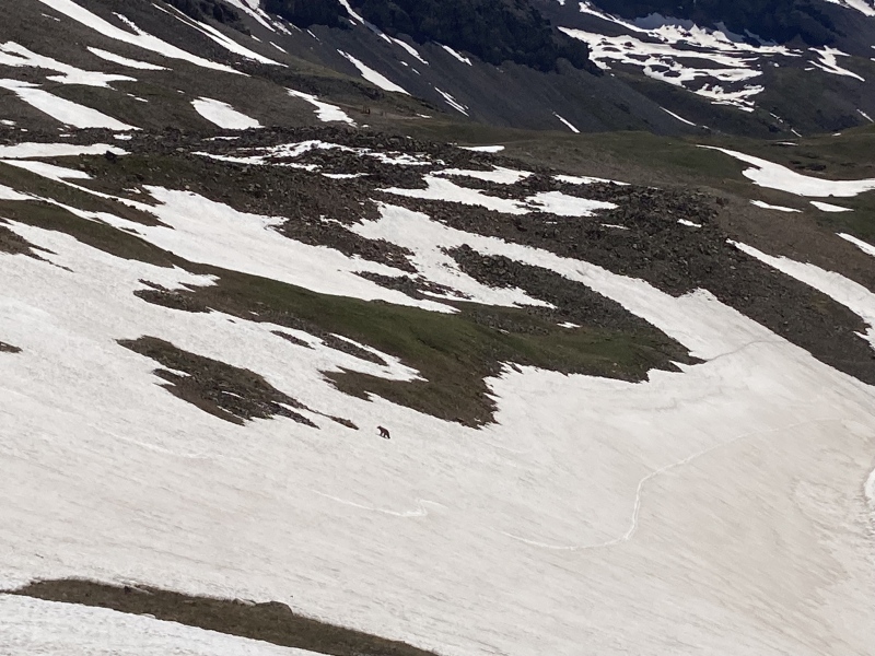
From Gilpin we returned to the couloir we climbed where Brent's carrying of skis all day finally paid off. He used skis to traverse from Emma to Gilpin in the higher basin, but he finally got in a good run for his effort down to Yankee Boy. The other Brent and I jealously downclimbed the couloir into upper Yankee Boy. As I was working across the basin, I had the pleasure of seeing an amazing site with a black bear in the snow at ~12,700 feet. He saw me as I approached and scampered up higher into the basin towards the Sneffels trail and I didn't see him again. It was so curious to see him that high this time of year as I can't imagine there was much food up there for him. It almost seemed he was going to hop the pass to Blue Lakes area but who knows why he was up that high this time of year. Regardless it was a special wildlife spotting. 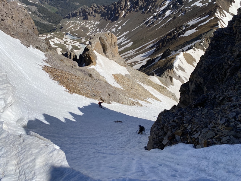
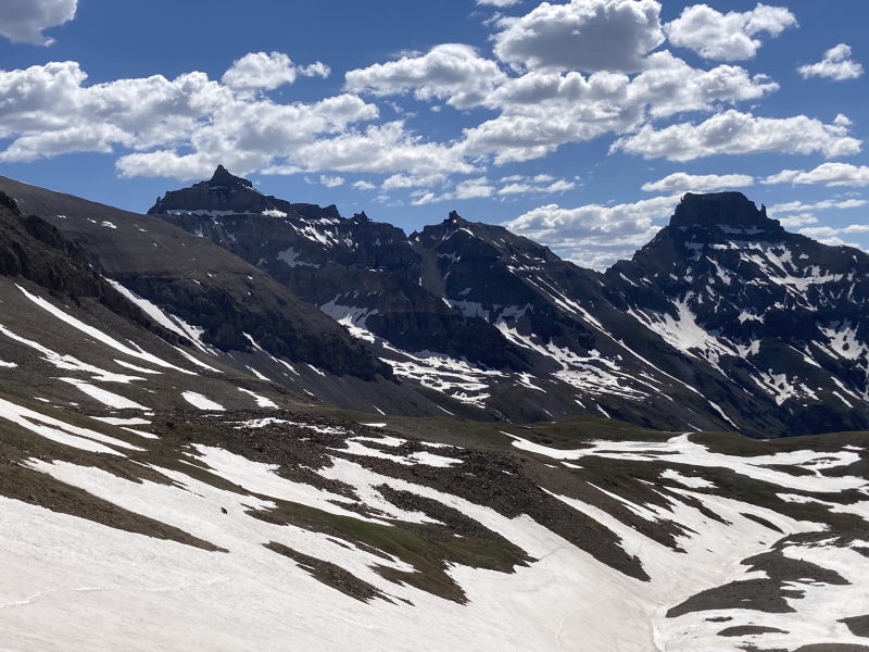
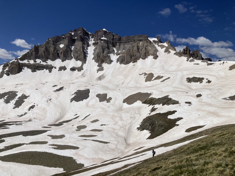
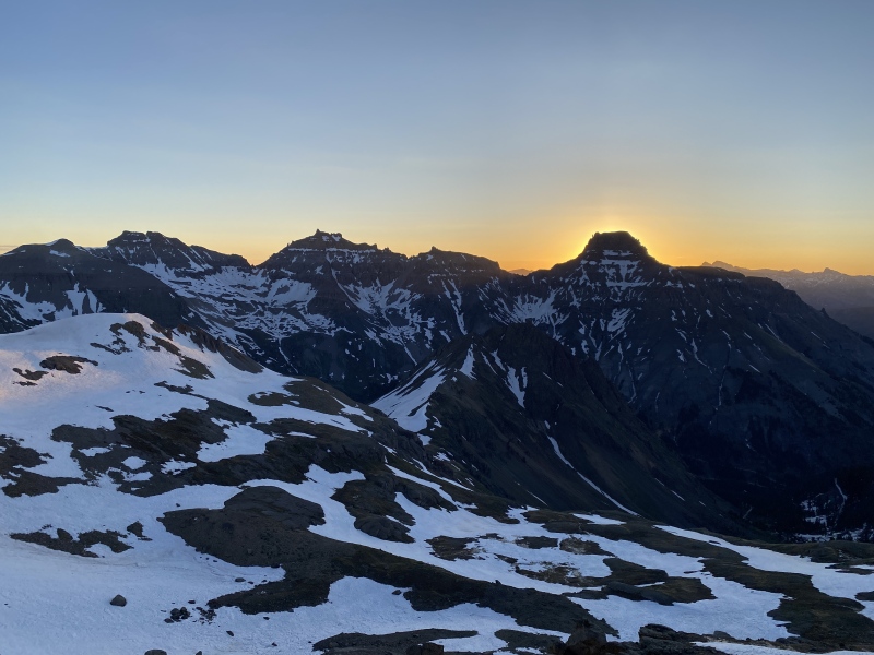
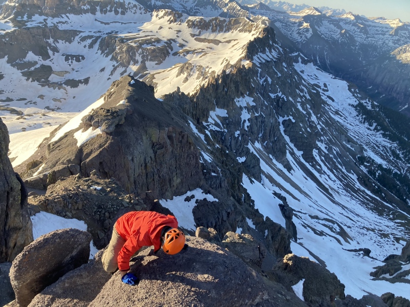
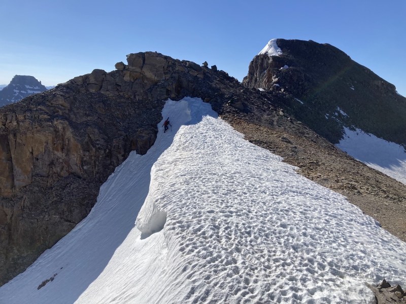
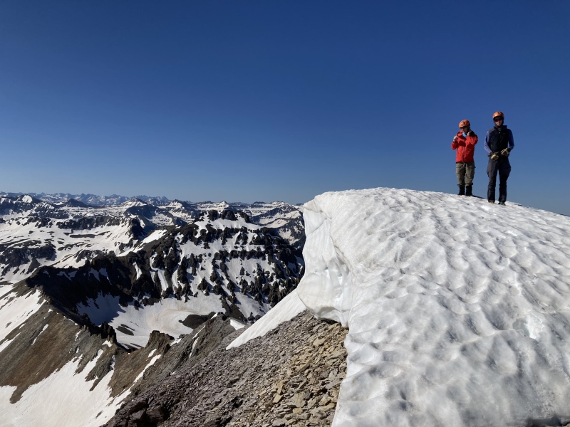
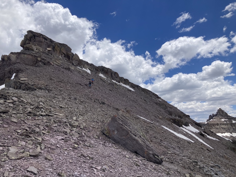
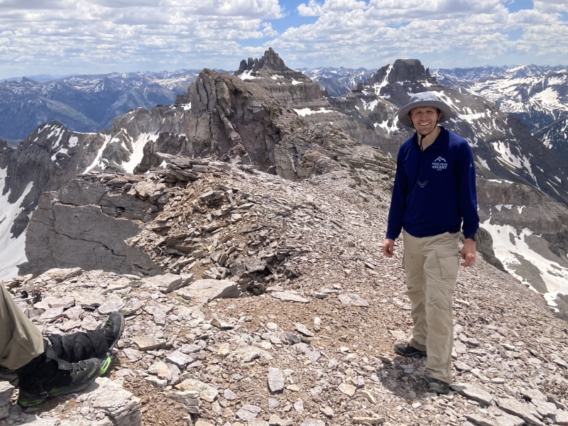
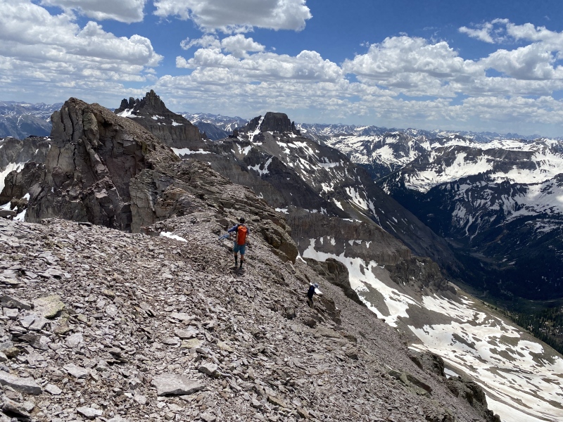
After the bear sighting and descent of Gilpin we traversed across the basin towards Cirque Mountain and climbed the less steep (compared to the rest of the day) slope up to the Kismet and Cirque saddle. There was much less snow on this south facing aspect but still some snow to help aid progress over the talus. From here Sneffels and Teakettle really steal the show and it was a pleasure walk over point 13500 and to the summit right about noon with some class 2+ scrambling intermixed with shale like talus trail. The dramatic drop offs to the north were unexpected and for the first time I realized the Cirque name seemed very appropriate. We could not determine which summit was the highest of the two Cirque candidates, but the summit log said the southeast contour summit had been deemed higher by LiDar, so we went to this summit as well with some loose class 2 traversing where there was a new register as well. Both seemed equally as high standing on them from our perspective. 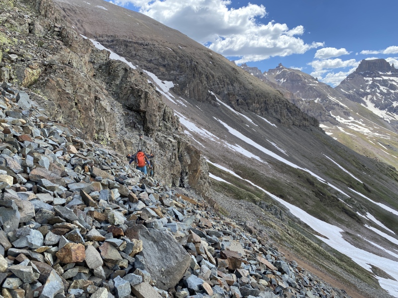

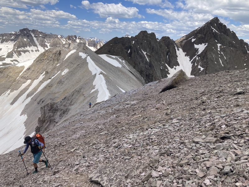
After our climb of Cirque we retreated to the Kismet/Cirque saddle. Looking at Kismet this entire walk back to the saddle made me thankful that bump is unranked! It looks UGLY!!! From the saddle, Brent was able to salvage a bit more skiing down towards the road and the other Brent and I got in some lower angle glissading. We had an enjoyable small road walk down the Yankee Boy Basin road to our cars to finish this incredible loop. 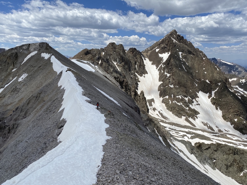
Final thoughts - This was a fantastic loop in an amazing place enabling us to climb three amazing bicentennial peaks and a route I would highly recommend if snow were still on the ground to help with the climbs and upper basin traverses. Thanks Brent H and Brent F for your friendships and I will always cherish these days out I get with you guys! Thanks for reading and I hope this is helpful to some. I love you Kim, Bryce, and Nolan! Thumbnails for uploaded photos (click to open slideshow): ")
")
")
")
")
")
")
")
")
")
")
")
")
")
")
")
")
")
")
")
")
")
")
")
")
")
")
")
")
")
")
")
")
")
")
")
")
")
")
")
")
")
")
")
")
")
")
|
| Comments or Questions | ||||||
|---|---|---|---|---|---|---|
|
Caution: The information contained in this report may not be accurate and should not be the only resource used in preparation for your climb. Failure to have the necessary experience, physical conditioning, supplies or equipment can result in injury or death. 14ers.com and the author(s) of this report provide no warranties, either express or implied, that the information provided is accurate or reliable. By using the information provided, you agree to indemnify and hold harmless 14ers.com and the report author(s) with respect to any claims and demands against them, including any attorney fees and expenses. Please read the 14ers.com Safety and Disclaimer pages for more information.
Please respect private property: 14ers.com supports the rights of private landowners to determine how and by whom their land will be used. In Colorado, it is your responsibility to determine if land is private and to obtain the appropriate permission before entering the property.


