| Report Type | Full |
| Peak(s) |
Gladstone Peak - 13,923 feet |
| Date Posted | 05/28/2024 |
| Date Climbed | 05/26/2024 |
| Author | kyrawhitworth |
| Additional Members | Themanisme, RyanOlsonDDS |
| Making it Epic: Gladstone East Face Snow Route |
|---|
|
Gladstone East Face Snow Route: Making it Epic Preface (just scroll on by to get to the real info) On April 28th, I was enjoying some uphill at Vail and as we skied down, my skis caught as I went to turn and I fell. My knee had some intense pain but I was able to ski down. On May 2nd, my PCP told me to RICE for 6 weeks and that my ski season was over as I had a sprained or torn MCL. Not good. After one weekend of not moving and icing my knee was much worse and after talking it through with folks, I got myself in for PT. They were encouraging and said we’d work to get me back out there and they thought it was just sprained. On top of this, we had to email the guide we’d booked for Shasta on May 18th (a reschedule from March due to avy conditions) and tell them skiing the west face was out due to my injury. They suggested to hike via Avalanche Gulch if I could do a couple hikes in CO and those felt good. Fast forward, we ended up going and bailing due to winds being high enough that they completely blew me over at 11K. This was a very disappointing bail for me with all the compounding factors. Once home, my PT cleared me to try skiing gentle terrain as I was progressing pretty well. I’d had my eyes on Gladstone as a snow climb for a while and with snow in the San Juans being consolidated and a promising weather window, the adventure was set--witness! Let’s Party! (said like Chris Hemsworth in Furiosa) Ryan and I set up camp across from Cross Mountain Trailhead and our friend Mike joined us. The weather on Saturday was windy with various snow squalls but we could see our route from camp and we didn’t see anything that gave us a lot of doubt. Gladstone’s East face looked filled in up high so we knew the basin would be too. We could feel some winds outside through the tent in the night but things calmed down as the night went on. We set off at 3am with skis on packs. We’d received some info that snow starts about 1.5 miles in so we just hiked in ski boots. 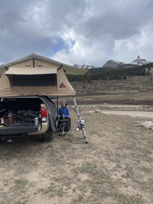
Snow patchiness did start about 1.5 miles in but we decided to boot for another half mile or so as the snow did get a hard overnight freeze so it was very supportive (a good sign). We skinned up to the base of the pass and then had to decide where to go as there was a steep snow field, steep rocks, or we could dip down lower and maybe connect to where we’d want to drop in Bilk Basin. Having the gpx was helpful here as it looks like dropping down makes sense but you do want to gain the pass which is steeper than I expected. This meant skis back on packs. Lizard Head views are excellent and as we got on the pass, the sunrise lit up the area so we took ample photos. Here was a nice rolling ridge walk to get over to enter Bilk Basin. Some snow to cross but not worth skinning as we likely would boot down into the basin anyways. 
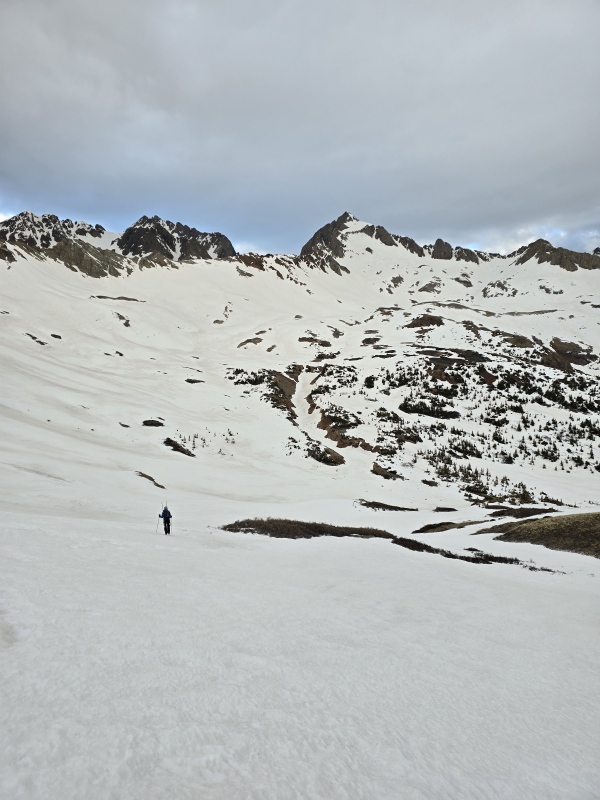
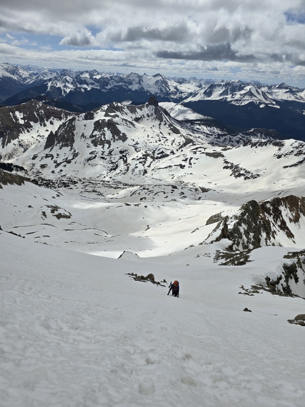
The route was now in full view with the basin and upper portions indeed looking filled in. Man, the upper face of Gladstone looks so so steep from here. Cloud cover remained after sunrise as we began skinning up the basin. This was great as the snow would warm much more slowly so we didn’t feel an intense time pressure for our ski down. The basin seems vast at first but it traverses quickly as the terrain is gentle and rolling for a while. We eventually reached a point where crampons and skis on pack made more sense. I had packed ski crampons but the snow was the perfect consistency to boot up steeper lines. It was that nice hard but grabby, easy to kick in but not sloughing, snow. We reached the cliff band and headed as far left to some rocks as it made sense. We dropped skis here and took a good break. Up to this point, things had gone smoothly and we knew the next sections would be more difficult. 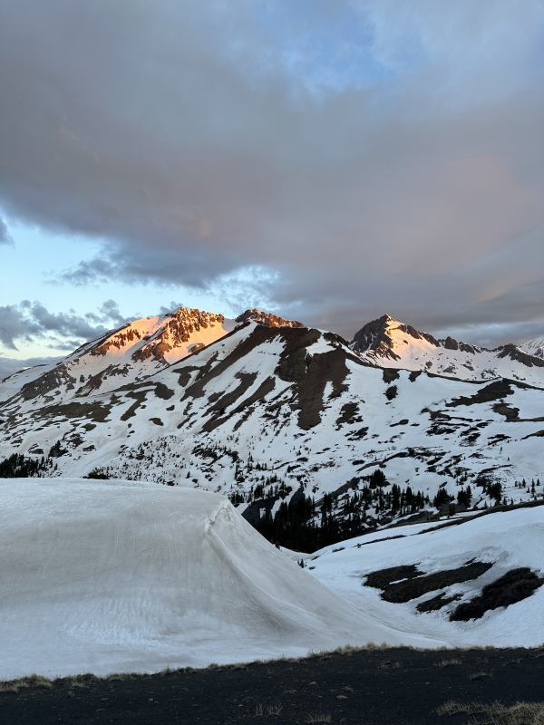
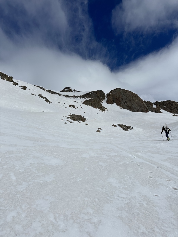
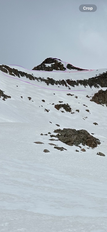
Scrambling through the cliff band was just awkward on rock or snow as there just wasn’t a truly good path. We all chose different routes that worked well enough as it was pretty short. Above the cliff bands is what I’d call a mellow ramp to the final steeper summit push. We had this almost cornice wave like feature that provided a little guarding from the cliff band below. On the left is totally sheer and you get a great view of the connecting ridge to Wilson and the impressive South face of Gladstone. Truly, this is not terrain you want to fall on as while not steep I don’t think you could successfully self arrest before getting close to real trouble. Mike lead through these sections being much more comfortable as things got steeper. The couloir was filled in and snow conditions were remaining stable. We could not really tell which route some of the other less snow-covered photos took. We could see remnants of boot tracks going around the couloir which would mean a steep exposed more rocky scramble. 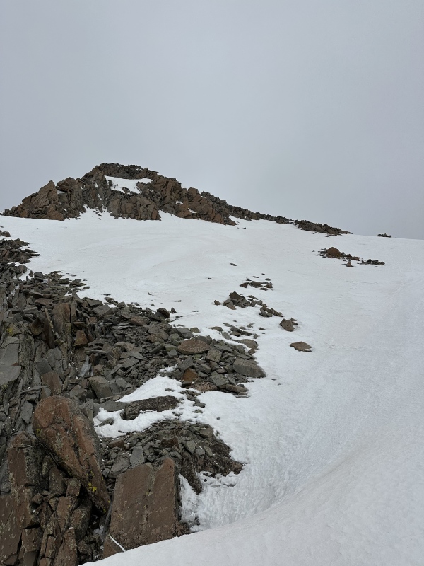
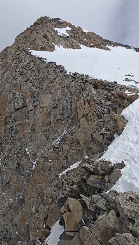
We could see a group of skiers going up the face on Wilson. They looked epic as we couldn’t even figure out how they were still skinning as the face looked insanely steep. Mike has saved the surprise that it was in fact his birthday until the summit so we took some time to just enjoy as the sun had only just come out so we still had some time before it would be soft enough to ski really well. I wish I had some better photos of the steeper spots up high but I just wasn't in a good spot to take my phone out. 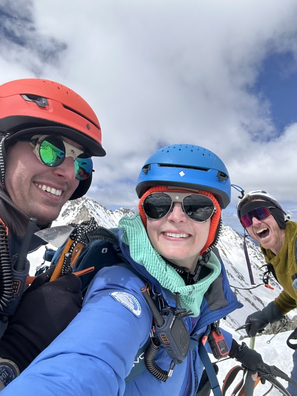

We decided to follow some other tracks we could see as from the summit it looked less steep than the couloir. We carefully scrambled down the rocks to a very exposed downclimb on snow. Mike walked me through his steps and I was able to kick them in even more to feel ok-ish. The exposure on climbers right felt spooky so protect the assets. Soon enough I was comfortable enough to not have to climb face in (hooray) and we made quick work back to our skis. The downclimb off the cliff band seemed easier than going up. A lot of what allowed for us to feel pretty good on this was the fact that it was a morning with intermittent clouds so that the basin wasn't an oven and the snow did not soften too quickly. It was also warm enough where the snow wasn't bulletproof either; snow was perfect in every way. Timing will depend largely on what the snow is doing as you ascend. 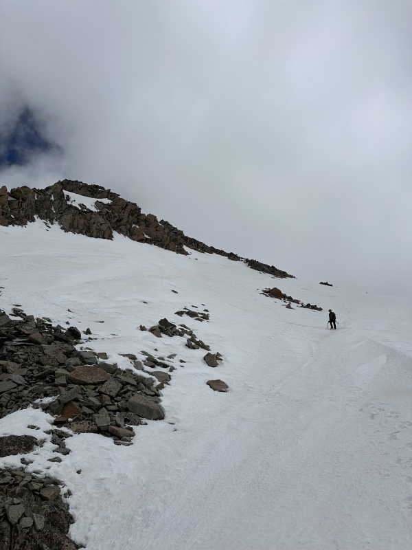
We booted down slightly to a flat spot and got ready to drop in for the corn harvest at noon. Ryan went first and radioed “it couldn’t be better!” We got a surprise radio back from the group on Wilson and we wished each other awesome descents. I took it nice, slow, and easy for my first turns back. The basin has a lot of lines to choose from to make it fun or mellow. We took turns taking some videos with Gladstone behind and Lizard Head in front. It felt so good to be back on skis! 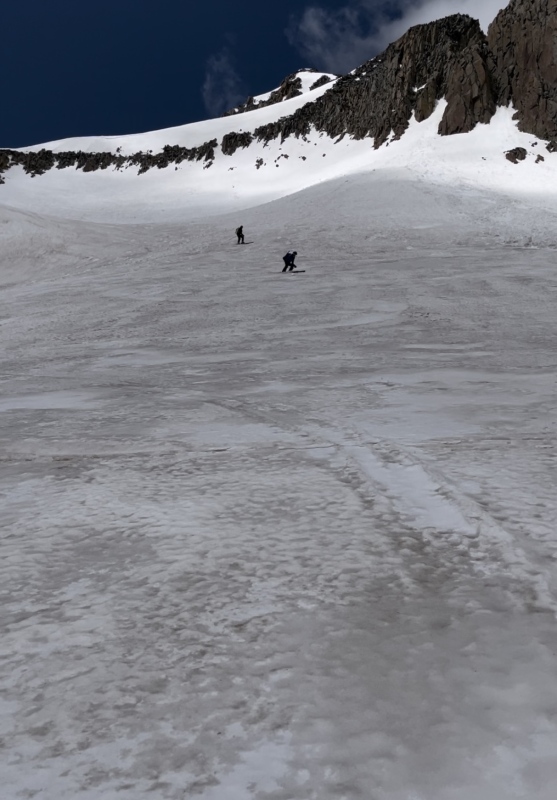
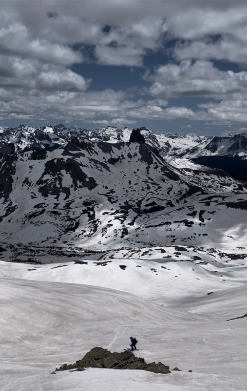
We stayed as high as we could in the basin then had to boot up a short ways to the connecting ridge to the pass. We decided to take the same line down that we hiked up earlier as we weren't sure where another set of faint ski tracks we could see went. We put skis on packs until we got to a good continuous snow patch just below the pass (no need to climb back up to the top of the saddle). I skied until the first big dirt patch as the trees started then decided to boot as I was afraid of torquing my knee weird if I had to stop suddenly to avoid something. Mike was able to pick lines through the trees and stay on skis until about 1 mile from the TH. Ryan stayed with me and booting sucked but thankfully we could tread lightly to avoid most postholing. My knee was definitely sore by this point but not in any way that was concerning. We ended up meeting up with the Wilson skiers at the parking lot just before 4pm and traded epic photos! This was honestly one of the best days I’ve had where everything just goes—what a day, what a lovely day! I would highly recommend this as a snow route and you can be a noob skier like me and get great turns. You definitely need to have strong snow skills as the terrain near the summit feels serious. (Or maybe it was my first big outing post injury and I’m mediocre.) I hope the photos showing full spring snow conditions are helpful despite them being somewhat limited up high. 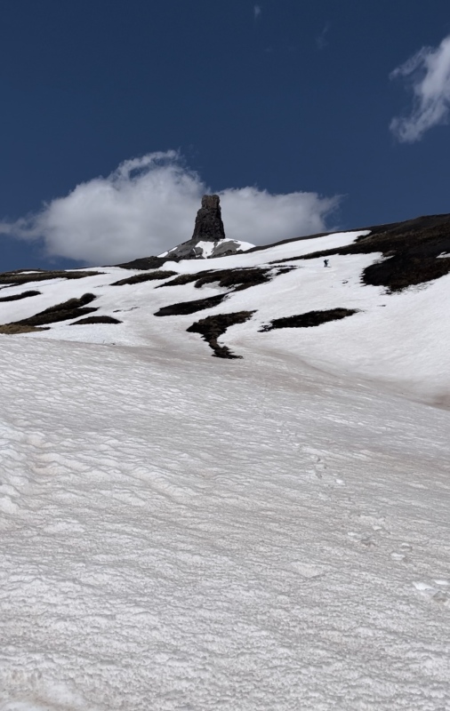
Counting the cost: Distance: 11.82 miles, Vert: 4383 ft, Time: 12 hrs 33 mins Thumbnails for uploaded photos (click to open slideshow): ")
")
")
")
")
")
")
")
")
")
")
")
")
")
")
|
| Comments or Questions | |||
|---|---|---|---|
|
Caution: The information contained in this report may not be accurate and should not be the only resource used in preparation for your climb. Failure to have the necessary experience, physical conditioning, supplies or equipment can result in injury or death. 14ers.com and the author(s) of this report provide no warranties, either express or implied, that the information provided is accurate or reliable. By using the information provided, you agree to indemnify and hold harmless 14ers.com and the report author(s) with respect to any claims and demands against them, including any attorney fees and expenses. Please read the 14ers.com Safety and Disclaimer pages for more information.
Please respect private property: 14ers.com supports the rights of private landowners to determine how and by whom their land will be used. In Colorado, it is your responsibility to determine if land is private and to obtain the appropriate permission before entering the property.


