| Report Type | Full |
| Peak(s) |
Mt. Valois - 13,173 feet Sheridan Mountain 12795ft |
| Date Posted | 05/14/2024 |
| Date Climbed | 09/22/2023 |
| Author | ShadowAviator |
| Endlich Mesa trail to Mt. Valois |
|---|
|
Alright, here goes my first trip report. Leaving north central Kansas, I drove all the way to the Florida Campground area north of Bayfield. Mostly two-lane highways, pastures, and cows. Thus, I felt at home. My route went through Walsenburg, then over the mountains and through Alamosa. The next pass is, of course, Wolf Creek Pass and then on to Bayfield. The road north of the Lemon Reservoir (243, I think) turns to well maintained gravel at a certain point. Instead of camping at the Florida campground, I slept in my truck parked in the gravel lot just before the rocky mountain road heading up to the trailhead. I was unsure about the rough road heading up the mountain, but decided I would be okay after talking with an elk hunter headed up the same way. The unmaintained road (2597 or 597) was rough and travel was slow. Mostly rocky with mud in spots. My stock F250 did fine. I just slowly went up in 4x4 Lo. I don't know if 4x4 is for sure needed, but I wouldn't want to try without it. Good ground clearance is needed, though nothing crazy. 
The trees thinned out, and cattle could be seen grazing the hillsides. The road branches near the top. Going right at the first fork and left at the next, brings you to the trailhead. There is a little bit of an area to park. You may see quite a few elk hunters parked here during those seasons. Overall, its about 10 miles of road that took 3 hrs to travel. Its narrow and passing other vehicles would be a little tricky. From the trailhead, the trail goes up hill somewhat steeply heading to the east (about 3/4 mile). Once the trail turns north it levels out a bit. 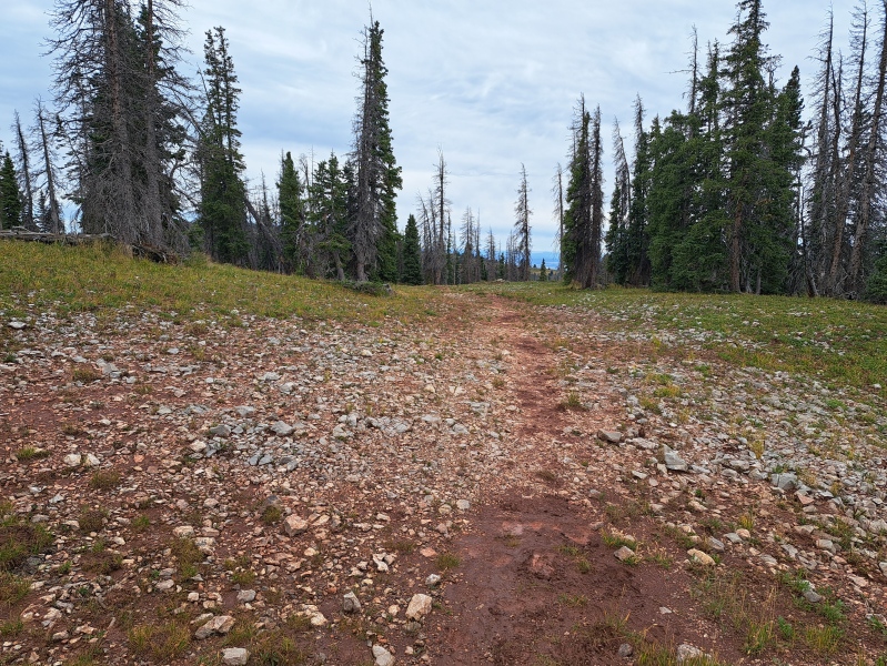
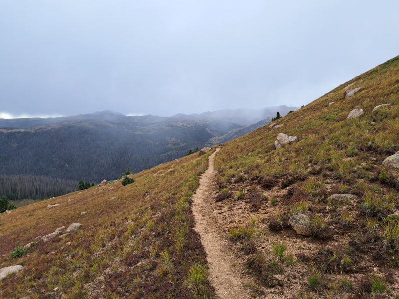
After hiking north for about 2.5 mile, you are near Endlich Mesa. After another mile, the trail drops steeply down the valley to City Reservoir. Another trail goes east toward Sheridan Mountain (remember this for later). The trail seems to take forever through the trees dropping to the reservoir. I was glad to be near my first campsite. The best site seems to be just north of the reservoir and on the east side of the Florida River. 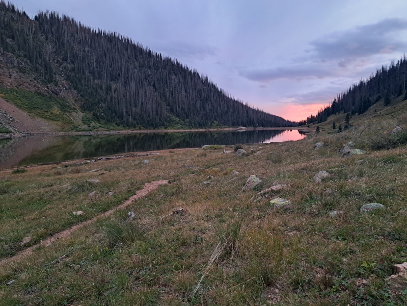
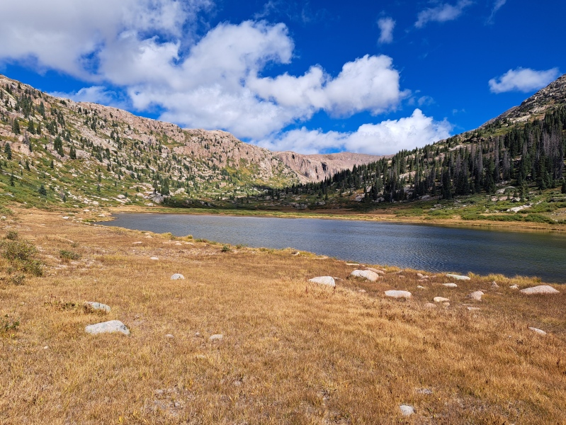
Weather came through overnight. For me it was just a little rain, but Sheridan Mountain above was dressed in ice and light snow. The trail continues north along the Florida River. The trees clear and you are greeted with the beautiful view of Lake Marie and the valley that surrounds it. 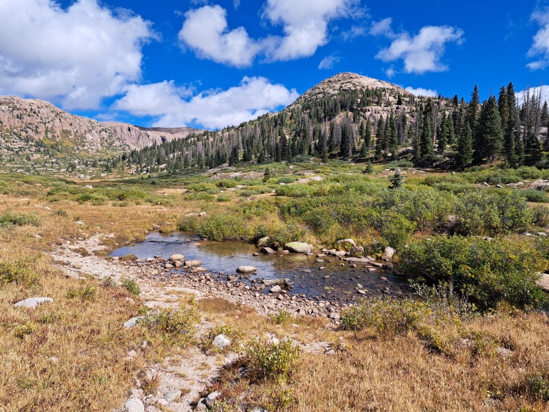
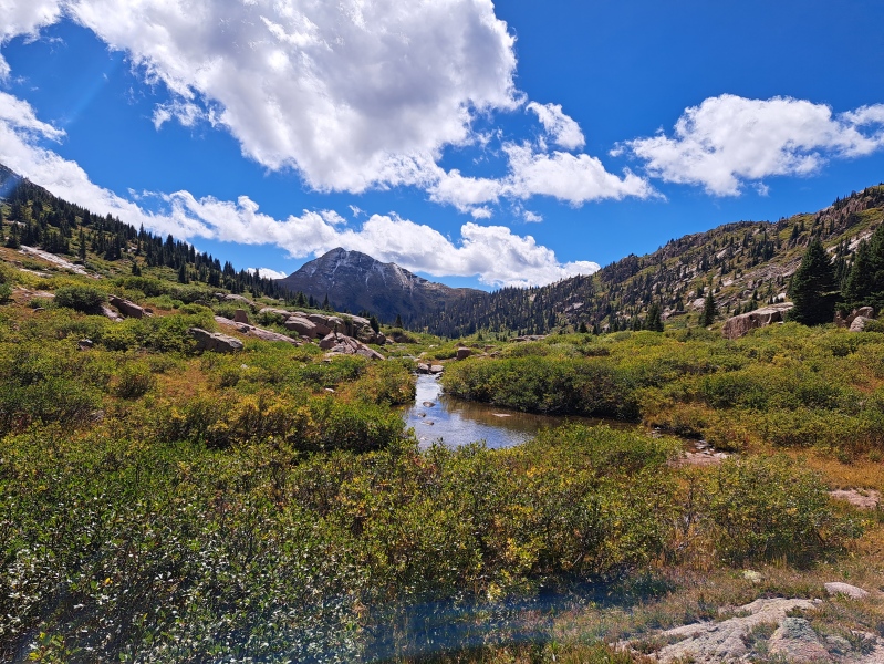
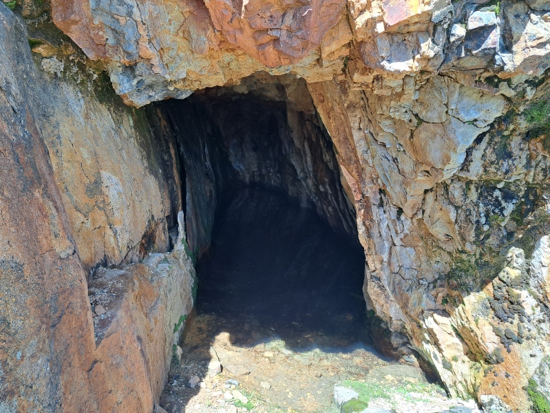
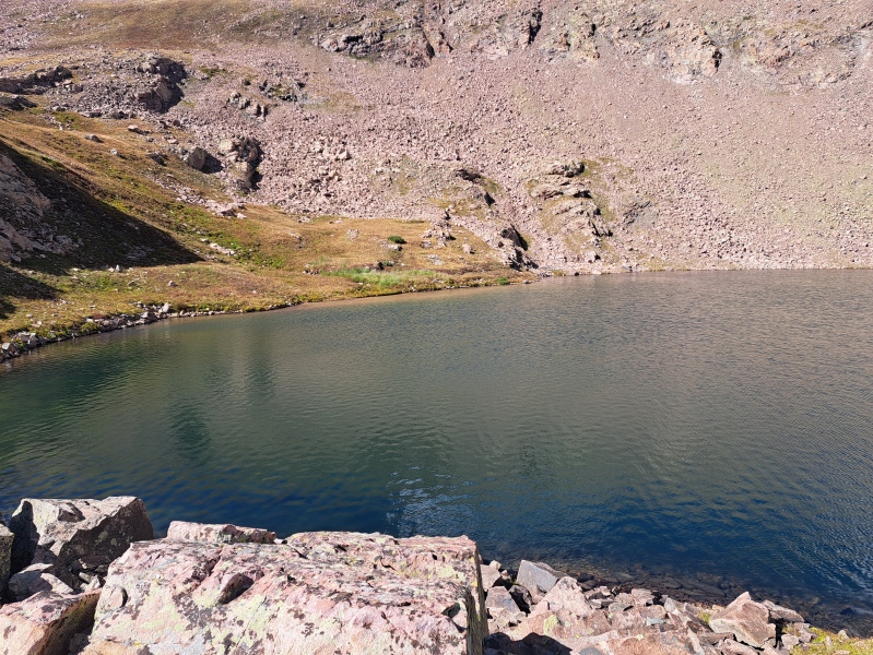
From Lake Marie, I explored the valley. I checked out old mines and random holes dug in the ground (some were kinda deep). While trying to find the entrance to one mine, I ended up climbing all the way to Lillie Lake from the south. I would not recommend this approach. 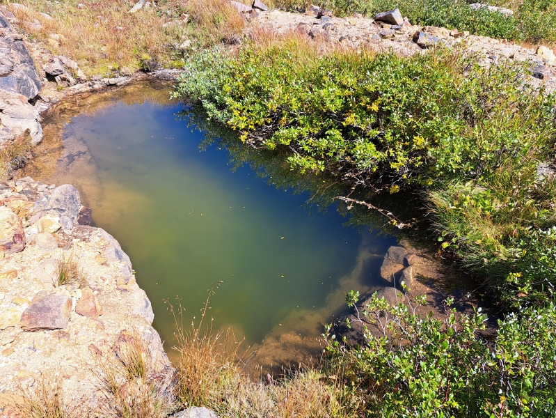
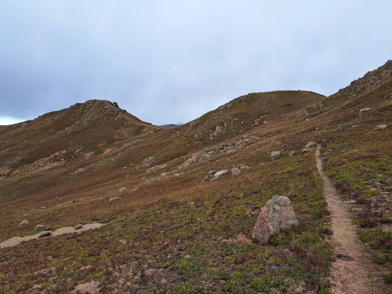
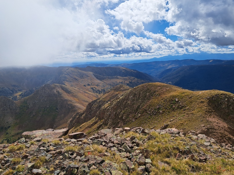
My second night was spent in the valley. On the third day, it was time for Valois. I worked my way south along the west side of Valois taking every clear path that went up higher. Eventually I found myself on smooth rocks that allowed me head north up the ridge to Valois. Before heading north I dropped my boat anchor of a pack, and made a waypoint of its location and took a picture. Large smooth rock is easy to travel with excellent grip. Once you find yourself on top of the ridge, its easy to follow. Some rocks weren't super solid, but good for the most part. The east side drops off steeply, so I tend to stay just on the west side a bit to minimize exposure. 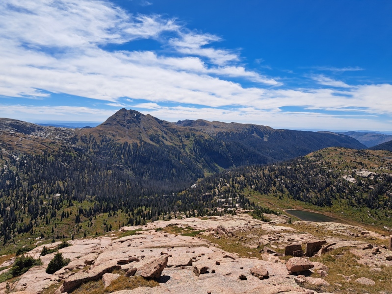
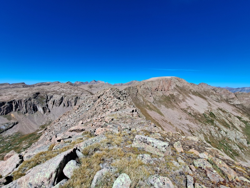
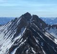
The summit of Valois is just a big hill of rock. Good view of the 14ers. 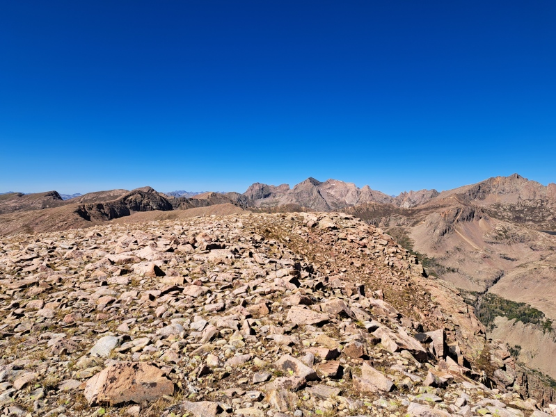
From the summit, I simply backtracked to my backpack. Though the summit and ridge themselves are not overly amazing, the views FROM them are great. 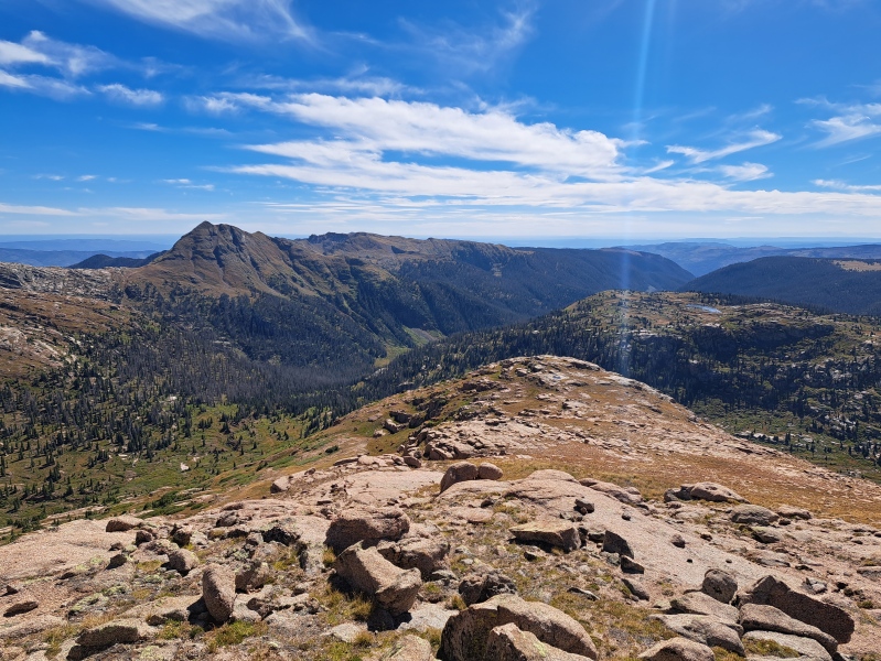
I grabbed my pack, and wandered down the south slope find my way back to Lake Marie. After enjoying one last look at the lake, I decided I could make it to camp back at the City Reservoir. It was then I discovered that I was not alone... 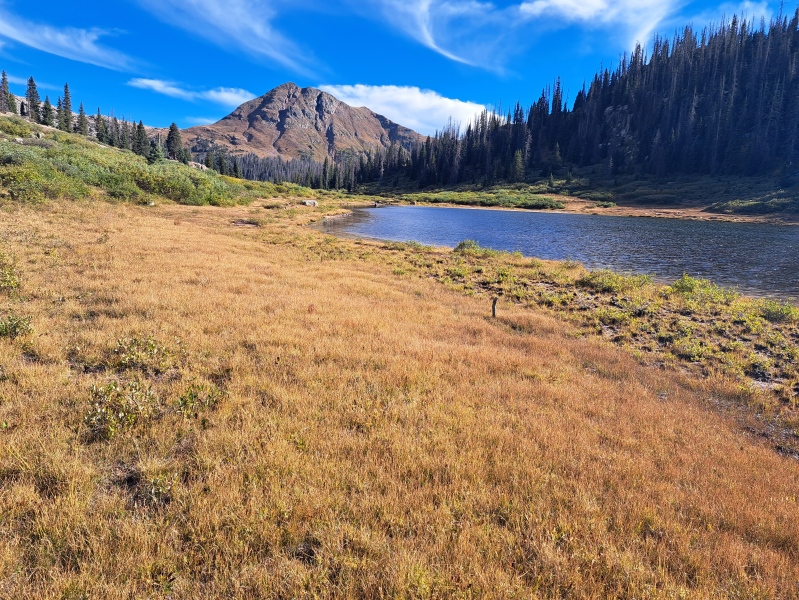
Upon arriving at my old campsite, I was greeted by an odd creature. 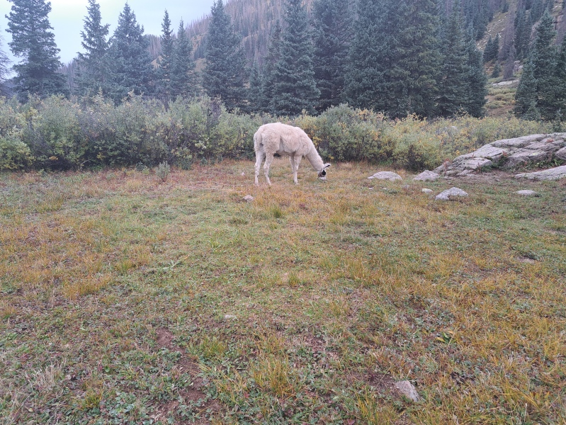
Turns out, an elk hunter and his three llamas were also using this campsite. While I usually like being alone, it was nice to have someone to camp with. The next day I just explored the area not finding anything too interesting. On the fifth day, we were both headed back up toward Sheridan. The hunter and his llamas out paced me up the steep trail out of the City Reservoir. Where the trail splits and goes back to Endlich Mesa or over toward Sheridan is where the hunter had set his next camp. I stopped there for a bit, and he headed out for elk and I ditched my pack and headed for Sheridan Mountain. I have no idea if there is a route up Sheridan, but I just followed up the southwestern ridge to the top. Mostly grass and rocks til the very top. 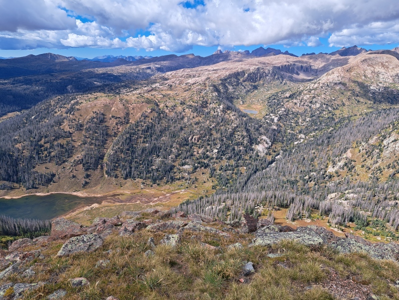
At times I was climbing through clouds, though no rain or lightening. The final summit is mostly rock. 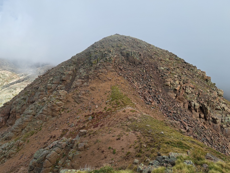
Sheridan had shed its snow and ice by now. After coming back down from Sheridan, I enjoyed the view of an alpine pond. 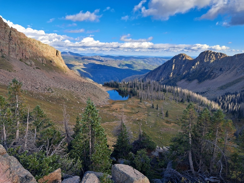
I had debated throughout the day about making the push back to my truck, or staying another night with the the hunter and llamas. I decided to stay the night. The location was beautiful, and I would have an easy next day getting back to my truck. 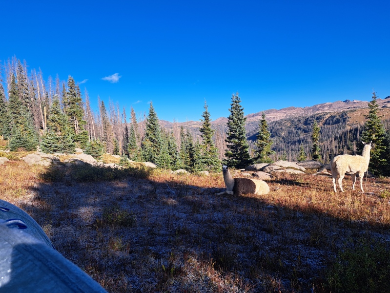
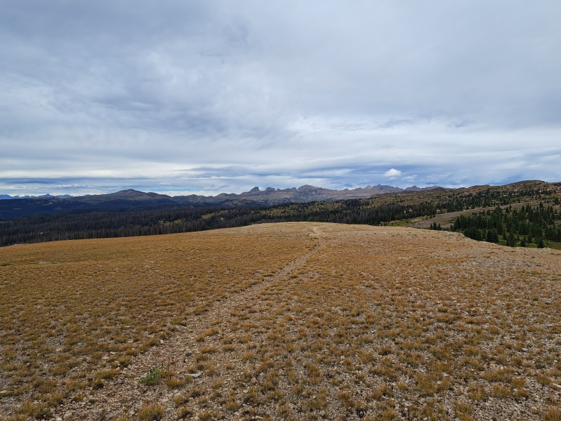
On the six day, I started late. After saying goodbye to my new friend and his llamas. I headed back to my truck via the Endlich Mesa trail. I broke away from the trail to walk up to the top of the mesa. It over looks small valley with a pair of lakes. 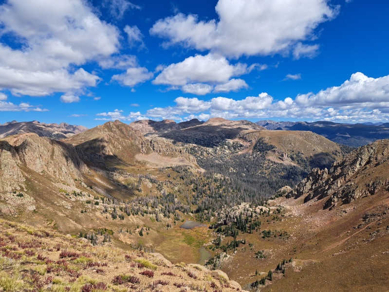
After a short rest and some food, I continued back on the trail. Arriving back at my truck, I rested the remaining part of the day. I also visited with more hunters. The road down was the same as when I came up. Overall, I feel this is a hidden gem of an area. My goal was to have a long backpacking trip in a remote area with minimal trails. The trail to the mesa is pretty easy walking. Beyond that it hasn't been maintained much. The descent to the City Reservoir has fallen trees on it requiring a detour. And all the way to Lake Marie the trail is washed out in spots. After Lake Marie, I was off trail. If someone is willing to bushwack, then it didn't seem too hard to get around. The valley above Lake Marie has holes dug in a few places that could be a hazard. I assume they are from the prospecting days. With the time I had, I maybe could have worked my way over to do Sunlight and Windom. However, I find myself drawn to lesser known/popular destinations. I guess I prefer a 13er with no one in sight versus a 14er with people on it. Anyway, if someone wanted a long trip in to do the 14ers around Chicago Basin, then this route could be an option. The main issue is probably the rough road up, its not horrible, but its still something you have to worry about. Some of the hunters park in the big gravel lot down below and take ATVs up. Thats not a bad idea. I think I will make trips to the Weminuche an annual vacation for me. At least 7 days each year. The ruggedness and solitude are exactly what I like. Finally, I should thank those on here who have written reports in this area. Those reports and threads were very useful for not only discovering this area, but also knowing what to expect. Thumbnails for uploaded photos (click to open slideshow): ")
")
")
")
")
")
")
")
")
")
")
")
")
")
")
")
")
")
")
")
")
")
")
")
|
| Comments or Questions | ||||||
|---|---|---|---|---|---|---|
|
Caution: The information contained in this report may not be accurate and should not be the only resource used in preparation for your climb. Failure to have the necessary experience, physical conditioning, supplies or equipment can result in injury or death. 14ers.com and the author(s) of this report provide no warranties, either express or implied, that the information provided is accurate or reliable. By using the information provided, you agree to indemnify and hold harmless 14ers.com and the report author(s) with respect to any claims and demands against them, including any attorney fees and expenses. Please read the 14ers.com Safety and Disclaimer pages for more information.
Please respect private property: 14ers.com supports the rights of private landowners to determine how and by whom their land will be used. In Colorado, it is your responsibility to determine if land is private and to obtain the appropriate permission before entering the property.