| Report Type | Full |
| Peak(s) |
Pettingell Peak - 13,559 feet |
| Date Posted | 05/13/2024 |
| Date Climbed | 05/12/2024 |
| Author | Danger_D |
| Pettingell South Slope Ski |
|---|
|
Route: South Slopes Trailhead: Herman Gulch Distance: 8.75 Miles Vertical Gain: ~3,300 feet Time Elapsed: 7ish hours As I work my way through all of the Front Range 13ers I've had my eye on Pettingell as an ideal peak to knock out on skis. Its travelled enough that there is usually a skin track at least part of the way and the south slope route is relatively mellow except for the final summit push. With a recent batch of spring snow my buddy Pat and I decided to finally give it a go. We hit the Herman Gulch trailhead at 7:15 and there were about a dozen cars there. Some people heading for the Citadel or Watrous Gulch, but we ended up being one of two groups to do Pettingell itself. It had snowed the night before so we were able to skin from the parking lot to summit without any breaks, but by the time we came down in the afternoon the trail had melted out below 10,700'. The trail up to that point is a narrow single track with some rocks poking through, so not fun to ski down anyway. After 10,700' the trail really mellows out to a very gentle valley that made for an excellent morning tour. There is about 1.5 miles of this mellow terrain for you to soak up the views. In the spring I've heard that there is often a skin track to follow, but if not you can just follow the stream a little bit to climbers right. 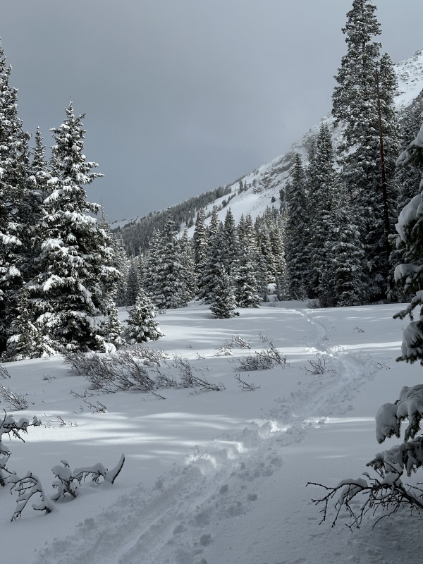
As you get closer to Herman Lake you can choose to follow the summer trail up to the lake, or stay closer to the creek and then turn right once you get even with the lake. Either of the options are relatively easy. The skin track on our climb followed the summer trail so that's where we went 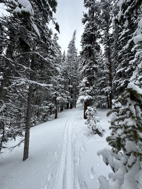
If you follow the summer trail it will spit you out a few feet above the lake as you curve around a gentle ridge and the summit will be in front of you looming over the lake 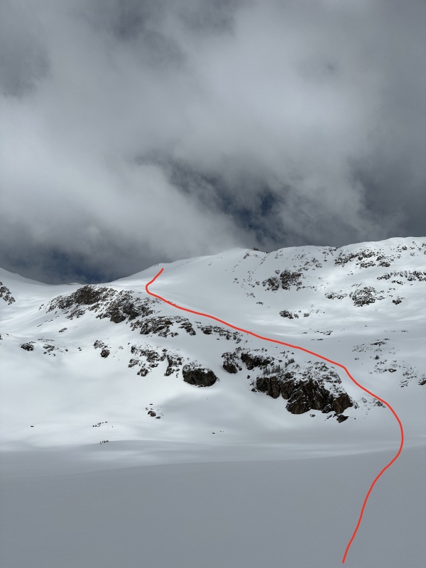
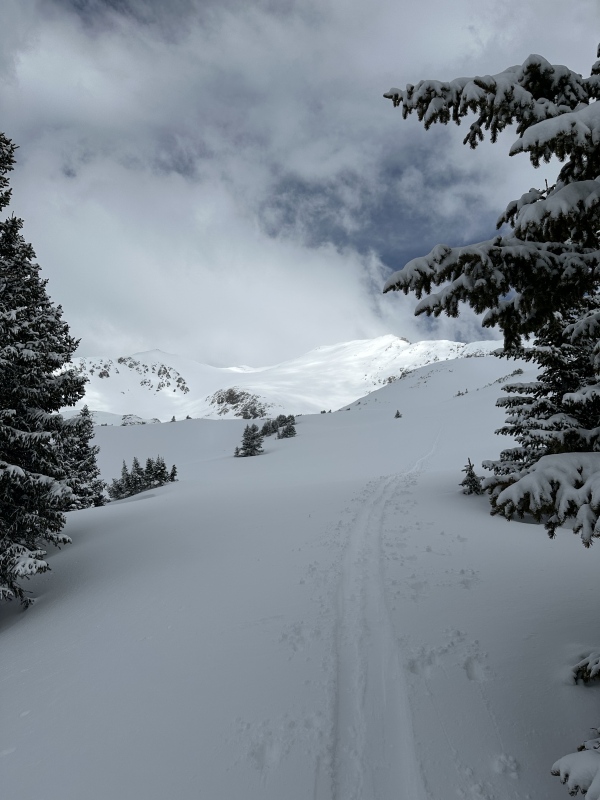
Once you are at the lake the rest of the route is fairly obvious. You will gain the top of the ramp above the cliffs and follow that up to climbers right. You do have the option to continue from the top of the ramp all the way to the saddle and then turn towards the summit, but we opted to go up the final face. When skiing down there are several options including the wide-but-steep gully that drops down on climbers left of the top of the ramp, and some steeper shoots an neighboring unranked Point 13,418. Its easy to scout these lines from down below When leaving the lake you will hit some steeper sections that will be more intense than anything so far, but they are on easy terrain. Once past this initial steep pitch the line up the ramp is obvious and easy. You will pass many different gullies that come down from the summit so you can scout your specific line. Everything was very filled in for our ski, but this face melts out quickly in the spring 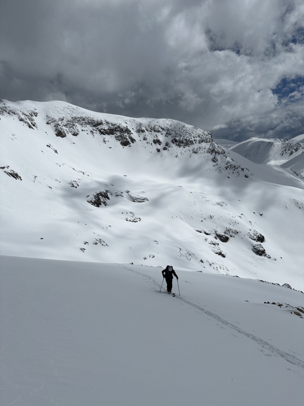
Near the top of the ramp the angle will mellow and you will be faced with a couple options. As mentioned before you can continue straight to the saddle and then take the ridge to the summit. You can also turn up the main face and make a more direct approach. We chose to head up the main face and slightly underestimated the angle. We ended up in terrain that was around 40 degrees and a little spicier than we were looking for. On the last section to the summit I opted to boot up the face which worked nicely, but if you're good at steep kick turns you can skin up things. Less experienced parties should probably stick to the saddle/ridge route. 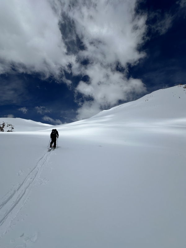
The summit itself was wide and the views are great. Soak it in and then decide on your ride down. We opted to ski down the gully we climbed, but it looks like there are several options (at least when snow is in). After the first steep pitch the angle mellowed and we enjoyed a great corn harvest, even if the snow was stickier than we could have wanted. We did see some small point release slides from the cliffs away from the ski line, but be aware of your surroundings. After a quick ski down to the lake we decided to ski all the way down to the creek instead of follow the summer trail. There was a pretty solid ski track down the valley but the snow at 1pm was incredibly sticky so we had to work pretty hard to keep moving. For any splitboarders be aware this a very flat section so you might have to either work those poles hard or transition back into touring mode. We quickly made it down to 10,700 where that last bit of trail melted out and then booted back to the trailhead. It took us around 4:45 from car to summit, and about 2 hours on the way down. Go get after it! Thumbnails for uploaded photos (click to open slideshow): ")
")
")
")
")
")
")
")
|
| Comments or Questions | |||
|---|---|---|---|
|
Caution: The information contained in this report may not be accurate and should not be the only resource used in preparation for your climb. Failure to have the necessary experience, physical conditioning, supplies or equipment can result in injury or death. 14ers.com and the author(s) of this report provide no warranties, either express or implied, that the information provided is accurate or reliable. By using the information provided, you agree to indemnify and hold harmless 14ers.com and the report author(s) with respect to any claims and demands against them, including any attorney fees and expenses. Please read the 14ers.com Safety and Disclaimer pages for more information.
Please respect private property: 14ers.com supports the rights of private landowners to determine how and by whom their land will be used. In Colorado, it is your responsibility to determine if land is private and to obtain the appropriate permission before entering the property.


