Download Agreement, Release, and Acknowledgement of Risk:
You (the person requesting this file download) fully understand mountain climbing ("Activity") involves risks and dangers of serious bodily injury, including permanent disability, paralysis, and death ("Risks") and you fully accept and assume all such risks and all responsibility for losses, costs, and damages you incur as a result of your participation in this Activity.
You acknowledge that information in the file you have chosen to download may not be accurate and may contain errors. You agree to assume all risks when using this information and agree to release and discharge 14ers.com, 14ers Inc. and the author(s) of such information (collectively, the "Released Parties").
You hereby discharge the Released Parties from all damages, actions, claims and liabilities of any nature, specifically including, but not limited to, damages, actions, claims and liabilities arising from or related to the negligence of the Released Parties. You further agree to indemnify, hold harmless and defend 14ers.com, 14ers Inc. and each of the other Released Parties from and against any loss, damage, liability and expense, including costs and attorney fees, incurred by 14ers.com, 14ers Inc. or any of the other Released Parties as a result of you using information provided on the 14ers.com or 14ers Inc. websites.
You have read this agreement, fully understand its terms and intend it to be a complete and unconditional release of all liability to the greatest extent allowed by law and agree that if any portion of this agreement is held to be invalid the balance, notwithstanding, shall continue in full force and effect.
By clicking "OK" you agree to these terms. If you DO NOT agree, click "Cancel"...
The planning and timing of spring ski tours is always an interesting puzzle, and one that is hard to get exactly right. I'll read the weather forecast, look at beta on a route, and try to make a timeline for when we should plan to summit and ski. This was one of those rare days where despite an imperfect weather forecast, our timing for the day worked out quite well. The forecast for this day seemed to indicate that a decent freeze was on the cards, but also showed substantial cloud cover for most of the day. With that in mind, I tried to find a route that would be low angle enough that skiing it in firm conditions wouldn't be too unpleasant. I haven't seen this specific face of Geneva Peak called out as a ski route before, and I only had one picture of it that seemed to confirm it would hold snow, but we kept our expectations low and made a commitment to be flexible with whatever the day threw at us.
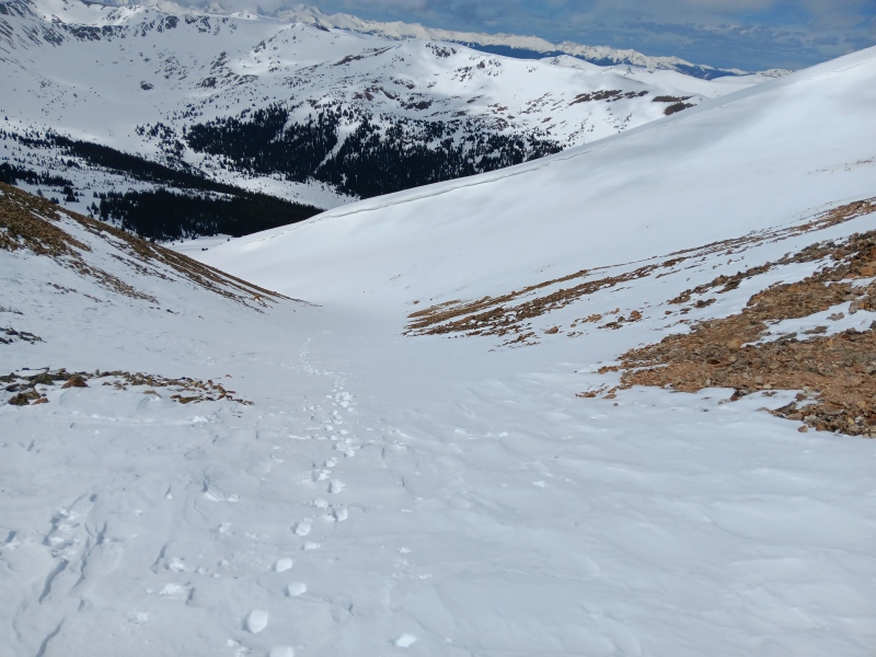
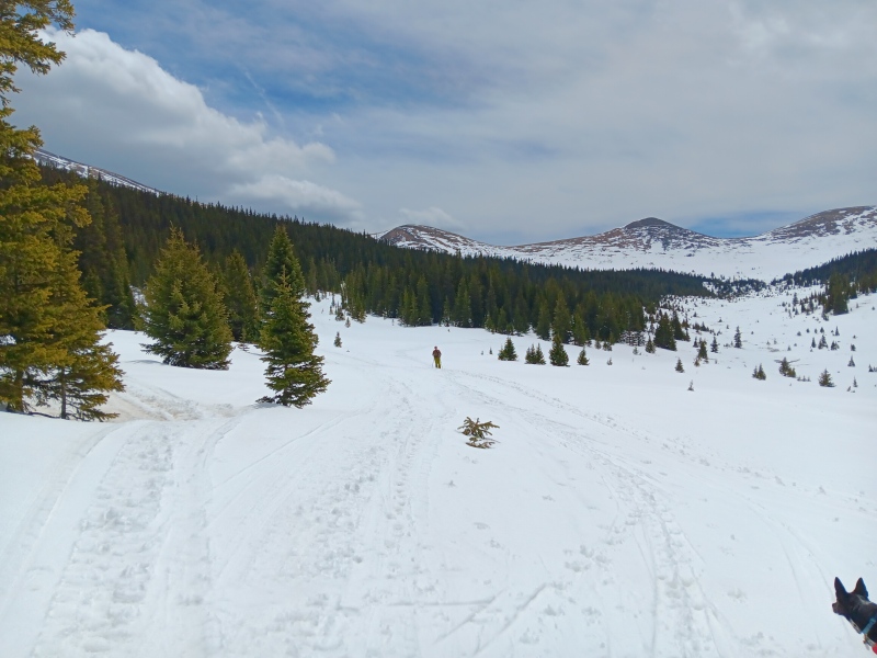
The group for this day was me, my dad, and my dog Zuma. Parking at the large trailhead up the road from Montezuma was easy enough, and in hindsight we could have probably skinned directly from the parking lot if we had known how to navigate the trees to avoid private property. However, we decided it would be simpler to just walk the Webster Pass Road until it got snowy enough to put on the skis. Thankfully this didn't take long, and in less than a mile from the car we had our skis and skins on. We encountered two other parties, both of whom seemed to be headed for Santa Fe or Sullivan. This drainage allows snowmobiles, and we certainly saw some sled tracks in the valley. However, we didn't end up seeing or even hearing any snowmobiles at any point throughout the day.
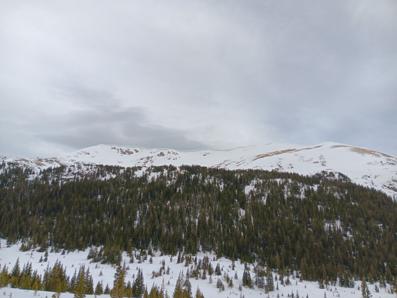
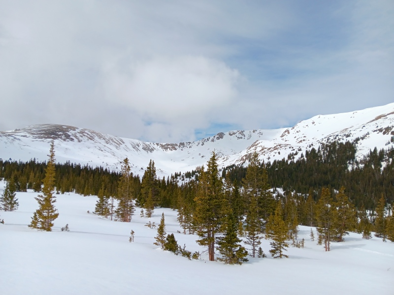
The approach up the valley was straightforward, and at this point we were still very much not in a hurry given that there was close to 100% cloud cover, and the forecast called for that number to remain high throughout the day. We aimed for an obvious weakness in the trees to give us easy access up to the base of the line, and without too much fuss we finally got the first real view of our goal for the day. Not only did it hold snow, but the snow looked pretty decent. It was right around this time that the clouds started to dissipate somewhat, and we finally got some sunshine.
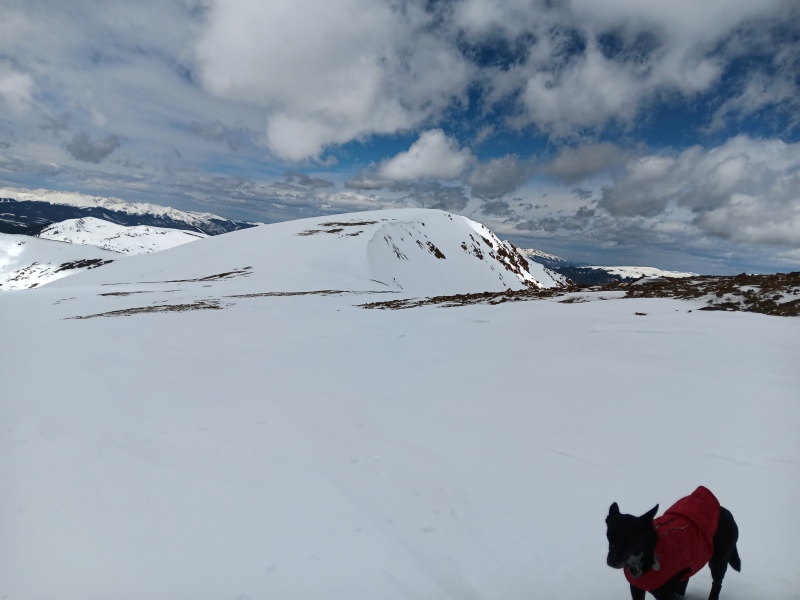
Handcart Peak to the leftLine in sight, and finally some sun
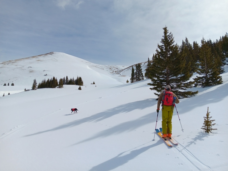
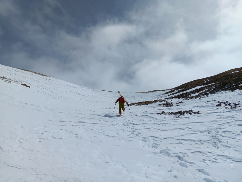
The sunshine was extremely welcome, but clouds continued to roll over us from the southwest on a regular basis. This face looks similar to Dave's Wave off of Loveland Pass, with a moderate sized cornice running vertically up the slope and a dogleg turn at the bottom. We debated whether to skin up the center of the face or stay on the rounded ridge above the cornice, and decided that the face was the preferable option for the day. On a day with greater avalanche concerns, sticking to the ridgeline above the cornice would probably be advisable. This was my first time using my ski crampons, and I think this is the beginning of a beautiful friendship. At about 12,500' the face opens up to the east, and we decided to bootpack up the west facing gully towards Landslide Peak so that we could tag it on the way to Geneva while we waited for the snow to soften a little more. A more accomplished skinner could almost certainly have kept their skis on their feet the whole way up this gully or the south face proper, but it was great conditions for kicking steps and we had lots of fun with it.
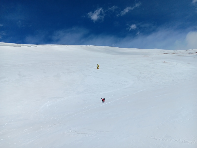
Leading the chargeNot particularly steep. Still, don't drop the phone.
The gully eventually gave way to the flat expanse of Landslide's summit, and after initially misidentifying the true summit we made our way over to the very dry summit block. The snow coverage resumed a few feet west of the summit, so we put the skis back on our feet for the final push up to Geneva. At this point it was very windy, so we spent less than a minute total on both summits.
Zuma was ready to ski down, and not particularly impressed with the wind
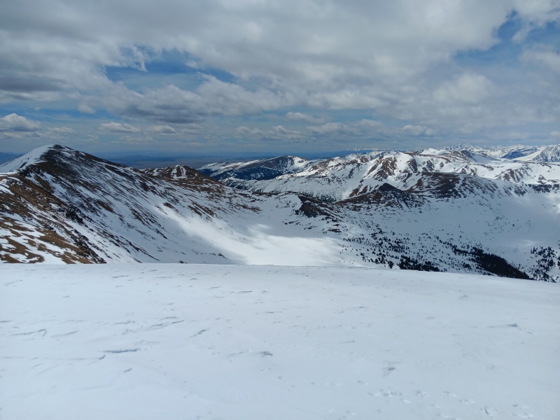
Red Cone and Webster Pass
After a short downhill skin to give us some separation from the cornice above the east face (to ease my mind about Zuma wandering over it) it was time to transition. The upper face was an interesting combination of wind deposited spring pow on top of a partially softened base that was still slightly breakable. Not the best conditions I've ever skied, but much better than I had expected a few hours before. After the first few hundred feet the wind abated, and the surface softened up nicely into a very pleasant corn that continued all the way to the valley floor.
Zuma likes to check on the whole group
Once we made it to the valley floor, it was clear that the sun had done more work down here than anticipated, which made for a bit more skating and poling on the way out than I had expected. That effort was well worth the soft turns up top though, so I didn't mind the extra workout. We were able to navigate the lower trees along what appeared to be a snowmobile route that was marked with blue diamonds, then popped out of the trees maybe 200 yards from the car. Great times were had by all, especially Zuma.
Work those triceps!
My GPS Tracks on Google Maps (made from a .GPX file upload):
I was one of the 3 parked next to y'all that morning......that south side of Geneva was so good! Super fun! We had some firm snow off of Sullivan so Geneva made the day all worth it.
@PostholePete Very cool! We saw your group climbing up the north facing slope between Geneva and Landslide when we looked over the cornice at the summit. The route you took looks like it would be an awesome choice on a day where the clouds are a bit more cooperative and soften up the SE face of Sullivan earlier in the morning, but not get too soft on the north slope for the climb to link the two.
I just snowshoed up Santa Fe and Geneva today and had everything from solar-oven to nuking snow and total white out. Crazy time of year in the high country. Can't believe I opted not to bring skis for this since I was too lazy to carry them across the traverse, the conditions looked so nice for a ski off Geneva. Found your tracks!
Caution: The information contained in this report may not be accurate and should not be the only resource used in preparation for your climb. Failure to have the necessary experience, physical conditioning, supplies or equipment can result in injury or death. 14ers.com and the author(s) of this report provide no warranties, either express or implied, that the information provided is accurate or reliable. By using the information provided, you agree to indemnify and hold harmless 14ers.com and the report author(s) with respect to any claims and demands against them, including any attorney fees and expenses. Please read the 14ers.com Safety and Disclaimer pages for more information.
Please respect private property: 14ers.com supports the rights of private landowners to determine how and by whom their land will be used. In Colorado, it is your responsibility to determine if land is private and to obtain the appropriate permission before entering the property.

")
")
")
")
")
")
")
")
")
")
")


