Download Agreement, Release, and Acknowledgement of Risk:
You (the person requesting this file download) fully understand mountain climbing ("Activity") involves risks and dangers of serious bodily injury, including permanent disability, paralysis, and death ("Risks") and you fully accept and assume all such risks and all responsibility for losses, costs, and damages you incur as a result of your participation in this Activity.
You acknowledge that information in the file you have chosen to download may not be accurate and may contain errors. You agree to assume all risks when using this information and agree to release and discharge 14ers.com, 14ers Inc. and the author(s) of such information (collectively, the "Released Parties").
You hereby discharge the Released Parties from all damages, actions, claims and liabilities of any nature, specifically including, but not limited to, damages, actions, claims and liabilities arising from or related to the negligence of the Released Parties. You further agree to indemnify, hold harmless and defend 14ers.com, 14ers Inc. and each of the other Released Parties from and against any loss, damage, liability and expense, including costs and attorney fees, incurred by 14ers.com, 14ers Inc. or any of the other Released Parties as a result of you using information provided on the 14ers.com or 14ers Inc. websites.
You have read this agreement, fully understand its terms and intend it to be a complete and unconditional release of all liability to the greatest extent allowed by law and agree that if any portion of this agreement is held to be invalid the balance, notwithstanding, shall continue in full force and effect.
By clicking "OK" you agree to these terms. If you DO NOT agree, click "Cancel"...
I'll begin this trip report with a question: how can you see this couloir and not want to climb it?
This photo (used with permission) brought to you courtesy of Marmot72's excellent trip report on Bushnell's east ridge.
You can't is the obvious answer, or at least it was to me. I began scouring the internet for someone who felt the same way, but my search turned up nothing. Could it be true that nobody had climbed this incredibly aesthetic line? Perhaps they had, but hadn't published it. Either way, it looked like I would need to provide my own beta.
The Sangres get less snow on average than other mountain ranges in Colorado, and as April faded into May I became eager to climb the line before it was too late. A weather window opened on the first Saturday in May and I swapped the day shift I was supposed to work for a night shift. The thought of working a 12-hour night shift after a big day in the mountains was not appealing, but even less exciting were the wind speeds the following days. Saturday's forecast was simply too good to pass up. I experienced my usual pre-trip anxiety the day before. Would the line be melted out? Would it be too narrow for a ski descent?
Seriously, gross.
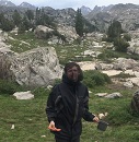
Fortunately, my partner Bill (climbingcue) is always up for an adventure into the unknown. We arrived at Hayden Creek Campground the night before. A connector trail from the campground to the Rainbow Trail apparently exists, but we could not find it in the dark. I wasn't willing to spend too much time looking for it just to save 0.3 miles and 100 vertical feet, so we drove back down to the road to the Hayden Creek Trailhead at 7,600 feet. We parked at a pullout across the road from the trailhead and promptly went to sleep.
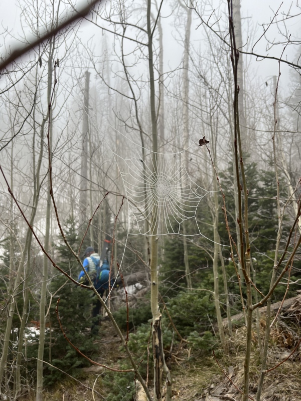
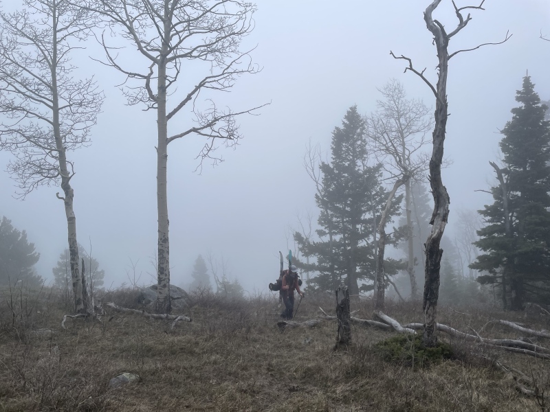
We were on the trail at 5:00 AM the next morning. The Rainbow Trail was easy to follow by headlamp but we wanted daylight for the bushwhack, which we knew was likely to be terrible. A little over two miles in, we departed the Rainbow Trail and followed the North Prong Hayden Creek drainage up, attempting to find the path of least resistance. The tops and bottoms of our skis caught on everything as we clambered over deadfall, and our boots stuck out like giant wings on our backs. Sometimes it was easier to charge through the dense trees like a linebacker and emerge on the other side in a cacophony of snapping branches. At one point, Bill noticed the strap holding my skis in A-frame was gone. Now besides being grabbed by trees, my skis would hit me in the back of the legs. Awesome. On the bright side, the early morning frost made the spiderwebs look cool and helped prevent us from walking face first into them.
Frost: the easy spiderweb detection system!
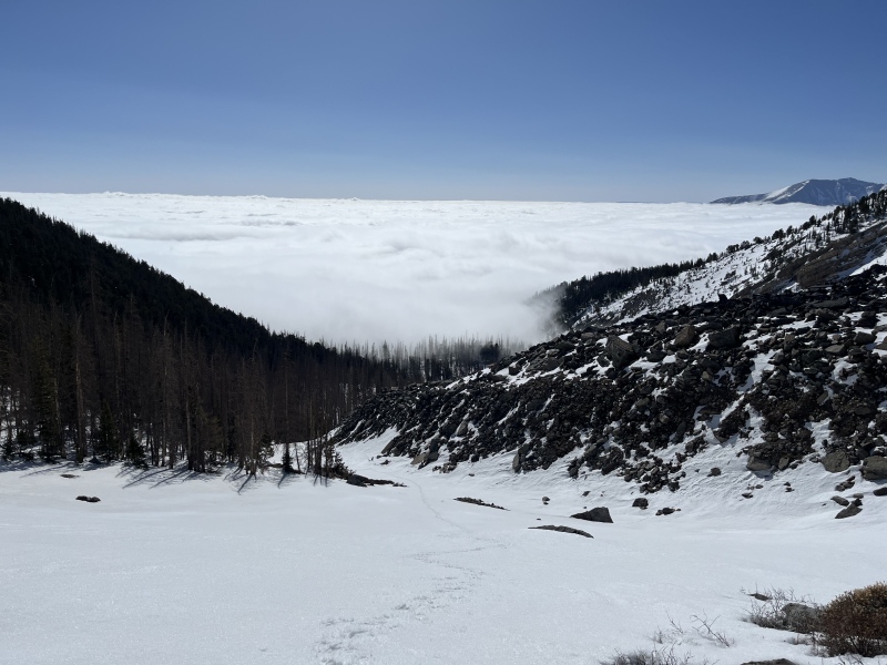
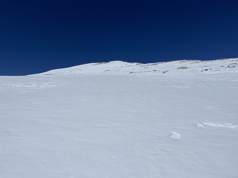
Snow line was at 10,000 feet. The deadfall was too thick and the snow too icy to skin anyway, so we booted across the frozen snow surface. We eventually tired of slipping and swapped out our light hikers for snowboard boots and crampons. Treeline and cloudline arrived at the same time, and we emerged from the forest squinting like newborns in the unexpected bright sunlight. The sky overhead was a deep, unblemished blue and below us was a sea of clouds, mountains rising like islands throughout.
From booting up in a cloud......to being above the clouds.
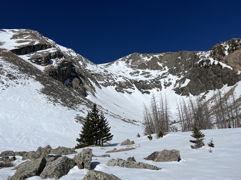
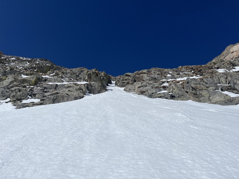
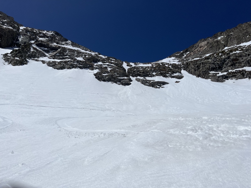
At this point we could have switched to skinning, but we knew we were near the foot of the couloir and it hardly seemed worth the effort to take off our crampons and pull skis off our packs just to have to reverse the operation soon. We finally got our first look at the line and our excitement rose. It was impossible to see the entire couloir until we were directly below it, but it was definitely filled in.
First view of the bowl, the couloir is visible but partially obscured by cliffs. Possible alternate descent route just out of frame to the left.Our line left of center.Getting closer.
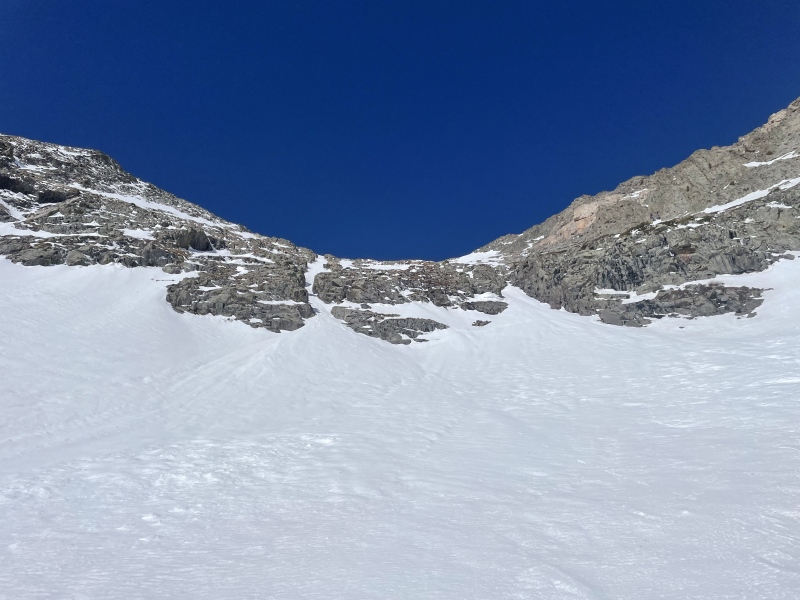
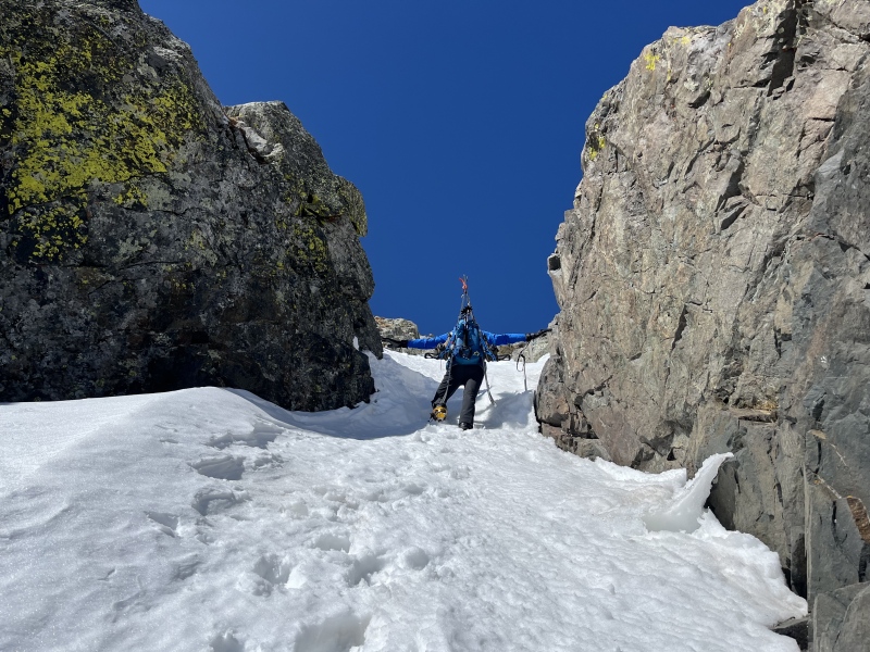
Helmets on head and axes in hand, we started up. The snow was soft and supportable for booting and we fell into an easy rhythm of step, step, plunge axe. At the 46-degree choke, Bill stretched out his arms and could nearly touch the rock walls on either side, making it roughly six feet wide. The choke was icy, and this was the only part of the couloir I used the front point of my axe for.
The choke is approximately one Bill (official unit of measurement) wide.Climbing up the icy choke.
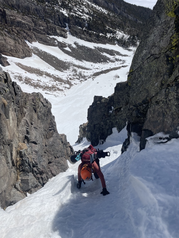
Past the choke, the couloir widened slightly and the angle mellowed to low 40s. In the background, we could see the class 4 east ridge Marmot72 had climbed. It looked incredibly fun. This mountain has a lot of cool features!
In the upper part of the couloir.
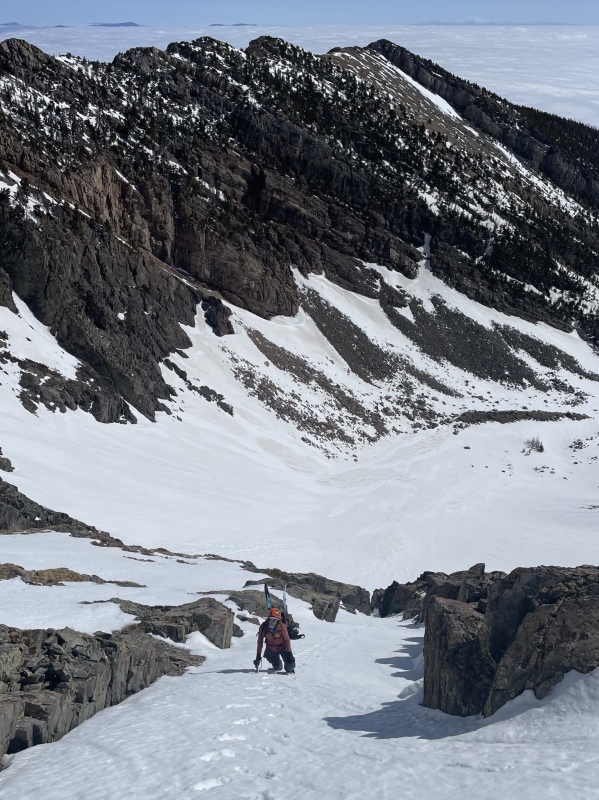
The steep portion of the couloir only lasted for 400 feet. It would have been really satisfying to top out at the summit, but we still had 850 feet to go on mellow snow. The CAIC report had mentioned a wind slab problem on north and east-facing slopes above treeline, and we found a one-inch thick wind crust on the mountain's upper reaches. Since it wasn't steep enough to slide, our only concern was whether the crust would support our weight or send us plunging through. A little of both ensued as we progressed upwards.
Bushnell's nondescript summit comes into sight.
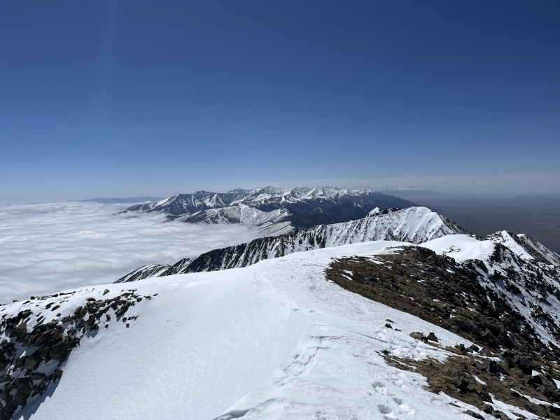
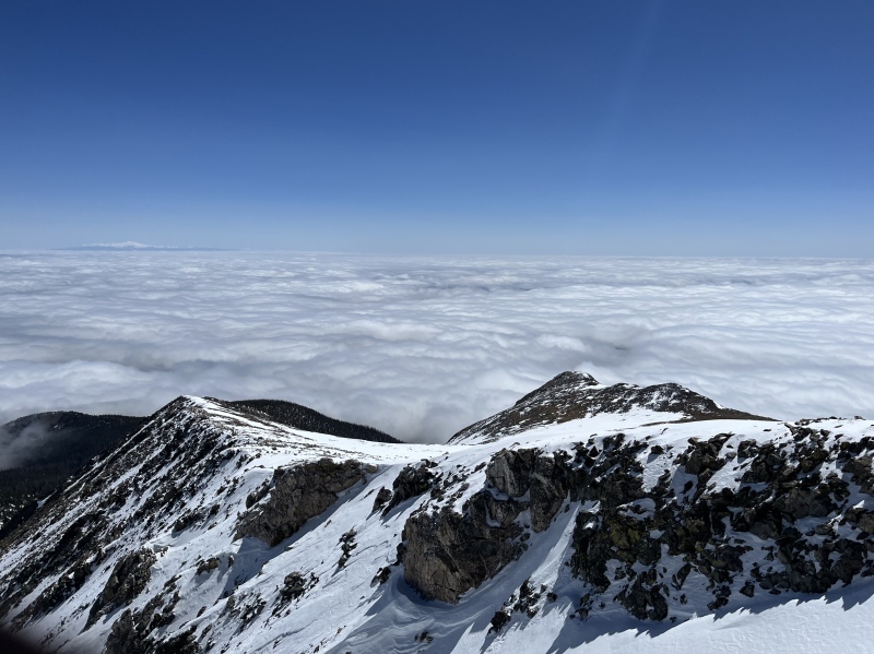
We reached the summit shortly before 11:00 AM. It had taken us an embarrassing six hours to ascend five miles, in large part because of the bushwhack. I sent a text to my boss, letting her know I was definitely going to be late to work. Thankfully, she was understanding. The inversion still hadn't burned off, and we had clear views in all directions. The Sangres sprawled out to the southeast and Pikes Peak was a lone colossus on the northeastern horizon. We set about transitioning for our descent.
Sangres to the southeast from the summit of Bushnell.Looking back at our ascent route between the two ridges, Pikes Peak top left.
Initial wind affected turns off the summit became progressively nicer as we rode down the wide snow field toward the couloir. Once in the couloir, what we thought would be an enjoyable descent quickly became a lesson in sluff management. A thin top layer of snow kept sheeting off, exposing the firm surface beneath. Bill went first, waiting in a safe spot while I made careful jump turns down to him. In the back of my mind was the knowledge that a fall would send me pinballing off the rock walls of the couloir. We squeezed through the choke and onto the apron, whose wide-open nature was a relief after the constriction of the couloir.
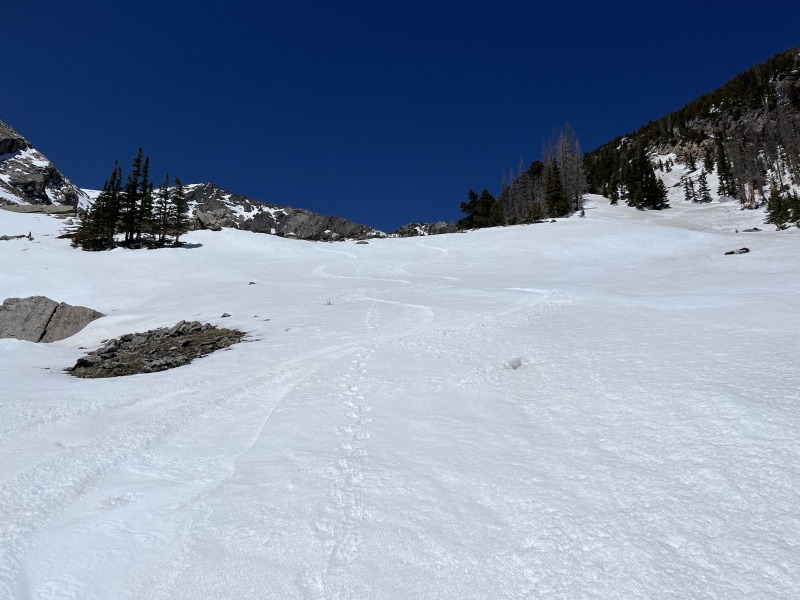
Our tracks exiting the couloir.
With the hardest riding behind us, we made some stress-free corn turns down into the trees, billy-goating a few sections until the snow became too discontinuous to ride. We had descended nearly 3,000 feet from the summit.
Corn turns over our footsteps from the morning.
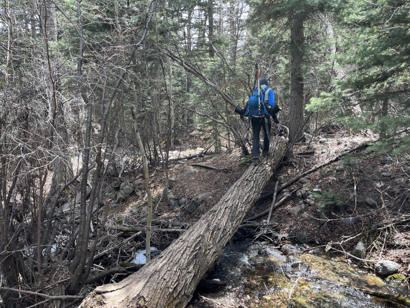
The bushwhack was even worse on descent. The snow we had walked over so easily that morning had softened and no longer supported our weight. The bottoms of our skis were also more likely to catch on things going downhill than uphill, where the ground slanted away from the tips. My ski strap did not reappear but we found an old Mountain House meal, evidence that someone beyond us had been up this godforsaken drainage. The sound of dirt bikes alerted us of our proximity to the Rainbow Trail and I thought longingly of my own, parked unhelpfully 172 miles away in the garage at home. My shoulders were killing me, and I could have done without the last two miles of trail walking, nice as it was compared to the bushwhack.
When one rider stopped briefly to chat, I told him I wished I had my dirt bike. He responded, "I don't know, the three miles up this trail and back are almost too much. You guys are probably doing better than we are!"
I sincerely doubted that.
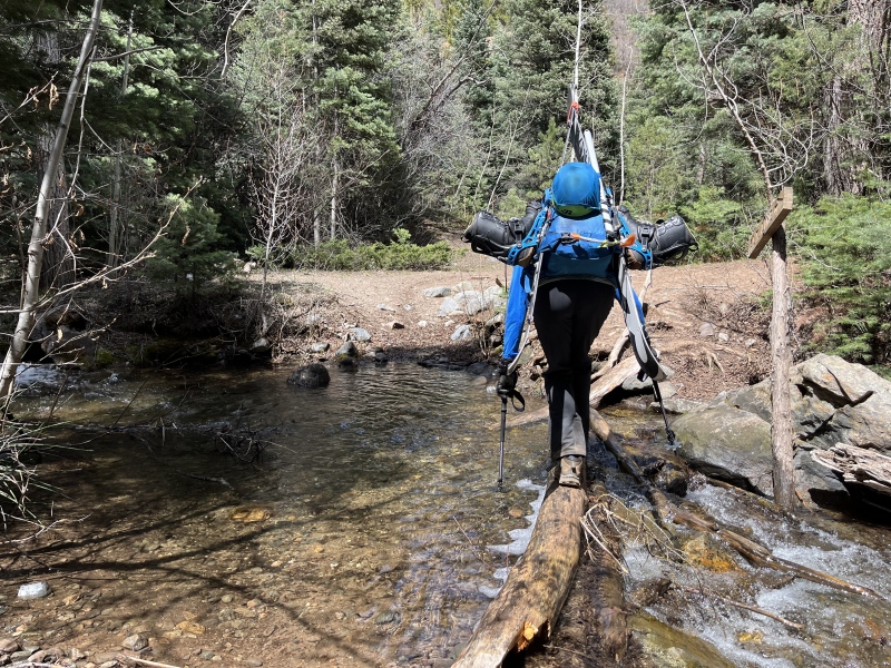
He rode off to catch up with his friend and we followed at a much slower pace, reversing the five creek crossings we had completed in the dark that morning. I managed a one-hour nap during the drive home, arriving at work 1 hour and 20 minutes late with profuse apologies to my coworker, but no regrets on a day well spent.
Crossing the creek on a downed tree.Bill stubbornly refusing to extend his poles to help with the crossing.
My GPS Tracks on Google Maps (made from a .GPX file upload):
Really enjoyed reading this. The bushwhack both sounded and looked dreadful - and the pic of Bill at the choke is cool. How you folks ski through spots that tight is beyond me!
As soon as someone installs a ski lift. Or gondola. Or tram. Which would also presumably mean they would be nice enough to clear a proper path up to it.
This just got added to my list, looks like a blast!!! Ive had nothing but wretched luck on Sangre Snow but this looks fun enough for me to toss the dice again.
@Marmot - thank you again for the inspiration, and for reading. Im glad you enjoyed it!
@Boggy - we were definitely fortunate to get it in such good condition! Thanks!
@Geo - if they put in a chairlift Ill be right there with ya! Though I seem to remember another attempt to open a ski resort in the Sangres that didnt go so well
@Steve - if I had to compare the two, I would rate this couloir as slightly easier with only one choke point compared to the many we had to navigate between beginner skiers on Why Not
@Geckser - you and Arthur are always doing cool things in the backcountry, let me know your take on it if you go! If you follow my track you may even get a free ski strap out of it
@Dave - thanks for the info, I will have to check out that book! I figured someone else had to have done it, and it tracks that that person would be Furthermore
@Eric - thanks! Me too, wind is my least favorite type of weather
I spotted this line 8 years ago and talked to Marmot 72 on if he'd ever climb or skied it or if it went.... Now I know, freaking rad work and I can't wait to get on it, cheers!
Caution: The information contained in this report may not be accurate and should not be the only resource used in preparation for your climb. Failure to have the necessary experience, physical conditioning, supplies or equipment can result in injury or death. 14ers.com and the author(s) of this report provide no warranties, either express or implied, that the information provided is accurate or reliable. By using the information provided, you agree to indemnify and hold harmless 14ers.com and the report author(s) with respect to any claims and demands against them, including any attorney fees and expenses. Please read the 14ers.com Safety and Disclaimer pages for more information.
Please respect private property: 14ers.com supports the rights of private landowners to determine how and by whom their land will be used. In Colorado, it is your responsibility to determine if land is private and to obtain the appropriate permission before entering the property.
")
")
")
")
")
")
")
")
")
")
")
")
")
")
")
")
")
")