| Report Type | Full |
| Peak(s) |
Mt. Oso - 13,689 feet "Mt. SoSo" - 13,421 feet Irving Peak - 13,216 feet "Weminuche Peak" - 13,240 feet Peters Peak - 13,138 feet "P 2" - 13,288 feet "P 3" - 13,279 feet Unnamed 13229 - 13,229 feet Unnamed 13350 - 13,350 feet Unnamed 13323 - 13,323 feet |
| Date Posted | 05/04/2025 |
| Modified | 05/29/2025 |
| Date Climbed | 09/02/2023 |
| Author | Chipmunk |
| Additional Members | climbingcue |
| Moon Lake 13ers |
|---|
|
Moon Lake 13ers Trailhead: Pine River Distance: 58 miles Vertical Gain: 18,260 feet Dates: September 1-4, 2023 Table of Contents Day 2: Peters Traverse & Weminuche Peak Day 4: SoSo, Oso, Irving and pack out Introduction Tucked away in a remote corner of the Weminuche, this cluster of peaks sees more marmots than mountaineers. The Rock Lake approach is used most frequently, though I use “frequently” somewhat liberally, as none of these summits boasts more than 100 recorded ascents on the 14ers website. Even Mount Oso, a bicentennial and undoubtedly the biggest draw to the area for most peakbaggers, has just 92. When you look at its shorter neighbors, the number halves. My partner Bill and I were working through the bicentennials, with Mount Oso high on our list. Despite my interest in the peaks, I was vastly uninterested in yet another long, bone-rattling drive to Beartown. Having bounced my way up that road twice already, I was in no rush to do it again. This led me to explore alternative approaches, and Moon Lake quickly caught my eye. It offered easy trailhead access and an approach similar in stats to Chicago Basin from Purgatory. While longer than the Rock Lake route, it came with a major perk: no re-climb of Hunchback Pass on the way out. That was all the convincing I needed. We set our sights on Moon Lake and quiet summits beyond. Day 1: Pine River TH to Moon Lake We were both exhausted when we arrived at Pine River Campground the night before, myself from a climb of US Grant, V4, and V2 that day and Bill from his 7-hour drive from Granby. The campground came equipped with the basics: a vault toilet and a large parking area. We chose a spot near some horse trailers and quickly turned in for the night. When we arose the next morning, the group of cowboys parked across from us were already awake. From the looks of all the gear they had laid out in the parking lot, it was clear it would be some time before they were ready to hit the trail with their horses. We, on the other hand, had a much simpler task organizing our packs and were on our way at 7:40 AM. Before the trip, I had noticed on Google Maps that County Road 501 continued past the campground and paralleled the trail for the first two miles. I reached out to the Forest Service, who quashed my hopes of shortening the approach by responding that it was a private drive. And indeed, these signs peppered the side of the trail for the first couple of miles. 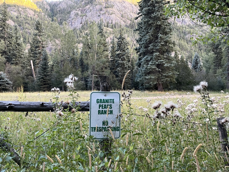
No matter - we continued on. The first six miles were flat and passed quickly as we followed the trail along the Los Pinos River. At mile six, we crossed a bridge over Lake Creek and reached a trail junction, where we turned left onto the Lake Fork Trail and began our first real climb. Over the next four miles, we gained 2,000 feet to reach Emerald Lake, the second largest natural lake in Colorado. We truly got a sense of its scale as we followed the undulating path along its shoreline for an impressive two miles. 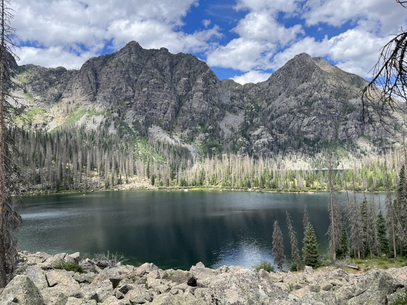
At the northern end of the lake, the trail continued through a long meadow, fainter than it had been below Emerald Lake. As we navigated this section, we encountered a flooded stretch of trail. Following a bypass stamped out in the willows to the left, we discovered the source of the water - a rushing stream. A pair of logs had been placed across it, forming a makeshift bridge. We crossed carefully, grasping the encroaching willows for balance. Once safely across, we rejoined the dry trail and continued through the meadow. At its upper end, we crossed the creek and began the final push up to Moon Lake. This climb was steeper and more taxing, especially as the fatigue of the day began to set in. 

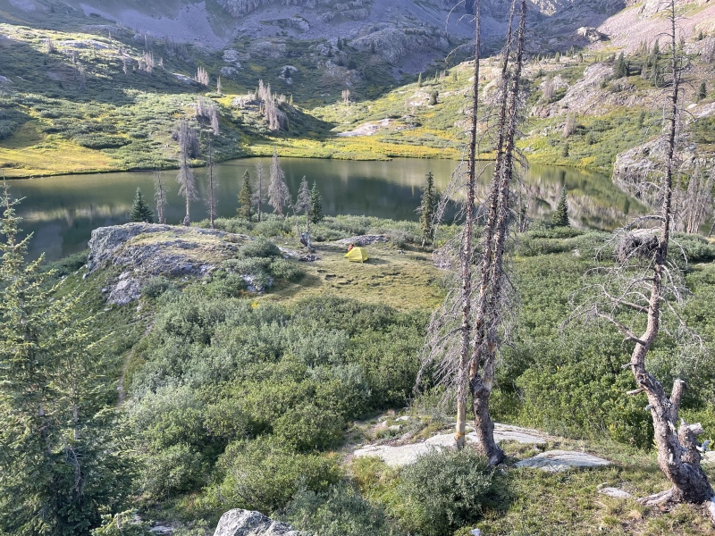
We arrived at Moon Lake and set up camp in a spot tucked in the ‘crescent’ of the lake. As we were setting up, a group of anglers showed up, no doubt hoping to catch some of the many cutthroats we saw swimming in the crystal-clear water. After they left, we took much-needed baths in the lake, with the warm sun drying us quickly. As we cooked dinner, we spotted an approaching party - it was Dillon Sarnelli and his dog, T-Rex! Dillon had orphaned Weminuche Peak on a previous trip and had returned to collect it. We chatted for a bit while T-Rex frolicked around us with the wild abandon of someone who had not just hiked almost sixteen miles. I was envious of his energy levels, and eventually, we all retired to our tents for the night to replenish our own. 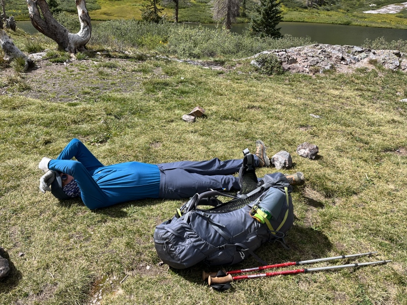
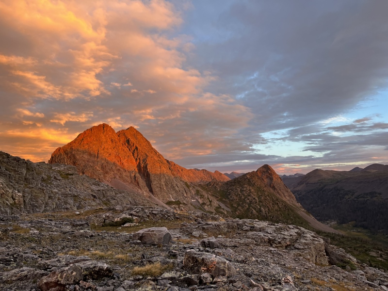
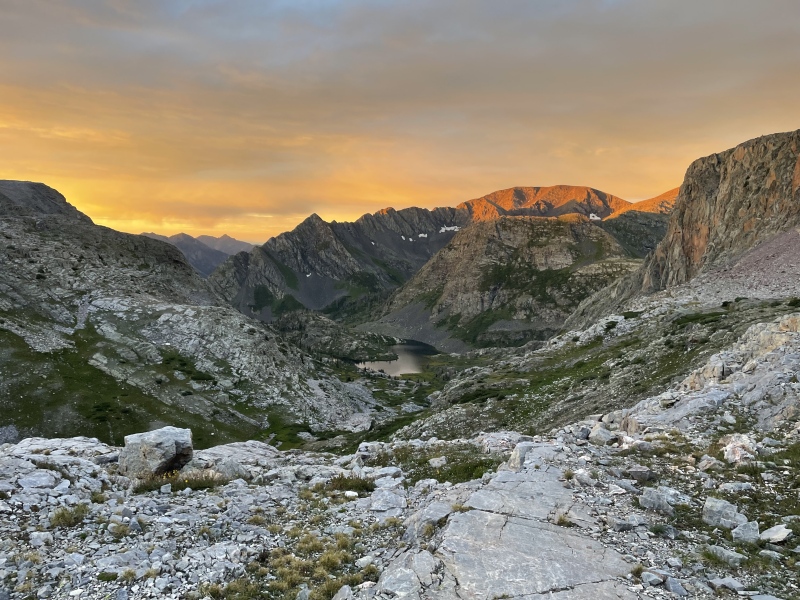
Distance: 15.7 miles Vertical Gain: 4,500 feet Time Elapsed: 7 hours, 15 minutes Day 2: Peters Traverse & Weminuche Peak We were up and on the trail by 6:00 AM the next morning, knowing this would be the biggest climbing day of our trip. Much of the time would be spent on an exposed ridgeline, so we prepared ourselves accordingly. The trail petered (no pun intended) in and out as we followed easy grass and rock slabs toward Half Moon Lake and the pass beyond, where a glorious sunrise and alpenglow on the surrounding peaks rewarded our early efforts. 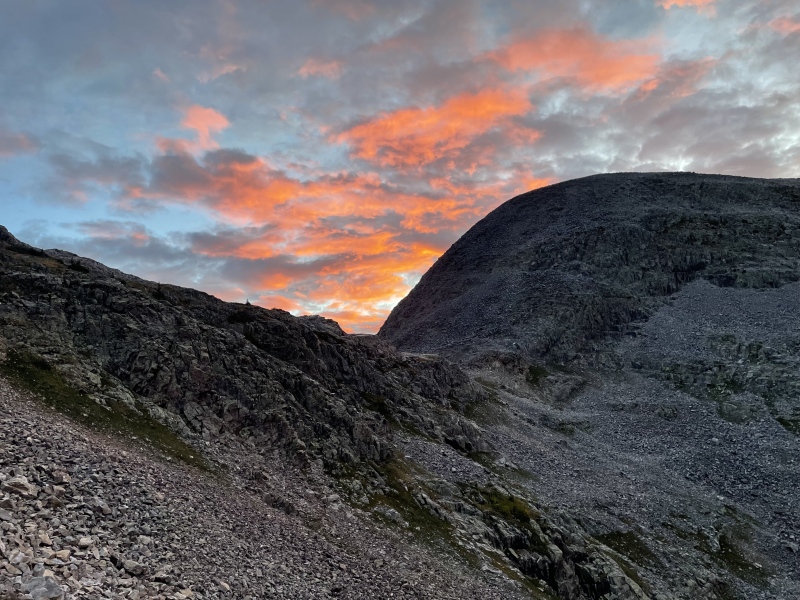

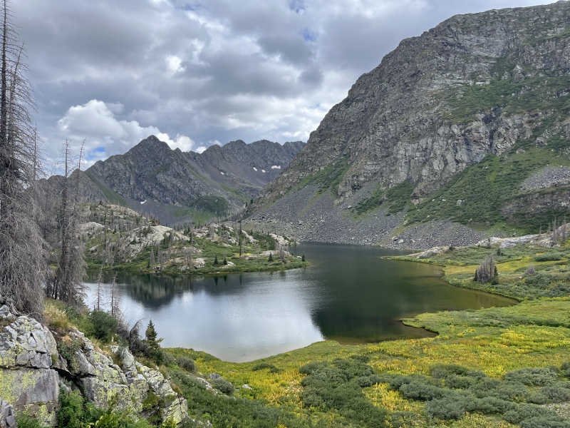
The trail was better defined on the Rock Lake side, and we descended 600 feet to reach the lake. We had elected to start the traverse with Peters Peak to get on the ridge sooner. From Rock Lake, we ascended past a small lake to the Peters-Buffalo saddle, then directly up a steep grass and rock slope to the summit of Peters. It was only 8:15 AM, but already we noted storm clouds to our west. After a quick discussion about the weather we continued on to UN 13,229, reasoning that we could always retreat the way we had come if conditions deteriorated. 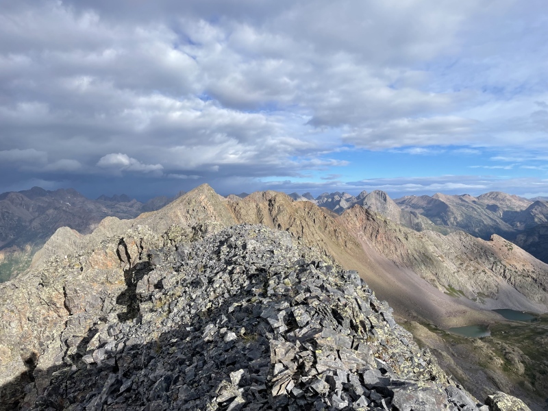
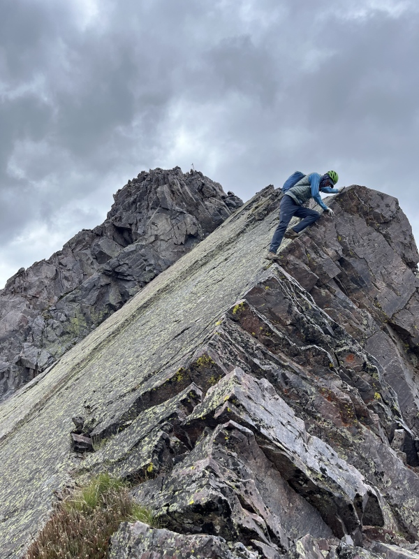
Much has already been written about the Peters Traverse, and for more detailed beta, I’d direct you to the excellent trip reports already posted here and here on the 14ers website. The weather was holding as we stood atop UN 13,229 and committed to the traverse. There wouldn’t be another reasonable exit for a mile and a half, well past our next summit, so this was the point of no return. The next mile to P3 was, in a word, talus. Endless talus. Not the worst I’ve seen, but not exactly inspiring either. Fortunately, P3 redeemed itself at the top with a short, exposed summit block that offered fun, airy class 3/4 scrambling. From there, more talus led us to the false summit of P2, where the main feature of the day awaited: the Slab. An enormous, solid, downsloping sheet of granite lined with jagged teeth, the Slab dropped steeply away from the ridge like a giant natural slide. We descended it with care, using the serrated edges for hands and feet. The exposure and uniqueness of the feature finally made the long effort to get here feel worth it. 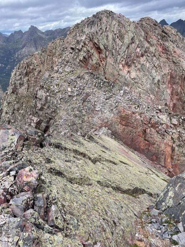
From the saddle, a loose class 3 gully brought us to the true summit of P2. Our hiking poles stood tall back on the false summit, where we had left them to await our return. By this point, we'd tempted the weather gods enough, and our desire to be off the ridge outweighed any lingering ambition to tag unranked P1 and its promise of untold riches… er, more scrambling. Besides, returning the way we came meant we got to climb the Slab twice! We hastened back over P2's false summit and descended to the P2-P3 saddle, where we picked a spot to slip-and-slide down to the rock glacier below. A sped-up video of me returning over the Slab. We still had a long way to go to camp, so we trended northeast, passing an unnamed lake and following its drainage down. Easy passage was soon marred by the slash of a cliff band. I worried this might be the end of the line as I skirted east atop it, but the appearance of a perfect ramp angling down to the valley floor quickly banished that thought. I failed to take a picture of the ramp itself but did take a picture of the columbines growing on it, so enjoy that instead. 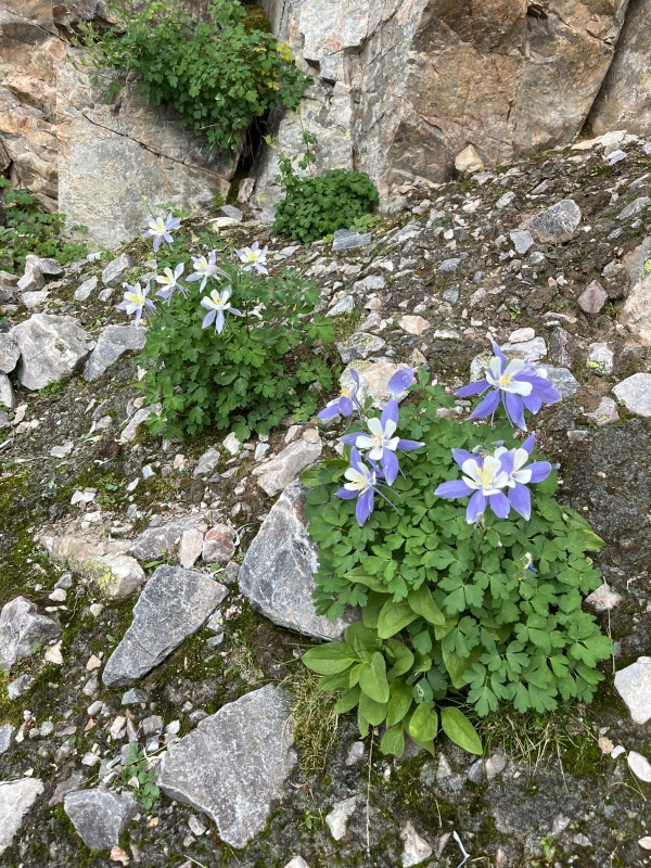
Back on the Rock Lake Trail, we made good time to its namesake, where we found Dillon and T-Rex lounging on the shore after successfully summiting Weminuche Peak. We stopped to swap stories about our respective days before continuing on. A light sprinkle of rain began as we re-ascended to Half Moon Pass, where we had witnessed that spectacular sunrise nearly eight hours earlier. At the pass, we faced a decision: either climb Weminuche now, or head back to camp. We already had four 13ers under our belts and our legs were feeling it, but there was no need to revisit Half Moon Pass for any of the other summits. Putting it off would mean a lengthy detour later on. Opting for present suffering over future suffering, we angled around talus on the southern slopes of unranked UN 13,144 to its conjoining saddle with Weminuche. As we began ascending the west ridge, the skies finally did what they’d been threatening all day and unleashed a brief graupel storm. Though short-lived, it made the rocks slick and the climbing tedious. The summit felt anticlimactic - perhaps an unfair comparison when its competition is the Peters Traverse - and we didn't linger. We retraced our steps across the talus and descended a grassy slope back to camp, ready for a well-earned dinner. 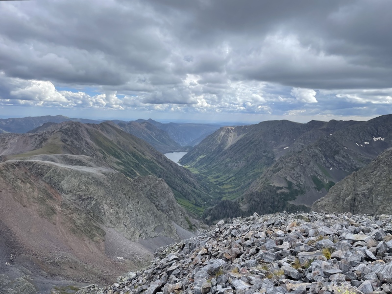
Distance: 12.25 miles Vertical Gain: 5,700 feet Time Elapsed: 10 hours, 30 minutes Day 3: UN 13,323 & UN 13,350 After our pack-in and the previous day's big push, we were thoroughly worked and declared it a rest day. Well, a mountaineer's idea of a rest day, anyway. While many people link the two unnamed peaks with nearby Mount SoSo, we had heard enough horror stories about the loose, chossy ridge between them to opt out. Instead of attempting the troublesome trio, we turned it into a more manageable duo. We headed south from camp, dropping down a gully that led us to a small unnamed lake. From there, a decent game followed a drainage west into the valley these two peaks stand sentinel over. We stayed on the north side of the valley during the approach and quickly found ourselves in the first circle of hell - willows - followed promptly by the second - marsh. Within minutes, we were soaked. The valley climbed to another unnamed lake, where we paused to scope out our route. Two gullies rose above the lake toward the saddle between the peaks. We chose the one to looker's right and began climbing. It was loose and unpleasant, but thankfully short-lived; grassy slopes took over and delivered us to the summit of UN 13,323. From there, the journey to neighboring UN 13,350 was quick and unremarkable, providing a bit of a breather. 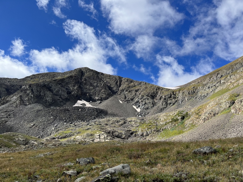
For the descent, we gave the other gully a try since it was slightly closer to UN 13,350. It wasn’t any better than the first, just a different flavor of rubble. Back in the valley, we stuck to the south side on the way out, hugging the rockier terrain. This was significantly better than the willow car wash we endured on the approach, and I highly recommend following our descent track both ways. We made it back to camp by 11:30 AM and spent the rest of the day letting our bodies recover from the previous days' exertions and soaking in the luxury of an unhurried afternoon in the alpine. 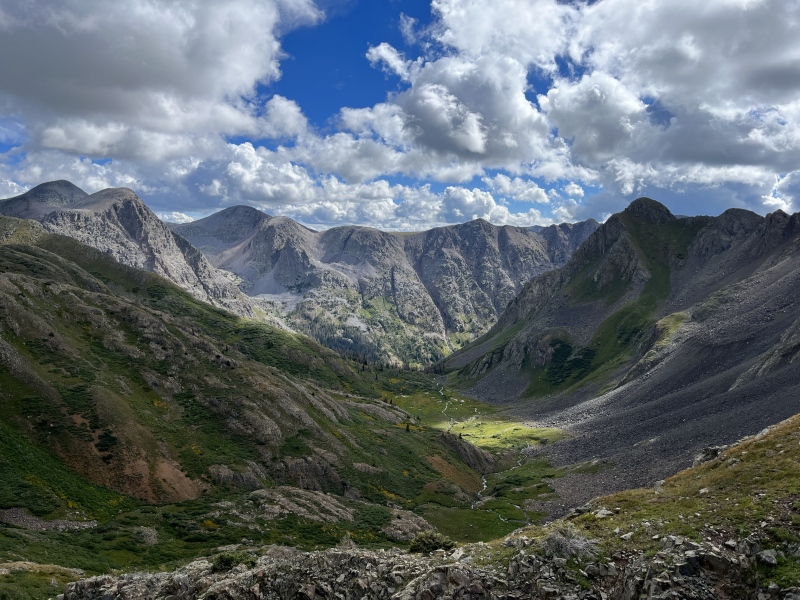
Distance: 5.5 miles Vertical Gain: 2,500 feet Day 4: SoSo, Oso, Irving, pack out On our final day, we began by contouring around Moon Lake from camp, aiming for a willow-choked ramp on the opposite shore that would lead us into the basin below Oso. Faint game trails threaded through the dense willows, offering just enough passage. 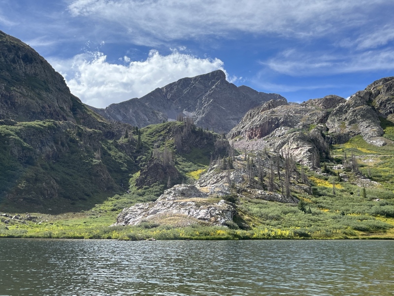
Above the willow ramp, we set our sights on the saddle between Oso and SoSo. The slope leading up to it was split cleanly between dark volcanic black and faintly reddish rock, forming a striking contrast. I immediately dubbed it the Harlequin Couloir. 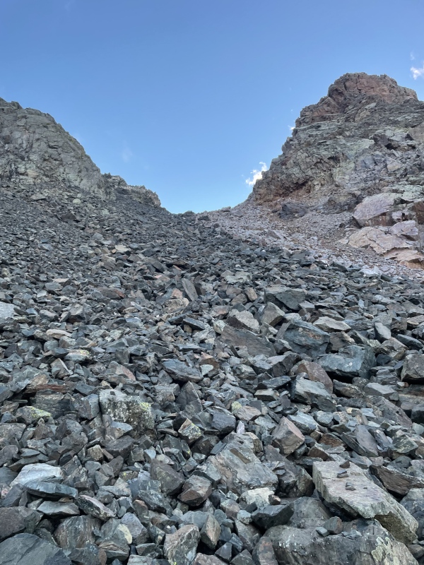

Though Oso was our primary objective for the day, just below the saddle I pitched a change of plans to Bill: why not tag SoSo first? He agreed, and we scrambled up to SoSo's northwest ridge, which had been shielding us from the wind until now. We quickly threw on windbreakers and warmer gloves before continuing up a mix of class 3 and 4 blocks. The rock quality and the fun factor both improved significantly as we climbed. Don't let the name fool you - SoSo delivered some superb scrambling. 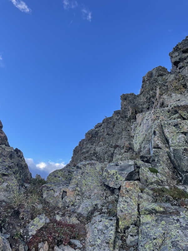

We retraced our steps to the saddle, then dropped 200 feet westward to avoid cliffs before beginning the grind up Oso’s south slopes. Loose talus and a biting wind made for a tough ascent. We reached the summit chilled and windblown, marking Bill’s 195th and my 192nd bicentennial summit. It was a subdued celebration, huddled behind a windbreak and eyeing our final objective: Irving, which looked dauntingly far away. 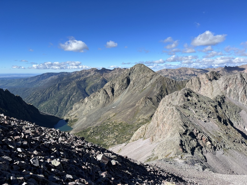
We descended Oso’s broad, rocky west slope to a saddle, which offered us deliverance to the valley below via some grassy class 3 ledges. Once down, we headed due west toward Irving. Instead of dropping to the easier grass, we made things harder by sidehilling across talus. Eventually, we clawed our way up a loose, crappy gully to the saddle between Irving and North Irving, turned south, and strolled up to the summit. 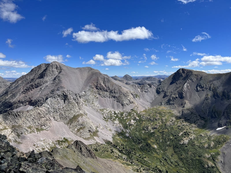
The valley felt sweltering on the return hike. I found myself apologizing to the wind for every nasty thing I’d said about it earlier in the day. Back at the Oso-SoSo saddle, we were especially glad we’d tagged SoSo in the morning, since climbing another peak was the last thing either of us felt like doing. Moon Lake was a welcome sight, and we bashed our way down the willow ramp back to camp. 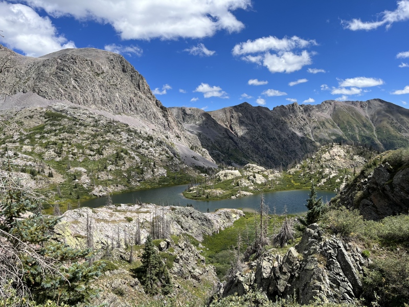
We packed up our home of the past three nights in record time and hit the trail. Our plan was to hike six miles to a small lake at the southern end of Emerald Lake and camp one final night before finishing the hike out the next morning. But when we got to Little Emerald Lake, we were feeling strong and decided to keep going. I snacked on wild raspberries plucked from trailside bushes, doing my best to keep up with Bill's blistering pace. It was nearly 8:00 PM when we got back to our vehicles. Skeptical that any restaurants would be open so late on Labor Day, but craving food that wasn’t freeze-dried, we were delighted to find that the Weminuche Woodfire Grill was, in fact, open. It was karaoke night, and the hostess apologetically informed us that the only available seating was in the karaoke section. We scarfed down hot food while listening to other patrons drunkenly warble out renditions of Stacy's Mom and Love Shack, a jarring reintroduction to society after four days of near solitude. Mileage: 8.5 miles (peaks) + 15.7 miles (pack out) = 24.2 miles Vertical Gain: 4,900 feet (peaks) + 860 feet (pack out) Time Elapsed: 8 hours (peaks) + 30 minutes (tear down camp) + 5 hours, 30 minutes (pack out) = 14 hours Conclusion If I had to do these peaks again, would I still choose this approach over Beartown? I believe I would. Trailhead: The drive to Pine River Campground is simpler and more accessible. Unlike Beartown, which requires 4WD and high clearance, Pine River is reachable with any vehicle. It’s also closer to the Front Range, as well as much of Colorado, excluding areas like Silverton. Even when Beartown appears geographically closer, I suspect the extra miles on paved roads to Pine River are still faster than the slow, rough drive into Beartown. Approach and Deproach: While I’ve approached Leviathan Basin from Beartown, I haven’t hiked the full trail to Rock Lake - only a small section at the bottom of the Peters Traverse. Still, I think I can offer a fair comparison. Both routes offer beautiful scenery and well-maintained trails, but the approach from Beartown to Rock Lake is shorter and has less elevation gain. That said, the return from Rock Lake requires a 2,500-foot climb back to Hunchback Pass, while the Moon Lake exit involves less (though not negligible) elevation gain. I underestimated the undulating nature of the trail along Emerald Lake, mistakenly assuming it would be all downhill. In the introduction, I compared the Moon Lake approach to that of Chicago Basin from Purgatory. Now, having completed it, I’d rate Moon Lake as slightly more difficult despite similar stats. The approach can be broken up with campsites near Little Emerald Lake or by the bridge at the trail junction about six miles in. Camping: While I imagine Rock Lake offers great camping, I personally preferred Moon Lake. It provides stunning views of Oso, numerous flat spots to set up camp, and its unique shape allows for a surprising amount of privacy. Peaks: This aspect is more of a toss-up. There are endless ways to link up the peaks in this region. From Moon Lake, you’re farther from the more technical peaks along the Peters Traverse but closer to other summits. The trails from Rock Lake are more established, but overall, I found the mileage and vertical gain required for the peaks to be fairly comparable regardless of which base camp you choose. Thumbnails for uploaded photos (click to open slideshow): ")
")
")
")
")
")
")
")
")
")
")
")
")
")
")
")
")
")
")
")
")
")
")
")
")
")
")
|
| Comments or Questions | ||||||||||||||||||||||||
|---|---|---|---|---|---|---|---|---|---|---|---|---|---|---|---|---|---|---|---|---|---|---|---|---|
|
Caution: The information contained in this report may not be accurate and should not be the only resource used in preparation for your climb. Failure to have the necessary experience, physical conditioning, supplies or equipment can result in injury or death. 14ers.com and the author(s) of this report provide no warranties, either express or implied, that the information provided is accurate or reliable. By using the information provided, you agree to indemnify and hold harmless 14ers.com and the report author(s) with respect to any claims and demands against them, including any attorney fees and expenses. Please read the 14ers.com Safety and Disclaimer pages for more information.
Please respect private property: 14ers.com supports the rights of private landowners to determine how and by whom their land will be used. In Colorado, it is your responsibility to determine if land is private and to obtain the appropriate permission before entering the property.


