Download Agreement, Release, and Acknowledgement of Risk:
You (the person requesting this file download) fully understand mountain climbing ("Activity") involves risks and dangers of serious bodily injury, including permanent disability, paralysis, and death ("Risks") and you fully accept and assume all such risks and all responsibility for losses, costs, and damages you incur as a result of your participation in this Activity.
You acknowledge that information in the file you have chosen to download may not be accurate and may contain errors. You agree to assume all risks when using this information and agree to release and discharge 14ers.com, 14ers Inc. and the author(s) of such information (collectively, the "Released Parties").
You hereby discharge the Released Parties from all damages, actions, claims and liabilities of any nature, specifically including, but not limited to, damages, actions, claims and liabilities arising from or related to the negligence of the Released Parties. You further agree to indemnify, hold harmless and defend 14ers.com, 14ers Inc. and each of the other Released Parties from and against any loss, damage, liability and expense, including costs and attorney fees, incurred by 14ers.com, 14ers Inc. or any of the other Released Parties as a result of you using information provided on the 14ers.com or 14ers Inc. websites.
You have read this agreement, fully understand its terms and intend it to be a complete and unconditional release of all liability to the greatest extent allowed by law and agree that if any portion of this agreement is held to be invalid the balance, notwithstanding, shall continue in full force and effect.
By clicking "OK" you agree to these terms. If you DO NOT agree, click "Cancel"...
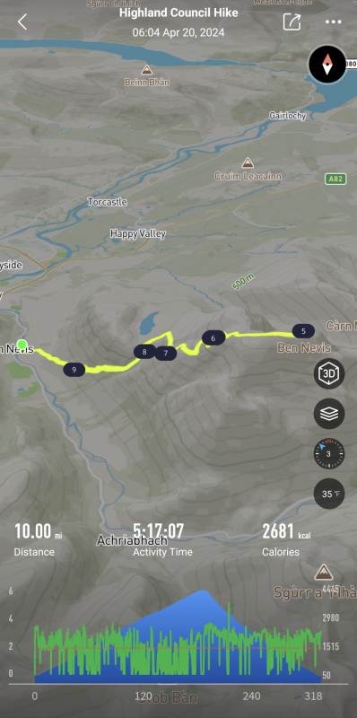
Ben Nevis A.K.A "Beinn Nibheis" 10.0 Miles - 4,600' - 5 hr 17 min Saturday 20-April-2024
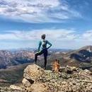
After today when someone asks me if I've hiked the highest peak in the British Isles, I can state that I've simply "Ben There, Done That."
Location
Elevation (ft)
Distance (mi)
Split (mi)
Time
Time (HH:MM)
Split (HH:MM)
Ben Nevis Visitor Centre
50
0.00
0.00
06:04 20-Apr-2024
00:00
00:00
Ben Nevis Summit
4,413
5.00
5.00
09:08 20-Apr-2024
03:04
03:04
Ben Nevis Visitor Centre
50
10.00
5.00
11:21 20-Apr-2024
05:17
02:13
Or in metric...
Location
Elevation (m)
Distance (km)
Split (km)
Time
Time (HH:MM)
Split (HH:MM)
Ben Nevis Visitor Centre
15
0.00
0.00
06:04 20-Apr-2024
00:00
00:00
Ben Nevis Summit
1,345
8.05
8.05
09:08 20-Apr-2024
03:04
03:04
Ben Nevis Visitor Centre
15
16.09
8.04
11:21 20-Apr-2024
05:17
02:13
*All as measured by my Coros Apex 2 Pro
Introduction Well I haven't been really hiking in a while. Aside from some "Denver Area" hikes that I don't really think count my last "real" peak was over a year ago. So I guess it was a bit of a surprise to me that the next decent summit I would get happened to be very far away from the Centennial State. One who's summit happens to be lower in elevation than Denver but is nevertheless significant as being the highest peak in the British Isles.
Ben Nevis; the remnants of an ancient volcano that towers over nearby Fort William, where the Scottish Highlands meet the sea. 4,413' / 1,345m of elevation may not seem like much but given that "The Ben" is at a much higher latitude relative to Colorado, and that most routes start basically at sea level, this is not a mountain to take lightly, particularly in winter or shoulder season.
I happened to be on a work trip to Scotland that would give me this free weekend in-between time in Glasgow and then Aberdeen. I decided to give The Ben a go, and even packed much of my regular Colorado hiking gear prior to my flight. There is plenty of beta on the mountain out there; even two previous Trip Reports on this site: 24-Aug-2008, 23-May-2023. I decided to just not do anything fancy and take the Standard Route which apparently goes by many names including the Ben Path, the Mountain Path or the Tourist Route. The start of this route can be subtly different depending on where you decide to park, or if you decide to do something like stay at the Ben Nevis bunkhouse. I decided to simply start at the Ben Nevis Visitor Centre, which appears to be the most popular option.
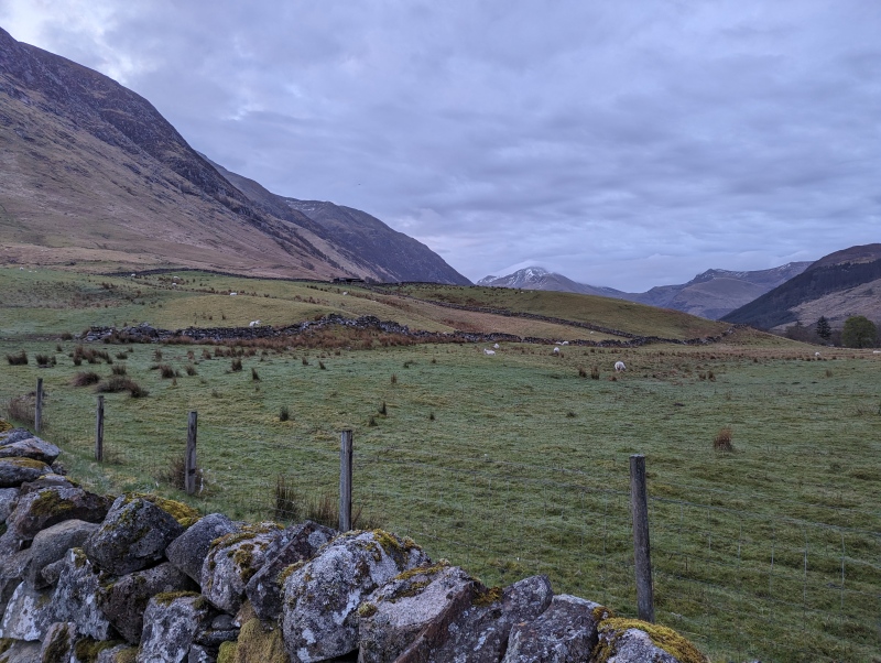
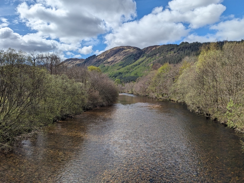
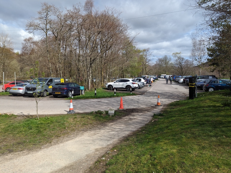
Glen Nevis Visitor Centre and Start of Hike Parking at the Ben Nevis Visitor Centre isn't free. There's an automated kiosk you must use and when I used it I mistakenly put in parking for a full 24 hr and £6, though if you specify less than 24 hr you'll save a few quid. I arrived before 6:00 AM and the place was nearly empty but there were already a few vehicles for hikers that already started or were about to start. I should also mention the Visitor Centre, at least as of the time of this writing, is "temporarily closed" thanks to staffing shortages so I can't speak to what services or amenities they supply (it looks like the toilets were still accessible though).
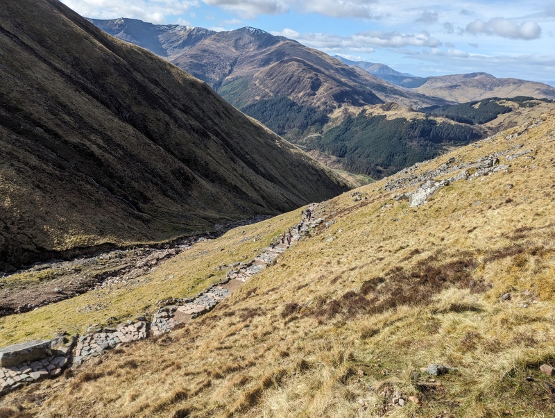
The hike from here is pretty straightforward. Take the bridge from the visitor centre across Glen Nevis, then follow the trail along the edge of a sheep field to the "official" trail that comes out of the Ben Nevis Inn. From here on you're steadily gaining elevation, heading southeast-ish hugging the western flank of Meall an t-Suidhe, a smaller peak north of Ben Nevis.
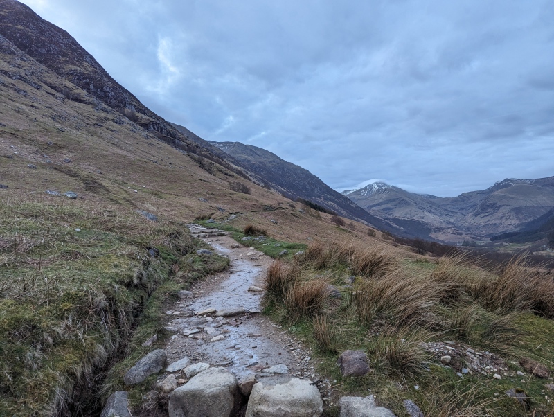
The western flank of Ben Nevis looking a little sheepish to start. Summit not visible here.I've decided these three are named Glenfiddich, Cragganmore, and ArdbegIt's very much a Class 1 trail most of the way to summit. Hugging the side of Meall an t-Suidhe here.
Eventually the route steepens a bit and turns more eastward around 1,400' / 430m, heading towards the saddle between Meall an t-Suidhe and Ben Nevis.
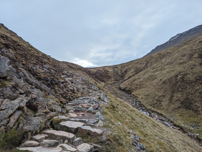
Approaching the saddle, maybe ~200' / 60m below it
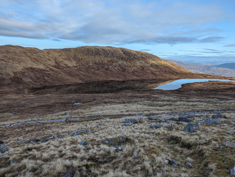
Saddle, Talus, Snow, and Summit The saddle flattens out a bit to give you a bit of a reprieve, and there happens to be a lake sitting up here... or I'm sorry, not a lake, "Lochan Meall An T-suidhe," which gives some nice views. Unfortunately though you're not quite halfway yet. You're close... but you have to then start heading southward on some switchbacks up The Ben from the saddle for a couple hundred feet to actually reach the halfway point.
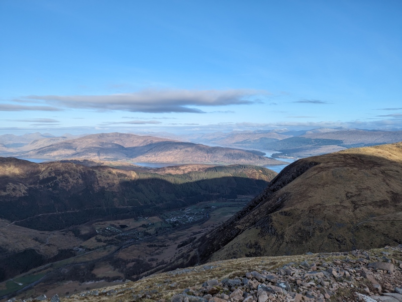
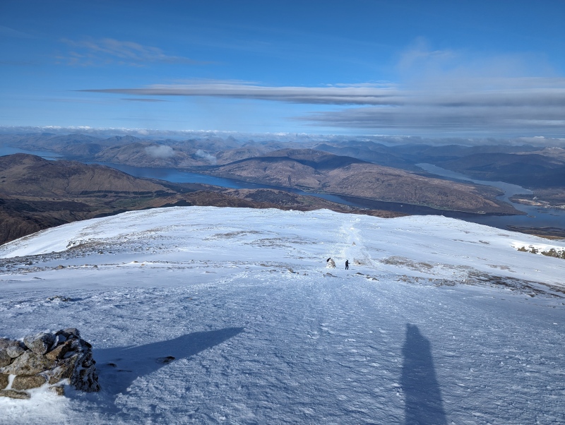
Looking North in the saddle towards "Lochan Meall An T-suidhe" and the smaller peak that gives the water feature its nameHeading up the aforementioned switchbacks looking back northward for those gorgeous views. This was probably about at, or right after, the halfway point. Loch Eil and Loch Linnhe visible, Glen Nevis Visitor Centre just barely obscured.
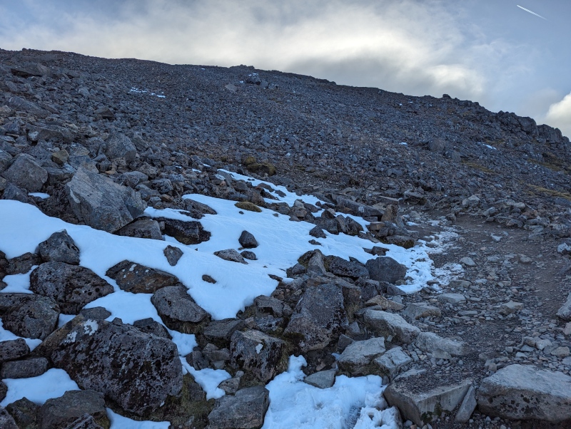
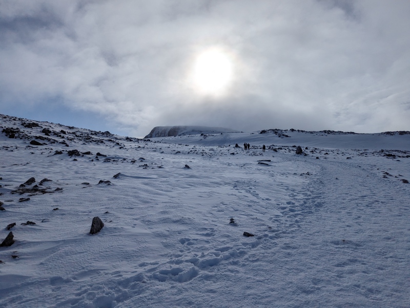
From then on it's much of the same. Long switchbacks up a talusy class 1 trail. About 1000' / 300m the trail starts to get snowy, and given the popularity of the trail this snow is pretty packed down. I put on microspikes here and was very thankful that I did so. Not to say you couldn't summit without them, in fact the vast majority of the people on the mountain that day didn't appear to have any, but the final push to summit in particular seemed troublesome for those who didn't have traction.
The familiar sight of switchbacks up talusThe snow began around 3,300' / 1,000 m
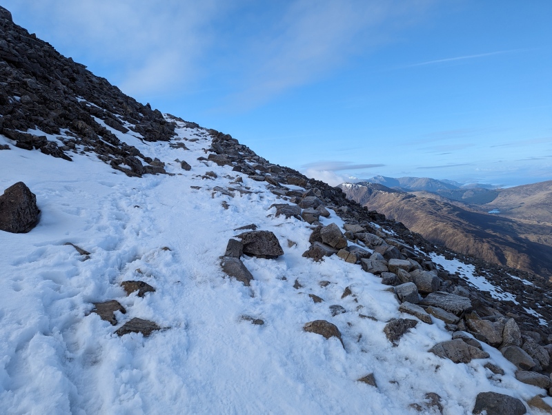
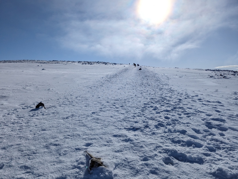
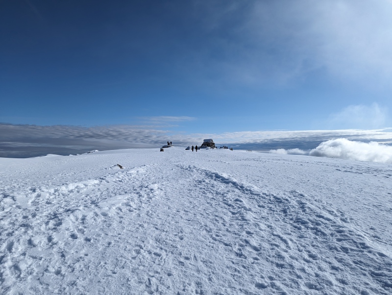
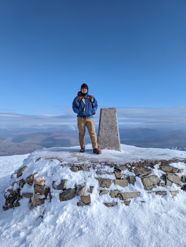
The switchbacks end around 3,900' / 1,200m and then you pretty much head straight south towards the summit. You have a minor false summit or two while making this final push and there's two straight steep bits where traction was definitely helpful. Eventually it starts to flatten out and then you're finally greeted with the view of a summit marker and the remains of a long abandoned meteorological observatory.
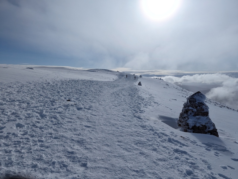
End of the switchbacks and some signs of improving weatherThe last truly steep bit......then a flat bit with a very small false summit......then summit.Highest point in the British Isles, and the highest point for 459 mi / 739 km in any direction.
I'm very thankful for how the weather turned out on this hike. The relatively clear skies are very much atypical for Ben Nevis, especially in "Early Season" as this hike would be classified in April. At summit temps were about 28° F / -2° C or about 18° F / -8° C with wind chill.
The numerous and rather large cairns that start to appear in that final push are indicative of the thick fog that often plagues the summit, fog that can be especially hazardous for navigation. Indeed, it doesn't take much of an internet search to pick up stories of hikers, often ill prepared hikers, getting completely lost at summit who then, in the worst of cases, can even end up descending one of the mountain's steep gullies by mistake.
Descent and Conclusion After a short spell on the summit the descent began, which again was very much helped by my use of traction. I came across more than a few people on the descent who were certainly struggling or slipping/falling without it.
It then became apparent how popular this peak happened to be. Starting around 6:00 AM there weren't too many people joining my ascent, but on my way down the trail was as crowded as Quandary Peak's standard route on a summer weekend. And also, much like Quandary in summer, it was worrying seeing the number of hikers ascending wearing nothing but tennis shoes and carrying nothing but a water bottle. I guess there's a reason they call this the "Tourist Route."
Other than that though the descent was straightforward. My legs were certainly tired given my recent dry spell of "real" hiking but I nevertheless made it back to my car without issue.
Enjoying the last bit of views on the way downCrowds! Just below the saddle.Crossing Glen Nevis bridgeThe car park was WAY busier around 11:00 AM when I finished
Overall a really good day. A tiring one, but a good one. If I were to do it again though I'd definitely choose one of the non-standard routes if able to do so. The CMD Arete route in particular was recommended to me by a friend (and is covered in one of the trip reports mentioned above) but I wanted to avoid something that technical; especially since I was solo, and especially since it's early season.
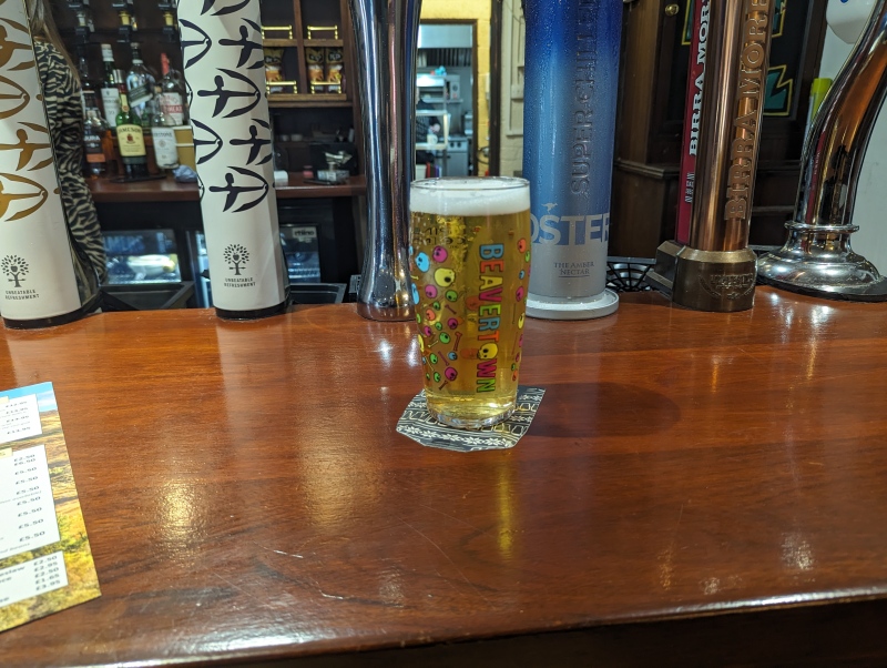
Anyway after packing everything up at the car all that was left for me to do was head into town and grab a pint to celebrate.
Pint at "The Lochy"Coros Track
*note the GPX file comes from Gaia GPS on my phone, since Coros apparently formats .gpx files in a way that isn't accepted here (?). So there will be subtle differences.
My GPS Tracks on Google Maps (made from a .GPX file upload):
this brings back such awesome memories- we climbed in late september, so no snow, but very cool to see it at a different time of year! i don't think i'll soon forget this hike (or the beef pie i had afterwards)
We went the back way the Carn Mor Dearg Arete Route, missed all the chanting monks. :)
Caution: The information contained in this report may not be accurate and should not be the only resource used in preparation for your climb. Failure to have the necessary experience, physical conditioning, supplies or equipment can result in injury or death. 14ers.com and the author(s) of this report provide no warranties, either express or implied, that the information provided is accurate or reliable. By using the information provided, you agree to indemnify and hold harmless 14ers.com and the report author(s) with respect to any claims and demands against them, including any attorney fees and expenses. Please read the 14ers.com Safety and Disclaimer pages for more information.
Please respect private property: 14ers.com supports the rights of private landowners to determine how and by whom their land will be used. In Colorado, it is your responsibility to determine if land is private and to obtain the appropriate permission before entering the property.

")
")
")
")
")
")
")
")
")
")
")
")
")
")
")
")
")
")
")