Download Agreement, Release, and Acknowledgement of Risk:
You (the person requesting this file download) fully understand mountain climbing ("Activity") involves risks and dangers of serious bodily injury, including permanent disability, paralysis, and death ("Risks") and you fully accept and assume all such risks and all responsibility for losses, costs, and damages you incur as a result of your participation in this Activity.
You acknowledge that information in the file you have chosen to download may not be accurate and may contain errors. You agree to assume all risks when using this information and agree to release and discharge 14ers.com, 14ers Inc. and the author(s) of such information (collectively, the "Released Parties").
You hereby discharge the Released Parties from all damages, actions, claims and liabilities of any nature, specifically including, but not limited to, damages, actions, claims and liabilities arising from or related to the negligence of the Released Parties. You further agree to indemnify, hold harmless and defend 14ers.com, 14ers Inc. and each of the other Released Parties from and against any loss, damage, liability and expense, including costs and attorney fees, incurred by 14ers.com, 14ers Inc. or any of the other Released Parties as a result of you using information provided on the 14ers.com or 14ers Inc. websites.
You have read this agreement, fully understand its terms and intend it to be a complete and unconditional release of all liability to the greatest extent allowed by law and agree that if any portion of this agreement is held to be invalid the balance, notwithstanding, shall continue in full force and effect.
By clicking "OK" you agree to these terms. If you DO NOT agree, click "Cancel"...
It was about that time of year again where Owen and I wanted to tackle a miserable, snowy fourteener. We had previously talked about going for Quandary West Ridge, since it seemed like it wouldn't be too much of a step up from Kelso Ridge (which we had done the previous year in MUCH worse conditions). It was a pretty easy plan to put together, just kind of leave before I-70 traffic got too bad, then climb it with skis and take the easy way down. We arrived at the trailhead at 7:00 or so (if my memory doesn't fail me, which it often does), the only souls in the parking lot at such a God-forsaken, early, alpine-start-type hour.
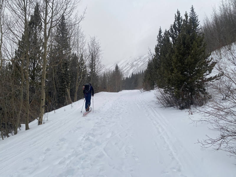
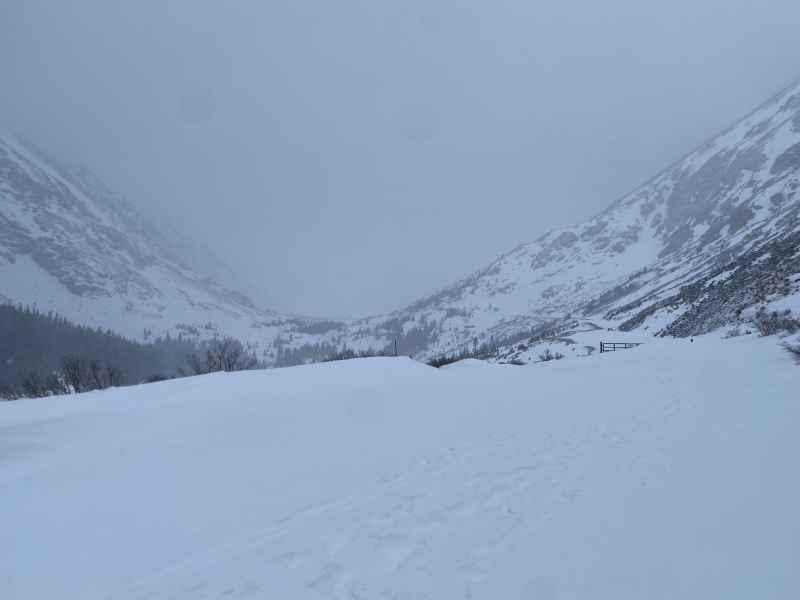
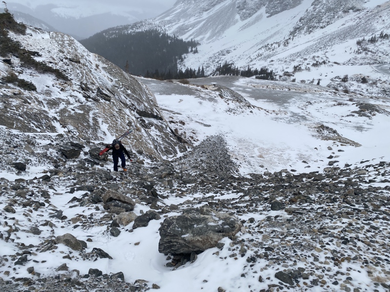
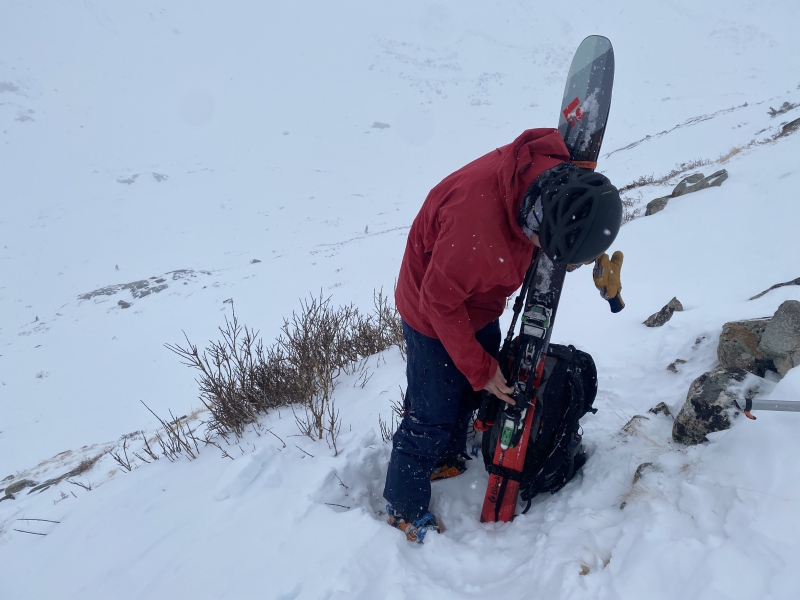
We decided to skin up the Blue Lakes Road, a good decision. Towards the top the road was a bit windblown, but we never had to take off our skis so it was definitely worth it in retrospect. Once we got to the dam we did have to take off the skis briefly to go up a talus slope, but we put them right back on on the top. We had decided to forego the traditional (summer) approach due to avalanche concerns, so we were going to be touring up a bit further than is typical for this route, to the lower-angle slopes that could still take us up to the notch at the start of the ridge.
Love that the road was filled in, made our lives a whole lot easier.Visibility wasn't exactly terrific. We knew a storm was coming in later in the day.The quick slopes under the dam.
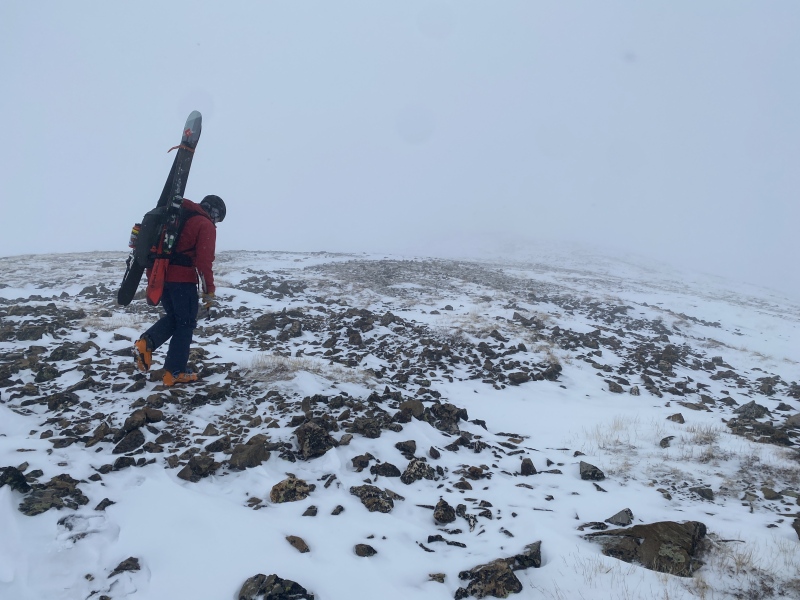
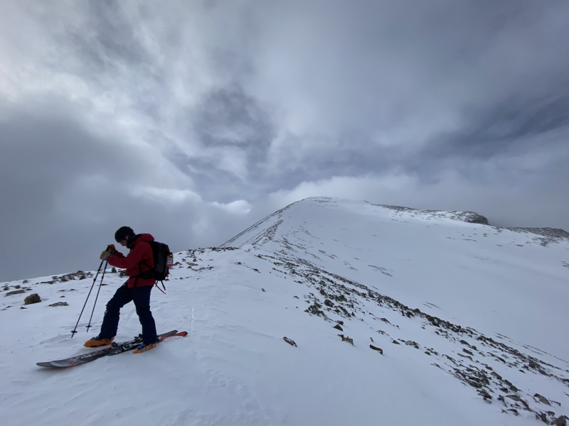
After we saw some slopes that looked thin enough to just head straight up, we turned north and painstakingly booted up for some rocky elevation gain. We figured it was likely safe enough from an avalanche standpoint (despite being pretty steep) due to how thin the snow actually was up there. Before long we were walking along the ridge with a view (if you can call cloudy skies a view) of the West Ridge route itself.
One of the brief dry spots along the Blue Lakes drainage.Quick take off the skis to quick boot up to quick walk to the ridge.Looking across the drainage that the summer trail travels up.
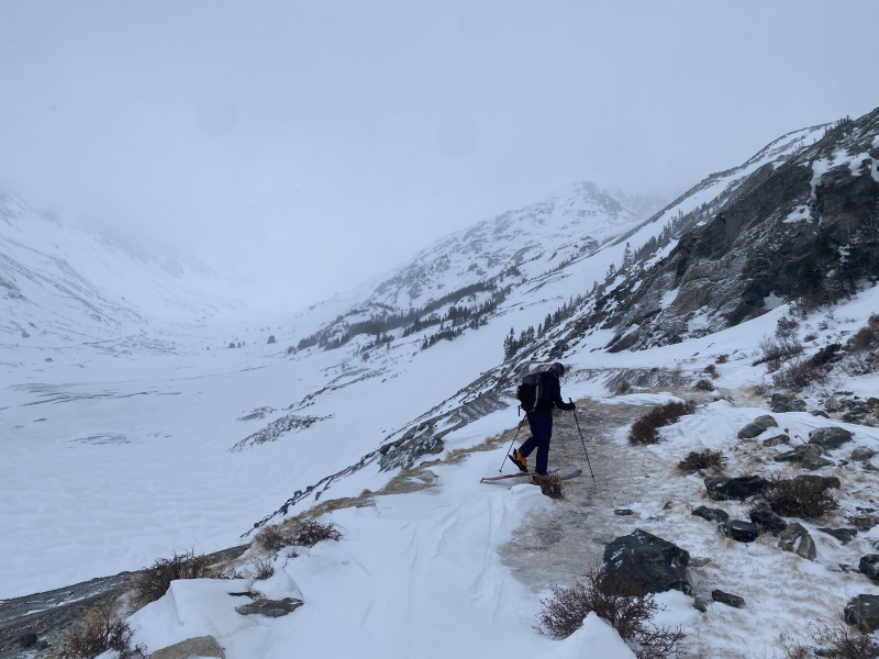
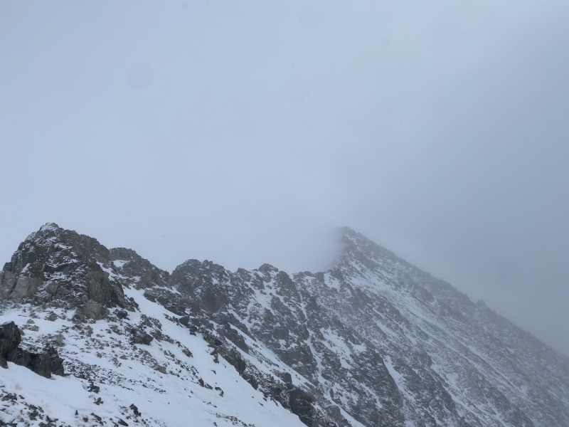
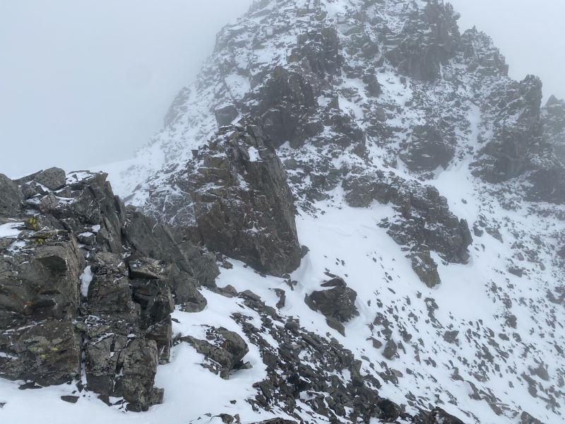
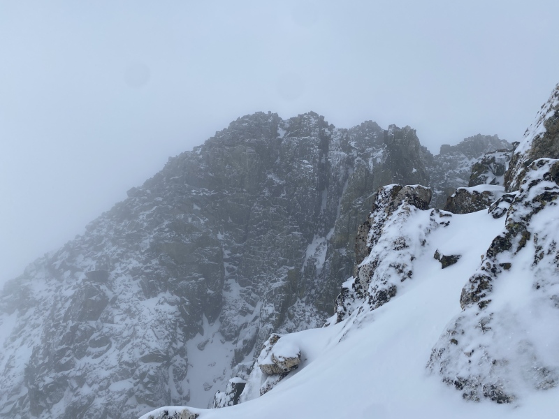
Despite really not being able to see anything, the weather was pretty awesome. It was perfect temps with little wind, so we had to do a bit of de-layering while we crossed the talus field. Once we got to the notch in the ridge we got a good look at the drainage you usually use to approach the climb, and I felt justified in the way that we took (despite the additional vert you have to gain), since the top portion was full of snow and had a pretty nasty wind layer on top of it.. The sky was clearing up just enough for us to see the route that lie ahead of us, making for some dramatic photos.
The endless walk across talus before the ridge starts.The ridge into oblivion.The real final stretch to the notch in the ridge.
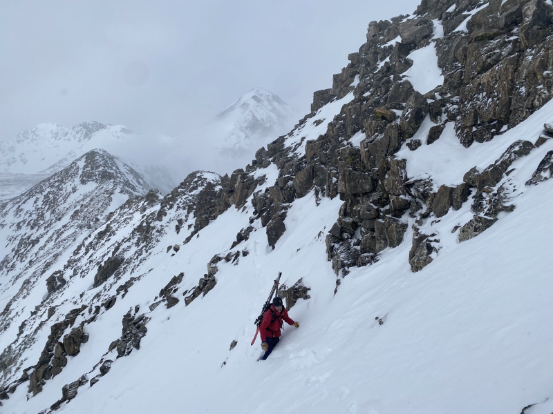
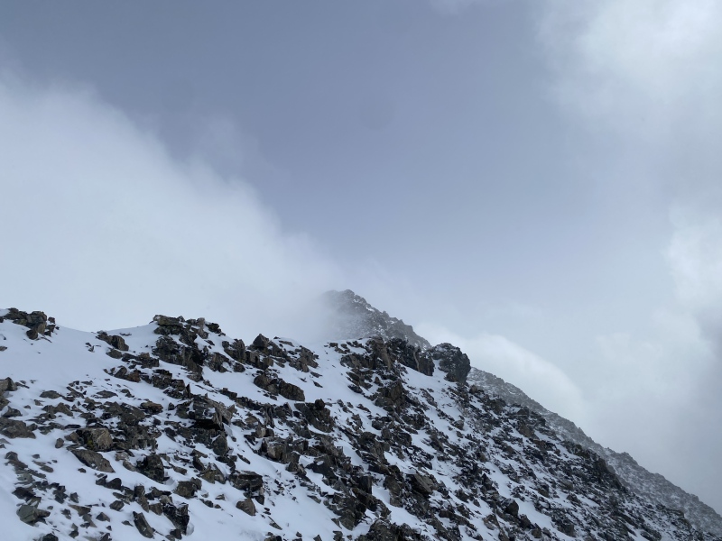
Now the part where we had to grind out all the vert to 14k feet. The very beginning of the ridge had some interesting snow crossings above some decent exposure, but it soon just turned into a trail with a bunch of switchbacks. We left crampons on for the entirety of this trail, though not actually necessary we were just too lazy to transition. It really is a long way until anything even resembles Class 3 on this ridge.
Some snow to cross on the right-hand side.Clearing up a bit!
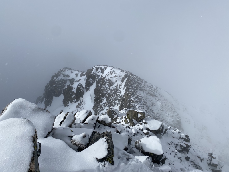
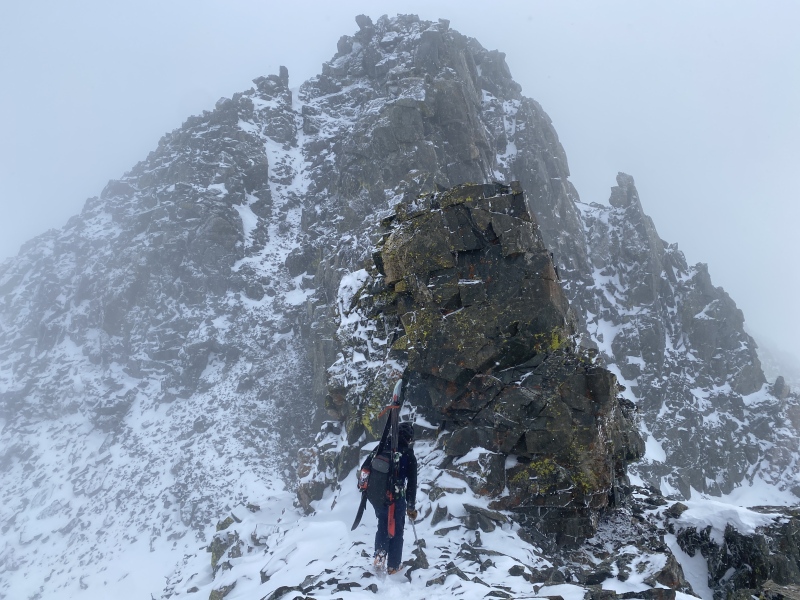
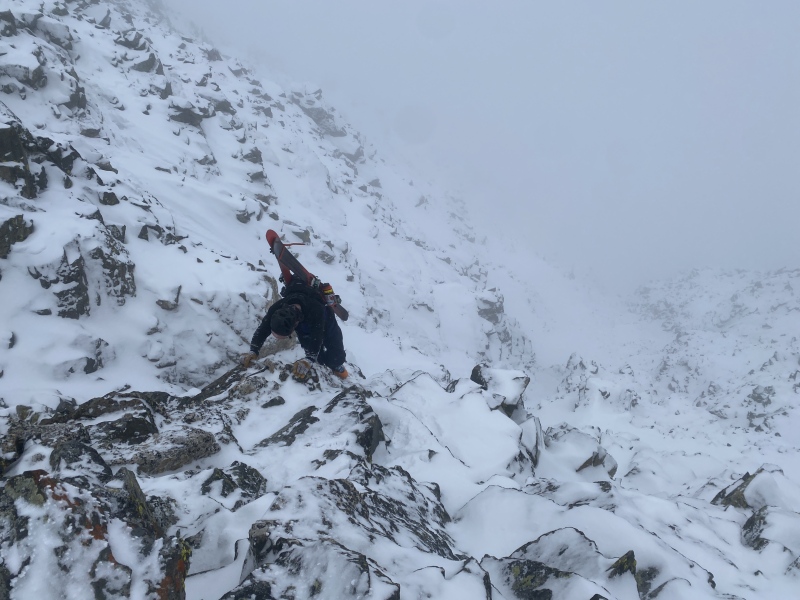
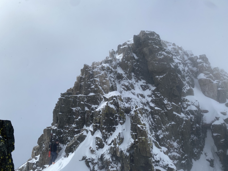
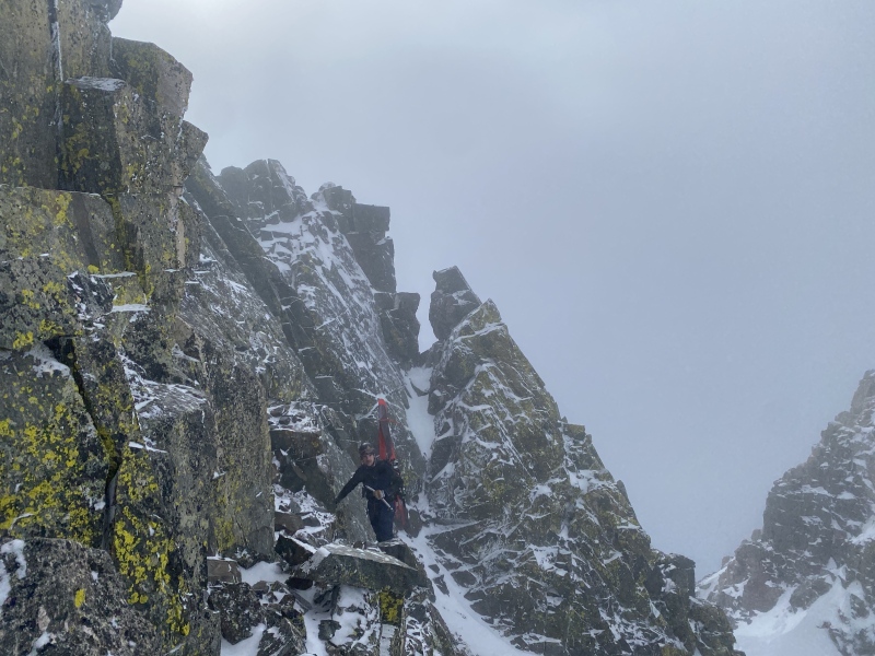
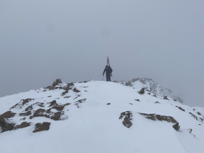
At the end of the trail we finally got to the spicy part. The ridge started to narrow and steepen, and we got to do a bit of scrambling and ridge-walking to warm us up to the actual cruxes. There were several spots that were definitely Class 3, but I can't recall every single one. What I do remember was that we went pretty fast up until the wide crack that has to be climbed, then even slower for the remainder of the ridge. The downclimb right before the final crux headwall was definitely the crux, we decided, since it was snow-covered and SUPER exposed. I think my variation might have been Class 4. The actual headwall was just as easy in the winter as it had been in the summer, and once through it we were finally at the summit, pretty much.
Looking down. We came up the Class 3 scramble to the right, out of frame.Owen standing in front of the impending cruxes of the ridge.Owen finishing up some of the more scary, exposed climbing.The crux headwall. The downclimb from here to there was the actual winter crux.Owen took the looker's left downclimb route, while I took the uber-exposed right side.The summer crux didn't even feel that hard, basically a staircase.Past the difficulties, time to summit!
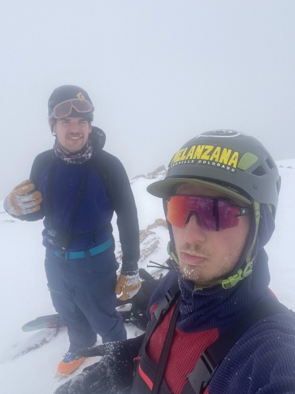
A quick walk up and we had the summit to ourselves! I finished up my cold, stale tortillas and drank some water, then we put on skis and started east down the ridge. The snow up top was windblown crap with a few sharks, and remained that way through the entire upper bowl. We basically stuck to the summer trail due to exposed rocks. Once in the lower bowl I of course made the mistake of saying we could ski northeast, forgetting (yet again) that then you have to skate back up the McCullough Gulch Road, a miserable experience after a long day on a fourteener. Regardless we took our time on the road and did eventually make it back to the car, all in one piece.
Boy is that an ugly summit photo. Perfection.Coverage in early February 2024.
Thumbnails for uploaded photos (click to open slideshow):
ajegers, I don't seem to have a gpx for this one. We followed the summer beta to the tee, with the exception of going further into the Monte Cristo drainage on the approach to stay low angle, instead of going up that initial cirque.
Caution: The information contained in this report may not be accurate and should not be the only resource used in preparation for your climb. Failure to have the necessary experience, physical conditioning, supplies or equipment can result in injury or death. 14ers.com and the author(s) of this report provide no warranties, either express or implied, that the information provided is accurate or reliable. By using the information provided, you agree to indemnify and hold harmless 14ers.com and the report author(s) with respect to any claims and demands against them, including any attorney fees and expenses. Please read the 14ers.com Safety and Disclaimer pages for more information.
Please respect private property: 14ers.com supports the rights of private landowners to determine how and by whom their land will be used. In Colorado, it is your responsibility to determine if land is private and to obtain the appropriate permission before entering the property.

")
")
")
")
")
")
")
")
")
")
")
")
")
")
")
")
")
")
")
")
")
")
")
")
")
")
")
")


