| Report Type | Full |
| Peak(s) |
Bushnell Peak - 13,112 feet |
| Date Posted | 02/20/2024 |
| Date Climbed | 02/17/2024 |
| Author | notidealbutfine |
| Winter Ski on Bushnell Peak - West Ridge |
|---|
|
This report is from my blog, give me a sub if you enjoy: https://notidealbutfine.wordpress.com/ February 17, 2024 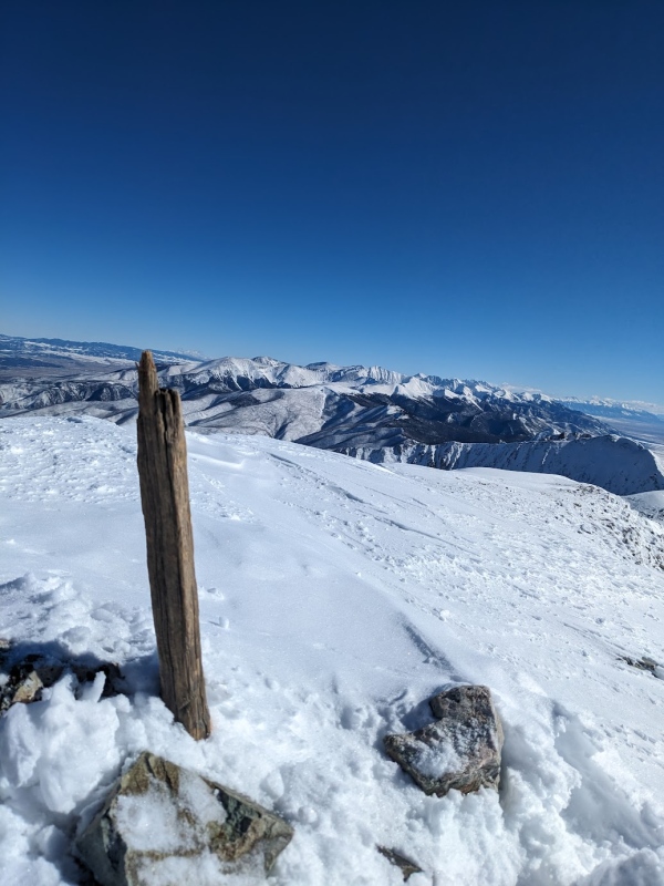
Whenever February rolls around, I seemingly always start to get that itch to bag some winter summits. Most of my early winters are often spent ice climbing and resort skiing, but this 2023-2024 season I mostly gravitated toward training for and researching an extensive expedition-style trip into the Chama Basin for an attempt at a couple of new FA's in the area. With multiple nights of winter bivvying, two 10+ mile ski days, and a committing 500' WI5 flow waiting at the end of it all, the logistics and skillsets required for the trip were not only deep, but also wide. After getting shut down by two different massive storms in January and a botched attempt in February (to which my climbing partner dislocated his knee 4 miles into the trail resulting in an arduous and exhausting self-rescue), I decided to shelf the project for the season and take on some more solo projects that were closer within my grasp. Besides, I'm beginning to think having a "white whale" isn't the worst thing in this world; it's motivated me train ridiculously hard, lead on harder and harder ice, get my winter bivy setup dialed in, and finally get really into backcountry skiing. Overall, this project has been the most successful failure I've had to date and am feeling a lot of catharsis coming out of it, knowing that I'll have even better chances next season. I've been eyeing the Northern Sangres for some time, but never climbed any of these lower, more moderate 12ers and 13ers, let alone in winter. Hunts, Bushnell, and Twin Sisters all caught my eye, but I ultimately decided on Bushnell due to there being at least some preexisting beta on the route (though it has only been recorded as a winter ascent once according to 14ers.com) and from the highway, there seemed to be a lot of snow on the peak itself. Going solo, my thought was to keep the descent as safe as possible and ski along Bushnell's West Ridge, hopefully avoiding any terrain traps or avalanche paths. What resulted could be one of the best and most memorable ski descents I've ever had the pleasure of experiencing in the mountains. 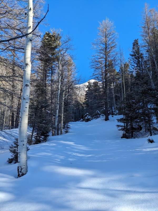
Saguache County Road 57 was plowed about as far as I expected, leaving about an additional 3 miles and 1000' of gain to skin up to get to the summer parking lot at the Brook Creek Trailhead. The first few miles were generally uneventful, but pleasant and beautiful to be hiking east in the valley as the sun was coming up. Once in the forest, the snow got to be extremely deep and powdery, a big difference from the icy crust on the valley floor. Shortly after passing the summer parking lot, an abandoned cabin presented itself as the trail climbed up the north side of the ridge. 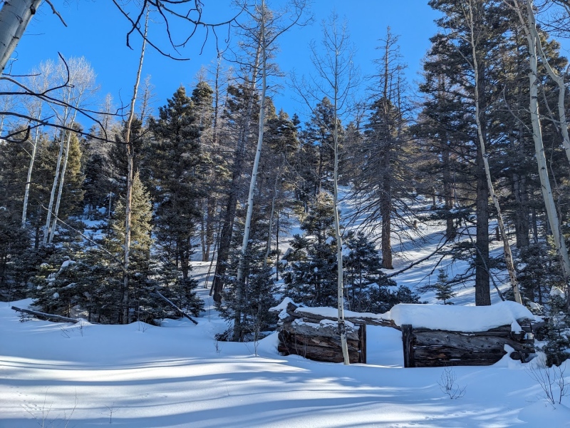
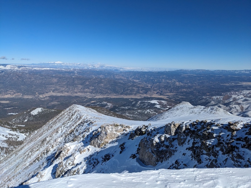
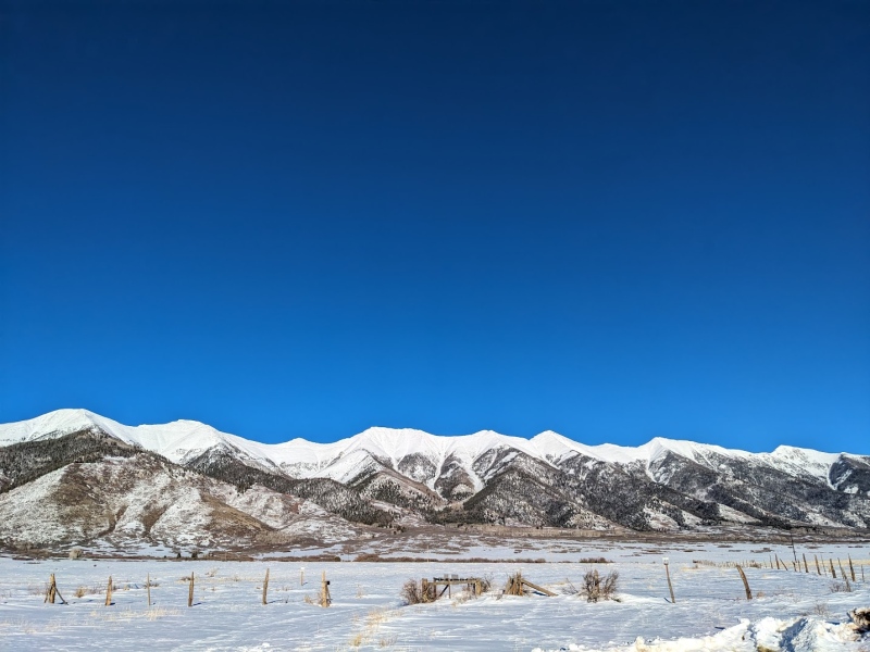
After some steep switchbacks, I left the trail and proceeded southeast directly up the north side of the ridge. This section of the climb was slow-going and pretty exhausting due to the steep and powdery nature of the snow, but after half a mile of slogging, I had gained Bushnell's West Ridge: I was finally out of the veil trees and the views started jumping out at me from all directions. A truly wonderful panorama! 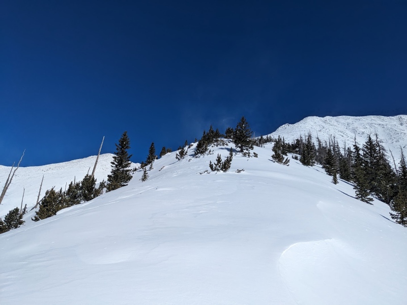
From the West Ridge, the beta is simple: just stay on the ridge and climb to the summit. Skinning up was beautiful and aesthetic until about tree line. From there, the snow transitioned from fluffy, light powder to rock-hard, wind-scoured crusty slabs. Without ski crampons, skinning up this section would be especially dangerous as the ridge thinned out, so as a result, I ditched my skis and pack at around 12,000 feet in favor of AT boots, micro spikes and ski poles. From here, I'd attempt to boot pack a light and fast push to the summit, then descend to my gear for the final ski out. 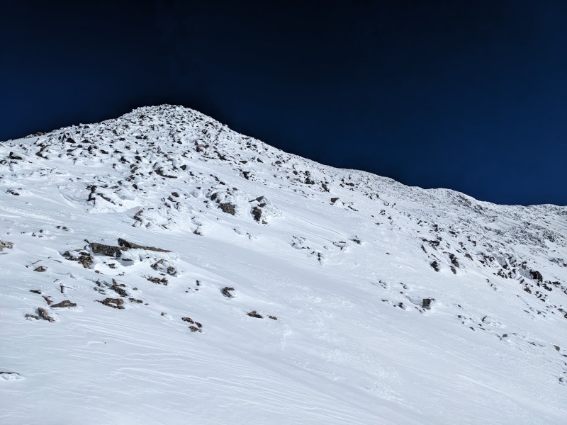
After a few hundred feet, the mountain's talus really started to show it's teeth, making me truly happy I stashed my skis. The snow was just light enough to post hole though with a boot, but at this point I was mostly rock hopping to stay away from the snow. Slow and steady wins the race, and eventually I found myself on the false summit, just a few hundred feet away from my goal. 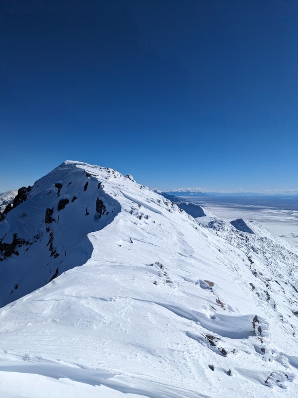
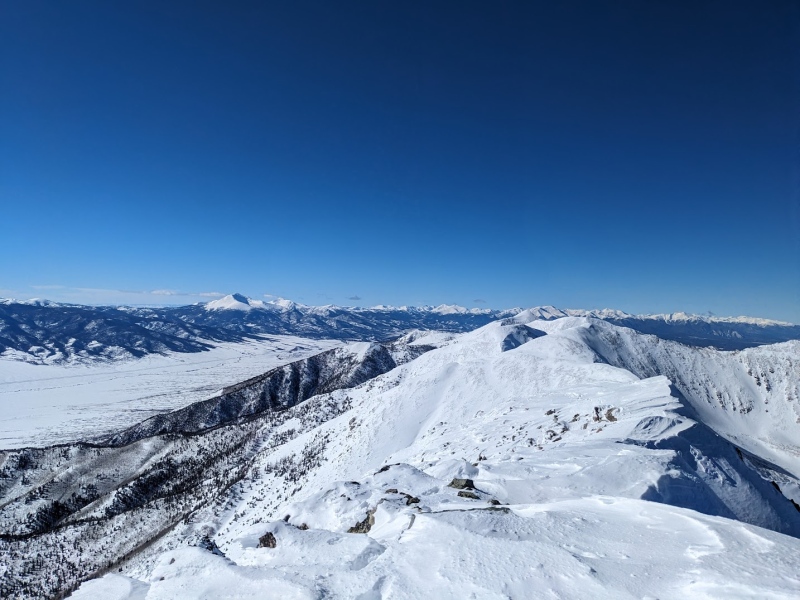
And just like that, the trifecta of summit feels all come rushing back in: the relief of knowing the uphill is finally over, the tranquility on the summit itself, and the anticipation of the descent to come. The lack of wind on top really added to the feeling of peace and isolation. It's been a long time since I've been on a summit on this nice of a day. To the north, the views of the Sawatch Range and Mt. Ouray were the clearest I've ever seen. To the east, Pike's Peak revealed itself in the distance past the expanse of the Wet Mountains. And to the south, the elongated spine of the Sangres continued on for what seemed like forever, further fueling my stoke for a possible attempt at a Sangre de Cristo Traverse this summer... 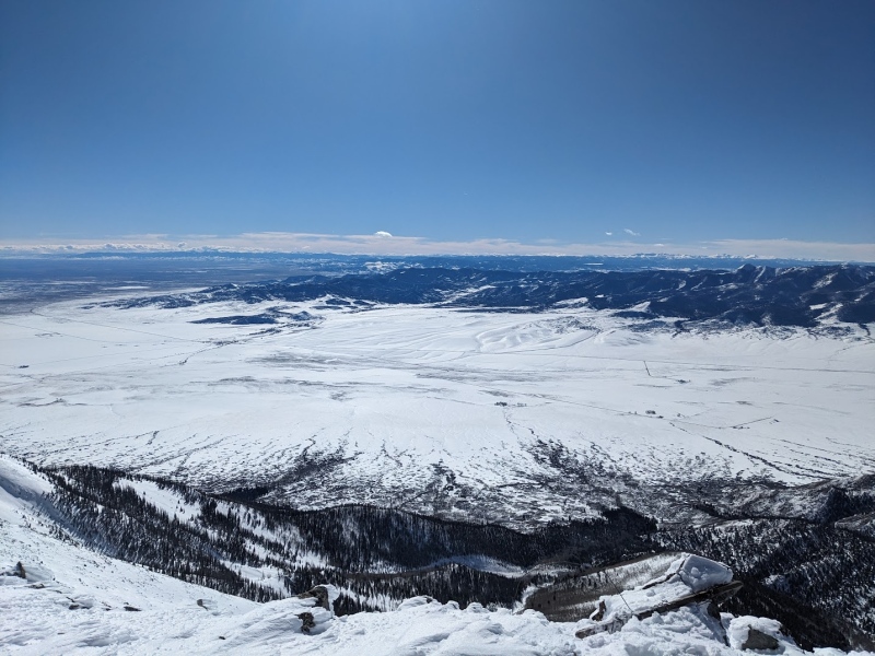
As per my typical style, my brief stay on the summit was just long enough to snap a few pictures and eat a granola bar. It was about 2:00 PM and I wasn't sure how long the descent would take me so I got into gear pretty quickly. Less time to be anxious about the descent too! I eyed my path down and locked it in for one final hike down to my skis and pack: it seemed a lot steeper from up here, that's for sure! 
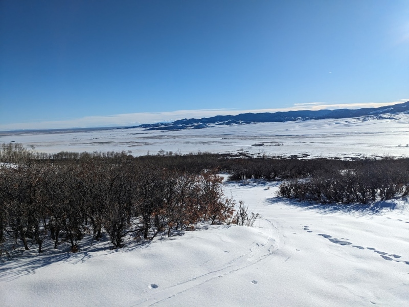
A quick 30 minutes got me from the summit back to my gear, transitioned and ready to go. My original plan for the descent was to ride the West Ridge all the way from 12,000 feet to base of the ridge near the cabin, therein bypassing a large portion of the trail (and switchbacks). Looking back, the smarter plan would have been to ski a little closer to my skin track. The ridge crest had some rocky formations that were awkward to get through and some of the tightest skiing in an aspen grove I've ever experienced. With my fatty 183cm skis, it was really tricky to navigate. About half of the way down the ridge, I decided to ride the north slopes of the ridge back down to my skin track, resulting in some of the most sustained skiing I've ever experienced. This was a great choice, as the trail was already cut for trees, so the ride out was quick, slick and easy. The mountain provided me with some absolutely prime powder all the way to the valley floor and with the exception of a couple of annoying creek crossings (never an easy feat on skis), was able to ski uninterrupted with no transitions for close to 6 miles all the way back to the car. From my skis, I made it back in 2 hours and 8 minutes: WAY faster than I was anticipating. 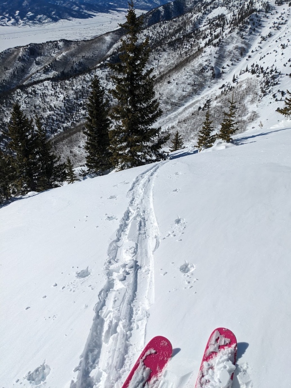
Bushnell provided me with some much needed catharsis this Winter and I thank the mountain profoundly for it. Coming off the multi-month failure of my previous big trip, this quick (but certainly not easy) day has gotten my mind and body back into the winter mountaineering game. With over a month of calendar winter still remaining, there's definitely still some juice to squeeze in these hills. Here's to many more good days in the mountains: thanks for reading! 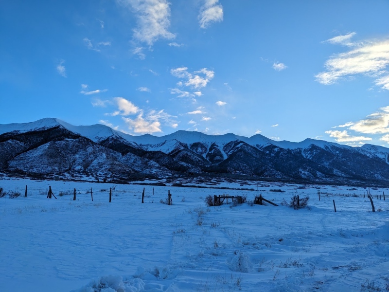
Bushnell Peak (13,110') Winter Ascent/Ski Descent
Thumbnails for uploaded photos (click to open slideshow): ")
")
")
")
")
")
")
")
")
")
")
")
")
")
")
")
")
|
| Comments or Questions | |||
|---|---|---|---|
|
Caution: The information contained in this report may not be accurate and should not be the only resource used in preparation for your climb. Failure to have the necessary experience, physical conditioning, supplies or equipment can result in injury or death. 14ers.com and the author(s) of this report provide no warranties, either express or implied, that the information provided is accurate or reliable. By using the information provided, you agree to indemnify and hold harmless 14ers.com and the report author(s) with respect to any claims and demands against them, including any attorney fees and expenses. Please read the 14ers.com Safety and Disclaimer pages for more information.
Please respect private property: 14ers.com supports the rights of private landowners to determine how and by whom their land will be used. In Colorado, it is your responsibility to determine if land is private and to obtain the appropriate permission before entering the property.

