Download Agreement, Release, and Acknowledgement of Risk:
You (the person requesting this file download) fully understand mountain climbing ("Activity") involves risks and dangers of serious bodily injury, including permanent disability, paralysis, and death ("Risks") and you fully accept and assume all such risks and all responsibility for losses, costs, and damages you incur as a result of your participation in this Activity.
You acknowledge that information in the file you have chosen to download may not be accurate and may contain errors. You agree to assume all risks when using this information and agree to release and discharge 14ers.com, 14ers Inc. and the author(s) of such information (collectively, the "Released Parties").
You hereby discharge the Released Parties from all damages, actions, claims and liabilities of any nature, specifically including, but not limited to, damages, actions, claims and liabilities arising from or related to the negligence of the Released Parties. You further agree to indemnify, hold harmless and defend 14ers.com, 14ers Inc. and each of the other Released Parties from and against any loss, damage, liability and expense, including costs and attorney fees, incurred by 14ers.com, 14ers Inc. or any of the other Released Parties as a result of you using information provided on the 14ers.com or 14ers Inc. websites.
You have read this agreement, fully understand its terms and intend it to be a complete and unconditional release of all liability to the greatest extent allowed by law and agree that if any portion of this agreement is held to be invalid the balance, notwithstanding, shall continue in full force and effect.
By clicking "OK" you agree to these terms. If you DO NOT agree, click "Cancel"...
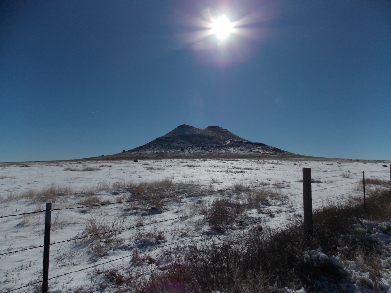
Two Buttes was a place I had never heard of before, but in August of 2020 my daughter and I were on the way back to the Texas Panhandle from Wellington, CO and had opted to take the highways through the eastern plains of Colorado rather than I-25. It was definitely a part of Colorado I had rarely seen. Then I saw the bump out in the middle of the flat plains after hours of absolutely nothing. As soon as I got home I looked on Google Maps to see if that point had a name. I kind of forgot about it for a while and then my wife and I were on our way home from Breck in Sept of 2023 and had opted to take the route east and when I saw it a second time I decided to do some research and see what info I could find about climbing it. I found a few scattered trip reports on this particular mountain, a couple here, a couple on Peakbagger and listsofjohn, even a couple videos on YouTube, but nothing really gave a lot of info as far as access or the fact that Two Buttes is the shortest ranked mountain in the state. I am going to assume it is volcanic in nature just because of the type of rock I saw throughout the hike...someone might verify that for me.
I had Monday, Feb. 12th off, wasn't on-call at work, and was kind of getting the "road trip itch" that I often do when I haven't taken any kind of trip for a while...some call it wanderlust, so what the heck, I had my summit goal set. Since I didn't have anything urgent to do at home I decided that I'd make the quick 3 hr drive up and do a quick hike of the shortest ranked peak in the state and then head back home.
I left the house at about 7:30 AM CST, stopped for a gas fill-up in Boise City, OK and arrived at the fence on the NW side of the peak at 9:35 MST. I got started heading that way at 9:42, opting to go under the barbed wire fence where I parked, more on that detail in a bit.
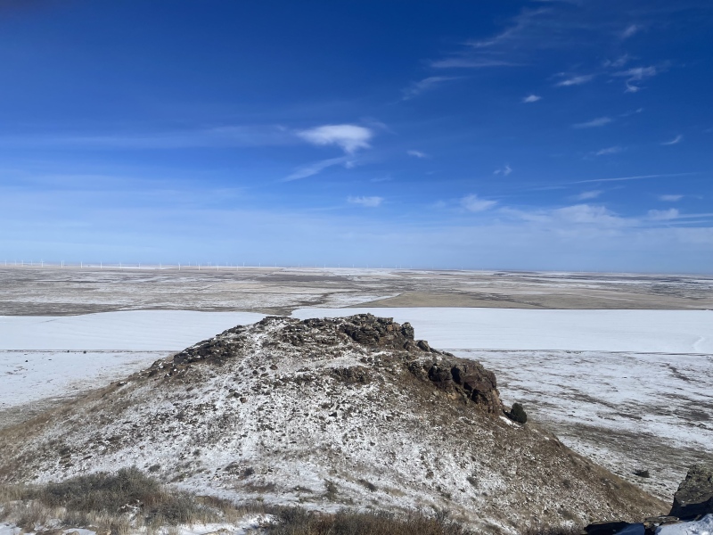
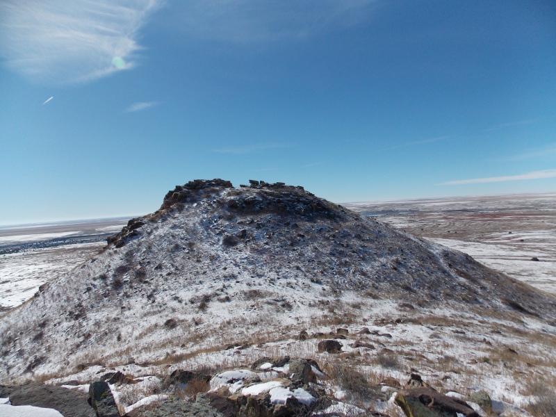
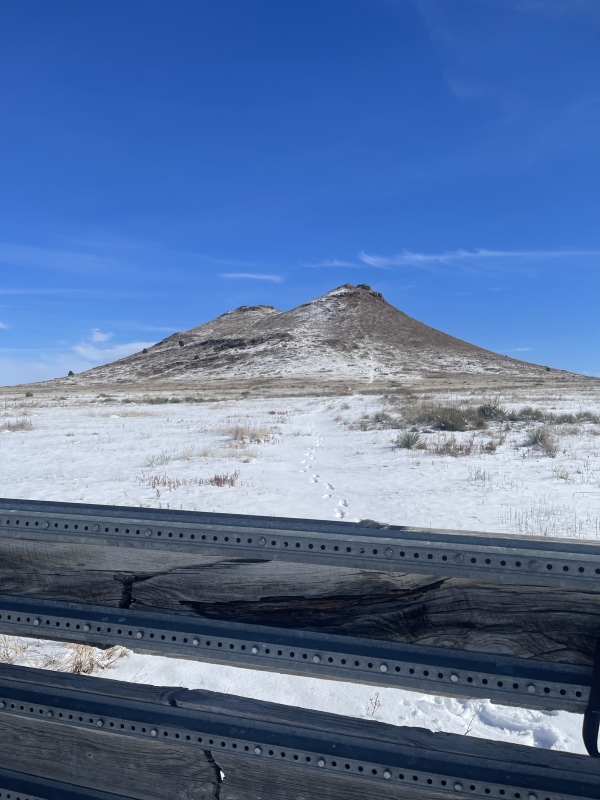
A cool looking little mountain.
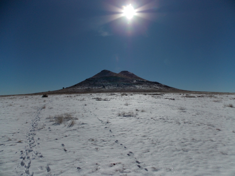
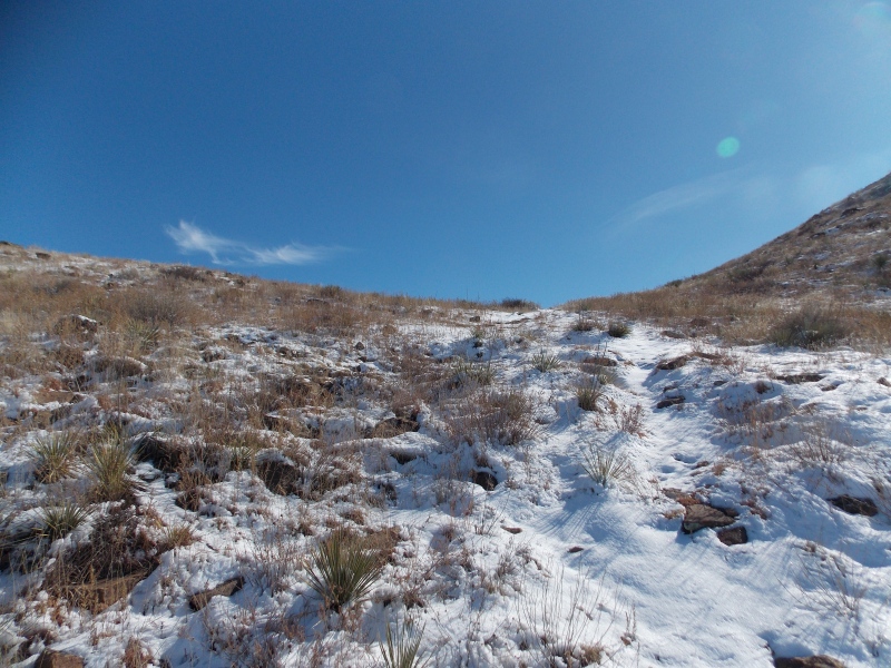
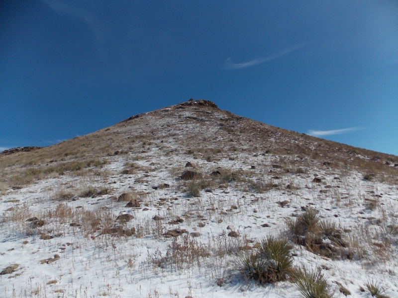
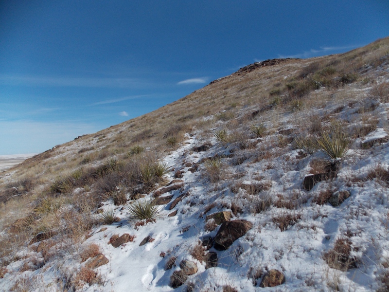
It had snowed quite a bit throughout the High Plains the previous Saturday night through Sunday night and, while we only had about 2-3 inches of snow at home I could see that the further north I went the snow accumulations were increasing, but most of the snow drifted into the fencelines along the roads. I hiked through about 5-6 inches of snow that was piled up on the grasses and weeds, so basically getting wet up to mid-shin until I got right at the west base of the mountain. The north slope is pretty steep, so I angled towards the west slope that is gentler and leads right up to the saddle between the two summits.
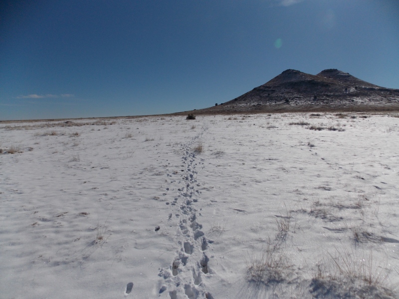
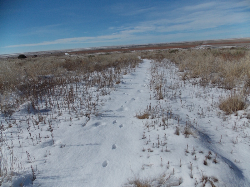
Just on the inside of the barbed wire, picking my lineI followed these tracks that were left by pronghorns earlier in the day.
I continued up the west slopes, postholing a couple times up to my knees through snow as well as bushes that were under the snow, nothing too bad though.
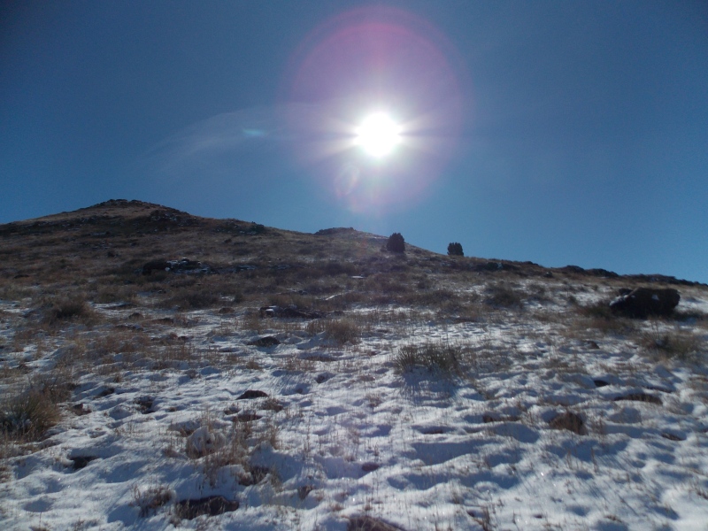
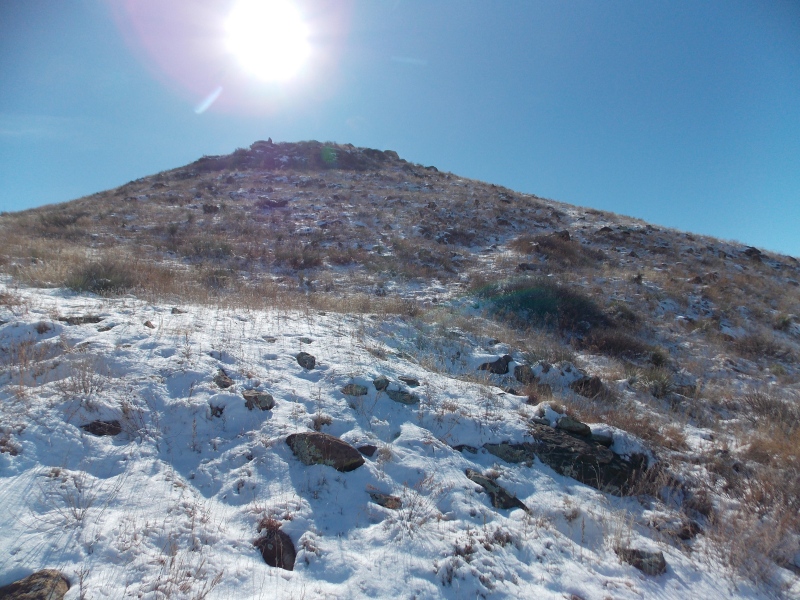
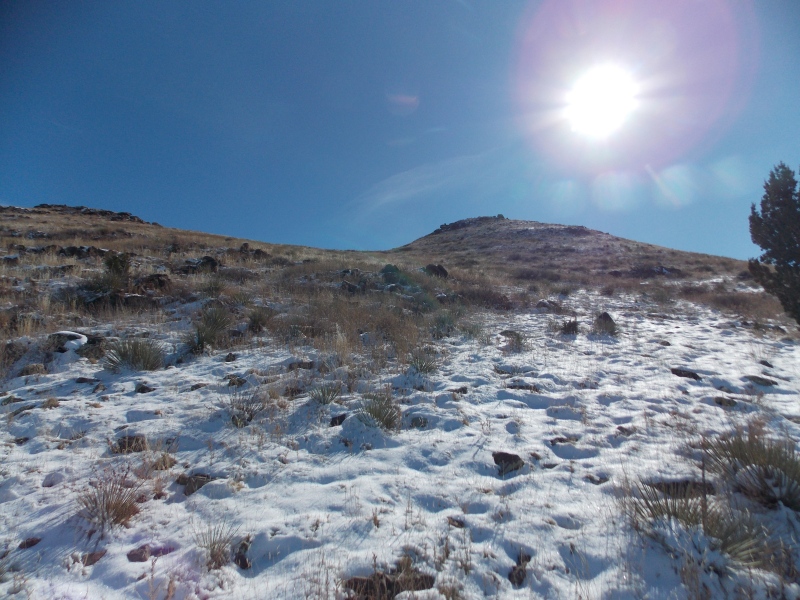
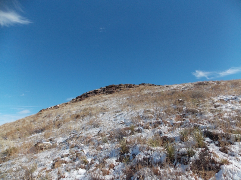
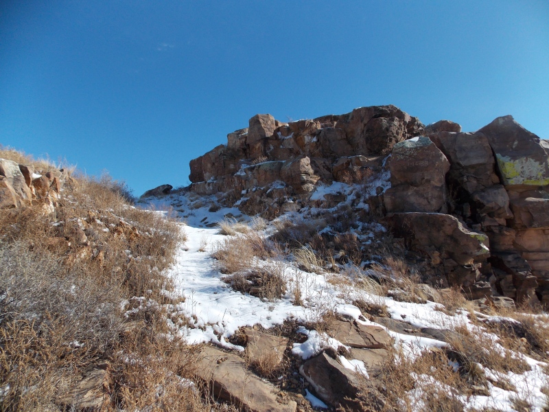
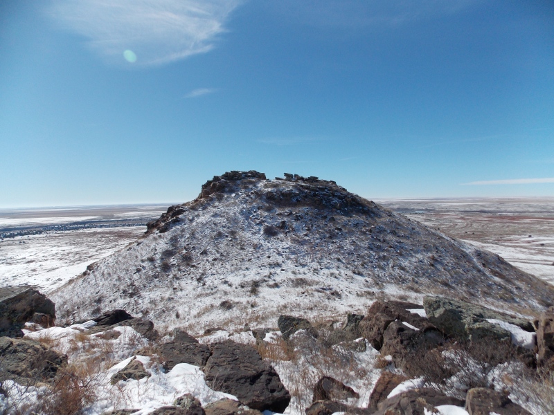
Looking up the west slope to the higher summitSnowy, gentle ascentLooking up towards the saddleAlmost to the saddleLooking up at the north (shorter) summitLooking SW from just below the saddleAlmost to the rocky summit block
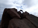
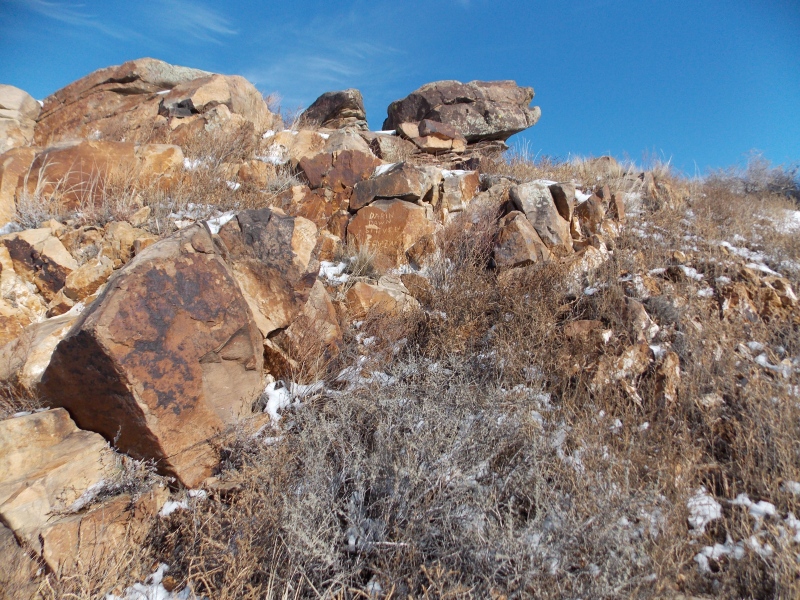
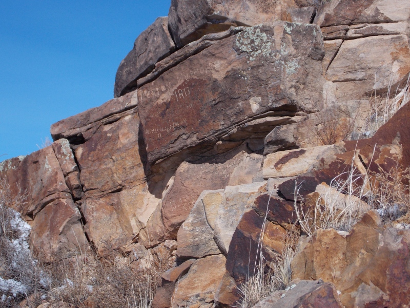
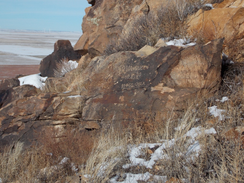
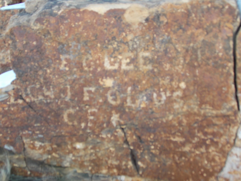
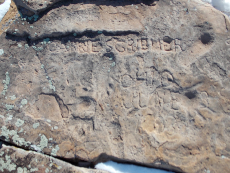
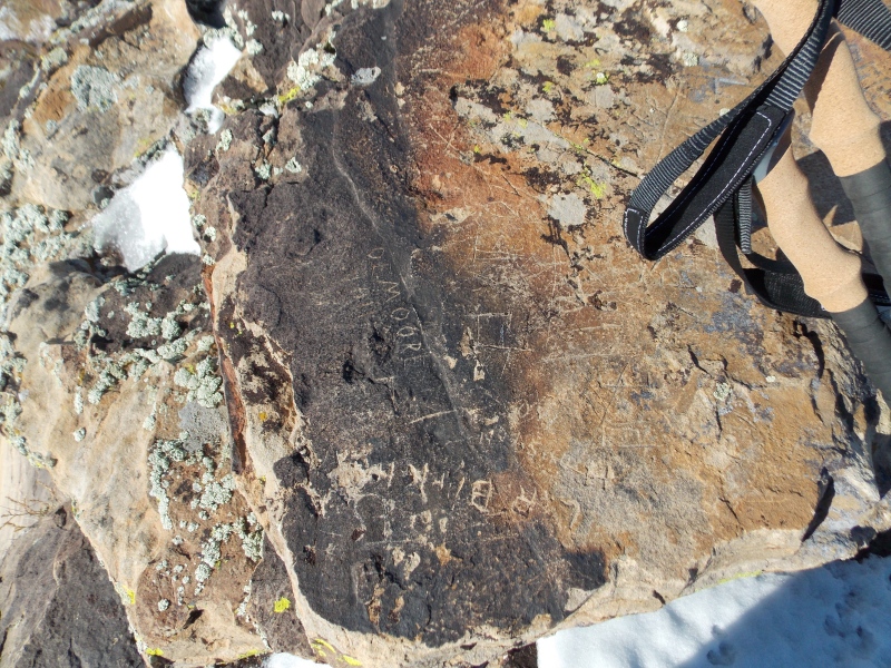
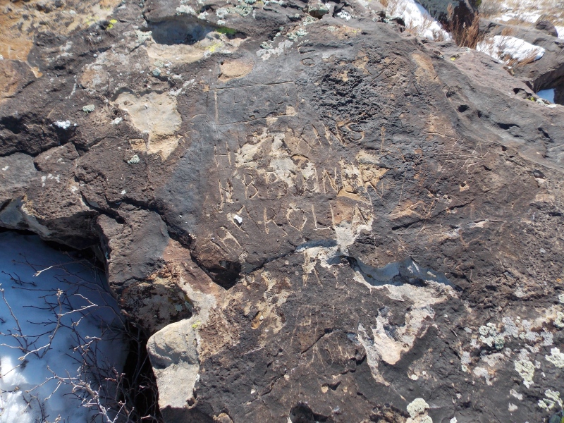
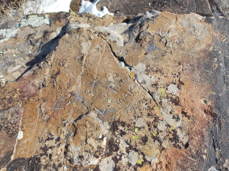
One thing that immediately stood out to me was all the names carved into the stones around the summit. What I thought was just graffiti turned out to be an interesting glimpse into the past. Many of the names were accompanied with where the person was from and the year that they stood at that spot, many of those dates going back to the early 1800s. I tried to get pics of many of those carvings.
You may have to enlarge the pics to see the carving detailsLots of interesting history found in these carvings, this one was dated 1813.Not sure if Vandusen meant 1830 or 1930.Another name worth looking upAnyone know a Gridner family from Ohio?
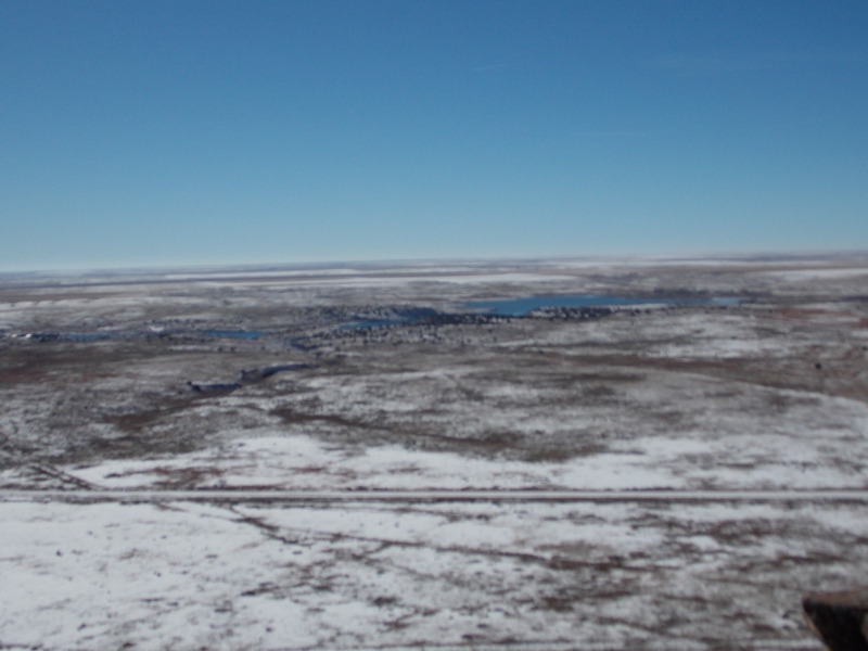
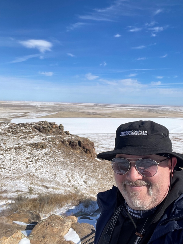
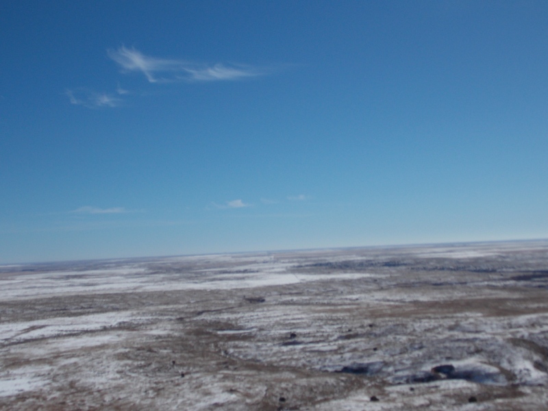
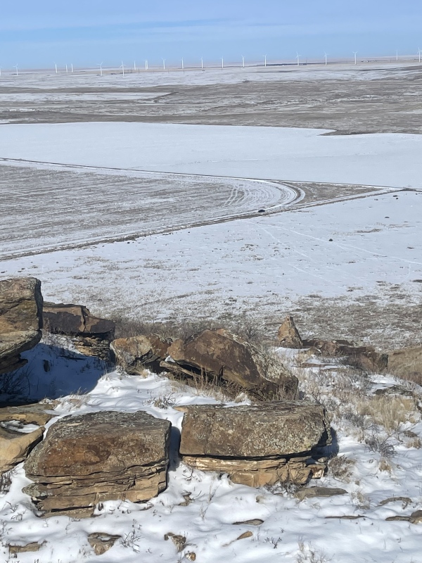
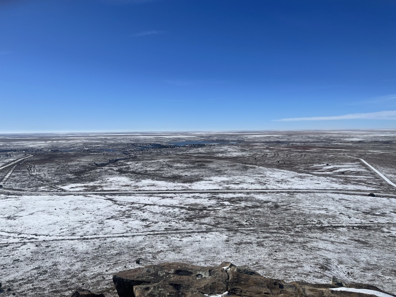
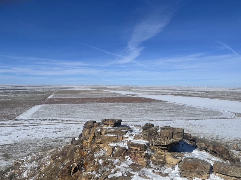
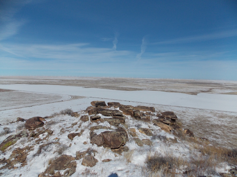
The views from the top are expansive, though that word doesn't really encompass it. No trees except for a few that grow around Two Buttes reservoir. Prairie land as far as the eye can see, with wind mills dotting the horizons.
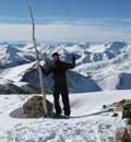
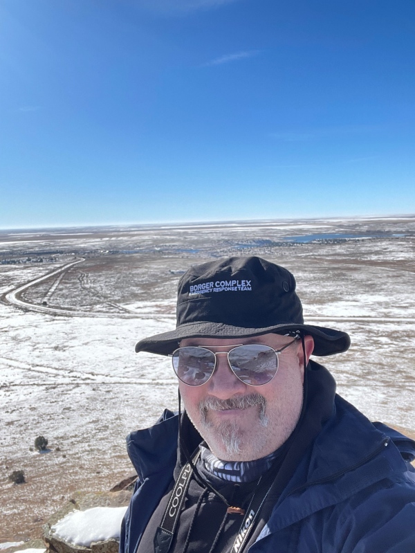
Looking down at the reservoirsummit selfieselfie looking N/NENothing as far as the eye can seeTwo Buttes Creek below to the rightLooking at the true summit from the north summitLooking over the shorter summit from the true summitThe trail I took down is easily visible to the SWMy truck (and my starting point) is just right of centerTwo Buttes Reservoir visible to the SLooking at the true summit from the shorter summitLooking W/NW from the true summit
I spent roughly 25 minutes at the two summits, it was in the low 30s but with no strong winds, only a light breeze and sunny, it was pretty nice out.. I opted to descend from the clearly visible path that went from the saddle down to the SW to a boarded up gate.
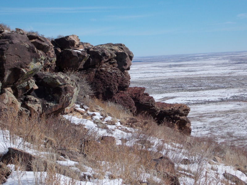
Cool volcanic rock outcroppings on the descent.Fun hike, I'm glad I did itThe trail was pretty obvious on the way downThe snow highlighted the trail nicelyFollowing the wildlife tracks
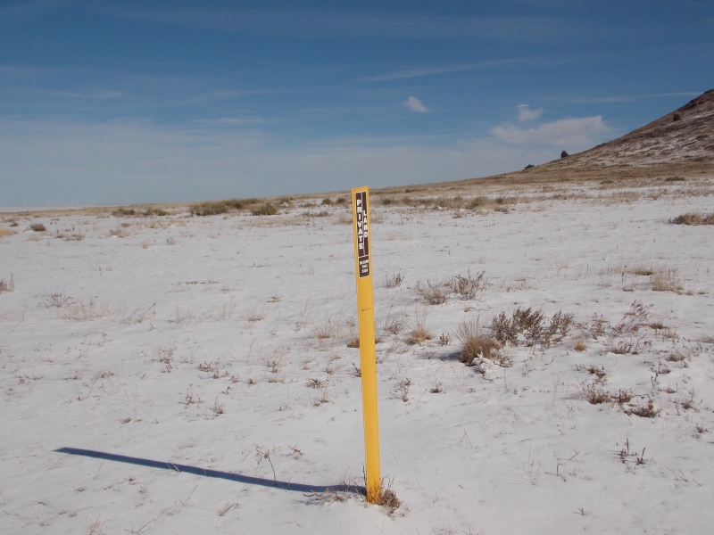
Earlier I said I would get back to a detail about going under the fence where I parked. Turns out there is a public access point further south, right where the roads splits to go down to the wildlife preserve. I got a couple pics of the signs and markers that I found on my descent.
I don't know what "seasonal access" means...From the boarded up gate. I assume this is meant to be the public access point.According to this marker anything north of it is private land, the entire trail is south of this marker, so you should be able to avoid any issues.
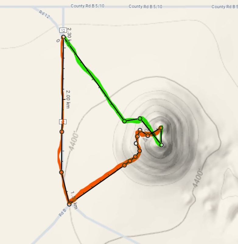
I got back to my truck and checked my time...10:42, exactly one hour for this 1.5 mile hike with plenty of time at the top for pictures and semi-bushwhacking on the ascent.
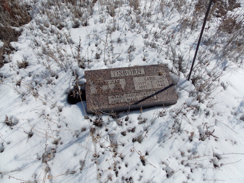
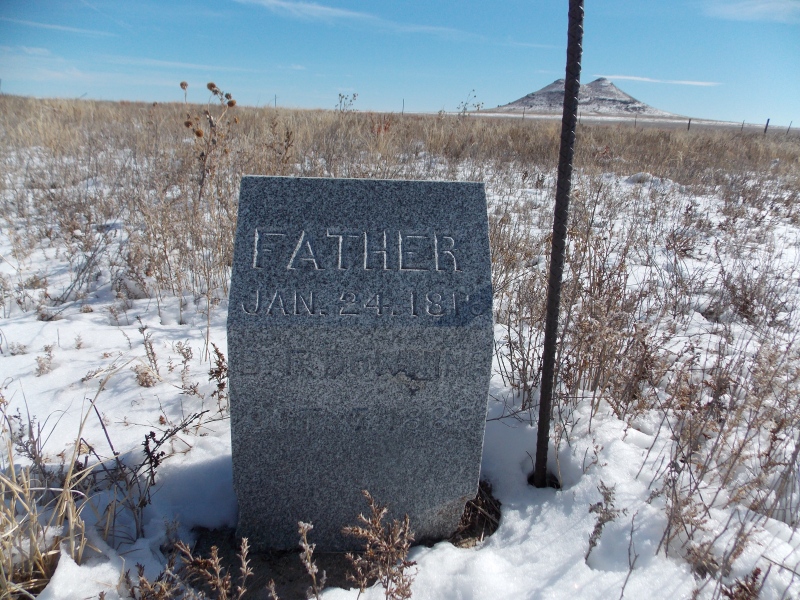
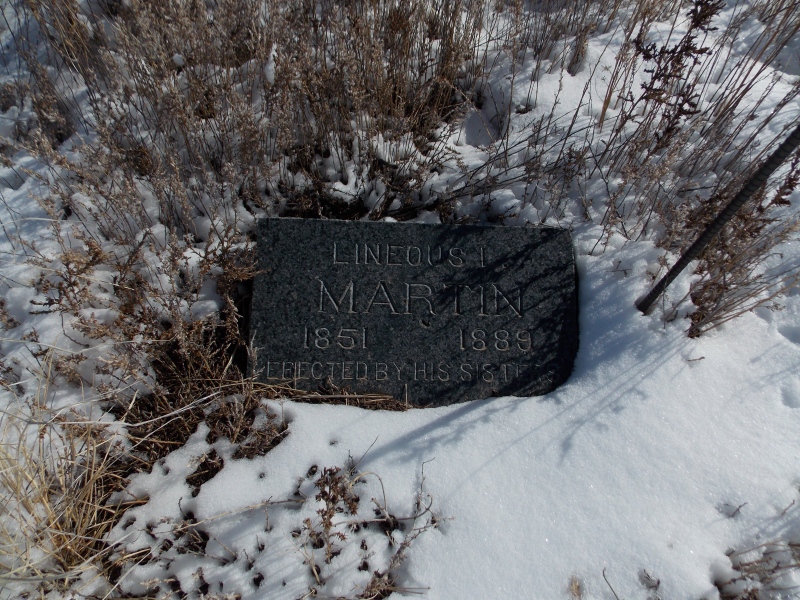
I noticed on Google Maps that there was a cemetery just west of the peak that you drive by on your way to the peak. I decided to check it out on my back towards US 287. It looks like most of the headstones had been relocated or possibly under snow but there were still three I could see. findagrave.com had a lot of interesting information about folks that had been buried there though.
View of Two Buttes from the public access gateMy path here. Green is the ascent, orange is the descent down the actual access path. About 1.5 miles total with 350ish feet of gain
Now, as per my modus operandi, my thoughts and advice for this hike:
This hike is simple, the hardest part was because of the snow, but anyone could do this peak. I would highly advise doing it in the early spring or fall, or even a decent winter day, once things have cooled down. Rattlesnakes and extreme heat are common in this area. The views from this isolated point are actually pretty cool, and knowing how much pioneer/early state history took place in the area helps make this a pretty fun experience, plus it is the shortest ranked peak in the state as well as the Prowers County highpoint.
Thumbnails for uploaded photos (click to open slideshow):
It really is a neat little hike. I may do this one again with my kids on a day that doesn't have snow. I really want to get more pictures of the carvings and names, as well as any more headstones in the little cemetery. I've already started looking into some of the names I read.
I was curious about the state trust land and found this map on the CPW website. Looks like the true summit is on private property however bordered by public land on 3 sides. Per the the Colorado State Recreation Lands brochure, the Twin Butte STL is open 9/1 to 2/28-29.
I'm guessing some of these names could be from travelers along the Santa Fe Trail? Some of these could also be from the great migration from Oklahoma to California? Maybe Kansas after the Dust Bowl/Great Depression. Very well known landmark for miles around. Either way, very historical newspaper rock.
On a side note, my uncle worked at the plant in Borger in the late 60's. Visited Lake Meredith once. You gotta love Fritch, TX I'm sure you've heard quite a few Fritch jokes?
dwoodward, that looks like an accurate line as far as where I saw the private land marker, but that was the only one I saw.
boudreaux, I have a lot of family, coworkers and friends from Fritch and I go to church there. One of former neighbors in Borger grew up with Ron White. I am going through all the pics I took and looking up some names from the legible carvings as well as the ones that had the years and hometowns carved also. I love these out-of-the-way places that have so much history. Which plant did your uncle work at, if you don't mind me asking?
Caution: The information contained in this report may not be accurate and should not be the only resource used in preparation for your climb. Failure to have the necessary experience, physical conditioning, supplies or equipment can result in injury or death. 14ers.com and the author(s) of this report provide no warranties, either express or implied, that the information provided is accurate or reliable. By using the information provided, you agree to indemnify and hold harmless 14ers.com and the report author(s) with respect to any claims and demands against them, including any attorney fees and expenses. Please read the 14ers.com Safety and Disclaimer pages for more information.
Please respect private property: 14ers.com supports the rights of private landowners to determine how and by whom their land will be used. In Colorado, it is your responsibility to determine if land is private and to obtain the appropriate permission before entering the property.


")
")
")
")
")
")
")
")
")
")
")
")
")
")
")
")
")
")
")
")
")
")
")
")
")
")
")
")
")
")
")
")
")
")
")
")
")
")
")
")
")
")
")
")
")