| Report Type | Full |
| Peak(s) |
Grays Peak - 14,275 feet Torreys Peak - 14,272 feet Whale Peak - 13,080 feet Mt. Edwards - 13,860 feet Hoosier Ridge - 13,362 feet Mt. Guyot - 13,372 feet Boreas Mountain - 13,083 feet Bald Mountain - 13,703 feet |
| Date Posted | 03/03/2024 |
| Date Climbed | 04/10/2023 |
| Author | justiner |
| Loveland Pass to Hoosier Pass |
|---|
|
This is a debrief of my project where I tried to traverse the Continental Divide from Loveland Pass to Hoosier Pass. This turned into three trips, but the original idea was to do it all in one go - a goal that I failed at fairly miserably. But - cue the inspirational Google Earth Flyover! It's no secret I LOVE ridge traverses, and am always on the hunt for interesting, multi-day trips after I completely the Mosquito-Tenmile traverse - a trip wholly inspired by Peter Bawkin's trips on this same ridgeline. But I also wanted to find a trip I could do in Winter Conditions as both an extra challenge, as well as a way to have a warm-up trip to what I thought would be a much harder challenge (the Sangre de Cristo Range Traverse). So, looking at a map, I realized that Loveland to Hoosier would probably go without too much spice, with only a few problematic parts where avalanche danger would be an issue. In fact, there is a variation of the CDT that summits Grays, and takes the Continental Divide ridge over Edwards, then down to Argentine Pass, and then I think all the way to Georgia Pass ("The Argentine Spine" - oooh scary sounding!). So, tack on the ridge from Loveland Pass that includes an additional 14er (Torreys), then keep going to uh: Hoosier Pass, and you've got this trip. Pretty straightforward. Back to the avy danger. The few places I was worried about were perhaps leaving French Pass heading west, and descending Boreas Pass heading west. Mt. Guyot was a little bit of a question mark: would its south ridge be the crux of the whole thing? Looked steep. Hard to preview any of this while on route and it's so easy for conditions to change. If weather moved in, there are bailouts to somewhere, but it's a long way back to a road most of the time. My initial hope to do this in Winter was stymied by really cold weather - about 20 degrees colder than I was planning on. I actually grabbed a pair of boots for this, hoping to keep all my toes. Trangos aren't exactly winter boots, but they'd work better than my trail runners. But still: they had their limits. Rescheduled for April 10th, I set off at the crack of 10:30 am - essentially the earliest time I could get a bus to Frisco and hitch a ride from a local. 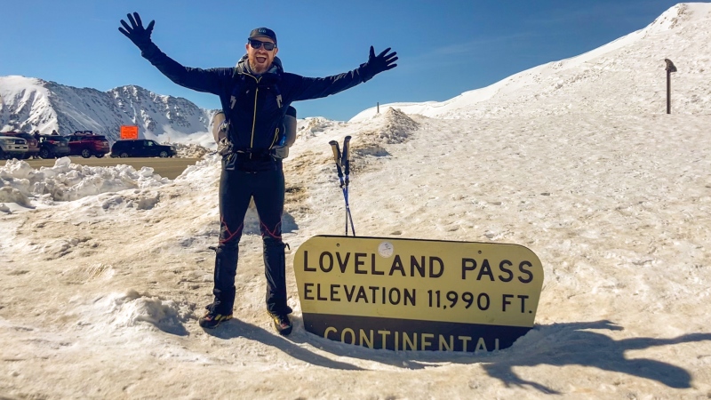
So off I went! The hiking was fine enough - I've done the route from Loveland to Torreys in Winter before, so no real surprises. Good weather, not too cold, very sunny. Torreys, Grays, and Edwards went fast enough, but the late start meant the sun was already setting as I made my way down to Argentine Pass. 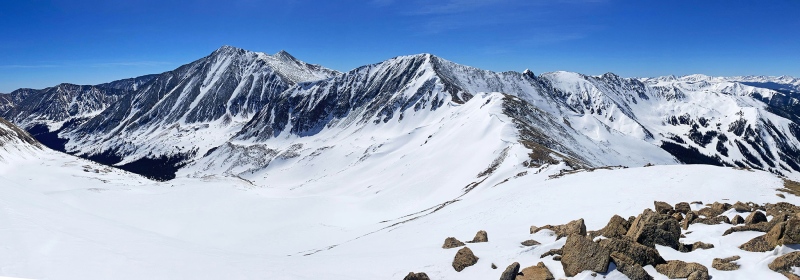
I took a break for dinner, summited Argentine Peak, then descended down to 12,397' to a saddle before Decatur Mountain for the night. Although I brought a tent, the ground was clear, and I just slept out in the open. 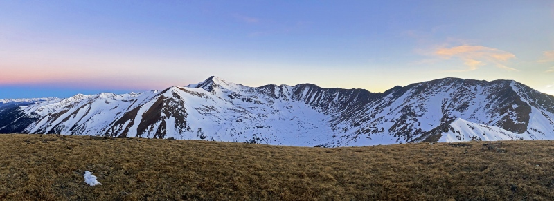
The next day would be all new terrain for me, with no 14ers or Centennials that usually attract the masses so I didn't expect to see anyone. The goal was Georgia Pass at least, so off we went! The day was sunny and once afternoon rolled around: toasty: now about 20 degrees warmer than I was expecting, and I was getting seriously sun burnt. I was covered completely and still got burnt through a sun hoodie. But the walking was easy enough. I think the high point was... Geneva Peak? At ~13,250'. It was dark by Glacier Peak and the descent to Georgia seemed to take forever. I once again just slept out in the open in the shadow of Mt. Guyot. With such a warm day previous, I was worried about snow condis, and the avy forecast looked less than ideal. My eye was developing an infection and once I got to Georgia Pass itself, I decided to bail, as the slope up Guyot seemed a little risky, and I couldn't see anyways. 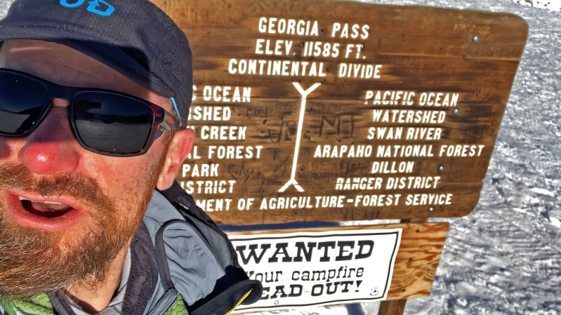
Bailing meant about a 12 mile hike of shame back to the highway/bus stop, so it wasn't a soft option. A few miles of pavement in those big boots - ugh! I rejoined the line a few weeks later in 5/24/23, hiking back up Georgia Pass via the CT, then moving onto the road when that was taking too long. Camped (in a tent!) at Georgia Pass again. 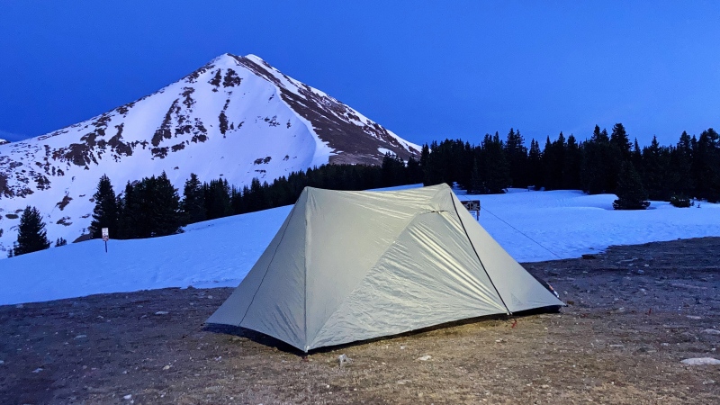
Goyut looked like in great conditions, so the next day, up I went. Wonderful hike to the summit, and the south ridge looked good so off we went. There was a bit of hard snow that was pretty steep that gave me a little bother, having to face inwards - so mind that part if you do this yourself. I decided to tack on the actual summit of Bald and Boreas mountain, which are not quite on the Divide ridge, but what the heck. Descending down Boreas Pass was a huge slog, as the snow had warmed up (like snow does). I kept looking at the opposite slope up Red Mountain/Hoosier Ridge, and it looked like more sloggin'. Hmm. I made it to the hut at Boreas Pass proper, took a nap, and thought what best to do. 
I could have camped for the day, but I guess I'm not used to stoppng so early in the day, so I decided yet again to bail down, this time via Boreas Pass road to town. Ofta. Another long walk to the border of public land to camp, then I got up crazy early to take the single track to town. Once in town I thought it would be fun to just make a loop out of it, and walk to the bus stop I started out at near Tiger Run Road. My summer was pretty action packed, included a successful traverse of the Sangre de Cristo Range, this time from North to South. That took me three tries over a few years and is one of my proudest trips, especially since I might actually be the first one to ever do it in this direction (this needs to be confirmed) and most certainly the first to now have done it in both directions - a feat I don't know if anyone would want to repeat. So I guess the Loveland-Hoosier idea worked as training trips. I also somehow sneaked in an attempt at the unsupported FKT of the Colorado Trail, but I don't know if I wanna talk about that one! (kidding). But once the snow started falling again, I thought of finishing the Loveland/Hoosier line. The 14er Winter Welcomer seemed to be a good excuse to get out there, as the ending at Hoosier Pass is not so far to the Quandary TH, so I could do the last 9 miles from Boreas Pass, summit Red Mountain and Hoosier Ridge, then drop down and find a camp spot on McCullough Gulch road and meetup with everyone the next day. But unfortunately, the Winter Welcomer was cancelled because of... Winter weather, and I changed my trip date for the same reason, so that didn't happen. But again, I hoofed it up Boreas Pass Road to camp on top of Boreas Pass, to start up the rest of the line the next morning on 11/1/23. 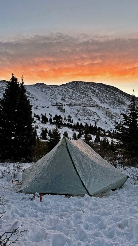
Wallowing up the slope didn't prove too difficult, but it was apparent that wind was going to be the main crux of the day. By the time I got to Red Mountain, it was getting near impossible to make forward progress, and I almost bailed down north into some weirdo basin. But I persisted, albeit freezing. 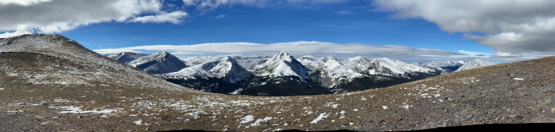
I was hoping to do Silverheels as a bonus peak, but that was out due to wind, so I just made it to Hoosier Pass and with no fanfare, finished my little hike, I thought it would take at most 3 days, but it turned into three separate trips - yikes! 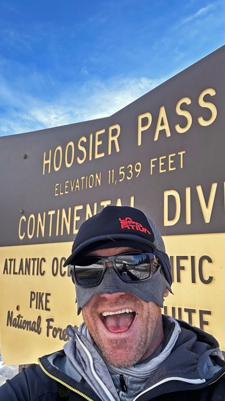
But Hoosier wasn't the real ending on my trip - I still had to get to town! I could hitch from Hoosier, buuuuut there's a trail at the end of McCullough I could easily, so why not? Getting to McCullough Gulch Road was somewhat of a SNAFU. I thought for sure there was some sort of trail that took you northwest to Blue Lakes Road, and deposited you right on the trail up Quandary Peak. That map line was actually showing an old aqueduct, not a trail! and that aqueduct was in bad shape, and I found myself bushwhacking down CO 805 (not Blue Lakes Road). It was dark by now and I kind of gave up on following the aqueduct due to how much snow was in the area, so I hoofed it to the highway to walk the shoulder to the McCullough Gulch Road, where I then made camp. 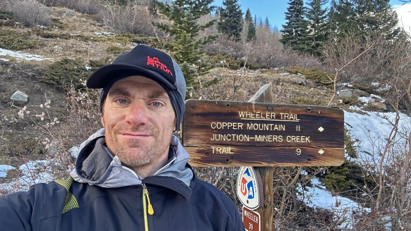
In the morning, I walked up McCullough Gulch to the start of the Wheeler Trail. Snow was present, but it didn't make too much sense to put on snowshoes and just dealt with the above ankle-high snow. Wheeler met up with Spruce Creek Trail, which I switched onto, and changed over to the Burro Trail CO 225. As I got farther north, the snow level got lower, and moving got faster. Finally, I passed under a chairlift at the Breck Ski Resort, and was walking on concrete, passing people swimming in the hotel pool. Such a wild change. Hiked to the bustop yet again, and my trip was over. I hope to revisit the line and try to do it all in one go in the future. In summer, this should be pretty easy, but in Winter could be a challenge. Have fun out there! Thumbnails for uploaded photos (click to open slideshow): ")
")
")
")
")
")
")
")
")
")
")
")
|
| Comments or Questions | ||||||
|---|---|---|---|---|---|---|
|
Caution: The information contained in this report may not be accurate and should not be the only resource used in preparation for your climb. Failure to have the necessary experience, physical conditioning, supplies or equipment can result in injury or death. 14ers.com and the author(s) of this report provide no warranties, either express or implied, that the information provided is accurate or reliable. By using the information provided, you agree to indemnify and hold harmless 14ers.com and the report author(s) with respect to any claims and demands against them, including any attorney fees and expenses. Please read the 14ers.com Safety and Disclaimer pages for more information.
Please respect private property: 14ers.com supports the rights of private landowners to determine how and by whom their land will be used. In Colorado, it is your responsibility to determine if land is private and to obtain the appropriate permission before entering the property.


