Download Agreement, Release, and Acknowledgement of Risk:
You (the person requesting this file download) fully understand mountain climbing ("Activity") involves risks and dangers of serious bodily injury, including permanent disability, paralysis, and death ("Risks") and you fully accept and assume all such risks and all responsibility for losses, costs, and damages you incur as a result of your participation in this Activity.
You acknowledge that information in the file you have chosen to download may not be accurate and may contain errors. You agree to assume all risks when using this information and agree to release and discharge 14ers.com, 14ers Inc. and the author(s) of such information (collectively, the "Released Parties").
You hereby discharge the Released Parties from all damages, actions, claims and liabilities of any nature, specifically including, but not limited to, damages, actions, claims and liabilities arising from or related to the negligence of the Released Parties. You further agree to indemnify, hold harmless and defend 14ers.com, 14ers Inc. and each of the other Released Parties from and against any loss, damage, liability and expense, including costs and attorney fees, incurred by 14ers.com, 14ers Inc. or any of the other Released Parties as a result of you using information provided on the 14ers.com or 14ers Inc. websites.
You have read this agreement, fully understand its terms and intend it to be a complete and unconditional release of all liability to the greatest extent allowed by law and agree that if any portion of this agreement is held to be invalid the balance, notwithstanding, shall continue in full force and effect.
By clicking "OK" you agree to these terms. If you DO NOT agree, click "Cancel"...
"S what? Six already starts with an S, it's not Ssix, that's just redundant. Wolc... Wol... c..." Who cares, like 17 people have ever heard of these mountains so here's your trip report.
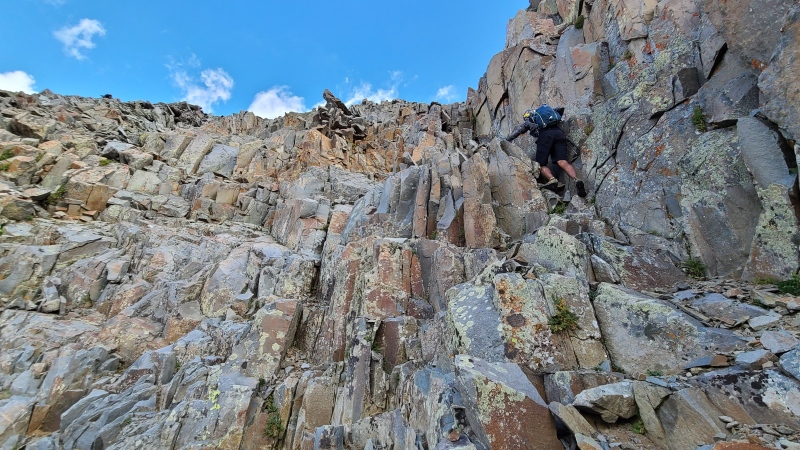
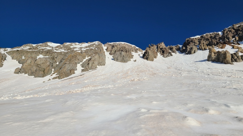
"S 6" is most often done from Blue Lakes up and over the saddle between "S 3" and "S 5" (these names are "S 0" good... get it?) or from the Iron Mountain trail on the Telluride side of the Sneffels Range. Wolcott Mountain just isn't done, because nobody cares about unranked thirteeners. Those people are wrong, I might add, wrong. Anyway, "S 6" is your typical Sneffels Range pile of happy go lucky fun times. I'd already done "S 6" before with Whiley and Yusuf (Bombay2Boulder) via the Iron Mountain trail and while it wasn't the worst I've done it does rank pretty low on the list of enjoyable peaks.
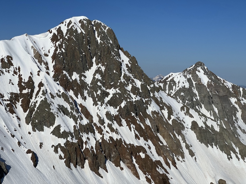
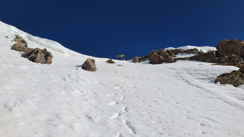
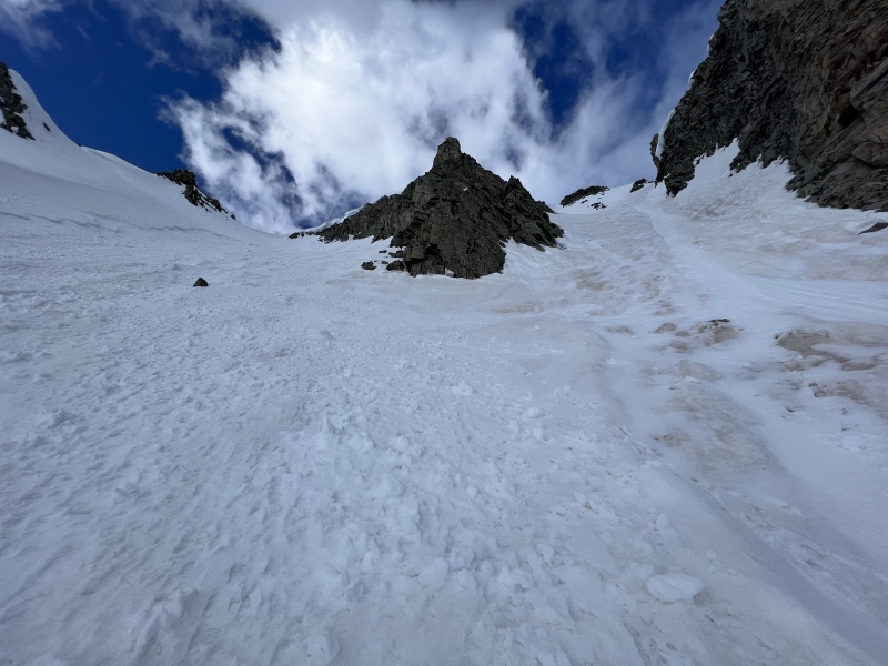
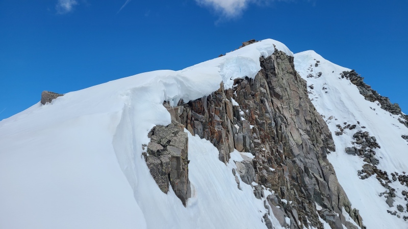
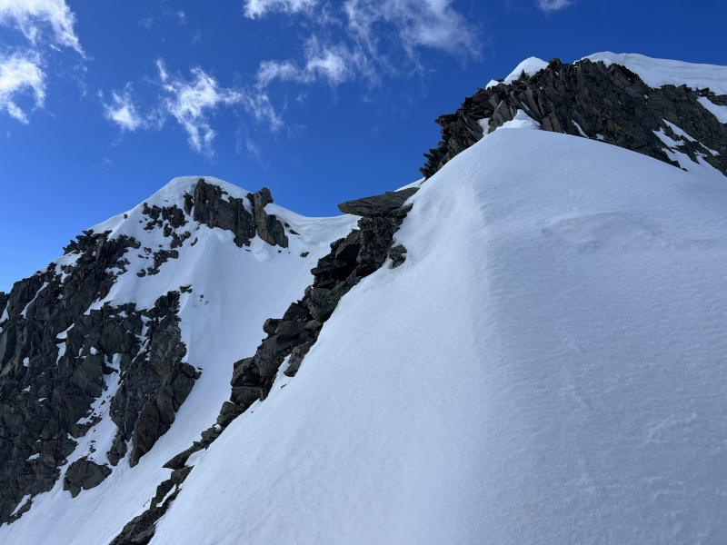
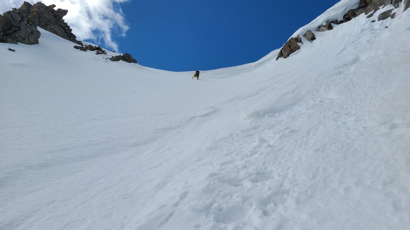
Pretty janky scrambling up "S 6", though among Sneffels Range peaks this is actually good.Our descent route. Safer but still somewhat miserable.Descent gully from a distance. We'd ascended farther right, which was worse in hindsight.
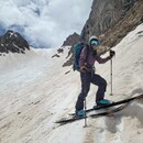
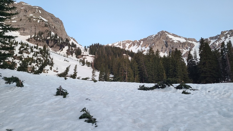
On the other hand I knew absolutely nothing about Wolcott. Wolcott's southwest side looked most approachable (that is, lowest angle and fewest cliffs) when dry but since most Sneffels Range peaks are vastly better on snow I figured I'd save myself the scree sufferfest and climb it on snow. Some eastern couloirs looked good on satellite photos so that was settled. Heather needed both peaks so we figured we could also climb "S 6" from the north after doing Wolcott via a number of couloir-like features. Both mountains could be approached from the northeast via the Blue Lakes trail, which would also save us a lot of route finding and bushwhacking trouble. Heather came out and stayed at my place and we did Silver Mountain by Ophir on Saturday with Garrett, then planned to do this dynamic duo Sunday. We started stupid early to avoid crappy snow - 4:32am - but fortunately it's not that long of a drive to Blue Lakes from my house.
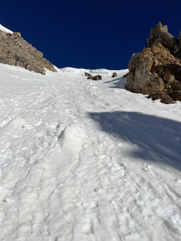
All told we only had about an hour of darkness before we had to ditch the headlamps. Even then we had the bomber Blue Lakes trail to assist us. This may be the easiest approach for some of the western Sneffels peaks there is. We took the trail to about 10,400' where the trail crosses an intermittent stream. We left the trail south of the crossing at a break in the trees, which meant zero bushwhacking for the day. Great start!
From the trail. Easy terrain to get higher on the left. Wolcott's summit is dead ahead, not the point on the right.
We hadn't brought snowshoes today but we did put on our crampons right at the trail. The snow was icy and we'd be climbing very soon. We took advantage of the open slopes below "S 4" directly to our south and made quick progress into the upper basin.
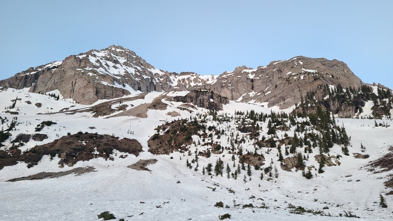
North face of "S 4".Neat mineralized rock.Crystals in one of the geodes.Mount Sneffels from a little higher up.
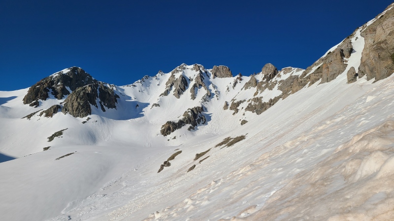
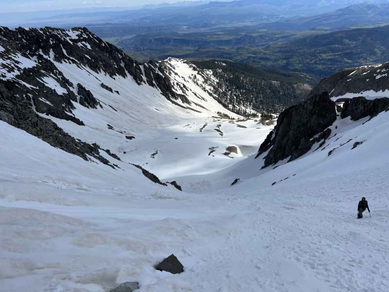
It wasn't long before we were in the basin high enough to see Wolcott's summit and east face, which was split by our couloirs.
There are two potential couloirs we could have climbed, one on each side of the summit.Closer shot, rounded summit left of center.. Both couloirs would get us where we needed to go, so it depended on which looked better from the bottom.
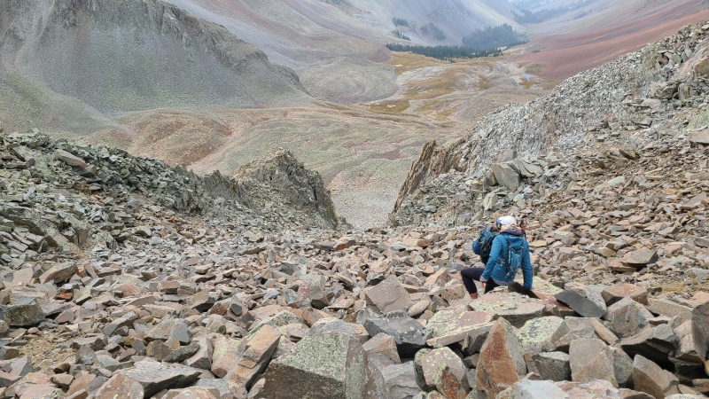
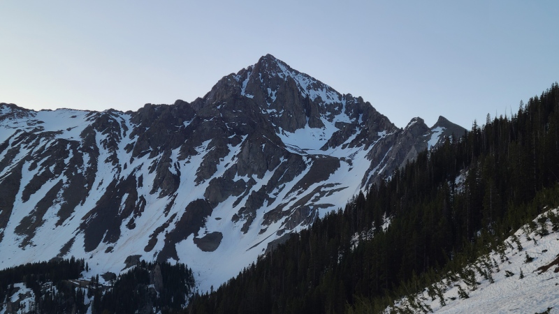
We continued passing under "S 4"'s towering walls and spires and then across the massive rock glacier spilling off "S 6"'s north side. It's close to half a mile long! Thank god for the snow cover, since we crossed it three times over the day. Once we reached the bottom of the couloirs it was game time. Left or right?
Right!
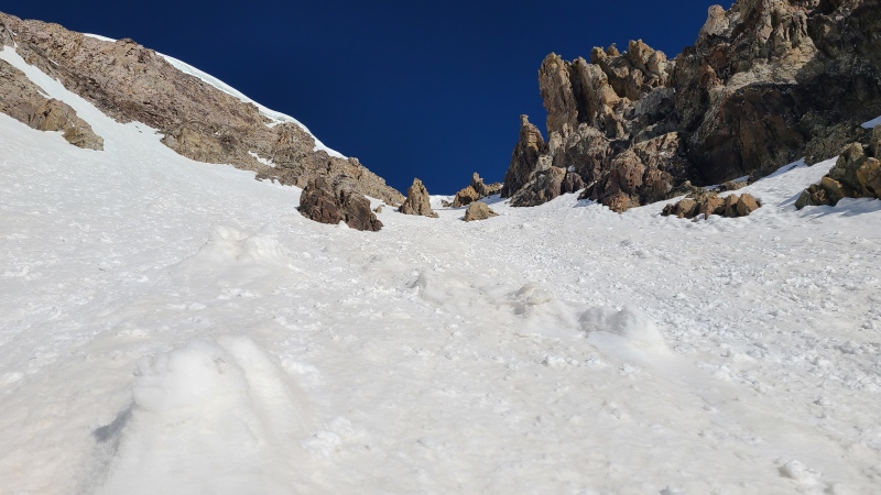
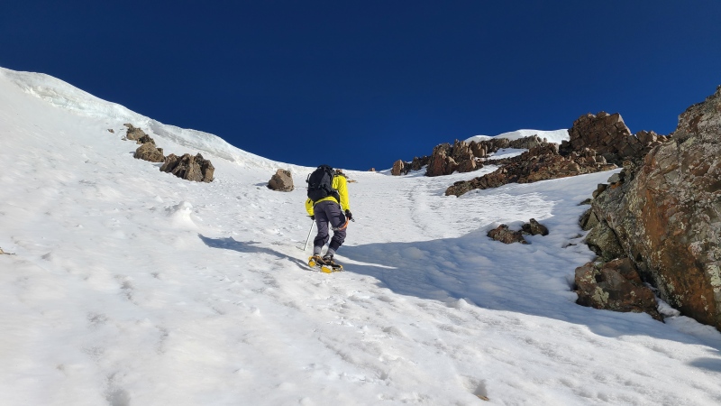
We began up the snow, which was already a bit soft in the early eastern sun. We knew we wouldn't have a lot of time on Wolcott but that was OK. The climbing was in the Moderate Snow range and we made quick time up the couloir.
"S 6" from the apron. The giant rock glacier extends far past the lefthand edge of the photo.Looking up the right side from near the split.
Creamy snow led us ever higher. Some small towers, oddly dropped mid-couloir, needed to be worked around. It was strange they weren't eroded away, but who am I to question nature's ways?
Little towers and blobs of rock in the middle of the couloir.Me climbing up the couloir. "S 4" on the left, Dallas Peak and "West Dallas" center and center right. Photo: Heather R.
We had no real difficulties on this couloir. We carried a second axe in case but it was never needed. About 700 feet of the good stuff led is to the ridge, which was partially blocked by a small cornice we dodged to the right.
Oh Sneffels Range... My heart sings for you... Photo: Heather R.Last bit with cornice. Photo: Heather R.Easy bypass to the cornice.
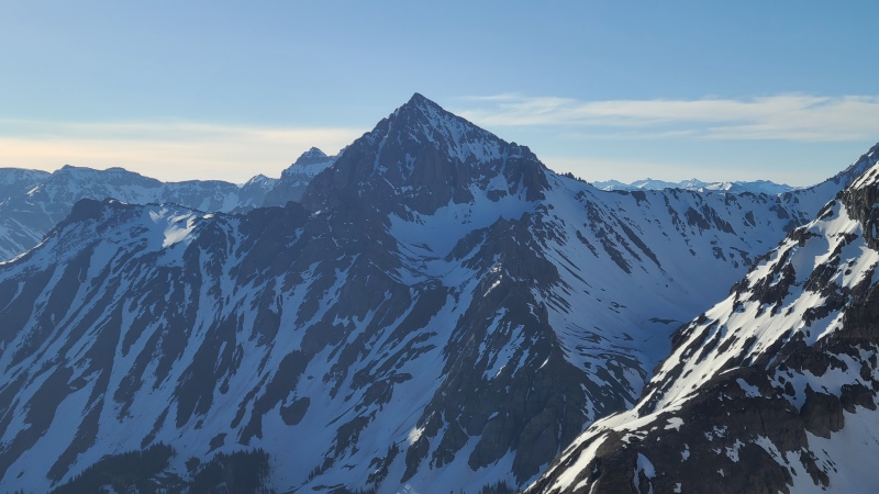
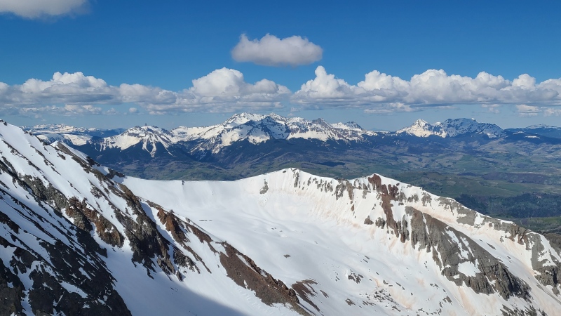
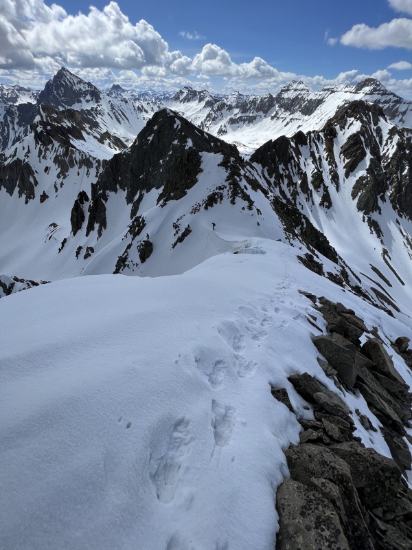
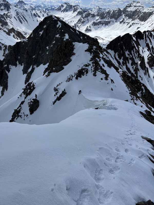
From the ridgetop it was a few minute's short walk to the summit. Wolcott is barely above 13,000 feet so the views of the northern Sneffels Range were huge and wicked.
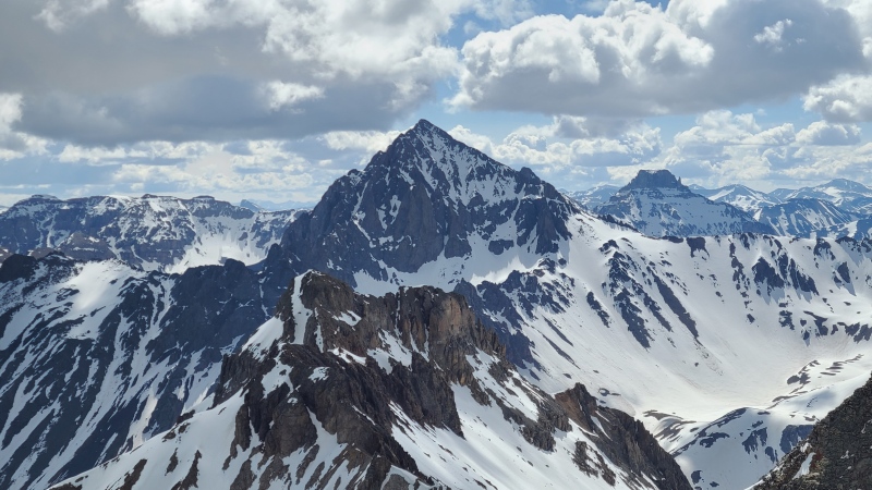
How dare some critter be up here before us!"S 6". Multiple options to get up this bad boy.Mears Peak and "S 7". Lone Cone is in the far back between the two. Photo: Heather R.Mighty Dallas Peak. Photo: Heather R.Mount Sneffels with Cirque Mountain standing to the left. The teeny tiny rise off Sneffels' left skyline is the summit of Teakettle.
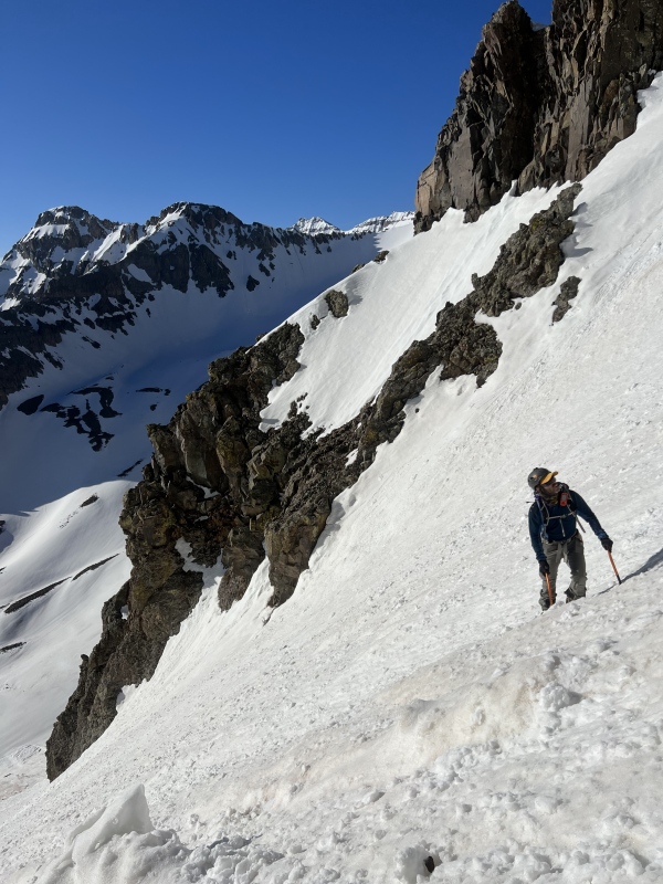
It was a couple of minutes after 7:40am when we reached Wolcott and the sun was beating down, so we didn't stay long. We reversed the ridge to the couloir and quickly made our way down. In hindsight it would have been fun to go down the couloir we didn't go up, but it's not like this wasn't also fun.
Initial down climb off the ridge. Nothing too steep on this one.Down, down we go. Photo: Heather R.Heather doing the crampon cancan. Talk about style!Lower couloir and me pointing at... something. Yep, that's a rock alright. Photo: Heather R.
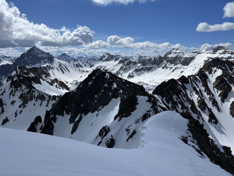
We were soon back on the rock glacier spilling off of "S 6" and hiking towards the latter. The rock glacier was an easy affair, low in angle and smoothed by snow. Undoubtedly it would be miserable dry. We passed by a couple of other more southern couloirs slicing up Wolcott's east face.
Flowing in ultra-ultra-ultra-ultra-ultra-slow-mo. Photo: Heather R.Additional southeast couloirs up Wolcott. The summit is far to the right. Photo: Heather R.
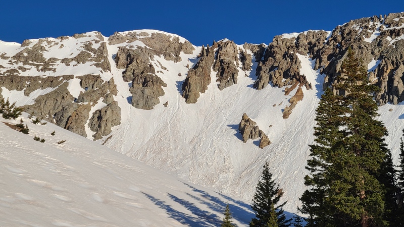
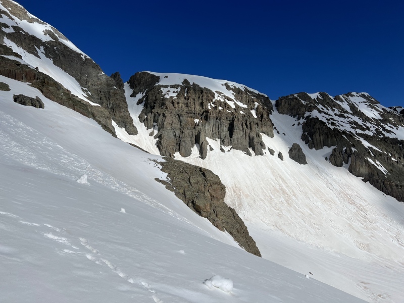
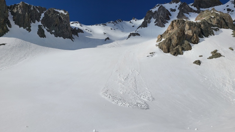
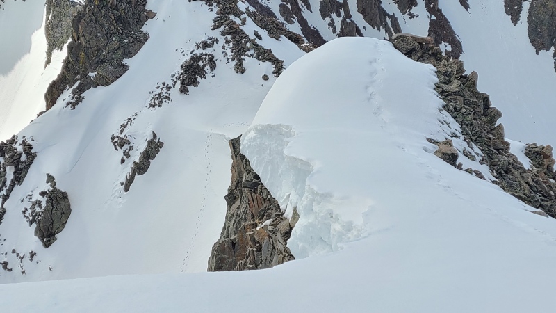
As we got closer to "S 6" we were again presented with a dual choice: left or right. This time our decision was easy. We knew from as far away as Wolcott that there was a truly enormous cornice hanging over the righthand (northwest) line and we weren't about to mess with that. The lefthand line was also that much closer so there was no point in going out of our way.
Again, left or right? The righthand option has a visible cornice above it. We weren't sure what the two far right options would lead to so left was the clear choice. Photo: Heather R.
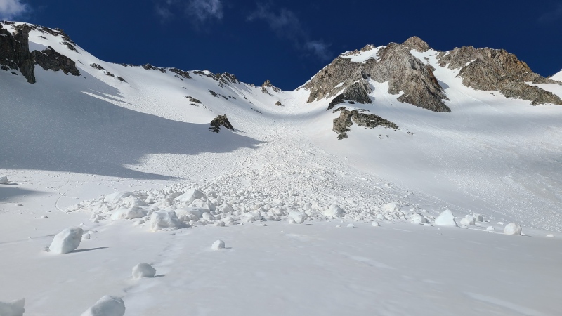
As we approached the apron we crossed a few large, frozen piles of wet avalanche debris. We'd have to be fast to avoid any wet avalanche danger.
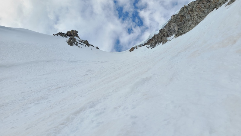
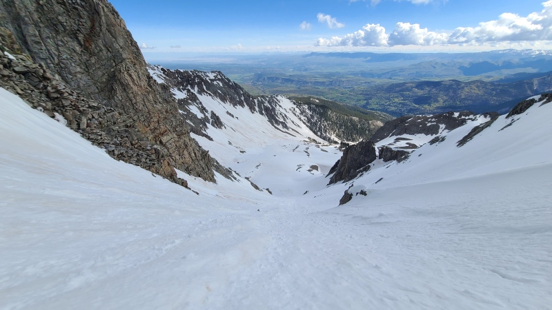
Beginning up the left side. Lots of chunky slides.The top out isn't quite visible from here, but this is 95% of the climb.
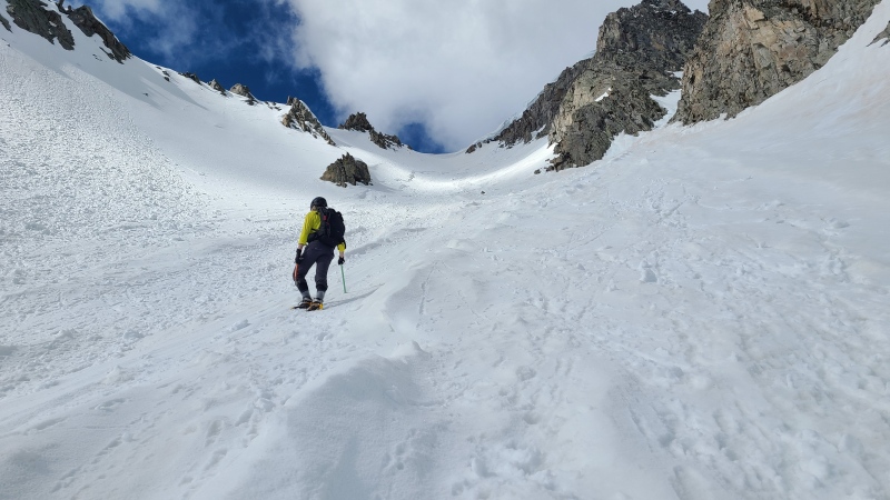
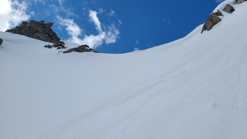
For most of the couloir the climbing was again easy, in the Moderate Snow range up to maybe 40 degrees. We enjoyed the climbing and the mutual company. Heather is just as much of a snow climbing maniac as I am and it's always a blast getting out with her.
One of the better lines I climbed in 2023.Go greenhills racer. Photo: Heather R.
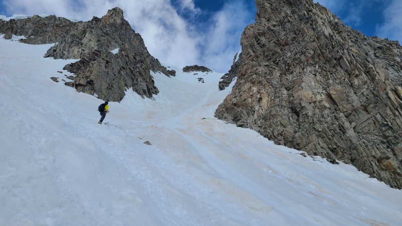
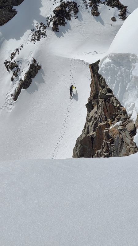
Approximately halfway up the couloir we reached a fork. Surprise surprise: left or right? We'd already gone right up Wolcott and now left up "S 6" so obviously the correct answer is climb directly up the choss cleaver in the middle.
Right up the middle, duh. Photo: Heather R.To the left. It's actually a lot further than it looks.To the right.
We sort of split the difference on this one. I went left, Heather went right. We planned to meet at the summit and hoped our respective lines would get us there. Neither of us could tell where they ended. My side ended up being easy breezy until it curved further left towards the top and turned into a beautiful Steep Snow finish, 50 degrees or just a bit higher. Just what I was looking for to knock off the climb. Front pointing ensued for this short section.
Just below the top. No cornice on this side.Looking down the upper half. The top 50 feet are deceptive and a lot steeper than it looks.
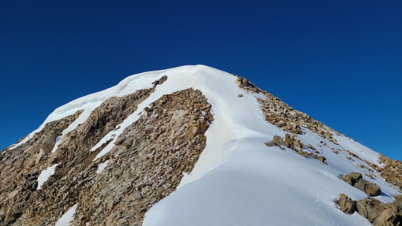
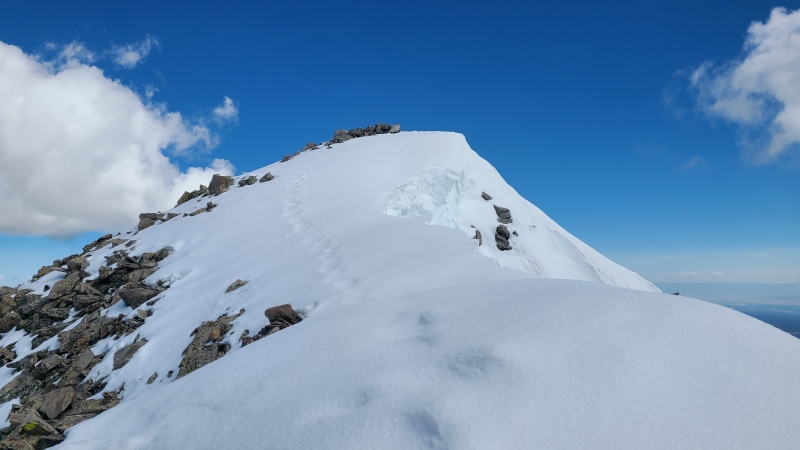
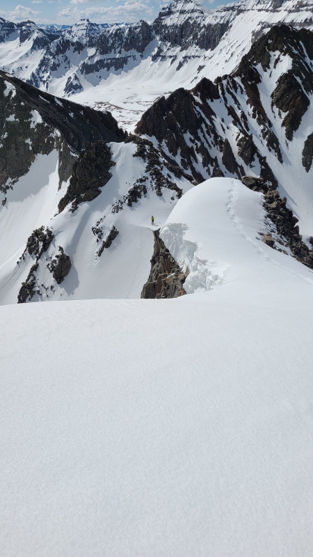
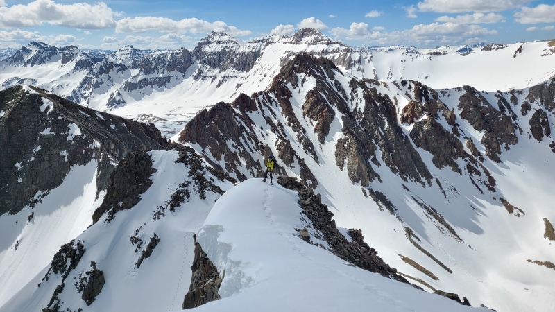
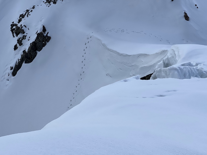
From the top of the snow climb there was only steep, somewhat exposed ridge to climb to the summit. Surprisingly there were some recent climber's tracks leading up the ridge, but I couldn't tell where they'd come from. Certainly not the north side like I had.
Summit on the right.
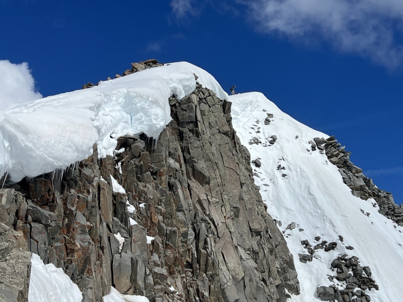
It was actually a bit hard to tell where the edge really was as I climbed up the ridge. The cornice was broken into precariously hanging pieces and the tracks mere feet away. I figured the tracks were safe but climbed swiftly nonetheless.
Wild.Walking on water.I love all the weird angles of my tracks in this shot.
I peered down slightly to the west of the summit, being careful not to get too close to the edge, considering I couldn't see where the cliff began under the snow. I couldn't see Heather nor any of her tracks below me, so I sat and waited. It turns out her branch had been steeper and continued to fork. She'd tried a couple of the forks and none worked. The most promising ended in a nearly vertical wall of shattered, extremely loose rock surrounded by cornices. For good reason she stopped there and turned around before climbing back down and taking the left branch I'd gone up.
Her branch certainly was more interesting than mine. Photo: Heather R.Heather's high point, a no go. Photo: Heather R.
It wasn't long before I saw her coming up the way I had. At that point I wasn't sure why, as we hadn't been able to communicate yet, but she made quick work of the rest of the couloir and ridge.
My favorite shot of the day.Close up showing how steep the top really is.What a vantage point!Zoomed shot of me on the summit. Heather would have come up somewhere to the right and behind me, if she'd been able. Photo: Heather R.
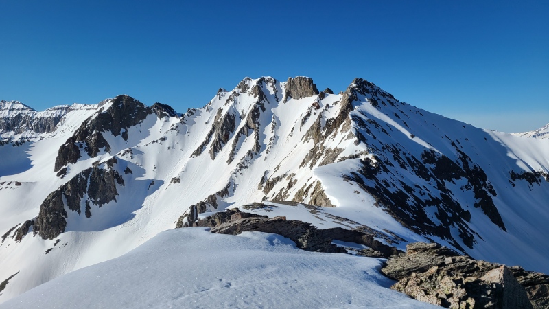
When Heather arrived on the summit she relayed her story to me. I didn't see photos until after the trip, but her description was enough to know she'd made the right choice. We drank in the views, which were among the finest we'd ever seen.
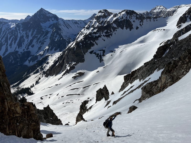
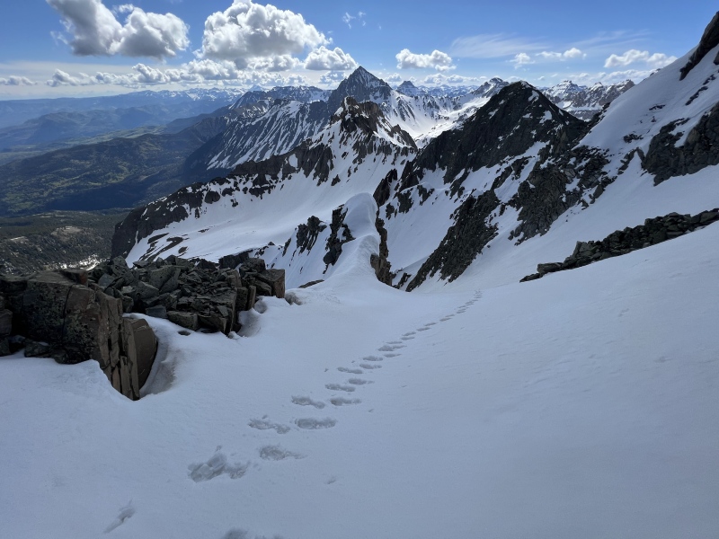
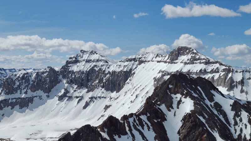
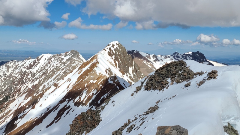
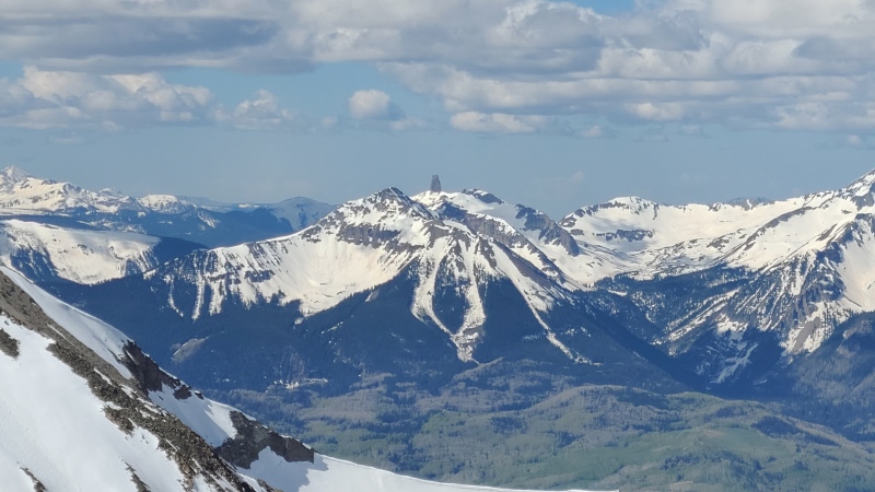
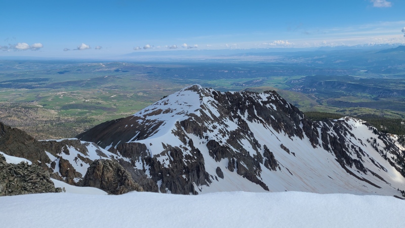
Sneffels."S 4", "S 5", and "S 3" in the foreground, Sneffels, Potosi Peak, Gilpin Peak, Mount Emma, Dallas Peak, and "West Dallas" in back/middle ground. Handies can be seen way back between Potosi and Gilpin. Photo: Heather R.Closeup of Dallas and "West Dallas". "S 3" in front."S 7", Mears Peak, "S 8", "S 9", and "The Corpse".Wilson massif and Little Cone.ð¦head.Little old Wolcott Peak! A "standard" route would probably come up the dry southeast slopes on the left.
Now that had been worth it! Wolcott by itself would have been a fine prize for me, but "S 6" really rounded out the enjoyment of the day. We could even get down for a nice lunch if we were fast, so having had our fill of mountains we departed back down.
When life gives you lemon colored shirts, climb snow, and other useless and terrible non-sequiturs by Benguy.Ephemeral beauty. Photo: Heather R.
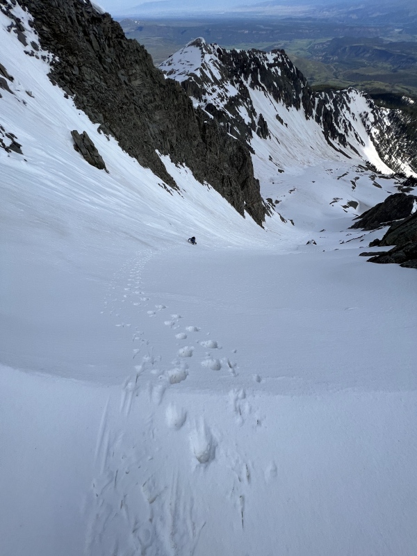
I went down the couloir first as Heather took some photos. We both agreed that this one was particularly awesome and worthy of the time and effort it had taken us to climb. The top was steep enough to down climb facing in, and Heather soon joined me on the last bit of glory.
Assessing the situation. Photo: Heather R.
Easy does it. Photo: Heather R.Again, deceptively steep when looking down. Photo: Heather R.Reality.
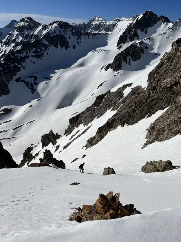
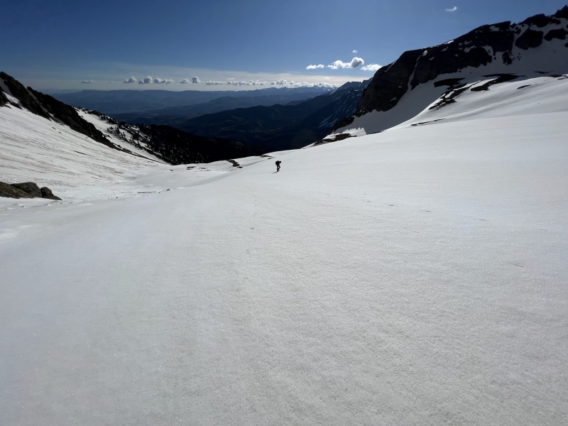
After a couple hundred feet facing in we were able to turn around and plunge step down, then eventually glissade all the way back to the rock glacier.
It's always bittersweet having to go home.Tons of glissading made for a fast, easy descent.
The rest of the hike back to the trail was zippy, and once back on the trail even zippier. There were a few cars at the trailhead when we got back but we didn't see anybody all day. We rounded out the day with beer and wings at Ouray Brewing Company, and then took naps. Is there a better day than climbing two great peaks, eating and drinking delicious food and beer, taking an afternoon siesta, and overall having a great time with your buddy? I think not.
Statistics
Climbers: Ben Feinstein (myself), Heather R. Trailhead: Blue Lakes/East Dallas Creek
Total distance: 8.8 miles Total elevation gain: 5,433 feet Total time: 7:23:03 Peaks: One ranked thirteener, one unranked thirteener
Wolcott Mountain, 13,040' (unranked)
"S 6", 13,455'
Splits:
Starting Location
Ending Location
Via Time (h:mm:ss)
Cumulative Time (h:mm:ss)
Rest Time (m:ss)
Blue Lakes Trailhead
Bottom of Wolcott Northeast Couloir
2:32:59
2:32:59
0:00
Bottom of Wolcott Northeast Couloir
Wolcott Mountain
0:39:51
3:12:50
0:00
Wolcott Mountain
"S 6"
1:42:09*
4:54:59*
0:00*
"S 6"
Blue Lakes Trailhead
2:28:03
7:23:03
Trip End
* I reached the summit of "S 6" significantly before Heather but didn't keep track of time well. There's some play in these numbers.
My GPS Tracks on Google Maps (made from a .GPX file upload):
So much fun to be had in the soon-to-be-permitted Sneffels Wilderness Zone.
S 6 is highly entertaining. Heather's route is what I call the Directissimo and is righteously steep at the top, when there's snow. When there's not you have to go up a side chute (which she did), then from there proceed left up that spur to the summit. It's as bad as it looks (here's Kylie with less snow). Your route is "Celestial Lotion" (not sure if that's a historical name but Stiles skied it in August so I think he can name it).
Your Wolcott couloirs are definitely the correct way to summit that.
@Michael: that route looks terrible but typical of the area. No thanks. Assuming permits won't start til like Memorial Day or around there, that will make these peaks even more appealing on snow. No problems there!
@Eric: install this man as head Twitter memelord/shitposter, stat!
Thanks, as always for sharing these fun snow routes in the Sneffels range. They made a good ski linkup this past weekend, tho snow conditions were less than ideal, I think they could be worth a repeat in better snow someday.
"S 6" is definitely the better of the two peaks, plus being ranked. These make a great combo from this approach so might as well add on Wolcott too. That way if you do both you'll still have infinite things to do on your San Juan list. :lol:
Caution: The information contained in this report may not be accurate and should not be the only resource used in preparation for your climb. Failure to have the necessary experience, physical conditioning, supplies or equipment can result in injury or death. 14ers.com and the author(s) of this report provide no warranties, either express or implied, that the information provided is accurate or reliable. By using the information provided, you agree to indemnify and hold harmless 14ers.com and the report author(s) with respect to any claims and demands against them, including any attorney fees and expenses. Please read the 14ers.com Safety and Disclaimer pages for more information.
Please respect private property: 14ers.com supports the rights of private landowners to determine how and by whom their land will be used. In Colorado, it is your responsibility to determine if land is private and to obtain the appropriate permission before entering the property.


")
")
")
")
")
")
")
")
")
")
")
")
")
")
")
")
")
")
")
")
")
")
")
")
")
")
")
")
")
")
")
")
")
")
")
")
")
")
")
")
")
")
")
")
")
")
")
")
")
")
")
")
")
")
")
")
")
")
")
")
")
")
")
")
")
")
")