| Report Type | Full |
| Peak(s) |
Tabeguache Peak - 14,158 feet |
| Date Posted | 01/28/2024 |
| Date Climbed | 01/27/2024 |
| Author | daway8 |
| Tab Winter Revenge |
|---|
|
This is the sequel to my rather dramatized Shavano Winter East Ridge Direct. The intent is to fill in a few gaps having seen how the route changed over the course of the week and having made it all the way to Tab this time. Included in this report will be:
Trailhead: Angel of Shavano Route: Shavano East Slopes Ridge Direct Stats: 13mi, 5,700ft total time 15h 44min (note: starting from Angel of Shavano adds about 4 miles to the standard 11.5mi round trip but some very large switchback slices cut off a good bit of distance - at the cost of painful steepness). 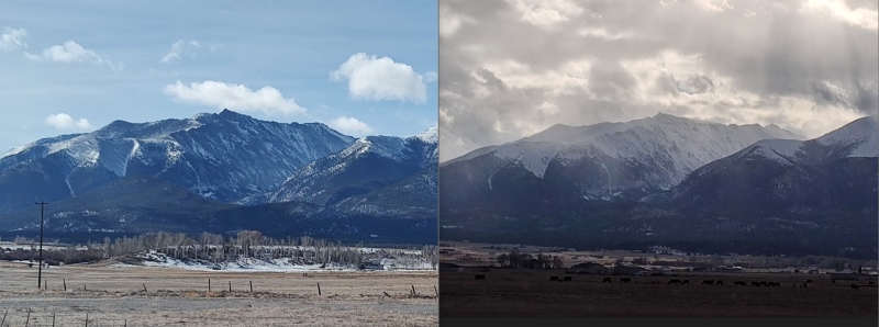
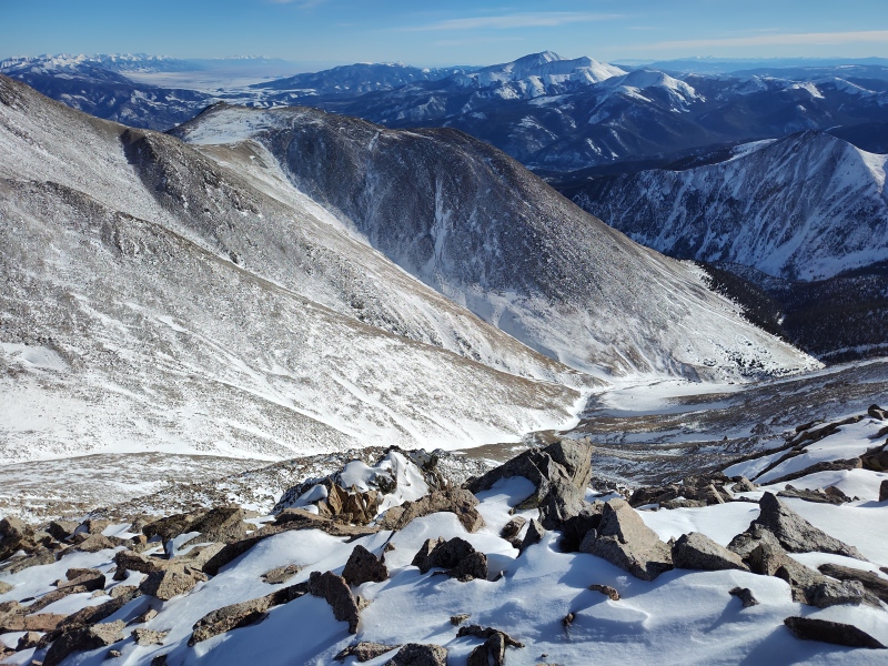
Background So after last weekend’s mostly successful trip where everyone in our team of 7 people tagged Shav and Tab except me (and some even added on UN13,712) I at first had decided to leave Tab for the end of winter, going along with a friend who wanted to get a ski descent of the Angel of Shavano. But between the weather, the constantly changing avy forecast, trailhead access issues, etc, etc all the various options I was looking at for the weekend just didn’t seem very optimal. That’s when I looked again at Tab and saw only a few inches of snow had been added since last weekend but over a foot of snow was forecast to come the following weekend. Well, looks like this is the time to go get it! I had restarted my weighted pack training exercises this week after lapsing over the holidays (and having greatly regretted it last weekend) and was going solo this time so I knew there would be no pressure whatsoever of feeling like I needed to keep up or feeling hesitant to take breaks as long or as often as I felt like. I had hoped this strategy would produce better results than last weekend and, while I did get both peaks this time, and overall felt better throughout the day, it’s quite apparent that a few days of weighted pack training is woefully inadequate to get me going in the manner I’d like to be going in the mountains. But at least I feel like I’ve started moving in the right direction. Avy Analysis Revisited So I did a pretty exhaustive analysis of potential avalanche concerns on this route in the last report (scroll down to the large bolded Avy Analysis section in Shavano Winter East Ridge Direct). But since I took very few notes/pictures on last week’s trip I wanted to fill in a few specifics to show more precisely where the areas of possible concern are. The slope between the Angel of Shavano trailhead and the normal summer trailhead had gotten really dry, despite some fresh snow during the week. So still zero danger there. 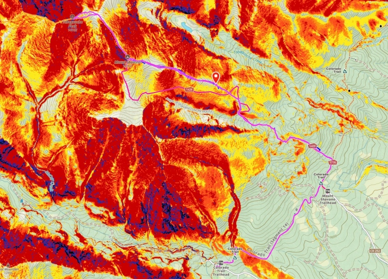
As for the regions mentioned last time – the first very steep section (red shaded on the map - the first switchback cutoff) started at roughly 3.78 miles into the hike at around 11,250ft. It continues until about 3.88mi at 11,500. So it’s a pretty short section but its red shading should make you alert and, as described in the last report, this section is also at the bottom of where some historical avalanches have run down from the Angel in big snow years. However, even with a little refresh of snow, this region was still fairly lightly covered with increasing amounts of bare ground and so I still didn’t consider it any real risk. 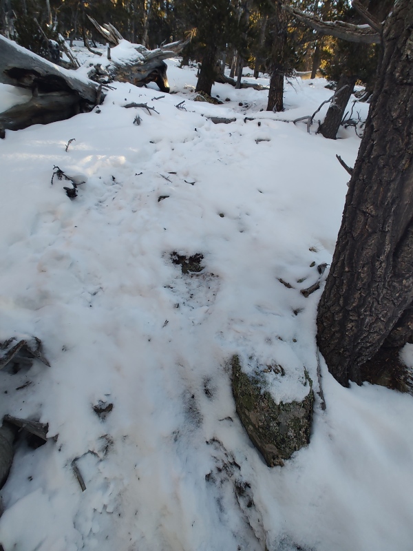
The next section of possible concern starts at about 3.98mi into the hike at about 11,650ft and runs pretty much to treeline at 4.28mi, 12,444ft (I’m using treeline loosely here – it’s more like the location of the final bush – and the spot where snowshoes were stashed both weekends - this region corresponds roughly to the second switchback cutoff with a waypoint shown for the stash location in the snapshot above). 
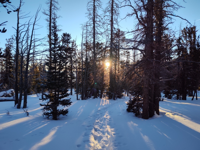
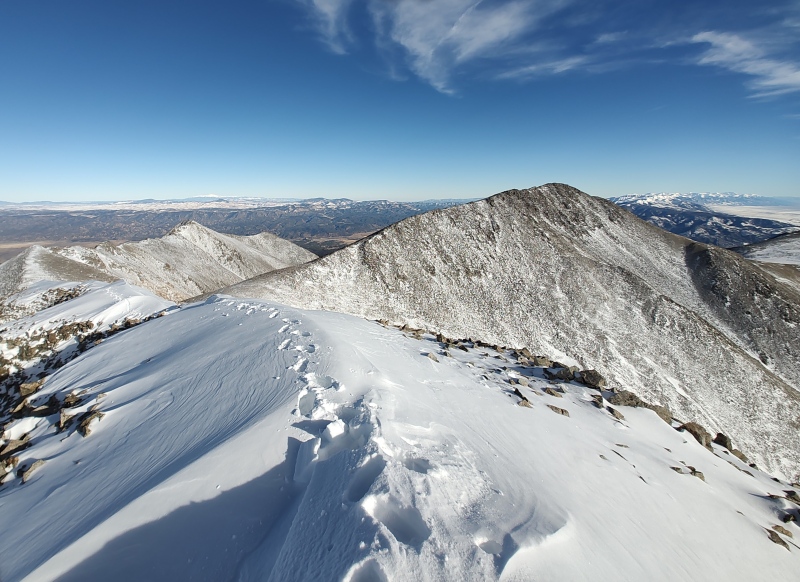
This section has splotchy yellow shading with some orange and a couple tiny flecks of red with dispersed splotches that aren’t even shaded. So that means it’s overall on the lower end of the danger scale for having enough of a slope to slide but it’s still certainly possible. There is a sparse scattering of robust trees which builds confidence but the section is a butt-kicker for trenching up and so had me uneasy both weekends as the entire section above about 12k to the 12,444ft tree/bushline had last week’s trench largely obliterated by wind. There was the tiniest of wind slabs on top of the slope yesterday – not a concern at present but if we do indeed get a foot of snow dropped on that weak layer this coming weekend and have drifts deeper than that pile up on top then this slope might get a little more… interesting. Getting to Shav There was a pretty solid trench in below treeline, especially the first part which runs along the Colorado trail. After that, the groups that followed mine occasionally made slight tweaks to our line. I could see a thin layer of fresh snow covering our old tracks. 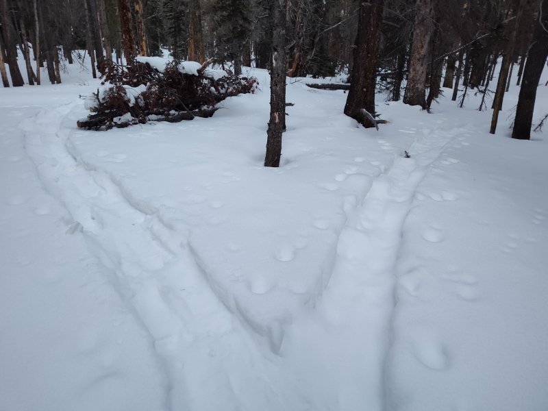
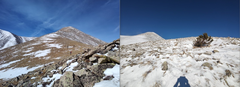
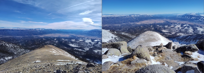
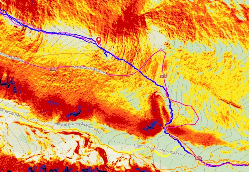
After treeline it’s just a big long slug up never ending hills with countless false summits to get to Shavano. The few extra inches of snow gave it a more wintery look and the bitter wind (vs hardly any last weekend) give it a more wintery feel. The most annoying thing here is coming back down the boulder/talus field that has countless trapdoors in it from all the snow building up in between rocks and a smattering of ice in all the places you don't want it. Takes just as long to descend as to ascend due to the need for very carefully placing your feet. Getting to Tab Most of the route between Shav and Tab was pretty dry overall – some more of the lovely trapdoor snow – more so past the saddle than on the way down to it. But the top of Tab was quite a different story than the rest of the area. 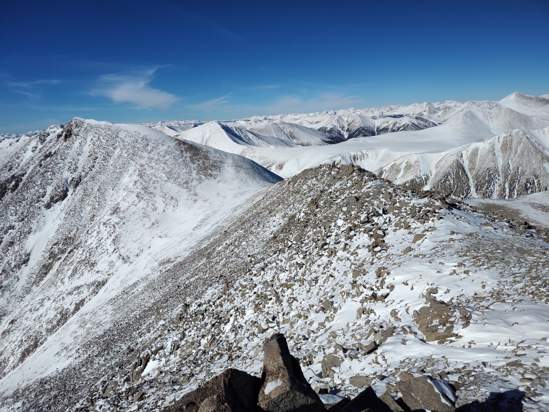
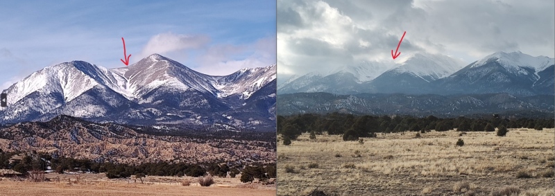
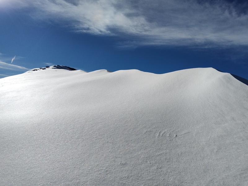
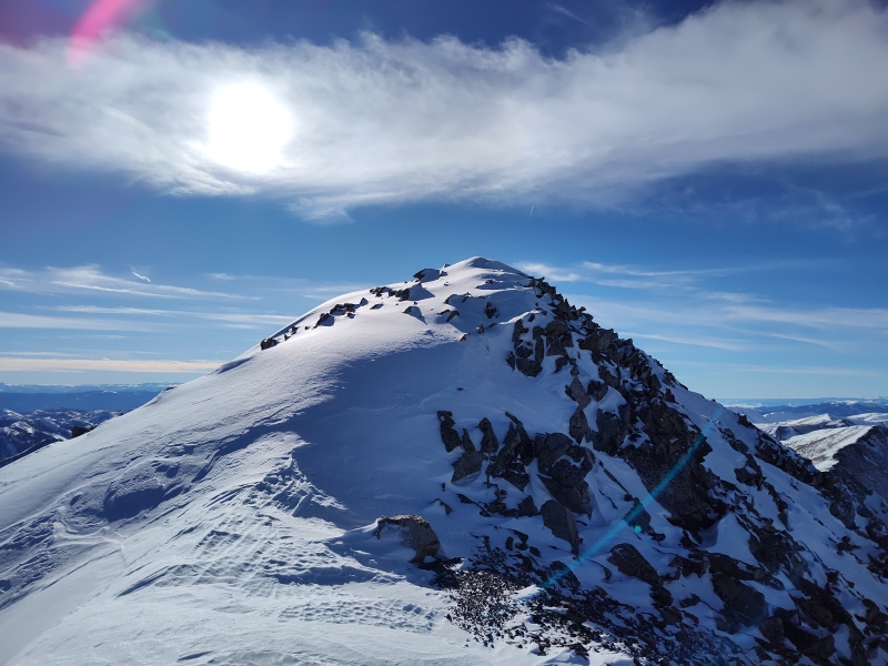
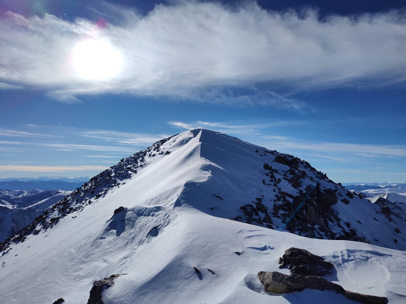
Tab had a sizeable snowfield building up on the summit and the ridge leading up to it. Along the right side it appeared to drop precariously and seemed like it might possibly have some cornices starting to form over there. The left side (as approaching from Shav) is a little more mellow of a slope for the small section leading up to the summit but it was heavily loaded at the top. 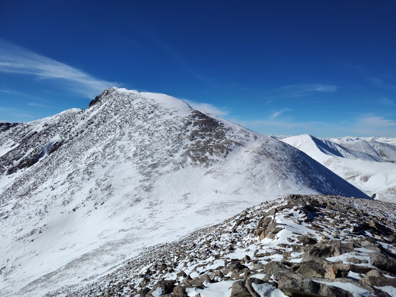
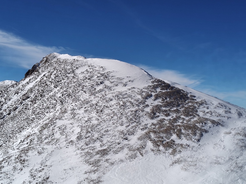
Diverting around on the right seemed an obvious no-go with steep snowy rocks. Diverting to the left seemed possible but you’d have to sidehill a good ways below the summit then try to shoot up and still probably have to deal with some of the snowfield anyways. After evaluating the situation and taking into account how late in the day it was already getting, I decided that this was a comparatively small snowfield that was clearly very sunbaked and wind blasted. So I had good hopes that it would be pretty firmly set and decided to risk a straight assault, staying below to the left of the crest in case there were any cornices I didn’t have a proper angle on to see. 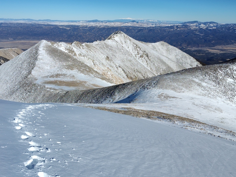
As I got further along and could now see rocks off to the right, I knew there was solid ground on that side and so opted to go along the crest rather than the steeper slopes to the left since all I had were mircospikes and an ice axe. I honestly didn’t even bother to check the slope shading before going for it and am actually surprised to see it have only flecks of shading along there since it looked/felt rather steep off to the side though it’s entirely possibly that the snow could have loaded up at a different angle than the underlying slope thanks to the wind – I didn’t attempt to measure it. 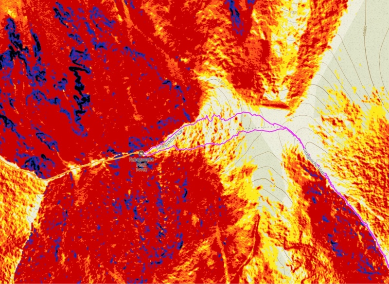
Anyways, that was a bit of a calculated risk that didn’t bite me on this occasion. On the return I opted to drop down to the rocks down below the snowfield which was another of those horridly annoying sections of trapdoors between occasionally loose rocks. I had one nasty wipeout close to the bottom when I got overconfident and tried to move faster and slammed my left knee into a rock. Fortunately, no significant damage done but that did induce me to move slower for the rest of the descent there and the really exceptionally long and annoying version of the same stuff coming down Shav. 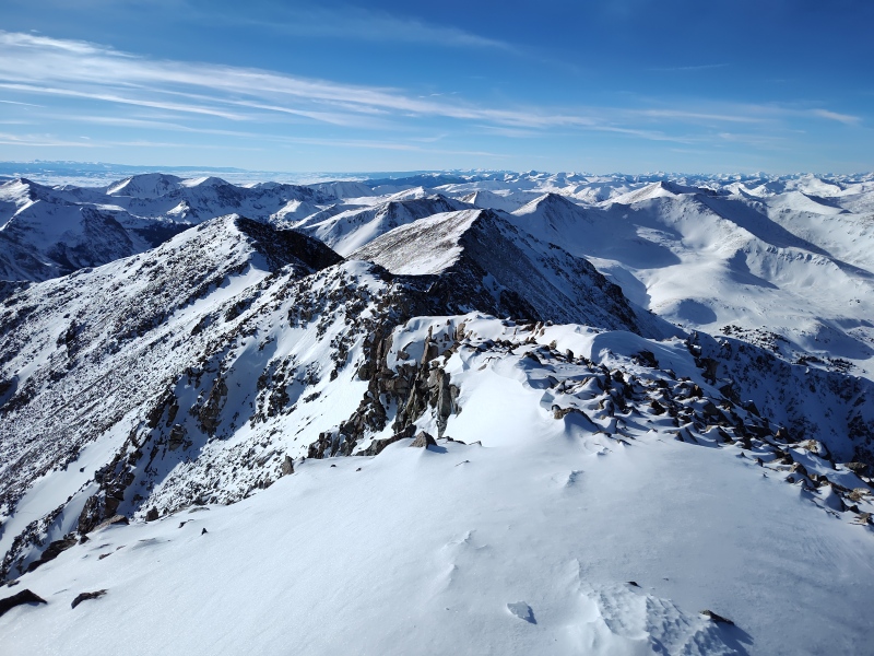
The sun was already dropping to the horizon as I started dropping off Shav. 
My Times Still much more pokey than I want to be - gotta carry-on the exercise routine that I started before Christmas and only just rebooted after the recent group hike highlighted how I'm lagging... 4:54am start from Angel of Shavano Trailhead 5:58am summer trailhead 7:47am 3.78mi 11,250ft base of first steep section 8:07am 3.88mi 11,500ft now on less steep snow 8:30am 3.98mi 11,650ft finally put on snowshoes 9:04am 4.11mi 12,020ft finally a short flat section but lots more steep stuff ahead - and previous tracks blown away a little above this 9:50am 4.28mi 12,444 finally at the snowshoe stash location - the final bush 12:03pm 5.2mi 13,730ft resting behind large boulder to block the "horridly cold, strong wind." 12:44pm pausing just below the summit of Shavano in wind sheltered spot to fuel up and rehydrate (brought more liquids this time and also controlled body temp better - not hard to avoid overheating given the wind) 1:10pm move on the tag Shav then go straight to Tab 2:02pm finally at the Y saddle between Shav, Tab and UN13,712 2:35pm stopped for microspikes and ice axe for steep snowfield to summit 3pm Tab summit 3:22pm return 3:55pm at the Y saddle 4:48pm back on Shav 6:34pm back at snowshoe stash 8:38pm finally back at trailhead Thumbnails for uploaded photos (click to open slideshow): ")
")
")
")
")
")
")
")
")
")
")
")
")
")
")
")
")
")
")
")
")
")
|
| Comments or Questions |
|---|
|
|
Caution: The information contained in this report may not be accurate and should not be the only resource used in preparation for your climb. Failure to have the necessary experience, physical conditioning, supplies or equipment can result in injury or death. 14ers.com and the author(s) of this report provide no warranties, either express or implied, that the information provided is accurate or reliable. By using the information provided, you agree to indemnify and hold harmless 14ers.com and the report author(s) with respect to any claims and demands against them, including any attorney fees and expenses. Please read the 14ers.com Safety and Disclaimer pages for more information.
Please respect private property: 14ers.com supports the rights of private landowners to determine how and by whom their land will be used. In Colorado, it is your responsibility to determine if land is private and to obtain the appropriate permission before entering the property.

