Download Agreement, Release, and Acknowledgement of Risk:
You (the person requesting this file download) fully understand mountain climbing ("Activity") involves risks and dangers of serious bodily injury, including permanent disability, paralysis, and death ("Risks") and you fully accept and assume all such risks and all responsibility for losses, costs, and damages you incur as a result of your participation in this Activity.
You acknowledge that information in the file you have chosen to download may not be accurate and may contain errors. You agree to assume all risks when using this information and agree to release and discharge 14ers.com, 14ers Inc. and the author(s) of such information (collectively, the "Released Parties").
You hereby discharge the Released Parties from all damages, actions, claims and liabilities of any nature, specifically including, but not limited to, damages, actions, claims and liabilities arising from or related to the negligence of the Released Parties. You further agree to indemnify, hold harmless and defend 14ers.com, 14ers Inc. and each of the other Released Parties from and against any loss, damage, liability and expense, including costs and attorney fees, incurred by 14ers.com, 14ers Inc. or any of the other Released Parties as a result of you using information provided on the 14ers.com or 14ers Inc. websites.
You have read this agreement, fully understand its terms and intend it to be a complete and unconditional release of all liability to the greatest extent allowed by law and agree that if any portion of this agreement is held to be invalid the balance, notwithstanding, shall continue in full force and effect.
By clicking "OK" you agree to these terms. If you DO NOT agree, click "Cancel"...
In October, 2021 I purchased a house in Ridgway. Why Ridgway? Primarily for the views of the Sneffels Range and Cimarron. Ouray is cool but too enclosed, and Telluride too expensive. It took about a year for the stars to align on the purchase, and I had made multiple offers prior to landing the house I'm at now (and forever). I hadn't even finished pulling into the driveway before I knew I had to have it. I mean, it's hard to say no when this is the view from my dining room.
Now what does one do with a view such as this? Well, sigh whimsically, spend inordinate amounts of time gawking, and grit their teeth when the property tax bill comes. But I also like to look out and say I've climbed every peak I can see from my house, which is true with the exception of three peaks in the Cimarron (at the time of writing), Dunsinane Mountain, Chimney Rock and the foreboding Turret Ridge. They'll be mine eventually. The Sneffels Range is the real draw to Ridgway though, I think, and I can point at it and say I've climbed everything the sun touches, kind of like Mufasa from the Lion King. But that's not enough. Besides the peaks themselves there are obvious routes to the peaks that I can see, and climbing those too just made sense. What's the point of having the view if you merely look at it? You have to climb the view too, my friends.
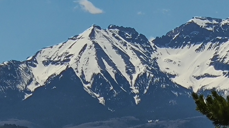
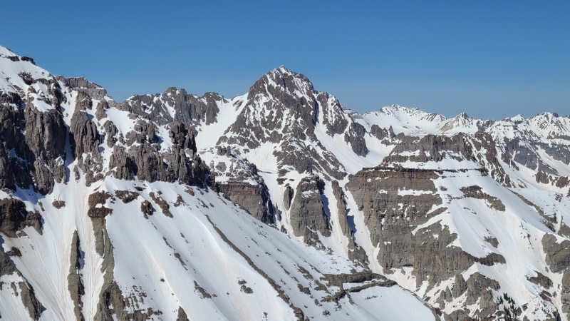
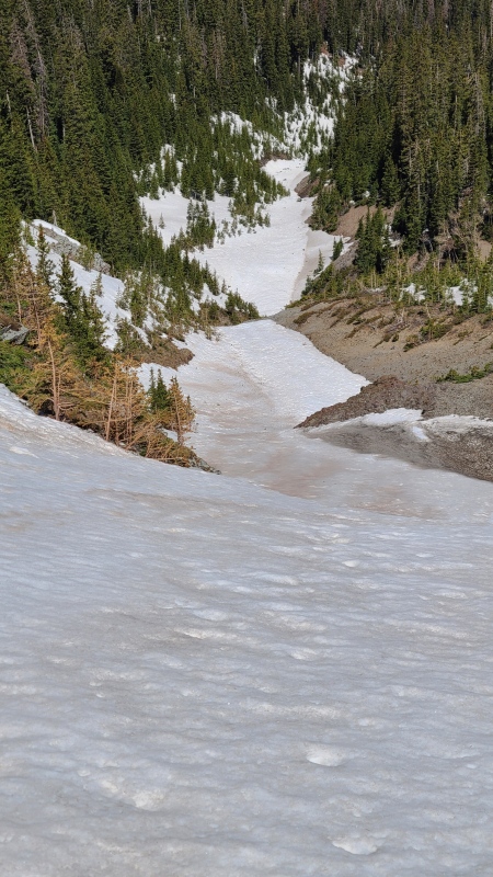
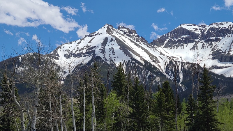
The first line I chose was on a peak I'd already climbed twice, "Corbett Ridge". The standard route on "Corbett" ascends the north-northwest ridge and it's your typical Sneffels Range pile of crap (the mountains are pretty to look at, not so much to climb in many cases), ascending a steep bushwhack to treeline and then a rather irritating never ending field of rounded, somewhat unstable talus to the foresummit named "Son of Corbett", before dropping down to a small saddle and traversing an exposed ledge to the plateau which the aptly named "Corbett Ridge" itself rises out of. It's a quick, half-day climb but there are better climbs in the Sneffels Range. When I spied a couloir to the aforementioned saddle between "Son" and "Corbett" I knew I had to climb it. Here's what it looks like from my place.
"Corbett Ridge" in the middle, which is the northeastern most ranked Sneffels 13er, "Son of Corbett" is the rounded lump on the left, and Whitehouse Mountain is the flattopped giant on the right. Taken two days before our climb, on May 25, 2023.The west couloir shown by arrows - we named it Kidney Stone couloir (explanation below). It'd be quite the undertaking to climb from the bottom. The standard route ascends the minor ridge descending about 7 o'clock off "Son of Corbett" with the lipstick-shaped dry patch.
How could one look at that and not want to climb it? I figured it'd be a beautiful line if it went from top to bottom, since not many couloirs start below treeline. It's also not a line many people would even know about. The neighboring peaks don't see too many visitors and the entire north side of the Sneffels Range is owned by fashion magnate Ralph Lauren, so really the only vantage points are from State Highway 62 or in the area between the highway and Loghill Mesa northwest of Ridgway. I couldn't find any beta on the couloir at all, so I was flying blind with the planning and my crew - Heather, Vera, and Patrick - were OK with that. We'd give it our best shot, see if it did indeed go, and maybe climb a fun couloir. Maybe we'd get skunked. Who cares, we'd have a good time regardless.
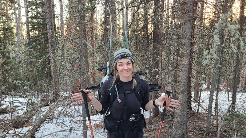
We all met up at my place and made final preparations. I'd be on snowshoes, Heather on splitboard, and Vera and Patrick on skis. If we could get to the couloir we all surmised it'd be a good ski, I just suck too much at skiing to give something like that a shot. But I'd damn sure climb it and lope along behind on the downhill. We planned to just drive there in the morning from my house and have boots on the ground at 5am. Since I'd been up the standard route twice before I knew the general area we'd be starting from towards the southern end of Ouray County Road 5. The county road eventually turns into a network of Forest Service roads. Instead of starting a little further east, as we would have if we'd gone up the standard route, we decided to start at the Wilson Creek trailhead at end of the county road and ascend the most minor of multiple northwest ridges in an area carved into deep drainages and try and find our way into the couloir from there. This would be the ridge west of the couloir, just to viewer's right of the lower arrow in the photo above. The route finding at the bottom would be the most difficult since we had to get on the right ridge, but then it would be obvious where to go, since the drainages would likely keep us bound on land.
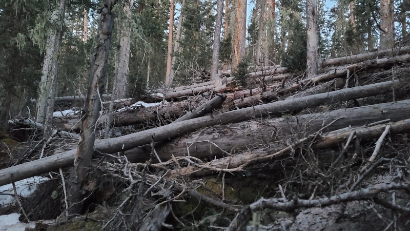
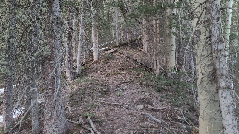
From our early morning parking spot just into Forest land we groggily began picking our way to the ridge. We were walking just before our planned 5am start time so it was still dark for about 55 minutes and thus we were relatively slow even though terrain early on was gentle and easy. Once we determined we were on the ridge we made our best attempt to stay on the rounded crest. Bushwhacking was pretty ugly here, especially on the lower parts, with copious deadfall (note the horrific beetle kill in later photos) and a heavy mix of dry ground and soft snow.
Yup, Class 3 scrambling action on trees.
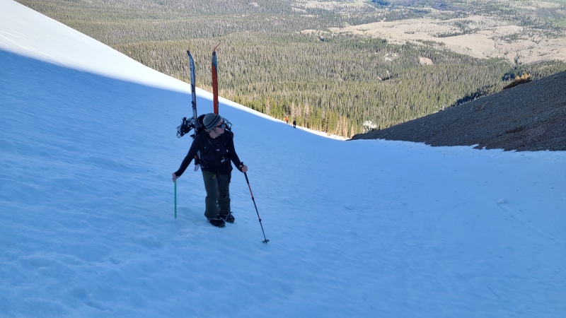
I had an easier time with the bushwhacking than my skiing companions did. It wasn't yet snowy enough for us to put on our flotation, and they struggled with both ends of their skis getting stuck in the trees and branches.
Heather showing how high the skis were vs how low the branches went. Not ideal.
I quickly pulled ahead of my friends since my snowshoes were much less likely to get caught on everything, and actually found a somewhat decent animal trail up the ridge. We all assumed humans had been up here, but not frequently, so the trail was nice even if it was still somewhat of a mess. We were high enough, and the ridge was narrow enough, that there was nowhere else to reasonably go, so the trail helped us out considerably.
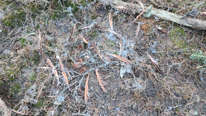
Actually pretty darn good for an animal trail. We made quick progress up this section.Something died and/or was eaten here. Yum?
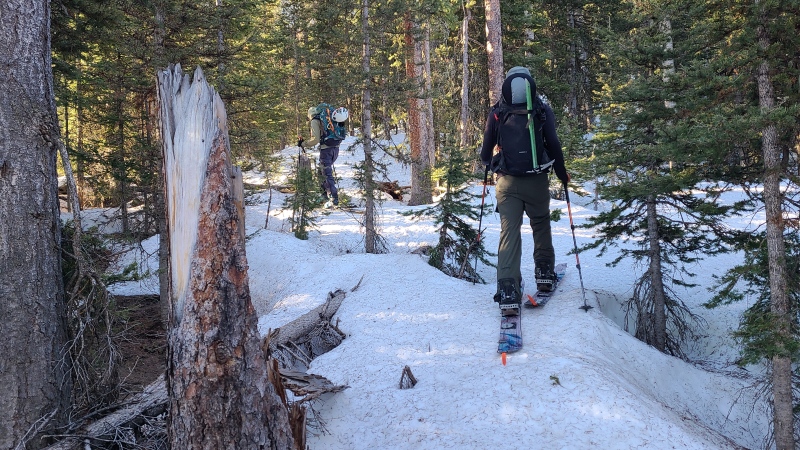
All good things must come to an end and eventually the trail became too snowy for us to navigate, and that snow became too soft for us to continue without flotation. We all put on our respective floaty footwear and continued up through the forest. At this point we were all able to stay roughly together, since the Skrio (the ski trio. Just go with it.) weren't catching on all the trees. Route finding was still easy owing to the constraints of the ridge.
Vera and Heather zig-zagging through the middle ridge.
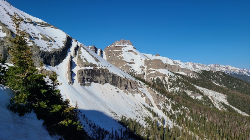
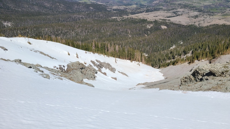
Most of the middle and upper ridge was pretty unremarkable, and unfortunately we never found a good way into the below treeline part of the couloir, since the flanks dropped away too steeply for us to find an obvious way down into the couloir. This ended up being to our benefit despite our desire to climb the whole thing. In any case, there wasn't much to do except continue the steep forest 'schwack, which paid off once we got to treeline, whereupon we could see all the way to Dallas Divide and up the couloir's entrance and upper section.
12,993-foot "Reconnoiter Peak" towering above the northern valley.Untouched, as expected, with the upper couloir also visible.
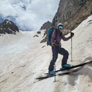
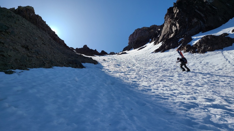
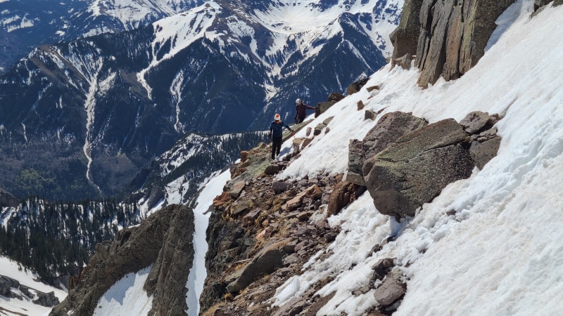
Here it was time to switch from skis and snowshoes to crampons and ice axes. We sheltered at a little stand of trees to transition, partake of the views, and refuel. Since this little expedition had been my idea my compatriots were kind enough to let me go first - thank you guys! The initial traversing section off our pit stop was the steepest of the entire route, though nothing that a single axe couldn't handle, and was over quickly. The snow was solidly frozen and absolutely perfect for cramponing.
Initial, steep traverse from the trees.We were quickly on more moderate terrain, with the main bulk of the couloir behind me and below me to my right.Couloir down into the trees. The plan was to go down this as far as possible, but first to summit!
This gamble had so far paid off and I was grateful to be back on my favorite type of climb. My heart soared. I hadn't felt this good in many months, after one of the darkest and most cruel winters of my life, and to be back where I belonged was almost more than I could handle. I will never take for granted the blessing of having this kind of terrain available, these kinds of mountains nearby (quite literally in my backyard now), and these kinds of friends. Lives like this are for living, and that's exactly what the four of us did this day.
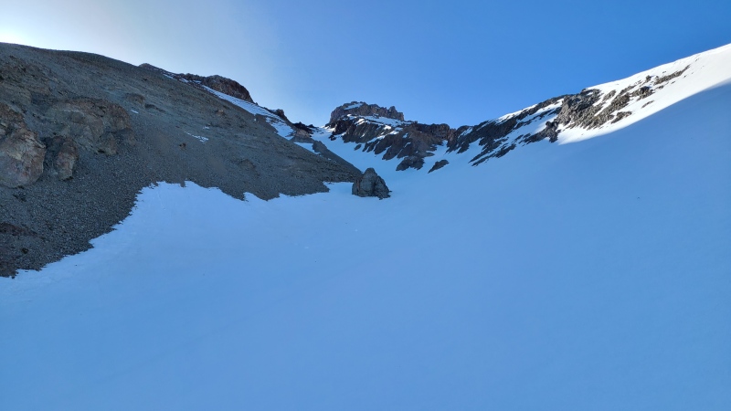
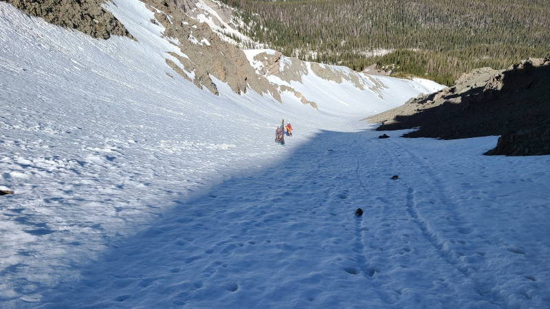
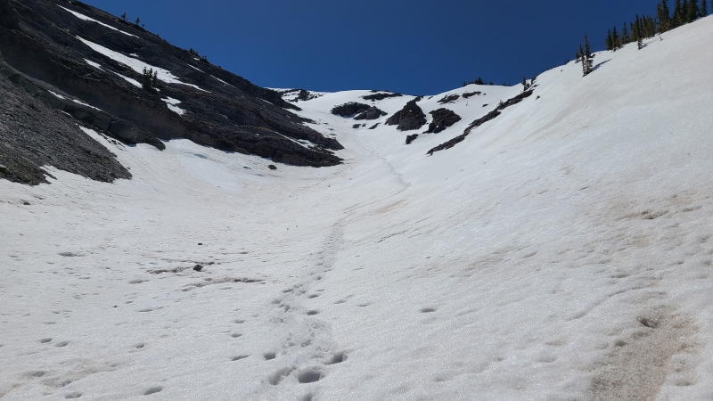
After the steep traverse came more moderate traversing until we were in the middle of the couloir's dogleg. Above us stretched snow to the saddle, and below and away from us more snow and views.
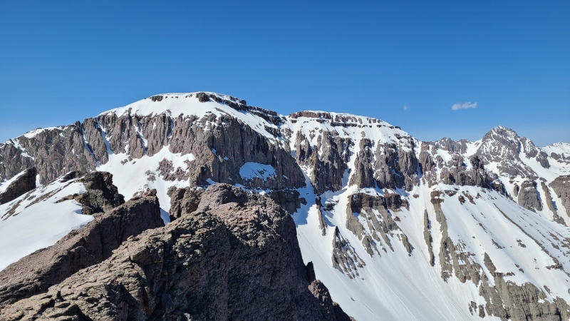
Kidney Stone couloir. The summit of "Corbett Ridge" is somewhere around the middle of the giant block right of the couloir.
As we cramponed our way upwards we entered the shadow of the mountain. We'd have to wait a little for this to soften on descent, but for climbing we had no reason to delay.
The Skrio making their way up.
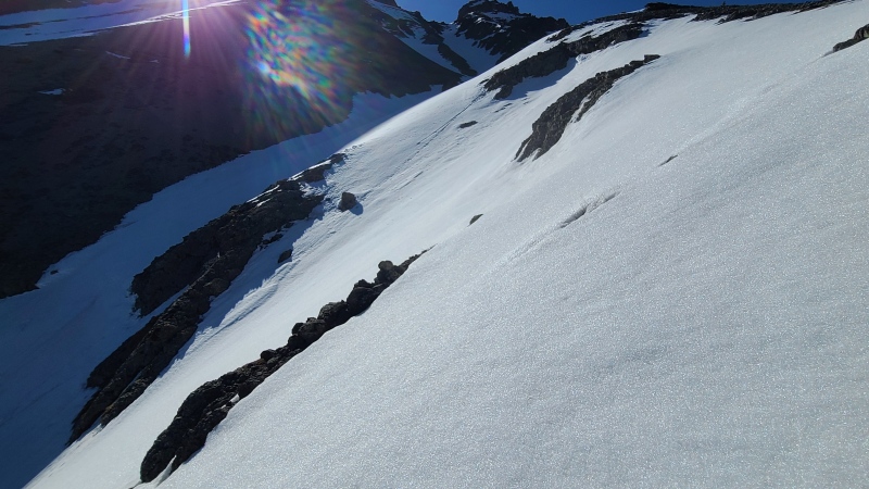
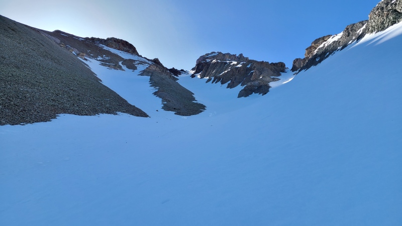
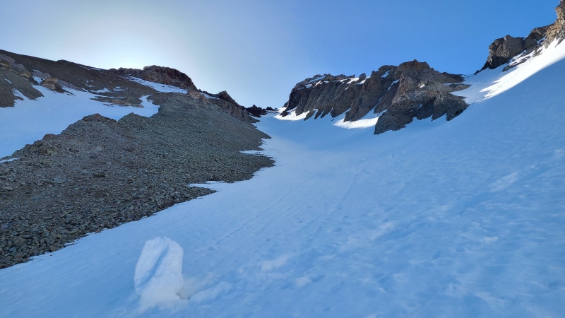
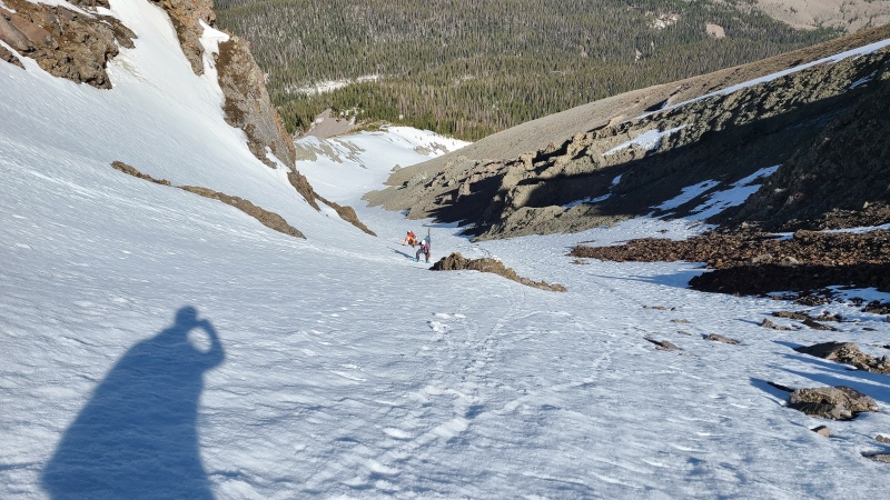
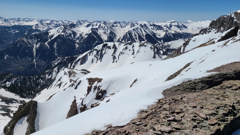
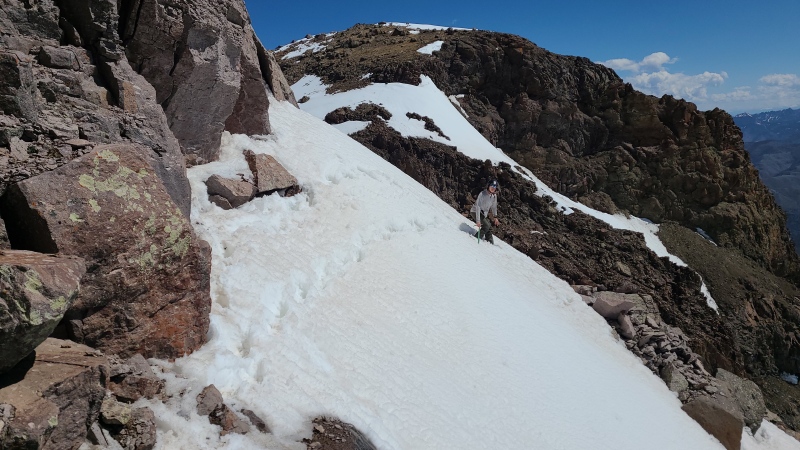
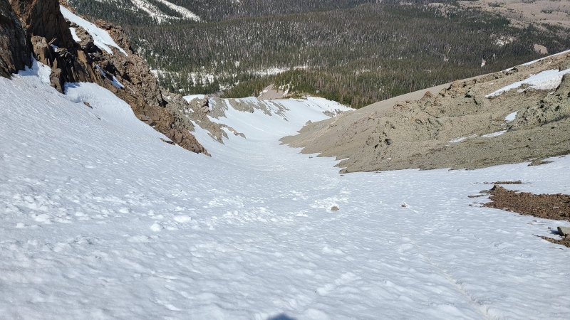
Rounding the dogleg revealed the remainder of the couloir all the way to the saddle. Though it split into three branches we stayed in the middle branch. The lefthand branch ended in a mess of awful looking Sneffels scree and we weren't sure where the righthand branch would lead us exactly, though based on distant views it probably ended fruitlessly at the walls of the summit block.
Riding the main branch.I can see my house from here! Literally though...
Rockfall became a problem the higher we went into the now-narrowing couloir. The upper part was no doubt getting baked, and the "rock" that makes up "Corbett" is barely held together so we spent the remainder of the climb keeping our eyes up and dodging rockfall - hence the name Kidney Stone couloir, kidney stones flying all around us through the slim passage. Most rocks were pebbles but some fist sized and larger rocks did come down and were large enough to injure or kill if they hit the right spot. Rockfall was nearly constant, so we made our way up carefully.
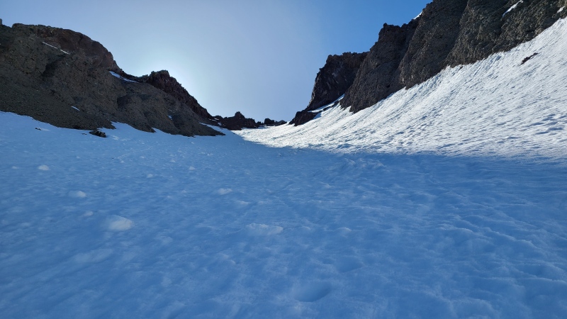
Nearing the upper couloir to the saddle.Juicy.You can tell why poor Corbett has so many kidney stones. Damned thing is held up by magic!
As far as couloirs go this one's about as straightforward as it gets, and tops out at maybe a cool 40 degrees. At the end of the dogleg all we had to do was climb straight up and dodge an infinite rain of kidney stones. We made sure to stay hydrated, so as to avoid our own.
Nowhere near as steep as it appears, every bit as good as it appears though.Gonna be a fun ski for the Skrio.The summit block is comprised of somewhat better rock.
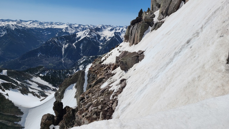
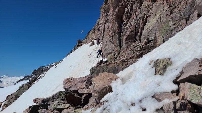
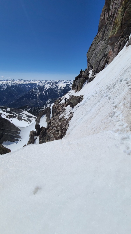
Upon reaching the saddle we had a view both down the couloir and across the ledge we'd need to traverse to reach easy enough ground to summit. The ledge, which is a simple and exposed walk when dry, was covered in high angle snow. Nothing like some fun to add to your fun!
Ohh, dat's real nice.Looking across the ledge traverse. We'd try to stay high and away from the edge but the edge ended up actually being safer.
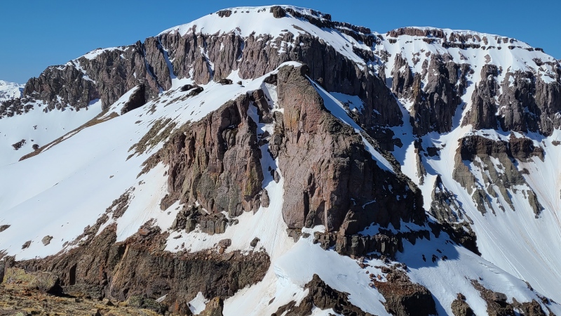
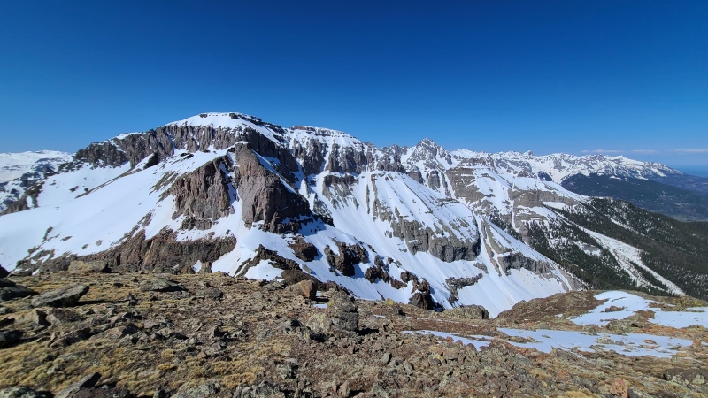
From the saddle we made the quick jaunt up "Son of Corbett" (typically ascended and re-ascended on the standard route) to get a wider angle on the remaining route and nearby peaks.
"Corbett" dwarfed by Whitehouse. It doesn't even look ranked from this vantage. The direct couloir was basically vertical and not an option. We went left before wrapping up and back to the summit, which is the same when dry.Mount Sneffels in all its glory.Wide shot from Whitehouse and "Corbett" through the northwest corner of the range.
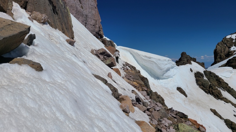
We returned to the saddle, dropped our packs, and tunneled through an enormous, overhanging cornice that threatened the eastern side of the saddle, opposite the way we came up, before carefully climbing down to the ledge.
The cornice taken from the ledge. You can see our relatively tiny tunnel directly above Heather. The snow looks vertical from there but wasn't too bad. (Taken on descent.)
The snow on the ledge, being east facing, had been baking in the sun all morning. Heather led across, first going up and over the broken corner of the ledge, then back down to the edge of the snow, which was incredibly soft. She'd been postholing up to waist deep and we figured the drier edge, regardless of the exposure mere feet away, would be safer than trying to brute force a trench through mush with sloping trash we couldn't see underneath. Being that close to the edge demanded attention, since a fall over the side would probably be fatal, so we didn't take any photos on our first crossing. Once past the initial overhead cliffs we got back on the snow and made the quick, wet snow climb to the summit.
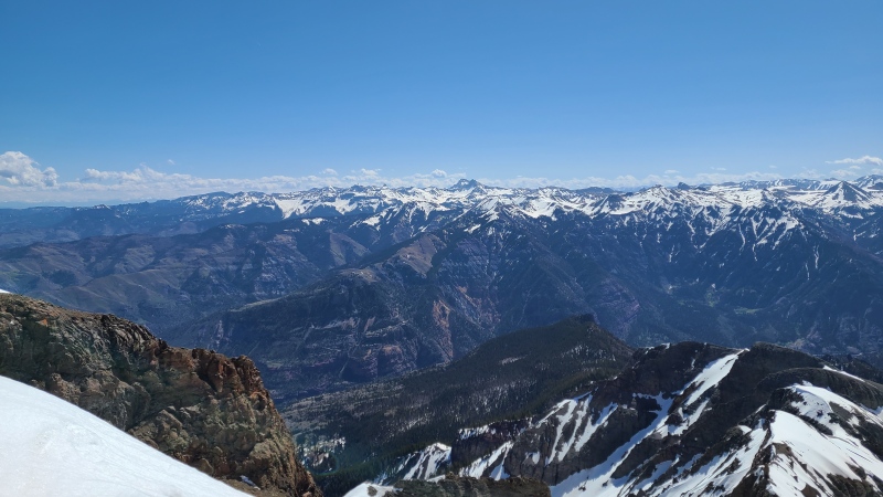
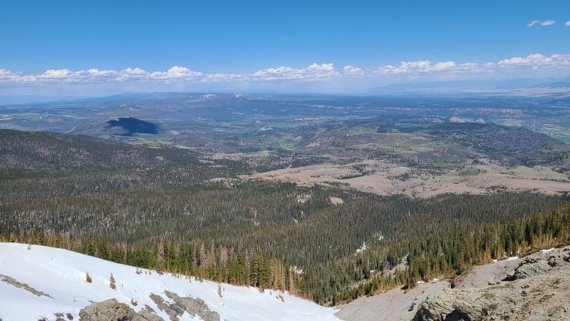
Whitehouse and Sneffels from the summit."Angel Knob" (12,583'), my last ranked Sneffels Range peak. We considered it early on but it was too late in the day by now.Cimarron with Uncompahgre and Wetterhorn in center.
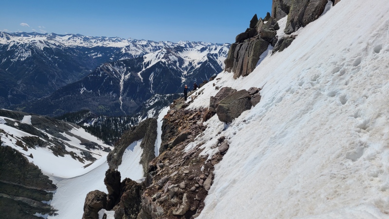
Being that it was about 10:30 when we summitted, we didn't want to linger getting back across the ledge since we were worried about the snow becoming even junkier. We quickly down climbed the steep snow back to the ledge, which we once again picked carefully across.
Vera and Patrick coming down off the summit. Taken from the ledge.Returning across the ledge, with abandoned higher start shown.Close shot showing the width of our path.Don't fall off!"Pose where you're not going to die!" "Son of Corbett" in the background.
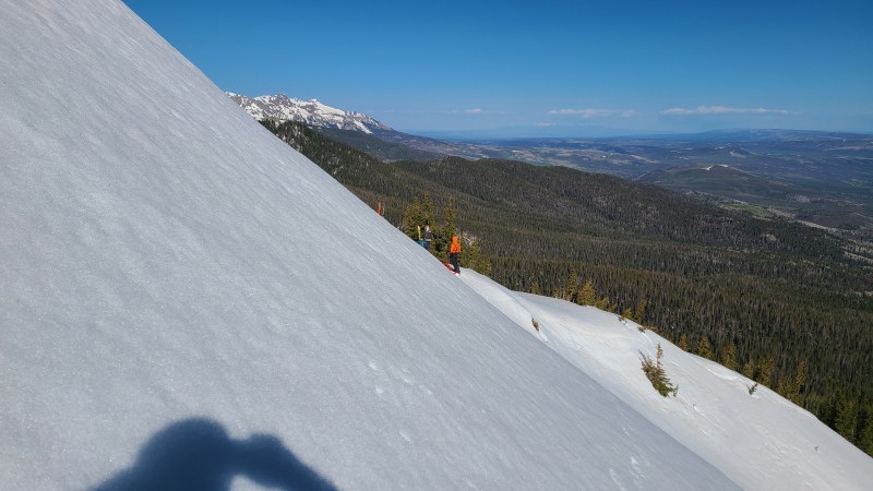
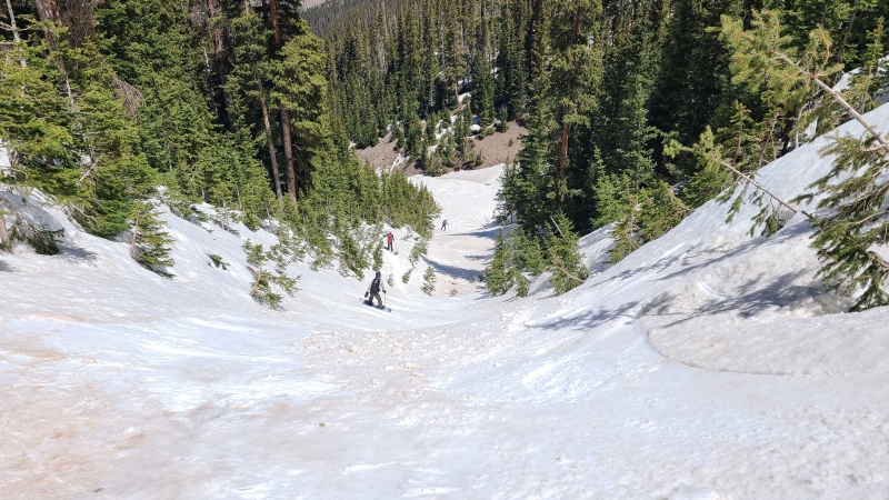
By the time we'd returned to the saddle an hour had elapsed since we'd first arrived. Kidney Stone couloir was now in full sun and probably getting corned up, so I began down while the Skrio got their skis and splitboard ready. The snow was indeed almost ready, and I raced down trying to get away from the rockfall and the ski route.
Looking down a now sunny couloir from the saddle.Softening up nicely.View northwest. The peaks left of center with a small amount of remaining snow are 10ers Flattop Mountain and Horsefly Peak.
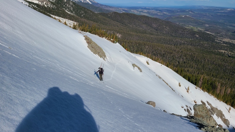
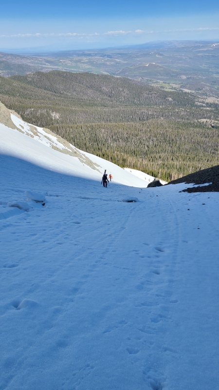
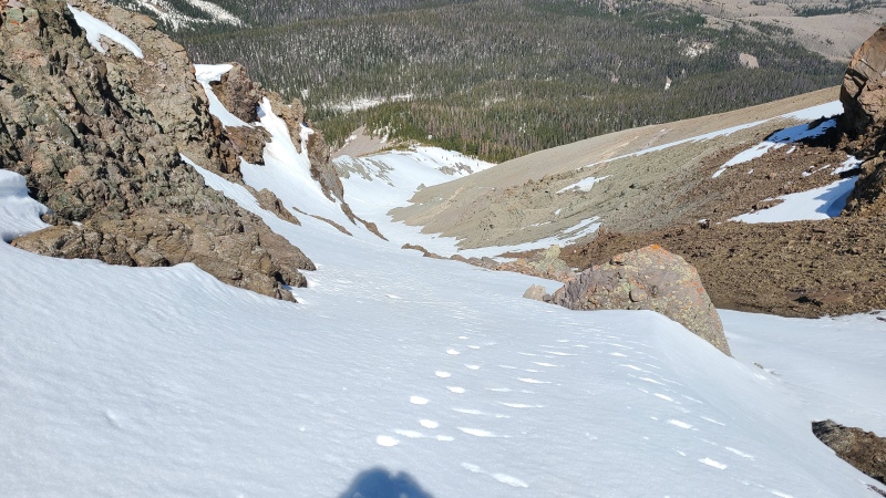
I went down past the dogleg before the skiers began down. I assumed they were waiting for the snow to soften a little more, so I continued down further, hoping to meet them down lower and not waste time catching up to them.
Nearing where we departed the ridge in the morning.Looking back up a majority of the couloir, kidney stones strewn haphazardly about.
I caught some footage of them skiing down, then booked ahead. I wanted to check out what looked like it could be a cliff, and stop them early in case we had to climb back up a bit to escape back to the ridge.
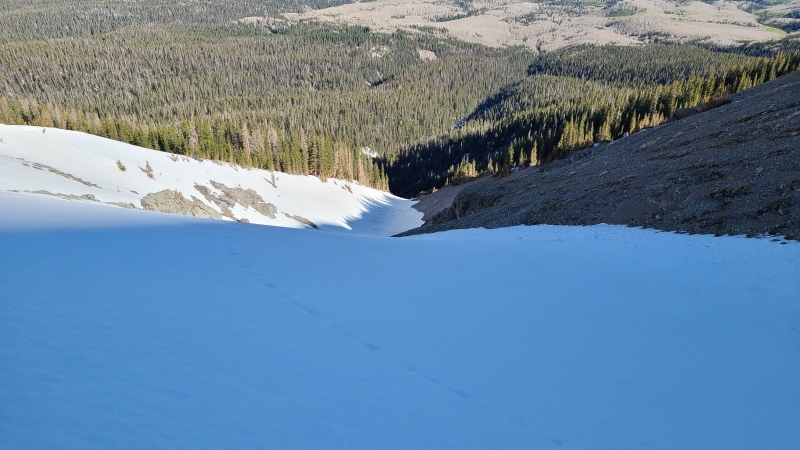
Is that a cliff?
It turns out that yup, there was a cliff in the middle of the couloir. It was below treeline so we hadn't seen it on our ascent. I descended down to the top of it at about 11,375 feet before ascending back another 150 or so feet in an effort to catch them. They took off their ski gear and we all climbed back partway up the ridge, traversed the flank past the cliff, and returned to the couloir below, where they put their ski gear back on and sped ahead. I'd catch up to them later down where the Coal Creek drainage we were in became too steep and inset to continue further.
Back in the couloir below the cliff.Small cliff we avoided. You could get one pitch of ice out of this.
I arrived just in time for the Skrio to finish packing, then we made our way back to our ascent path and quickly returned to the cars, bushwhacking happily all the way. We packed up and chatted excitedly about the route, which had worked surprisingly well for only seeing it from a distance and just going for it. Vera had to get going but Heather, Patrick and I hung out for a bit before going back home. It feels good to be able to say that. If "Corbett" is on your list then consider trying to pass the Kidney Stone couloir. It's a fun, scenic way to meet "Corbett" and make a new friend.
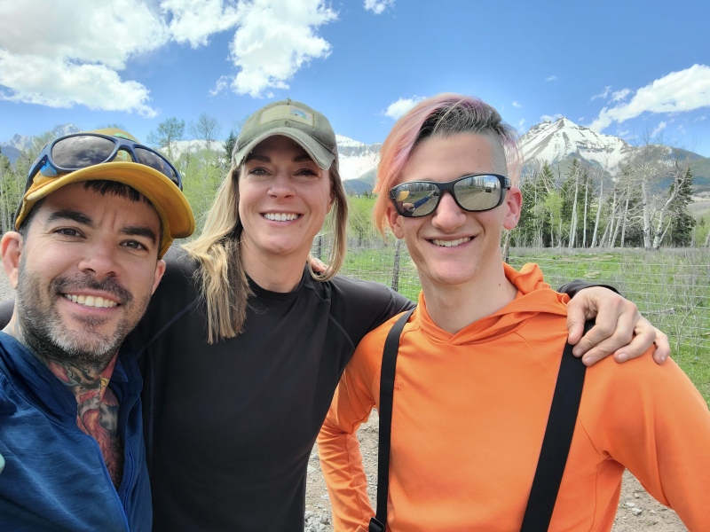
"Corbett Ridge", Whitehouse Mountain, and Mount Ridgway from the drive out.Pretty dang nice couloir (right of center), if I do say so myself.Me, Heather and Patrick with "Corbett" watching over.
Statistics
Climbers: Ben Feinstein (myself), Heather R., Vera U., Patrick M. Trailhead: Wilson Creek Trailhead
Total distance: 7.92 miles miles Total elevation gain: 4,397 feet Total time: 9:00:56 Peaks: One ranked thirteener, one unranked thirteener
"Son of Corbett", 13,084' (LiDAR)
"Corbett Ridge", 13,107' (LiDAR)
Splits:
Starting Location
Ending Location
Via Time (h:mm:ss)
Cumulative Time (h:mm:ss)
Rest Time (m:ss)
Wilson Creek Trailhead
"Son of Corbett"
5:01:25
5:01:25
0:00
"Son of Corbett"
"Corbett Ridge"
0:28:28
5:29:52
0:00
"Corbett Ridge"
Wilson Creek Trailhead
3:31:03
9:00:56
Trip End
My GPS Tracks on Google Maps (made from a .GPX file upload):
Breezed over the absolute post-holing joy we had on the way out, but at least we could see the class 3 trees after the post holes.
Also I think I said "it's pissing rocks down" and you made the "passing the kidney stone" joke and we just stuck with it. I remember it fondly a long with the rest of this great day with a great crew!
I thought we agreed this was unrepeatable and unrecommendable? Time heals all wounds I suppose.
This was no joke one of the most fun (and productive!) long weekends I've ever had in the mountains. Thanks a ton for playing host and getting us up some silly shit. Fantastic memories with fantastic people, let's be sure to do it again, with you on skis this time!!!
I don't remember the misery of this one, probably because I was on snowshoes. :lol:
I don't think I'd call it unrepeatable, though probably not worth repeating. Says the guy who didn't have skis on his back for the schwack, and is probably the only person dumb enough to do this peak three times. Mostly I wanted to write about an alternative route for "Corbett".
Nice report, and route! Love the name. Sounds like it has all the magical elements of an unknown Sneffels range northside adventure--namely the unholy trifecta of blowdown, shite snow, and rockfall. Only area I've ever bailed (twice!) due to bushwhack futility levels.
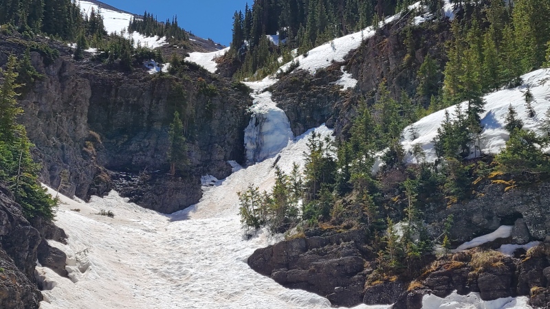
That small chunk of ice is actually the top of a series of 7ish pitches we wandered over to after climbing the (very lame) thing at the bottom of the north face. All pretty rotten then (mid May) but it's high on our list when avy settles down. Would be cool to finish up the couloir after climbing the ice, but conditions are probably rare to enjoy both activities together in this elevation band.
Thanks for the additional beta, Michael. Interesting that there's even more ice below what we saw. It must have either been buried or melted when we were there. If conditions ever come together for an ice+couloir combo climb hit me up - I'd be down for actually doing the full length of this route, that'd make an otherwise pretty unremarkable couloir on a pretty unremarkable peak a lot cooler! Not many thirteeners here where you could get a legit ice climb in as part of the route.
As for the northside trifecta I'll have another trip report out soon that's for a nice Sneffels Range north side twofer (two peaks, two couloirs) but without all the typical frustrations. I'll post the link in a comment here when I publish it.
Should have checked your track. Looks like avalanche deposit covers most of the drops in a high snow year. The cliff in your photo is actually 100 feet tall lol. In our May recon the 50-foot cliff above that--where you headed back up--was mostly a snow ramp. There is a decent 40 foot pillar below where you traversed out of the drainage. So.. 2 smallish pitches in late season unless it's a dry one. Still I've walked farther for less haha.
As I mentioned in a previous comment here's my trip report for a couple of other Sneffels Range peaks, Wolcott Mountain and "S 6", with a northern approach that doesn't suck: https://www.14ers.com/php14ers/tripreport.php?trip=22483
Caution: The information contained in this report may not be accurate and should not be the only resource used in preparation for your climb. Failure to have the necessary experience, physical conditioning, supplies or equipment can result in injury or death. 14ers.com and the author(s) of this report provide no warranties, either express or implied, that the information provided is accurate or reliable. By using the information provided, you agree to indemnify and hold harmless 14ers.com and the report author(s) with respect to any claims and demands against them, including any attorney fees and expenses. Please read the 14ers.com Safety and Disclaimer pages for more information.
Please respect private property: 14ers.com supports the rights of private landowners to determine how and by whom their land will be used. In Colorado, it is your responsibility to determine if land is private and to obtain the appropriate permission before entering the property.


")
")
")
")
")
")
")
")
")
")
")
")
")
")
")
")
")
")
")
")
")
")
")
")
")
")
")
")
")
")
")
")
")
")
")
")
")
")
")
")
")
")
")
")
")
")
")
")