| Report Type | Full |
| Peak(s) |
Mt. Shavano - 14,230 feet Tabeguache Peak - 14,158 feet Unnamed 13712 - 13,712 feet |
| Date Posted | 01/22/2024 |
| Date Climbed | 01/20/2024 |
| Author | daway8 |
| Additional Members | yaktoleft13, kyrawhitworth, headsizeburrito, weakenedwarrior, Chipmunk, RyanOlsonDDS |
| Shavano Winter East Ridge Direct |
|---|
|
This long planned winter summit of Shavano (and Tab plus UN13,712 for some of the team) almost got cancelled when we went suddenly from a very mild winter to a huge dump of snow that shot the avalanche danger through the roof on all aspects at all elevations. But a webcam tipped us off to the fact that the CAIC forecast might have been casting too wide of a net with its regional generalizations. Then followed many days of intensive study, observation, discussion, and eventually a last minute recon trip to decide if we could safely proceed despite a very non-ideal avalanche forecast. Spoiler alert: no one died and we only ended up on one slope that had even a possibility of sliding given the surprisingly dry current situation - but please be aware that conditions change day by day and even hour by hour so at other times there could be much higher avalanche danger on this route! Don't just blindly follow what we did and assume you're golden. One primary goal of this report is to share my own personal avy analysis of this route to give others a head start on what sort of things to watch out for - but as always please do your own research to confirm as I can't guarantee I haven't missed some things and, again, conditions change constantly. Trailhead: Angel of Shavano Trailhead Route: Standard Shavano East Slopes until just below treeline then East Ridge Direct Peaks: Shavano (all), Tabeguache (all but me), UN13,712 (Eric and Max) Mileage: Shavano only - add 4mi RT to start from Angel of Shavano TH, but subtract milage for shortcuts: total = 11 miles. Tab is 0.76mi from Shav and UN13,712 (ranked 13er) is 0.89mi from Shav (or 0.79mi from Tab) Pronunciation: So how do you say the names of these peaks anyways? No one really knows, that's why everyone just says Shav and Tab. Lol, just kidding. Shavano is pronounced Sha-va-no. Tabeguache is pronounced Taba-watch. Included in this report will be:
As is typical for my TR's, look for large bolded section headers if you want to quickly jump to a specific section for extra beta with less of the story... 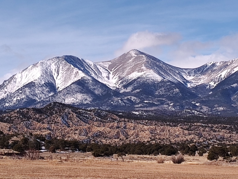
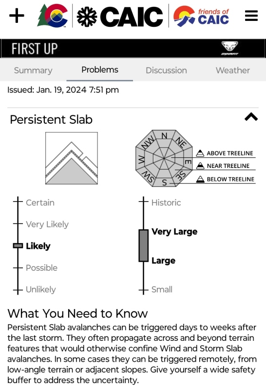
Background So I've been slowly racking up 14er snowflakes (and 13ers as well) which means I'm running low on low hanging fruit. Prior to this trip I was at 22 14er snowflakes, still having all of the oh-so-far-away San Juans to do plus all of the Elks and most of the Sangres plus a handful of Sawatch peaks left to flake. That means there aren't a whole lot of ones left for me which aren't either way far away and/or at a whole nother level of difficulty than what I've done thus far. Shav/Tab were two that weren't terribly far away and - under the right conditions - not too terribly hard. Still, you never know exactly what to expect when trenching through trees so I decided to let the word out that I was looking to snag Shav/Tab this winter and see if I could round up some more people to help with the tiring task of trenching. The Team In the early stages of planning we had quite a large number of folks on the potential list to come - friends who saw Shav/Tab on my goals posts or when I mentioned it elsewhere on the forum and/or people I or my friends reached out to. I asked everyone about their availability and - although realizing the low odds that a date picked weeks in advance would hold in winter - I went ahead and asked everyone to hold Jan 20, 2024 on their calendars as the date when the largest number of people were available. But as details settled, then storms came and the chaos of the avy forecast threw plans into disarray until the last minute we finally ended up with a trimmed down team of 7 members: Yaktoleft13 (Eric) - I half-jokingly told the rest of the team that I was paying super close attention to Eric's availability because I knew if we lost Eric we'd loose 75% of our team's trenching ability - this guy is like a monster truck in the snow - on previous trips I've seen him plow uphill through waist deep snow and broke trail the entire way because I was struggling just to keep up! If Eric ever invites you to join him on a winter hike say yes! Awesome trencher and overall great guy as well! Weakenedwarrior (Max) - The above 75% stat was given before I saw Max in action on this trip. This guy needs to drop "weak" from the name and just stick with warrior - there's nothing weak about him! From what I saw I believe he was the only one close enough to being on level with Eric that he actually traded out being in the lead (typically when I hike with Eric and offer to lead he's usually like "um, no thanks, I'll be fine...") Headsizeburrito (Burrito) - While he prefers to minimize personal info/pictures posted on the internet (can't blame him these days...) my nickname for him by the end of this trip was MyFavoriteBurrito due to the way he stuck by my side and kept me motivated as I was dragging my near lifeless body to the summit of Shavano (more on that over-dramatized recounting later...) Chipmunk (Tiffany) - Don't let the little sounding screen name fool you - this gal may be small in stature but she can really kick ass in the mountains. Commonly seen doing crazy split-boarding with Bill (climbingcue), Tiff was solo this time since Bill had already flaked this pair of 14ers. Kyrawhitworth & RyanOlsonDDS (Kyra and Ryan) - This dynamic duo wins the contest for the most creative usernames of our group, lol. Ryan's massive frame could perhaps allow him to compete with Eric but I don't think I ever got to see the two go head to head since he tended to hang back with Kyra (although at one point before everyone finally put on snowshoes I heard Kyra say: "I don't like walking behind you - you sink too deep!"). This couple made a solid addition to a very strong team. Daway8 (David) - yep, that's me. The only one of the group to not reach Tab; the only one to have a near-death experience (ok, dramatizing a wee bit but I gotta cover myself somehow...). But I take solace in the fact that I was the one who assembled a team that out-did me and I played an important role in enabling my entire team to crush their goals by doing the advance recon that allowed us to decide to go ahead and make use of this perfect weather window despite the highly concerning avalanche forecast. I took the safety of my team extremely seriously and put in a huge effort to ensure we stayed as safe as possible. Super stoked that everyone else nabbed everything they were after and all got back safe! From the Perfect Winter to the Perfect Storm (disturbing changes in the avy forecast) As mentioned earlier, this winter started off very mild - mild enough to allow me to grab a snowflake on Longs via the standard Keyhole route on the last Friday of December this past year. A silly but determined optimism had me hoping this would remain for our scheduled Jan 20 climb of Shav/Tab but I also figured we had enough people on our potential crew to plow through whatever snow was dumped. I knew the odds of it staying as dry as it was were pretty low, but when winter decided to dump this year - boy did it ever dump! The CAIC map had actually just recently been green across the entire state - ultra rare for this time of winter. Then, about a week before our planned hike it changed and looked like this: 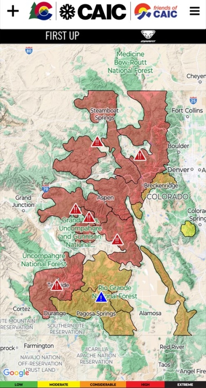
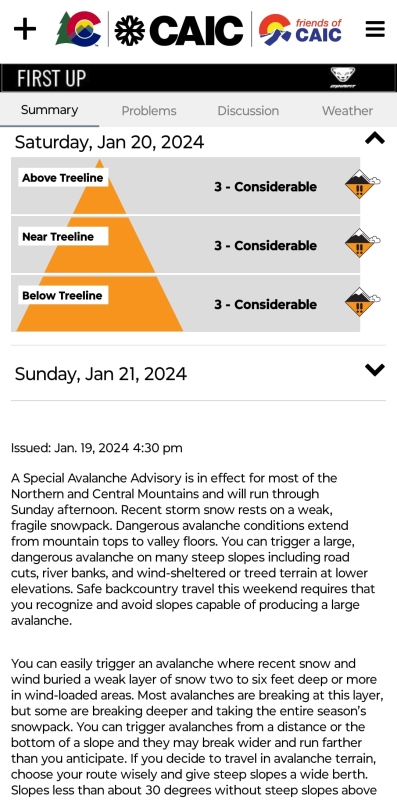
Almost all red and with double exclamation marks to indicate an avalanche warning! Oh-no - our trip is doomed! There's no way this will settle in time for the weekend! The CAIC forecasters were straying from their typical analytical style and getting a bit poetical in style trying to emphasize the dangers (...a chorus pealing...) 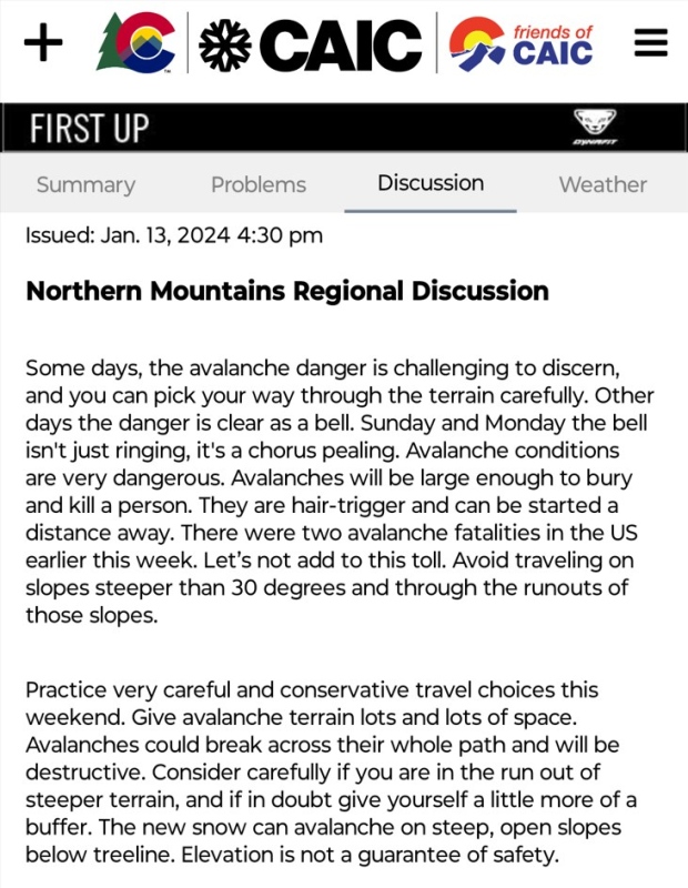
When you see the red triangles with double exclamation marks show up on the CAIC map that is a VERY bad thing. 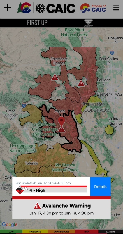
However, having a few slightly snarky members in the team, the initial bravado from some on seeing this report was illustrated by this famous LOTR meme: 
However, all of us knew the likelihood of things settling down by the weekend were very low and hope of being able to safely climb these peaks on the intended weekend was almost zilch. Curious as to what the peak would look like under such conditions, I remembered an old bookmark for some 14er webcams and suddenly hope was reborn! (At the very useful site linked above click on the Sawatch range along the left side then scroll all the way down to TandA Cad Cam to see a good view of Shavano) 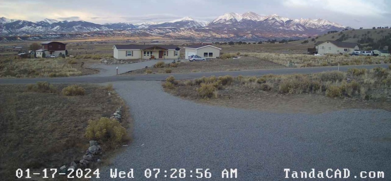
Despite all the dire warnings from CAIC, for this particular peak it looked pretty darn dry above treeline! Granted the problems extended below treeline as well so we still had to figure that piece out but at least now we had hope that the upper elevations might be safe and so maybe, just maybe, we might possibly not be out of business quite just yet... 
Then began a renewed, more intense study of the route to try to determine exactly where the problem spots were, how likely they were to be loaded and whether or not we might be able to safely divert around anything dangerous (jump down to the Avy Analysis header if you want to skip to the detailed analysis). 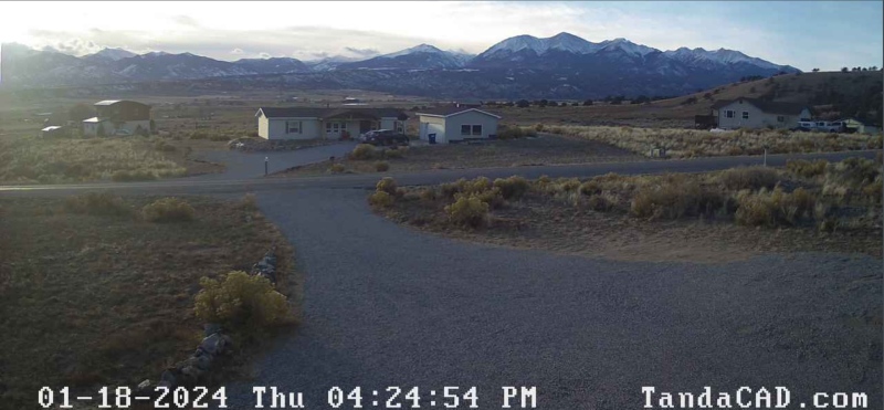
I was very surprised - as dire as the CAIC forecast was I was expecting to see nothing but solid white from the trailhead to the summit. Knowing that CAIC only provides broad regional data and that Shav/Tab is sort of towards the edge of one of the regions, my hope continued to grow, but my skepticism remained. At the last minute the CAIC forecast started to at least move in the right direction which was encouraging but a danger level of "Considerable" accompanied by a "Special Avalanche Advisory" is not something I would normally mess around with. However, that shockingly dry webcam view intrigued me and the weather window for the planned weekend was one of those golden jewels typically seen maybe once or twice a winter. I certainly could not endanger anyone by going out under overly risky conditions but, my goodness, if the weather really is that perfect and that mountain really is as dry as the pixelated webcam makes it look this might just be one of the best winter windows ever seen for these peaks so I couldn't give up on them just yet... 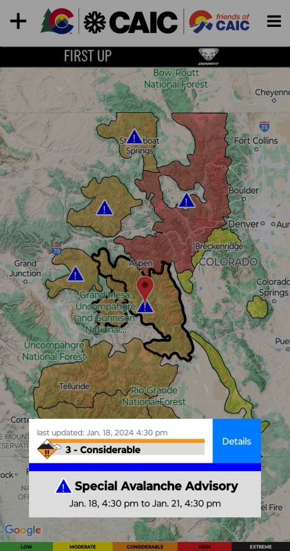
So here we were having on the one hand an avy forecast from trusted professionals screaming "don't go, stay home!" and yet this tantalizing webcam view suggested a distinct possibility that Shav/Tab just might not fit the pattern of the broader region and with a team already available and a weather window that was absolutely perfect I didn't want to abandon the plan without confirming the conditions. Besides, since I've starting to toy with the idea of possibly one day trying to become a Frozen Finisher, I knew it would become essential to be able to dig into the details of avy conditions at a finer level of detail than the CAIC regional forecast since conditions can vary tremendously from peak to peak and even from one aspect to another on a peak. CAIC is an essential starting point and the information these professionals provide is absolutely to be paid very close attention to, yet the regional nature of the data means it's necessary to be able to use the data they provide and then dig deeper and evaluate the exact specifics of the particular mountain and route you're going after. So I decided, as much for practice as for any real hope that it would indeed pan out, that I would make every effort to dig into the details and try to ascertain if we might really be seeing a safe exception within a broader region of elevated danger. Avy Analysis This is intended to be a detailed but not necessarily exhaustive look at avalanche dangers on this route. The idea is to give people a kick-start for their own research and make sure a few key observations are not overlooked. Please be aware: this route has the potential to have extremely dangerous avalanche conditions in multiple locations!!! Don't flippantly stroll out there in winter without first educating yourself about the possible dangers and using the many available tools to help you discern what the current level of danger is. Don't blindly follow what we did and assume what worked for us on this day will work for you on another day! What follows are the personal observations of an experienced amateur - I'm an engineer by trade so I'll try to be thorough but I can overlook things so don't rely exclusively on my analysis. Take an AAIRE class or two or at least check Google or YouTube for some basic avalanche safety videos. I offer this analysis as a public service to help increase the awareness of others and point people to potentially highly useful resources but please heed the warning that people die every year in avalanches so do your own research since your life may depend on it! Ok, hopefully that's enough warning to keep the lawyers off my back - now let's get on with it... 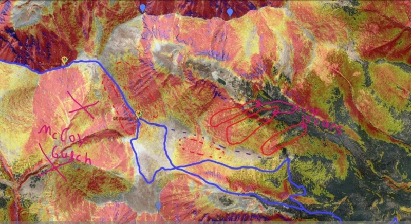
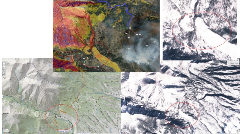
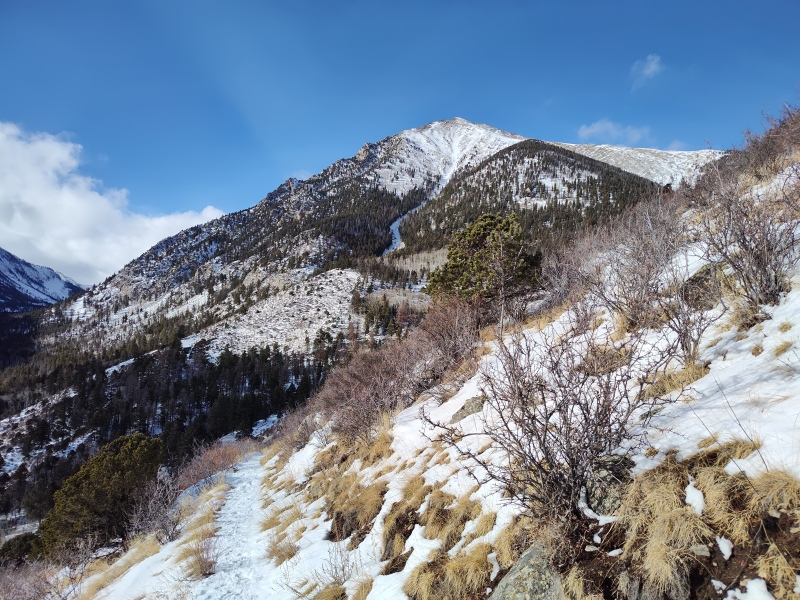
So how many ways can you die on these mountains? Well let's count... On second thought, no, let's just point out a few key considerations that are highlighted in the photo above. McCoy Gulch: Don't know where McCoy Gulch is? Neither does anybody else except for all the Search And Rescue (SAR) teams who have recovered people and/or bodies over the years as people again and again get sucked into thinking this is a good shortcut back down - or sometimes just get disoriented. Make sure - regardless of what time of year it is - that you know where McCoy Gulch is and know how to avoid it. People get cliffed-out here all the time - don't be the next person SAR has to come for! Visible avalanche scars: Turn on the satellite view and you'll see several of the characteristic "scars" cut into the forest below steep gullies - this is a classic sign that one or more avalanches have ripped out trees from the forest below the slopes. There are several highly obvious scars just north of the Ridge Direct option (on your right when going up the ridge). If this ridge is loaded then there IS significant avalanche potential just off to your side. But on the date of our trip this ridge was blown bare and of no concern at all once you get a little above treeline. That may not always be the case - if you see from the highway or the webcams (more on that later) that this slope is loaded then you probably shouldn't attempt this route. As you would expect given the dire avy warnings, we had some robust discussion among the group about the route. Below is a sample from astranko who ended up not joining us: 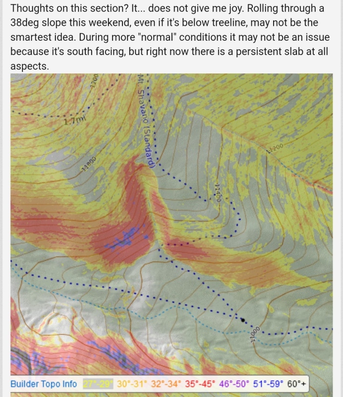
I knew that if we could make this work at all there would likely be some re-routing needed. To get a better idea of where the worst problem spots were I opened up Google Earth and went to the historical satellite images. Sure enough, if you look between 2011 and 2013 you see a section a trees down below the Angel simply vanish. That's a classic sign that an area went for many years with no major avalanche activity and then had a big one come blasting down and ripping out the trees. The slide appears to have come up to and possibly slightly over the standard summer trail. Well crap - that certainly doesn't sit well with the current forecast - but there was hope of a re-route... 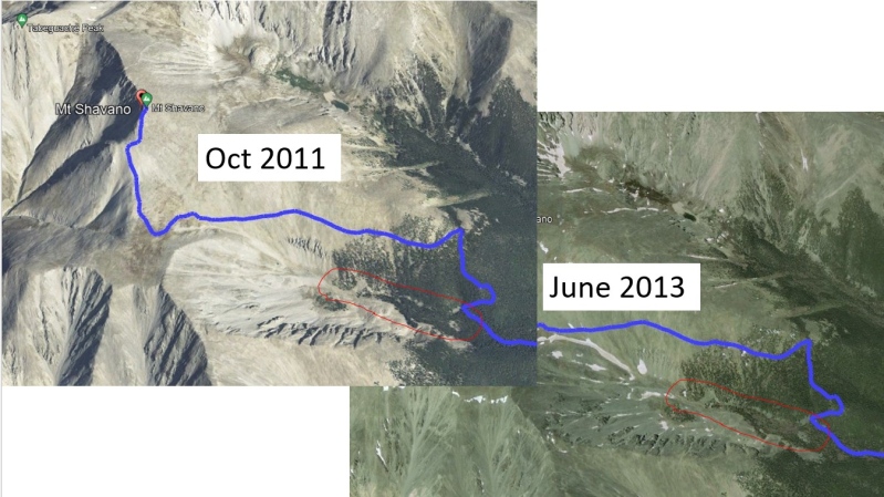
Anthony continued to shoot holes in my now quivering dreams of utilizing this amazing weather window under seemingly dry conditions... At the time the trip was originally planned it was such a mild winter that I had every reason to believe we might get most if not all the way to the standard summer trailhead (more details on that below in the section titled: "The Recon Trip and the Trailheads"). But when the huge storm cycle rolled in not long before the trip I decided it was better to divert to the Angel of Shavano trailhead which sees snowplows go up the road. But Anthony pointed out a yellow and orange shaded slope between the trailheads and how there was absolutely no way to re-route around it. Granted it's low altitude and south facing, so normally not a problem, but we were not dealing with a normal avy forecast - CAIC specifically warned about all aspects and all elevations and went on at length about normally safe areas not being safe now. My faint hopes were almost dead at this point. This just wasn't going to work. It was a great weather window and I had a great team standing by but it just wasn't worth the risk. It looked like we were going to have to switch to something in the Sangres, which had a much safer CAIC forecast - but I knew we'd probably not get all our team matched for one objective there. 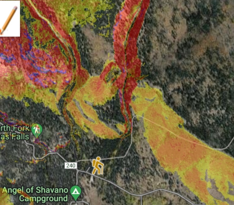
At this point another extremely valuable resource was called to mind: the weekly high-res satellite photos posted online which give an idea of snow coverage across the state. If you have a CalTopo subscription you can access these images as a layer in that software (look for Sentinel Weekly at the very bottom of the layers under "Live Satellites (pro)" If you don't have that and don't have any cash to spare you can get these satellite images for free at: On the left side make sure Sentinel-2 L2A has a check next to it and then, a little above that, click the green "Show latest date" button. In the top right is the "Go to Place" box where you can navigate to where you want to go. So I pulled up the satellite images for the region and found they were updated right after the most recent dump of snow! 
Suddenly hope was reborn! I'm seeing some non-white pixels there baby!!! 
Given how dry the webcam showed the upper slopes to be and given how the satellite view hinted that there might possibly be dry ground on the slop of concern between the trailheads, I once again asked myself if we were looking at a rare exception where these peaks on the edge of a CAIC forecast region were perhaps not currently in as dangerous of conditions as some other nearby areas (Monarch, for example, had gotten absolutely dumped on). I then went to OpenSnow (subscription) and looked up the recent and seasonal snowpack data. This too painted a hopeful picture - nearby Monarch was reporting 40" over the last 5 days with a 57" base depth while Shavano was only reporting 7" over the last 5 days with a 20" base depth! This correlated well with the webcam and satellite data, as fuzzy as those were! 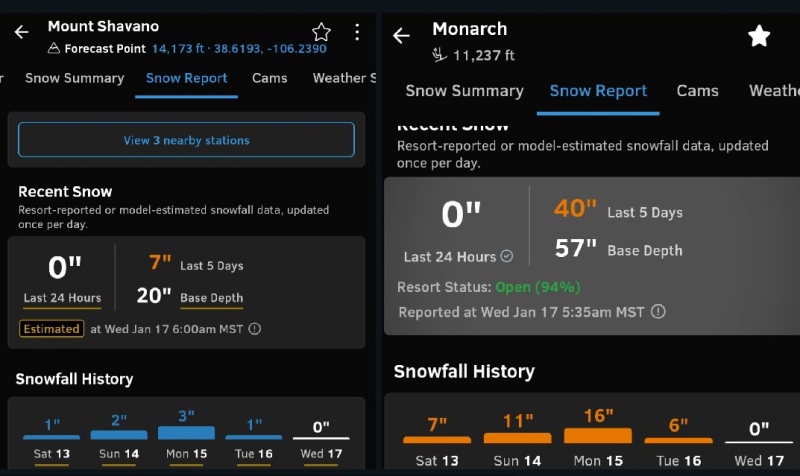
Based on all these details I eventually decided that, at least on paper, it looked like we had viable re-route options around all the potential zones of concern that might have enough snow on them at the moment to be a concern. But still, as the one organizing this group, if any of my analysis was wrong or inadequate and someone got hurt because of me giving the green light when I should have diverted the team elsewhere, then I'm not sure I could ever get over being the one to lead a team into disaster. The CAIC warnings were just so clear and so dire - yet the limited data I could get online (webcams, satellite, snowfall records) all painted a much more mellow picture and everything except the avy forecast seemed so ideal in so many ways. That's why I decided I didn't want to pass up a golden opportunity for a great time and yet also wasn't willing to put my team at needless risk by blowing off stern warnings. So the only thing left to do was to go take a closer look for myself... The Recon Trip and the Trailheads We were running out of time and I needed something more concrete than a few blurry webcam and pixelated satellite images before I could lead people out on a trip that could risk our lives if I was wrong. So I take a last minute vacation day on Friday and drove down to the trailhead to check things out with my own eyes. 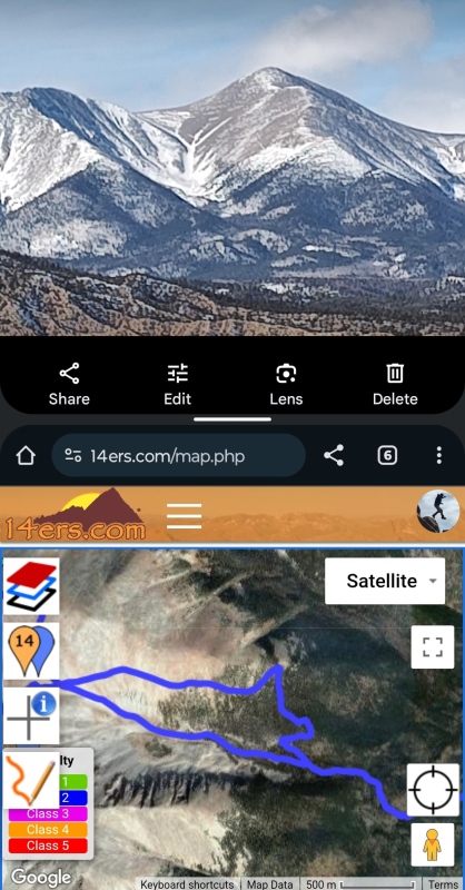
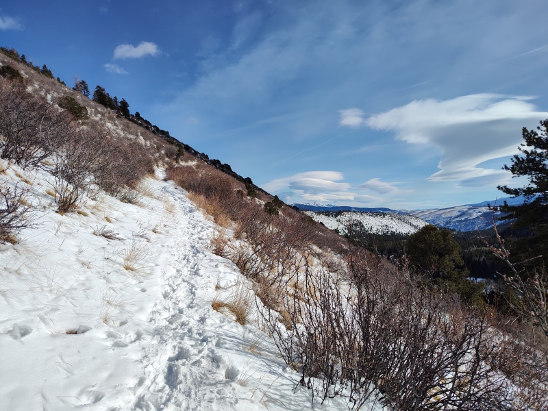
Pulling off the highway I confirmed in greater detail what the webcams had already shown - get a little above treeline and we're golden! 
So the standard summer trailhead comes up from the SE via FR252 but has a Y intersection with 250A - either road will get you to the trailhead if its passable, but they only plow the first 1/2 mile or so to the cattle guard. Depending on conditions you might add as much as 13mi round trip on top of the 11.5mi+ depending on what you're going after. Sometimes people report getting at least to the Y of 252/250A which means only an extra 6mi round trip added. 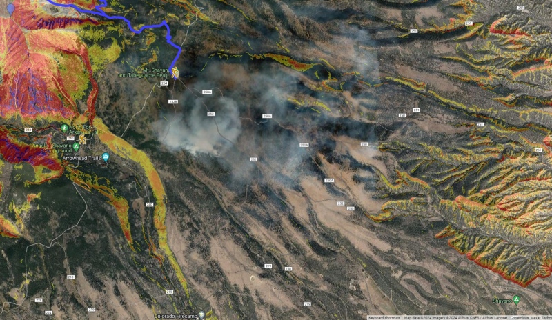
Alternately, CR240 to Angel of Shavano is plowed to just past the trailhead, though unfortunately not typically including the trailhead itself. We were able to park in the snow plow turnaround area with 5 vehicles because it was abundantly clear the snowplow wouldn't need to come back until the next storm. We were careful not to block the road for snowmobiles that go further. 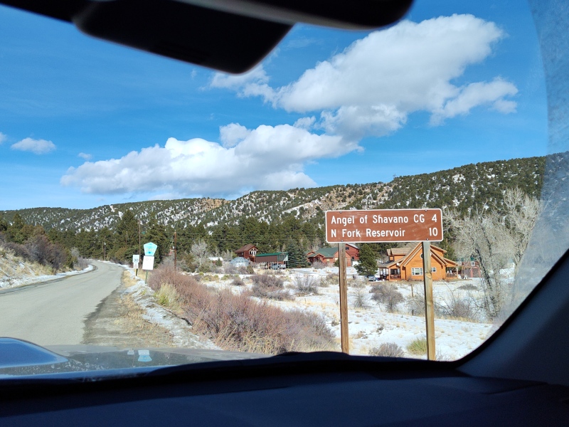
If the snowplow turnaround isn't an option then make sure you have 4WD for the trailhead area which is an unplowed loop. 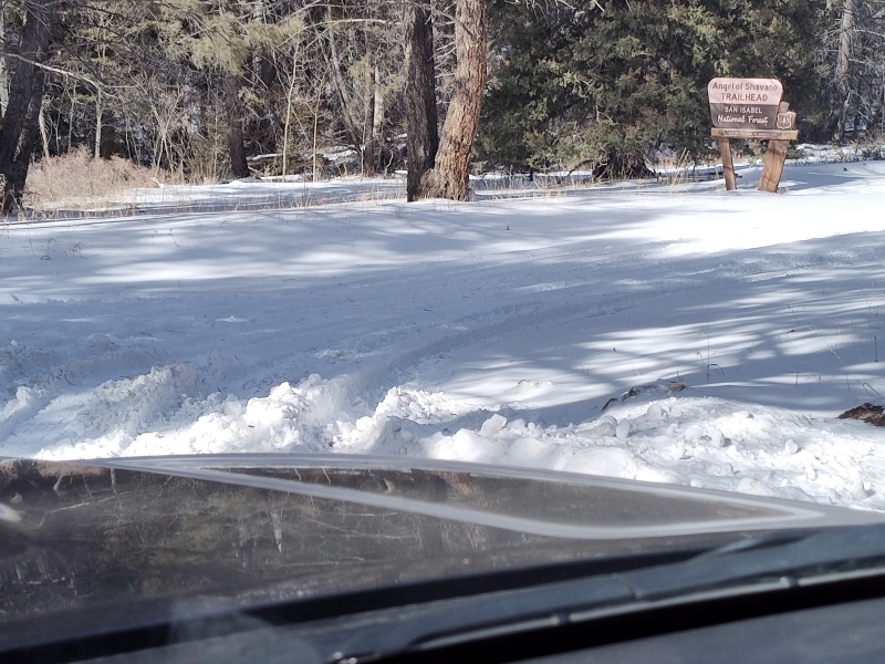
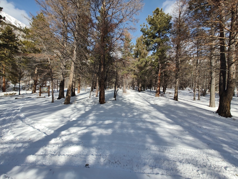
Trail Tidbits - More Recon Beta A few random pictures and notes on the start of the trail... 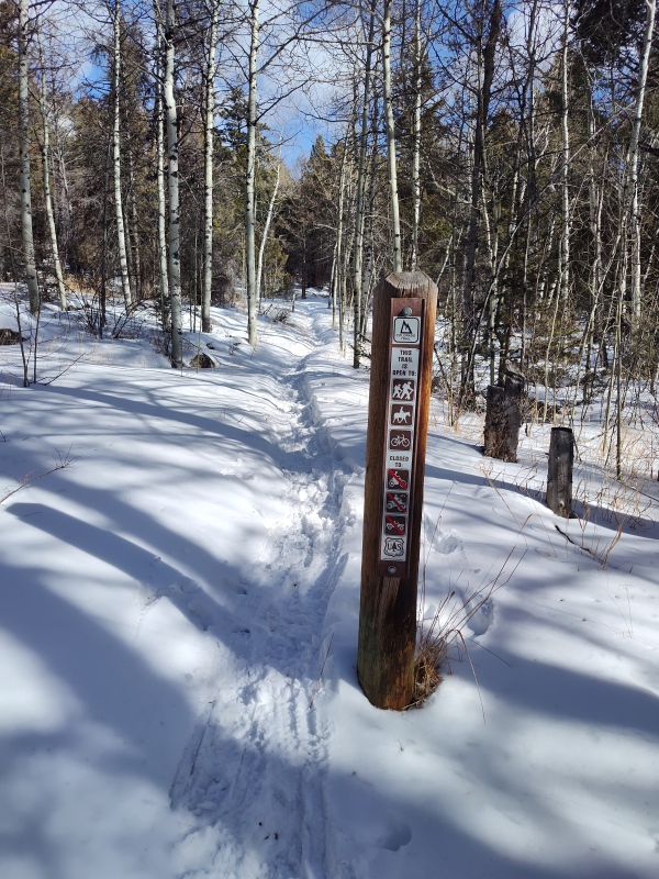
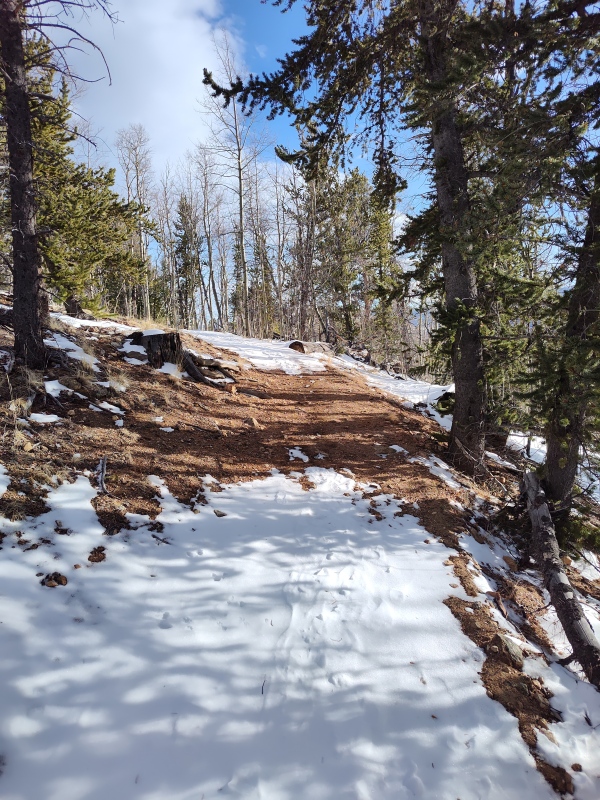
So the shaded hill to be crossed between trailheads was indeed a total non-issue. It has lots of scrub brush on it which probably helps anchor things even when loaded but it's south facing and mostly exposed to the sun so it was pretty bare on this occasion. 
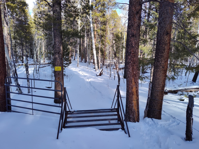
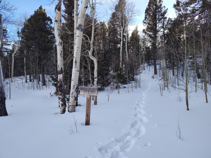
By the time I made it to the summer trailhead I had seen enough dry slopes in the distance that I now felt comfortable about our odds of summitting without getting buried in an avalanche despite the dire avy forecast which was no doubt accurate for some nearby peaks but not as much for this particular location. I actually had signal at the summer trailhead and so was able to send out a message to them team giving the green light for everyone to come and seeking confirmation of who was in. I also called and booked a room in Salida so I could sleep warmly down at 7,152ft before the day of the big climb. Game Day So finally the big day came. Seven of us slowly arrived at the Angel of Shavano Trailhead after a chaotic flurry of Friday afternoon messages to finalize the specifics (talk about last minute!) I was delighted that so many people were still on board to go despite how long the uncertainty persisted. We had started floating possibilities of Mt Marcy or such in the Sangres - which wouldn't have been too far a drive from there, but didn't need that backup plan. We ended up with a probably overly late start time of 6:11am - in retrospect should have probably hit the trail sooner but I wanted to have good light beyond the summer trailhead to inspect the remainder of the trail and didn't want to be too sleep deprived... I gave a short little talk to the team at the trailhead - reminding everyone not to get lured down McCoy Gulch, to stay away from the Angel since it's loaded, asking that we stick more or less together until we clear the snow above treeline (then split as desired for differing objectives) and reminding everyone to set their own pace and not push themselves to keep up with others. 
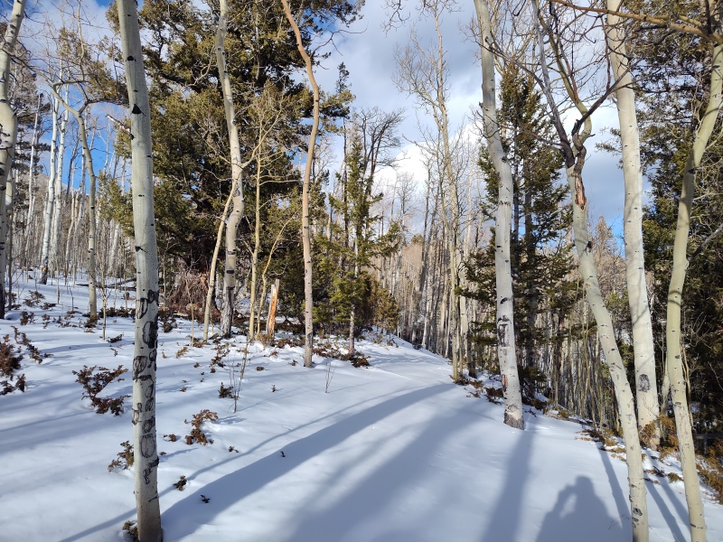
I led us to the summer trailhead then Eric and Max took over from there. I showed them my proposed turn-off on the map but, since everything was so last minute, I hadn't had the chance to distribute a gpx track of the proposed route. So it turned out that we shot past my proposed shortcut that would have allowed us to avoid the steepest section right around the real sharp switchback on the main summer trail. But when we got to the base of this region it turned out to be pretty lightly loaded with bare ground even sticking through in places. 
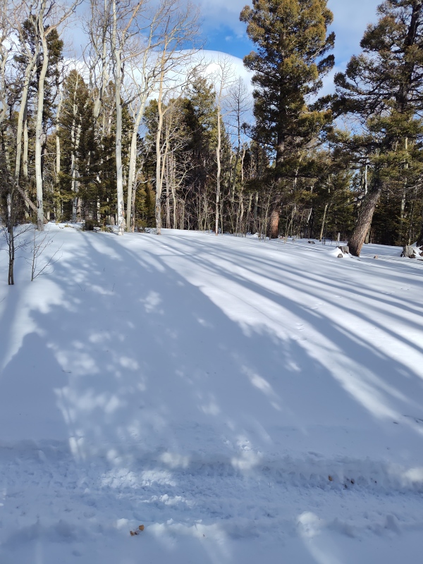
The part which was deepest - although I failed to take the level of notes I usually do to mark such things - I believe it wasn't until we were above the highest angle portion and turned left to start up the wide face to the ridge. This area is mostly just yellow shaded, so less of an angle and less risk but I did get uneasy seeing how much snow was on this section. But the concerning section was getting blasted by full sun and was rather wet and dense. By this time I was already lagging behind so I missed whatever initial analysis was done by the leaders but from near the back of the pack I chatted with Tiff and we poked around and didn't see evidence of slabs or cracks or other such signs (that of course doesn't guarantee safety but reduces the level of alarm). Under normal situations I would perhaps not be too worried about this slope - there were none of the typical signs of common avalanches - plenty of mature trees up to treeline, etc. But with the dramatic CAIC forecast I'll admit I did start to get a little nervous in that section. It turned out fine for us but this is one example of why I say do your own research and make your own call based on conditions that day. We didn't have trouble - that may or may not be the case for the next group... 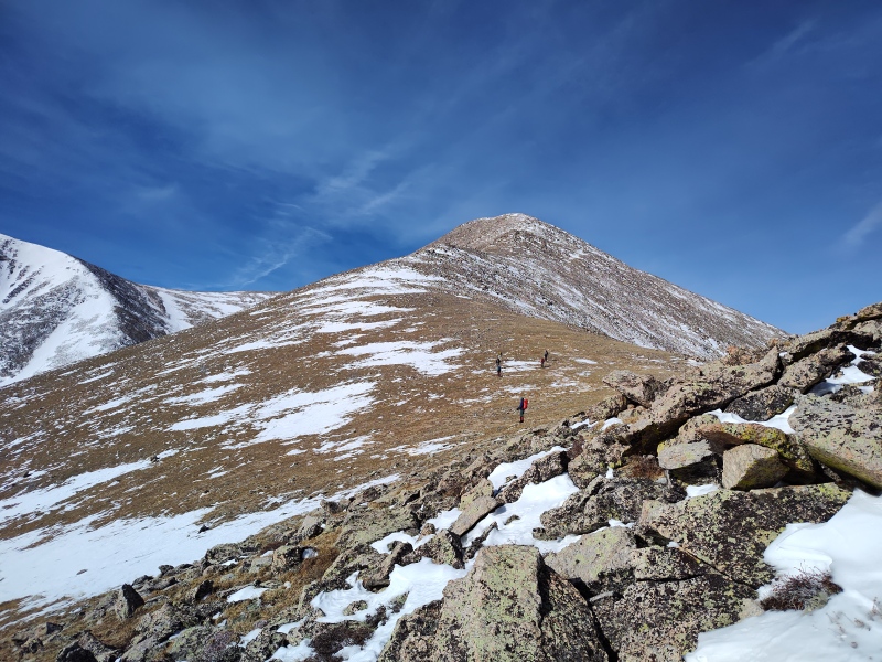
We stashed our snowshoes a little above treeline since it was painfully obvious we wouldn't need them again until the return (definitely no avy concerns up here this day!) 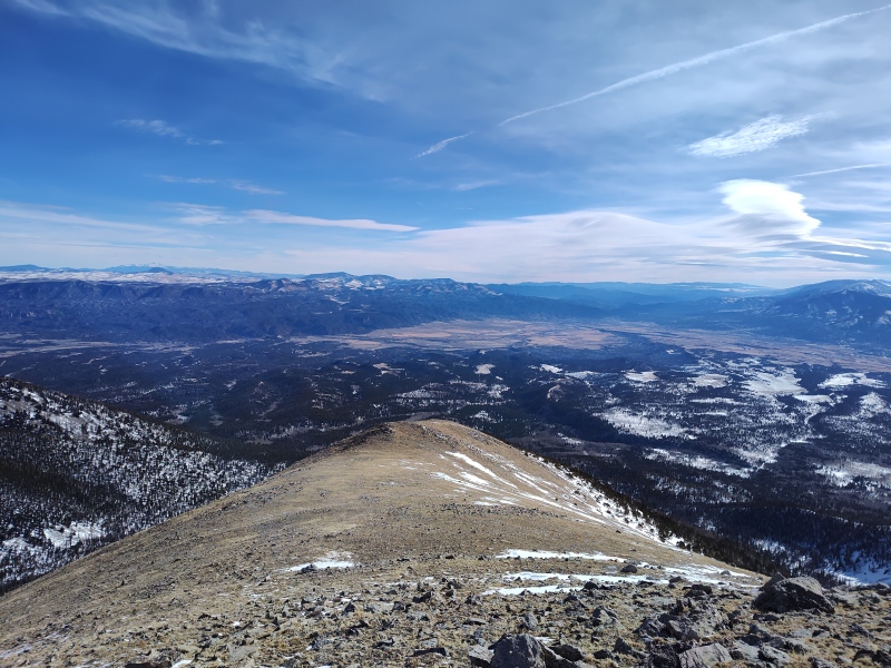
In case you're wondering - yes, there are false summits - a bunch of them! 
The team slowly spread out above treeline and I fell to the back of the pack. Headsizeburrito stuck with me and provided invaluable moral support to help me finish the trek up Shavano (stay tuned for more on that in the next section...). But eventually we made it to the summit of Shavano (after the others had already moved on to their next goals). 

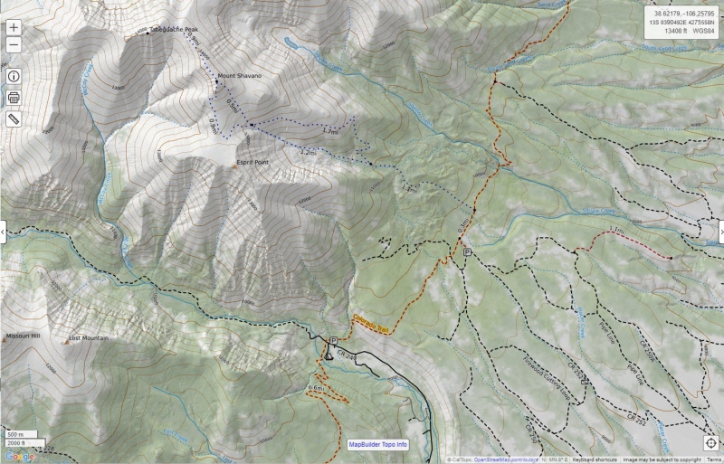
So one final tidbit: here's a sketch of the route I originally intended for us to take (dashed purple line) and the far more aggressive line in blue that we actually took as compared to the summer trail in pink and the Angel of Shavano (better as a spring climb) in yellow. 
Snow/dehydration/altitude sickness and why don't Alaskans melt snow... So this is the part of the story that no one else knows. I related some of this to a few of the team members later but not the full story. Here - in all its lack of glory - is the unedited recounting of yet another way I've found to get my picture to show up under search results for "You could learn a lot from a dummy." Call me an "expert-in-training" at the School of Hard Knocks. If I live long enough, one day I'm going to be really, really smart; just as soon as I finish learning from all the dumb things I do. In the meantime, might as well allow others to learn from my mistakes. And since I have a flare for the dramatic I'm just going to let it roll - might as well have a little fun with my stupidity - grab some popcorn if you're sticking around for this one... So what exactly it was that had me so wiped out that day I'm not 100% certain. I can point to several contributing factors:
And so now we return to our story - let's flashback to approaching the summit of Shavano... You'll recall that - as agreed to at the trailhead - we all stayed pretty much together until we were above treeline and past any possible danger of avalanches. Then everyone was free to hit whatever pace they felt like to climb whichever peaks they wanted (and when you look at the few little timestamps I did actually record you'll see some of our team was really hauling ass!!!). But MyFavoriteBurrito stuck with me and kept me distracted from my growing agony. A little ways below the summit I noticed my water was going unusually fast and getting really low (queue foreboding music...) But I wasn't overly concerned yet - I had still barely touched my winter secret weapon - a thermos of hot apple cider!!! And having recently seen some folks talk about melting snow on hikes I decided, what the heck, let's give it a whirl! Oh boy, the things that seem logical when too little oxygen is getting to your brain... I had my water in a couple GSI Micro-lite thermos type bottles. One was empty, the other pretty close to empty. Recalling that you want some water to help melt the snow (that's like the only part I recalled) I put some of my little remaining water into the empty bottle, added a handful of clean snow and then shook it up really good and stuffed it away to melt. Um, yeah. To let it melt. In a thermos. A bottle designed to keep whatever is inside it at whatever temperature it is. Yep. Hmmm, this seems to be taking a while. Oh well, I'll just stuff some snow in my mouth. The first blast of cold powder in my mouth was actually pretty refreshing - being dehydrated and overheated. I didn't immediately notice any problem. Well, hey, this is pretty nice - I don't need no stinking water bottle - I've got a whole freakin mountain to drink! We interrupt this story for a word from sunnysports: Outdoor Myths: Eating Snow and Dehydration Key excerpts below in quotes: "Eating snow is not the same as consuming water because snow is a solid that must melt before it becomes a fluid. Cells and organs in the body need water to be in a liquid state, so the body must work to heat and melt the snow once it is eaten. Because the organs must work harder to heat the ice and melt it, you will become further dehydrated rather than hydrated. You will continue to lose more water than you are taking in, even though you are hydrating the body by eating snow. If snow is your only option to rehydrate your body, the snow should be melted before it is consumed to prevent further dehydration and to avoid hypothermia." And here's the one you attentive readers that have made it this far after noticing the tag in the summary points at the start have all been waiting for - from wxresearch here's: Why Don’t Alaskans Melt Snow for Water? (Top Reasons!) A few key summary points for those already weary of reading this extra long trip report: "It typically requires about ten units of snow to generate a single unit of water, on average... Snow melting is a highly energy-consuming procedure that, when combined with its limited water content and impurities, results in an ineffective and potentially detrimental choice." Boy, wish I'd read those articles before the hike instead of after! Or that my brain had been functioning logically enough to reach those conclusions on my own. So upon reaching the summit headsizeburrito and I chatted for a bit. I assured him I'd be fine once I rested (not yet knowing what was to come...). I didn't want to deplete his water sources by asking for any and, besides, I was so distracted by the relief of reaching the summit that I forgot about the water issue. He explained his plans to go tag Tab and then come back. I said that sounded great and told him that I would bundle up and wait for him or, if I got too cold I might go ahead down on my own and, if they didn't overtake me, I would wait for everyone in my 4Runner to make sure everyone got down safe. So with my blessing headsizeburrito went off to tag Tab while I pulled out an extra layer and my long coveted hot apple cider - oh that was sooooo good! And still nice and hot!! That is often a great refresher that recharges me for the descent. But this time I slammed the entire thing super fast - before I even had much to eat. I'm starving by now so I start munching a Pro-bar and get thirsty. I grab the water bottle and notice there's only a tiny bit in there. I grab the backup bottle. It's the one I was trying to melt snow in. Nope, that doesn't work well in a thermos. So since it wasn't working I knew I couldn't add more snow to my melting experiment because clearly that wouldn't help. I know, I'll add some snow to the bottle that still has a little water in it! That way I'll get them both to melt together [pause to sink my forehead onto my hand while typing this...] In the meantime I'll much a little more snow... Some of you may have tried something similar without issue. But keep in mind I'm sitting down. On the summit. At 14,230ft. In a light breeze. Exhausted. Not moving. Realizing melting snow in a thermos isn't working, I take the lids off of both bottles and carefully shove them up under all my layers - reasoning that with the top off, my body heat will get in and - tadaa! portable human microwave! Not so much. Still thirsty. Extract one of the bottles - put the lid on and shook it vigorously one more time in hopes of melting a little more. Opened up and slurped the little nearly frozen liquid water that was mixed among the snow. Somewhere around this time I finally notice I'm getting a bit chilly. I carefully stash the bottles and pull out my heavy duty puffy and curl up behind a rock. This will have me warmed up in no time! Except it didn't. No worries, I've got backup layers! The Eskimo Hat I bust out the emergency Eskimo hat. I came into possession of this hat years ago when volunteering at a homeless shelter handing out gear in the middle of a cold winter to folks stuck out on the streets. We gave away hats and gloves and handwarmers, etc. But no one - not even the homeless people - would take that hat. At the end of the shift I asked the staff if I could take this hat that no one wanted and they were happy to part with it. I've only ever worn it once on a actual hike. I got lots of looks and lots of comments. I also got third degree burns on my head because the thing was so dang hot! How warm is this hat? Well if you're backcountry camping and forget your stove, just put this hat on and in 10 minutes you'll be able to fry bacon and eggs on top of it. This is the ultimate hat. The survive a night in a blizzard hat. The 'provide enough warmth to radiate out to an entire village' hat. So I pull back my hoods. I already have a very warm fleece cap on. I put the Eskimo hat over top of it. I pull the Gore-Tex hood of my first jacket over that. I pull the Gore-Tex hood of my backup layer over that. I pull the hood of my puffy on over that. I wrap my scarf around my face and curl up behind a large rock stuffing my water bottles under this mess. In mere minutes I'll surely have not only melted the snow but be ready to fix the team hot tea when they get back to Shavano! Though I'll be so toasty that I'll probably be taking a nap! Except... that doesn't happen. I should be baking my brains out now. But I'm barely warm. I give it a little longer. My brain is getting foggy, I'm utterly exhausted and my body isn't getting warm. I'm not shivering yet but I feel rather cool when I should be fiery hot in all that. Slowly a rational thought pushes through the fog in my brain: I'm on my way to hypothermia and most likely suffering from some form of altitude sickness. There's only one option left - no telling when the others will get back - I've got to get down as far as I can, as quick as I can to counter the altitude sickness and get to a warmer location. I manage to get myself up and and drag myself down to about 13,800ft. Between the movement, getting out of the breeze and getting a little lower I start to feel a tiny bit better and took off the Eskimo hat then the puffy. I sent a quick text to the team members I had a cell number handy for so they would have some chance of knowing I had indeed gone down. A while later I get a thumbs up text from Eric confirming he got the message. At this point I'm all in to get down to the trailhead as fast as possible. I felt bad being the "leader" of the group and leaving everyone behind but was reminded later that everyone on the group was very experienced and it would have done no one any good for me to not get moving. As I got lower my head gradually cleared up and I finally started warming up. Despite being thirsty I waited until I was very warm before risking drinking anymore of the semi-melted snow. Gradually I was able to remove some more layers and now and then chugged a little of my slushy - being careful to only do so while moving so as to not let my body temp drop again. It was a long trek but gradually turned more or less into any other 'tired at the end of the day' trek. I made it back to the trailhead, having climbed only one mountain. A little over 20 minutes later Eric and Max (who climbed 3 mountains) arrived along with Tiffany. Another 30 minutes and the final 3 arrive. The Conclusion So all in all, despite the drama, I'm calling this day a great success. Everyone got back safe. Everyone except me climbed every mountain they intended to. But I added a 14er flake to my list and I successfully confirmed for the team that the conditions were in fact viable for a safe climb despite the grave danger in surrounding areas - thus allowing everyone to take advantage of a perfect weather day with wonderful conditions and they all crushed their goals! Plus I learned a few more lessons for myself and to pass along to others. For lack of my normal notetaking, I have only a few notes on our times: A Few Timestamps Normally I keep a much more detailed log of my time to reach various features but I did fairly minimal note keeping on this hike and so only have a few tidbits to record: 6:11am groups starts together from Angel of Shavano Trailhead 7:19am group reaches summer trailhead 1:08pm I finally drag myself up to the summit - everyone else (as previously agreed/encouraged) had already proceeded on to their next goals, except Headsizeburrito who I then encouraged to go catch up with the others. 2:18pm I'm now crashed solo back down at 13,833ft 6:01pm I finally make it to the trailhead ~6:24pm Eric, Max and Tiff make it back to the trailhead 6:53pm The final 3 headlamps emerge from the trees - everyone is now back safe and sound - tired yet victorious! Useful Links For Winter Research Most of these are already sprinkled through the report but I'll collect them here and add a few for those who want quick access. CAIC avy forecast - never leave home in winter without checking it (even though it's regional nature means finer research may be needed) 14er webcams - some are more useful than others but when hours away these can give an important sneak peak. Copernicus Browser - free access to weekly high-res satellite photos to get a rough idea of snow coverage. CalTopo - The subscription version gives access the the satellite images with better overlays onto detailed maps/trails. Google Earth - An awesome feature of this is the ability to grab a slider and scroll through historical satellite photos. This sometimes allows you to pick out scars in the trees from avy paths that only run during big snow years and then get filled in during the years in between OpenSnow - they offer a fantastic app which among others features tracks the amount of snow both for the season and over the last week with daily totals plus the overall base depth and the forecast for what's coming. Subscription required for full functionality but I find it worthwhile. GAIA - My personal preference for GPS app on the phone. With subscription you get lots of great layers/overlays including slope angle, obscure trails, etc. Thumbnails for uploaded photos (click to open slideshow): ")
")
")
")
")
")
")
")
")
")
")
")
")
")
")
")
")
")
")
")
")
")
")
")
")
")
")
")
")
")
")
")
")
")
")
")
")
")
")
")
")
")
")
")
")
|
| Comments or Questions | ||||||
|---|---|---|---|---|---|---|
|
Caution: The information contained in this report may not be accurate and should not be the only resource used in preparation for your climb. Failure to have the necessary experience, physical conditioning, supplies or equipment can result in injury or death. 14ers.com and the author(s) of this report provide no warranties, either express or implied, that the information provided is accurate or reliable. By using the information provided, you agree to indemnify and hold harmless 14ers.com and the report author(s) with respect to any claims and demands against them, including any attorney fees and expenses. Please read the 14ers.com Safety and Disclaimer pages for more information.
Please respect private property: 14ers.com supports the rights of private landowners to determine how and by whom their land will be used. In Colorado, it is your responsibility to determine if land is private and to obtain the appropriate permission before entering the property.


