| Report Type | Full |
| Peak(s) |
Capitol Peak - 14,138 feet |
| Date Posted | 12/20/2023 |
| Modified | 11/27/2024 |
| Date Climbed | 08/14/2023 |
| Author | hellmanm |
| Storming the Capitol |
|---|
|
I had a lot of thoughts going into my 56th 14er, and one about which I'd heard so much. Since I began my 14er journey in 2014, my opinion on this foreboding peak has developed in a few different ways. It began during my initial research, when, as I made plans for Bierstadt/Evans, I discovered a strange peak on 14ers.com. It reminded me of the Washington Capitals (despite the spelling difference), and I could tell that it was tricky but that was about it. Fast forward to 2017, when I moved to CO permanently. By now, I had a good idea of where Capitol stood in the ranks of 14er challenges. Capitol was all over the news, as this was the year when 5 climbers died. As I rehabilitated from a broken leg, I thought about this and wondered if pursuing the 14ers was even wise. At the time, and for a long time thereafter, it was a question for another day. Fast forward now, to 2022. Having now known several friends who climbed it, and having listened to their various stories, my opinion remained mixed. One reported that he had a new favorite 14er. One hired a guide and was glad that she had. One was ditched by a prick of a hiking partner as soon as they were off the dangerous bits, and had been berated by said douchebag for most of the trip. So, when it came time to realistically consider plans for Capitol, I wasn't sure what to think. By this point, I had climbed an alt route on Snowmass, Jagged (with a guide), and had done North Maroon and Pyramid. I felt somewhat ready, but I wasn't sure if that was truly enough prep. Oh, wait... but then my knee started acting up. Capitol remained on ice for another year. Enter 2023. I was finally healthy, and I had been making good progress on my remaining 14ers. After coming down from Little Bear, Capitol was the last major obstacle to face en route to finishing the 14ers (with only Uncompaghre and Longs remaining after that). I had a strong partner with whom I've climbed half a dozen 14ers, and we had both done our homework. So, on the 13th of August, I set off for Aspen. If I ever get prohibitively wealthy, I'm buying a house in Aspen. It's so nice, but it hasn't lost its local flair. I arrived close to noon and ate an overpriced (but solid) lunch, while I waited for my notoriously late (sorry, Kevin!) hiking partner. We met at the Brush Creek lot outside of town (#free!), and set off for the trailhead while Kevin used a frisbee to prepare his 420 devices amidst the bumping of my blue Subaru. The road to the trailhead wasn't horrible as far as 14er roads go, but I'm a timid driver, so we took our time getting to our destination. 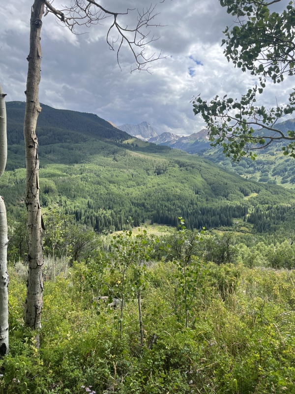
We set off on the mostly flat ditch trail around 3:30, with full packs and a leisurely pace. We still felt every step, as an overnight pack still wears on you a bit even during the most relaxing of times. A few miles in, as we marveled at the still-blooming wildflowers on the trail, we came across a hiker eating a plant of the side of the trail. I saw what looked to be off-color raspberries, which this stranger called Thimbleberries. Kevin dove right in, sampling the local cuisine. I was apprehensive, as I didn't know the stranger and wondered if he knew what he was talking about. I took a timid nibble or two while waiting to see if I'd have to save Kevin from deadly Thimbleberry poisoning. 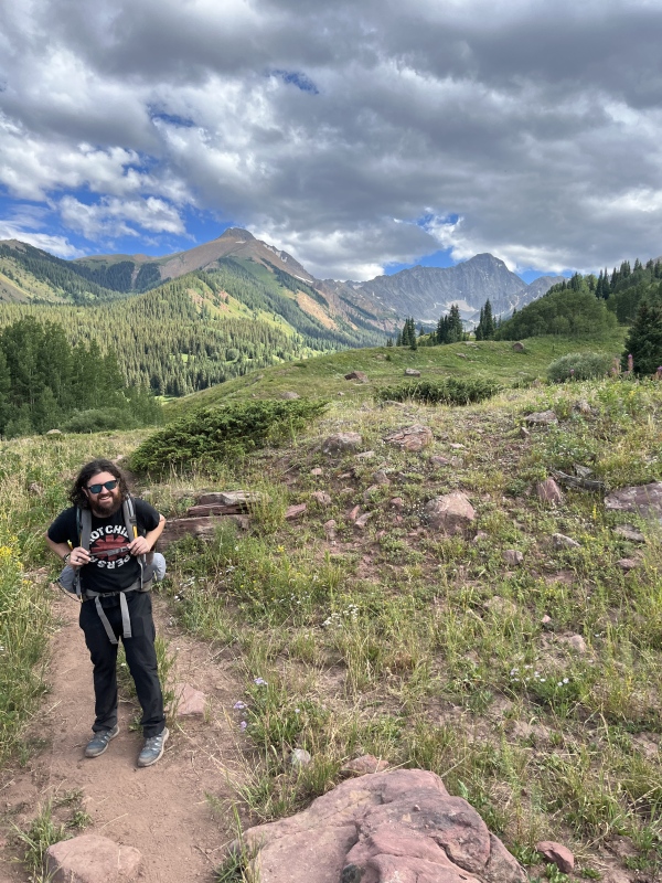
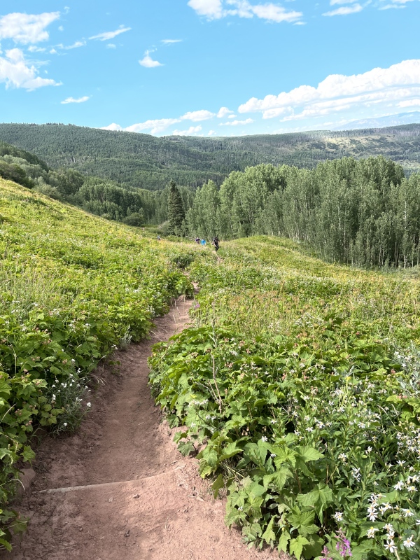
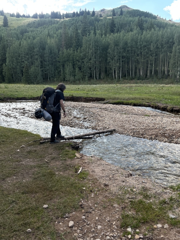
We eventually arrived at Capitol Creek, which we knew meant that the uphill travel which to this point we'd mostly avoided, was about to start. Some thin logs provided passage, but I turned at the sound of a splash to find that Kevin had stumbled into the creek! I immediately worried about an injury, as we had our packs on and any kind of a fall brings a risk of a lower-body injury. Kevin let me know that he was okay, though, and after a brief moment of fear, we pressed on. As we climbed higher, we noticed truly eye-popping wildflowers, reminiscent of the Weminuche and some of the prettiest places in our state. I had spent so long worrying about Capitol's dangers that I had neglected to research how jaw-droppingly gorgeous this area really is.
We arrived at camp tired, but feeling okay. Surprise! I rolled my ankle right as we left the trail to set up camp at our reserved spot. I worried that the trip was about to end right there, as rolling an ankle with a full pack on is never good. Surprisingly, though, it never swelled up, and after about 30 minutes I felt back to normal again. It's the same ankle that I always roll, and while it's clearly weaker, this was just one of a few false alarms over the years. Not ideal, though. We set up our tents, and Kevin set up a time-lapse to view the night sky over Capitol while we slept. We set our alarms for 2-something AM and I tried to fall asleep. So began one of the more frustrating nights of my time in the wilderness. I couldn't sleep. I was a little anxious at first, but was calm around 9:30 and just laid there waiting. I have horrible sleep problems, and they arose at the worst time. By 1AM I was shaking from sleep deprivation, and I wanted to cry at what has been a lifelong struggle that has worsened in recent years. I was scared of what it would mean for the next day, and worried that I'd slip and die if the sleep deprivation affected my coordination. Still, the alarm went off, and I got up ready to try Capitol on zero sleep. From a time perspective, our 2-something start seemed fine. We actually wondered if we had planned too conservatively and would end up walking over/around K2 in the dark. 45 minutes of get-ready time, plus a solid hour of well-paced hiking, brought us to the Daly saddle in darkness. We followed the trail by headlamp, making our way toward an area that I now think is an underrated difficulty on Capitol. As we dropped low and attempted to cross a gully, we faced our first challenge of the day. We had a short snow crossing, and although we had microspikes, we had both left our ice axes behind as the recent condition reports indicated that everything was pretty dry. Here is a picture, taken on the way back. The snow was frozen solid, and the runout was long enough that a slip would really hurt. I didn't like it at all. Still, there were tracks there, and we pondered whether we should take a 20-minute delay to avoid this. We chose the reckless option, and in hindsight, I'm not sure if it was wise. 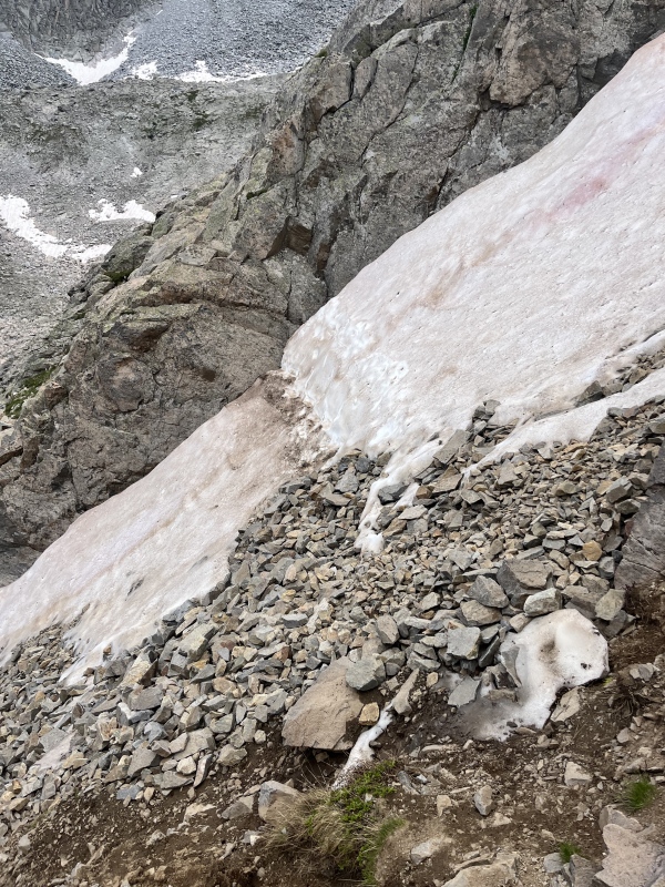
Beyond that, we saw what proved to be an enormous bowl. We knew that we had to regain elevation, but we were both struck by the size of this upper basin. I pushed the pace, now knowing that our early start had been wise. We would be lucky to be anywhere near K2 by sunrise. I cut right too early, heading up lower-angle snow and arriving at dry class 3 rock. Kevin went around, staying in other hikers' tracks through the snow. We met back up closer to the saddle and continued onward. 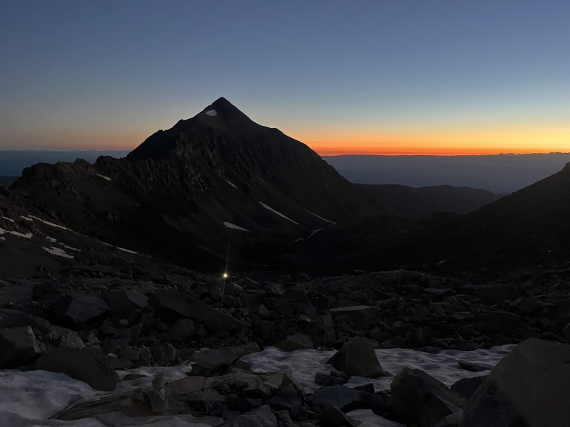
When we reached the saddle, it was almost 7AM. We needed to get going. I left my trekking poles standing upright as we debated what to do with K2. I opted to go around, making the exposed step into a gully, before immediately realizing that I hated this area. I cut up the final part of the gully, re-joining the ridge and avoiding the most exposed moves on the ridge proper. Kevin had gone straight up/over, as he has a better head for airy terrain. We both topped out on K2 and descended some confusing slabs en route to the connecting ridge. This area wasn't trivial. We both did some reasonably acrobatic maneuvers to get off K2, and in some ways, this area is as technically difficult as anything on the route. Okay. Time to confront the beast. Up until this point, this had been what I would call "normal 14er challenges". K2 was tricky, but we were about to be in a no-fall zone for hours. We had made our go/no-go call before K2, and despite our slow tracks to get to K2, we had approx. 4-4.5 hours before the usual afternoon storms would threaten us. Even then, though, I worried about thunderstorms anywhere past the Daly saddle. You're up there for a while on Cap. We talus-hopped over to the start of the knife edge, taking care to avoid the now-massive drop that was developing to our left. We eventually ran out of room on the right, too, and the knife-y terrain began. 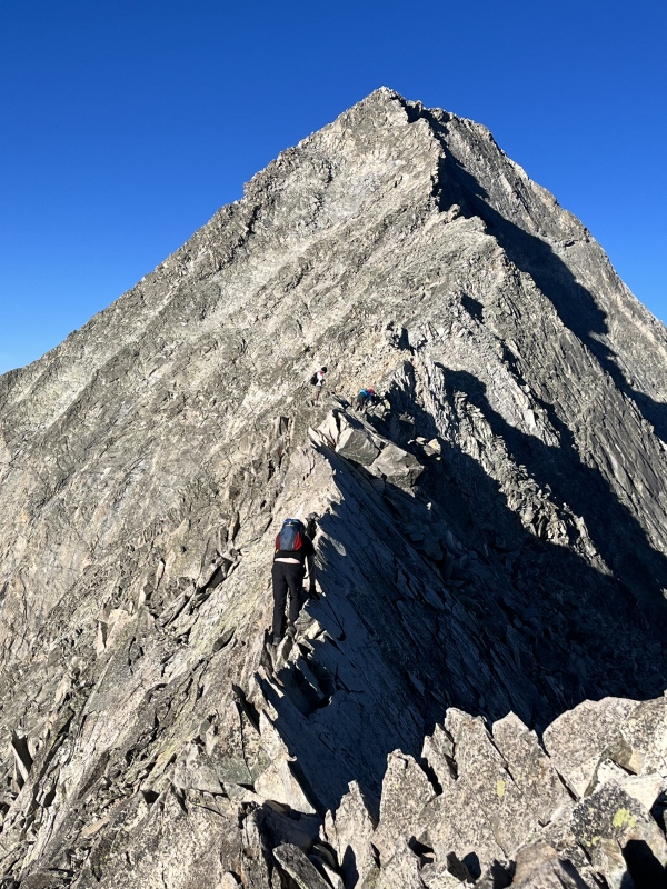
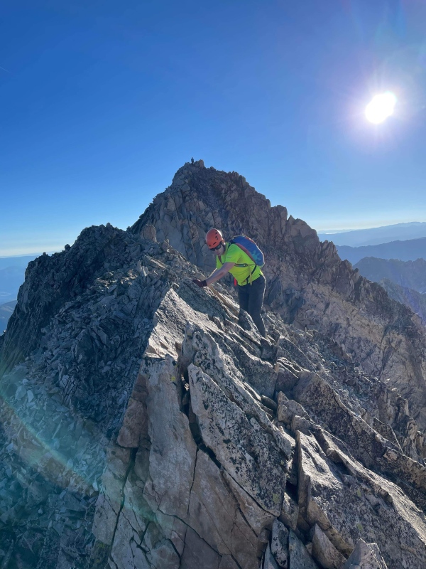
It was legit. I had a mix of adrenaline and fear kick into high gear, as I knew that if I fell, I'd die. I made sure always to have one foot on either side, knowing that I was climbing for my life. I silently spoke with myself, alternating between "focus" and "relax", taking care not to overdo either at the expense of the other. I reminded myself that I'd been in similar (and harder) terrain before, and that the moves weren't that tough and the rock was solid. Meanwhile, Kevin was chilling on the other side, mildly annoyed that I wouldn't be able to take any good pictures of him as we crossed this section. While I have ways to keep myself calm in exposed terrain, he's more naturally gifted when it comes to not letting exposure get to his head. It served him well here, and he crushed this section. I promised him that I'd give the picture-taking a shot on the way back. Whatever time I spent waiting en route to K2 was easily equaled out by the time he spent waiting for me on the knife edge as I butt-scooted and scrambled my way across. Past the knife, we both locked in. We both knew that the real challenge lied not at the knife, but with the loose face that we now had to cross and ascend. We followed cairns, hoping that our holds wouldn't give way. We had been passed by another group, and they took great care not to kick things on us when we were below. The traverse-y nature of this face made it such that it was relatively easy not to be directly below someone. We didn't take pictures here, but the basic idea is that once you're off the ridge, you go pretty much straight up, then traverse left following cairns until you reach a small bowl. There's a gray wall that needs to be dealt with in this bowl, and the wall is full of small ledges with loose dirt on them. If you're not linking cairns here, there's a reasonable chance that you're too high or too low. We eventually arrived at the other side, knowing that we had to ascend the small ridge on the left skyline. Though the first pitch post-knife still had significant exposure, once we started traversing it abated somewhat. As we arrived at a corner, though, it suddenly developed again in a big way. Taken from the way down, here's an idea of what I'm talking about. 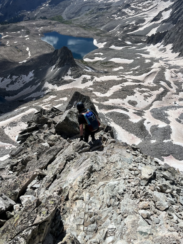
We ascended, with the summit ridge now coming into view. Before gaining the ridge, we saw cairns about 20-30 feet below marking a slightly less treacherous path to the true summit (instead of getting on the narrow ridge proper). It was still a no-fall zone, but after going too high too soon, we opted to follow these cairns until we found a better way up. Eventually, though, as we approached the summit, we said "screw it" and just gained the ridge a couple feet before the top. 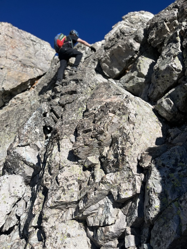
A couple careful steps later, and we were at the top! Wow. The summit wasn't exactly spacious, but it was surprisingly accommodating given how narrow and exposed the rest of this peak had been. We snacked, breathed out and took photos. I hadn't been to the lake the night before, and the early morning had been spent completely locked-in, so this was my first proper view of Capitol Lake: 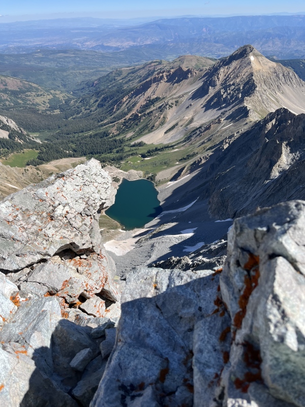
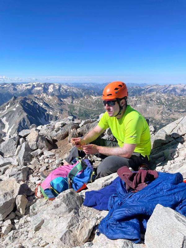
Still, though, we knew we had to get down, and that we couldn't sit there forever. we had topped out around 10, and we lingered for 15 minutes before heading down. We followed the same cairned path to the exposed corner, taking care with every move as we dropped back onto the loose face. I had to remind myself to take care here, knowing that so many accidents happened on the way down. My initial knife-edge nerves had worn off, but the loose gray ledges put a healthy fear back into me. Once again, no pictures here. For a peak that has you scrambling for so long, the routefinding actually isn't horrible. There are plenty of cairns, and it's so damn steep that in many places, you're just looking at the moves ahead of you and adjusting if you run into a tricky one. We took our time, but the descent across the face went smoothly. Once we arrived back at the knife, I actually felt pretty level-headed. The knife itself, which was incredibly unnerving on the way up, was actually incredibly fun on the way down. Once you're in a no-fall zone for so long, at some point you get used to the exposure and only think about the moves themselves. There were some clouds building, but we knew we had just enough time to scamper across the knife and back to K2. I kept my promise and tried to get Kevin his pictures, but I ended up too far away to get anything super cool. We quickly got back to the other side of K2, electing to go around this time and getting a little lost in the process (too low). We ended up having to backtrack before eventually finding the way back to my trekking poles. 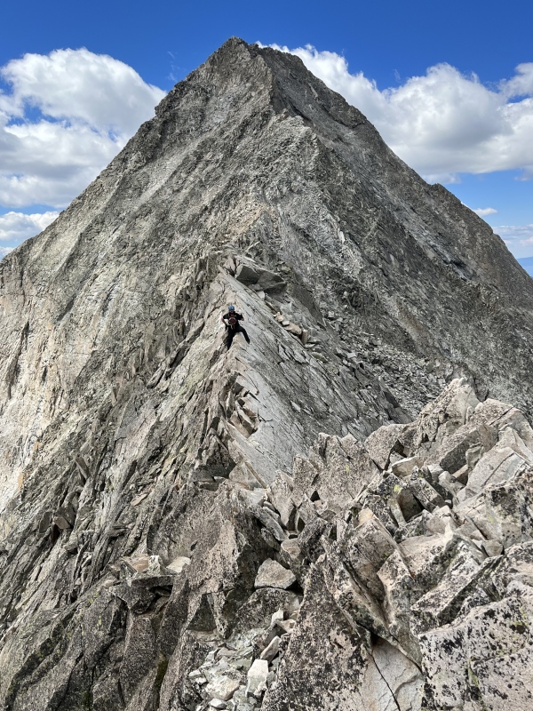
Speaking of which, I was bummed to discover that my fancy poles had been shredded! They must have fallen over at some point, because the grips were now marmot-chewed to pieces. I knew that this was a risk, as this had happened to me on Crestone Peak back in 2018 when I had underestimated the determination of these fat rodents. I got out my hand sanitizer, dousing them out of an irrational fear of getting rabies or other diseases from the chew marks. I gripped the poles to the best of my ability, and we boulder-hopped down into the lower bowl between K2 and the Daly saddle. So began a surprisingly treacherous section, and one where the lack of sleep really got the better of my judgment. Kevin is a fan of glissades, and with all the snow around in this large bowl area, we used this to move efficiently in low-angle snow. One problem: it was all melt-y! We were sinking in during our steps, and losing our balance constantly. I hiked with another dude once who had to call SAR for a similar case -- a hiker on Snowmass had punched through and sliced up his leg. I knew this, and I thought about it with every step. This was sketchy. I fell on snow couple of times, thankful to have kept my helmet on. I kept thinking that this was a horrible idea, but I was so eager to get back that I didn't want to sound like too much of a jerk. In hindsight, I should have gone around and caught up with Kevin later, since this was so unsafe. I knew better and regret not being more assertive as we went. 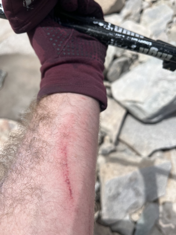
Still, after what seemed like hours of this slippery and sketchy nonsense, we made it back to the Daly saddle. The clouds that had threatened us since K2 had cleared a bit, but even if they had built, we were now on the homestretch. I looked back and couldn't believe how far we had come. We scampered down to camp, rested, and packed up camp as we chased daylight back to the TH. 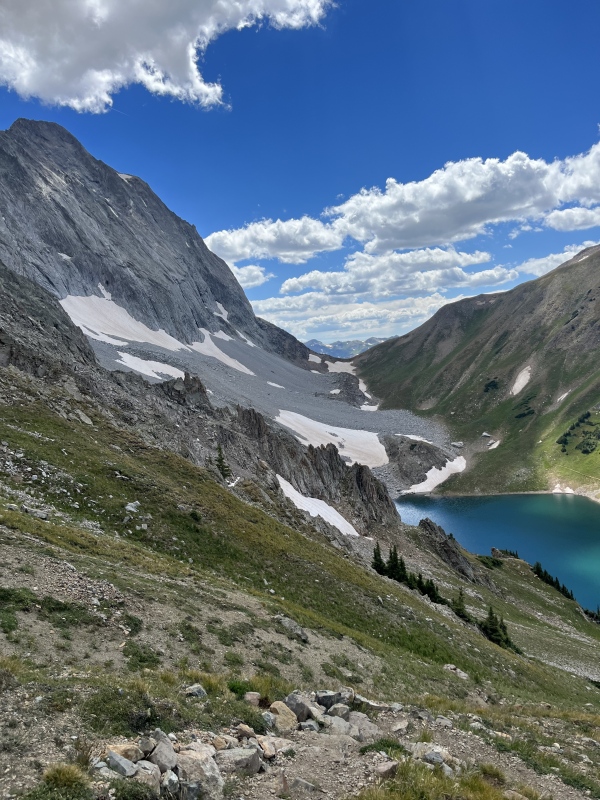
Before we left, though, I took note of a bug that had annoyed us since camp. Anyone know what this is? 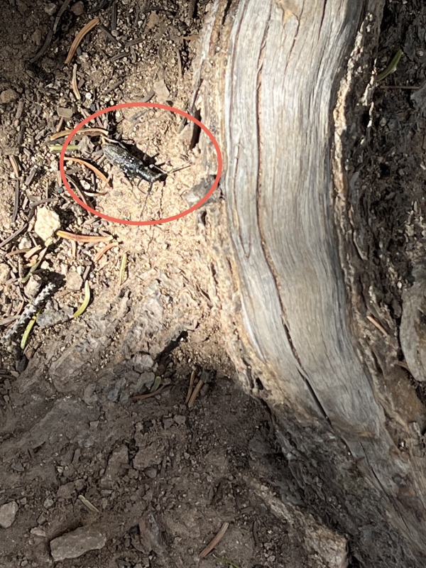
The way back was mostly smooth sailing, but it turns out that the trail splinters quite a bit on the way down. We had to check ourselves once or twice, realizing that we were too high up. I also got cocky and tried to avoid getting my feet wet by the main creek crossing. This resulted in my boots becoming caked with mud for several miles, with me pausing intermittently to try to remove muck with one hand while eating Thimbleberries with the other as Kevin sailed on ahead. About a mile or so from the trailhead, we were delayed by a cow that wanted to stand firm in the trail. It didn't seem upset; it just didn't want to move. We took this time to quickly get some water, and in due time, the cow moved on to join the other cows in this area. We arrived back at the trailhead around 8PM, just before headlamps would have been necessary. It felt good, but I couldn't help but feel that I got away with a lot. Some of our pacing and snow travel were avoidable errors, and I didn't feel like I had summited in the safest way. I don't think attempting on zero sleep was wise to begin with, either. It was tricky to reconcile, because I didn't feel as freaked out as I had when I'd made stupid mistakes in the past. This time, I was just annoyed -- at myself, at Kevin, at having felt like I hadn't put the wisdom I've accumulated over the years to good use...etc. Every successful summit feels good when you return safely to the trailhead, but this one probably wasn't the safest of endeavors. Maybe this mountain is just really dangerous, and there are just more opportunities to make a bad mistake (or have a smaller one burn you). 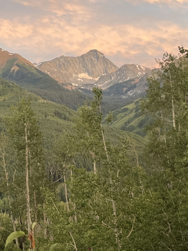
Either way, we drove back to Aspen, with Kevin returning to get some sleep before work the next day. I stayed in Snowmass Village, knowing that despite getting away with some mistakes, that I had now overcome a major obstacle as I continued to get closer to finishing the 14ers. It felt good, and Kevin and I had still done a lot right (communication and level-headedness during the scrambly bits, assessing weather properly, packing appropriately, reserving a site and being good LNT stewards...etc). I think that Capitol, despite the danger, is a pretty fun peak. Once is probably enough, but it was a cool adventure and a great test in so many ways. |
| Comments or Questions | ||||||||||||
|---|---|---|---|---|---|---|---|---|---|---|---|---|
|
Caution: The information contained in this report may not be accurate and should not be the only resource used in preparation for your climb. Failure to have the necessary experience, physical conditioning, supplies or equipment can result in injury or death. 14ers.com and the author(s) of this report provide no warranties, either express or implied, that the information provided is accurate or reliable. By using the information provided, you agree to indemnify and hold harmless 14ers.com and the report author(s) with respect to any claims and demands against them, including any attorney fees and expenses. Please read the 14ers.com Safety and Disclaimer pages for more information.
Please respect private property: 14ers.com supports the rights of private landowners to determine how and by whom their land will be used. In Colorado, it is your responsibility to determine if land is private and to obtain the appropriate permission before entering the property.
