Download Agreement, Release, and Acknowledgement of Risk:
You (the person requesting this file download) fully understand mountain climbing ("Activity") involves risks and dangers of serious bodily injury, including permanent disability, paralysis, and death ("Risks") and you fully accept and assume all such risks and all responsibility for losses, costs, and damages you incur as a result of your participation in this Activity.
You acknowledge that information in the file you have chosen to download may not be accurate and may contain errors. You agree to assume all risks when using this information and agree to release and discharge 14ers.com, 14ers Inc. and the author(s) of such information (collectively, the "Released Parties").
You hereby discharge the Released Parties from all damages, actions, claims and liabilities of any nature, specifically including, but not limited to, damages, actions, claims and liabilities arising from or related to the negligence of the Released Parties. You further agree to indemnify, hold harmless and defend 14ers.com, 14ers Inc. and each of the other Released Parties from and against any loss, damage, liability and expense, including costs and attorney fees, incurred by 14ers.com, 14ers Inc. or any of the other Released Parties as a result of you using information provided on the 14ers.com or 14ers Inc. websites.
You have read this agreement, fully understand its terms and intend it to be a complete and unconditional release of all liability to the greatest extent allowed by law and agree that if any portion of this agreement is held to be invalid the balance, notwithstanding, shall continue in full force and effect.
By clicking "OK" you agree to these terms. If you DO NOT agree, click "Cancel"...
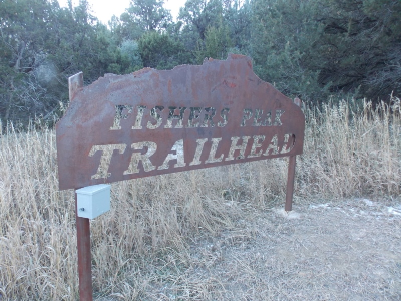
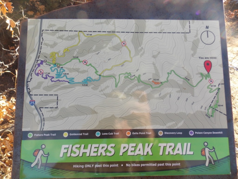
Trailhead: Fishers Peak State Park Route: The newly opened Fishers Peak Trail Length: 16 miles Vertical: 3400 Partners: Solo
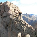
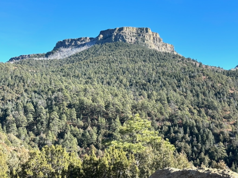
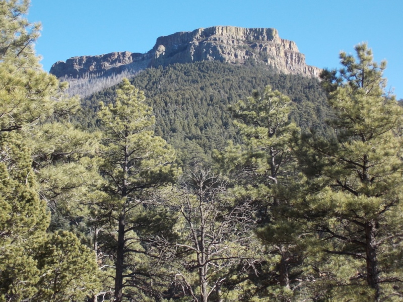
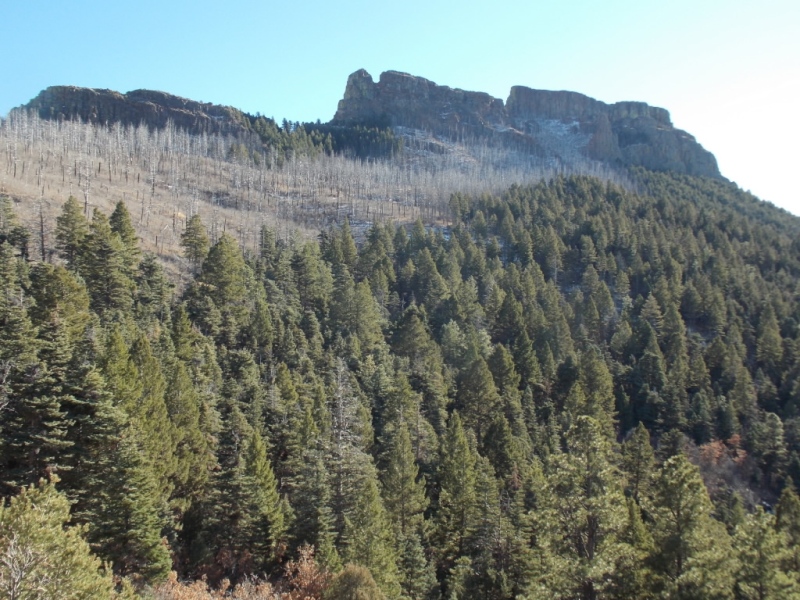
Fishers Peak is visible as you drive south on I-25 towards Trinidad. It sits just east of Raton Pass and is very visible from the New Mexico side as well. It is also the tallest mountain from where it is (West longitude 104/27'46") going east to the Atlantic ocean. And while not technically a mountain (it's more of a mesa), it is none the less pretty cool looking.
Fishers Peak just became accessible in the last month with the finalization of the trail from the entrance to Fisher Peak State Park to the summit and I immediately put it on my list. It was well worth the trip to Trinidad to hike this one - if nothing else than the 360 views one gets from the summit.
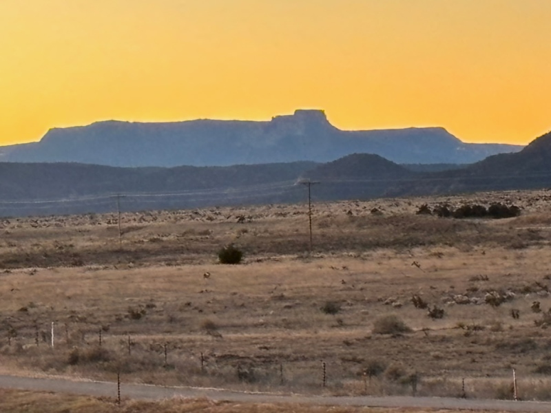
Taken at an exit off I-25 a few miles north of Trinidad
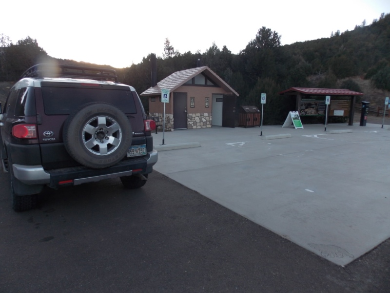
The entrance to the park is clearly marked - Take exit 11 off I-25 and follow the signs. There isn't any sort of visitor center but there is adequate (for now) parking and clean restrooms.
My FJ all alone in the parking lot
I guess this park hasn't been discovered yet - at least not for Tuesday mornings in December. I was the only one in the lot at the start, I saw only one other person who was biking up as I was hiking down and when I got back to the parking lot, there were only two other vehicles in the lot. Something tells me that will change this coming Spring.
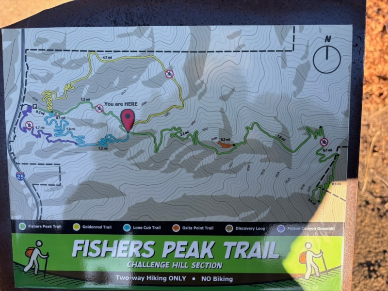
All the signs in the park have the silhouette of the peak across the top.And speaking of signs, there are signs at each segment of the trail.
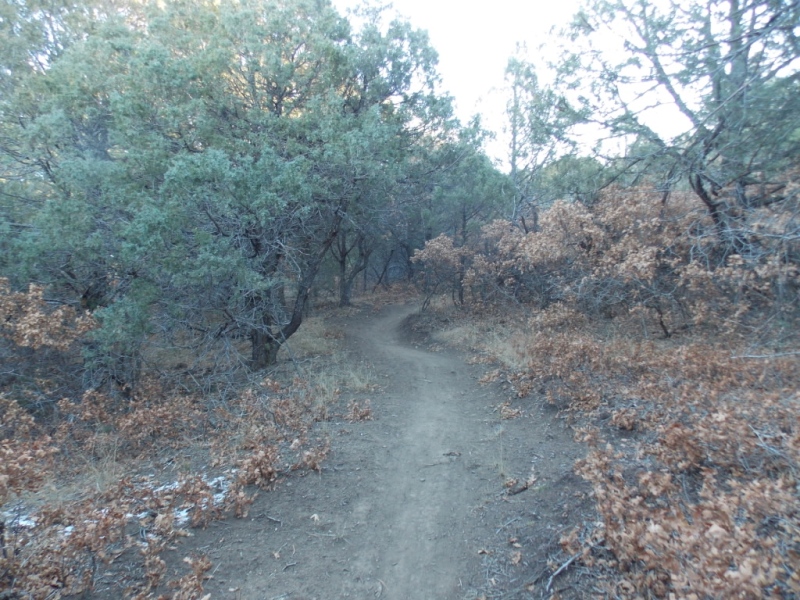
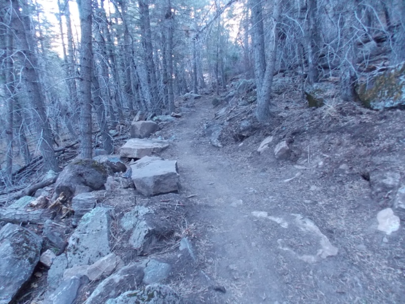
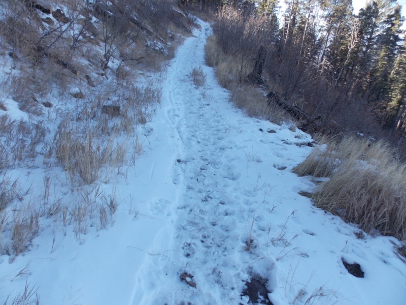
You start out on a gravel road (pictured above) and it goes on for about a mile and a half. That was the only part of the whole system I didn't like much. The picture shows it being flat - and it is at the start but it does get steeper and was kind of a pain in the neck - more accurately feet - coming down after a long day. It is also a lot rockier in the steep section but I didn't take a picture of that.
Another note here - there is no water anywhere on the trail and the first half of the trail has very little shade. Even in early December, I was chugging down the water on that section and I normally don't drink all that much on the trail.
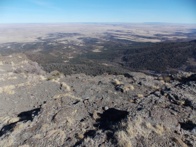
As you gain elevation, the views really start to open up. But you ain't seen nothing yet!
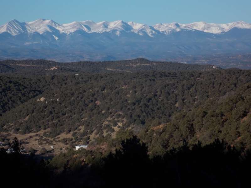
The Sangres!
And then there was this...
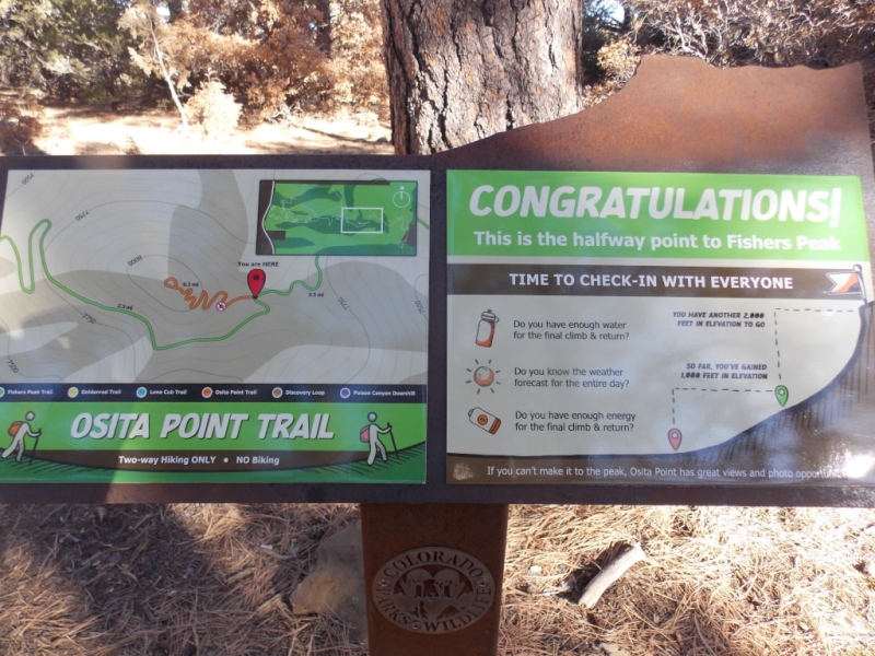
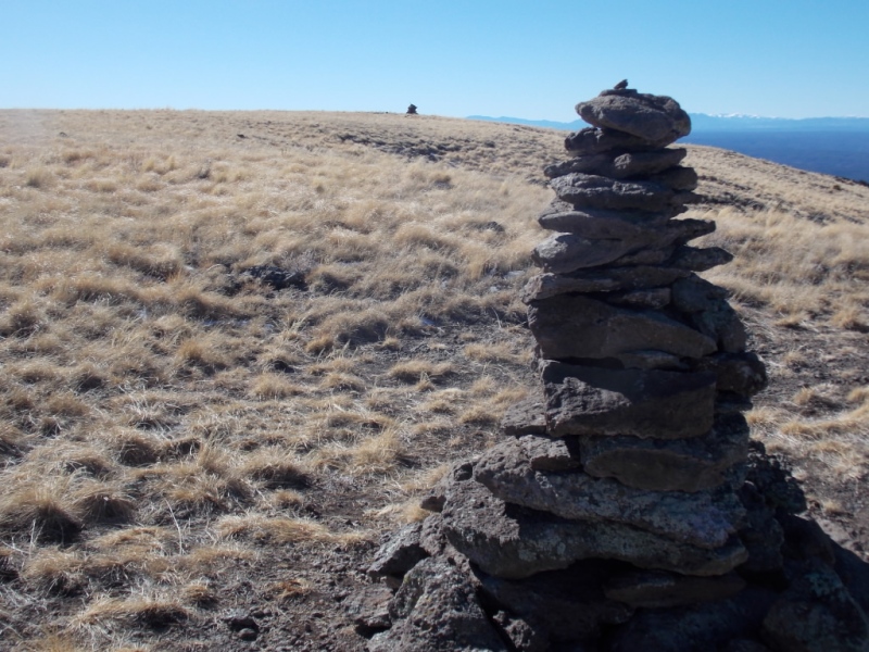
Right where the road ended (as far as hiking goes), they had built what almost looks like a medicine wheel. From this point, several trails start off in different directions.
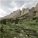
What follows are several pictures of what is called the Osita Ridge section of the Peak trail
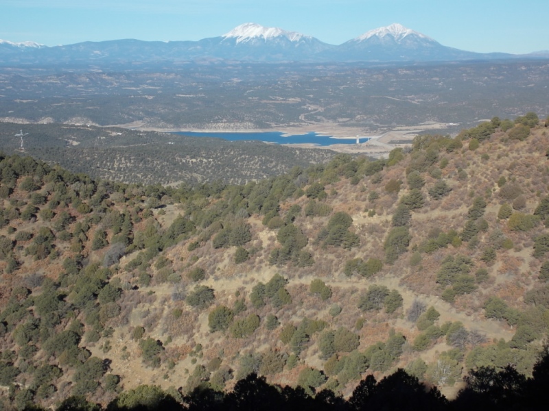
The Spanish Peaks! - Note the trail in the foregroundThe trail finally gains a little shade.
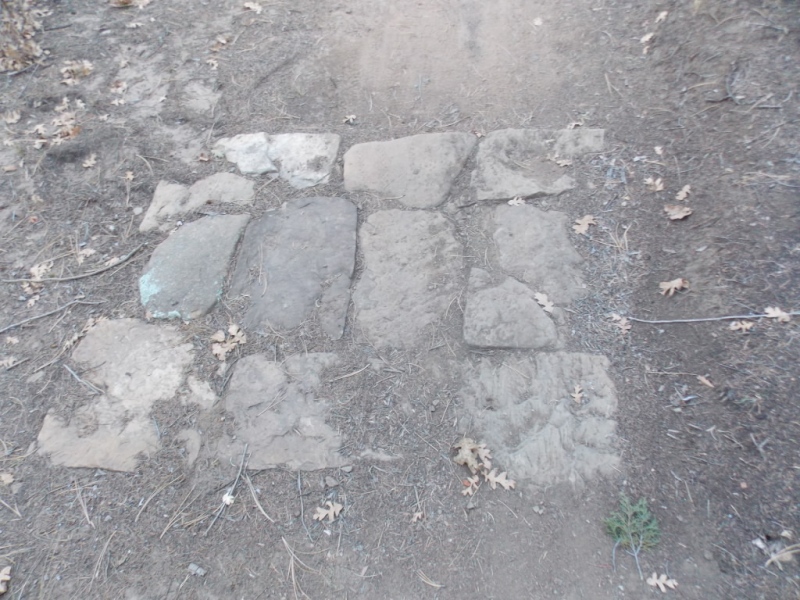
A note here about the quality and maintenance of the trails. It has been my experience that Colorado State Parks do a really good job of trail maintenance and Fishers Peak is no different. Pictured below is what they have done most places where it's obvious that a runoff stream would cross the trail. I saw several of these. And the signs were always in the right spot each time the trail segment changed. They also note if bikes are allowed on the segment - and they are allowed on the Peak trail with the exception of the first (the gravel road segment and there is a bike-around) and the last segment. I didn't see a lot of footprints but did see a lot of bike tracks. Were I to do this again, I would probably take a bike but I'm glad I hiked it the first time as it gave me time to focus on all the great scenery.
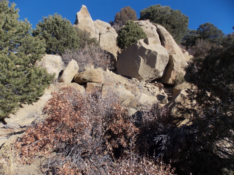
Erosion mitigation.Cool rocksFirst good view of the peakGetting closerHalfway there
I chose not to hike up to Osita Point - it is a view spot that I think might have been available long before the Peak trail was complete.
This section is called the Shady Forest segment. And it was exactly that.This is at about mile 6. No bikes past this point.Trial curves around to the north side of the peak.And there was a little snow. It was December after all.
From here on, the hike was on the east side of the peak. Lots of switchbacks and great views to the east.
And a short video I took around this spot.
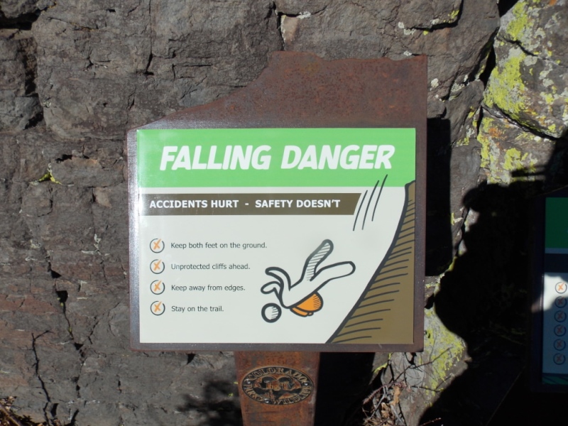
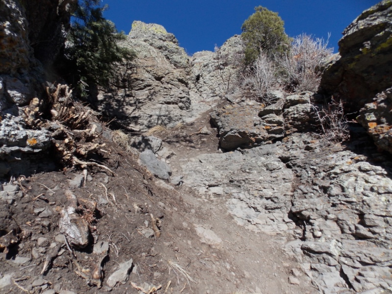
As you about to hike up to the summit, you see this sign.And then you get the only section that isn't pure trail
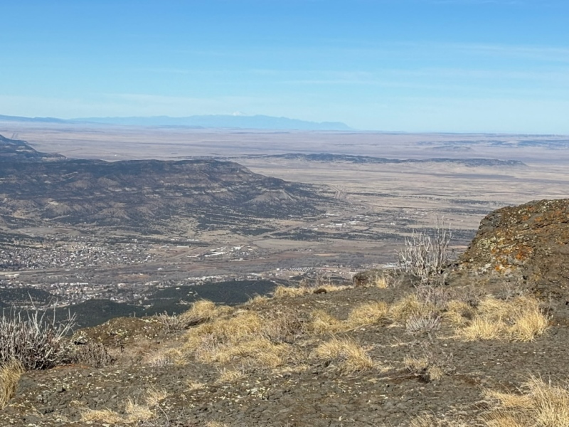
Once up that short section, you are on the mesa/summit and the views are fantastic.
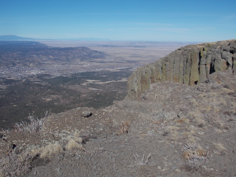
Looking south. That is Raton Pass in the upper right.
A short vid I took here.
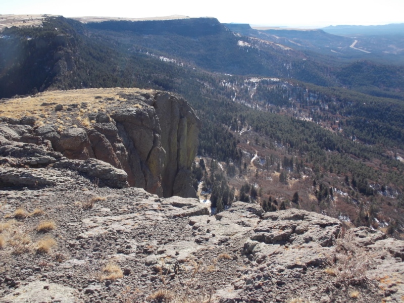
And then the trail makes a loop around the edge of the summit and it's all about the views.
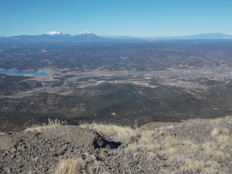
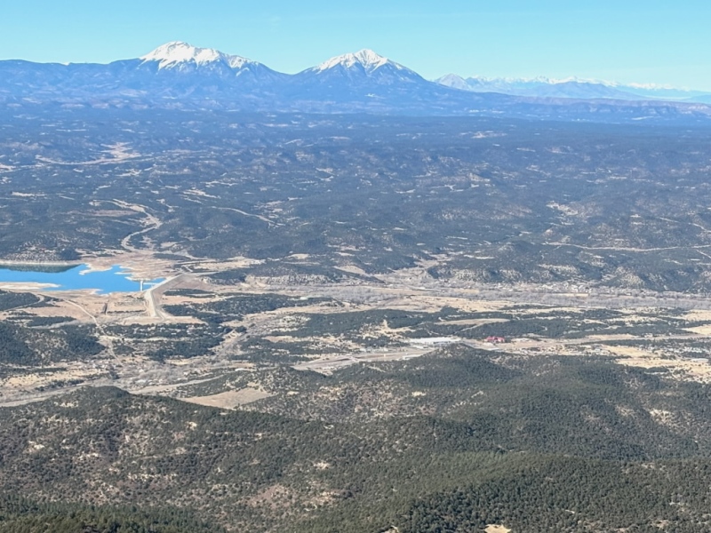
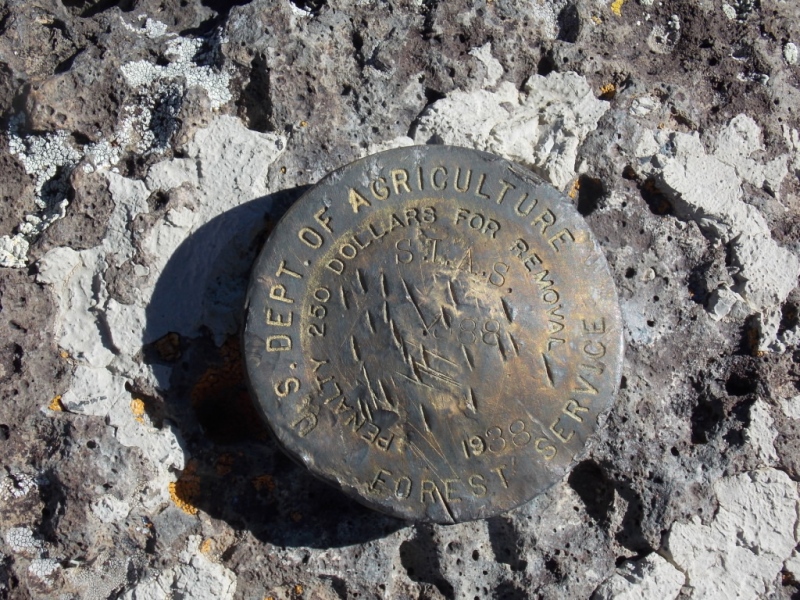
Trinidad Lake, Spanish Peaks, Trinidad and Greenhorn MtnAnd a slightly different angleLooking northPikes Peak in the distanceSummit benchmarkTwo large cairns - the benchmark is next to the one in the distance.And the view east - almost looks like you could see Kansas.
Strava link - which doesn't jive with what the CPW website says (it says 3000 vertical) Strava link
I really enjoyed this hike and I would recommend it to anyone. There are also a lot more trails in the Park - some are hikers only and one is bikers only. Kudos to Colorado State Parks for this new one.
Thanks for taking the time to read this and as always, please be careful out there!
Thumbnails for uploaded photos (click to open slideshow):
Was hoping you'd do a TR after I saw that you'd hiked this recently. Thanks for sharing! Looking forward to doing this on a weekend when avy conditions make going anywhere else ill-advised.
Jay, excellent report. Had to smile as it stirred memories of my hike on a similar great-weather December day. I wasn't counting but probably saw about 8 people on Wednesday. Getting popular already, "if you build it they will come." I think your Strava is overestimating the vertical. Trailhead is about 6300' elevation and summit is 9633'. My Garmin Forerunner came in at 3400', which given a few ups and downs seems pretty close. Congrats on pioneering this route and spreading the word. A great late season trip for those of us who are snow-phobic.
Reading your trip report on the state park route to Fishers Peak prompts me to mention mine by a different route from the north in a different time, 1987 when I climbed Fishers from a Trinidad subdivision. "Follow the route of the pipeline clearing," a local informed me. So, I went up a thorn brush covered canyon without finding a pipeline clearing in the direction of the peak. I found out later the pipeline clearing was in an adjacent canyon. I don't believe I had a map other than a sense of direction of where the peak was and used game trails to get around the east side to the south end where I could climb the peak. It was an adventure such that I wrote my story in a magazine.
There is also an interesting story on how the peak got its name. Waldemar Fischer was a U.S. Army Captain who became lost while marching south with his men during the Mexican conflict in 1846. He declared he would climb the peak before breakfast to find his bearings but did not return until a day and a half later. Whether he actually climbed the peak itself is unknown but by 1870 his name became attached to the peak replacing the historic name of Raton Peak shown on earlier maps.
I think if I ever climb Fishers Peak again I will follow the state park route in your report.
GG - I absolutely love your historical perspective on all things mountain. I had it on my list to research where the name came from but you have saved me the trouble. I can only imagine how tough the bushwhacking must have been for you going up from the north side. I didn't take a picture of it but on my pic # 18 (the shady forest one), looking both left (down) and right (up), the deadfall was horrible. I could see why Walderman FIscher would take a couple days to make the summit. If he did... And it's interesting that they dropped the "C" in his name when naming the peak.
Will - you deserve that title more than I do - you have certainly done more in quantity, quality and difficulty than I am capable of doing. Thanks for your nice words!!!
Joel - At the last trail segment where bikes aren't allowed, there was a sign that I did not take a picture of that said that section of the trail would be closed from March to July for raptor nesting so I think getting to the summit in Spring wouldn't be allowed. But you're correct - seeing it in Spring would be really nice.
report, Jay. The pictures in this really do it justice. They really did a great job with the trail and trailhead.
Nice to see Colorado access to this one. Kudos!!
Hi Ted - Yeah, I only heard about it opening on a local news report. The CPW website didn't mention it at all and I went down there not really knowing if I would be able to hike it or not. Obviously it was. As I mentioned earlier, I think that the final summit trail is closed for the Spring for nesting raptors. Thanks for your nice words!
Luke - I don't remember the specific dates but I do recall when I read about the last leg on a Pueblo news station (can't remember which one either) that it said 4 months starting in March. So I would assume something like 15Mar - 15Jul. Perhaps a phone call or email to CPW could answer your question more specifically. Sorry...
Update! Just found the dates of the closure - 15Mar to 31Jul. The article I read said it would be closed on those dates every year.
Alright Jay! Wow, you really grinded that one out. 16 miles is no gimmee. Nice pictures as always. Thats a long ways for a peak. I love the pictures of the Spanish Peaks and the Culebra Ramge of the Sangre De Cristos.
Yeah - it was a nice day. I've been trying to up my game distance wise but honestly, this was a pretty easy hike. Thanks for your kind words. They mean a lot to me...
Thanks for your kind words, Luke. Glad you had a great hike up!
Caution: The information contained in this report may not be accurate and should not be the only resource used in preparation for your climb. Failure to have the necessary experience, physical conditioning, supplies or equipment can result in injury or death. 14ers.com and the author(s) of this report provide no warranties, either express or implied, that the information provided is accurate or reliable. By using the information provided, you agree to indemnify and hold harmless 14ers.com and the report author(s) with respect to any claims and demands against them, including any attorney fees and expenses. Please read the 14ers.com Safety and Disclaimer pages for more information.
Please respect private property: 14ers.com supports the rights of private landowners to determine how and by whom their land will be used. In Colorado, it is your responsibility to determine if land is private and to obtain the appropriate permission before entering the property.


")
")
")
")
")
")
")
")
")
")
")
")
")
")
")
")
")
")
")
")
")
")
")
")
")
")
")
")
")
")
")
")
")
")
")
")
")