| Report Type | Full |
| Peak(s) |
Hunter Peak - 13,506 feet Keefe Peak - 13,532 feet Hilliard Peak - 13,422 feet Unnamed 13552 - 13,552 feet Unnamed 13214 - 13,214 feet "Triangle Peak" - 13,405 feet |
| Date Posted | 04/28/2024 |
| Date Climbed | 07/12/2021 |
| Author | Cool Hand Luke |
| Highlands Peak to Triangle Pass - My Elk 13er Finisher |
|---|
|
In 2014 I began a project of biking from my apartment in Aspen to climb all of the Elk Range 14ers. It was a really fun project, but I ran out of peaks to do sooner than expected. I realized there were so many amazing peaks in the Elk Range that were under the 14,000 foot benchmark, and decided to begin the project of climbing all of the Elk Range 13ers by riding my bicycle to the respective trailheads. Sure, the project could have been completed much faster using a car, but the idea of biking to a trailhead encouraged me to try to efficiently link up as many peaks as possible per outing. As I slowly chipped away at the list, there was one logical linkup that continued to elude me- the string of 6 13ers from Highlands Peak to Triangle Peak between the Conundrum and East Maroon valleys. My buddy TJ David and I attempted the traverse in the summer of 2018. We decided to meet at Aspen Gondola Plaza around 5 AM one morning, and proceed to the Congo Trail to gain the ridge to Highlands Peak. We thought it would be a fun day out in the alpine, and severely underestimated the time and physical effort the ridgeline would command. TJ and I made good time up to Highlands Peak and enjoyed the traverse over to Tonar Peak (roughly 12.5k). After Tonar, it was a series of high alpine meadow traverses to the start of Hunter Peak. The traverses were fun and easy going, but after Hunter Peak we ran into ridgeline difficulties we did not expect. We hoped to follow the ridge proper, but between Hunter and Keefe the ridge turned rotten between sharp and loose spires. We had to descent several hundred feet, taking turns ducking behind rockbands while the other person descended to avoid inevitable rockfall. What started as a fast and fluid moving alpine day slowly turned into an alpine crawl. In the late afternoon we came to the saddle between Keefe and Hilliard, but there was no obvious path. Storm clouds were beginning to build, and TJ wisely said that the day was more than either of us planned for, and that we should descend. It was a hard announcement, but in my gut I knew TJ was right. We talked it over for a minute, then decided to descend towards Conundrum Creek Trail. It took us a few hours of bushwhacking to reach the trail, but we made good time back to our bicycles once we hit the trial. The full adventure would have to wait until another day. 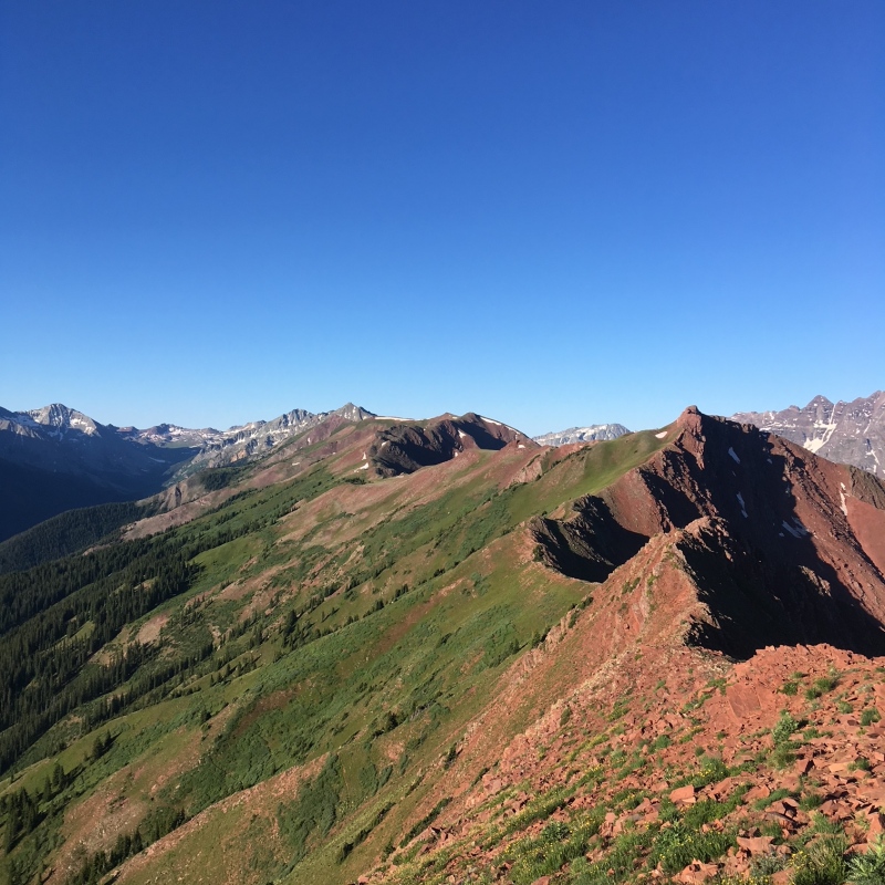
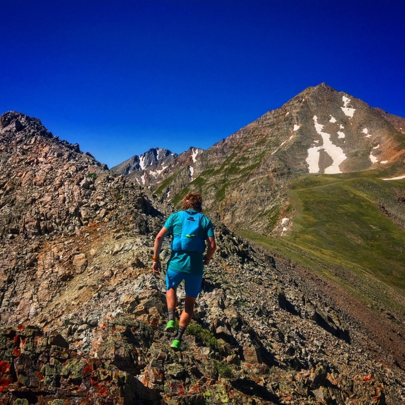
A few years passed between our first outing on the ridgeline and the next opportunity to give it a try. In the meantime, I began a career in teaching and did a 10-day bikepacking trip to Gunnision for my Masters of Arts in Education degree at Western Colorado University. During the bikepack trip, I climbed all of the Elk Ranger 13ers around Marble, Crested Butte and Gunnison. Chapters of my Elk Range 13er project were beginning to end, and I began to think of a way of how I could complete the project before winter set in. TJ and I gave the ridge another go the summer of 2021. This time we used the wisdom gained from our first outing to determine that we needed a much earlier start, and that we would need to carry ice axes to negotiate the couloirs when coming off ridge lines. The day started great, and we made up significant time from our previous attempt on all aspects of the trip. The 5th class ridgeline move from before was still sketchy- enough so that neither of us have pictures from either outing. We were able to negotiate the crux ridgeline descents much faster than the previous attempt, but the going was not fast. Finally, after Keefe Peak we began to search for the way to gain the ridge to Hilliard Peak. We were at the saddle, but could not find an obvious route. The NW side of Hilliard looked extremely loose and unsafe, and the east side looked only marginally better. We decided to explore the east side a bit more, and began a tedious scramble on loose terrain. After about 45 minutes of looking for the route, we realized we were in a precarious situation. During our search for a reasonable way up Hilliard, we had been searching on loose terrain above a 200' cliff. It did not seem dangerous at the moment, but over time we realized that one wrong slip would lead us over the cliffband with no chance to recover. Clouds were beginning to move in, and all of the time we had saved on our previous outing had long ago slipped away. We made the hard decision to once again descend to Conundrum Creek Trail and abandon the route. As we began to descend, we looked back and realized how truly dangerous of a situation we were in on the cliffbland we had just been on. 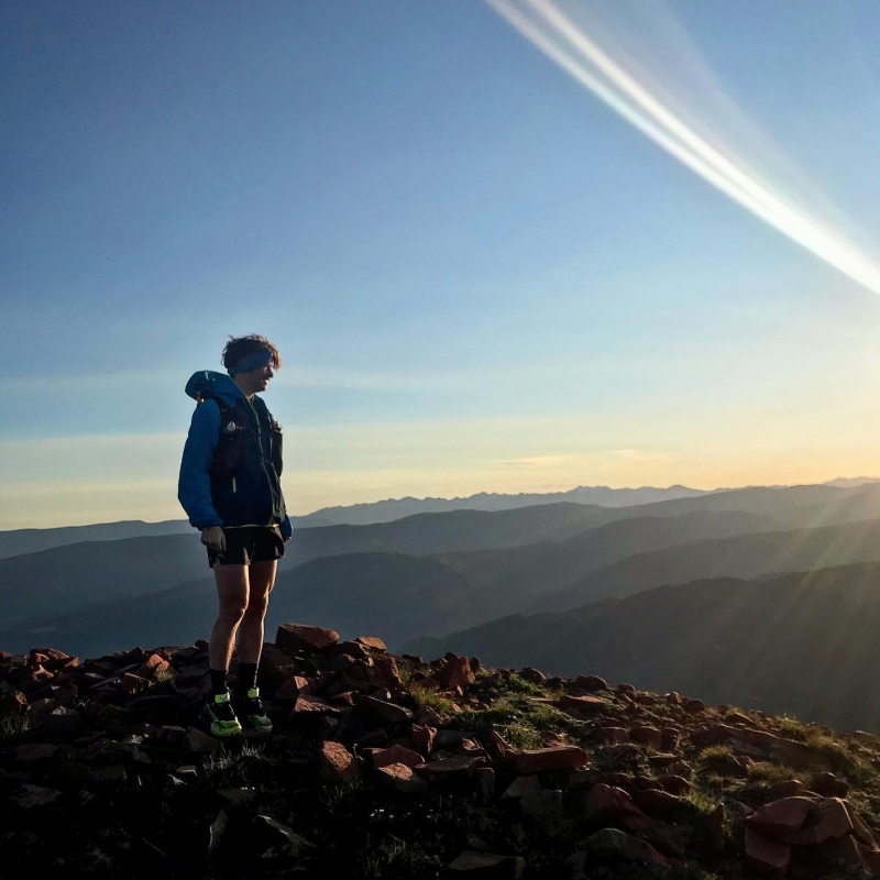
Third time is a go? After TJ and I attempted the ridge a second time, we both pursued our other summer projects. I chipped away at other Elk Range 13er bike adventures, and found myself in the position in July to give the ridgeline another go, which would be my finisher of the 52 Elk Range 13ers. Unfortunately during this time, TJ's schedule did not work out for another attempt on the ridge. I went back and forth on whether to give it a go, but the weather window was perfect. I decided I would have to give it a go, as this would be my last chance of the year to get up on the ridge in ideal conditions. The day started early, and it was eerie biking up Castle Creek Road in the dark on my own. Normally TJ was at my side and we were normally busy chatting about music or the day that lie ahead. On my way cycling up Castle Creek road, I saw two bright eyes in my headlamp, and realized it was a bear near the side of the road. No worries, it was just minding its own business, and the bear darted away as I got closer. I made it to the Congo Trail trailhead and locked up my bicycle, as I had done twice before. I started up the trail, but it felt really weird heading up on my own. It was dark and cold, and it had to be around 3 AM by the time I was heading up the trail. I made sure to scan the trees around me with my headlamp in the eerie darkness . About 30 minutes into my hike, I scanned the area around me with my headlamp and saw two eyes gleaming back towards me. As my headlamp hit the eyes, they did not move, only staring back at me intently. The spacing of the eyes was strange, and they angled up towards the corner of the eyes. I realized that this was a mountain lion looking straight at me from about 20 yards away, and it was not giving up any ground. My adrenaline surged, and I began to make noise and throw rocks and branches in the general vicinity of the eyes. I knew my best bet was to gain higher ground and put distance between myself and the cat without turning my back, but also realizing that the switchbacks of the trail stacked the situation in the cat's favor. On previous trips, TJ and I talked about how this was absolute mountain lion terrain, but had never encountered a cat. Unfortunately at this moment I was alone, and I rapidly scanned all of the area around me as I tried to distance myself from the lion. In what seemed like an eternity, I made it to one of the ski run roads on Aspen Highlands, but I knew I was not in the clear yet. It was wide open terrain, and a distance a cat could make up in mere seconds. Additionally, I was comforted by the thought that the cat could be following along in the trees parallel the trail. It didn't help that the deer on the trail were more than plentiful, and they would begin to dart as I got close, or their eyes would light up in the the glow of my headlamp. I made it down to the Merry Go Round on Aspen Highlands and found a safe spot to collect myself. It had been an hour of fight or flight, and I was emotionally spent at this point. Every time I thought I was safe I would spot deer eyes in the distant gleam of my headlamp, and mistake them for cat eyes. I decided that my day was done- I simply could not handle anymore. Plus, I had descended a long ways to Merry Go Round in search of safety, and was far away from the ridgeline. As I descended, the sun began to come up. It was a pesky reminder that I should be well past Highland Peak, but at that point I was glad to not be a cat snack. As the dawn grew brighter, I began to doubt my decision to descend back to my bike. Plus, I could actually see what was around me at this point, and thought I could spot a cat from farther away if it were stalking me. I made the tough decision to turn around and go back towards Highlands Peak, but to steer clear of the trees and stay as far into the center of the ski runs as possible. On the way up several deer darted from the trees, and I yelled at more deer that morning than I ever thought I would in my entire life. But still, I kept going up, one step at a time, and by the time I reached the ski patrol shack near the top of Loge Peak I knew I could breathe a sigh of relief as I went above treeline, and hopefully left the cats down below. 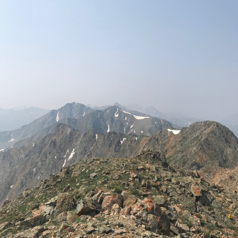
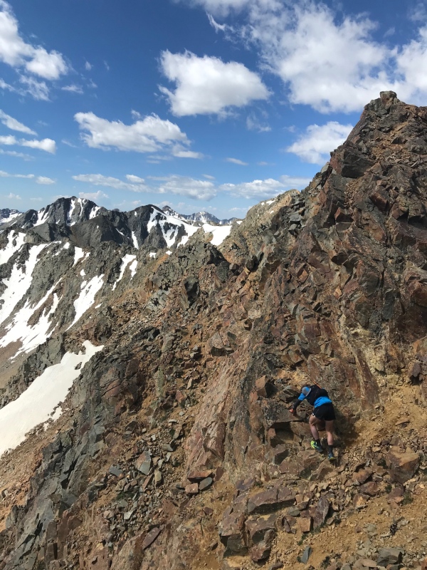
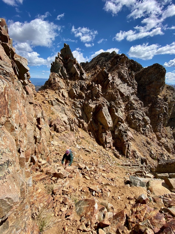
I began to make my way along the ridgeline between Highlands Peak and Hunter Peak, as I had done before several times. By now I knew the route well, and made good time. After Hunter Peak, I knew the couloirs that I needed to descend on the east side to gain the ridge to Keefe. Although going down several hundred feet on loose rock was tedious, it was the only way I found to make the route go. Eventually I gained the ridge back to Keefe peak, and scrambled to the summit. The scramble off of Keefe was adventurous as always, but by now I knew all of the loose sections. I came up to the section where I had a grab a hold a hang my butt over 30 feet of air and a very steep drop below, but I was used to this move by now. It is similar to the rock move on Kieners, but with way less air below, but with much less trustworthy rock. Being solo on this trip, it was actually easier to move between the loose terrain to the Keefe/Hilliard saddle. This area was definitely the crux of the route. Finally, I came up to the saddle between Keefe and Hilliard were TJ and I had been stuck twice before. I made sure to really look at all possible routes this time, and found a 4th class chimney that I had not noticed before. I made my way slowly up the chimney, making sure I could downclimb if necessary if it did not go. As I crested the chimney, I realized this had to be the way to the top of Hilliard. I rounded a ledge system, and encountered another move where I had to reach around a rock bulge and swing my body across. This move had some air under it, and a fall would be really bad- especially solo. I slowly moved my hand around the rock until I felt the best hold I thought possible given the rock quality. I grabbed the rock and slowly moved my body across the rock bulge, and breathed a sigh of relief on the other side. From there, I could see a clear class 3 route to the summit of Hilliard, and was on terrain I had never seen before. 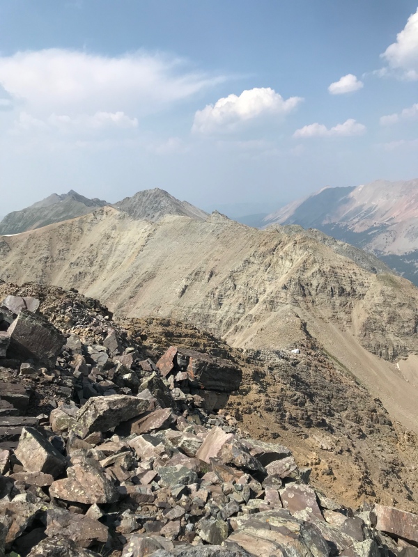
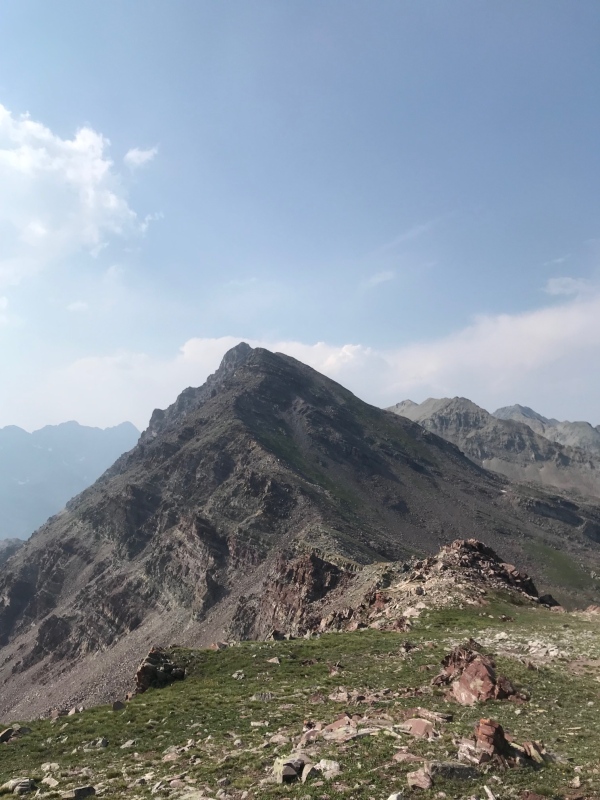
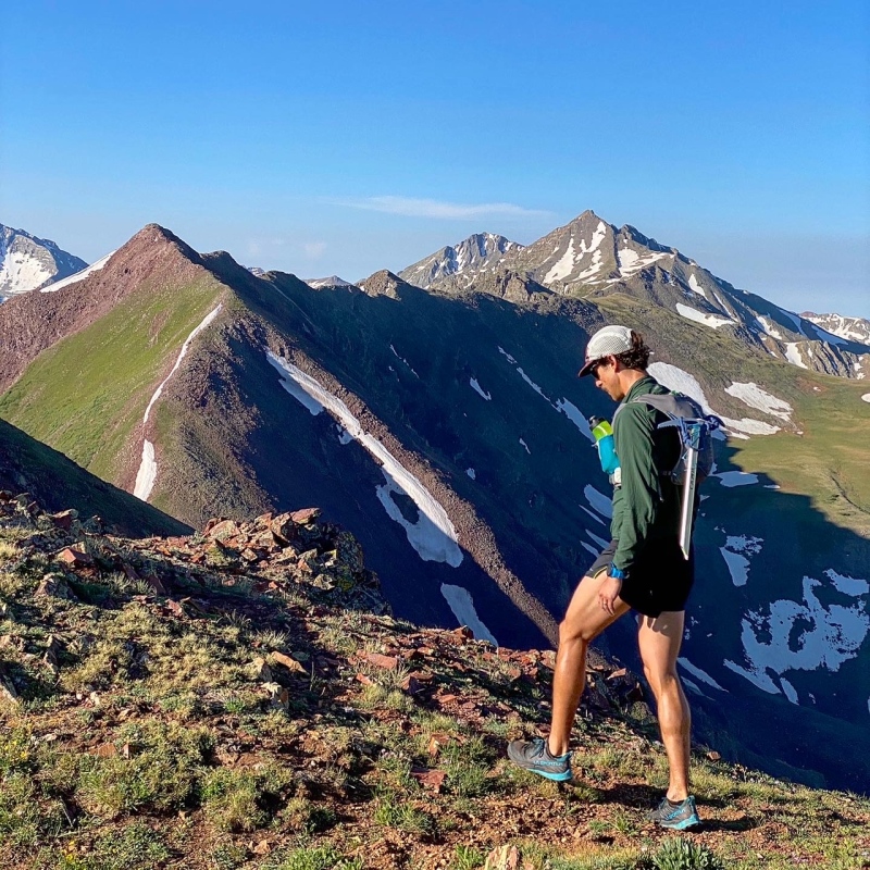
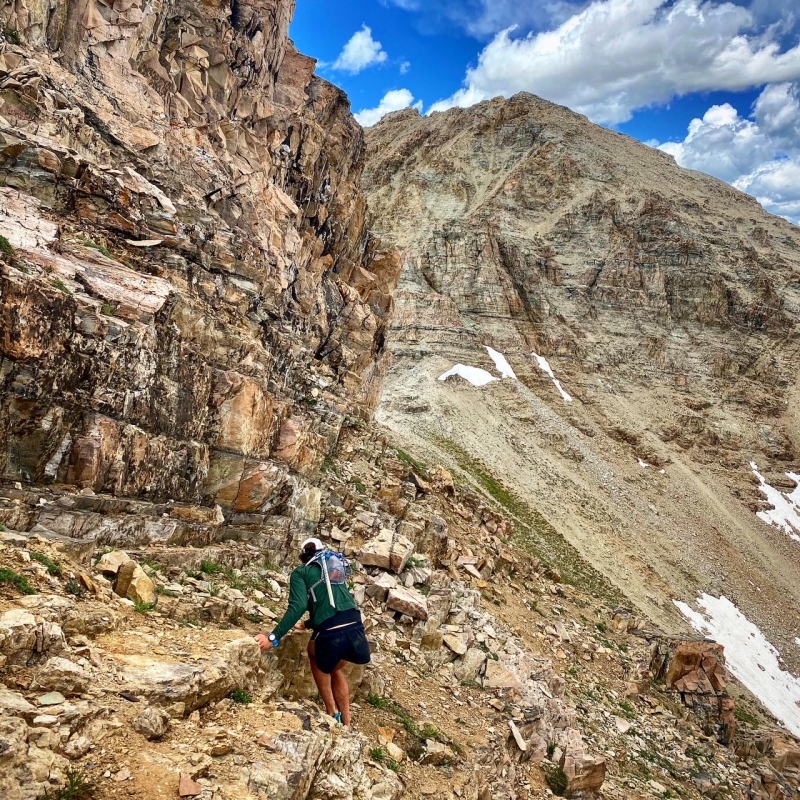
From here the scrambling began to ease up to third class, with nice grass jaunts between peaks. 13,537 was a really enjoyable scramble to the top, and the first time in hours I was able to let my guard down for a moment to recollect myself. The descent towards 13,216 was enjoyable, and the rock quality began to improve. The miles and hours on my feet began to catch up to me at this point. I knew that I was close, and needed to hold it together a bit longer. I could clearly see Triangle Pass now, which helped me keep moving. 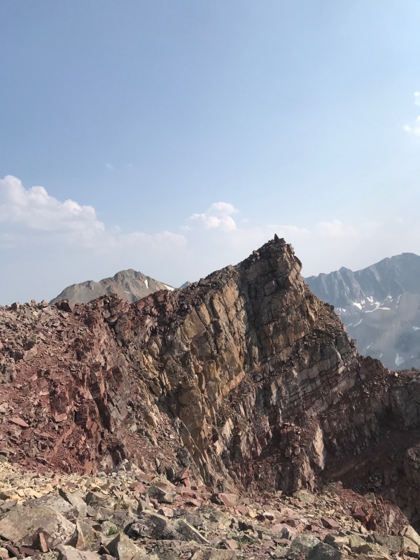
There was a decent downclimb from Pt. 13216 to the Triangle/Copper Pass Trail. I definitely lost some time here, as I was really tired and my route-finding was not at its best! I finally made it to Triangle Pass, and began the ascent to Triangle Peak. The elevation gain and time at altitude from the day was catching up with me, but I proceeded to make my way up. 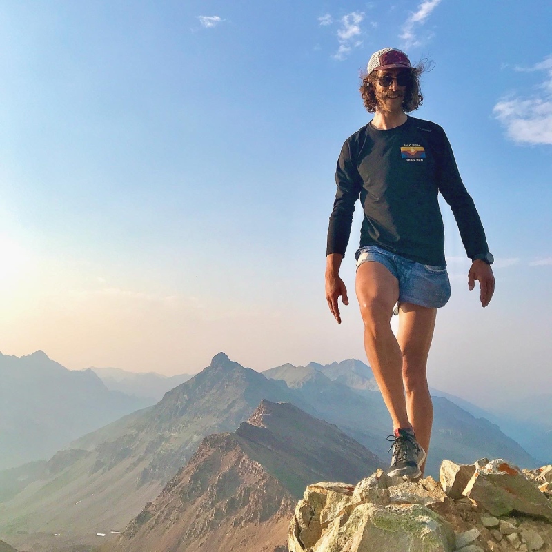
At the top of Triangle Peak I took a moment to reflect on the experience and to text my wife on my Garmin. She had been tracking my progress all day, and watched my GPS track as I found the route between Keefe and Hilliard that had stopped me before. While it was a time for celebration, I also knew that I needed to make my way back towards my bike, which was quite a distance away. The jog down to the trailhead went well - I felt like a diesel that could just keep going and rolling over whatever terrain the trail threw at me. The sunlight began to fade to darkness, and I was skittish everytime I saw deer eyes illuminate in my headlamp the final few miles of the trail. Finally, I reached my bicycle at the Congo Trailhead, however, the rear taillight on my bicycle was flashing. Almost delusional at this point, I chided myself for forgetting to turn my tailight off, but wondering how it had stayed on for so long. But then, I remembered I had been very methodical at the start of the day and deliberately turned the taillight off. I got closer to my bike and saw my ID and and gear on the ground. "Who the F*** breaks into a bicycle bag" I muttered, as I gathered my gear from the ground, but realized my frame bag was slashed open rather than unzipped, and there were teeth marks on the frame bag. I hoped to be down much earlier in the day, but it turns out in the meantime a bear found my bike, and my emergency Snickers in my bikebag must have been as appetizing to the bear as it would be to me. Now I needed to bike home in the dark, without any food . Well, the best way out of this is just to start pedaling down, I thought to myself. It was cold as I began to pedal down Castle Creek, the cold air sinking into the valley from above. About a mile down the road, I saw the flash of eyes in my headlamp, as I whizzed down the road at 30 mph. It took a moment for me to process, but the eyes disappeared as everything faded into black outside of my headlamp glow. All of a sudden, the eyes reappeared, looking straight at me from 10 feet away as the bike slowed to a stop. It was the %**#! bear in the middle of the road, likely the same bear that had just stolen my last Snickers! To add insult to injury, I guess the bear would not be happy until it had unseated me from my bicycle on the asphalt at near full speed. The bear ran off into the woods, and I was still bitter and hungry for the Snickers that was ripped from my frame bag. The frayed edges of the frame bag rubbed against my leg with each pedal stroke home, a gentle reminder of the caramel, nougat and peanuts that the bear must have enjoyed. Eventually I steered my bike to the last climb back to my house. I was flat out tired and exhausted from a major day above 12K that took longer than anticipated. Still, I was really happy to close the chapter of climbing all of the Elk Range 13ers by biking to the peaks. I pedaled the last few yards to my house, threw my bike in the garage, and fell right to sleep. Stats for the day: 6 13,000 Foot Peaks Climbed (Hunter, Keefe, Hilliard, N13,537, UN 13,216, Triangle Peak 16 miles by bike, 33 miles by foot. Over 13,000 feet elevation gain total 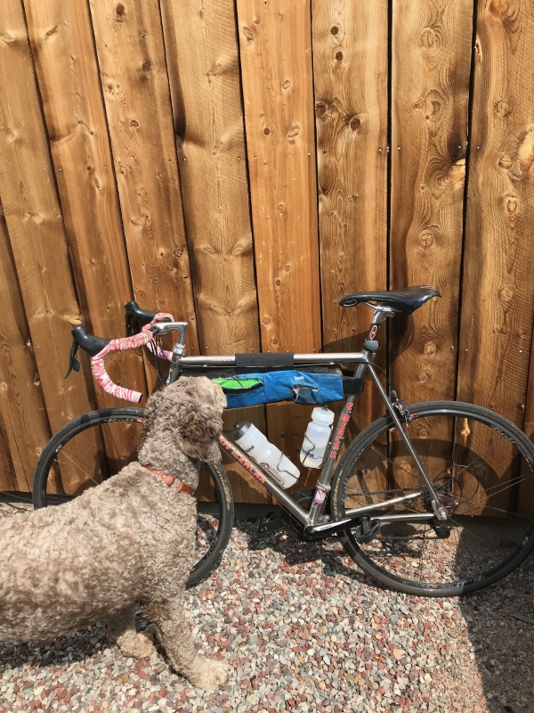
Thumbnails for uploaded photos (click to open slideshow): ")
")
")
")
")
")
")
")
")
")
")
")
")
")
")
")
")
")
")
")
")
|
| Comments or Questions | ||||||
|---|---|---|---|---|---|---|
|
Caution: The information contained in this report may not be accurate and should not be the only resource used in preparation for your climb. Failure to have the necessary experience, physical conditioning, supplies or equipment can result in injury or death. 14ers.com and the author(s) of this report provide no warranties, either express or implied, that the information provided is accurate or reliable. By using the information provided, you agree to indemnify and hold harmless 14ers.com and the report author(s) with respect to any claims and demands against them, including any attorney fees and expenses. Please read the 14ers.com Safety and Disclaimer pages for more information.
Please respect private property: 14ers.com supports the rights of private landowners to determine how and by whom their land will be used. In Colorado, it is your responsibility to determine if land is private and to obtain the appropriate permission before entering the property.


