| Report Type | Full |
| Peak(s) |
Denali, 20,310' |
| Date Posted | 11/08/2023 |
| Date Climbed | 06/14/2023 |
| Author | aksean22 |
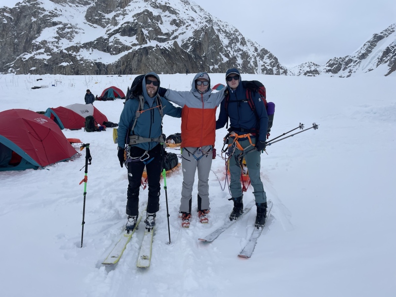
| Additional Members | akcasey12 |
| Denali: The Summit of North America |
|---|
|
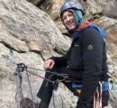
Denali - The Summit of North America On June 14th, 2023, my brother Ben and I stood on the summit of Denali (20,310’). We climbed the mountain unguided via the West Buttress and skied off the summit, returning to Talkeetna 15 days after flying onto the Kahiltna Glacier. It was a very cold and physically demanding climb, but the experience was incredibly rewarding. For better or worse, the mountain lived up to its reputation. Denali has been on my radar for years. I grew up in Alaska, and on a clear day the mountain can be seen from our hometown near Anchorage, dominating the landscape from 150+ miles away. The trip was delayed a few times due to various injuries to team members, Covid restrictions, and other dumb ideas, but all the pieces finally fell into place this year for me to give it a shot. Our team consisted of myself and my brothers, Ben, and Daniel. We’ve climbed and skied a lot together the past few years, and make a pretty good team in the mountains. The three of us flew to Alaska on May 30th. It took two hectic days of grocery shopping, organizing gear, repacking bags, and a dozen other last-minute errands before we were finally ready to go. We drove to Talkeetna early on June 1st for our mandatory NPS ranger briefing, checked in with our flight service, and were promptly shut down by the weather. After a 36-hour delay, we got just enough of a break in the clouds to fly into basecamp late the following evening. The 45-minute flight onto the Kahiltna Glacier was one of the highlights of the trip. We stayed glued to the windows the entire flight, completely captivated by the rugged mountains and glaciers that we were flying through. The scale of the Alaska Range is just insane. 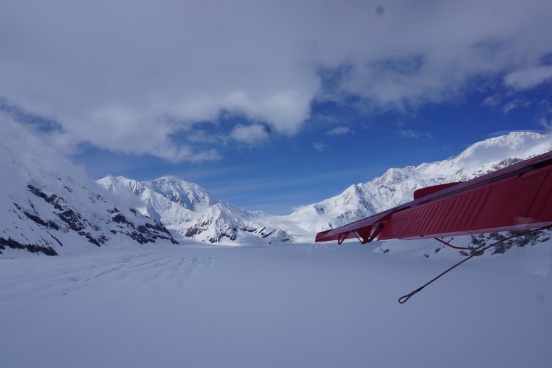
Due to a not-uncommon period of extended bad weather, it had been 6 days since anyone had flown in or out of basecamp. There were over 100 people waiting for a flight out, including one guided group we talked with that had been on the mountain for 26 days(!!) and were down to their last day of food. They looked very over it (no summit either, to add insult to injury). We quickly dug a cache to ditch some food, picked up our fuel, and were on our way to Camp 1 by 8pm. The West Buttress is by far the most popular route on Denali, and we were going during the busiest time of the year. When we checked in with the rangers there were already 609 other climbers on the mountain and 995 registered for the season. That sounded like a lot, but the mountain is so big, and everyone is so spread out to the point that it was barely noticeable. The route is well-traveled and well-marked from basecamp to the summit. We were never alone, but it never felt dirty or crowded or took away from the experience. It took 4 hours to single-carry the 6 miles up to camp 1. Because of the late flight, we arrived well after midnight and in deteriorating weather. The next morning, I unzipped the tent to find 12 inches of new snow and more coming down. Unable to see more than 100’ in any direction, we called it a weather day and stayed put. 

Unfortunately, this is where things went south. Long story short, dinner that night (pasta and meat sauce) did not sit well with Daniel, and he ended up with a bad case of food poisoning. Ben and I (who ate the exact same thing) were completely fine, so the next day we decided to make a load carry to camp 2 while Daniel stayed and rested. We were hoping it was just a 24-hour bug, but the next morning it was clear he was too sick to continue, and we made the unfortunate but very easy decision to evacuate him down to basecamp. The weather was good, and he was able to fly out the same afternoon (Note - we carried his gear, and he made it out under his own power. If we had called the Park Rangers for assistance, the trip would have been over for everyone). It took a few bags of IV fluids at the hospital and several days in bed, but he’s fine now. After the plane left Ben and I returned to Camp 1. Morale was low, and to be honest if our stuff wasn’t split between Camp 1 and Camp 2, we might have bailed with him. As it was, we still had 17 days of food and fuel and nowhere else we were supposed to be, so we decided to keep pushing upwards as a team of two. The following day (Day 5) we finished our move to camp 2 at 11,000’, finally feeling like we made some progress up the mountain. 

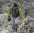
The next day we made a load carry up to Camp 3 at 14,200’. This section of the route took us across some of the more recognizable features of the mountain, and despite the heavy packs it was a lot of fun to experience it all for the first time. Directly out of camp 2 is Motorcycle Hill, where we had to break out the crampons for the first time and add skis to our already over loaded packs. Motorcycle Hill leads to Squirrel Hill, and then around the infamous Windy Corner. The weather was perfect, and we bypassed the traditional cache point and trudge along the rest of the way to Camp 3 to drop our packs. From there we clicked in and enjoyed our first “real” turns skiing back down to camp 2. The snow was firm, and there were a few sections of blue ice to be careful on, but it felt great to be moving without the heavy pack. It took us 4.5 hours up and less than 20 minutes to get back down. 


A weather day at camp 2 followed, and then we repeated the route to finish our move to Camp 3, leaving behind the sleds and a cache of food. Unfortunately, we screwed up our departure time and left about 5 minutes behind 4 guided groups. With 50+ people spaced out on ropes ahead of us, there was a conga line as far as I could see. It was difficult to pass without using up a ton of energy, so we just hopped in line and trudged along. It was the only day we had a bad/annoying experience with other groups, which could have easily been avoided had we left earlier. Camp 3 is on a large, protected plateau at 14,200’. It is essentially an advanced basecamp, where teams usually take a few days to rest and acclimate before making their summit push. It’s also an easy place to get stuck waiting for a good weather window. For the next several days the forecast was mediocre at best. We managed to get in a few ski tours up to 16,200’ but spent most of the time stuck in camp. The thing I remember most is just always being cold. Life revolved around eating and staying warm, and the routine got old fast. It wasn’t all bad; we met some cool people, the skiing was good, and the views were great, but after 5 days in camp we were very ready to get moving again and took the first decent weather window we saw for our summit push. 

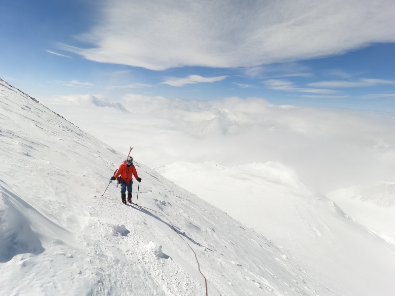
Most climbers will make one more move to high camp at 17,000’ before starting their summit bid. This has the obvious advantages of helping with acclimatization and makes summit day much shorter, but it also involves lugging heavy packs another 3000’ up the mountain and spending (at least) one miserable night in a cold, frozen wasteland of a camp. It also requires a much longer weather window, which was not in the forecast anytime soon. An increasingly popular alternative is to make the summit push directly from 14 camp. It’s a big day at altitude, and the park rangers are not exactly fans of people trying this, but as skiers we thought it made a lot more sense this way. Light packs would allow us to cover ground much faster, and we could escape back to camp on skis much easier if anything went wrong. With unlimited daylight, we planned for an 8:00am start, but everything takes longer in the cold, and it was 8:45 before we were finally moving. This ended up working out to our benefit because we walked out of camp at the exact same time as another group of four who were also headed for the summit. Our paces were similar, and we ended up spending most of the day within earshot. The first 1500’ up the West Buttress is an absolute highway that leads up to the fixed lines. We cruised up an old skin track and out of the clouds. Just below the base of the fixed lines, there is a large face to climbers right which leads to a couloir known as Rescue Gully. This is a more direct path up to 17 camp and was also our intended ski route down (The Messner Couloir and Orient Express were unfortunately in very poor condition this year and we had ruled them out almost as soon as we saw them). We had planned on using the fixed lines, but the other group was already setting a fresh booter up Rescue, so we decided to follow them instead, which saved us a good chunk of time and effort. The only downside to this move was that the gully was still in the shade, and Ben and I both were dealing with very cold toes. I was quite concerned we were going to get turned around because of them, but the sunshine at the top of the gully helped a lot. We were able to warm them up at 17 camp and it wasn’t an issue the rest of the day. 

Next up was the Autobahn; a long, traversing section that leads to Denali Pass at 18,000’. The terrain is not technical, but it is a steep slope that is rather infamous for how many people have fallen to their deaths (24, in case you were wondering). The Park Rangers protect this section with pickets to clip into the entire way. We clipped in occasionally, but conditions were good, and we didn’t feel like it was mandatory. 

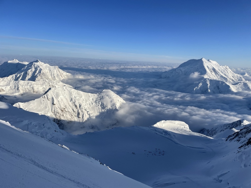
From Denali Pass you can see off the north side of the mountain all the way down to green pine trees 18,000 feet below. We veer right and finally got a glimpse of the true summit. From here, the climb mellows and seems to drag on forever. The next notable feature is Archdeacons Towers, which marks the start of a flat plateau called the Football Field at 19,000’. Up until this point we had been mostly sheltered from the wind, but at the football field we lost our protection and got a full artic blast of it. A guided group of 4 turned around just in front of us as we reached them, saying it was too windy to continue. It was noticeably colder in the wind, but by the time we crossed the football field it had subsided, and we regained some protection again. 


The final obstacle is the infamous Pig Hill, which lived up to its name. It must have been the slowest, hardest 500’ of vert I’ve ever done in my life. 10 steps, stop and catch my breath, repeat. Neither of us were feeling or showing any signs of altitude sickness, but the air was still noticeably thinner. The whole day up to this point had just been head down, one foot in front of the other. It wasn’t until we topped out of pig hill onto the final summit ridge that we realized we were actually going to make it. We took our time on the summit ridge; partly because breathing was hard, and partly to take lots of pictures. We passed a group of four on their way down and had the rest of it all to ourselves. A few more steps and we were standing at the USGS marker on the top of North America. 


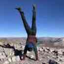
I’ve stood on a lot of summits in my life, but this might be the best one. We were high above the clouds and could see hundreds of miles in every direction. According to our meteorologist (more on that below), it was -29 degrees on the summit that day, but the wind died down and the sun was shining, and I was plenty warm in all my layers. We ended up spending over an hour at the top before for clicking in for the ski back down. I skied cautiously down the summit ridge and then followed Ben around a huge serac that lead back down to the Football Field. From there we followed the route back down to Denali Pass. Snow was mostly windpacked and icy, with pockets of powder. It wasn’t good, but it’s also relatively easy terrain to navigate. I took my skis off to cross the Autobahn. Ben (and the lone skier from the other group) left theirs on and had no problems. Three hours later, another skier took a bad fall in this spot and was lucky to make it out alive. By the time we got back to 17 camp, I was starting to feel the altitude. I had eaten exactly 2 packs of energy chews, half a candy bar, a mouthfull of mostly frozen gel, and a liter of water. As we started down Rescue Gully, I could feel myself starting to bonk. Ben was having the run of his life and I was stopping to rest every 3rd turn. I didn’t realize it but my right ski wasn’t fully locked in, and as I made my way out of the gully and onto the face, I made a turn and it popped off. I fell and started to slide. For a brief second I was accelerating, but I had a whippet in one hand and an ice axe strapped to my pole in my other hand, and managed to self-arrest after about 50’ with my loose ski underneath me. Disaster averted. 

That gave me the last jolt of energy I needed to get down. We straight-lined a bergschrund to get back on the main West Buttress trail below the fixed lines, and it was smooth sailing from there. Back in camp I stuffed my face with hot liquids and snacks and quickly felt much better. In total it took us 14 hours round trip from camp 3 to the summit; 10 hours up, an hour on top, and 3 back down. Although had I not walked across the Autobahn and bonked in Rescue Gully we probably would’ve made it down in half the time. We had achieved our goal, but the adventure wasn’t over yet, and there was still lots of skiing to do to get back to the runway. The next day was another beautiful day. We debated getting packed up early and trying to make it down to fly out that same day, but neither of us were feeling very motivated. We woke up around 9am when the sun came out and spent a few hours packing and talking to other climbers before we finally headed down. Because we were skiing, we had left the sleds at 11 camp, which meant everything we had left went on our backs for the first section. Turns out skiing with 60+ pound packs is hard. It wasn’t pretty, but it was still faster than walking, although side slipping down blue ice at the top of Motorcycle hill was probably the spiciest part of the trip in my opinion. 


Back at 11 camp, we put most of the weight into the sleds, pawned off some fuel and food, and continued down to camp 1 and then onto basecamp, arriving around 10pm just as it started to snow. We flew out the next morning, thankful not to be stranded, psyched at what we had accomplished, and very happy to be headed back to the land of fast food, internet and indoor plumbing. The Logistics A lot has been written about the West Buttress, and except for sharing some cool pictures, I probably haven’t added anything groundbreaking. I read a lot of trip reports when planning our own expedition. Most of them were very helpful and fun to read, so I wanted to add a few things that we learned along the way for anyone who has Denali on their own bucket list. Hire a Meteorologist. We received daily updates from Chris Tomer and I cannot overstate enough how key it was to our successful summit. The weather on Denali was historically bad in 2023. The forecast provided by the park Rangers is generic and would be tough to plan a summit day around. Several parties we met got stuck at 14 camp waiting for a perfect bluebird day that just never came. Chris gave us updates every day via inreach and twice a day leading up to our summit day. 14 camp was in a cloud when we left on our summit bid, but we quickly got above it and weather was about as good as one could expect. If you’re already spending the money to be out there, spend a few hundred bucks more and it will significantly increase your odds of summiting. Flight Services. There are three flight services that will fly you into Kahilta Base Camp; Sheldon Air Service, Talkeetna Air Taxi, and K2 Aviation. All three charge basically the same (I believe it was about $800 after taxes and fees in 2023). We went with K2 because they were the biggest and did the most advertising. The flight itself was great; like I said earlier it’s an awesome experience and one of the highlights of the trip. But to be completely honest K2 was much slower than the other two groups to get us in and out. The day we flew out they (K2) were telling us (via inreach) that the weather was too poor to fly, while TAT had two planes land, loaded, and out by 8:30am. Ultimately, we flew out around 12:30 with two tourists, leading us to think they were probably just trying to condense flights. I guess the nice way to summarize it is if I were to go on a flight seeing tour I would 100% recommend K2, but if I go again as a climber, I will use Sheldon or TAT. 
A Word on Skiing. If you don’t ski or splitboard then this is a non-issue, but if you do have a backcountry setup I’d say bring it even if your goal isn’t to ski off the summit. The skiing below 11 camp is mellow and straightforward, just stay close to the trail and look out for large holes. It’s also arguably a lot safer than snowshoeing (larger contact area reduces your changes of punching though into a crevasse). The skiing between 11 and 14 camp is not particularly difficult but is extremely conditions dependent. A week before we arrived people were skiing Squirrel Hill in knee deep pow. When we were there, it was firm nerve with some patches of blue ice to avoid. Skiing above 14 is more challenging. The Messer and Orient Couloirs are the obvious crown jewels for skiers but are also high consequence lines (IE, where the Orient Express got its name). Our original goal was to ski one or both, but conditions were poor this year and it was an easy no-go decision. To the best of my knowledge, each line was only skied once in 2023 by groups way cooler than us (Links here, and here, sorry if you don't have Instagram). From skimo setups to powder skis, we saw every kind of setup imaginable. One dude even had resort boots and frame bindings (bold strategy, Cotton). Same goes for boots; we saw everything imaginable, so I wouldn’t worry about that much. Use whatever you have, just make sure it’s warm and comfortable, because you spend a whole lot more time going up than going down. It’s also worth pointing out that guided groups account for about half of all climbers on the mountain and they are not allowed to ski (permits require them to be roped up at all times when moving). My best guess is about half of the non-guided parties were on skis. 
Gear. There is a ton of great gear options out there. I don’t want to get into the nitty-gritty too much, but I will share a few of my favorites. All the guiding companies have great packing lists on their websites that we used as a starting point. The short of it is that Denali is really cold; don’t skimp on cold weather gear, and test your layering on a few winter climbing trips beforehand.
Schedule: Take this with a grain of salt, but this is how we did it:
Final stats: 72 miles, 28,000’. Our strategy was basically to get to 14 camps as quickly as possible without killing ourselves and be in a position for a summit attempt whenever the weather allowed. The load carries between Camp 1 and 2, and later between 2 and 3, were by far the hardest days for me. My training included a lot of Stairmaster and long ski touring days, but never with a 75-pound pack. That was rough. We weighed ourselves before and after, and both lost 13lbs in the 15 days we were gone. 
Conclusion Whenever anyone asks me how the trip went, my first response is always “it was cold.” That’s my biggest takeaway; Denali is cold. But it is also very doable, and I think it’s an awesome goal for anyone who has it on their bucket list. It was a hard climb, but I’m really proud that we were able to pull it off in the style we did, especially during such a historically bad year. Mostly it was just nice to turn my phone off and not think about anything except staying warm for a few weeks. 
Thumbnails for uploaded photos (click to open slideshow): ")
")
")
")
")
")
")
")
")
")
")
")
")
")
")
")
")
")
")
")
")
")
")
")
")
")
")
")
")
")
")
")
")
")
")
")
|
| Comments or Questions | |||||||||||||||||||||
|---|---|---|---|---|---|---|---|---|---|---|---|---|---|---|---|---|---|---|---|---|---|
|
Caution: The information contained in this report may not be accurate and should not be the only resource used in preparation for your climb. Failure to have the necessary experience, physical conditioning, supplies or equipment can result in injury or death. 14ers.com and the author(s) of this report provide no warranties, either express or implied, that the information provided is accurate or reliable. By using the information provided, you agree to indemnify and hold harmless 14ers.com and the report author(s) with respect to any claims and demands against them, including any attorney fees and expenses. Please read the 14ers.com Safety and Disclaimer pages for more information.
Please respect private property: 14ers.com supports the rights of private landowners to determine how and by whom their land will be used. In Colorado, it is your responsibility to determine if land is private and to obtain the appropriate permission before entering the property.