| Report Type | Full |
| Peak(s) |
Hardergrat Brienzer Rothorn (7,710') Tannhorn (7,287') Augstmatthorn (7,011') Harder Kulm (4,334') Brunig Pass (3,426') |
| Date Posted | 10/23/2023 |
| Date Climbed | 08/11/2023 |
| Author | jfm3 |
| French (Swiss) Alps Training Camp Part 4: Hardergrat |
|---|
|
French (Swiss) Alps Training Camp Part 4 Hardergrat August 11, 2023 Interlaken, Switzerland After 9 days in Chamonix (see parts 1, 2 & 3 of this report) I traveled to Interlaken, Switzerland for the final mountain objective of the trip. I made another (and this time successful) attempt at the Hardergrat Traverse, a spectacular and demanding route along the summits above the Brienzersee lake. The Hardergrat route is extensively documented on the AlpsInsight page (trip reports at https://alpsinsight.com/trip/hardergrat-trail/ and https://alpsinsight.com/stories/the-hardergrat-interlaken-switzerland/) and is an exciting test piece for mountain runners. I first attempted it during my weeklong trip to Switzerland in 2022 (that full report is also on my profile). I made it to the small Allgaulicka col, about 40% of the way through the route, before dwindling water reserves and hot temperatures forced me to descend without completing the whole line. It was disappointing to fly back across the Atlantic without checking this one off, and even on the trip home I was already thinking how I would do it differently on my next attempt. 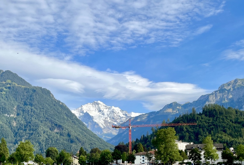
The opportunity to try the route again came just a year later. Interlaken is a few hours by train from Chamonix, and I decided Hardergrat would be an excellent way to end the trip this year. There were 3 factors that caused my DNF in 2022: 1) Starting too late in the morning. The route is quite literally on the crest of a very tenuous ridge for miles (and hours) at a time, completely exposed to the sun. The first ~8 miles and vertical mile of climbing are on steep hills and forested terrain west of the main ridge. I figured that a 3 AM start would allow me to complete the approach to the ridge entirely in the dark, when the temperature would be fairly cool. By reaching the ridge at sunrise, I’d be able to complete the bulk of the hardest terrain before 10 or 11 AM, when the heat would become a factor. 2) Not taking enough water. Because the route is on top of the ridge, there is absolutely nowhere to fill water between the hotel and the restaurant at the top of Brienzer Rothorn, 18 miles into the day. With such an early start I’d be passing the Harder Kulm restaurant, on the far west end of the route, many hours before it opened for the day. I drink a lot of water, so my plan was to take a 32 oz. bottle, 130 oz. Camel and 30 oz. soft flask, all filled to the brim, and refill at Brienzer Rothorn. Last year I took just the Camel and the flask, and in the heat of the day I wouldn’t have made it to Brienzer Rothorn before running dry. 3) Too much activity the day before. In 2022, I took the train from Zermatt to Interlaken, then went to Grindelwald and ran a short loop on the flanks of Faulhorn. This time around, my only activity would be getting from Interlaken to Chamonix. No training, an early bedtime and plenty of food would give me the best chance to get through the whole route. I would also be coming off a full week of demanding mountain running and mountaineering in France, so any rest I could get would be important. 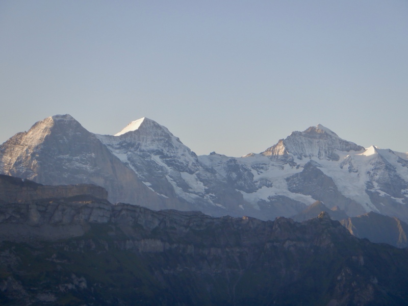
August 10: Travel to Interlaken I took a final look up at the Aiguilles and Mont Blanc as I walked through Chamonix to the train station. The train to Martigny took about 1.5 hours, stopping in Argentiere and Vallorcine along the way. The descent down to Martigny was quite steep and the wheels squealed loudly on the tracks as the train braked down the hill. I changed trains in Martigny and bought a (typically expensive) ticket to Interlaken. The train sped through the valley to Visp with mountains towering high above the whole way. The final segment from Visp to Spiez to Interlaken was rather familiar- I’ve now ridden that connection 3 times. I stayed at Hotel du Lac, just steps from the Interlaken Ost train station. It was 340 CHF for 2 nights, but the convenience specifically for Hardergrat was worth the price. I also didn’t make that reservation until the beginning of July, so my procrastination in planning probably cost me a few bucks. I had a very relaxing afternoon of editing photos, organizing my gear and checking weather forecasts for the next day. I had dinner at Ristorant Sapori: a glass of red wine, a breadstick, bruschetta and a huge pizza for 56 CHF. Expensive, but filling. I got an ice cream cone on the way back to the hotel, then went to sleep quickly. August 11: Hardergrat run. Strava: https://www.strava.com/activities/9628248881. The entire route is detailed here: https://elevation.alpsinsight.com/switzerland/hardergrat-trail-running/. I love it when mountain outings go exactly according to plan. My revised strategy after last year’s bail was perfect and it was a great idea to add this to the trip after Chamonix. This route is the most spectacular mountain run I’ve ever done and it was very satisfying to feel so great in this kind of terrain. I don’t know if I’ll run this ridge again, so I made sure to really enjoy it today. I woke up at 2:40, filled 1.5 gallons of water, ate a few bites and set off through a quiet & deserted Interlaken. The air was cool next to the river but quickly grew humid in the trees as I started up the hill. It took 75 minutes of easy hiking to reach Harder Kulm. I followed the signs and checked the map a few times to ensure I would reach the absolute western edge of the ridge. It was calm and the trail was deserted except for a few large slugs oozing along in the beam of my headlamp. I took just a few drinks of water on the way up and stopped to eat at the observation deck next to the restaurant. My legs felt great and I was quite determined to knock out the long forested traverse to Suggiture in the remaining 2 hours of darkness. 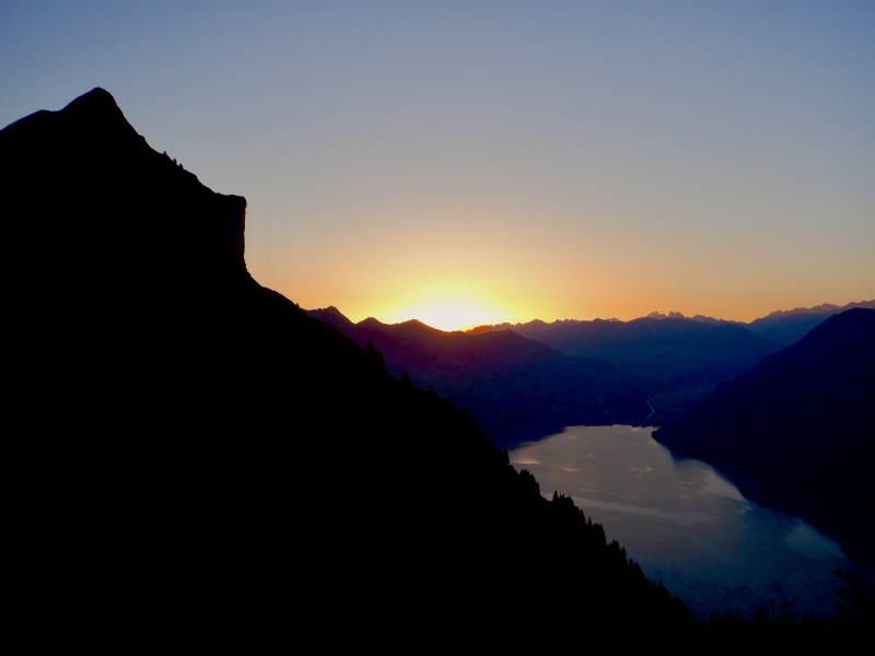
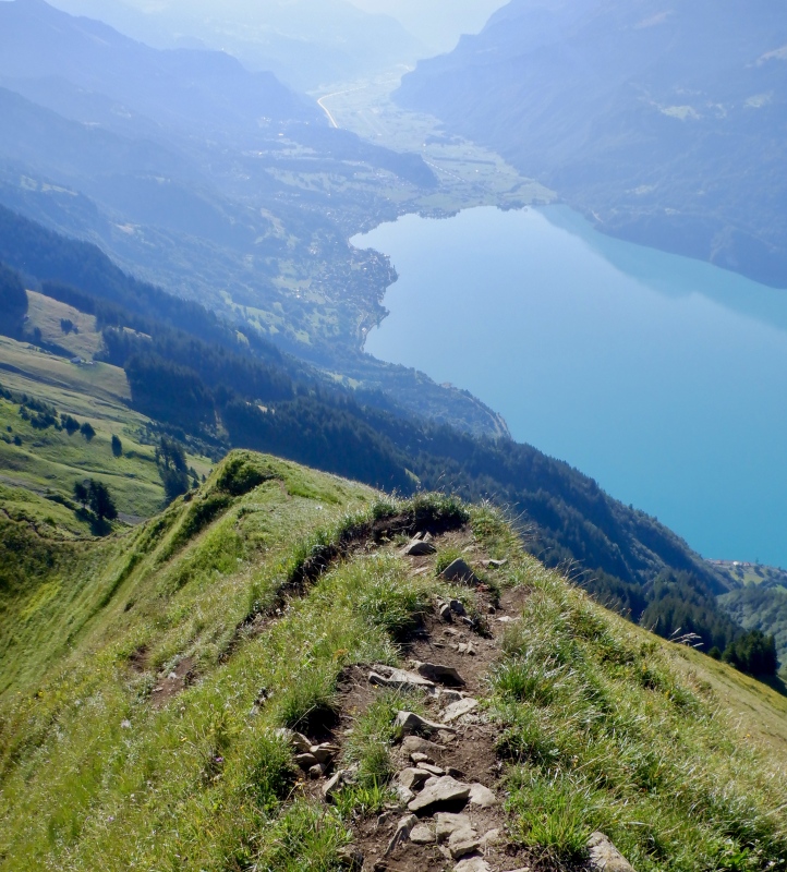
The west part of the ridge is definitely the least exciting portion of this route. I moved along steadily, focusing only on the ground lit by my headlamp. The air was cooler than the climb in the forest and I sipped water sparingly. The steep, overgrown trail was hard to run in the dark so I mostly power hiked. I could see the light at the Mitteleggi Hut to the south on the east ridge of Eiger, and occasional glimpses of the Interlaken lights below. The familiar gold Swiss trail signs indicated the bailout trails as I moved silently through the trees. The sky started getting light as I passed Hohi Egg. As the trees thinned I encountered quite a few cows, their bells clanging as they wandered across the pastures. They were quite large up close and stared at me as I went by. As I neared Suggiture I saw the barely visible silhouette of a red deer (I think), antlers standing out against the green. Before I could take a picture it bounded down the hill to the north. The final climb up Suggiture took 20 minutes. The first rays of light illuminated Brienzersee and the Eiger trio as I grunted up the first really steep trail of the day. A few people were already on the summit when I arrived, quietly speaking in German. The sun was barely over the horizon and much of the terrain south of the lake was still covered in shadows. 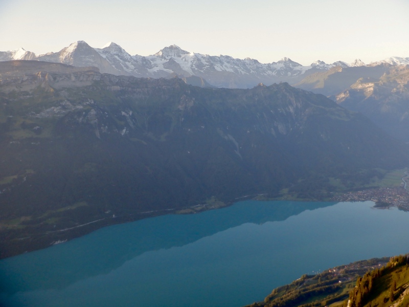
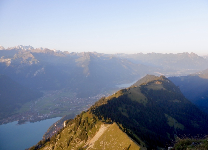
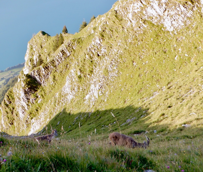
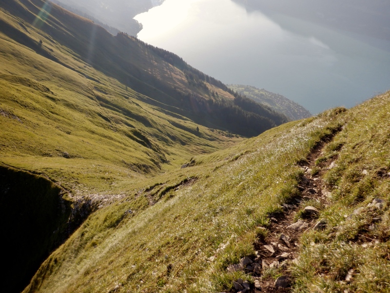
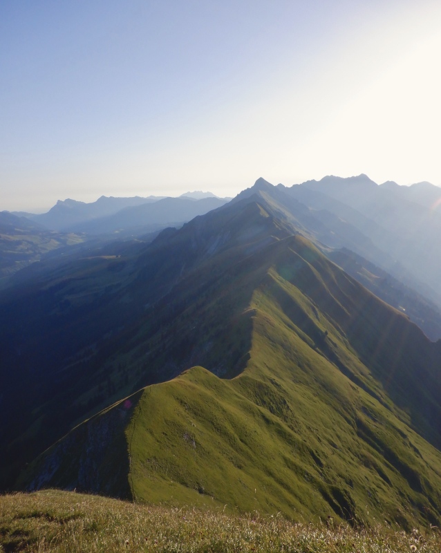
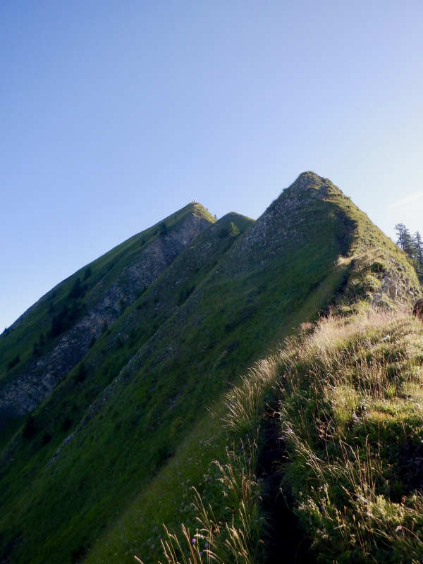
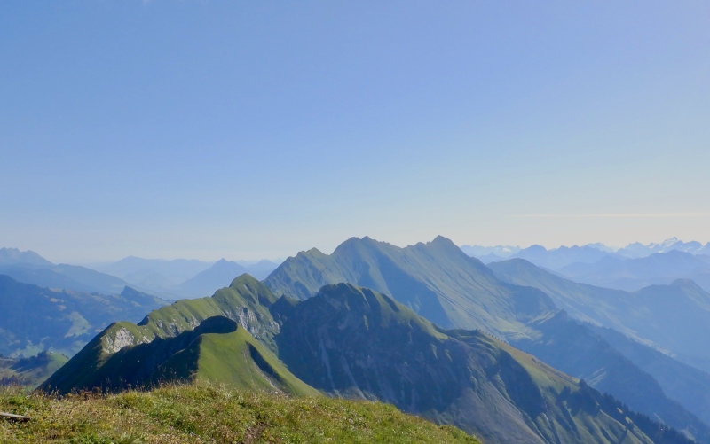
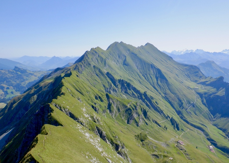
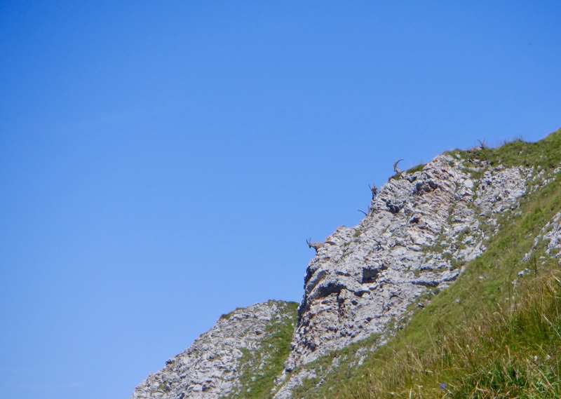
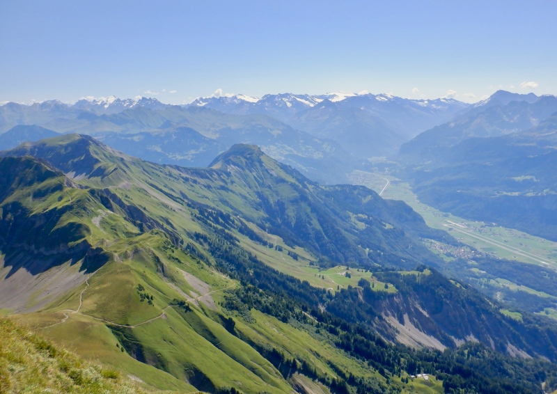
I took a break on top of Suggiture to prepare for the route ahead. The scenery in all directions was incredible and the serrated ridge ahead looked daunting. My legs felt great even with a vertical mile of climbing already done. I set off on the spectacular singletrack with the goal of being over Tannhorn in 4 hours. I ran past an ibex on the short section to Augstmatthorn. I stepped carefully on the steep descents down the far side, using the chains for support. The grass was dry, making for good footing. 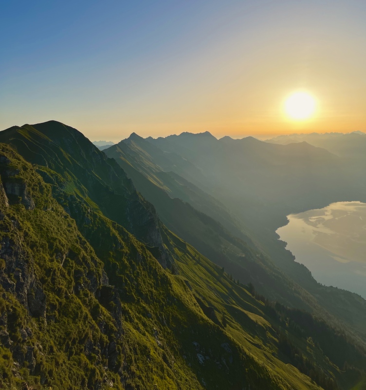
It took me 2 hours to reach Allgaulicka. I moved well, drinking sparingly and eating a few bits on the ascents. The descents down Gummwhoren and Schnierenhireli were just as steep as I remembered. There was shade on a few of the steeper climbs when the sun was behind the hill. My legs felt great and the temp was still cool. I still had plenty of water and with every step my confidence grew for completing the entire route. 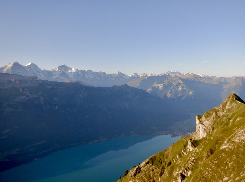
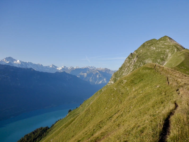
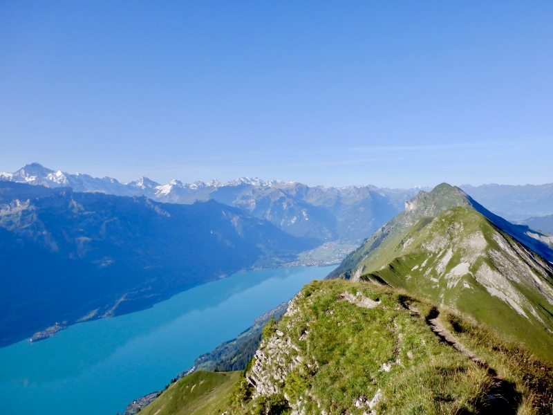
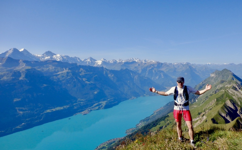
I took a break at the same spot where I bailed last year. I was on schedule and feeling great so there was no hesitation as I started up the Tannhorn climb. This was the steepest ascent of the day. The 2 rollers below the main peak were brutal calf burners and the temperature was starting to creep up. The exposure on the north side of the ridge quickly turned into significant air. After 40 minutes of hiking I reached the summit, and my max heart rate for the day. I took another break here. It was satisfying to see so much ridge behind me, and the scenery to the south was exceptional. The glaciated 4000 meter peaks towered over the turquoise & cerulean waters of Brienzersee. To the east, Brienzer Rothorn beckoned. It didn’t look too far away, but I knew I had a few thousand feet of climbing still to go. The ridge immediately below Tannhorn seemed fairly flat. I was 6.5 hours into the day but many hours remained, and I wasn’t really looking at the descent to Brunig Pass yet. 
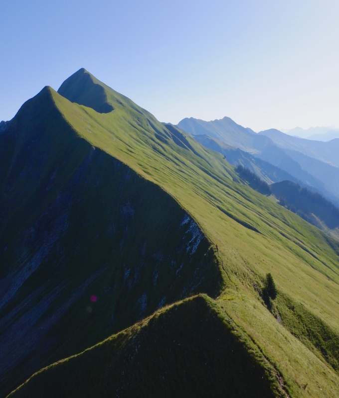
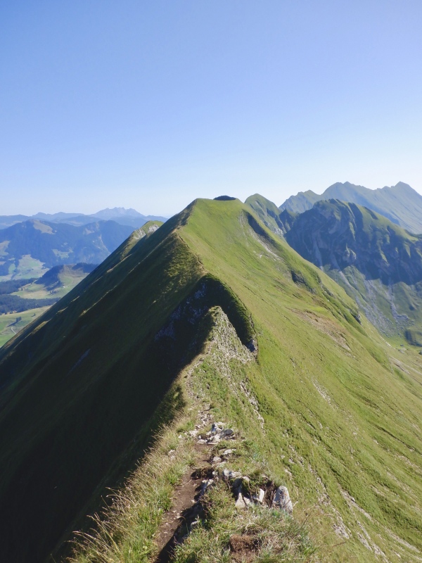
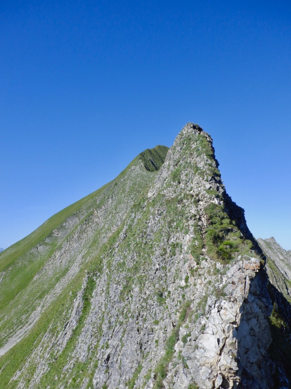
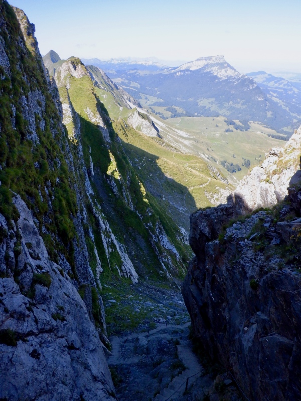
The descent off Tannhorn was by far the most exposed part of the entire route. The ridge narrowed to just the width of the trail with a few hundred feet of exposure to the north and a very steep slope to the south. I carefully walked along to the crux tower- a spike of rock with a sheer cliff on both sides. The path deviated from the crest to the south, descending 30’ of class 4 grass with big exposure. Wild stuff. I methodically climbed down, admiring the terrain while also trying to avoid falling. After the knife edge the ridge broadened and I took several pictures of the descent. Capitol should be no problem after that. 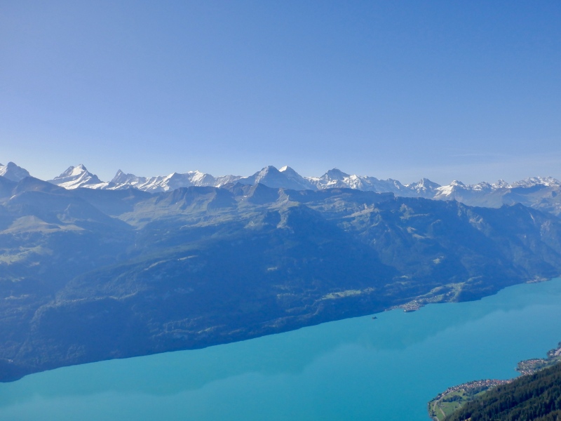
The next part of the ridge was easier than I expected. The rollers were relatively flat and for the first time all day Brienzer Rothorn looked close. The heat set in as I half-ran along the ridge to the base of the next tall serration. I thought the trail would stay on the crest but it went around the north side of the ridge. The hill provided good shade as I traverse above the farm pastures. The trail ended at a long staircase of rough concrete stairs up a gully right below the ridge. I hiked up and took a break in the shade before crossing back to the south side. 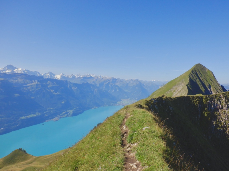
I came around the corner to see Brienzer Rothorn just ahead. The train was chugging up the hill far below. The trail didn’t go over the final 2 bumps but skirted along the face, staying almost flat on the final traverse to the train station. A herd of ibex was perched on a rock above the trail. Several people were hiking down, including a Chinese couple wearing boots and full rain gear. How the hell…..it was 80 degrees and I was pouring sweat. I hiked up the final slope and sat down at one of the picnic tables on the restaurant terrace next to the train station. I ate, drank, took pictures and allowed myself to finally think about finishing the route. 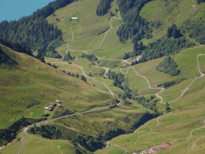
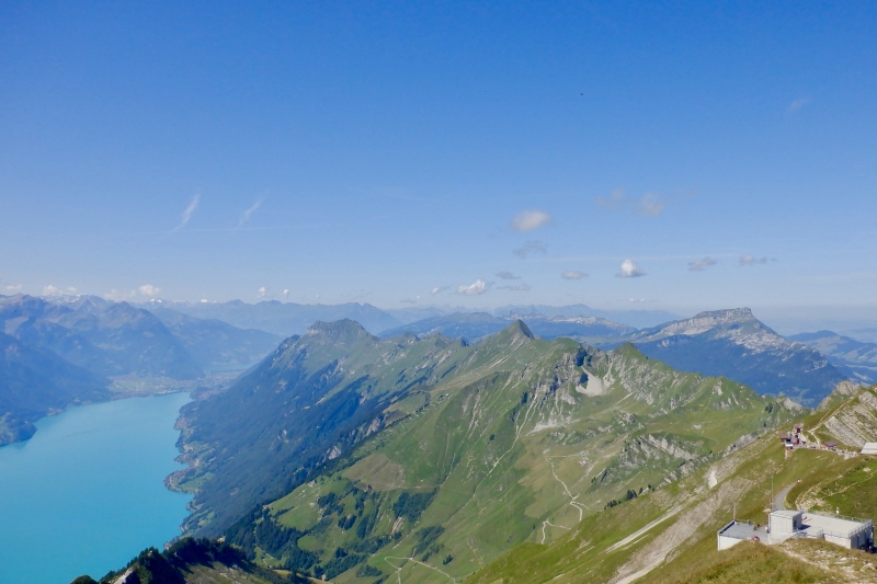
10 more minutes up the paved path brought me to the observation deck at the summit of Brienzer Rothorn. From the high point of the entire route I surveyed the incredible surroundings. The entire ridge to Suggiture stretched away to the west. The 4000 meter peaks dotted the horizon and the waters of Brienzersee glittered 6,000’ below. The remaining route was visible, and it looked to have a fair amount of climbing before truly dropping to Brunig Pass. I took pictures, ate, glugged water, changed socks and looked through the binoculars. 5 hours after arriving at Suggiture, I started descending from the ridge. 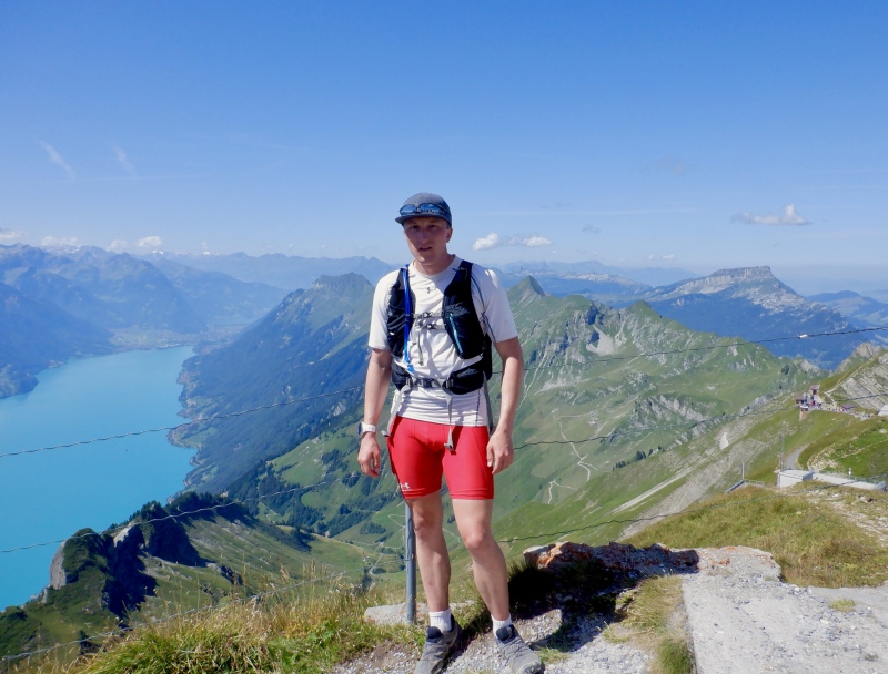
It took 20 minutes to run 1,000’ down to the col. I was then immediately met with a 600’ climb up Arnihaggen. Some of it was shaded but with over 10,000’ of climbing already done my legs weren’t thrilled to go back to a hike. It was also roasting hot. I had plenty of water but the sky was cloudless and the heat was radiating off the grass. As I came around the east side the final 2 ridge summits looked surprisingly far away. 20 more minutes of running brought me to a few benches on the col below Hoch Gumme. I didn’t take the (steep) trail to the top of this one because it looked more like a goat path, and the views to the west were just as good on the much better trail that skirted below the top. 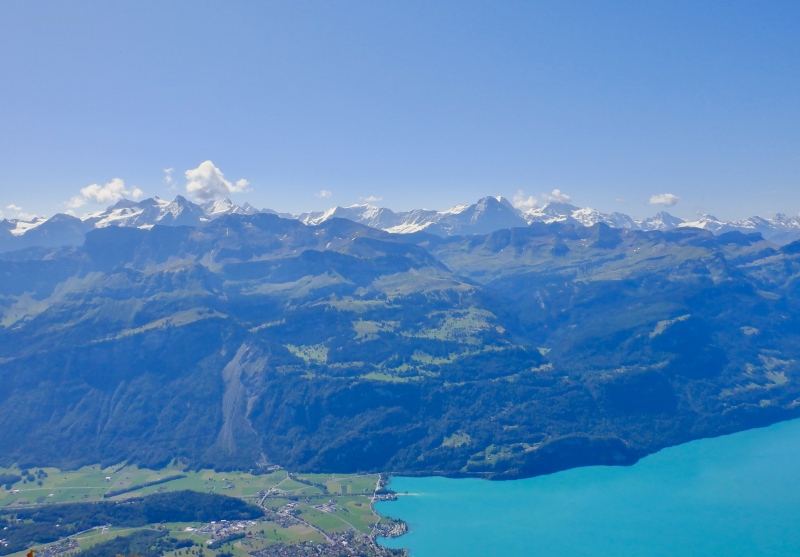
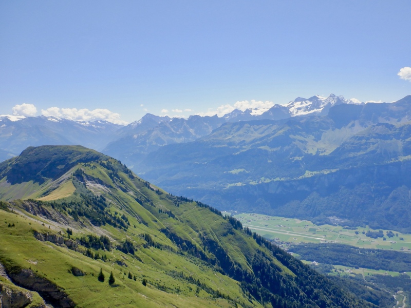
I really felt the heat on the final traverse and ascent to the broad summit of Hornli. The views to the east were interesting because I hadn’t seen over there all day, and scenery in general was still excellent. I was still eating & drinking enough but my legs were slowing down. The trail was overgrown in places and there were a lot of bugs flying around. 30 minutes after leaving Hoch Gumme I arrived on the last summit. Brienzer Rothorn was far behind me and the full length of the ridge was still visible. More serrated peaks and glaciers dotted the horizon to the southeast. Despite the difficulty of the day, I took time to scan with the binoculars and appreciate being on such incredible terrain. The Alps should never be taken for granted. 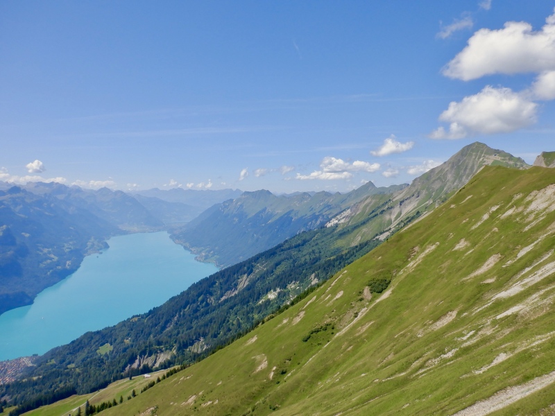
It took another hour to descend 3 miles and 3,300’ to Brunig Pass. It was all downhill, but it wasn’t easy. Nothing is easy in the Alps. The upper half of the hill was quite steep and occasionally went down sloping dirt trails. No one was on the trail with me so I suffered in silence as the sun broiled the ground. The scenery was still great, with huge views of the Faulhorn ridge and the mountains east of Grindelwald. I eventually started passing farm houses and other trails. I took a few breaks to eat, drink and slather on sunscreen. I still had enough water but I really wanted to find a water trough to dunk my head. I was pouring sweat and the heat was relentless. After running through a pasture with some cows I arrived at a trough and cooled off thoroughly in the frigid water. 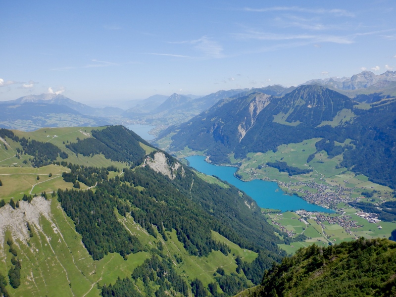
I thought of the Paulie Walnuts line from the Pine Barrens episode of the Sopranos as I descended the final mile and 700’: “I ain’t stopping until I hit cement.” The trail finally entered the forest and the shade provided some relief from the heat. I passed more houses and could hear traffic on the road ahead. The hill dropped steeply all the way to the pavement. I followed a paved path around the bend and crossed the road, running the final steps to the train station. 11 hours after leaving the hotel I was done. I sat on the ground next to the ticket kiosk, utterly destroyed but extremely satisfied. I bought a ticket back to Interlaken, ate/drank, checked the summaries on the GPS & watch and washed my hands during the 20-minute wait for the next train. I was very content to sit on the ground as I contemplated what I’d just completed. 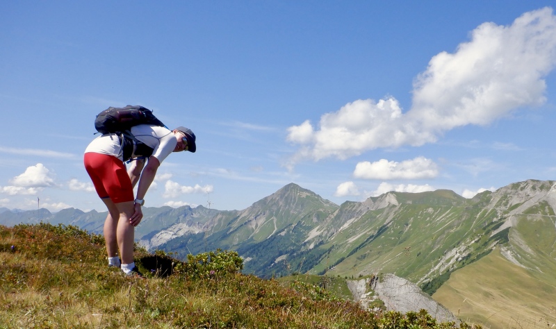
The train ride back to Interlaken took an hour. The cars were air conditioned and quite pleasant after so many hours in the heat. The train went slowly down the hill to Meiringen, then sped along next to the lake as the ridge towered above. I staggered off in Interlaken and shuffled back to the hotel. I thought about getting my swimsuit and jumping into the river at the park down the street, but decided to get in the shower instead because I was too disgusting from the run. I went to Restaurant Tenne for dinner: chocolate milk, bruschetta & penne alla’arabiata. I stared up at Hardergrat as I ate. August 12: Travel to Geneva My legs felt better than I expected this morning, but I'm still sore and generally fatigued from the last 2 weeks. It rained briefly and was still cloudy as I left the hotel. I had to wait in line with the tourist hordes to get a ticket. I slept on the ride to Bern as the rain continued. After switching trains in Bern, I selected & captioned photos from Mt. Blanc & Hardergrat and updated training documents with the trip summaries. The immensity of Lac Leman was cool to see on the final approach to Geneva. I got off the train at the airport and took a cab 2 km to the hotel (20 CHF- god it's expensive here). I took the train to the city center and got a pizza at La Cantinella, in the old town, then an ice cream cone at the Haagen Daz shop. August 13: Travel to Boulder Another long but largely uneventful travel day. I had a very quick breakfast of bacon & eggs before taking the shuttle to the airport. The first flight was delayed 45 minutes. It took 10 minutes to check the suitcase and go through security. I exchanged my remaining CHF for USD and worked on training log reports & photos on the computer. I was in an exit row with plenty of leg room and I slept for the short time in the air. The plane landed way out on the tarmac and we were bused to the main terminal. The passport exit was fast. I got a tomato-mozzarella sandwich for lunch. The long flight was completely full and was also parked very far from the building, requiring another bus ride. I had the aisle seat with plenty of leg room. I edited photos, read a New Yorker article and watched Miami Vice and some episodes of Veep & Silicon Valley. The meal was chicken with potatoes & bread, and the late snack was a granola bar and yogurt. I stayed awake for the whole flight and felt rather alert when it landed. I went right through customs & passport control but had to wait 45 minutes for the suitcase at baggage claim. I slept on the bus and walked home under gray skies. The mountains here look so small compared to the Alps. Overall this was an excellent trip, well worth the cost and worthy of the 3 years of training, planning & dreaming I put into it. I ran the classic trails in Chamonix, made a good attempt on Mont Blanc and had a spectacular day running Hardergrat. It will be a few years before I’m back in the Alps in the summer. Next year will be the APU glacier skiing camp & Mt. Hood (maybe), and 2025 will be Australia & New Zealand for the Kangaroo Hoppet & Merino Muster Worldloppet races. I’m already thinking about what I’ll climb when I’m back in Switzerland: Lagginhorn, Strahlegghorn, Weissmies and maybe some of the big mountains like Matterhorn, Eiger and Dufourspitze. The next trip to Chamonix will include, at the very least, Mont Buet, Aiguille Belvedere and, of course, a 1-day ascent of Mont Blanc. Totals for French/Swiss Alps Training Camp 40 hours 52 minutes; 81.49 miles; 40,603’ ascent, 39,176’ descent 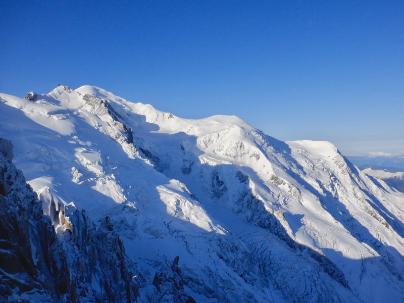
Thumbnails for uploaded photos (click to open slideshow): ")
")
")
")
")
")
")
")
")
")
")
")
")
")
")
")
")
")
")
")
")
")
")
")
")
")
")
")
")
")
")
")
")
")
")
|
| Comments or Questions |
|---|
|
|
Caution: The information contained in this report may not be accurate and should not be the only resource used in preparation for your climb. Failure to have the necessary experience, physical conditioning, supplies or equipment can result in injury or death. 14ers.com and the author(s) of this report provide no warranties, either express or implied, that the information provided is accurate or reliable. By using the information provided, you agree to indemnify and hold harmless 14ers.com and the report author(s) with respect to any claims and demands against them, including any attorney fees and expenses. Please read the 14ers.com Safety and Disclaimer pages for more information.
Please respect private property: 14ers.com supports the rights of private landowners to determine how and by whom their land will be used. In Colorado, it is your responsibility to determine if land is private and to obtain the appropriate permission before entering the property.

