| Report Type | Full |
| Peak(s) |
Jagged Mountain - 13,833 feet Pigeon Peak - 13,977 feet |
| Date Posted | 10/11/2023 |
| Date Climbed | 09/07/2023 |
| Author | Patrick Hollenbeck |
| Zig and Zag on Jiggity Jag |
|---|
|
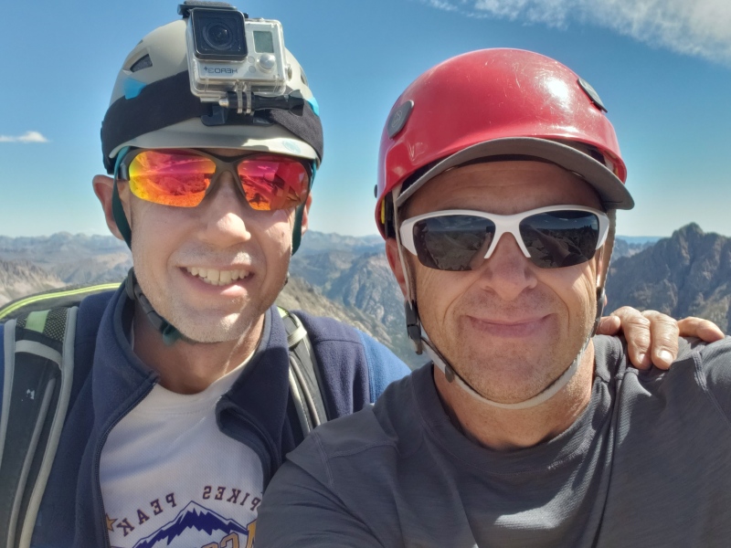
Before diving into this trip, I'd like to express my gratitude for being able to share this experience with all of you and for being able to learn from your experiences as well. That wouldn't be possible without this website and your participation! I grew up in Colorado, but I've been living in Ohio for the last 33 years. I make frequent visits to Colorado, and I typically try to climb a 14er at least once a year if possible. This website has been incredibly helpful for inspiring and planning my next adventures. Thank you Bill Middlebrook and all of you who participate! In addition to the written description, here's a link to a YouTube video of the trip. Hope you enjoy. An exciting adventure for the three of us (Patrick, Rick, and Vance)! We've known each other since high school, and we started climbing 14ers in 10th grade along with other friends in 1984. We continued climbing together until we graduated from college. I moved to Ohio while they continued living and working in Colorado. I've visited Colorado many times over the years and occasionally climbed a 14er, but unfortunately lost touch with Rick and Vance until recently. Rick and I climbed Mt. Rainier two years ago along with some other high school friends, but Vance couldn't make that trip. I hadn't seen Vance in over 30 years until this trip. They've climbed all of the 14ers and are well on their way to climbing the top 100 highest peaks in Colorado. I've climbed most of the Colorado 14ers and some 13ers, but nothing in the San Juan range. So, I was delighted to join these guys on this trip! 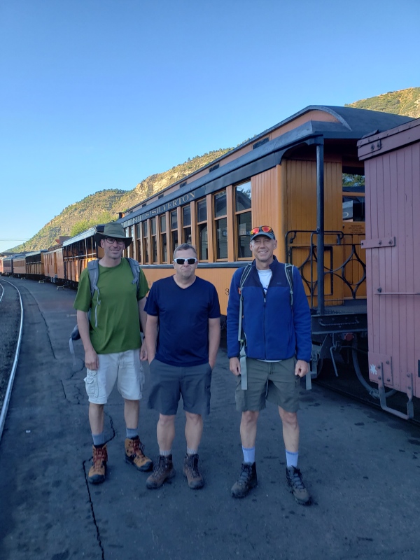
The original plan was to climb Jagged, Pigeon, Turret, and Jupiter peaks. We managed two out of four. So, here's a recap of what went right and what went wrong. Day 1: Boarded the Durango Silverton N.G. train on the morning of Tuesday September 5th at about 8am and got dropped off at Needleton at about 10:45am. While expensive, I really enjoyed the ride and would love to do it again. There were about 10 others that got dropped off. They all went south and headed for Chicago Basin, while the three of us headed north toward "Noname" Creek. Started on the trail heading North up the Animas River, but quickly got on the wrong trail without realizing it. While we were still going North, it wasn't long before we were also gaining a lot of elevation. Even after realizing that we were not on our planned route, we continued because it seemed to be going in the right direction over the infamous Water Tank Hill. 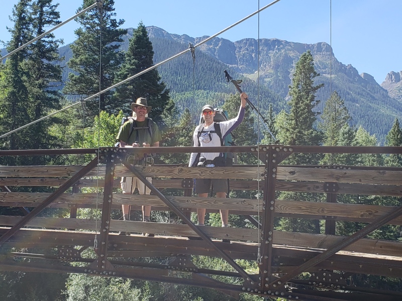
Instead of then descending after what we thought was the top of Water Tank Hill, the trail continued to climb and traverse the mountainside. It wasn't a nice flat trail and involved side hill stepping the entire way. This was very difficult and tiresome with a 60lb pack. Regardless, we continued because it was still heading North. After continuing like this for well over an hour, we came to a very rocky and exposed section of the "trail". A fall from here would have been potentially fatal, so I scouted ahead without my pack and crossed this section with great caution. I didn't find a continuation of the "trail". After a brief discussion, we wisely decided to back track to what we thought was the top of Water Tank Hill and bushwacked our way down to the correct trail. This mistake in proper route finding cost us at least two hours and a lot of energy. 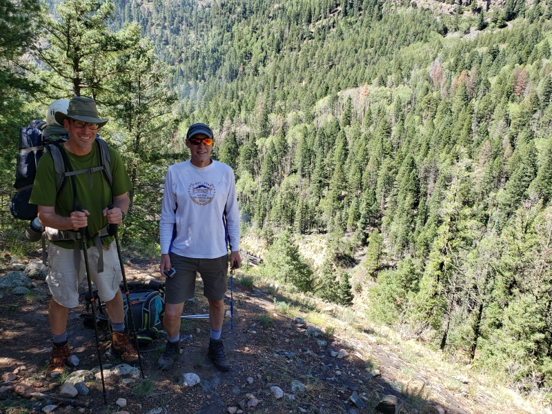
Even after getting back to the proper trail, things were not easy. The trail up the Animas River was very overgrown and difficult to follow. Fortunately, we found the Noname Creek trail turnoff without too much difficulty. However, this trail was even more difficult to follow. Very steep at times with lots of down timber and brush to fight through, we made very slow progress. Our goal was to make it past Jagged Cabin before setting up camp, but we got nowhere near it that first day. 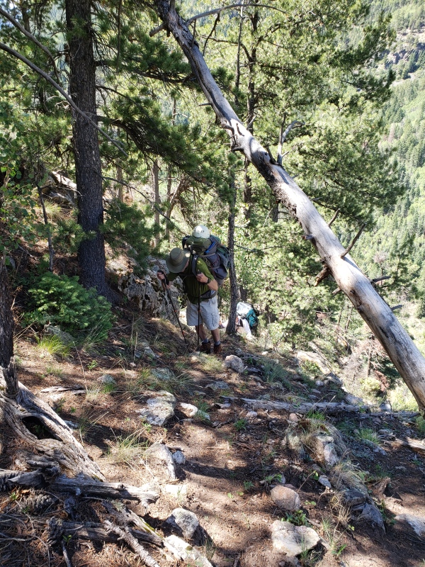
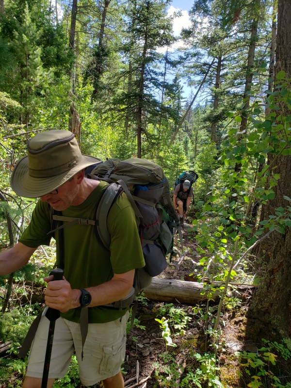 Even the easier sections of the trail involved constant stepping over or crawling under downed trees. 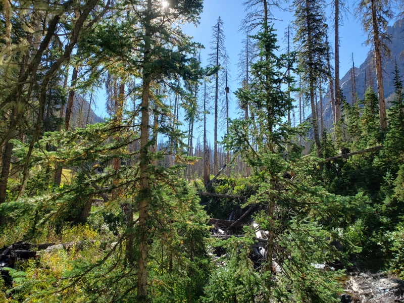
We continued the best we could and fortunately found a great camping spot near water just before dark. Unfortunately, we were nowhere near our intended stopping point. 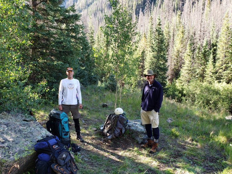
Day 2: We got a leisurely start to the day and continued up Noname Creek. After a few hours of difficult trail finding and bushwacking (our legs were a bloody mess after two days of this!), we reached our next camping spot late in the morning at about 10,800ft. While we had perfect weather, we decided against an attempt on Jagged. I'm sure we could have done it, but the late start would likely have us descending difficult terrain in the dark. Why risk it? So, Rick and I decided to make a half-hearted attempt on Pigeon Peak from our current location. We knew there wasn't much chance of making this happen in a safe and timely manner, so it ended up being more of a scouting trip to reach Noname-Ruby Pass. This also involved a lot of bushwacking, and Rick took a nasty willow-whip to the eye. Fortunately, it wasn't a direct hit. We turned back well before reaching the pass so that we could get back to camp at a decent hour and prepare for Jagged the following day. 
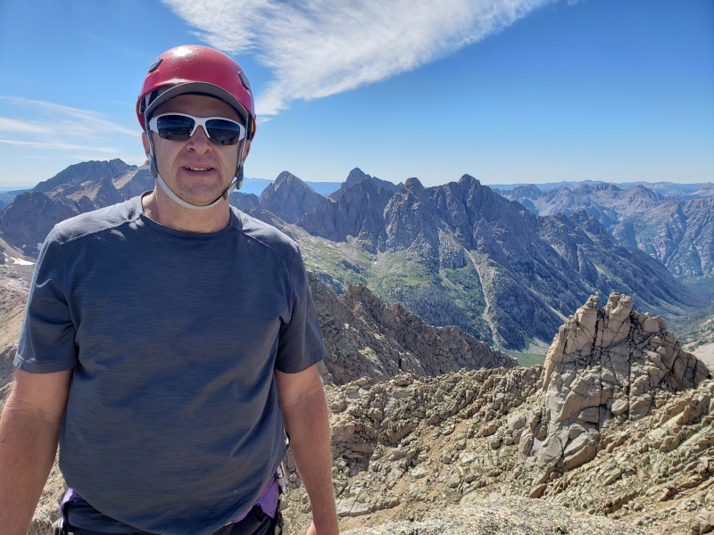
Day 3: Jagged Mountain We got a good start on Day 3, left our frosty camp shortly before sunrise, and continued up Noname Creek heading for Jagged Pass. Vance wasn't feeling well, and wisely decided to turn back long before reaching the pass. Rick and I continued and made good progress. 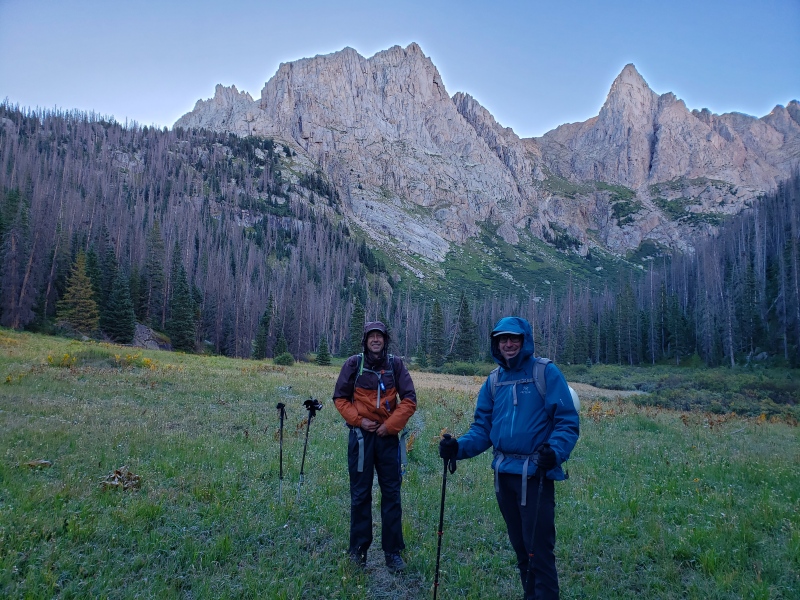
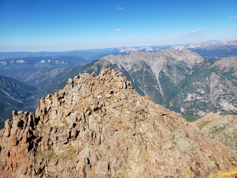
The traverse from the pass to the base of Jagged went smoothly over mostly grassy slopes. Then, the fun began! The easiest route up Jagged is complicated and not easy to see from the base of the mountain. Unfortunately, we didn't get started in the proper spot and quickly found ourselves in very difficult class 5 terrain. We wisely decided to downclimb and search for the proper start, which was much closer to the snow-filled gully. After that, things went really well. 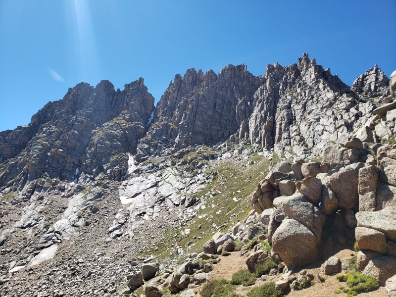
I'm comfortable leading most 5.7 rock climbs and some 5.8s. Exposure doesn't bother me much, and I seem to have a higher risk tolerance than most people. Rick's comfort with risk and skills on rock are about the same. Our fitness was also well matched on this trip, and we made a good team. While we had a rope and protection, we opted not to use them on our ascent with one exception. We used the rope to pull our packs up a chimney near the summit. 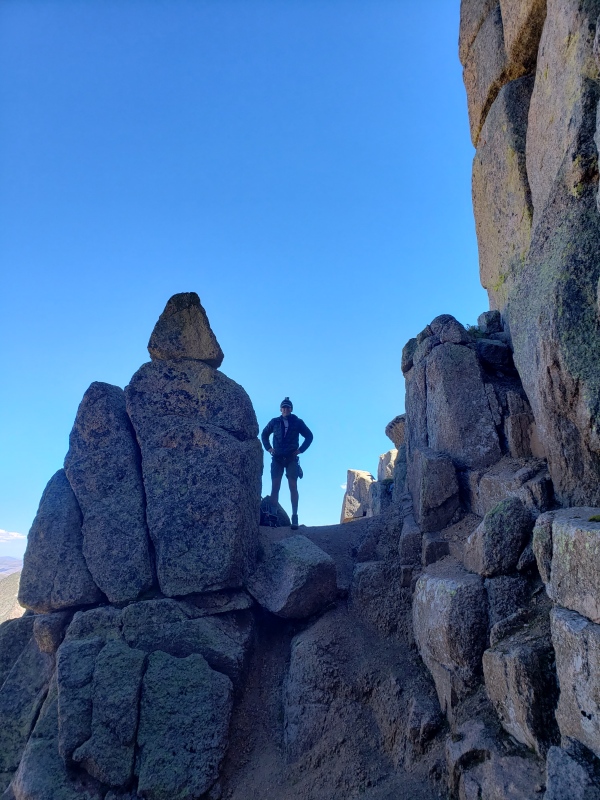
I was expecting the climbing to be more difficult than it was, and it didn't feel as exposed as I expected either. Regardless, I'm happy that we had the rope and protection with us. We had perfect weather and dry route conditions. As long as we stayed on route, things were easy. As I mentioned earlier, this is a VERY complicated route. It would have been all too easy to get off route and wander into difficult class 5 terrain. Fortunately, Rick did his homework and did a great job keeping us on route. 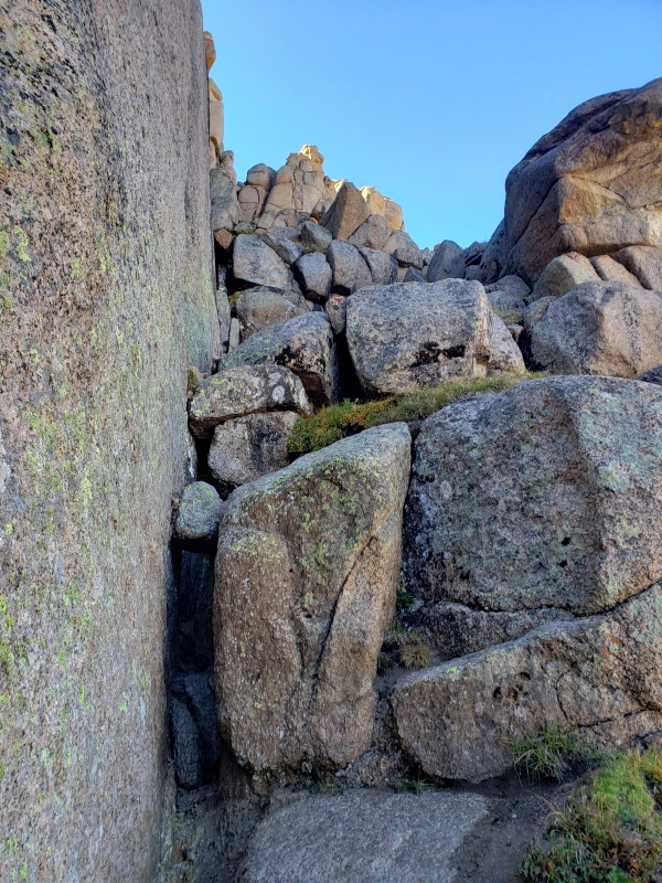
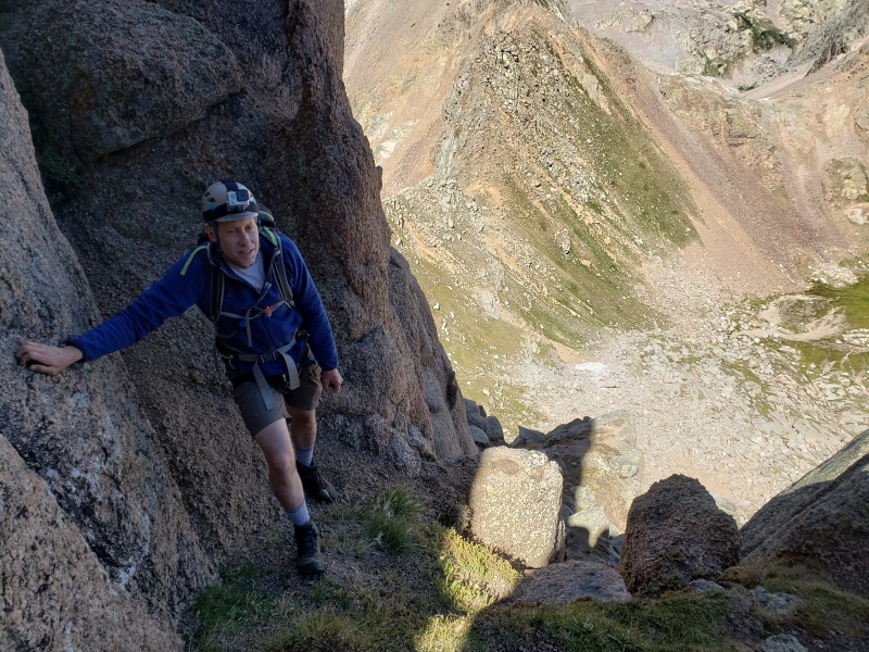
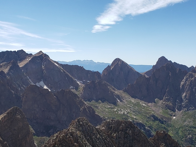
After reaching the saddle, the rest of the climbing is on the south side of the mountain. We traversed across the "Ledges of Doom" (as Rick likes to call them). Some may find this traverse intimidating since there's a bit of exposure through this section. Dry conditions make things much easier and safer. 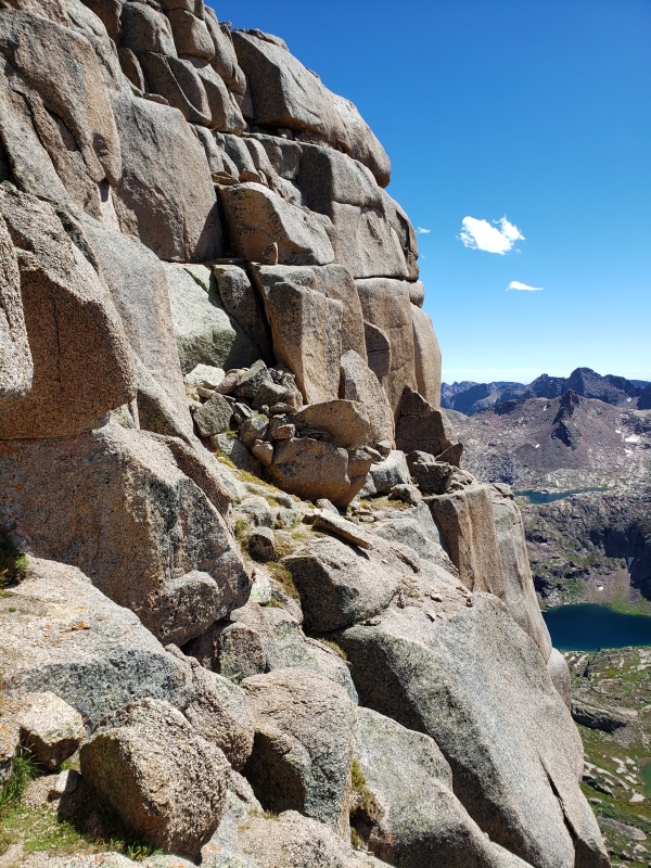

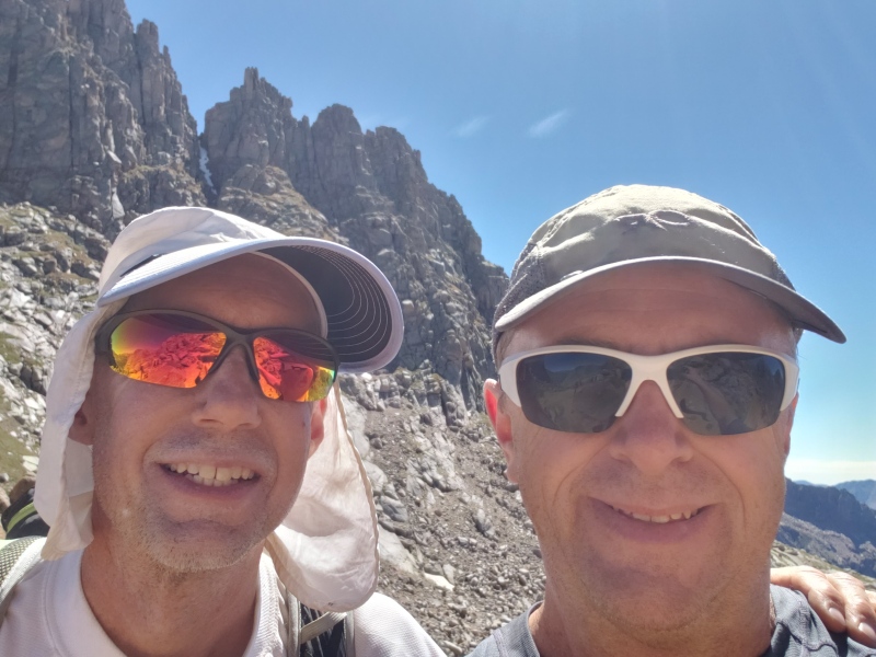
I was pleasantly surprised to find cell phone reception on the summit. It was nice to catchup with family and friends back home and send them a few pictures of the trip thus far. 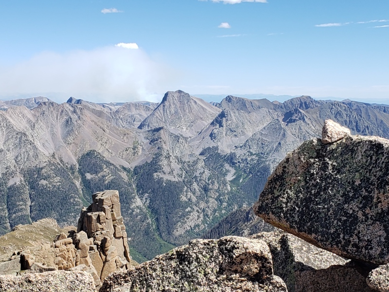
The descent was uneventful, and we simply followed the same route that we ascended. We did three short rappels and carefully downclimbed many steep and gravely sections. Reached camp at about 7pm. All in all, about a 12 hour round trip from our camp to summit and back. 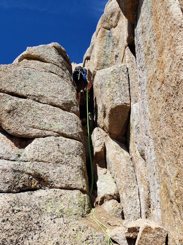
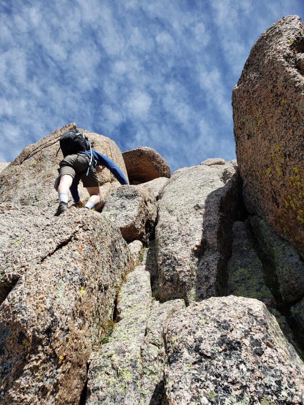
That evening, the three of us discussed our options for the following day. One option was to attempt Pigeon Peak from our current location. This would involve a steep and difficult route up and over a pass, downclimb and traverse between Pigeon and Turret Peaks, make the ascent of Pigeon and possibly Turret, and then reverse the route back to camp. This no longer seemed a realistic or safe plan given how slow we were on Day one. In addition, we weren't sure that we could descend from our current position all the way to the Needleton train pickup on Day 5 in time to make the 3pm train. We discussed several other options as well but ultimately decided to descend Noname Creek the following day. If possible, our goal was to get in the vicinity of Needleton on Day 4 in order to attempt Pigeon Peak on Day 5. Day 4 was a long day of descending Noname Creek and the Animas River valley, and we managed to reach the Needleton area just before dark. Going downhill and better knowledge of the route sped up the hike. Getting up and over Water Tank Hill on the proper trail was everything as described by Gery Roach in his 13er book. The ascent up the hill when traveling from North to South is on a "trail" (Class 2+ according to Roach) that seemed almost vertical at times! Fortunately, the route was dry. Ascending or descending this in wet conditions would have made it much more difficult and dangerous. I've read other older guidebooks that described a fixed rope in this section. We didn't see one. After reaching the Needleton area, we set up camp, had dinner, and made plans for our attempt of Pigeon Peak. From our current position, the climb would require about 5,760 ft elevation gain and 7 miles round trip. Adding Turret Peak to the itinerary didn't seem realistic. We budgeted 12 hours for the round trip and further descent to the train pickup at 3pm. Unfortunately, Vance still wasn't feeling well and planned to stay at camp while Rick and I climbed. Day 5: Rick and I left camp at 3am. We followed the "North Pigeon Creek" approach described in Gerry Roach's 13er book as best we could. This creek is named "Tie Creek" on some maps. We ascended a very steep trail for a short while and then bushwacked in the dark up steep terrain until reaching treeline, which was much flatter. We then skirted the willows to the right and eventually curved our way to the left and below Pigeon Peak. The route we took ascended a very steep grassy slope while dodging rocky slabs. Eventually we zig zagged our way through the upper section of the peak on a well cairned route that never exceeded class 3 in my opinion. This upper section was a system of ledges covered with very loose gravel. Exposure was minimal in my opinion. 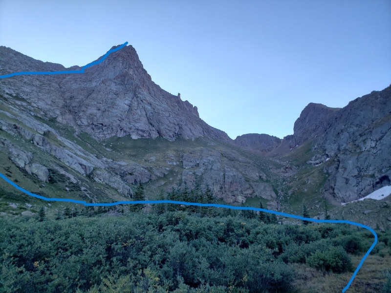
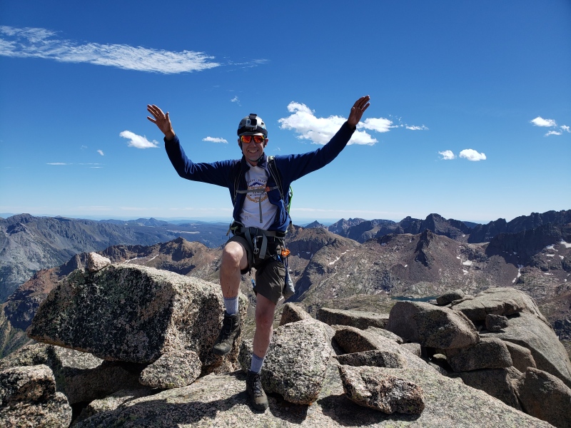
We had set a hard turnaround time of 10am. So close to the summit at that time, we pressed on and reached the top at 10:30am. Gorgeous views and a spectacular day! Unfortunately, we only spent 10 minutes on the top. Gotta catch the 3pm train! 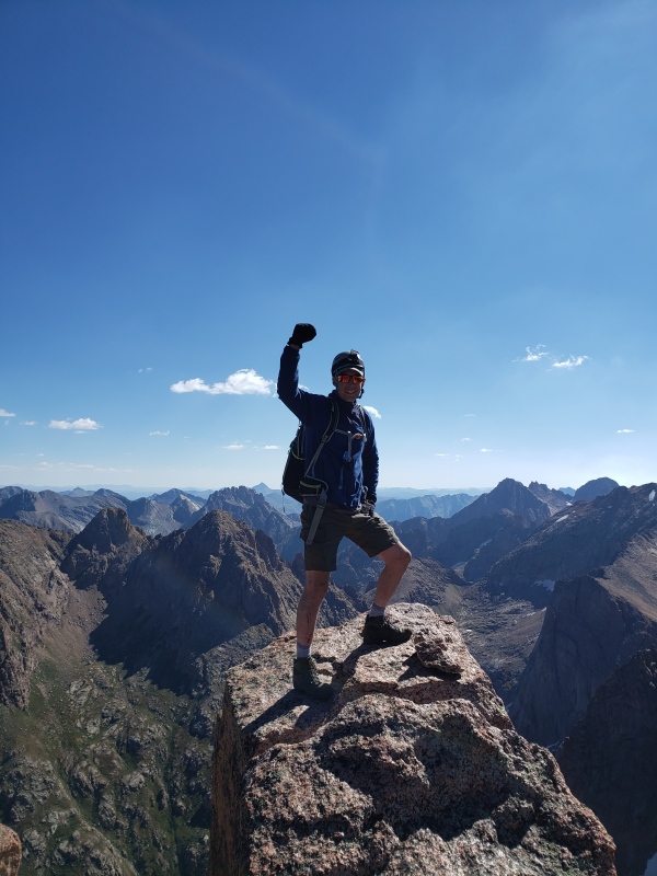
We descended as quickly as we safely could, reached our camp at about 2:40pm, grabbed our heavy packs, and then hustled to the Needleton Train pickup with 10 minutes to spare! 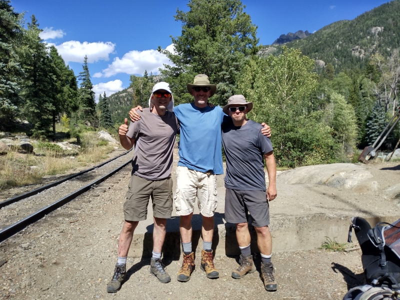
Things done right: We spent several months planning the trip. This included reading various route descriptions, trip reports, studying maps, downloading GPS tracks, etc. Our itinerary was very ambitious but also within our experience level and capabilities. Early September in Colorado typically has excellent weather, and it turned out to be perfect on this trip. We carefully considered and chose proper equipment needed for a variety of weather and climbing conditions. All of the equipment, clothing, food, etc., was familiar to us with years of field testing on previous trips. During the trip, we stayed within our limits and remained flexible when plans had to change. Communiation was open and honest. We didn't hesitate to question each other when one of us thought we were off route. We turned back when necessary instead of foolishly pressing onward (most of the time). I had with me a Garmin InReach for emergency communication if needed. It was also fun to enable family and friends the opportunity to track our progress. I got in better shape for this trip than I have in the past, and it helped immensely. I started running about 20 miles a week (mostly on trails) and lift weights about 3 times a week. This all began many months before the trip. Things done wrong: We got off route at the very start. Too much excitement and distractions while talking with each other, it was all too easy to miss a critical junction and get on the wrong path. Ultimately, I believe that this mistake cost us at least one summit. There were a few times that we got separated from each other, sometimes on purpose and sometimes inadvertently. Fortunately, this didn't result in any bad outcomes, but it easily could have given the difficulties we experienced staying on trail. As mentioned earlier, our initial goal was to climb 4 summits (a very ambitious goal given the time constraints. Extending the trip an extra day would have allowed us to achieve our goal. Hope you enjoyed the report! Post any questions in the comment section. Thumbnails for uploaded photos (click to open slideshow): ")
")
")
")
")
")
")
")
")
")
")
")
")
")
")
")
")
")
")
")
")
")
")
")
")
")
")
")
")
")
|
| Comments or Questions | |||
|---|---|---|---|
|
Caution: The information contained in this report may not be accurate and should not be the only resource used in preparation for your climb. Failure to have the necessary experience, physical conditioning, supplies or equipment can result in injury or death. 14ers.com and the author(s) of this report provide no warranties, either express or implied, that the information provided is accurate or reliable. By using the information provided, you agree to indemnify and hold harmless 14ers.com and the report author(s) with respect to any claims and demands against them, including any attorney fees and expenses. Please read the 14ers.com Safety and Disclaimer pages for more information.
Please respect private property: 14ers.com supports the rights of private landowners to determine how and by whom their land will be used. In Colorado, it is your responsibility to determine if land is private and to obtain the appropriate permission before entering the property.


