| Report Type | Full |
| Peak(s) |
Fowler Peak - 13,507 feet Unnamed 13575 - 13,575 feet |
| Date Posted | 09/27/2023 |
| Modified | 09/28/2023 |
| Date Climbed | 09/23/2023 |
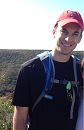
| Author | Tim A |
| Missing the Bus on Fowler |
|---|
|
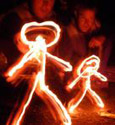
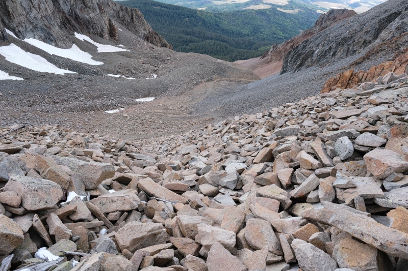
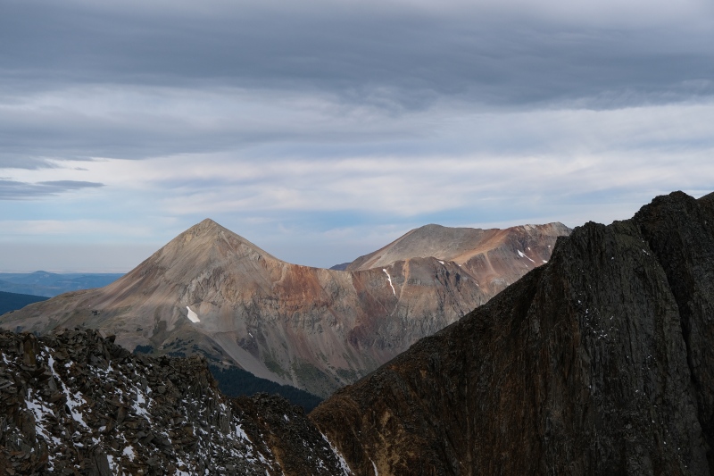
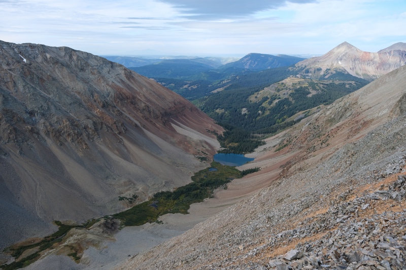
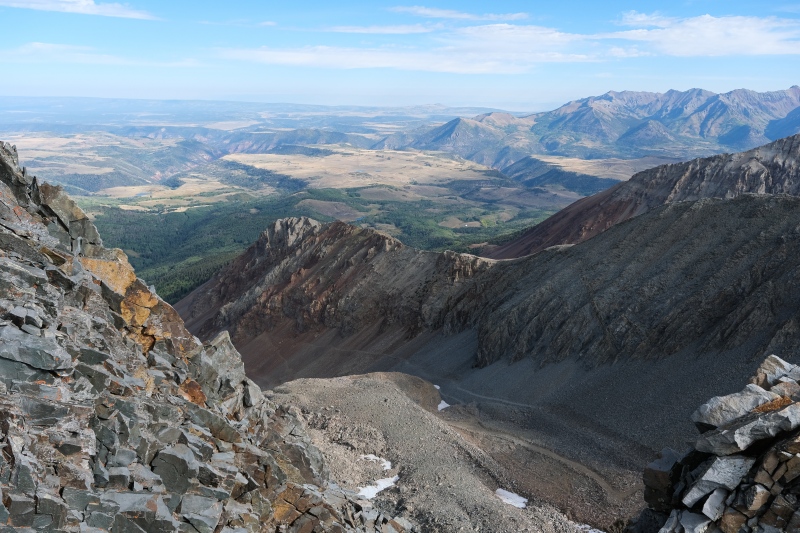
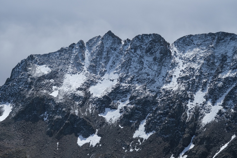
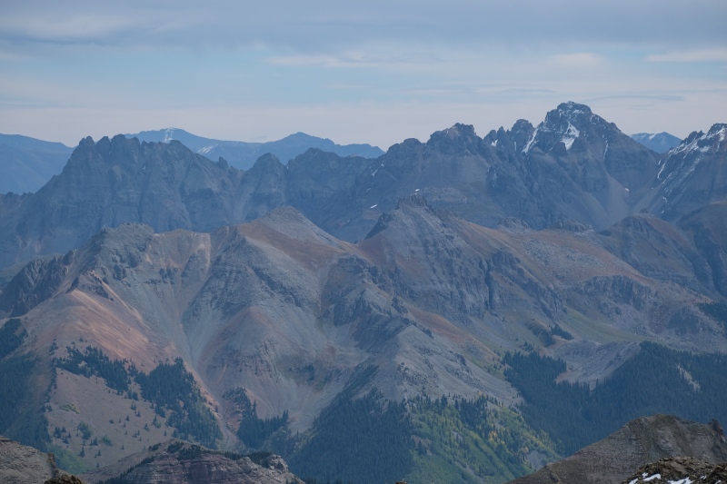
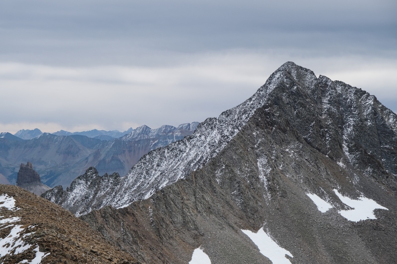
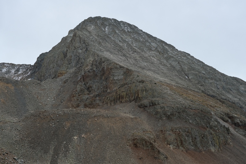
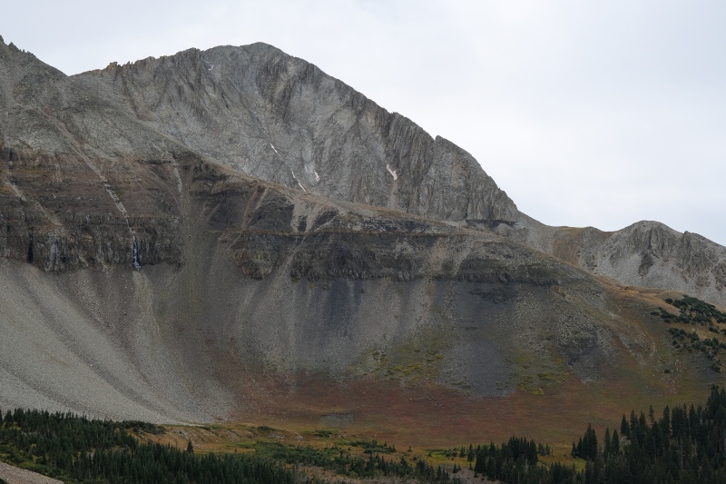
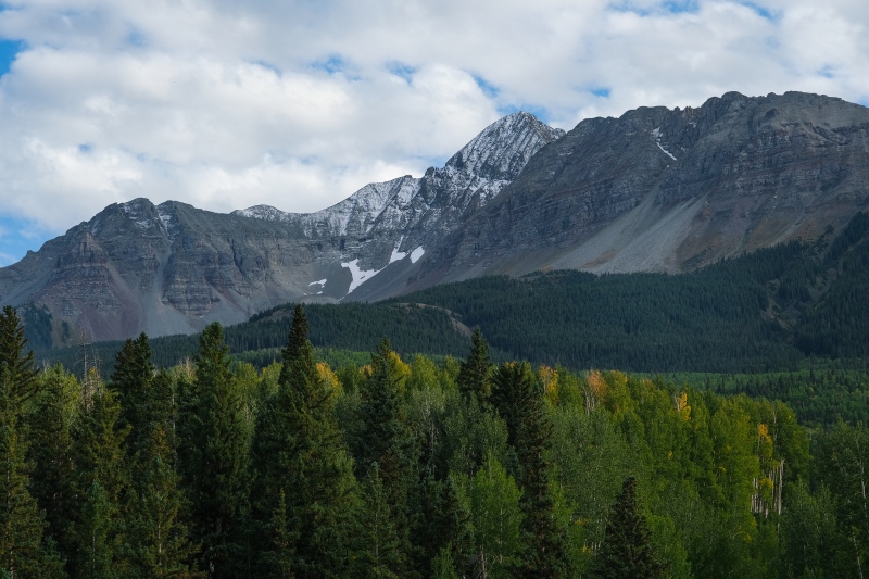
When scrolling around the map on this site with embedded 13ers, my eye is always drawn to smaller groups of peaks that lie by themselves, so naturally, the Wilson group of the San Miguels draws one's attention given it sits so far removed to the west. I live in West Texas and have limited opportunities to drive out to Colorado for outdoor recreation, so I choose particular peaks to go after based on either aesthetics of the route or the summit views. In the case of Fowler, I chose this group of peaks specifically because the approach goes up through "School Bus Basin" and I really wanted to do some photography of a Chris McCandless-style bus sitting high up in the mountains. I would be profoundly disappointed. I was surprised when camping in one of the sites below the Rock of Ages TH that even on a Friday night before the first official day of Fall, not a single car drove up the road past me to the trailhead. Even with the lingering snow on Wilson's north face, I thought at least a few climbers would give it a go this weekend, but I enjoyed a very quiet evening with nobody driving past until after I'd drifted off to sleep. I woke up around 430am to a car driving past, and that roused me enough that I got moving and drove up the last mile to the trailhead to find a few cars there who had quietly driven up in the night. By 515am I was on the trail and I initially jumped on the Elk Creek cutoff after a short hike up ROA. This would waste half an hour while I tried finding mining roads or just open slopes up into School Bus Basin. In the dark I kept encountering cliffs or steep loose dinner plate talus. I was working off the few TRs on this site for Fowler which mentioned that both a mining road and just generally drifting up the basin both go, but I couldn't figure it out in the dark. After building some character for a bit looking for the dotted-line roads on my USGS quad-sheet maps on the Garmin app which didn't seem to exist, I opted to backtrack and walk further up the ROA trail to try linking up with a different mining road that cuts high across the east end of SBB. I made it to this point as the dawn arrived through some thick overcast and was glad to see an obvious old mining road with a very gentle grade. It is easily followed all the way up to 12,600,' where I looked expectantly around for the old school bus. The views walking up this road aren't particularly memorable. Apart from Fowler's northeast face and the towers of teetering San Miguel Rock on the north ridge of UN13540B, there's not much to look at on this road walk, but I knew all this from looking at previous TRs and it would all be excusable once I found the bus. I was surprised to see a hiker keeping about a half-hour to an hour ahead of me on the mining road as I didn't think I'd see a soul after dropping off the ROA trail to Wilson. It turned out to be KFergie, who I never bumped into but saw on the summit register a few hours later. 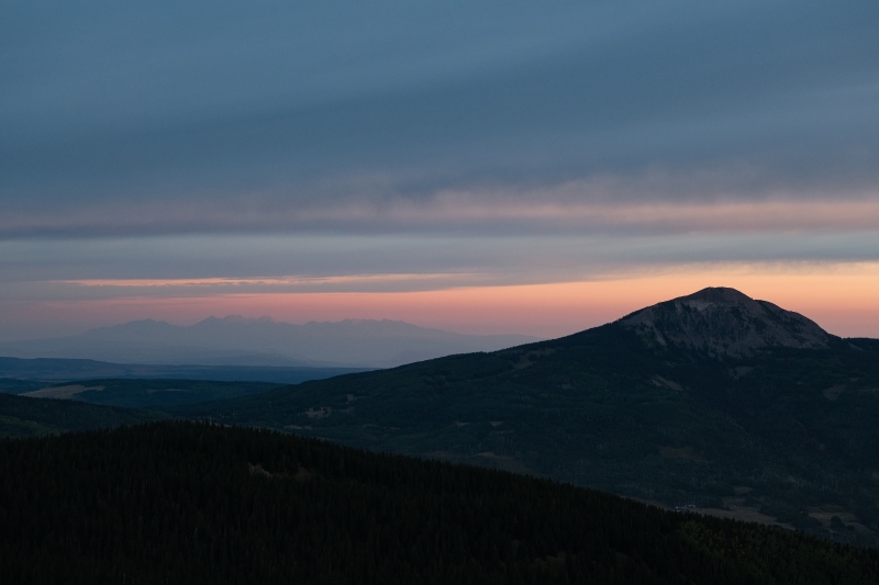
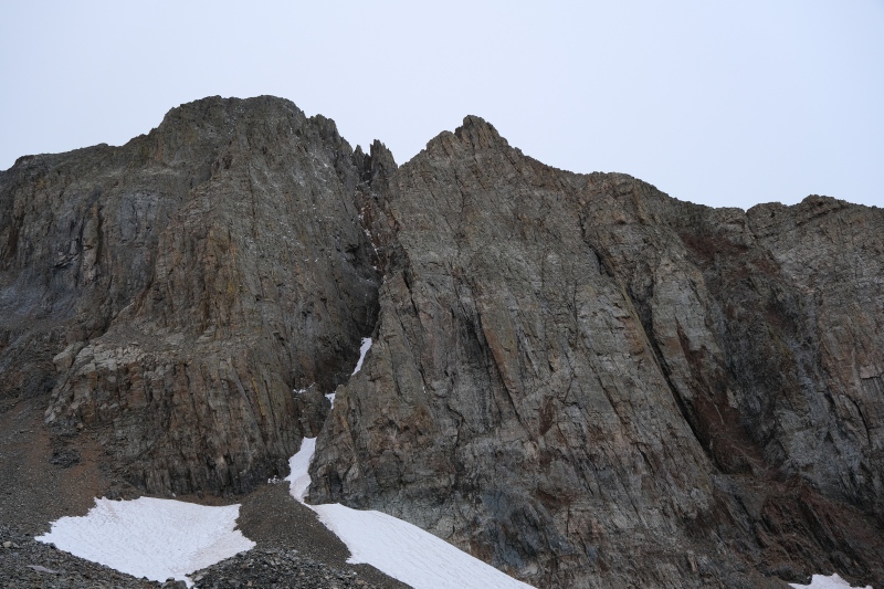
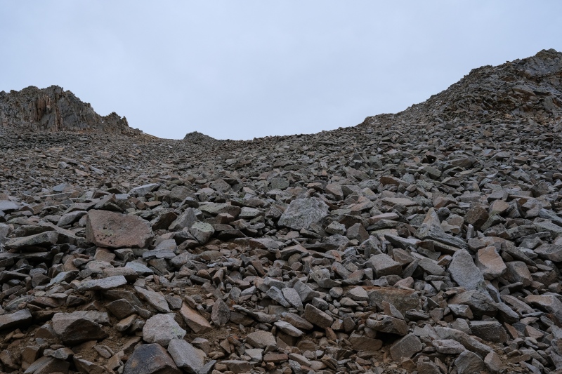
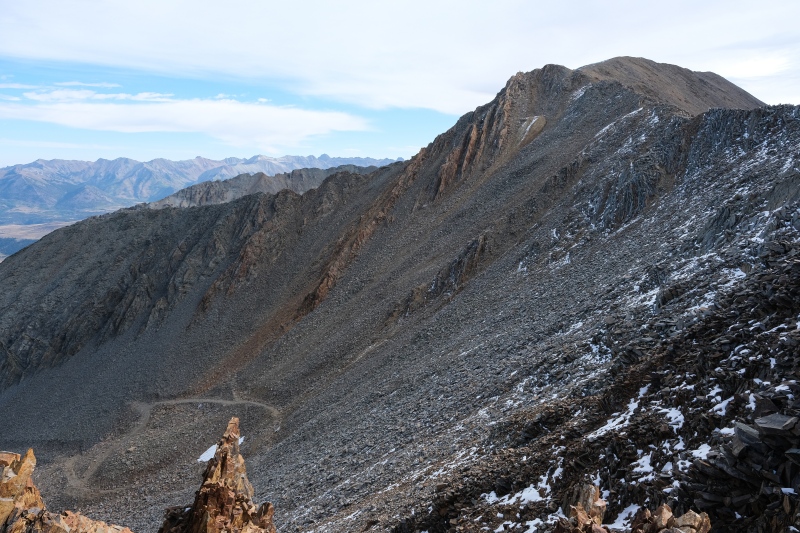
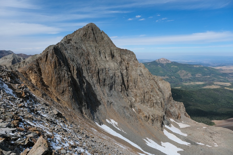
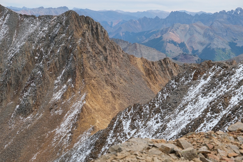
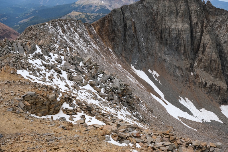
Once at 12,600' when the road runs out after a final switchback, I had to accept that the bus was gone. In hindsight, I hadn't really read all the available reports on this site detailing that the bus has been gone since 2014. If I'd known that, I probably would have hiked something else this particular weekend. I sat down at the top of the basin and had a snack while thinking of clever ways one can turn "the mountain will always be there" saying around with respect to missing the bus and came up with the title on this TR that caused you to click on it. From this point, WW's TR identifying the best place to ascend to the ridgeline between these two peaks came in very handy and I ascended the loose class 2 slopes of talus near the southeast "corner" of the basin. The rock here was loose but not horribly so. Because of some lingering snow I took a somewhat circuitous route pretty high up beyond the lower point of the saddle before landing on the ridge. From here, the unnamed 13er is close, but I wanted to deal with Fowler and it's class 4 summit pitch first. 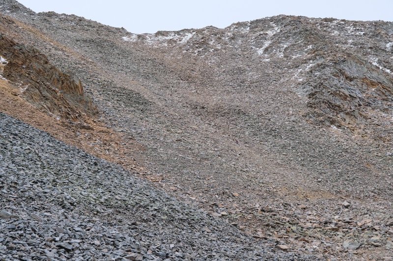
While ascending this slope I got some great pictures of KFergie silhouetted on the ridge and just cruising up Fowler. Here's a few. 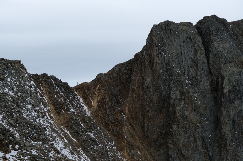
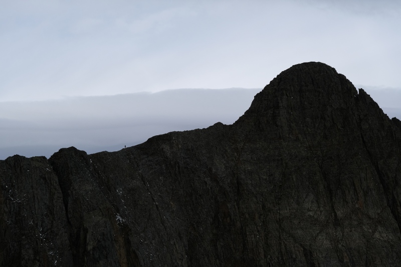
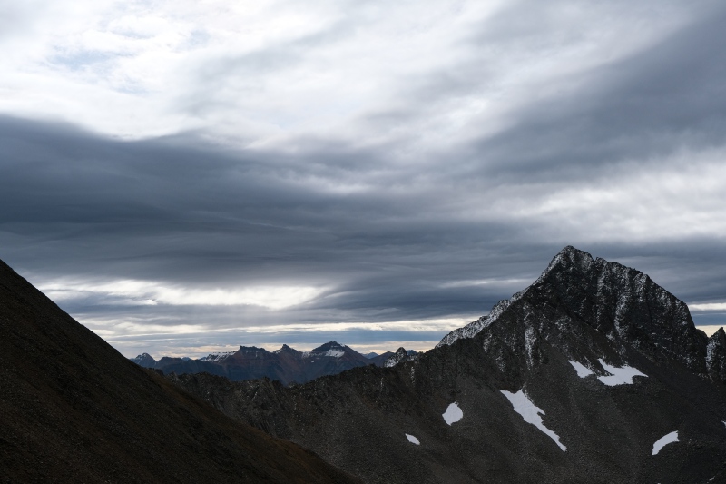
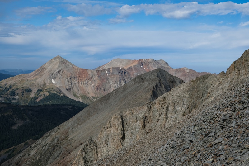
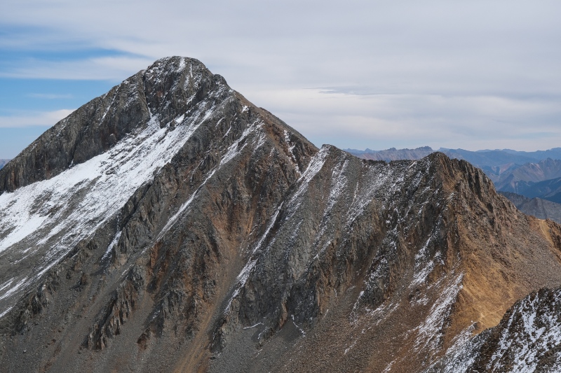
The walk over to Fowler goes quickly for most, but I paused often to take pictures as slivers of sunlight pierced the gray sky to illuminate different peaks around me. 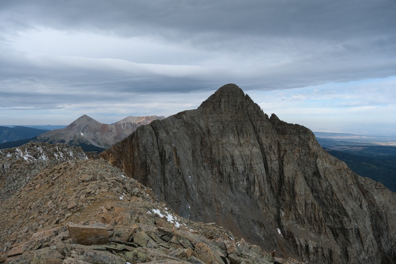
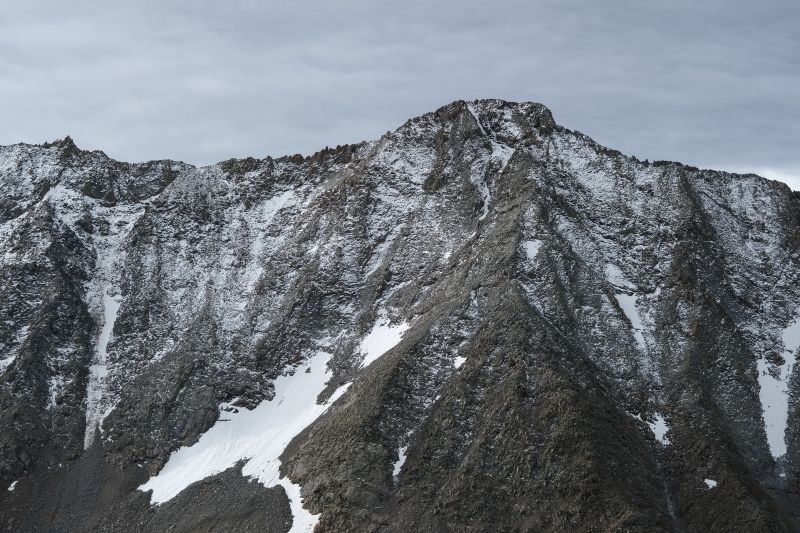
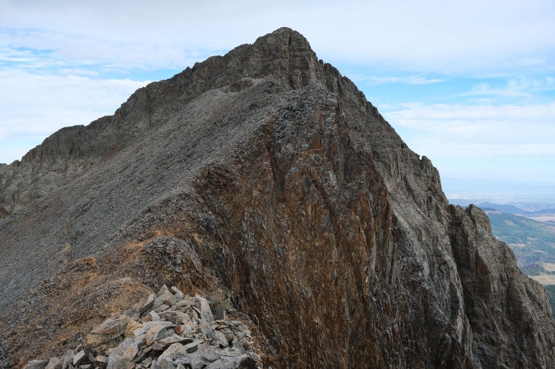
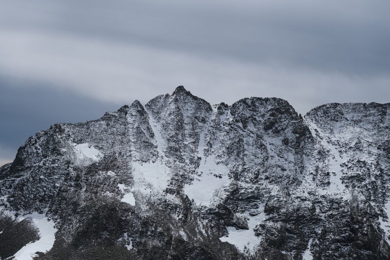
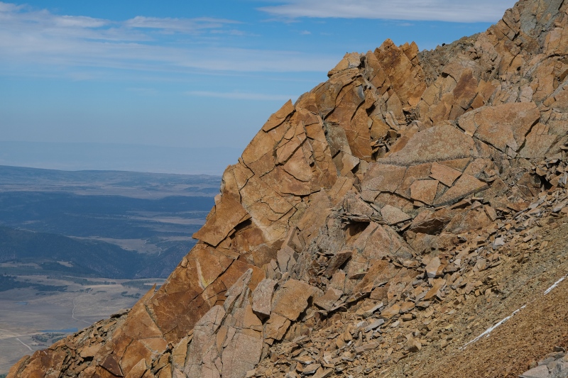
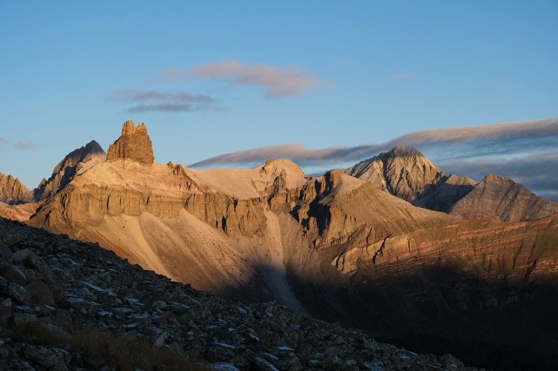
I've done some scrambling before on loose choss, in particular in the Cascades and the Livingston Range in Northern Montana. Until this outing in the San Miguel's, I thought the glacially-pulverized volcanic choss of those mountains was the definition of loose crap. The San Miguel's put me back in my place. How any of this doesn't just blow over with a strong breeze is beyond my understanding. 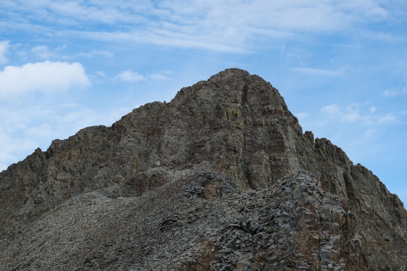
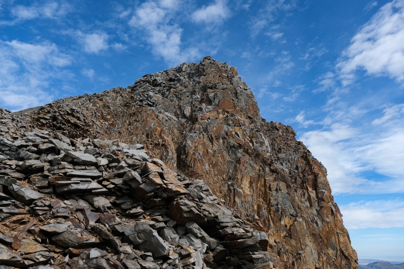
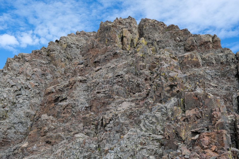
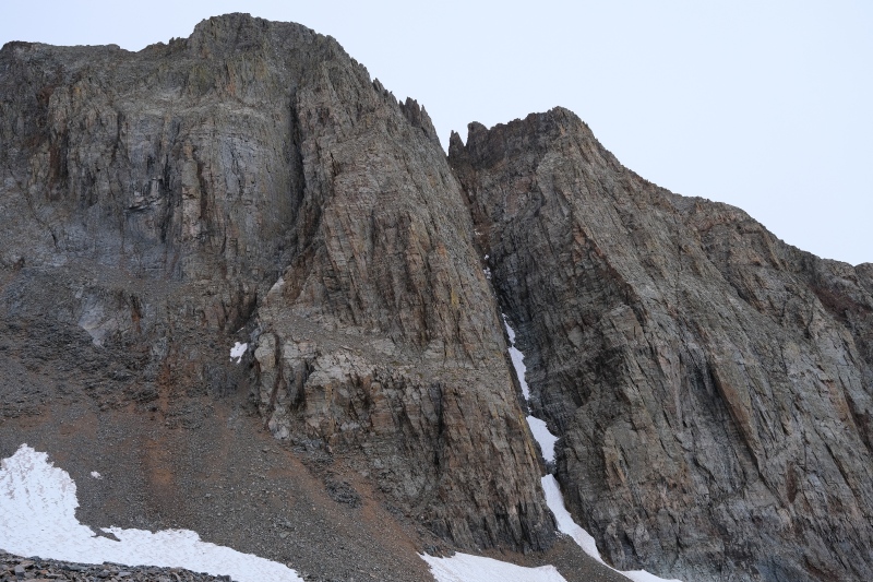
I attempted the initial scramble with my pack, but after wiggling some holds loose and generally feeling uneasy, I backed off and left my pack off to the side of the gully. Without my pack, the scramble went pretty easy. The hardest moves were the first 15-20 feet off the deck which felt like stiff class 3. All of the stable rocks are downsloping and polished smooth, and anything not steeply angling down towards the fall line is holding piles of scree and rocks. Once above this initial headwall, a short section of scree-wallowing ensues before the next section which felt much easier as the holds were not downsloping on either side of the chimney. Video below shows the scramble. Once above the gully, a short and simple scramble goes from the false summit to the true, where I found some familiar names on the summit register including KFergie from a few minutes prior. I was surprised that with so few names on the register dating back three years that two of us happened to climb it on the same day. 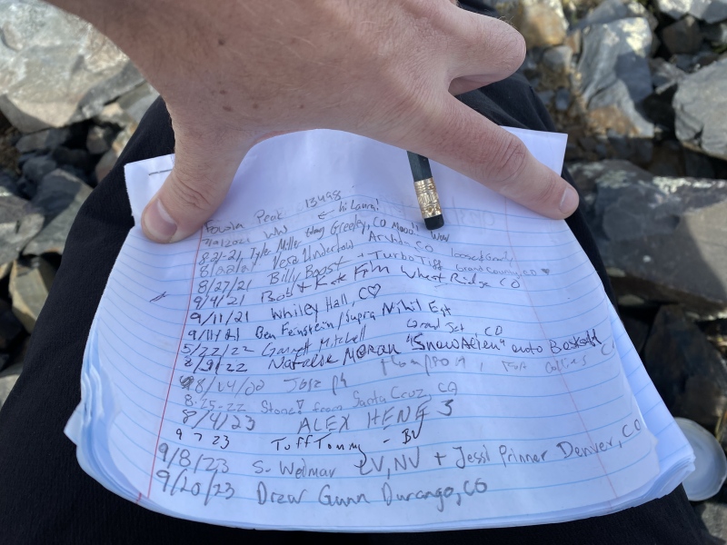
The scramble back down took me twice as long as I paused and took a lot of time carefully deciding how to drop down the lower headwall after I'd sent a few dozen rocks careening off the mountain there. I ended up facing out the entire way down and wedging myself into the narrow chimney on that pitch. I've done a handful of class 4 climbs but this class 3 felt like the sketchiest to me given the quality of rock. Fortunately, the exposure here isn't terrible. It's not a place you'd want to fall, but it's also not super-puckering either. 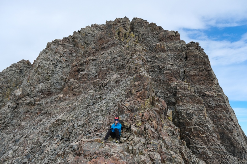
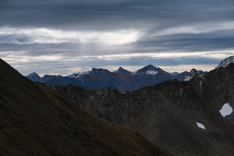
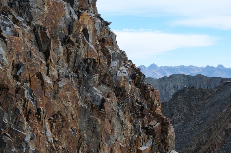
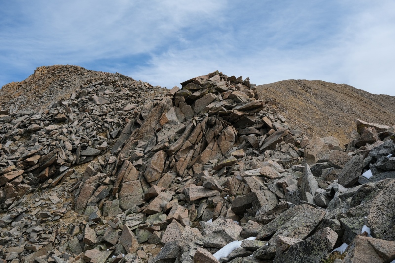
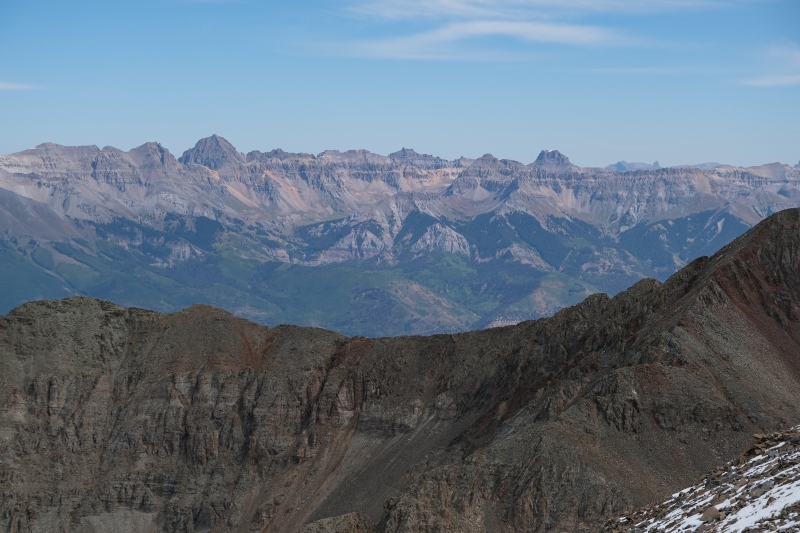
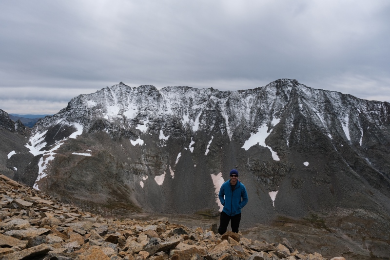
Once back on the ridge, it goes easy class 2 all the way to the summit of Unnamed 13540B. The views of the Wilson's don't necessarily get better, but on this moody gray day, the changing light gave me plenty to enjoy as the light changed continuously throughout the day. 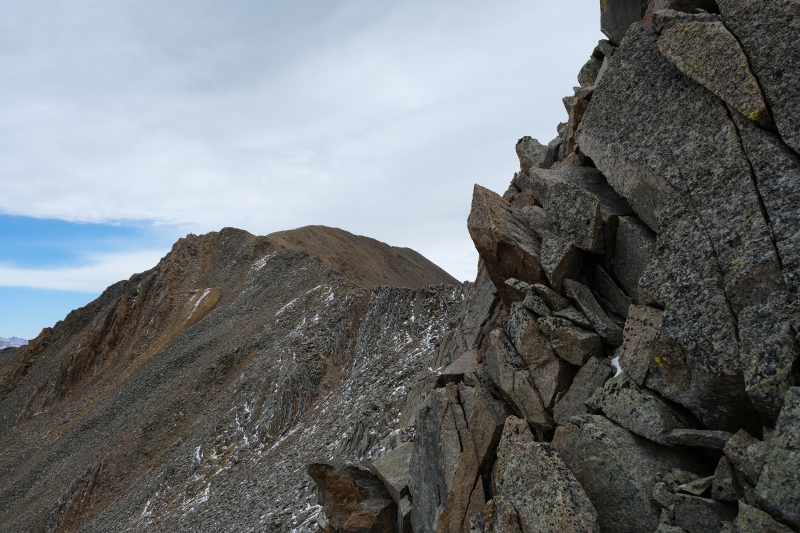
The summit register on UN13540B had an ironic curiosity. The PVC pipe, like the one on Fowler and like most I see on 13ers, featured a soggy unreadable paper, but there was an accompanying glass register left by WW that had some good old fashioned trolling on it. 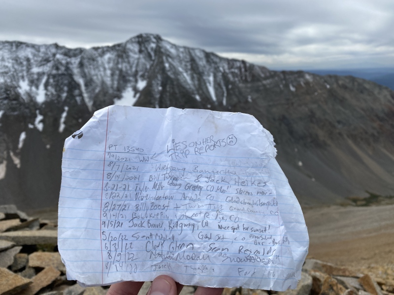
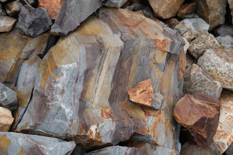
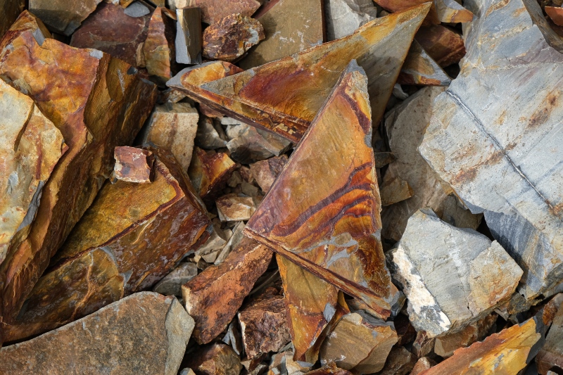
That the trolling was on paper and written with pencil that WW herself carried to what was clearly the actual summit of this forgettable class 2 peak made me smile at the irony. I'm not sure what the trolling on the register for UN13540B has to do with questionable ascents of TP, Snowmass, or the unpictured guide on Lizard Head. I was more concerned that not a single person made a comment about the missing bus. I still wasn't over it, so I couldn't judge whoever wasn't over the WW summit inquisition while they sat up here on UN13540B. The hike down the loose talus was as unpleasant as the hike up but went fast and I was back to the busless mining road for the walk back out to ROA. I generally take macro shots on my hikes out but given the lack of any real interesting features up here, I opted to shoot the most colorful rocks I could find. 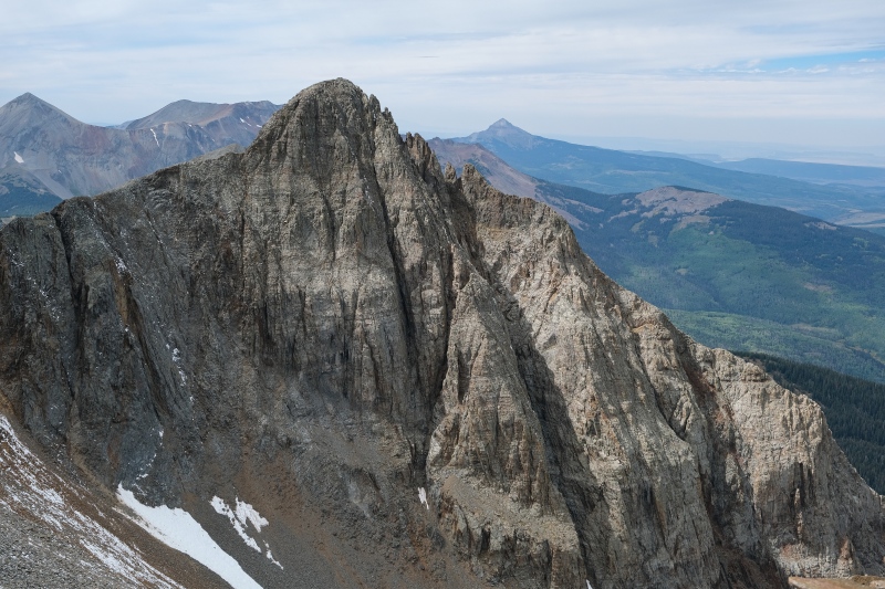
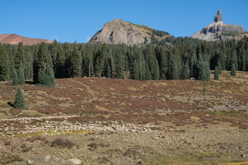
On the drive out from ROA I passed the upper Schmid Ranch where a wedding was taking place. Really cool spot for an outdoor ceremony. 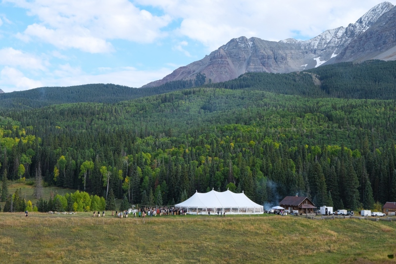
As soon as I was back in service I was researching what happened to the bus, and all I could find was that it was removed in 2014 by someone. I'd love to know why. Was the paint peeling and running off down stream? Was it leeching toxic chemicals into the creek that the other mining debris up there isn't? Was it helicoptered off by a giant magnet or did an earthmover drag it down that mining road? If dragged down, how did it not disintegrate on the journey down on the rotten rocky road? The next morning I had a 12 hour drive back to Texas to look forward to, so I settled for a quick sunrise hike of 12er Blackface near Lizard Head Pass, where it was cool to see the Wilson group from the other side. As usual, what would be a forgettable hike was made memorable by being up there during gold hour. 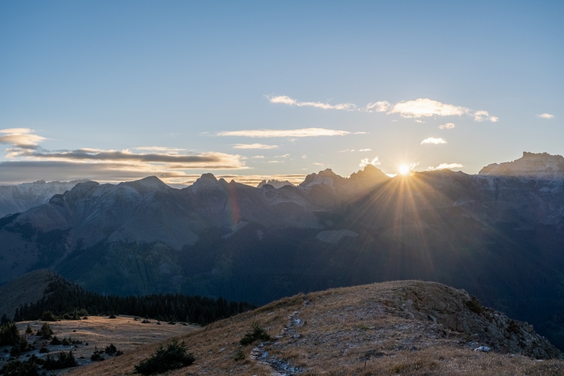

I look forward to getting some answers on the bus I missed. Thumbnails for uploaded photos (click to open slideshow): ")
")
")
")
")
")
")
")
")
")
")
")
")
")
")
")
")
")
")
")
")
")
")
")
")
")
")
")
")
")
")
")
")
")
")
")
")
")
")
")
")
")
")
")
")
")
")
")
")
")
|
| Comments or Questions | |||||||||||||||
|---|---|---|---|---|---|---|---|---|---|---|---|---|---|---|---|
|
Caution: The information contained in this report may not be accurate and should not be the only resource used in preparation for your climb. Failure to have the necessary experience, physical conditioning, supplies or equipment can result in injury or death. 14ers.com and the author(s) of this report provide no warranties, either express or implied, that the information provided is accurate or reliable. By using the information provided, you agree to indemnify and hold harmless 14ers.com and the report author(s) with respect to any claims and demands against them, including any attorney fees and expenses. Please read the 14ers.com Safety and Disclaimer pages for more information.
Please respect private property: 14ers.com supports the rights of private landowners to determine how and by whom their land will be used. In Colorado, it is your responsibility to determine if land is private and to obtain the appropriate permission before entering the property.