Download Agreement, Release, and Acknowledgement of Risk:
You (the person requesting this file download) fully understand mountain climbing ("Activity") involves risks and dangers of serious bodily injury, including permanent disability, paralysis, and death ("Risks") and you fully accept and assume all such risks and all responsibility for losses, costs, and damages you incur as a result of your participation in this Activity.
You acknowledge that information in the file you have chosen to download may not be accurate and may contain errors. You agree to assume all risks when using this information and agree to release and discharge 14ers.com, 14ers Inc. and the author(s) of such information (collectively, the "Released Parties").
You hereby discharge the Released Parties from all damages, actions, claims and liabilities of any nature, specifically including, but not limited to, damages, actions, claims and liabilities arising from or related to the negligence of the Released Parties. You further agree to indemnify, hold harmless and defend 14ers.com, 14ers Inc. and each of the other Released Parties from and against any loss, damage, liability and expense, including costs and attorney fees, incurred by 14ers.com, 14ers Inc. or any of the other Released Parties as a result of you using information provided on the 14ers.com or 14ers Inc. websites.
You have read this agreement, fully understand its terms and intend it to be a complete and unconditional release of all liability to the greatest extent allowed by law and agree that if any portion of this agreement is held to be invalid the balance, notwithstanding, shall continue in full force and effect.
By clicking "OK" you agree to these terms. If you DO NOT agree, click "Cancel"...
| Report Type |
Full |
| Peak(s) |
Mt. Massive - 14,427 feet
|
| Date Posted |
09/27/2023 |
| Date Climbed |
09/02/2023 |
| Author |
IowaWillyRH3 |
| Mt. Massive SW Route |
|
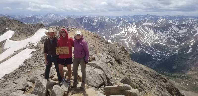
On September 2nd, 2023 I summitted Mount Massive. I arrived on Friday morning at 1:00 a.m. and carefully drove my way to within about 1/4 of a mile, to the Mt. Massive trailhead. I have a Suburban (not lifted) and did not attempt to navigate some large rocks and deeper dips on the road. I believe that I could've made it but there were numerous camping spots near so I claimed one and got some sleep. Friday was a 30% chance of rain but Saturday weather was projected to be 0% so I waited for Saturday. I was up at 3:15 a.m. and was on the trail by 4 a.m. The trail was easy to follow from the trailhead and through the forest but I did make a mistake at one point where the path split and I was not paying attention and stepped over a branch which was laid across that path, which lead to the creek, and was not the proper route. Any time there is a branch laid across the path, my understanding is, that is not the most direct route or maybe not the correct route at all. I made my way up and out of treeline and at the transition point of coming out of treeline there is a significant boulder field, and is easy to get off route, however line of site helps with adjustments. I met alot of people on the route and one of my favorite parts of hiking is meeting people and hearing their story. Like the 81 year old guy from Minnesota and his son. (If I can only be in his kind of physical shape when I am that age maybe I could summit all 58!) Once out of treeline and up to the first of several false summits I would say the route finding is easy. There is a section where you are required to hike downward between two false summits and I hiked much too low and had to hike back upward for about 300-400 feet. My best advice after reaching this area is "hug the ridge" because there is a noticeable path where it appears you should hike downward (and at this point for me hiking downward seemed inviting!) I believe this is mentioned in the SW Route description. After summitting a group of us determined there was no survey marker, which sucks but someone had a sign so that helped. I grabbed a snack, took some photos and then headed back down. Going back down was much easier but keep in mind it is easy to pick the wrong descending route which brings a hiker to the Mt. Elbert Trailhead instead of Mt. Massive Trailhead. One woman and her charming pup, who left the summit well before I did caught up to me on the descent because she had taken the wrong path and it adds several miles to your hike. My quads were very tight during the descent because of the work and I had lost 30 lbs. getting ready for this hike so, I can't imagine how much more I would've struggled if I had not trained for the hike and lost the weight. No rain, a little windy, but blue skies and beautiful views everywhere! Cheers everyone and thanks for the helpful website Colorado 14ers! Until next year, Bill from Iowa ~
Thumbnails for uploaded photos (click to open slideshow):
")
")
")
")
")
")
")
")
")
")
")
")
|
Caution: The information contained in this report may not be accurate and should not be the only resource used in preparation for your climb. Failure to have the necessary experience, physical conditioning, supplies or equipment can result in injury or death. 14ers.com and the author(s) of this report provide no warranties, either express or implied, that the information provided is accurate or reliable. By using the information provided, you agree to indemnify and hold harmless 14ers.com and the report author(s) with respect to any claims and demands against them, including any attorney fees and expenses. Please read the 14ers.com Safety and Disclaimer pages for more information.
Please respect private property: 14ers.com supports the rights of private landowners to determine how and by whom their land will be used. In Colorado, it is your responsibility to determine if land is private and to obtain the appropriate permission before entering the property.
")
")
")
")
")
")
")
")
")
")
")
")