Download Agreement, Release, and Acknowledgement of Risk:
You (the person requesting this file download) fully understand mountain climbing ("Activity") involves risks and dangers of serious bodily injury, including permanent disability, paralysis, and death ("Risks") and you fully accept and assume all such risks and all responsibility for losses, costs, and damages you incur as a result of your participation in this Activity.
You acknowledge that information in the file you have chosen to download may not be accurate and may contain errors. You agree to assume all risks when using this information and agree to release and discharge 14ers.com, 14ers Inc. and the author(s) of such information (collectively, the "Released Parties").
You hereby discharge the Released Parties from all damages, actions, claims and liabilities of any nature, specifically including, but not limited to, damages, actions, claims and liabilities arising from or related to the negligence of the Released Parties. You further agree to indemnify, hold harmless and defend 14ers.com, 14ers Inc. and each of the other Released Parties from and against any loss, damage, liability and expense, including costs and attorney fees, incurred by 14ers.com, 14ers Inc. or any of the other Released Parties as a result of you using information provided on the 14ers.com or 14ers Inc. websites.
You have read this agreement, fully understand its terms and intend it to be a complete and unconditional release of all liability to the greatest extent allowed by law and agree that if any portion of this agreement is held to be invalid the balance, notwithstanding, shall continue in full force and effect.
By clicking "OK" you agree to these terms. If you DO NOT agree, click "Cancel"...
The South Ridge of Tabor has been on my list of ridgelines to attempt for a year or two now. I'm happy to say that I finally got the chance to attempt the ridge, but sad to report that things didn't align well for us to complete the day successfully. That being said, one of the most important things that I've had to learn over the past few years is how to approach these mountains with a team mindset. While we ultimately 'failed' on our objective for the day, we succeeded in working well as a team, communicating our limitations, and made the right decision to back down. At this point, Gina and I have been tackling objectives every weekend for a solid 6 months. A lot of those weekends included 2-3 days worth of objectives and most objectives required a wake-up call of 3 AM or earlier to accommodate our drive from Golden. We've also been tackling progressively harder ridgelines and couloir ski descents. This is especially true for Gina, who's gone from skiing objectives like Eva last spring to skiing Dead Dog and Lost Rat couloirs this year - an absolutely incredible progression.
Needless to say, it's been an amazing season, but the relentless forward progress, in addition to challenging full-time jobs, overuse injuries, and consistent lack of sleep leads to eventual burnout. It's not that we weren't physically capable of continuing, but the mental game cannot be understated - especially on high-consequence ridgelines. On objectives like these, it's not about whether you can physically push through the elevation gain and the mileage, it's about whether you have the mental capacity to maintain the persistent focus required to safely navigate the hazards of the route while working through your personal fears and anxieties... something that can be hard on even the best of days. It's safe to say that we just didn't have the mental capacity to safely complete this route on this day... and that's okay. I'm pretty happy knowing this is the first time we've had to bail on a scrambling objective this season :)
Prelude
I won't talk much about the ridge up to West Tellurium or the traverse over to Tellurium (there are multiple trip reports on this), but it's a fun ridge romp with a big of Class 3 on the ridge proper to spice things up here and there. Our primary goal was exploring the portion of the ridge from Tellurium to Tabor. Due to the aforementioned burnout, we moved a lot more slowly than expected on the linkup up to West Tellurium and over to Tellurium. The terrain and route finding were straightforward and we would have otherwise made quick progress. Once we got to Tellurium, we were venturing into the unknown. No trip reports or beta existed on this portion of the ridge. We brought a 40 meter rope, along with webbing, rap rings, etc., but never needed to use it. The trip report will focus primarily on this portion of the ridge... I will be coming back to complete the remainder of this route, but figured it was worth going ahead and documenting this portion while it's fresh on my mind.
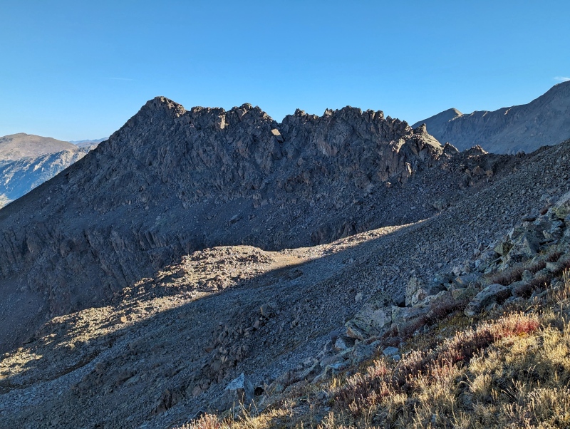
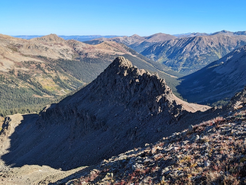
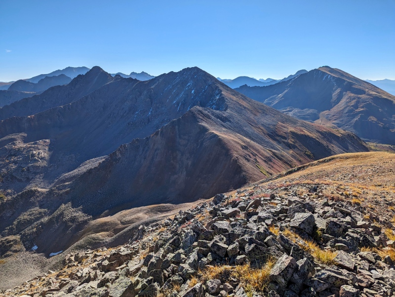
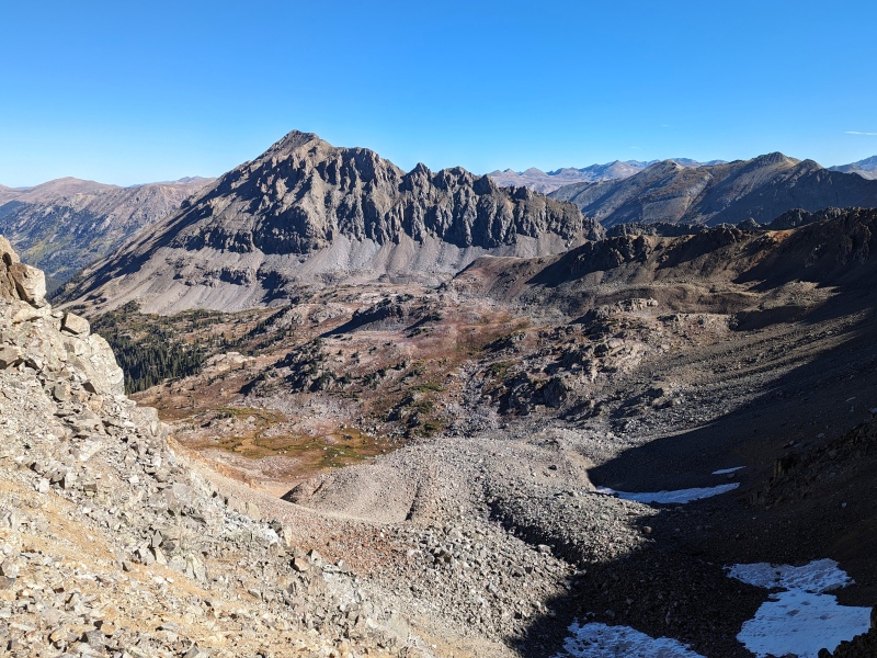
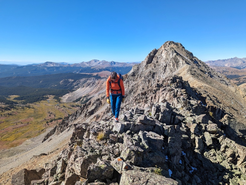
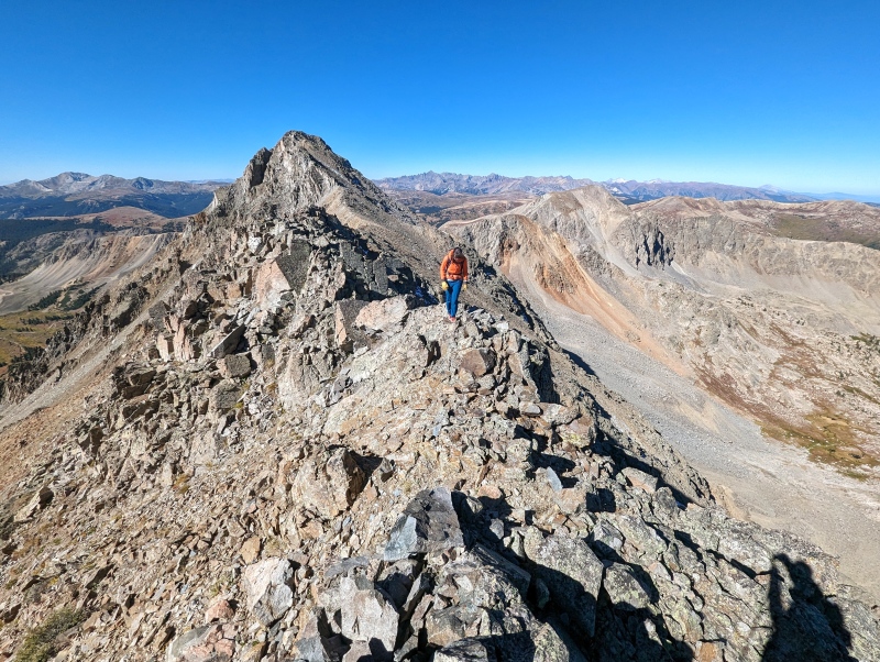
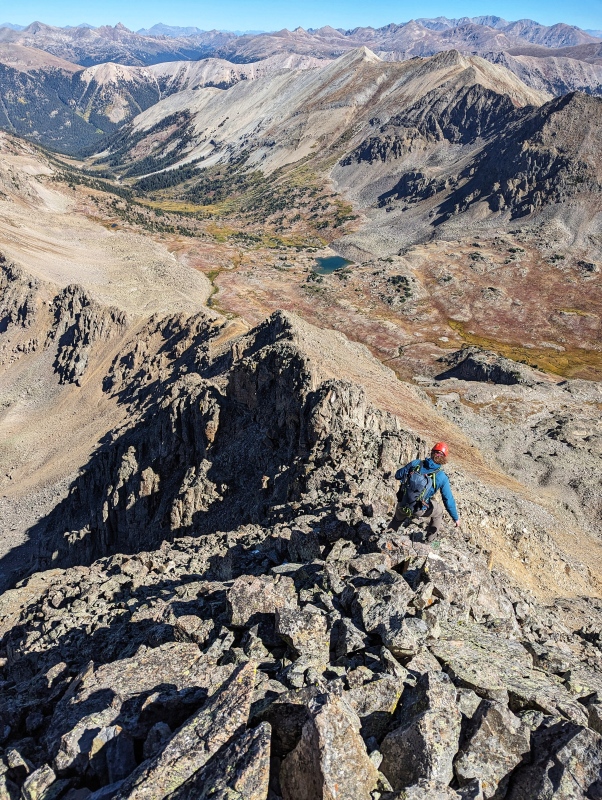
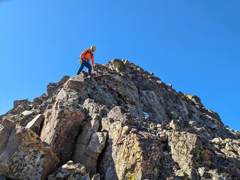
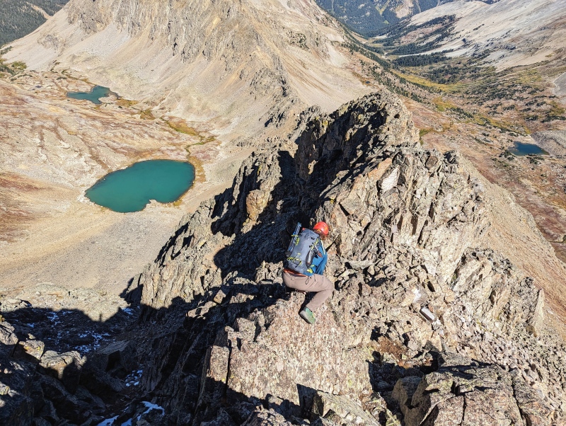
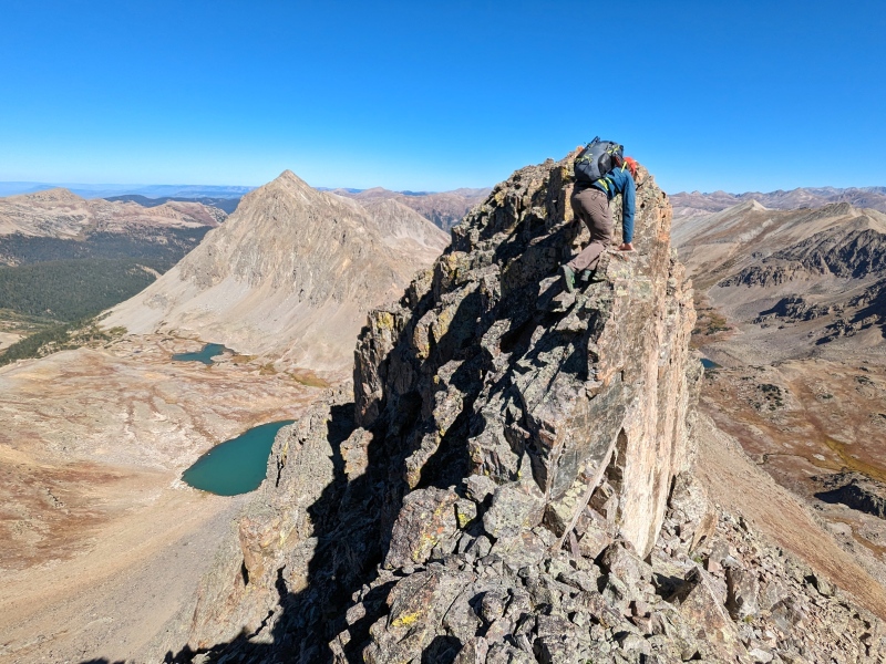
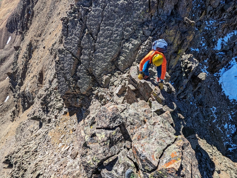
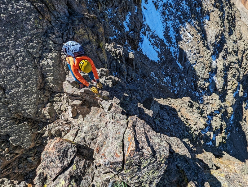
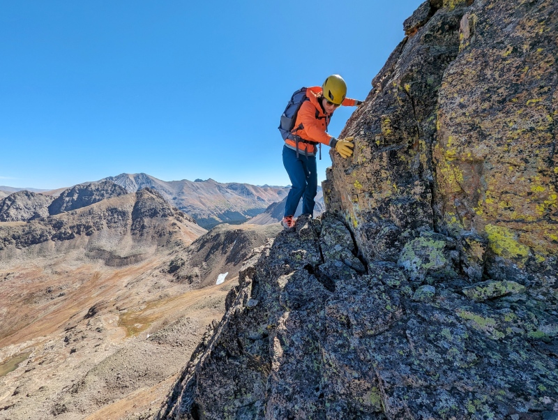
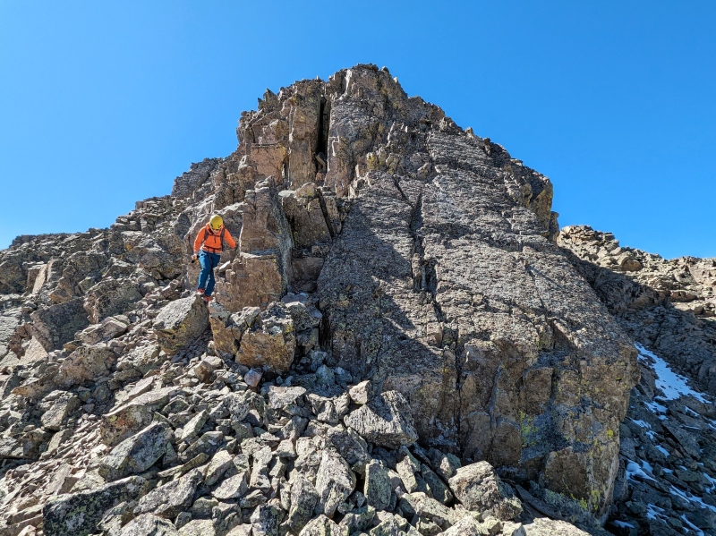
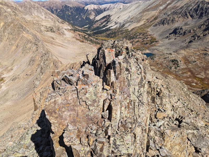
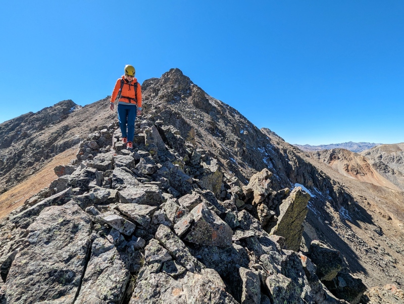
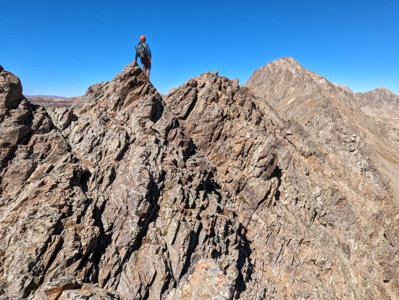
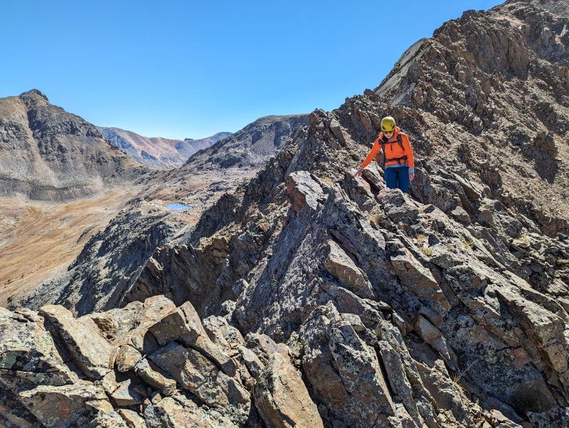
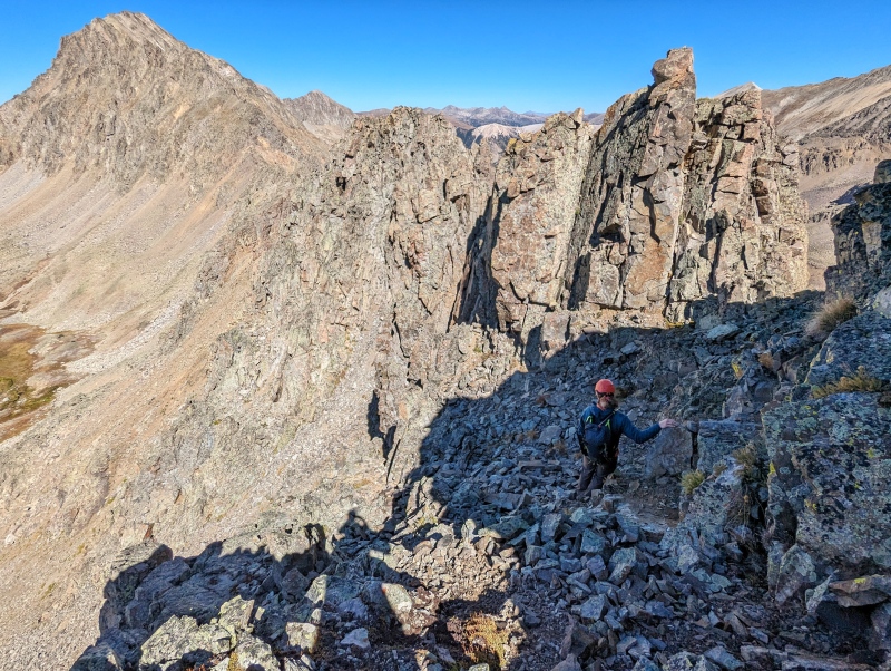
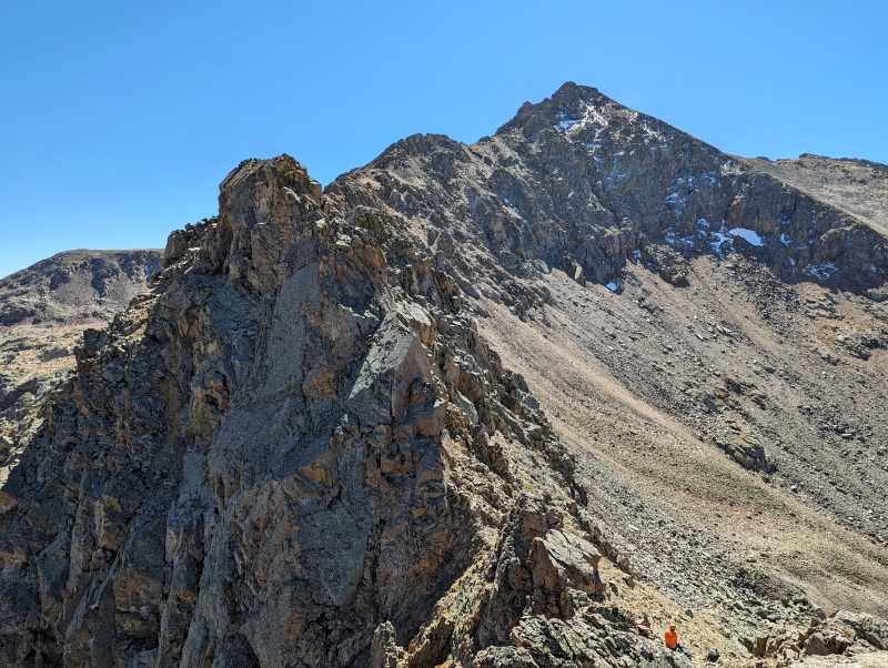
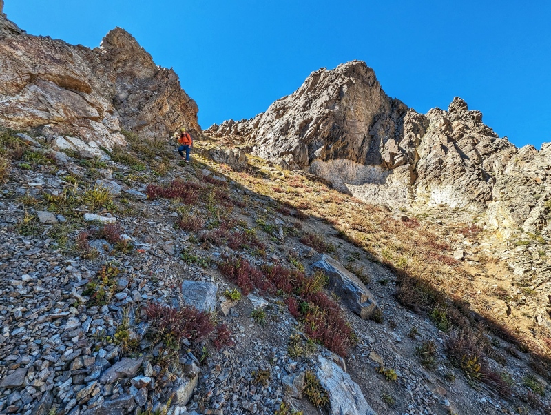
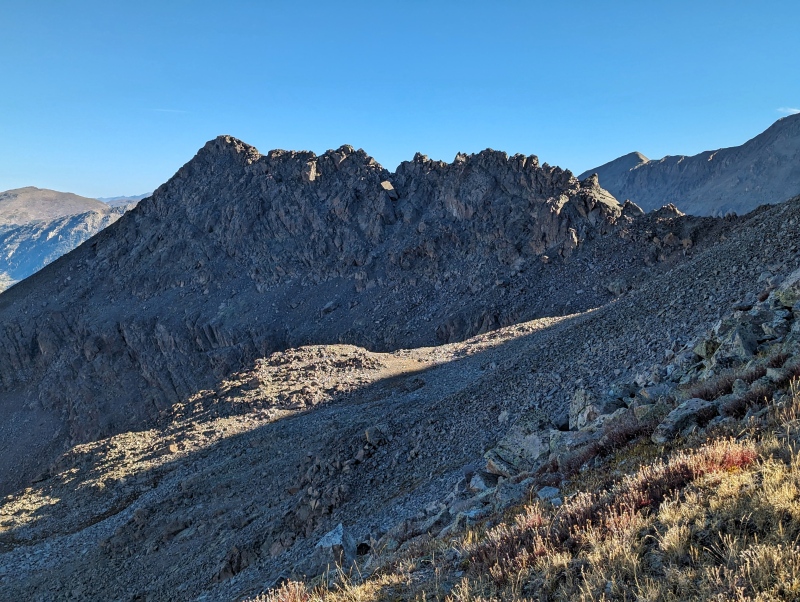
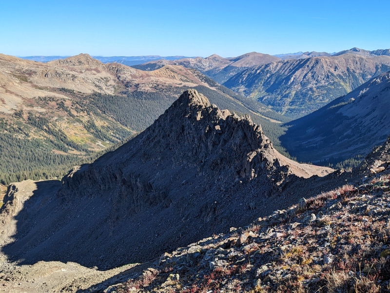
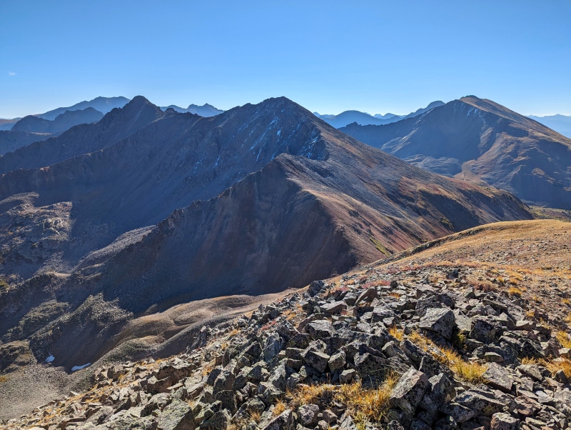
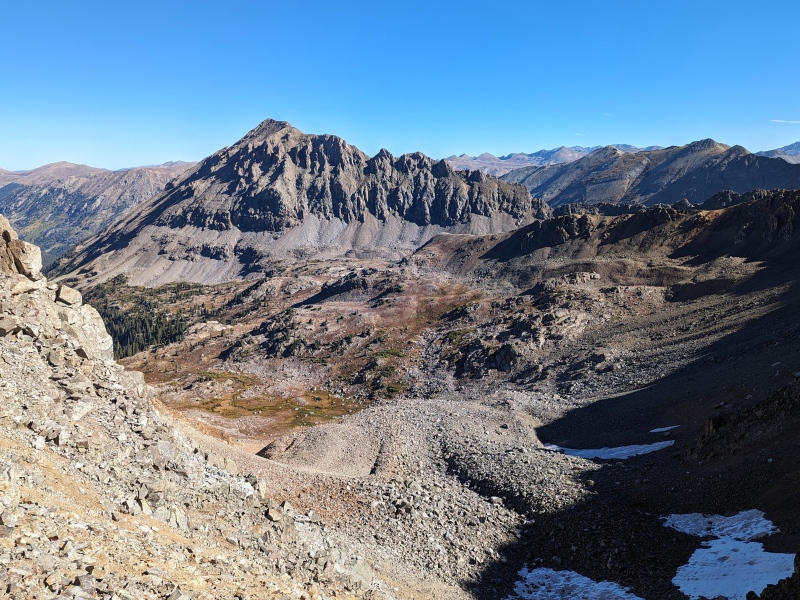
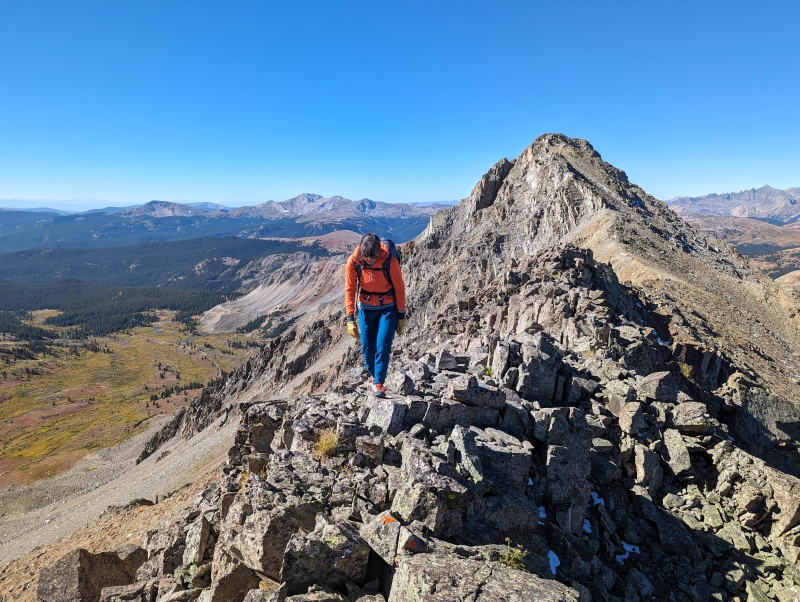
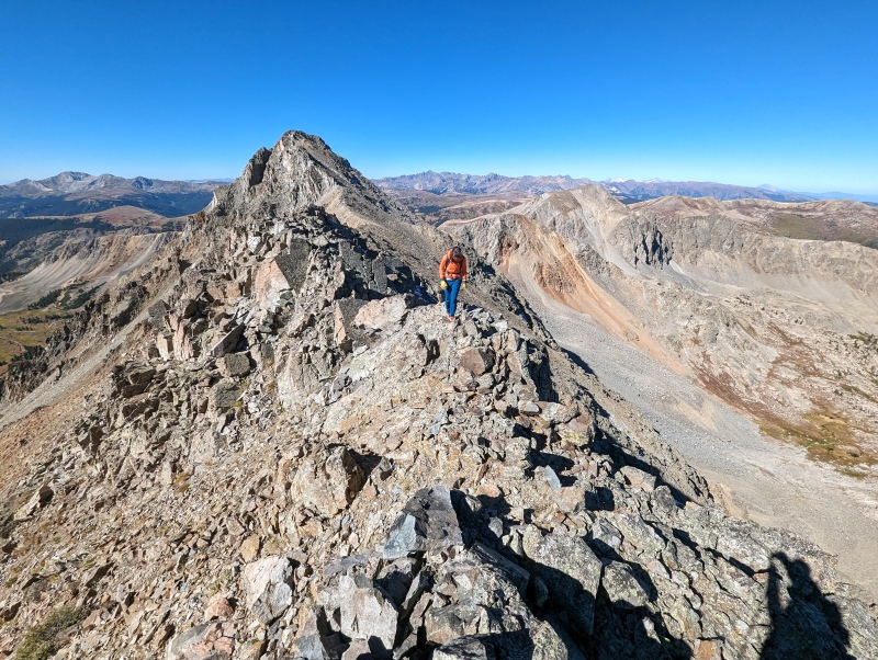
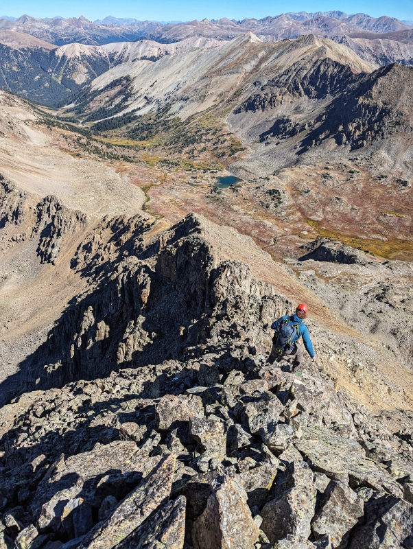
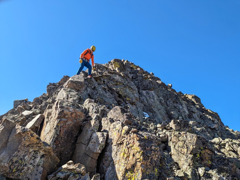
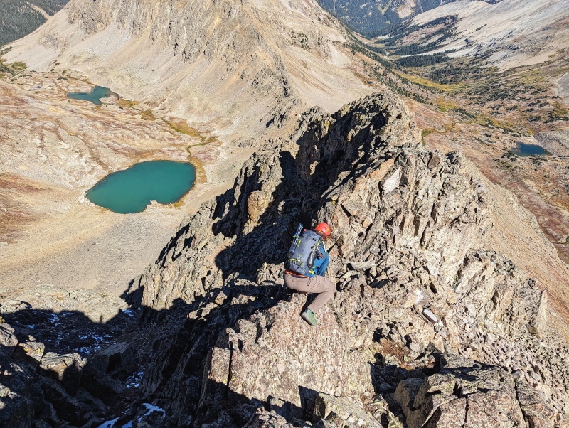
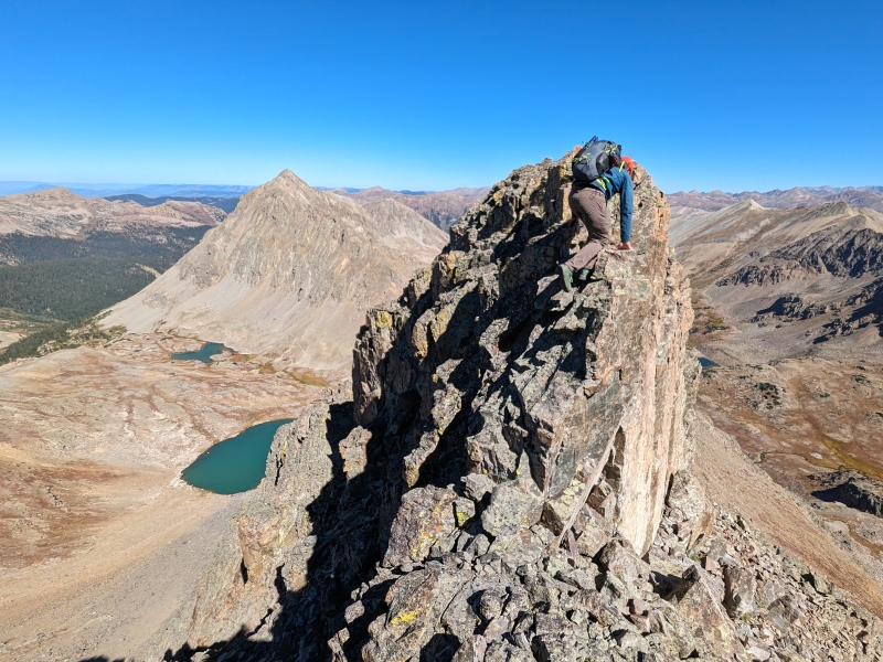
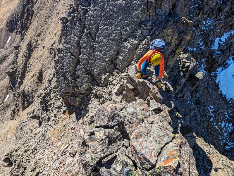
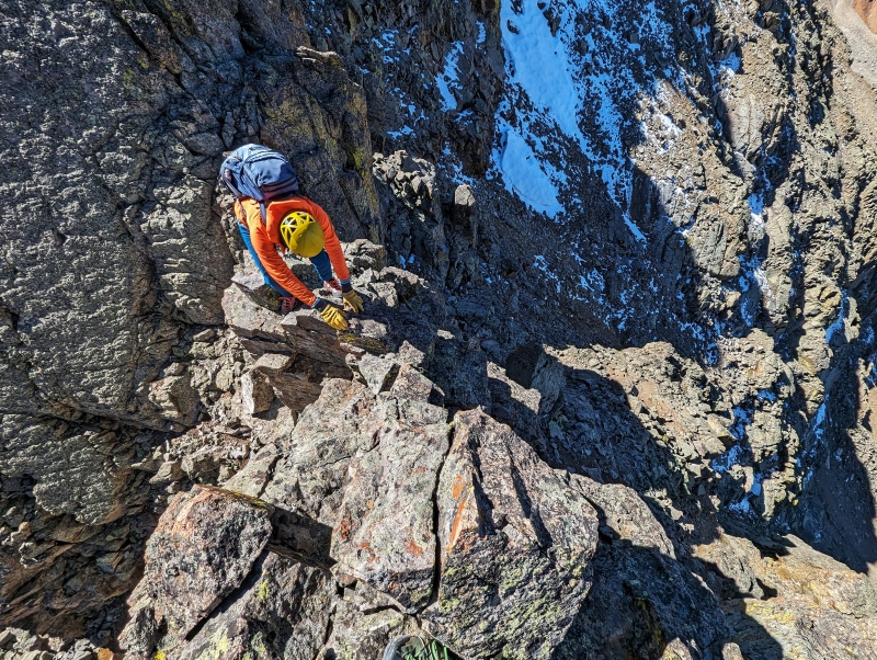
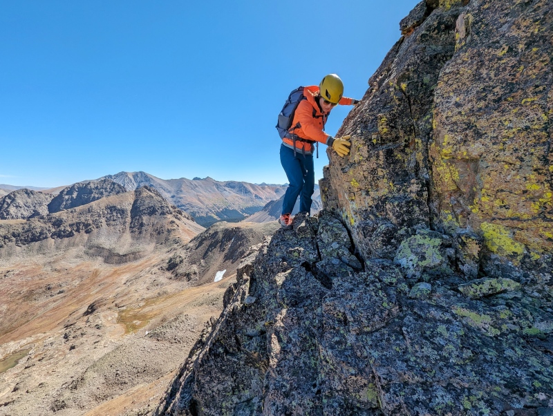
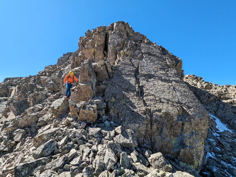
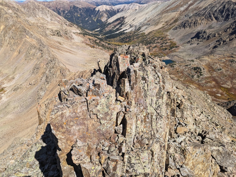
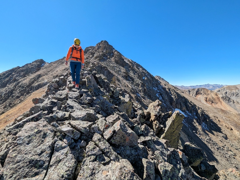
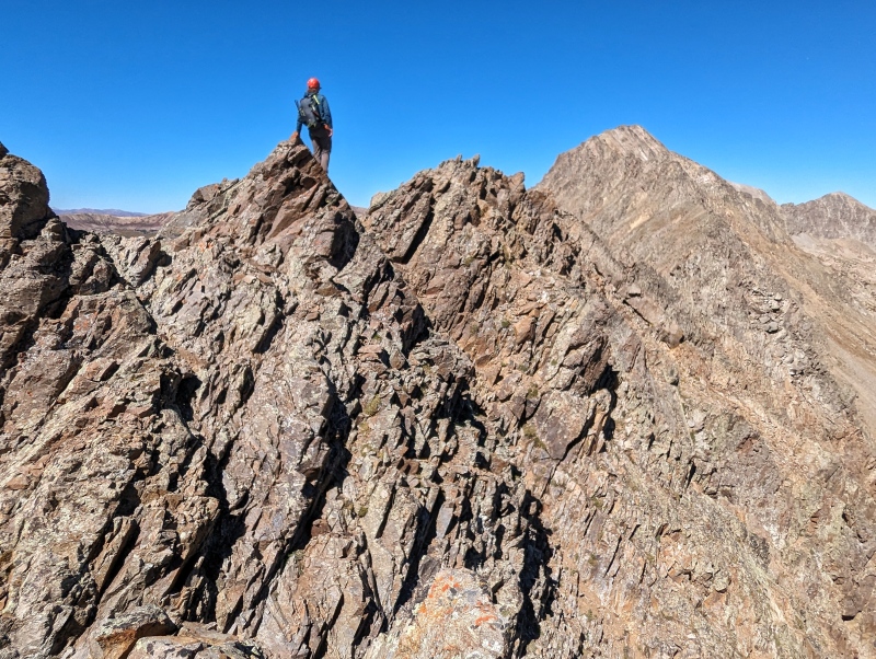
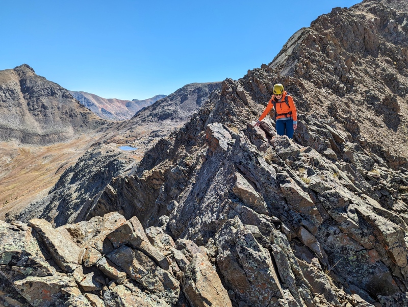
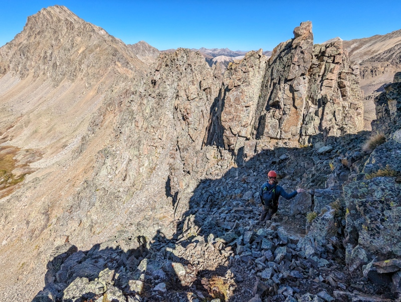
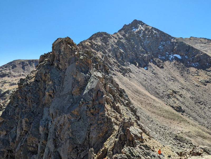
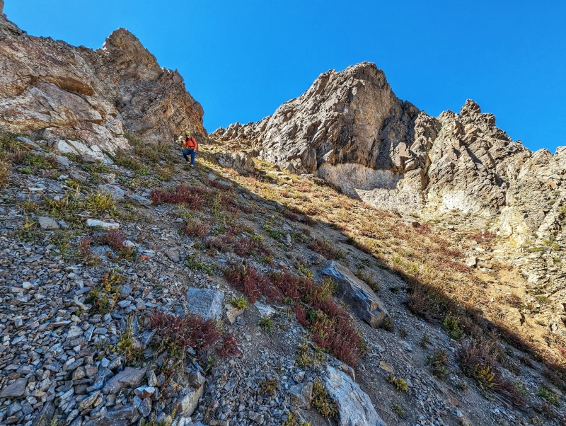
The descent down to the first bail gully never exceeded Class 4, but the ridge was exceptionally tedious. The foundations of the towers and ridgelines are very solid, but there are loose rocks covering EVERYTHING. There was always a solid hold to find, but finding the solid hold amongst all the loose rocks was extremely time consuming and brought our scrambling down to a crawl. It was almost like someone had built a ridge out of Quartzite and then covered it in loose Schist. It took us almost 2 hours to reach the first bail gully, which was only 1/3 of the ridge to Tabor. It's entirely possible that the remaining portion of the ridge is more solid, but we couldn't tell from our bail gully and the exits further along the ridge are steeper, longer, and potentially sketchier. For those reasons, we decided to drop early. There is one section of the ridge that we bailed around (just before the gully - it's noticeable on the GPX file). The towers looked very steep, loose, difficult to downclimb, and the slope angle shading showed a very steep downclimb or cliff leading into the notch. At that point, we didn't want to risk back-tracking that kind of terrain. Based on how the downclimb on the backside looked, we made the right call. A rappel down to the notch would have also been difficult due to a wonky fall-line - assuming a good anchor point was available.
Approach
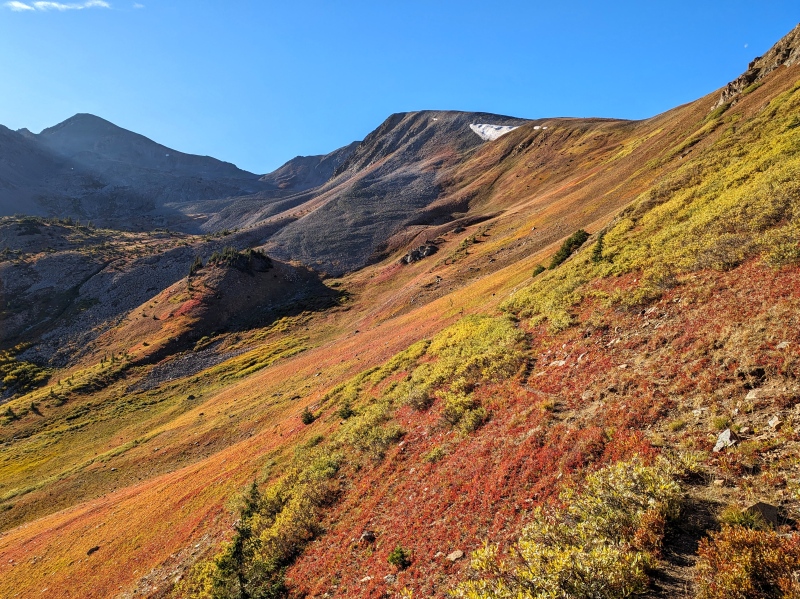
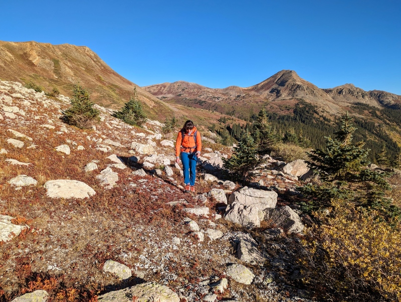
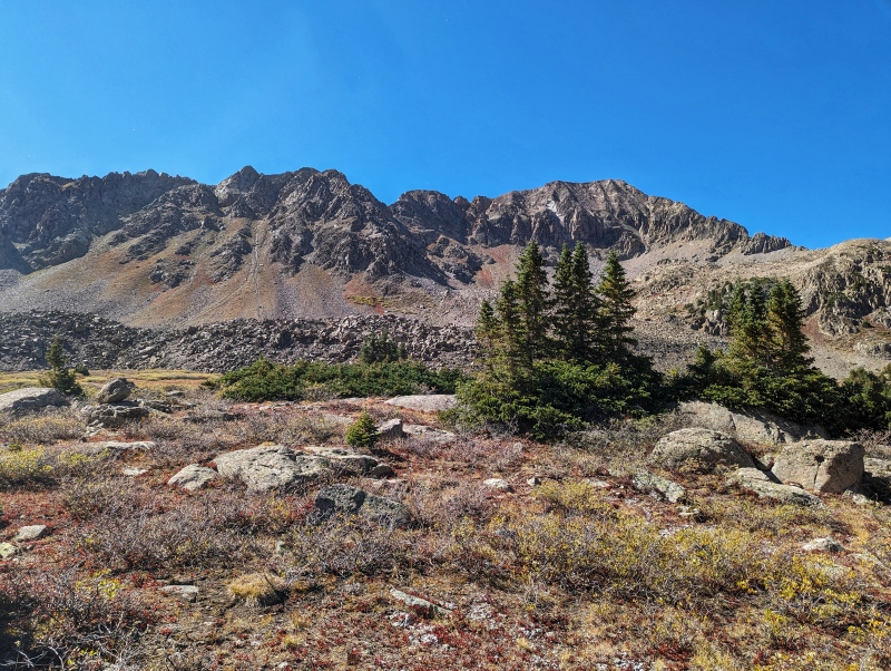
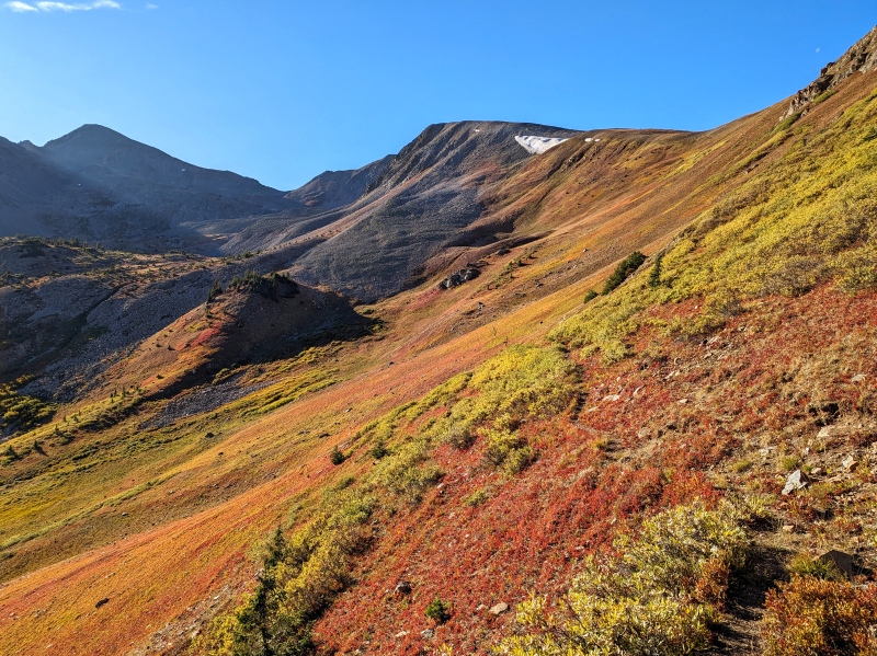
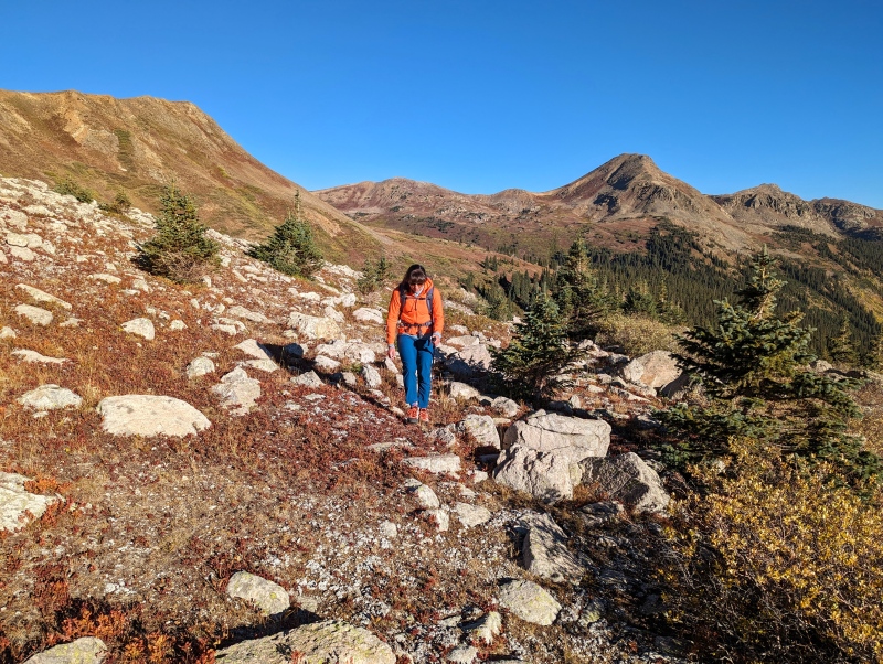
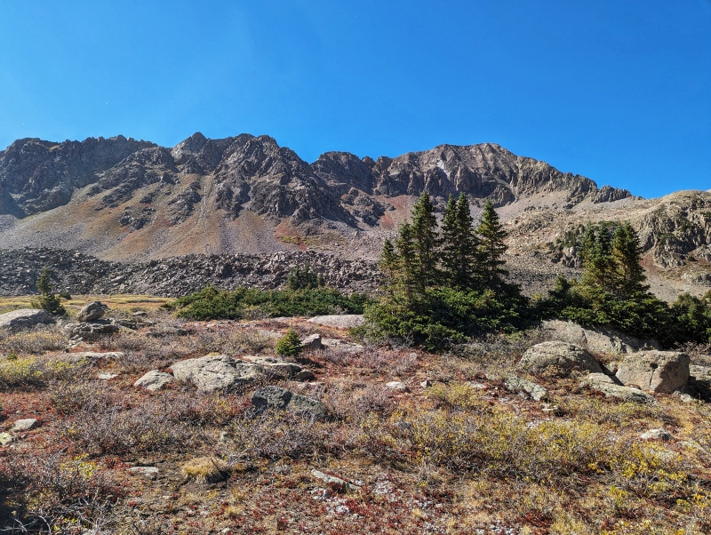
We approached via the New York Creek Trail and exited using the Tabor Creek Trail. The New York Creek Trail was easy to follow until we turned off just above 12,000'. We roughly followed that contour to the lake/tarn where New York Creek starts from. From there, we worked our way around some rock slide piles to a saddle around 12,400'. We ascended to the summit of West Tellurium from there and stayed on the ridge proper (mostly) until our bail point.
Route Information
Mileage: Approximately 12.25 Miles Elevation: Approximately 4,000' Class: 4 Time to Complete: 9 Hours
Exposure: Extreme Rockfall: Extreme Route-Finding: High Commitment: High
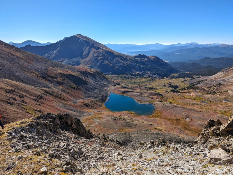
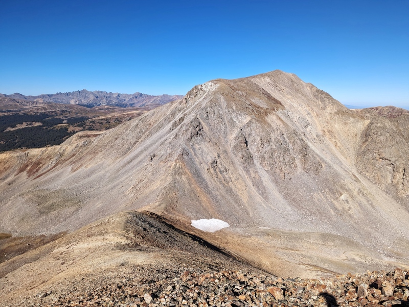
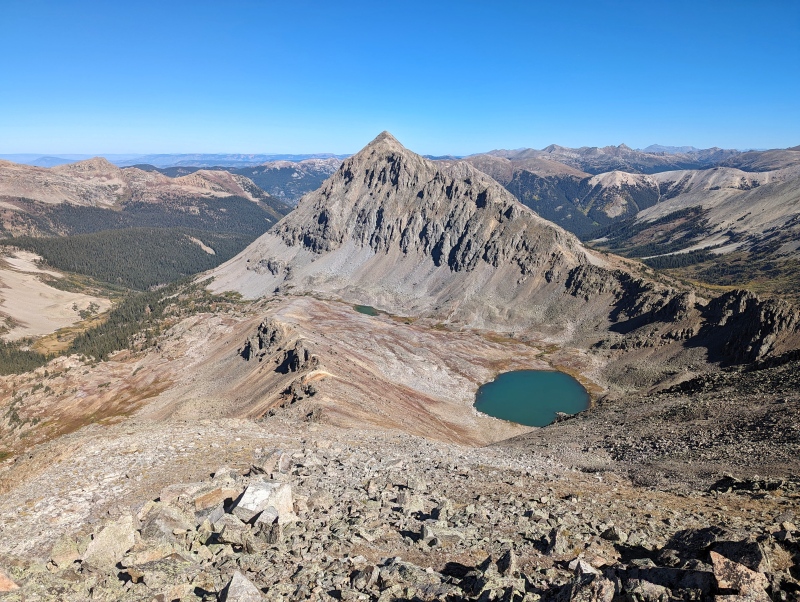
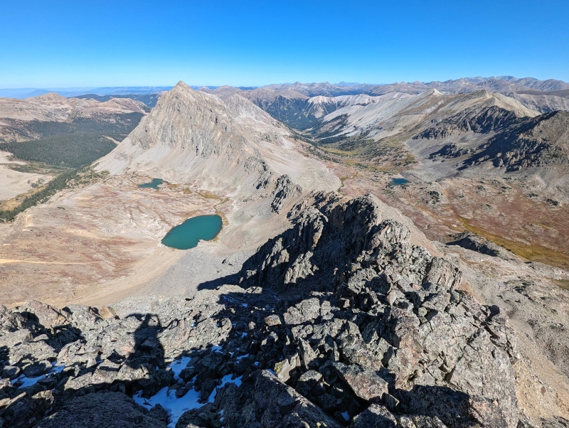
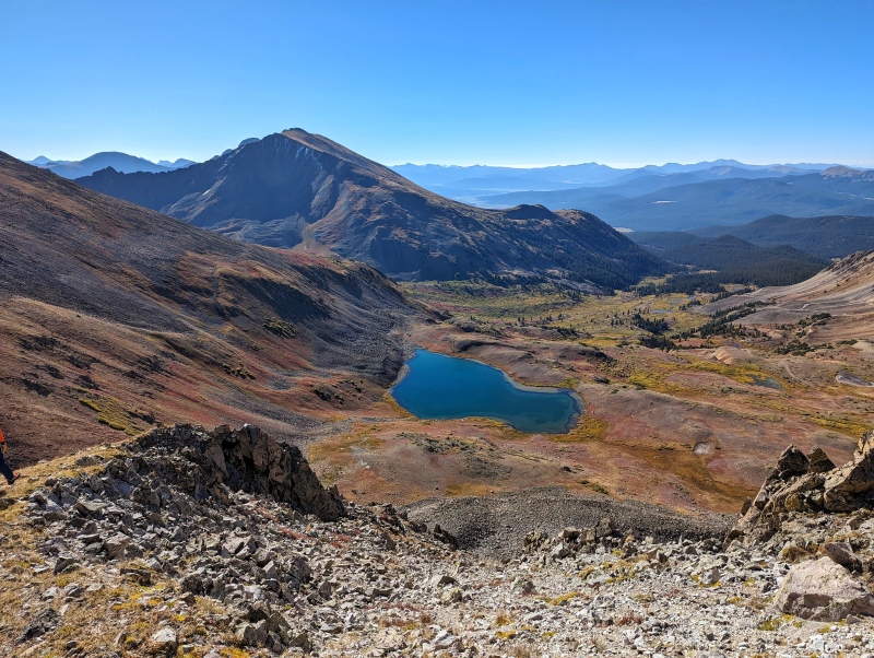
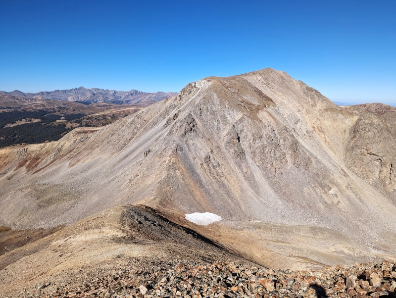
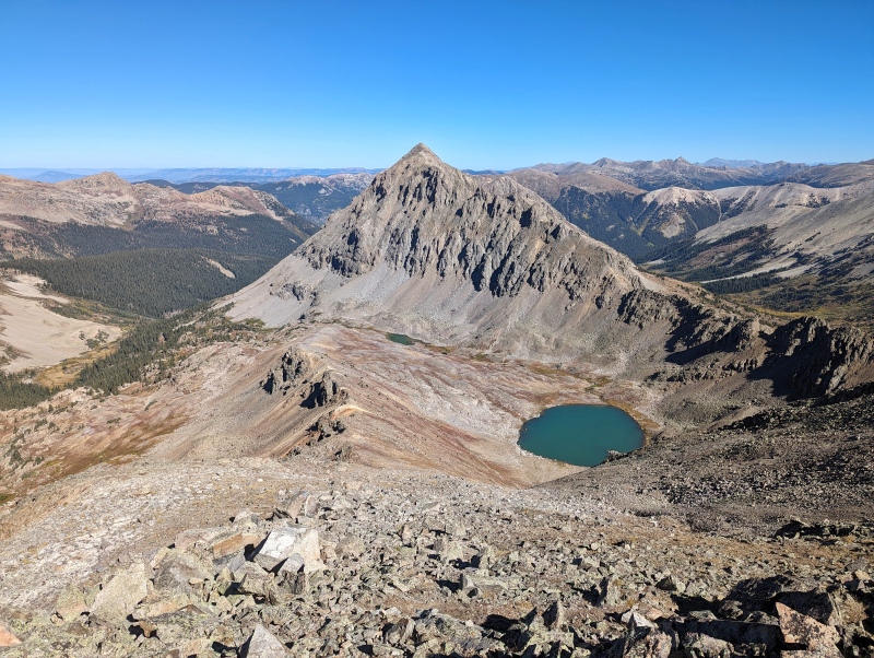
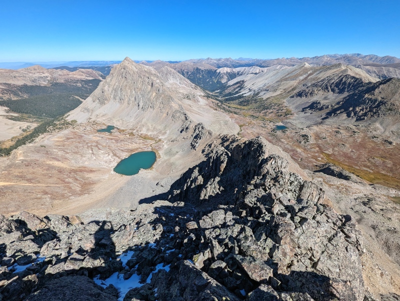
After splitting off the New York Creek Trail, we managed to find a faint use trail that led us part of the way to the New York Creek Terminus. West Tellurium is on the far left and the saddle we gained is just below and to the right.Very little schwackinessThe North Ridge of West Tellurium looks funI'll definitely be coming back for that one at some point - lots of unfinished business in this areaLooking towards Tellurium (far left - the bump in the middle doesn't have a name), Petroleum Peak to the right. The descent to the saddle holds some Class 2+/3- scrambling along the ridge proper. There's some fun Class 3 scrambling to be had between the bump on the ridge and Tellurium.Ptarmigan LakeLooking back on West TelluriumLooking toward Tabor's beastly South RidgeSome fun scrambling and catwalks on the way to TelluriumIf anyone is wondering, the tundra is officially dead for the season :(Another view of TaborHere we go! You can tell it's a loose pile because the way it is... neat!It's not all bad - some portions for very reminiscent of the Gore, but it goes right back to Schist (yay for rock word play)Looking forward to those patches of dirt where there aren't any gendarmes - just kidding, it's chossThe bright side - everything that looked stable was stable... it's just that most of it didn't look stable.One of the more exposed (and solid) sectionsLooking back on that same sectionA wee bit of exposureOne of the trickier downclimbsProbably the crux downclimb - looks like a large slab from the top. Lots of zig-zagging.Schist? Well, it looked like Schist anyway (this pun is going to get old eventually). We skirted the unstable part to the right and climbed up once the ridge widened (about 10 feet along the side).The wider section wasn't too badInteresting section of mini-towers. There's a few more later on the ridge that we didn't get to.From West Tellurium, the ridge looked solid. From being on the ridge, it looks like schist (told you).Bypassing this section of towers on the left (starting at the notch to the right). The bypass was also... SchistyLooking back at the downclimb we would have had to do if we'd stayed on the ridge... we made a good choice... it would have been difficult to rappel directly into notch. Bail gully is down and to the left.Bail gully - we were really sad we found out this wasn't even the saddle... the saddle was much further, but also not as nice of a bail option to Tabor CreekA look at the rest of the ridge to Tabor... there's a whole other section to the left of this photo as well.
As a side note, I'm not a geologist, but Schist looked right and was fun with puns.
GPS Track(s) on Google Maps (made from a .GPX file upload):
to see someone post a trip report where they didn't summit every peak they planned, we don't see many of those here these days. I have no doubt that you'll have another fun adventure completing these peaks in the future.
Oh and I hear you on the peakbagging burnout! Surprised nobody ever talks about it while churning our 100+ peaks per season. For me it's a very real end-of-the-summer thing.
Need more trip reports like this one! 10/2/2023 6:55pm
Thanks for posting, now I don't feel so bad. I also had to bail on my way from Tabor Pk to Tellurium this Summer. I did a contour on the south side and found the right saddle (according to my gpx tracks), but boy that lose hill and the one behind the saddle finished up my legs. My approach was from the Tabor Creek side. Next time I will probably attemp both Telluriums from the Tellurium Lake side.
I agree there is no good beta on any of these peaks, I read quite a few reports, but none seems to describe the route well.
Thank you! I've always enjoyed the skiing adage of "if you're not falling, you're not learning." Granted, if you fall on one of these ridges, you're going to have a bad time, but in this instance, I consider "falling" to be the same as needing to bail or back off from a route. The most important lessons I've learned have come from those scenarios. In a season where success has been the standard due to an incredible alignment of many factors and in a day where social media drives folks to gild their stories to only talk about the good things, I think it's more important than ever to talk about the times where we fail and acknowledge the events that lead to that failure.
It's a bear of a route! We actually thought the true saddle looked significantly looser than the bail gully that we took closer to Tellurium that's pretty much right across from lake beneath Tellurium Peak. NY Creek was a super chill approach. It looks like most folks drop from Tellurium via the NW face. I'm not sure if there's a social trail that descends the basin between NY Creek and Tabor Creek, but the the bail gully was a pretty chill way to connect over to Tabor Creek.
I saw your CR from the summit of Tabor down to the saddle and was hoping to see if the ridge proper (more or less) went better in the other direction! It was nice being able to fill in the blank between Tellurium and the Saddle, but I feel like we chose the loose part of the ridge lol I'm looking forward to when the snow makes the scrambling routes look less desirable and I'm perfectly content sleeping in on the weekend and getting brunch... at least until the snowpack stabilizes.
Caution: The information contained in this report may not be accurate and should not be the only resource used in preparation for your climb. Failure to have the necessary experience, physical conditioning, supplies or equipment can result in injury or death. 14ers.com and the author(s) of this report provide no warranties, either express or implied, that the information provided is accurate or reliable. By using the information provided, you agree to indemnify and hold harmless 14ers.com and the report author(s) with respect to any claims and demands against them, including any attorney fees and expenses. Please read the 14ers.com Safety and Disclaimer pages for more information.
Copyright: Route information, text, risk factors, maps, GPX files, charts, photos, 14ers.com-created map imagery, flythroughs, and other content provided in this route description are copyrighted by 14ers.com and may not be copied, reproduced, republished, distributed, modified, or used to create derivative works without prior written permission.
Please respect private property: 14ers.com supports the rights of private landowners to determine how and by whom their land will be used. In Colorado, it is your responsibility to determine if land is private and to obtain the appropriate permission before entering the property.