| Report Type | Full |
| Peak(s) |
Uncompahgre Peak - 14,318 feet Redcloud Peak - 14,037 feet Sunshine Peak - 14,004 feet Mt. Sneffels - 14,155 feet |
| Date Posted | 10/09/2023 |
| Date Climbed | 08/24/2023 |
| Author | GuiGirard |
| Wait, what! one can PREDICT weather! Tales of 1000 weather changes in the San Juans |
|---|
|
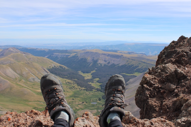
Day 6 into my road trip, freshly arrived in Lake City from centennial Stewart Peak the night before (see TR here https://www.14ers.com/php14ers/tripreport.php?trip=22334&cpgm=tripmine), I had my eyes on Wetterhorn. And, maybe I looked at it too much, because I hit a dead end at ~13,500 ft and I was unable to find an exit towards the rock rib above. Probably should have looked at the route description more than I looked at these slabs and the exposure below... but at least I will later learn that I was on the route. Thanks to everyone who gave feedback and support on an earlier 14ers FB page post, it's been much appreciated. Anyway, it is one of the nicest 14er approaches I have experienced, so it will be my pleasure to return. Day 7 (Aug 20) had perfect weather forecast with 0% chance of rain or t-storms (for Lake City and not the summits, but I still don't get how our national weather service can produce weather models with such certainty). Anyway, I interpreted this as the right weather window to hit Uncompahgre from Matterhorn creek TH. Since I had no desire to attempt the Nellie Creek TH road with a Subaru that I needed in one piece to complete my vacation and drive back home, and even less desire to hike the road, I settled for the alternative approach, which is only slightly longer than the standard route from the 2WD lot on CR30 but more exposed to storms. And what a treat it was! It wasn't as early of a start as early as I had hoped (third consecutive day of hiking probably was the culprit but at least I slept like a rock in my tent!). But this means I got treated by amazing views of Wetterhorn and Matterhorn once on the Ridge Stock trail. And eventually equally amazing views of the less often seen W face of Uncompahgre. 3h45 of hiking to hit the summit, and these 2-2.5 miles of traverse to merge with Nellie Creek route are some of Colorado's finest. 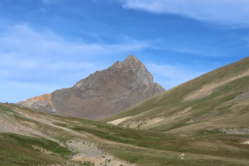
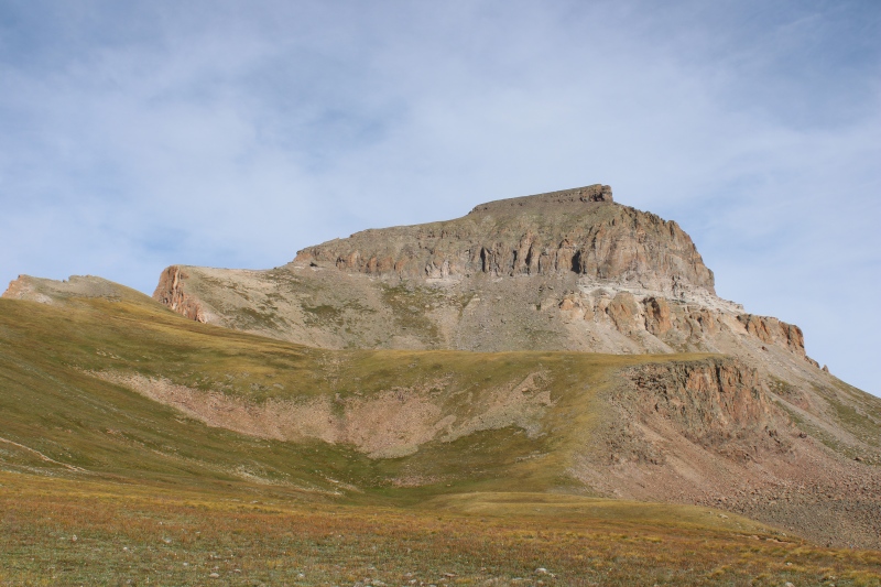
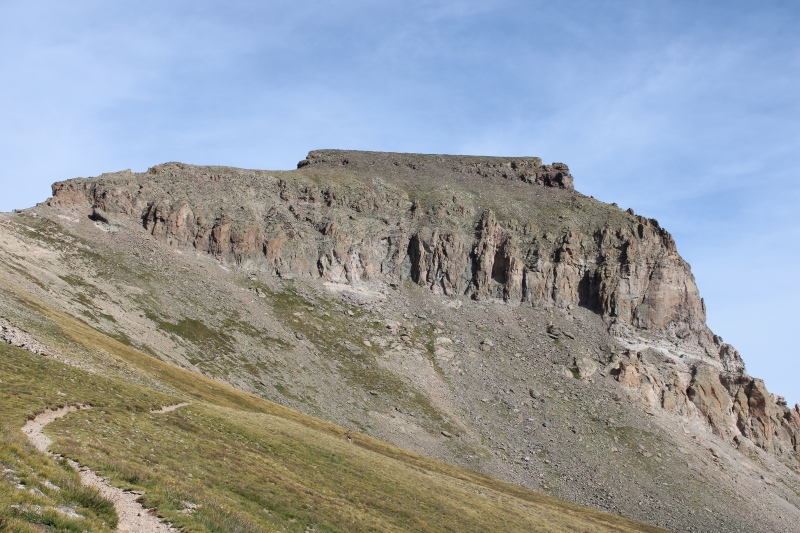 
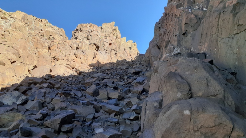
Lots of people, and deservedly for such a perfect weather Sunday. Somehow it seems that most people were heading for the couloir to the right of the rock tower at the steep crux section ~ 13,800 ft, and I instinctively landed myself there too. The line going to the left side appears to be less used. Anyway, this couloir is steep and full of loose rock, but it is short and passable without issue, if checking each and every hold. I was otherwise disconcerted by how easy the rest of the route (below and above this section) is. Surprising considering how well defended by cliffs the summit really is. 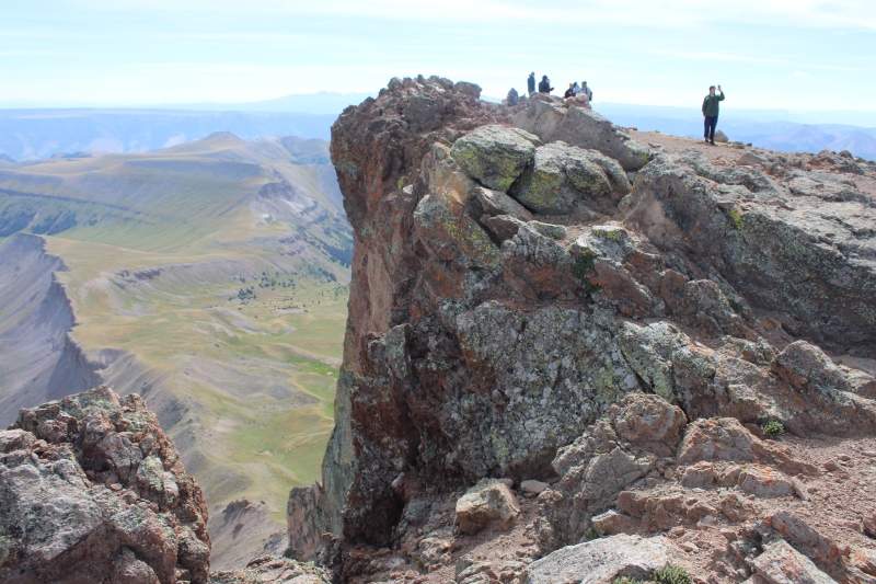
Some of the finest views on top of a 14er, with truly impressive cliffs and overhangs. A splendid mountain on a splendid day.
Return by the same route, with some elevation to re-ascend on the plateau, nothing steep or long but many uphill sections. 14 miles and 5100 ft vert from the lower 4WD lot. Plenty of water access along this trail. I decided to keep camping along Matterhorn creek road that night and call a day off the next day. By day 9, I had relocated to Silver Creek TH at the base of Redcloud and Sunshine peaks. Really nice dispersed campsite right past the parking lot, walking distance to TH, shared with friendly locals.
Forecast was calling for slight (~2-4%) chances of rain throughout morning and a little more in the afternoon. Problem: by 6AM, it had already rained twice since the last shower shortly before midnight. Ceiling was also completely black, almost thunderstorm-grade black, despite sky being starry by 5AM. I had done Redcloud many years ago but Sunshine escaped me that day, and I had my eyes set on Sunshine's NW ridge route for the ascent, so that I would only reascend Redcloud once on the descent. It wouldn’t take long (7AM) until the next shower during which I could see Handies being rained on more copiously 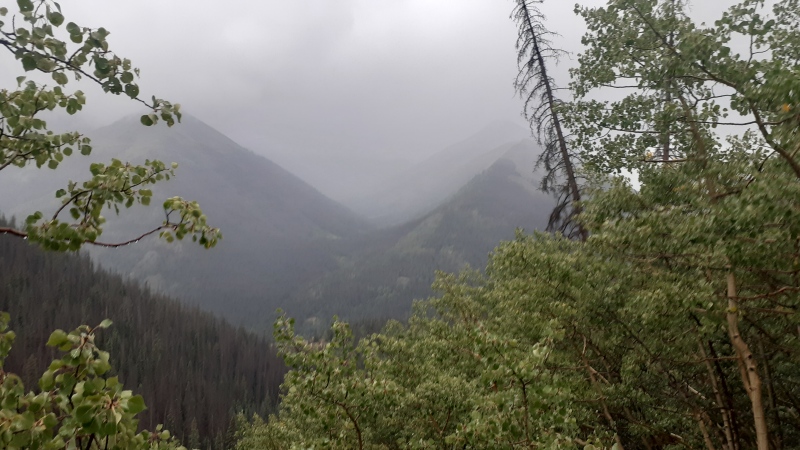 
, and I caught the second shower of the day in the avalanche area right after the split off Redcloud standard route. That made me question my sanity to commit to the rock glacier and couloir above, as I didn’t want to tackle a class 2+ non-standard route in poor weather. Of course the sky would “clear up” as soon as I made the call to turn back, then I leisurely descended while drying out and contemplating one of Lake City’s finest wildflower patches. 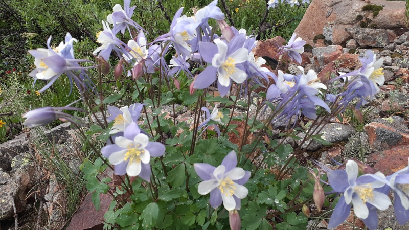    
Back at TH by 11AM not without disappointment and, you’d bet, clear sky. After eating brunch, hanging clothes to dry and sipping Hinsdale county’s best espresso at my tent, and after exchanging weather updates with fellow hikers, I decided to not call it quits for the day, and to drive up to American Basin. At worst I’d enjoy lunch in American Basin wildflowers, at best I’d “bag” a Handies repeat, for which, I’ll admit, leaving at 12.45PM wouldn't be the smartest idea. I got to Sloan Lake with darkening sky and attempted to push on. I quickly made it to the ridge, at which point I assessed weather on the other side of it (S/E). Well, bad news, it was even darker than in the directions I could see until then. 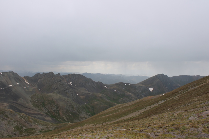
Quickly turned around and, one sprinkle later, called it lunch break in the meadows below Sloan Lake. What a fine place to stop. The weather will eventually clear up entirely with amazing views on the meadows and American Basin. Glorious weather all the way down my descent. 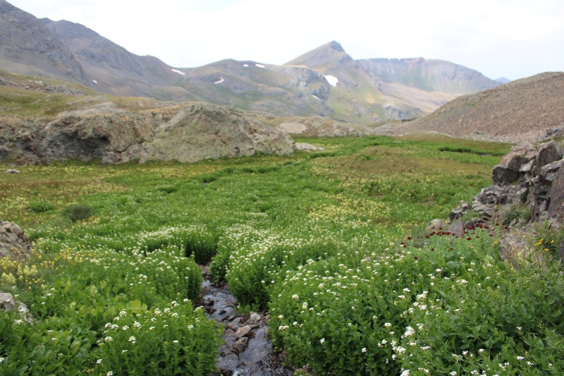   
No rain until I got back to my tent near Silver Creek TH. Then, by 6PM, boom! Sunshine peak will be trolling me with perfect sky. And I eventually ran out of time to finish eating dinner before it’d sprinkle again. 
Day 10 started just like the day before with apocalyptic light by sunrise, also preceded by starry sky pre-dawn… Except that I played weak and packed out my tent and drove down to town to refill groceries and assess regional forecasts in more detail. I will eventually regret it, as I spent a nice clear afternoon chilling at Mill Creek campground. Day 11 was the 5th consecutive day without significant chance of thunderstorms in Lake City but I hope you got the trip leitmotiv by now, this did not mean clear sky … eww, what a putrid one again before dawn! This time I stubbornly drove back up the shelf road, which is enjoyable at night without tourists not yielding to uphill vehicles by fear of falling off the cliff, and braced for the worst. Good news: by 7AM it had not rained yet (hypothesis 1: wow!, hypothesis 2: does that mean an overdue downpour?). Bad news: the ceiling dropped from the days before, and the peaks were in the clouds. So I again bailed of Sunshine’s NW ridge to compromise for the standard route and a dual Redcloud ascent. I made it to my Redcloud (or was it “Whitecloud”) repeat in complete overcast but there was no wind and it was almost mild, so I’ll take that for a glass half full. I spent the next half hour walking the ridge and imagining what the views should look like, and I reached my 25th 14er, “Foggy” peak with no views.
Still foggy for my Whitecloud reascent, but this time it looked like if the clouds were going to clear up. I hadn’t closed the door on climbing pt 13,832, in case weather would evolve for the better. Unfortunately, I think my legs had made the decision by then and the call was a hard no. So, I eventually reluctantly called it descent for good. And as I was descending the weather will clear up for the rest of the morning and much of the afternoon. And another miss, 13,832 will be for another day. 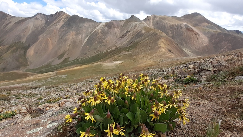 
I’d eventually come down to town that night to catch up on the local beer production and more importantly, on the bad weather forecast news for the weekend. I scratched my plans to travel to the Sangre de Cristo the next day and finally hike peaks there, because these flood warnings for La Veta pass had me concerned. Not sure if it was the right call or not, but I instead decided to head out to Ouray to attempt Sneffels. Perhaps that’d be a good consolation prize for missing Wetterhorn. I looked realistic that I could summit safely if descending no later than 10. The sight of afternoon thunderstorms welcome me in Ouray, as forecasted. These had been elusive for the last 6 days so it was a bit reassuring that maybe, weather would become more normal and somewhat predictable again. So, if that pattern holds, I’d be able to summit Sneffels early and come down before things get electric. And on Day 13 (Aug 26), I was up driving a soaked Yankee Boy road and I set sail for Sneffels’ standard route (I only made it to Governor basin junction with my Outback, but even that is a relatively short route compared to most peaks). I know how it’s not the most praised route around and that many folks prefer the SW ridge, but considering the forecast of the day and its accuracy as of late, it was probably safest to stick to the path of easiest retreat. 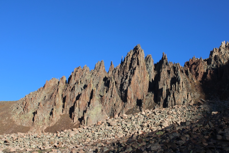  
The route ended up being far more enjoyable that I expected, despite being on a busy Saturday with significant rock fall due to crowding. And really, the only bad part is to get to the col. I found the couloir above to be actually pleasant to hike up, and everyone I saw was very cautious about loose terrain. 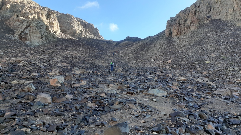
The V notch did not cause me much trouble, I am 6 ft tall so this might help. 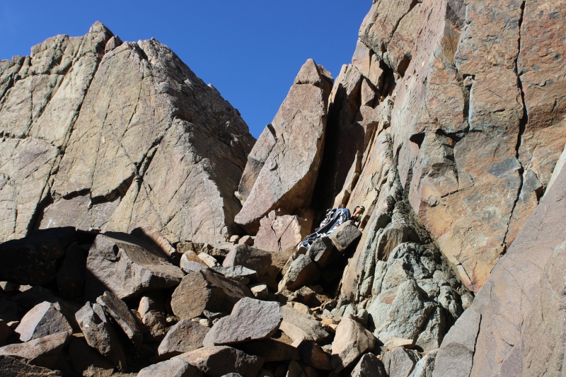 
The summit was soon in sight and wow, that one did not disappoint, despite only partial views on the western San Juans. 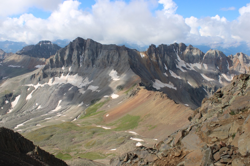
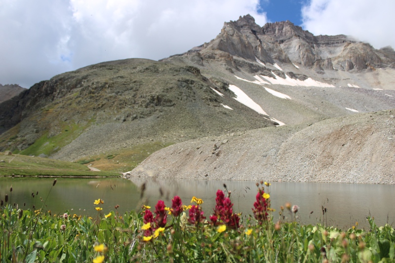
Since the weather had seemed to want to hold, I detoured on my descent to Blue Lakes pass, and spent the rest of the hike down enjoying amazing patches of wildflowers. 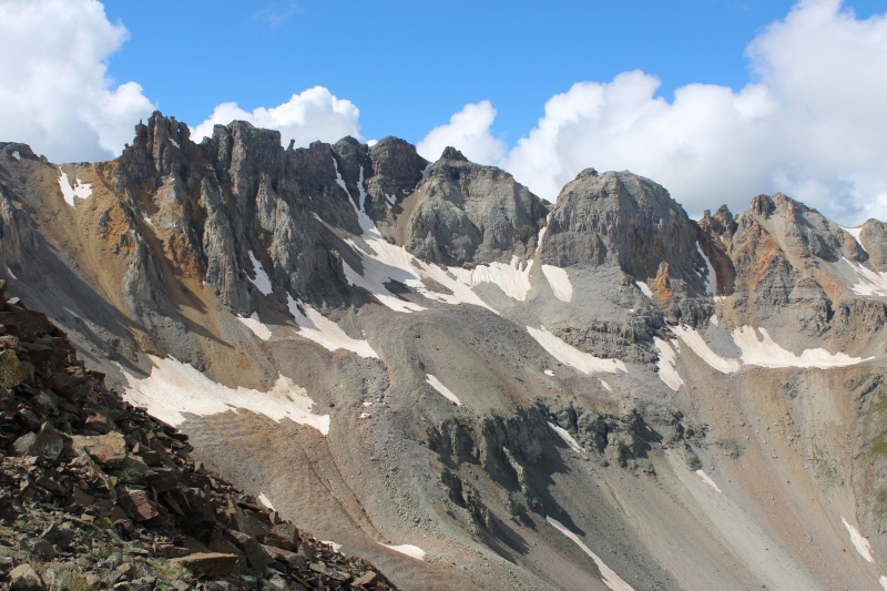 

Fair to say that Yankee Boy gives American Basin a run for its money.
Back down to car shortly after noon, and by 1PM, I was enjoying lunch at the campground, and the thunderstorm hit. Hit once, and hit twice another hour or so later. Anyway, time to go to town catch up on weather updates, supplies and to give some sign of life to my relatives. I eventually decided to stay a second night and enjoy a well-earned hot springs soak. I was driving back to my tent up CR 361 after dark and I noticed something about road closure to Yankee Boy on the flashing message board off US 550. Yep, it was closed just past Governor Road junction indeed. Oops. This was where I was parked, I thought… Indeed, I will later learn that it was about 100 yards above where I was parked that a washout damaged the road and got a few parked vehicles stuck. I do not know which of the two storms caused the ruckus, but morale of the story is: leaving early never hurts. I’m sure glad I did. A late morning hike to the Alpine Mine overlook the following day will conclude my extended visit to the San Juan, and getting soaked in the descent before noon convinced me I had enough of weather uncertainty, and that, maybe, the grass (or at least the weather forecast), would be greener on the other side (of the continental divide). Of course, forecast for that morning was wrong, at best.
I ended up that evening in Buena Vista, with robust intentions to make it to Mt Princeton the next morning. Little did I know that this would be another snafu. That’ll also be a separate TR, with FINALLY some awesome high peak traverses on the following days. Thanks for reading! Thumbnails for uploaded photos (click to open slideshow): ")
")
")
")
")
")
")
")
")
")
")
")
")
")
")
")
")
")
")
")
")
")
")
")
")
")
")
")
")
")
")
")
")
")
")
")
")
")
")
")
")
")
")
")
")
")
")
")
")
")
|
| Comments or Questions |
|---|
|
|
Caution: The information contained in this report may not be accurate and should not be the only resource used in preparation for your climb. Failure to have the necessary experience, physical conditioning, supplies or equipment can result in injury or death. 14ers.com and the author(s) of this report provide no warranties, either express or implied, that the information provided is accurate or reliable. By using the information provided, you agree to indemnify and hold harmless 14ers.com and the report author(s) with respect to any claims and demands against them, including any attorney fees and expenses. Please read the 14ers.com Safety and Disclaimer pages for more information.
Please respect private property: 14ers.com supports the rights of private landowners to determine how and by whom their land will be used. In Colorado, it is your responsibility to determine if land is private and to obtain the appropriate permission before entering the property.


