| Report Type | Full |
| Peak(s) |
El Diente Peak - 14,175 feet Mt. Wilson - 14,256 feet |
| Date Posted | 09/05/2023 |
| Modified | 09/19/2023 |
| Date Climbed | 09/05/2023 |
| Author | tygr |
| El Diente (via North Buttress) + Traverse to Mt Wilson |
|---|
|
We arrived at Navajo Lake on the evening of Sunday, September 3, 2023. It was about 8pm. It was a long day. None of us live in Colorado, so we all caught early flights in from the east coast. Bryant came in from Texas. We flew into Montrose, then drove to the Navajo Lake trailhead and hiked in, arriving at Navajo Lake around 8pm, just as the sun was setting. 

The plan was to do that, use Monday, Sept 4th as a rest day, then tackle El Diente via the North Buttress. Everything was going as planned. Monday was a mix of clouds and sun and a couple sprinkles. El Diente and Mt Wilso were shrouded in clouds most of the day. We were hoping for good weather the rest of the week and we got it. The weather was perfect! 

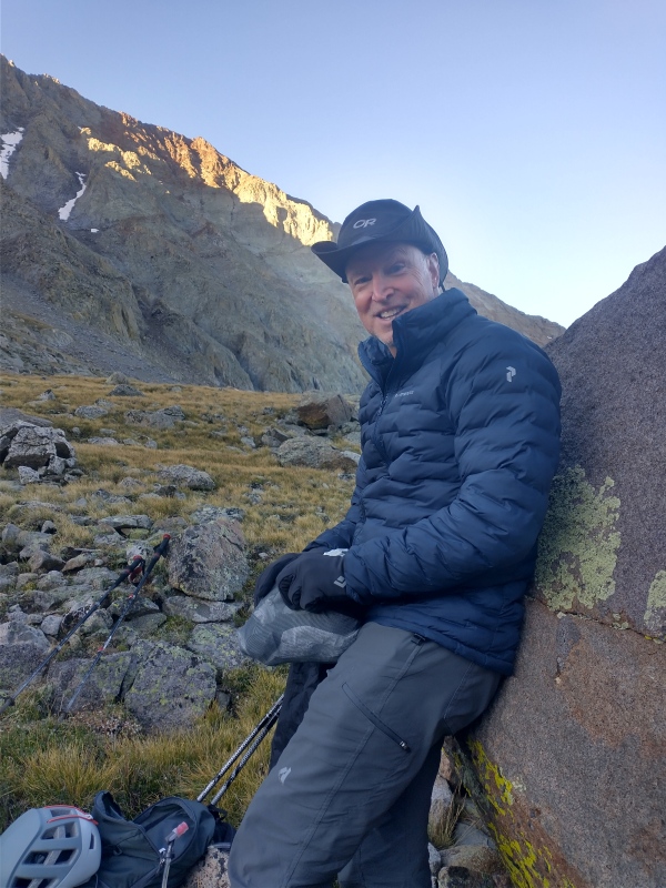

El Diente (North Buttress) 6am, Tuesday morning, September 5th, we left our campsite around 6am. There was just enough early morning sunlight that we didn’t need our head lamps. Everyone was feeling pretty good and the weather was perfect. 
I was planning to do the El Diente / Mt. Wilson traverse, while Joe, Bryant, Bob and Sean were planning to descend the Kilpacker trail route and circle back to camp. I had printed the El Diente North Buttress ascent route from 14ers.com (https://www.14ers.com/route.php?route=eldi8) but failed to copy step #6 (the Summit Pitch). That would prove to be costly. We’re all kind of slow hikers, but with the weather being as good as it was and the 6am start, there was no reason to worry about getting up and back. We followed the route up to the first bench, passing through the boulder field and the “Slabs” just as described: [VIDEO - Hike to the 1st Bench] 

We rested at the first bench, after the “Slabs” and then progressed through the “Jumble” and the “Hump”: [VIDEO - Jumble to the Hump] Nobody else was on the mountain that day. It was great. Here, we rested again on the 3rd bench just before the “V”. All of these landmarks were easily discernable. We also found carins along the way. [VIDEO - Hump to the V] 
After passing the “V” we entered the catwalk: [VIDEO - The Catwalk] 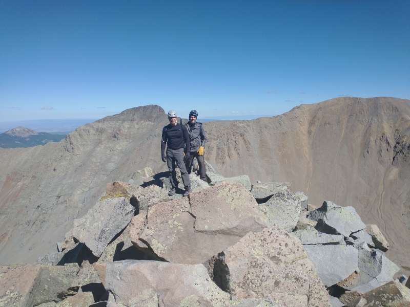
The catwalk was fun, even for those less accustomed to hiking. This was Sean’s first 14er ascent and he was doing great. This is where things broke down for us. Because I failed to copy all of the route off of 14ers. I’m not exactly sure of the altitude once we hit the tower after the catwalk. I think it was 13,900’ (or around there). The summit was easily in site, but because of my cut-n-paste error, I wasn’t exactly sure of the route. Using a clock for a sense of direction, I went slightly left (say 11am) up towards some ledgie slabs. It seems I should have gone up and over some large boulders immediately in front of me and then ascended to the right, which would have aligned with photo #19 from N.Buttress 14ers. What I think I did was more like photo #14 and (unfortunately) nobody felt really comfortable with that. Actually, I’m sure I was off route. The description talks about this being a class 4 section, but it felt a little class 5 to me. 
Unfortunately, I did not have my go-pro running while I was making my way through this section. I did turn it on again once I hit the final steep, loose section just below the ridge: Nobody followed me. Actually, it’s a good thing too, because that section I went up was so loose. You’ll see in my video as I was climbing onto the ridge, this basketball sized boulder came loose and would have been disastrous for my buddies if they were below me (though I would have used everything I had to keep that boulder from falling). Nevertheless, the boulder went down and, thankfully, nobody was there. My crew: Joe, Bryant, Bob and Sean got so close, but then turned around at the tower and descended some of the north buttress before blazing a trail down some of the gullies to the right. It took them longer to get down, but they felt safer than descending the catwalk. I hit the summit of El Diente at 1:45pm. [VIDEO - Summit Ridge of El Diente] El Diente / Mt. Wilson Traverse "Best Of" El Diente to Mt Wilson Traverse From there, I did the traverse to Mt Wilson. Again, I had the traverse description from 14ers, but decided to stay on the ridge leaving El Diente to make things a little more spicy: [VIDEO - Leaving El Diente (staying on the ridge)] The rock on the ridge leaving the summit of El Diente was pretty solid. Good hand holds and foot holds and it made for spectacular views on both sides of the ridge. From there, I descended on the south side of the ridge to the base of the “Organ Pipes” and picked up the normal traverse route: [VIDEO - Organ Pipes] After passing the base of the “Organ Pipes” (plenty of carins), I made my way back to the ridge. Finding carins along the way was fairly easy: [VIDEO - Past the Organ Pipes, below the Ridge] After regaining the ridge, this is a pretty tame section with great views on either side: [VIDEO - Ridge to the Saddle of Mt Wilson] I continued on this ridge until it hit what looked like a saddle before the push up Mt. Wilson. The summit ridge up Mt Wilson was fun. Definitely some exposure and class 4 moves along the way: [VIDEO - Mt Wilson Summit Ridge] I summited Mt Wilson at 5:30pm. I thought I’d have plenty of time to get back to camp at Navajo Like. In reality, I should have, however, I did NOT have the map / route for returning from Mt. Wilson into the Navajo Lake basin via the North Slopes. I thought I should go back to the saddle area then descend on the north side. There were no carins but it seemed there was some sort of worn path down that side and I just presumed it was the trail. It wasn’t. I got down maybe 150’ and realized that. I decided to continue going down, basically straight down, dodging the glaciers in the gullies. This was a loose and precarious descent. Another big mistake on my part. I got down into the basin (level ground) by like 8:15pm. Despite me attempting to go straight down, I had to angle to the right to avoid some cliffs and glaciers. It was a mess. I rested in the dark on one of the big boulders for about 30 minutes. I thought I might just spend the night there. It really wasn’t that cold (maybe upper 30s), but then I just decided to get up and try to find the trail and get back to camp. Eventually found the trail and then made it back to camp by 11pm. Yeah…took me that long. Thankfully the rest of my crew made it back safely from their descent of the North Buttress. They told me how they also got off trail, preferring to skip the descent of the catwalk to a gully, where they encountered similar steep, loose rock with glacier ice dodging and route finding to get back. Thumbnails for uploaded photos (click to open slideshow): ")
")
")
")
")
")
")
")
")
")
")
")
")
")
")
")
")
")
")
")
")
")
|
| Comments or Questions |
|---|
|
|
Caution: The information contained in this report may not be accurate and should not be the only resource used in preparation for your climb. Failure to have the necessary experience, physical conditioning, supplies or equipment can result in injury or death. 14ers.com and the author(s) of this report provide no warranties, either express or implied, that the information provided is accurate or reliable. By using the information provided, you agree to indemnify and hold harmless 14ers.com and the report author(s) with respect to any claims and demands against them, including any attorney fees and expenses. Please read the 14ers.com Safety and Disclaimer pages for more information.
Please respect private property: 14ers.com supports the rights of private landowners to determine how and by whom their land will be used. In Colorado, it is your responsibility to determine if land is private and to obtain the appropriate permission before entering the property.


