| Report Type | Full |
| Peak(s) |
Le Brevent (8,284') La Jonction (8,494') Chamonix Vertical Kilometer (6725') Grand Balcon Sud (6,791') |
| Date Posted | 09/11/2023 |
| Modified | 10/12/2023 |
| Date Climbed | 08/03/2023 |
| Author | jfm3 |
| French Alps Training Camp Part 1: Overview, Le Brevent Loop & La Jonction |
|---|
|
French Alps Training Camp Part 1: Overview, Le Brevent Loop and La Jonction August 1-4, 2023 Chamonix, France This is the first of a 4-part (possibly 5?) report detailing a 2-week trip I made to the French Alps in Chamonix, France and the Swiss Alps in Interlaken, Switzerland in August 2023. Over the years reading trip reports has been a significant part of my planning and research for mountain objectives, so I'm including many photos, links and general discussion of the trip. I first went to the Swiss Alps in August 2018, then returned in August 2022 (reports for both trips are on my profile). I also made a trip to the Italian Dolomites and Austrian Tyrolean Alps in January 2020 for cross-country skiing. Even as I made those trips, Chamonix was in the back of my mind. Way back when I first started getting into 14ers, I read Anton Krupicka's blog post about climbing Mt. Blanc in a single push from Les Houches as part of his training for the 2013 UTMB race (http://antonkrupicka.com/blog/aug-12-25/). At the time I barely knew where Mt. Blanc was, but it sure seemed like a neat thing to do. I soon learned that Chamonix is the mountain running capital of the universe, and is also considered the birthplace of alpinism. I first considered a trip to Chamonix as a real possibility sometime in 2020, with the main objective being a climb of Mt. Blanc in a single day. I knew from my first trip to Switzerland that the trail/mountain running opportunities are nearly endless in the Alps, so it wouldn't be difficult to create a 2-week itinerary. I also knew the Mt. Blanc climb would be harder than anything I'd ever done (12,000 vertical feet in ~7 miles, climbing from forest to rock to glacier) so I started gaining the skills necessary to attempt such an outing. I climbed 12ers, 13ers and 14ers in ice axe & crampon snow conditions, ran the Purgatory-Chicago Basin route twice (once for Eolus & North Eolus, the other time for Sunlight & Windom), knocked out most of the class 3/4 14ers and completed all the classic Colorado trail runs each summer: Tenmile Traverse, Boulder Skyline Loop, Four Pass Loop and Pawnee-Buchanan Pass Loop. 
After the cross-country ski season ended in April this year, I started planning for Chamonix. I entered this summer with only North Maroon Peak and Capitol Peak remaining on my 14er list. I planned an aggressive 3 months of training in May, June and July to reach peak mountain fitness by the beginning of August. I completed the following outings starting Memorial Day weekend and going through the last weekend of July, without taking a weekend off: Conundrum Couloir snow climb and traverse to Castle Peak, Boulder Skyline Loop run, 45 mile point-to-point rollerskiathlon in Summit County, Snowmass Mountain car-to-car snow climb in 15 hours (especially satisfying since this was my 4th attempt at a 1-day Snowmass climb), snow climb of "Southeast Longs" & Mt. Meeker, Tenmile Traverse run and Crestone Needle climb from the lower trailhead on the 4th of July weekend, North Maroon Peak climb with full snow conditions above the second gully, classic rollerski from Idaho Springs to the summit of Mt. Evans, Four Pass Loop run with the addition of Buckskin Benchmark from Buckskin Pass and Pawnee-Buchanan Pass Loop run with the addition of Sawtooth from Buchanan Pass. I also maintained my usual schedule of weightlifting and swimming twice a week, intensity training (either running or rollerskiing) and easy running/rollerskiing in Boulder to fill out each week. I ended up doing 206 hours of training in 3 months, with a significant portion of that being in the high mountains. I was in great shape for the trip and had no issues with fitness on any of the routes/objectives I did. Training in Colorado is also a bonus because the acclimatization comes for free. It's always fun to go to the Alps and see my vertical speed increase by 25%. Chamonix is at 3,300' and Interlaken sits at just 1,500', so there are no altitude effects to worry about. 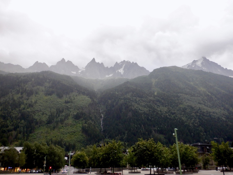
In addition to the physical training, there were a lot of lodging and transportation logistics to plan for the trip. The websites below were excellent for planning and information. Other websites that I used for specific parts of the trip will be introduced in those sections. https://en.chamonix.com/. General tourism information. The webcams on this site were by far the best, and offer views on both sides of the Chamonix valley. https://www.chamonix.net/english. General tourism information. This site seemed to be more useful for providing transportation schedules and links; I booked the mini bus from the Geneva airport (detailed below) from the main page. https://elevation.alpsinsight.com/. THE website for routes, photos and general information about trail/mountain running in the Alps. The authors (Dan & Janine Patitucci and Kimberly Strom) live in Interlaken, so the site focuses primarily on Switzerland, but there is an excellent section on Chamonix. I emailed Dan for advice about Mt. Blanc and he was quick to reply with lots of good information. https://runthealps.com/. Another good resource for trail/mountain running in the Alps. The Chamonix page is here: https://runthealps.com/blog/the-trail-runners-underground-guide-to-chamonix. https://www.sncf.com/en and https://www.sncf-connect.com/en-en/. French trains (used only to get from Chamonix to Martigny (Switzerland) on the way to Interlaken. Within Chamonix itself, the bus system was excellent. https://meteofrance.com/. Weather forecasts. This site appears to be only in French, but it was easy enough to figure out the forecast. https://www.chamoniarde.com/en. Mountain/route conditions for the entire Chamonix region. This is essentially a combination of the 14ers.com trip report and condition report pages. The Chamoniarde office is in downtown Chamonix and they provide daily weather forecasts for the high mountains and have guides that can offer advice and recommendations about conditions, routes, etc. Tuesday August 1 - Wednesday August 2: I flew from Denver to Munich, then Munich to Geneva, all on Lufthansa. I like taking the long flight from Denver directly to Europe, then taking the second short flight within Europe. This makes it easier to arrive at the final destination closer to hotel check-in time, and usually means a better arrival time in Denver on the return. I took a 15-person mini bus from the airport to Chamonix and was dropped off at my hotel. The mini bus was fairly cheap (40 euros) but my original leave time was delayed by 2 hours so I had to wait at the Geneva airport. Next time I think I'll just take a regular public transport bus from Geneva to Chamonix, then use the local bus to go the rest of the way to the hotel. I stayed at Hotel L'Arveyron, about 1 km from downtown on the banks of the river: https://www.arveyron.com/en. Door to door travel was about 22 hours and all my luggage made it without incident. After 4 trips to Europe, I seem to have a good system to adjust to the time difference: sleep, even if it's just a few hours, on the overnight flight from the US, then stay awake until ~10 PM the day of arrival in Europe. Then I usually feel alright the next day when I wake up at 7 or 8 AM. 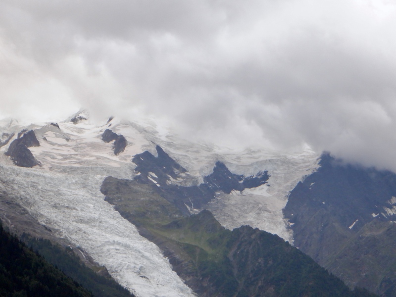
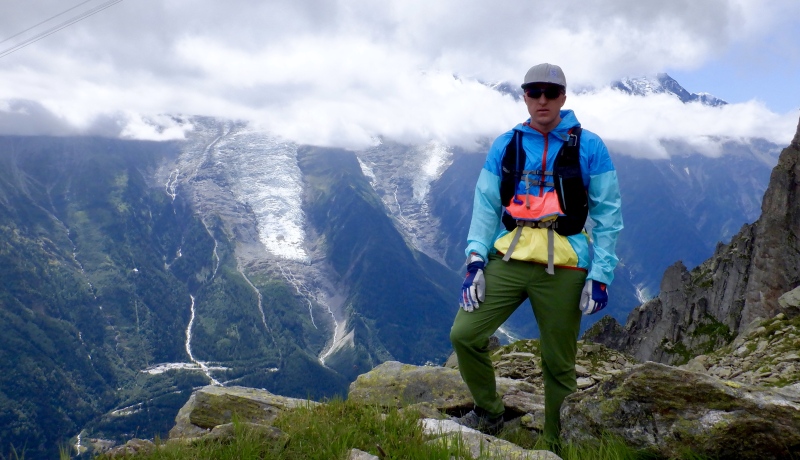
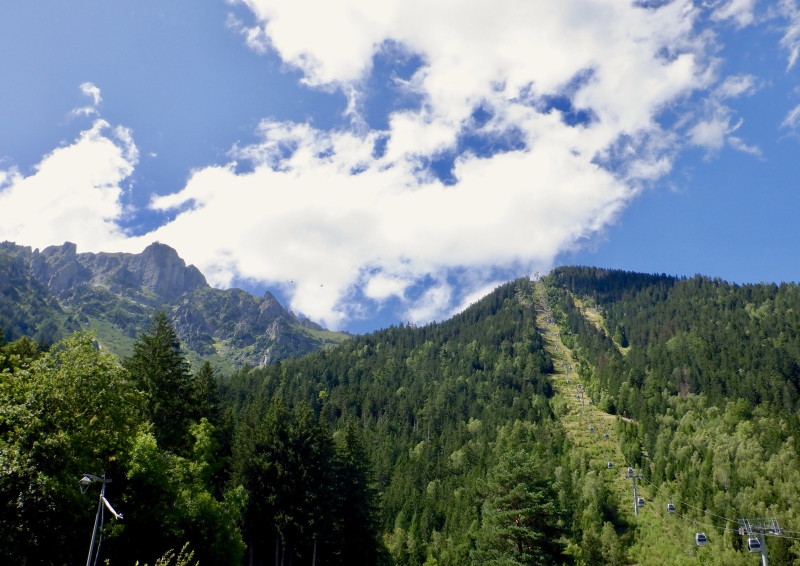
Thursday August 3: On my first full day in Chamonix I ran a loop on the north side of the valley that went up the Vertical Kilometer (https://elevation.alpsinsight.com/france/chamonix-vertical-kilometer/), then continued to the top of Le Brevent. From the summit I took part of the Grand Balcon Sud (https://elevation.alpsinsight.com/france/chamonix-grand-balcon-sud/) route to the east, then descended back to the valley floor. The Strava entry is here: https://www.strava.com/activities/9577169600. The reports for the outings are as I wrote them in my training log. 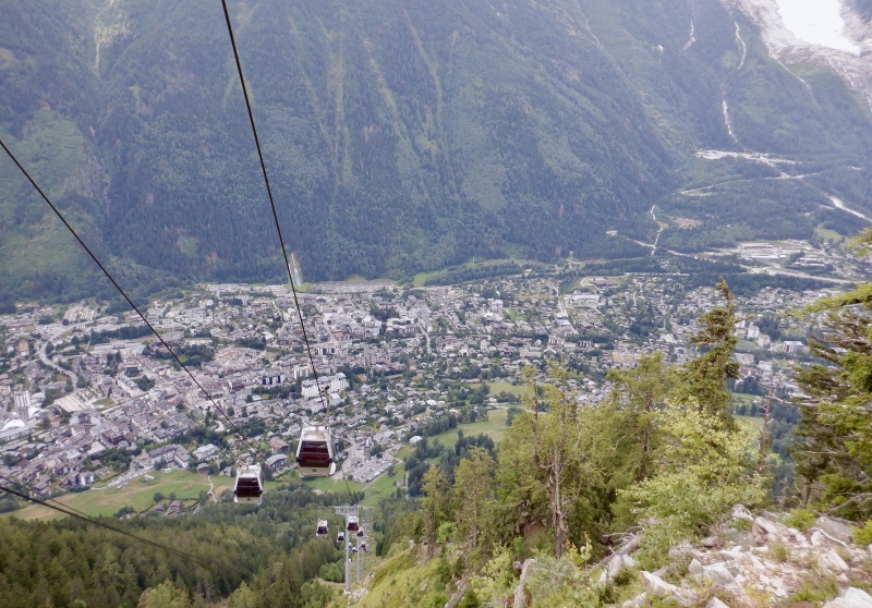
I think the mountains here eclipse all the other places I’ve been. The Swiss Alps are very impressive but the vertical relief here is hard to comprehend. I slept well and I seem to be adjusted to the time difference. The hotel is right next to the river that runs through town. The cool air and rushing water made for a pleasant night. The hotel room itself is really small, but I can fit all my gear without tripping over it. Breakfast was mostly bread. I got apples and bananas at the grocery store on the way home to supplement the buffet. I took the bus from the hotel to a few blocks from the start of the route. It’s very easy to get around with the bus- it’ll work well for the week. The Vertical Kilometer was relentlessly steep. The vert stacked up quickly but there was so much to accumulate. 
The top of Mt. Blanc was visible for a few minutes but the cloud layer hovered around 9000’ most of the morning. Not much was visible on the south side of the valley. It took me 90 minutes to reach the mid-mountain lift station at the top of the VK. I was in L1 the whole way, thanks to the low altitude, but my legs were burning. The clouds, fairly low temperature and wind made it somewhat cold so I put on my warm layers when I stopped to eat. 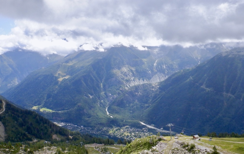
After seeing just 3 people on the VK, the trail to Col du Brevent had dozens of groups. Most people were moving slowly, carrying huge packs and hanging on their trekking poles. The clouds dipped briefly but when I reached the col there was sun in the valley to the north. The traverse to the summit took a surprisingly long 30 minutes. The trail was quite rocky and detoured slightly to the north around the sheer ridge on the edge of the mountain. After stumbling on a few of the larger rocks I arrived at the observation deck above the tram tower. 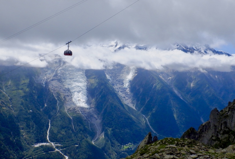

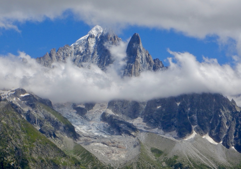
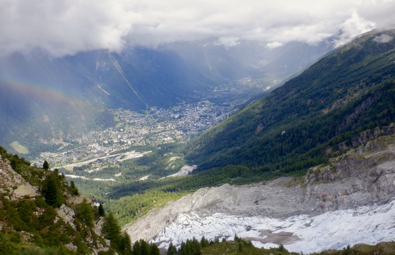
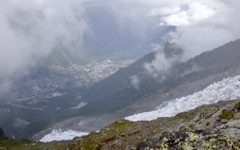
The view from the top was great despite the low cloud ceiling. Mt. Blanc was covered but most of tomorrow’s route up La Jonction was visible. All the buildings in Chamonix were tiny, a vertical mile below. The lower part of the Grand Balcon Nord and just a glimpse of the lower Aiguille Vert were also visible. I gazed around for awhile, then started down. The shorter, more direct route back to the top of the VK was closed due to construction, so I had to go back around the north side. As I descended the clouds on Mt. Blanc lifted and the entire upper mountain was visible. The glaciers gleamed in the sunlight, looking impossibly high above the valley floor. 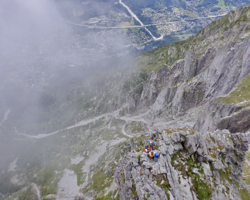

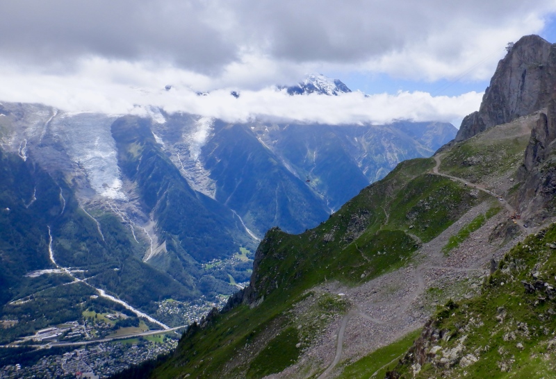
I stopped for a picture break before continuing up the shorter ascent to the top of the Cornu lift. The sky overhead was still cloudy so I kept my pants & windbreaker on. There were many people descending this trail, in widely varying states of clothing and enthusiasm. The initial descent back to the treeline was quite steep, down a narrow and sometimes faint trail. Mt. Blanc was mostly visible and provided a stunning view as I ran. I took off the long clothes when I reached the trees. 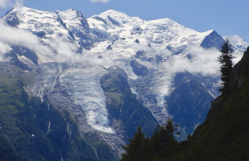

The sun was mostly out for the final hour of running down to Chamonix. The trail was excellent and the views to the south were fantastic. I crossed a few creeks and filled up my filter flask. My legs felt great the whole way down. I could see most of the Mer de Glace route I have planned for next week. I arrived back in town and sat on a bench looking up at the VK while I checked the stats on my watch. This was a great route to start the trip. The Mt. Blanc forecast for the weekend still isn’t great. Dinner tonight was at Joia Pizzeria. 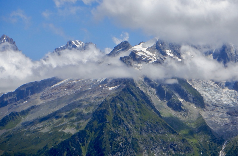
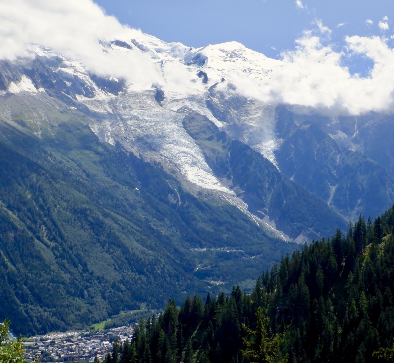
Friday August 4: The next day I went up & down the La Jonction route (https://elevation.alpsinsight.com/france/la-jonction-chamonix/). This steep ridge on the lower slopes of Mont Blanc splits the Bossons and Tacconaz glaciers, which reach all the way to the summit. The Strava entry is here: https://www.strava.com/activities/9583431218. 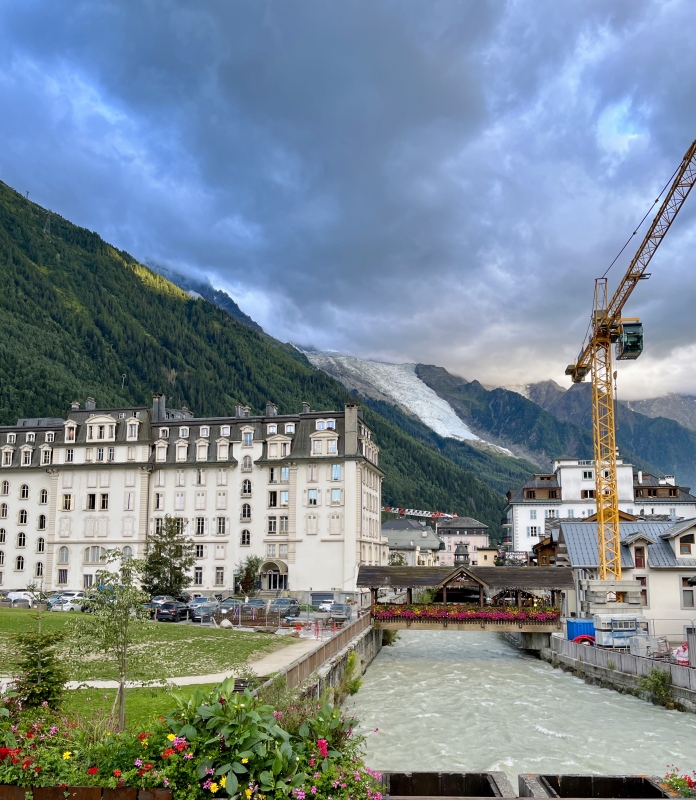
I think this ridge is even steeper than the Brevent climb yesterday. The high peaks were covered in clouds this morning but sunlight reached the valley floor on the bus ride to the bottom of the hill. The lower reaches of both glaciers were visible below the clouds from the bottom of the route. The plan was simple: go up. The trail was a leg burner from the first step. I passed some people low on the climb and took a break shortly after reaching the top of the chairlift. The first 3700’ of uphill was all in the trees, so none of the glacier terrain was visible. Glimpses of Chamonix below and the Brevent wall to the north provided a gauge of upward progress. 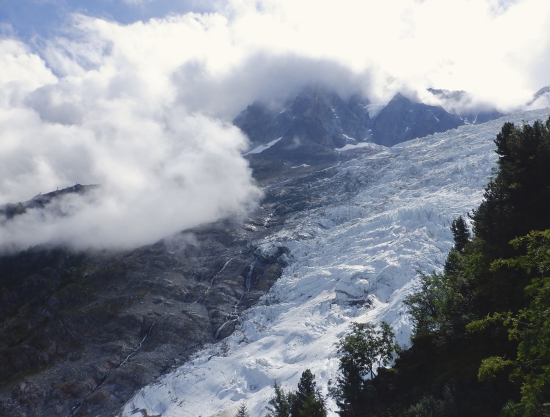
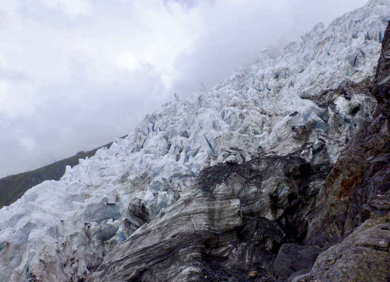
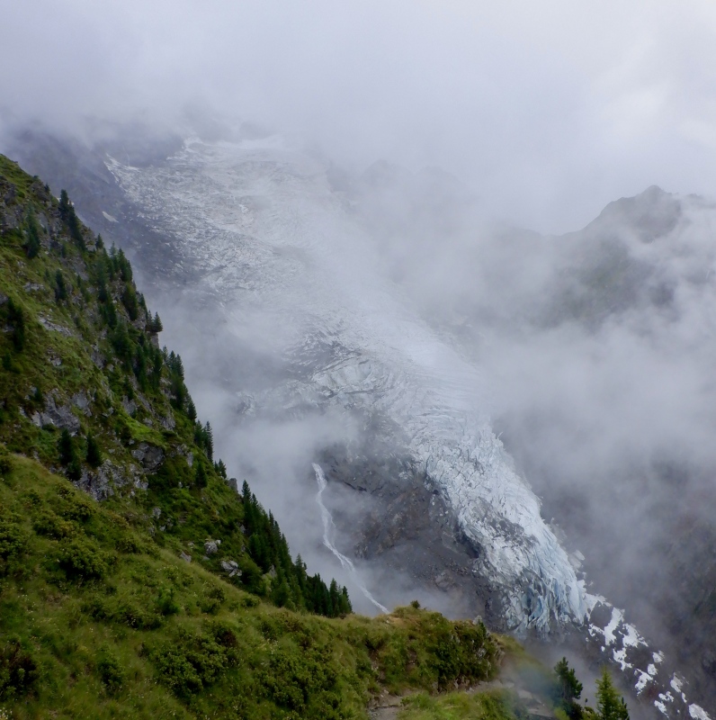
There weren’t many people on the trail all day. It took 90 minutes to reach the Pyramides Chalet. The first up-close view of the Bossons Glacier came just below the building. The trail got even steeper above the chalet and the day’s effort started to get fatiguing as I climbed out of the trees on the west side of the ridge. The cloud layer was partway up the Taconnaz Glacier. As I moved back to the east side, I heard and then saw a serac fall on the Bossons Glacier. The lift towers for the lower part of the Aiguille du Midi tram were visible at the bottom of the clouds. 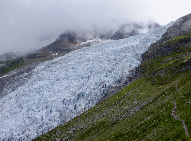
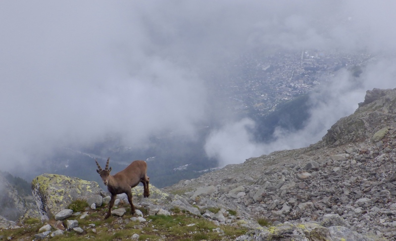
I took a final break at the tiny Mt. Corbeau col before the last section of climbing to the top. The trail turned into easy talus hopping but stayed very steep. Clouds covered everything but the very bottom of the glacier, leaving me to guess at the scenery above. The valley floor had occasional sunny spots far below. I arrived on top to find an ibex right next to the trail. It jumped up, looked at me for a moment and dashed off behind some rocks. More clouds moved in swiftly as I ate, so there wasn’t much to see. I looked down at town through the binoculars, then put on my waterproof layers as it started raining. Even next to the rock, the glacier was quite rugged, littered with moraine debris and scarred by many short, twisted crevasses. 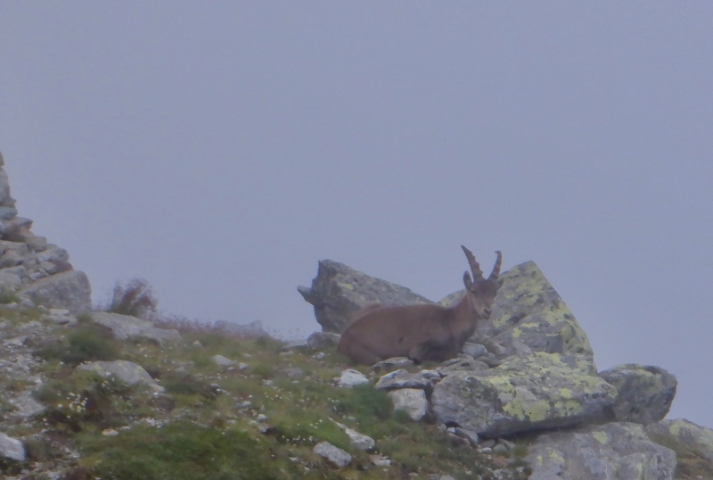

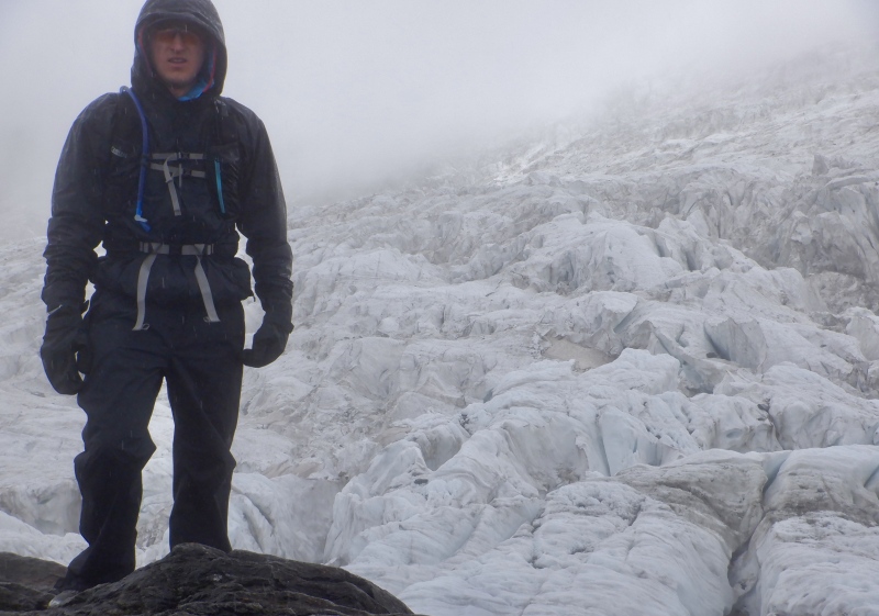
In good weather, this descent is probably a lot of fun, plunging down the steep trail with huge views over the valley. Today, in the rain and clouds, it was tedious. It took an hour to go from the top down to the chalet. The rocks were fairly slick from the rain and the dirt trail was quickly turning to mud. I paid close attention to my feet but I still slipped/tripped a few times. The rain fell with varying intensity, but it was always wet enough to keep my rain suit on. The only real scenery was the Bossons Glacier right next to the trail. The chalet was below the cloud layer, so I took off the rain suit once I got there. I figured the trees would provide enough cover to keep me dry. 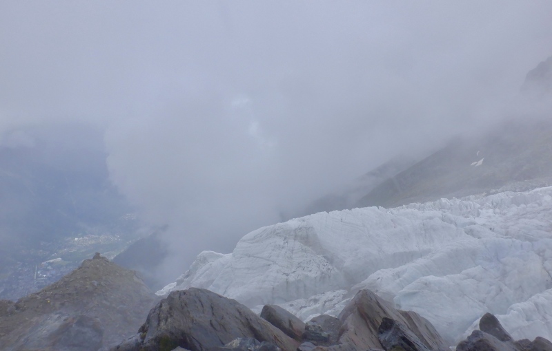
It took me another hour to descend the final 3000’ to the bus stop. The steep trail plunged steadily and I kept a pace slow enough to avoid too much pounding on my legs. A few people were headed up but the trail was quiet. The sun was out as I descended past the top of the chairlift, but more clouds swept in and the rain returned as I emerged from the trees. 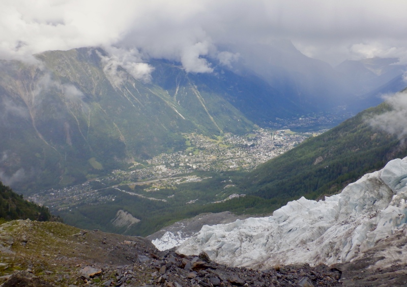
I waited 5 minutes for the bus and was soaked by the time it arrived. I got off in Chamonix and went to the Chamoniarde office to ask about Mt. Blanc weather/conditions. The rockfall and crevasse danger is minimal right now but the forecast for Sunday is deadly: windchill down to -20F, clouds and fresh snow on the upper mountain. They said the conditions will be much better starting on Monday, when a high pressure system arrives. I ate at Neapoli's Pizzeria tonight. 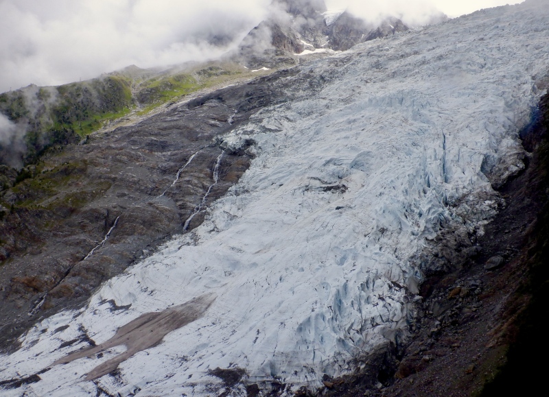
Part 2 of this report will cover the Mer de Glace-Plan du L’Aiguille Loop, sightseeing at the spectacular observation deck at the summit of Aiguille du Midi and a short run on the Aiguille Vert massif. Thumbnails for uploaded photos (click to open slideshow): ")
")
")
")
")
")
")
")
")
")
")
")
")
")
")
")
")
")
")
")
")
")
")
")
")
")
")
")
")
")
")
")
|
| Comments or Questions | |||
|---|---|---|---|
|
Caution: The information contained in this report may not be accurate and should not be the only resource used in preparation for your climb. Failure to have the necessary experience, physical conditioning, supplies or equipment can result in injury or death. 14ers.com and the author(s) of this report provide no warranties, either express or implied, that the information provided is accurate or reliable. By using the information provided, you agree to indemnify and hold harmless 14ers.com and the report author(s) with respect to any claims and demands against them, including any attorney fees and expenses. Please read the 14ers.com Safety and Disclaimer pages for more information.
Please respect private property: 14ers.com supports the rights of private landowners to determine how and by whom their land will be used. In Colorado, it is your responsibility to determine if land is private and to obtain the appropriate permission before entering the property.


