Download Agreement, Release, and Acknowledgement of Risk:
You (the person requesting this file download) fully understand mountain climbing ("Activity") involves risks and dangers of serious bodily injury, including permanent disability, paralysis, and death ("Risks") and you fully accept and assume all such risks and all responsibility for losses, costs, and damages you incur as a result of your participation in this Activity.
You acknowledge that information in the file you have chosen to download may not be accurate and may contain errors. You agree to assume all risks when using this information and agree to release and discharge 14ers.com, 14ers Inc. and the author(s) of such information (collectively, the "Released Parties").
You hereby discharge the Released Parties from all damages, actions, claims and liabilities of any nature, specifically including, but not limited to, damages, actions, claims and liabilities arising from or related to the negligence of the Released Parties. You further agree to indemnify, hold harmless and defend 14ers.com, 14ers Inc. and each of the other Released Parties from and against any loss, damage, liability and expense, including costs and attorney fees, incurred by 14ers.com, 14ers Inc. or any of the other Released Parties as a result of you using information provided on the 14ers.com or 14ers Inc. websites.
You have read this agreement, fully understand its terms and intend it to be a complete and unconditional release of all liability to the greatest extent allowed by law and agree that if any portion of this agreement is held to be invalid the balance, notwithstanding, shall continue in full force and effect.
By clicking "OK" you agree to these terms. If you DO NOT agree, click "Cancel"...
When I was on Rio Grande Pyramid in 2021 and saw The Window for the first time I was mesmerized. I know it existed, but had no idea where it was, it's such a cool formation. The day I did RGP I had a tight weather window and wasn't able to get closer to The Window than ascending RGP, I knew at some point I'd want to get back for a closer look. I had a week off work in July so planned a camping trip to 30 mile to get back to The Window, from there I just looked at what other peaks I could do in the area. I prefer long day trips to backpacking so I can sleep in my toaster, eat real food, and drink beer at night, so just planned on doing these trips daily from 30 mile.
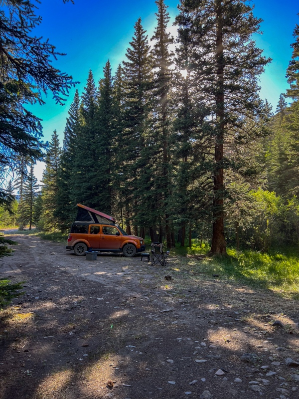
Drove to 30 mile on Sunday, used the same campsite I had for RGP 2 years ago.
This site is great, shade from both sides, it was a warm week.
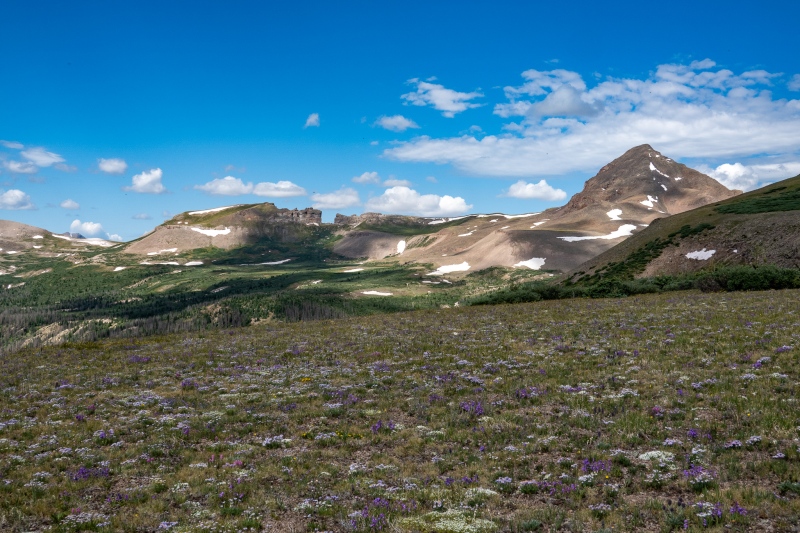
Monday morning I was up and hiking a little before 9am. There were no storms showing all week, so each day I just woke up whenever and started hiking. First objective was The Window. I wanted to stand inside that thing.
Along the way to The Window.
Getting to The Window is mostly just a casual walk, NBD. Views as I got closer were pretty awesome, as expected.
A little bit of willow fighting along the way, but not too bad.
From inside The Window looking east.
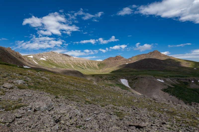
From The Window I circled around to the south and ascended up to Window Peak.
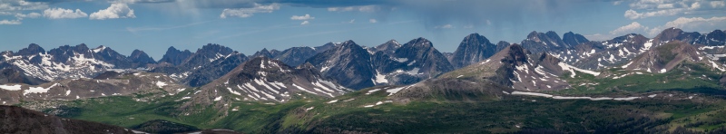
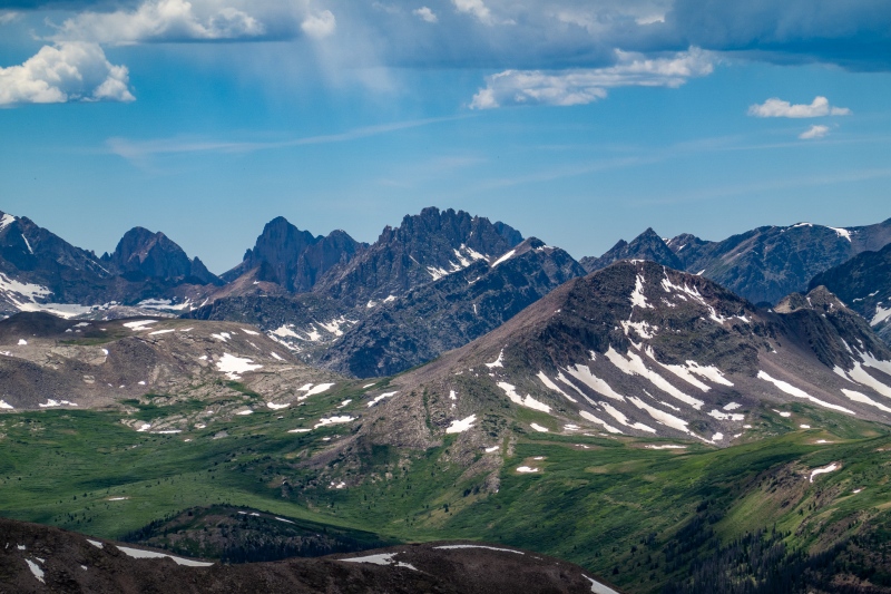
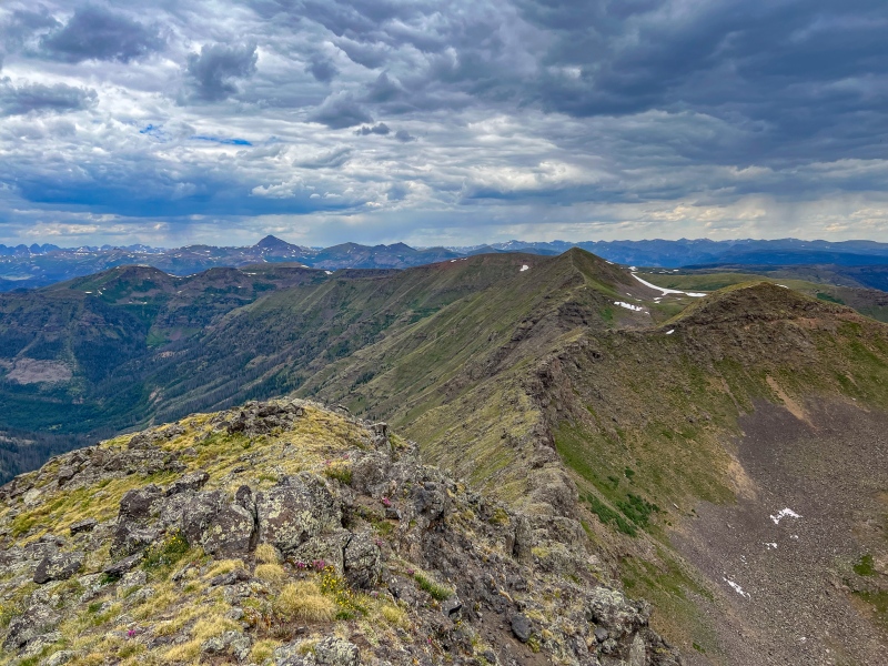
Window Peak, RGP behind meZoomed in on the Western Weminuche peaks from Window Peak.Jagged
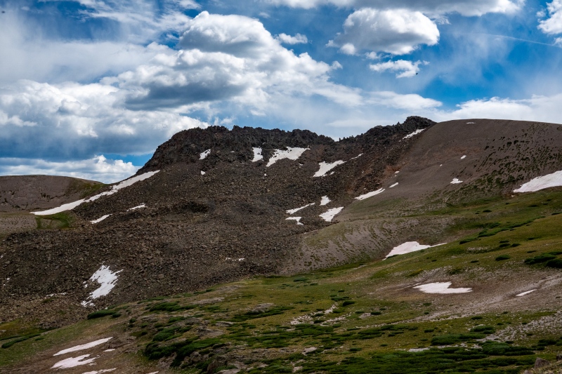
Next objective was 13,017', a short distance from Window Peak. I didn't really do much research on any of these peaks, just looked at their basic
13,017', taken on the way down.
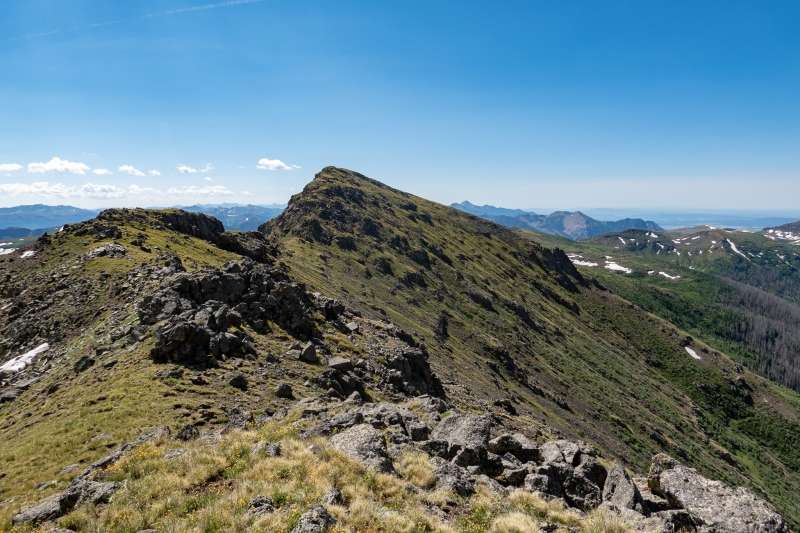
There was some tough routefinding on 13,107' (at least for me), and a few tough moves along the ridge.
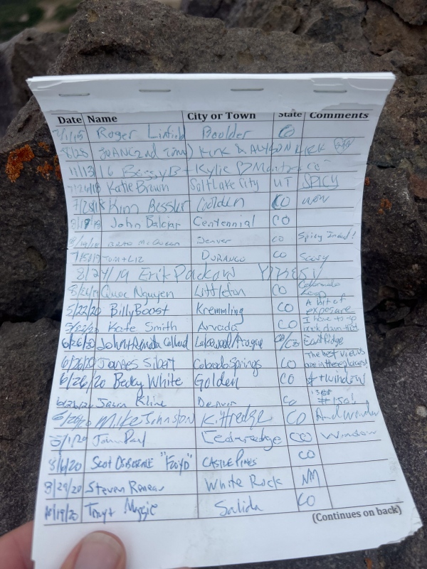
13,017', RGP behind meWhen I see some of the names on these obscure 13'er summit logs a song starts playing in my head, "I've got some Famous Friends".
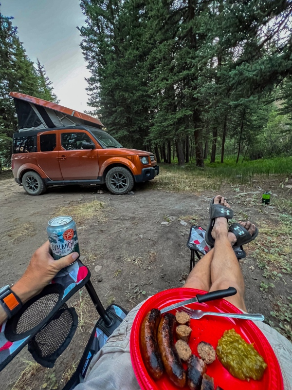
Made my way back to camp for a well earned dinner, a few shots along the way.
Brats, beer and relish. Nom nom nom
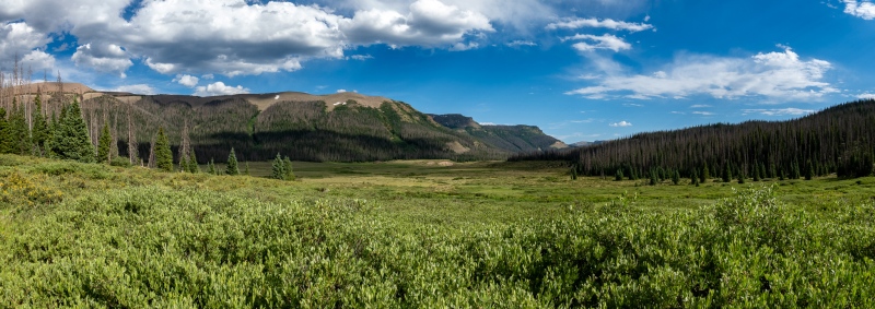
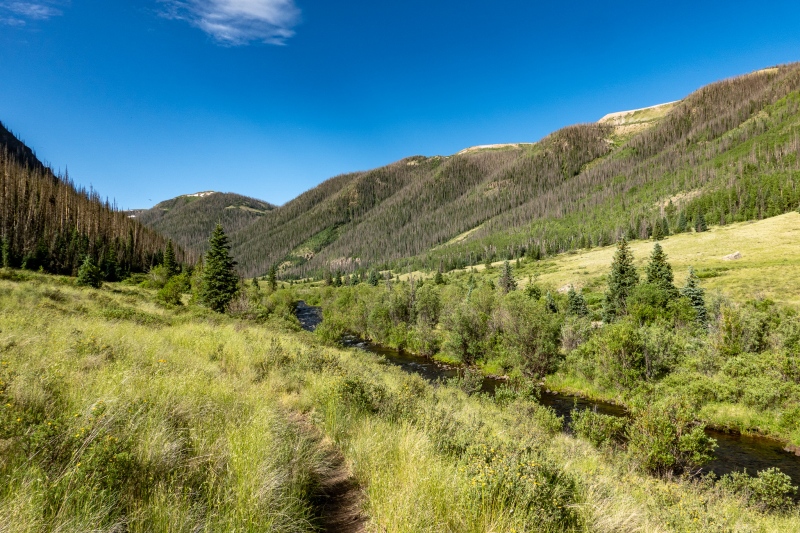
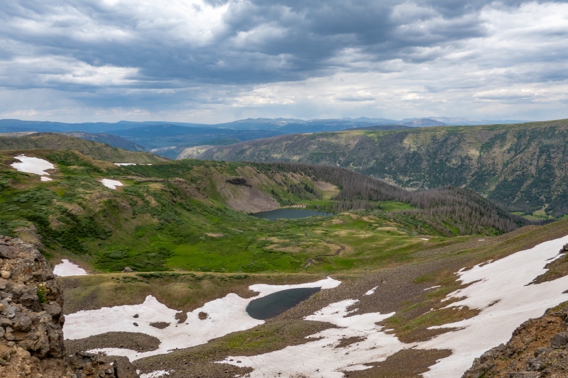
The next day I was planning to head towards 13,010'. I had no idea how far it was or if the ridge from above Squaw Lake even went, but figured I'd just head that way and see what it looked like. I'd been to Squaw Lake before, I know it was 9 miles or so one way, but didn't know how much further 13,010' would be.
On the way to Squaw Lake
When I reached the peak above Squaw Lake (I assume its an unnamed 12'er), I looked at the long distance to 13,010' and talked myself out of it, but there was another (presumably ranked 12'er) peak in between that wasn't far, so I planned to go to its summit and turn back, 13,010' just seemed too far.
From the second 12'er looking at the long ridge to 13,010'
When I reached the second 12'er I just decided I'd come too far to turn back with just a measly 12'er or 2 in my pocket. There were no storms to worry about, I had hours of daylight, so I decided there really wasn't any worthwhile excuse not to continue.
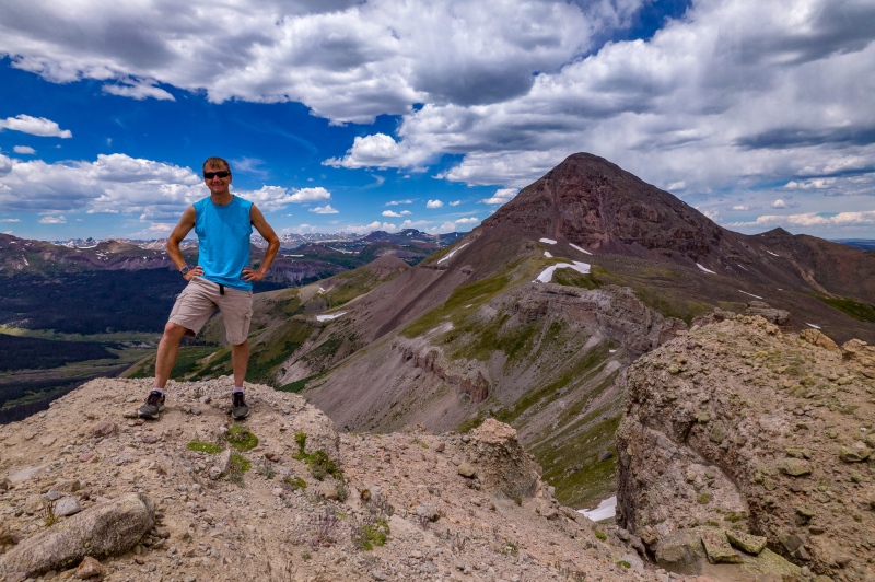
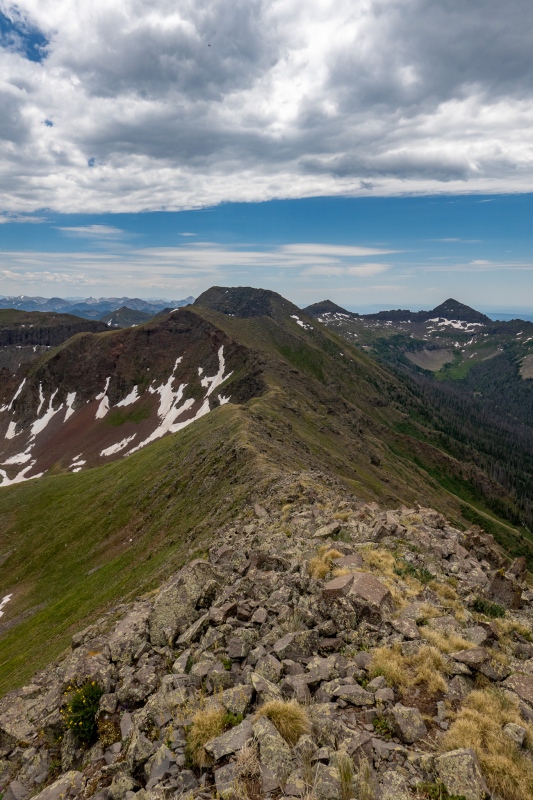
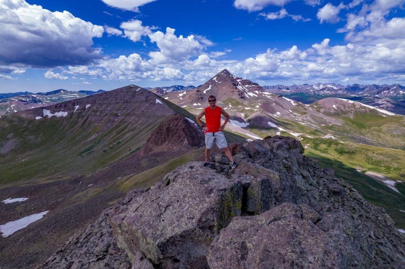
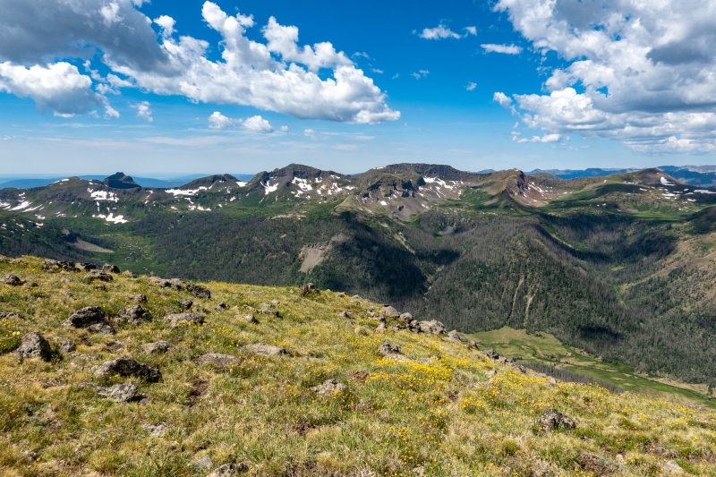
Summit of 13,010'Looking back at the ridge walk from 13,010'. Cool seeing The Window from different vantage points.
Headed back towards camp from 13,010', a few shots along the way.
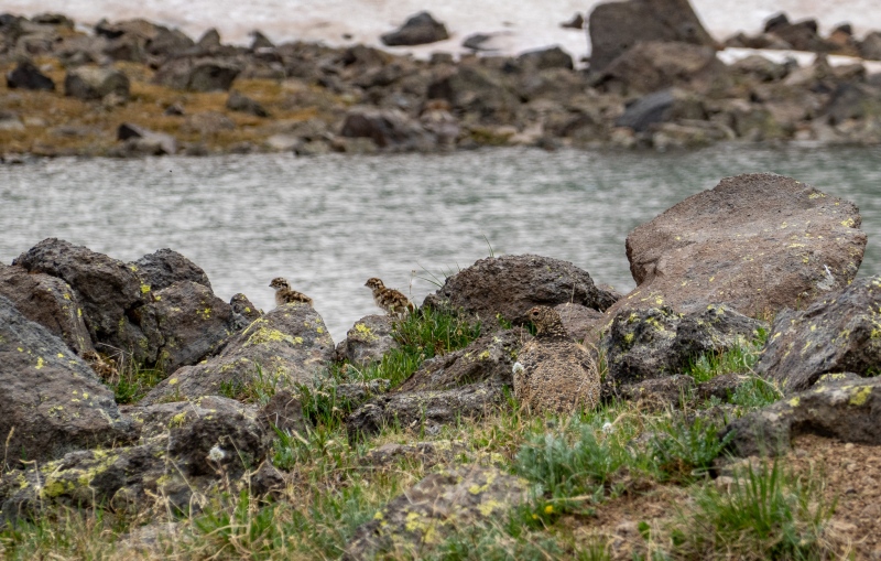
Spotted Mom and 2 babies just below the 12'er on the way back.Squaw LakeZoomed in on RGP.
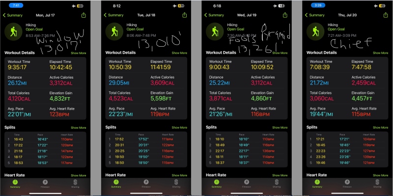
Made it back to camp, it ended up being just over 29 miles round trip for the day, really nice trip.
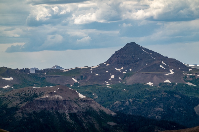
The next day I headed back towards the west, plan was to get 13,261' and Fool's Pyramid. I used a GPX file from the library to find my way, its not very obvious finding the way to 13,261', you start on the trail to RGP, then branch off onto another trail that isn't the easiest to follow, then ascend a loose scree field. I would never have figured this route out on my own.
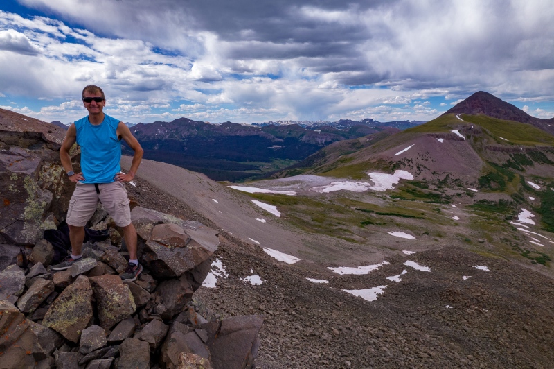
Nice views of RGP along the way to 13,261'.13,261' on the right, Fool's Pyramid on the left.
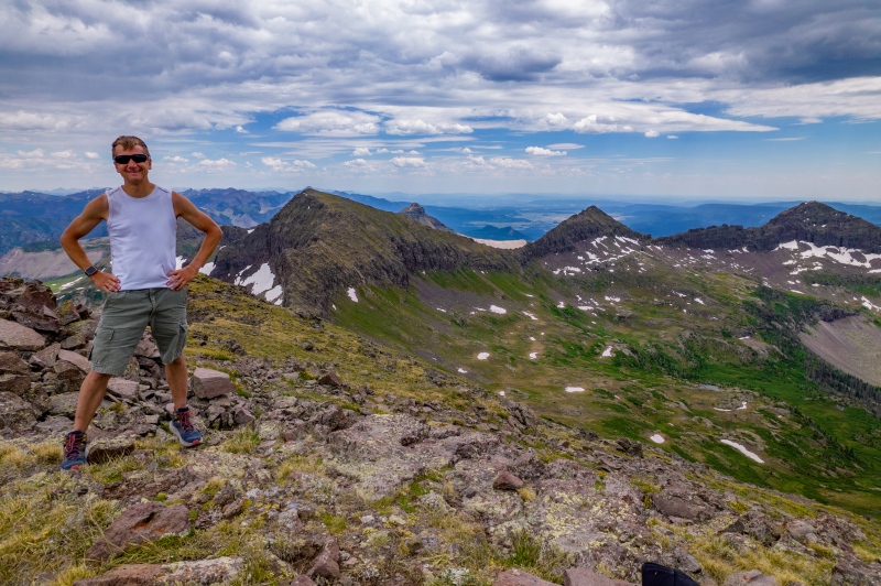
13,261' had some fun scrambling towards the top, but nothing difficult.
13,261'
From 13,261' to Fool's Pyramid there's one nasty dirt slope to cross, other than that its pretty much an easy ridge walk.
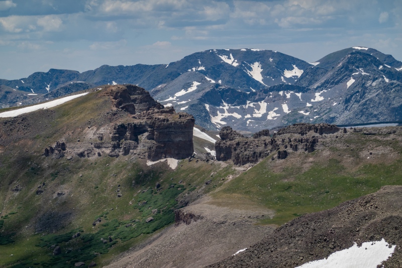
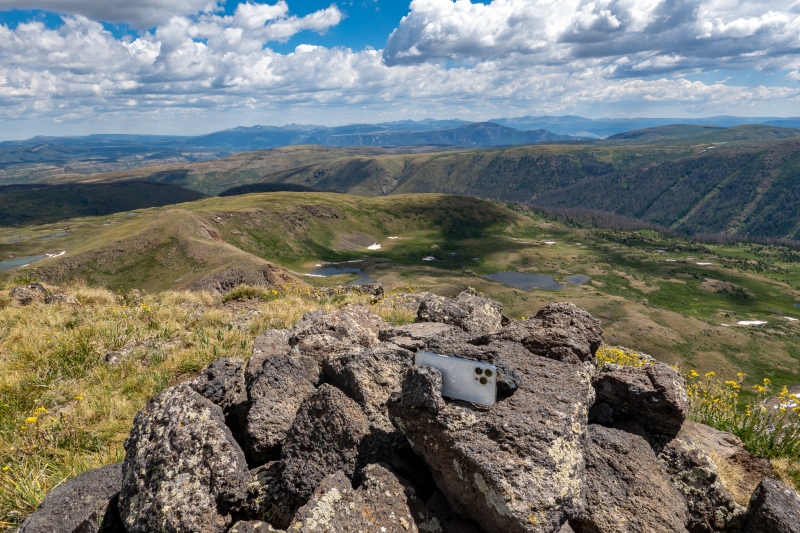
From Fool's Pyramid summit.Zoomed in on the window from FP.
I descended Fool's Pyramid on the west side and rejoined the trail back to 30 mile.
Got back to camp, another decent sized day, just over 25 miles. I had one more day of hiking planned, but wasn't planning to climb anything, I was just going to head south and keep going until I felt like turning back, I didn't even take my backpack, just a small shoulder bag with a few drinks and snacks. There was a turnoff to the east from the Squaw Creek Trail that I hadn't been up, so I followed it. It went up to treeline, then ended, but I could see a peak off in the distance. I had looked at Chief when I was doing my preplanning for the trip, but had no idea what the route was. Pulled out my phone and opened my handy 14'ers app, and sure enough, it was Chief that I was eyeing. Looked like a relatively easy route, so I headed that way.
One of the biggest herds I've seen, looking at Chief's false summit.From Chief's false summit.13,010' from Chief.
Makeshift tripod, worked out okay.
Return trip from Chief was uneventful, I was pretty excited to get an unplanned peak.
On the way back to the Squaw Creek trail, I had been mentally calculating my total mileage for the week, knew I was somewhere in the neighborhood of 100 miles, so made that a stat goal. When I reached the Squaw Creek trail, went south for a mile or so before turning back to put me at 100 miles. Then as I neared 30 mile I somehow lost my $5 Walmart sunglasses (pro tip: they're in the fishing section), so backtracked to find them (success).
Ended up with 102 miles and just under 20,000' of elevation gain for the 4 days.
As usual in the Weminuche, a great trip with beautiful landscapes and not many people. Thanks for reading.
Thumbnails for uploaded photos (click to open slideshow):
When I did 13,017 back in July, I was surprised by the rugged nature of that ridge. Its a nice little scramble back there. Also, congrats on the 100 miles!
13,017 is the LiDAR elevation of map 13,010. Coincidentally, 13,017 is the map elevation of what is now LiDAR 13,022, the peak south of the Window. All good peaks except Chief, which I found to be incredibly boring - the nearby 11er was an order of magnitude more exciting and even it was just a walkup. There's some nice scrambling and 12ers along 13,017's (LiDAR) ridge.
Caution: The information contained in this report may not be accurate and should not be the only resource used in preparation for your climb. Failure to have the necessary experience, physical conditioning, supplies or equipment can result in injury or death. 14ers.com and the author(s) of this report provide no warranties, either express or implied, that the information provided is accurate or reliable. By using the information provided, you agree to indemnify and hold harmless 14ers.com and the report author(s) with respect to any claims and demands against them, including any attorney fees and expenses. Please read the 14ers.com Safety and Disclaimer pages for more information.
Please respect private property: 14ers.com supports the rights of private landowners to determine how and by whom their land will be used. In Colorado, it is your responsibility to determine if land is private and to obtain the appropriate permission before entering the property.


")
")
")
")
")
")
")
")
")
")
")
")
")
")
")
")
")
")
")
")
")
")
")
")
")
")
")
")
")
")
")
")
")
")
")
")
")
")
")
")
")
")
")
")
")
")
")


