| Report Type | Full |
| Peak(s) |
Unnamed 13587 - 13,587 feet Coney Benchmark - 13,339 feet Unnamed 13573 - 13,573 feet Unnamed 13256 - 13,256 feet |
| Date Posted | 09/08/2023 |
| Date Climbed | 09/01/2023 |
| Author | ReginaThomas |
| Additional Members | Kiefer, mattpayne11 |
| Adventures at Carson Pass |
|---|
|
Peaks: Unnamed 13587’ (LiDAR) CO Rank #196 Unnamed 13573’ (LiDAR) CO Rank #209 Coney Benchmark 13339’ CO Rank #363 Unnamed 13256’ (LiDAR) CO Rank #435 Friday: ~13 miles/5K Gain, including hike to Cataract Lake to Camp Saturday: ~5 miles backpacking, ~5.5 miles and 1500’ gain for peaks Tacomas Damaged: Zero Humans Injured: Zero Pikas sitting on my foot: One (yes it happened) In 2020 I screwed up. I was not remotely focused on San Juan or any 13ers at that time, because my mom Paula and I were finishing the Colorado Trail, and that had consumed most of my time for years. 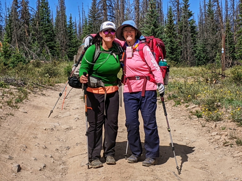
The call of the higher peaks was still there, but they were taking a HUGE backburner. In fact, Kiefer had to bear with me on some easy peaks while I got my 13er legs back. HOWEVER, Coney BM is all of 60 feet from the Colorado Trail, so I told my mom I would plan to tag it while she continued around on the trail. 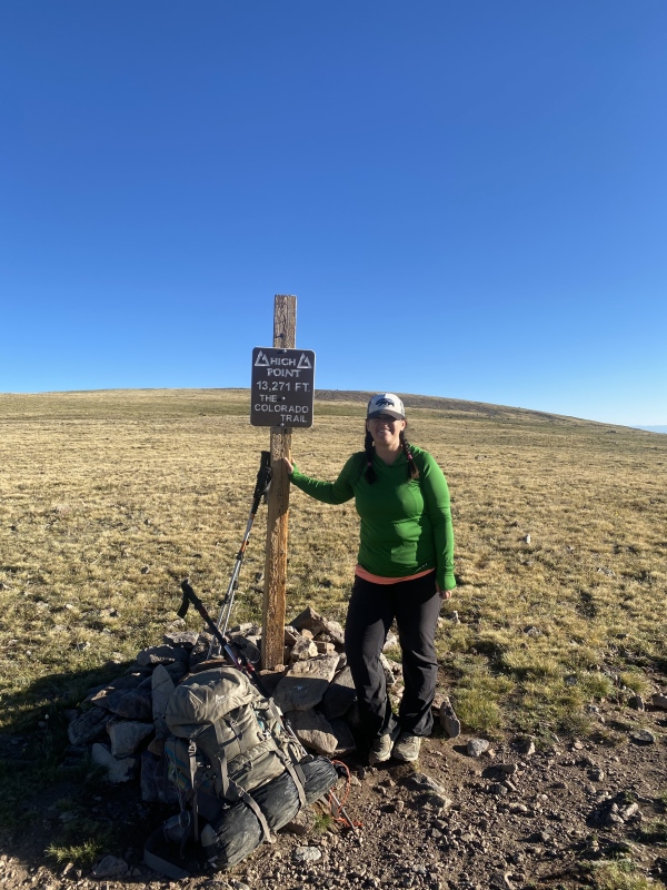
We got dropped off at Carson Pass by Darren at the Sportsman in Lake City, (THANK YOU!!) and we hiked up the steep road which transitioned to switchbacks, reaching the high point of the CT at 13,271’ much quicker than we expected to, AWESOME. Now to go up Coney, or so I thought, except I walked right by it, only realizing it over a mile later when we looked back. 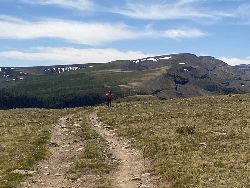
Two years later after Kiefer and I had bought our Tacoma I suggested a trip up Carson Pass for the fall gathering to run the ridge from Bent to Tundra Top (Success) and hike Coney and 12,256’ the next day. FAIL. It snowed 4 inches on our tent at Carson Pass overnight, and Kiefer had forgotten his boots on our way out the door, so we headed down. Once again the easy Coney BM eluded me, which also meant a third time for me up to Carson Pass (YAY… not; that road is awful). 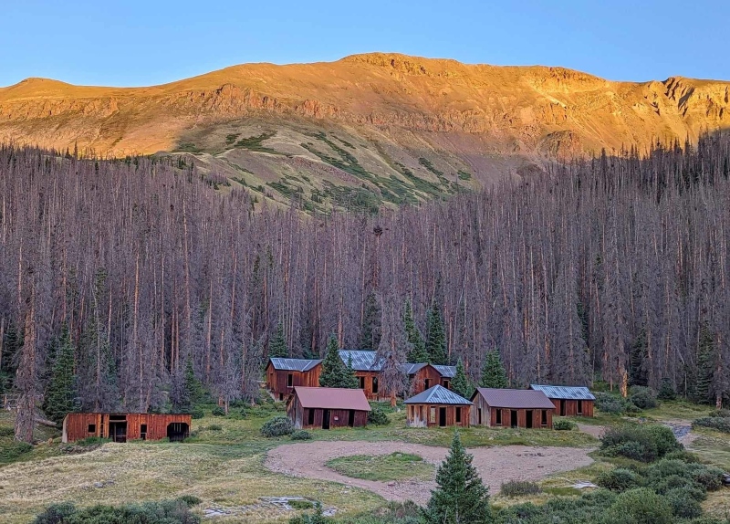

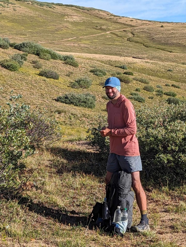
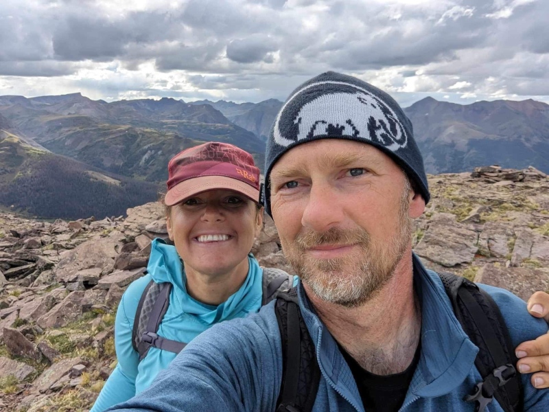
When one of my oldest friends Matt approached us about meeting him at Carson Pass while he through hikes the Colorado Trail to hike some peaks and camp with him, I was 100% committed. Would we finally get up the elusive oh so challenging class 1 Coney BM? Matt had hiked Coney on his way to Carson Pass so we decided with the perfect forecast it would be a good day to hike the peaks across from Bent and Carson, UN 13587 and UN 13573. We planned to camp at Cataract lake Friday night, so once Matt organized his pack with our resupply we headed out down the Colorado trail with our overnight packs. 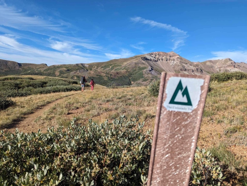
We were chatting and making great time along the trail. Matt was able to spot some moose in the valley by Lost Trail Creek and took some great shots with his telephoto lens. They are such beautiful creatures. Usually seeing a moose, or summiting a peak is the highlight of the trip, but the best was about to come. As we hiked we heard Pikas ‘eeping around us, and enjoyed watching the cuties gathering their hay for their winter reserves. I stopped because one was right next to the trail on a rock and I quietly watched him. I expected the pika to run away, which it did, before turning and running straight at my feet before hopping up onto my right boot and taking a seat. I was too stunned to move and tried not to squeal and scare it off. We were all too surprised to take a photo, but after a few seconds he hopped off my right foot, ran over my left foot and across Matt’s feet directly behind me. OH MY GOD A PIKA SAT ON MY FOOT GUYS I finally exclaimed after he took off. 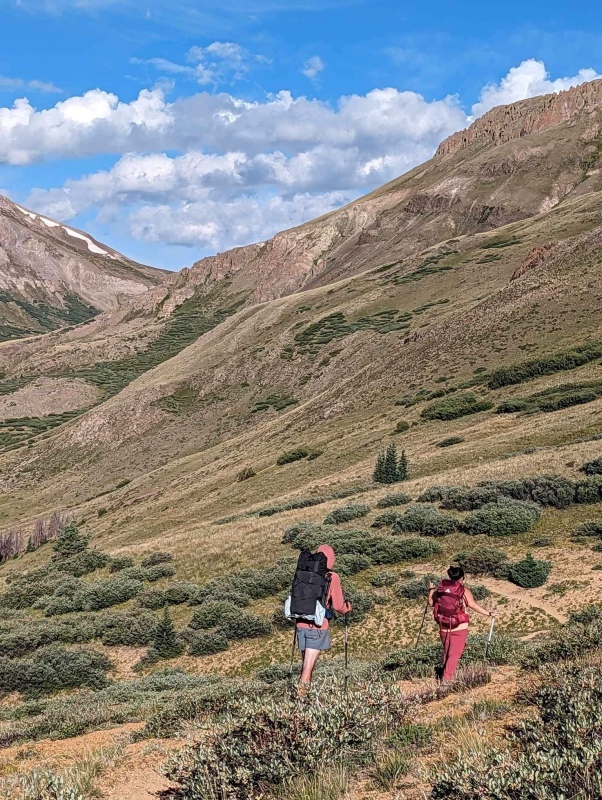
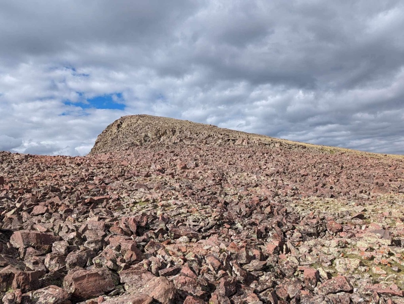
The trail to the saddle between Tundra top and the ridge leading towards 13,573 went quickly, and we stopped to build rock shelters for our packs and switch to day packs to hike 13,573 and 13,587 before returning to our overnight gear and hiking to Cataract Lake for the night. The ridge to 13,573 is a simple tundra stroll capped by a short talus romp to the summit. 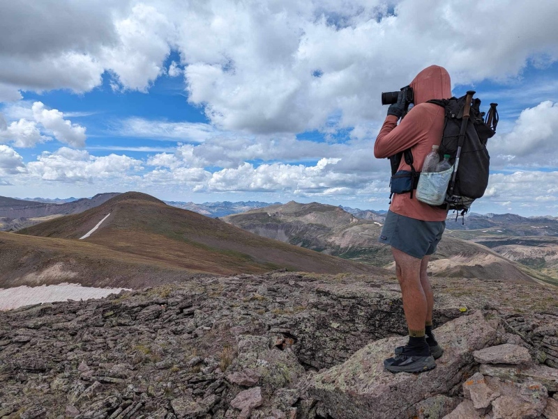
The weather looked like it might be iffy, but we decided to trust the forecast and continue, which turned out to be the correct decision. We only heard one rumble of thunder when we were almost to Cataract Lake to set up camp, hours later. 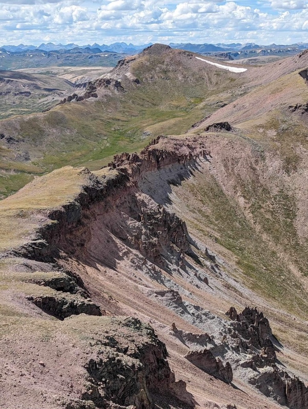
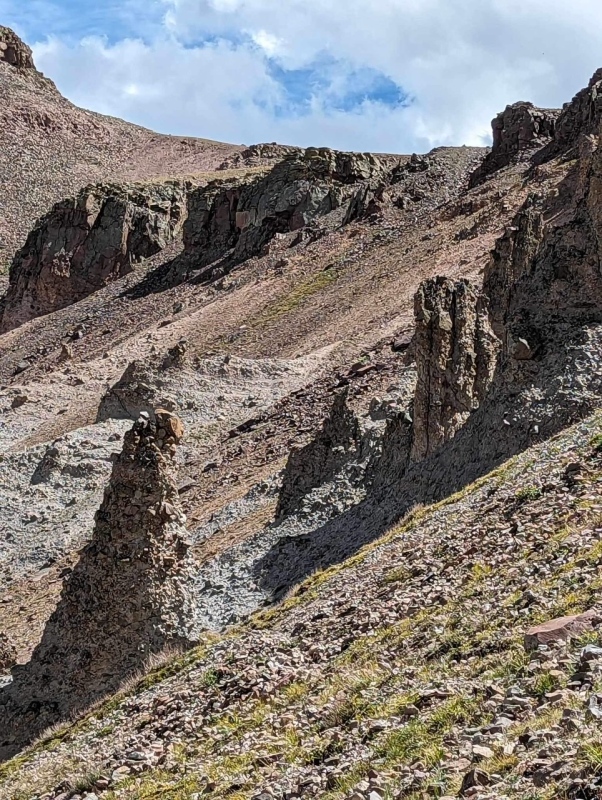
The connecting ridge and bypass “trail” with its many wombles would not be a good place to be in a storm. After some initial loose talus sidehilling (more yay) to skirt the first ridge obstacles we enjoyed a brief tundra romp before having to drop down again to avoid the true ridge vulgarities between the two peaks. 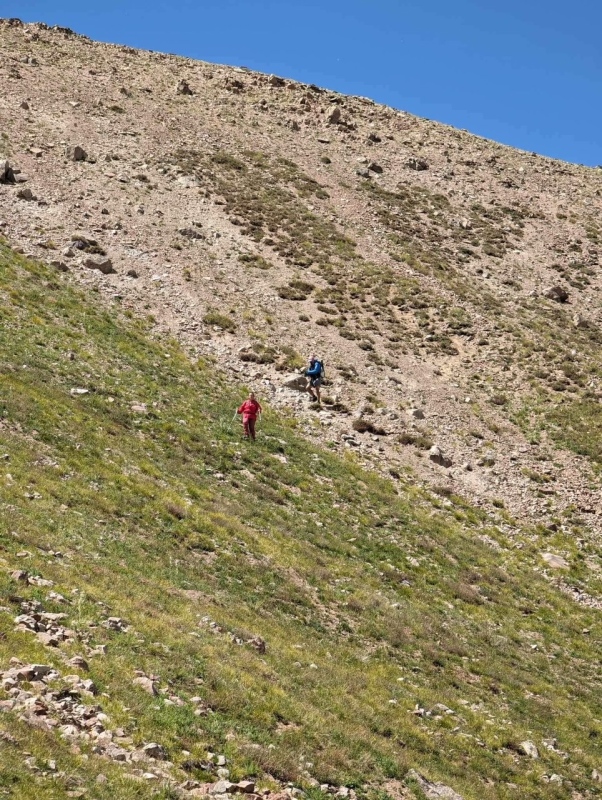
There is a “trail” between the two peaks, but it was often crossing 45-50 degree steep hardpan. It reminded me of the route Kiefer and I took down from US Grant Peak to connect to V2. However if you fell, you wouldn’t have fallen all the way to Island Lake, so there is that. 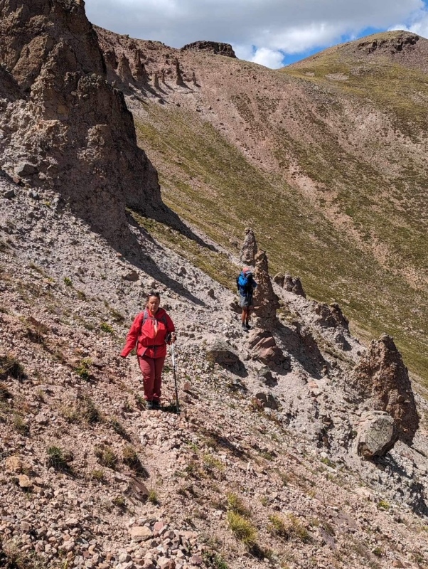
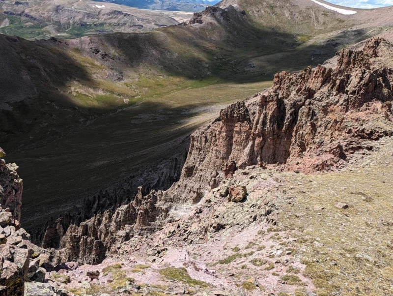
My feet slid out on the hardpan once, but it was a quick recovery, and we climbed a short scree gully to the ridge where we were back on the cushy tundra. To gain the summit, you have to wrap around the summit block to the north side where a climbers trail leads you to the final short, 3rd class pitch. 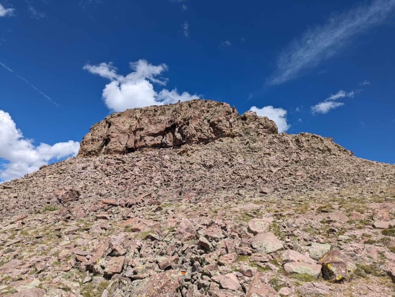
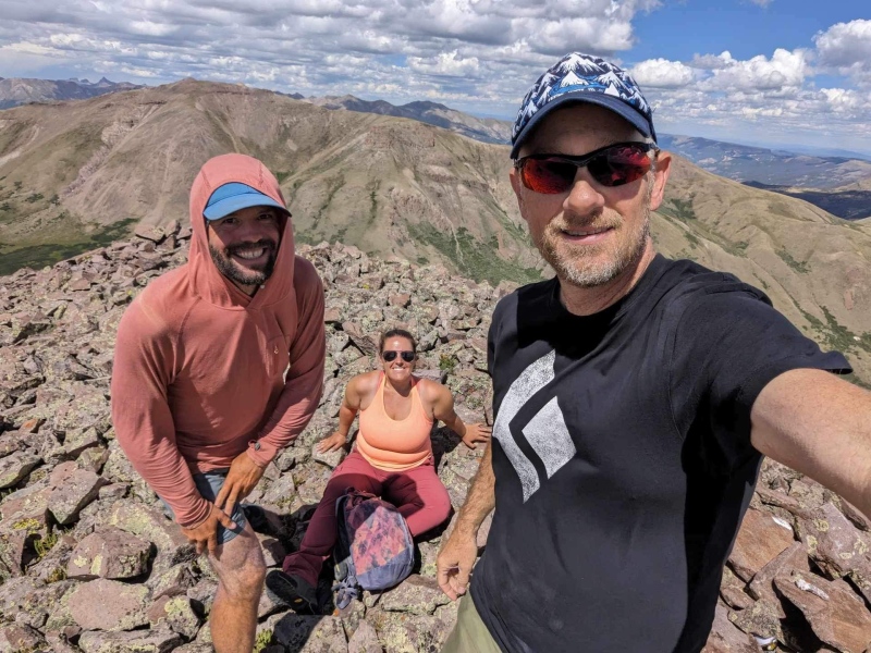
The scrambling was short and sweet, but over far too quickly. While I snacked on the summit, Kiefer and Matt scouted a gully that rolled into a nice tundra slope that would descend to Lost Trail Creek in the valley below where we could regain the CT and hike back to our packs on a pleasant trail. 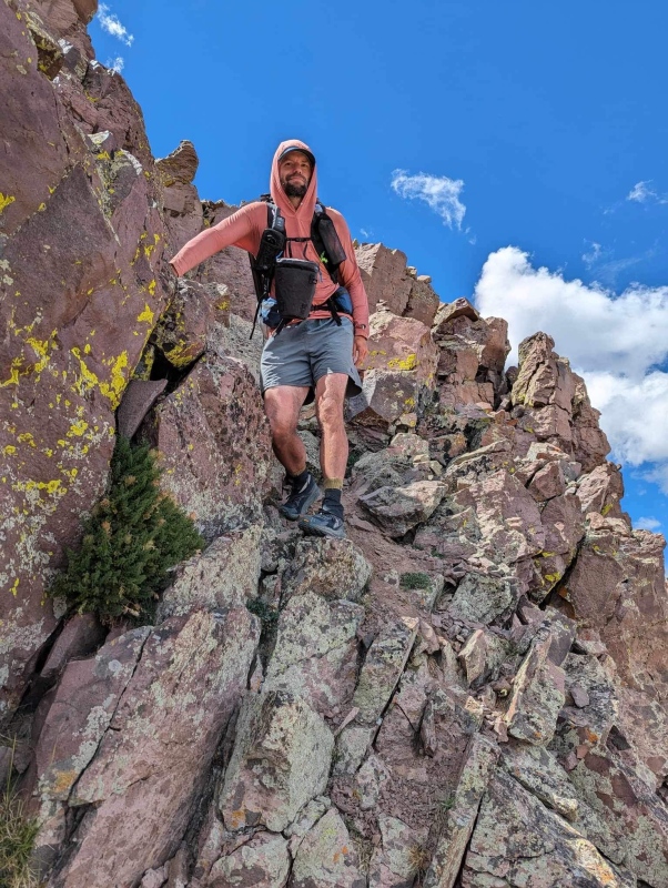
The gully descent looked worse than it was, and we even found a high mountain spring with delicious, fresh water on our way down. The tundra slope ended at the willows, but there was a jetty of boulders that we were able to hop through most of the willows; thankfully this allowed for minimal willow bashing. 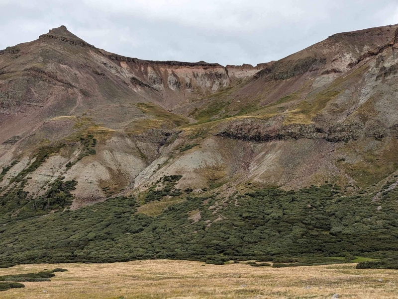
We regained the trail about 200’ above where we hit the valley floor, and crawled up to our pack stash. Matt and I had a few colorful names for 13,587’, but we will just call it Wombles Peak for the purposes of this report. The hike to Cataract Lake was uneventful, and we enjoyed a lovely campsite for the night. 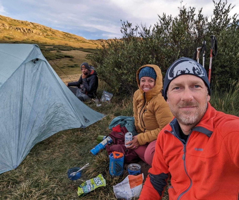
The next morning the plan was to hike back over Tundra Top and over to Cataract Peak as Kiefer and I still needed it, Matt would continue on the CT and we would continue back to the car and set a camp at Carson Pass for the night. 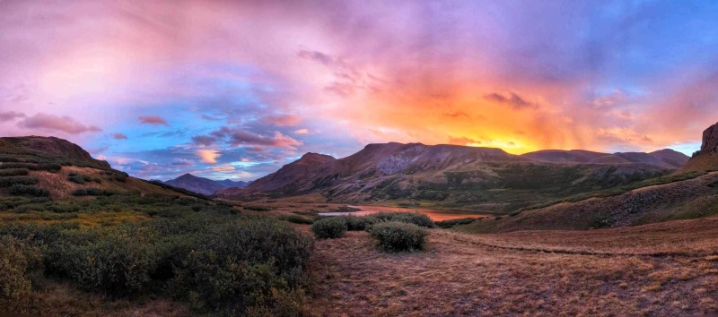
Kiefer and I headed out before Matt as we had to regain the Tundra top saddle with full packs and Matt had left his camp at Cataract Lake. When we got to the Tundra top saddle the sky was black and the cloud bank headed towards us. We decided since we still had a 3.5 mile hike above treeline to Carson Pass we would be better off hiking out to the car, and returning for Cataract when we hike Quarter Peak. Our decision was rewarded. As we hiked down the trail, Kiefer was photographing some CUTE marmots while I hiked ahead. 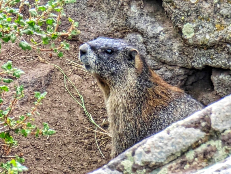
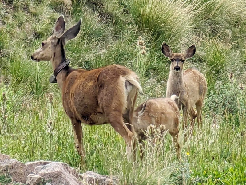
I crested a small hill and saw the prettiest doe about 75 feet in front of me in the grass. I stopped and motioned Kiefer to be quiet as he joined me. When he joined me his height allowed him to see the ears of another doe maybe 30-40 feet in front of us around the corner. We quietly watched her, and her two still spotted fawns walked out from behind her. They were beautiful and it was another magical wildlife encounter. I told Kiefer that the only way the pika sitting on my foot could be topped is if a moose put its head over my shoulder for nose scratches. 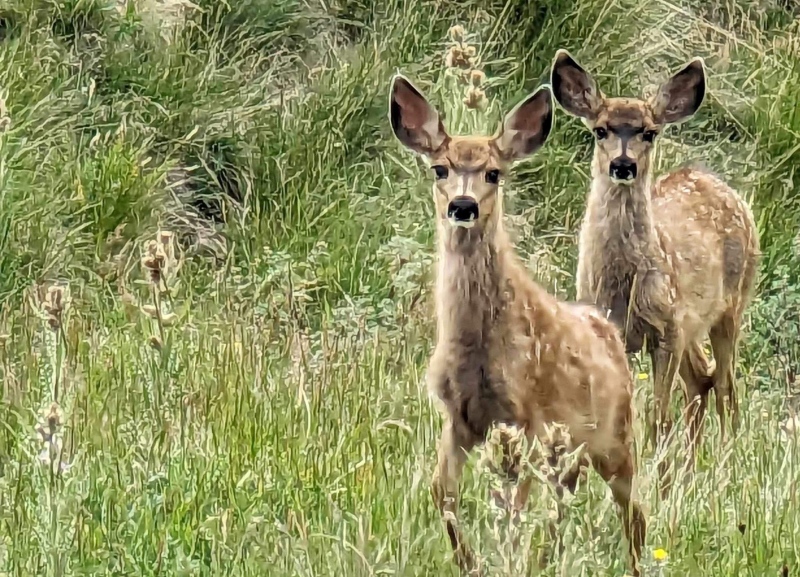
Upon returning to Carson Pass we set up our larger tent and sleeping bags/pads for the night, cooked some Cup noodles chili noodles (they taste AMAZING after a hike FYI), and shared a cold beer in our camp chairs. Carson Pass was BUSY. Side by sides, and ATVs, and even Jeeps were driving up relentlessly. It was also WINDY and cold. Since the plan was to hike Coney BM and 13,256’ the next day, we hopped into the tent for a quick nap, and to get out of the wind. At about 3:30 Kiefer asked if I just wanted to hike Coney that night. The same idea had crossed my mind as well, mostly because I was nervous about driving down Carson Pass and running into a car, but also a hotel room in Gunnison with a shower and a real bed was sounding pretty darn good. Alright let’s do this! Was I finally going to get Coney or were we going to have to go back Sunday? The sky was still dark, but none of the clouds were building up or threatening, so I changed from boots to trail runners and we began hiking up the STEEP road to 13,200 feet on the shoulder of Coney. 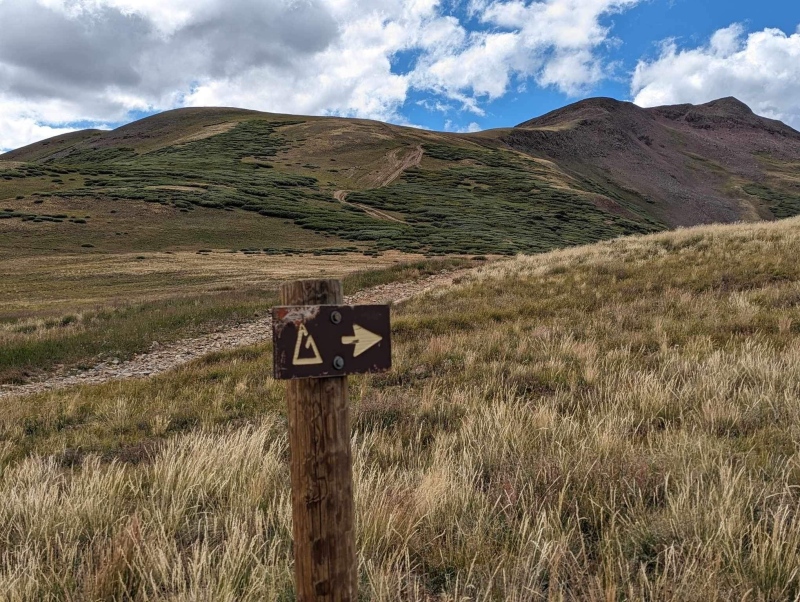

The CT switchbacks up this slope part way, which makes it easier, but the road was more direct. I originally wanted to hike 13,256 first as it was further away, but Kiefer suggested Coney so we could cruise the mellow CT out, and it was a good idea. Within an hour from leaving our camp we were on Coney and 30 short minutes later we were on 13,256. 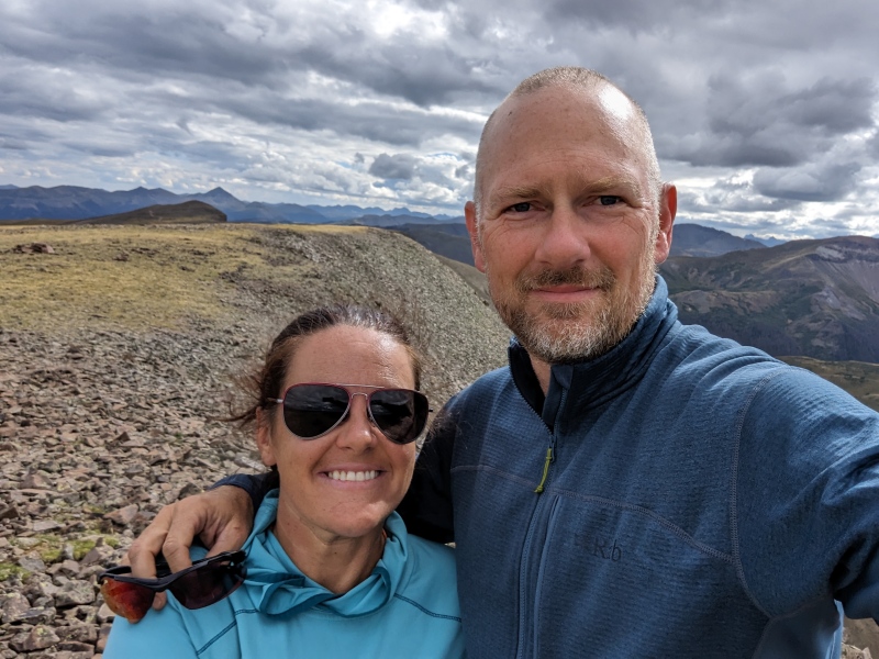
YAY two new peaks, but BIGGER YAY that we NEVER EVER HAVE TO DRIVE CARSON PASS AGAIN. I cannot stress that enough. We cruised back down and then up again on the Colorado trail until we hit the road. 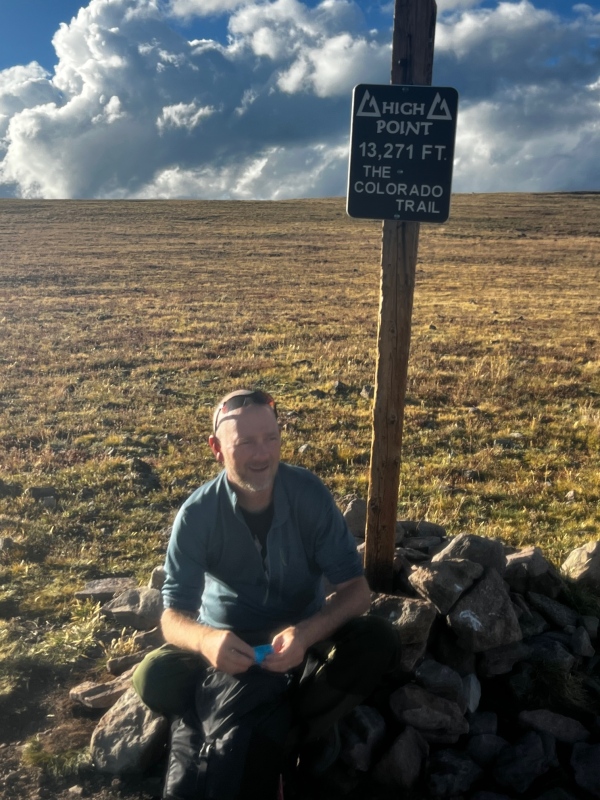
Once we hit the road Kiefer took off at what we call “Kiefer Pace” and began breaking down camp. I met him 15 minutes later, completed the tear down and we headed down the “road”, or rock pile, whatever you want to call it. We made it down the road (5 miles) an hour later and drove into Lake City. Imogene the Tacoma did great! As soon as we hit Lake City (or Houston to some), I booked the 2nd to last hotel room in Gunnison for the Saturday of Labor Day weekend. It was a great weekend with Kiefer and Matt up in the most beautiful country. Super excited to finally knock Coney off my short list, and to support such a great friend on his thru hike of the CT. BYE CARSON PASS!!! 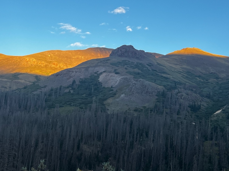
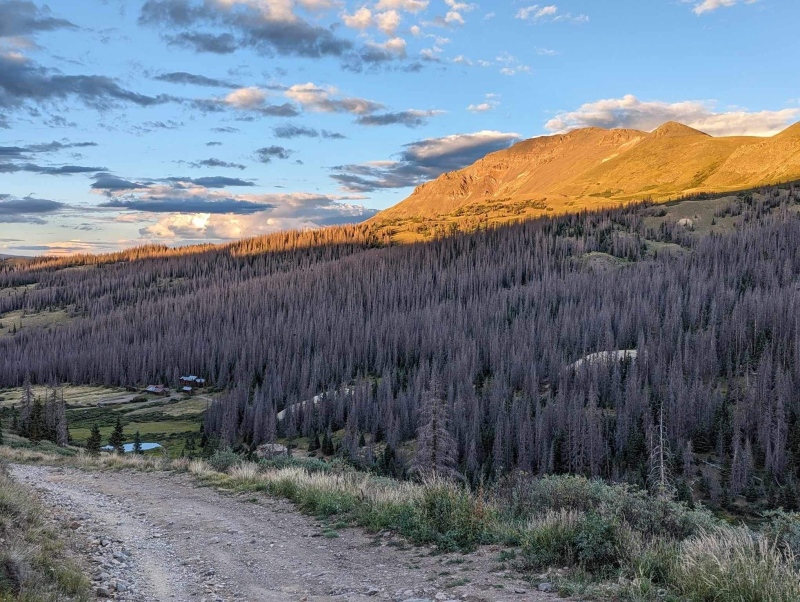
Most of the photos credit Kiefer - I hardly took any this trip! Thumbnails for uploaded photos (click to open slideshow): ")
")
")
")
")
")
")
")
")
")
")
")
")
")
")
")
")
")
")
")
")
")
")
")
")
")
")
")
")
")
")
|
| Comments or Questions | ||||||
|---|---|---|---|---|---|---|
|
Caution: The information contained in this report may not be accurate and should not be the only resource used in preparation for your climb. Failure to have the necessary experience, physical conditioning, supplies or equipment can result in injury or death. 14ers.com and the author(s) of this report provide no warranties, either express or implied, that the information provided is accurate or reliable. By using the information provided, you agree to indemnify and hold harmless 14ers.com and the report author(s) with respect to any claims and demands against them, including any attorney fees and expenses. Please read the 14ers.com Safety and Disclaimer pages for more information.
Please respect private property: 14ers.com supports the rights of private landowners to determine how and by whom their land will be used. In Colorado, it is your responsibility to determine if land is private and to obtain the appropriate permission before entering the property.


