| Report Type | Full |
| Peak(s) |
Gray Wolf Mountain - 13,604 feet Pt. 12988 |
| Date Posted | 09/09/2023 |
| Date Climbed | 09/04/2023 |
| Author | the_hare |
| Hells Howl: Gray Wolf via Hells Hole TH |
|---|
|
Gray Wolf from Hells Hole TH/ Pt. 12988 N Ridge 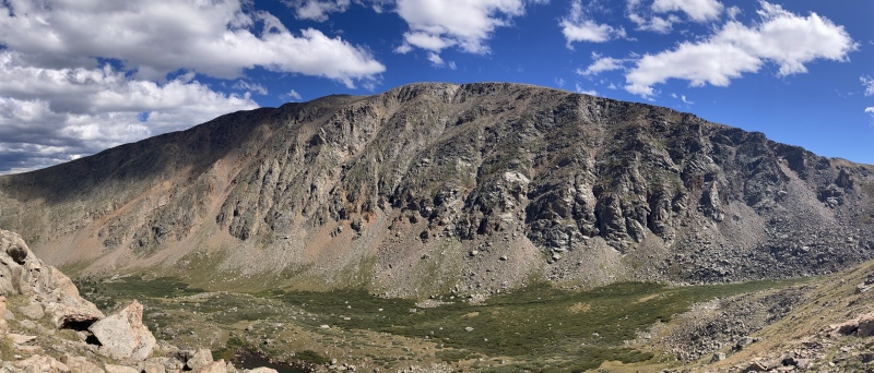
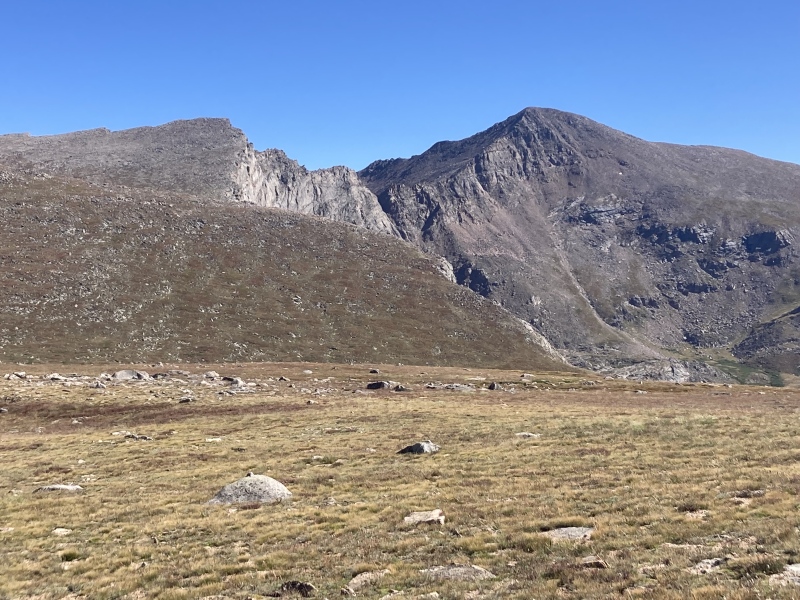
I've been thinking recently about how the easiest trails up mountains sometimes unfortunately don't allow you to really "see" the mountain. Of course, visually striking aspects like sheer cliffs or dramatic basins don't really make for as friendly of a trail as a gentle, unassuming slope or ridge. But take Bierstadt for instance--it just looks like a tedious hill with a Jeep road up the side from Guanella Pass, yet its northwestern basin fortified with cliffs of near-iridescent red and green hues and adorned with waterfalls weaving down the granite like tapestries remains mostly hidden. Perhaps even more awesome is the view from the opposite direction atop Rosalie or the Epaulets where Bierstadt's twin south & east ridges enshrine the unique-looking Frozen Lake basin. The Frozen & Abyss lakes with turquoise water contrasting against enduring ice are always wonderful sights from Bierstadt's summit ridge, but from above they don't seem to add the same character to the mountain itself as they do from afar. I considered this as I was planning a route up to Gray Wolf, which like Bierstadt is often done via Guanella Pass, a willow maze, and an open, unassuming slope to the summit. Yet this route obscures the mountain's dramatically gashed-out west face, simultaneously appearing as the legs and paws of an enormous canine and a flaying that such a beast might do. I noted the Hells Hole trail lies at the base of this face and runs north from there down the valley. I found two trip reports, here and here, that approach Gray Wolf from this area. The first user seemed to have trouble on the ascent from Hells Hole and the second had an unpleasant experience descending Gray Wolf's NW ridge back towards the TH. I saw that a ridge bisecting the Hells Hole area (N ridge of Pt 12988) branched down from the alpine flats between Gray Wolf & Spalding and nearly touched the trail in the basin below. Looking on satellite, the shortest crossing over West Chicago Creek from the trail to the toe of this ridge didn't appear to have any willows to bash through. I figured a route up through here would offer great views of the west face of the Wolf and avoid the difficulties these previous members faced. At the end of the day I was more than pleased with how it turned out! 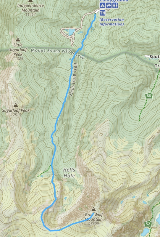
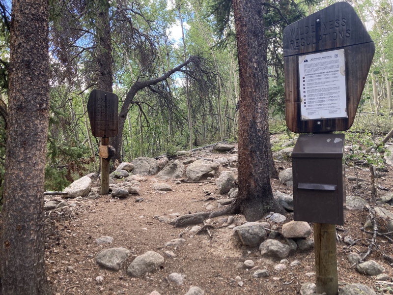
I really wasn't sure what to expect at the trailhead on Labor Day but it was about half-2/3 full. The dirt road to the TH turned off the road to Mt. Evans CO Hwy 103 at its first switchback. It was graded flat with no rocks, any car could make it to the TH. There's large gendered bathrooms with multiple toilets at the TH too. 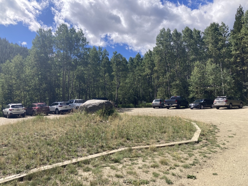
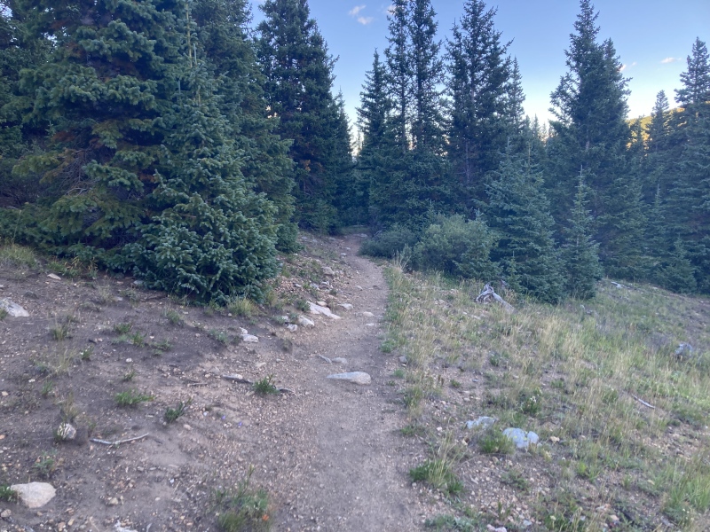
The Hells Hole trail from the TH to the turn-off for Pt 12988 N ridge runs at around 3.5 mi and 1700 ft of gain with the majority of the gain being in the first half. The trail was really pleasant and easily delivered a therapeutic feeling. It starts off into a spacious grove of towering pines with some nice picnic tables then transforms into a large aspen grove. Here the din of West Chicago Creek transitions into a gentle chorus of a thousand beating leaves. Unfortunately a blight took hold of one patch of aspen, dropping their foliage prematurely and turning the timbre of the remaining leaves into a death rattle. 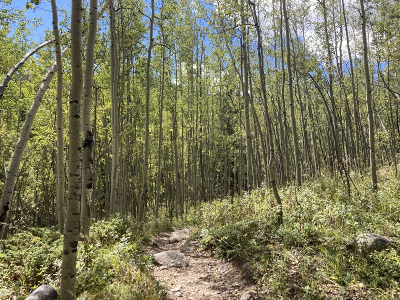
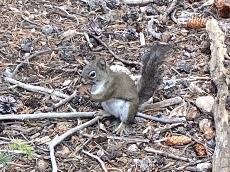
There were a ton of little squirrels all throughout the trail. It was fun to see the different temperaments of each one—some curious and almost begging, some inquisitive yet shy, and many others who were very alarmist and barked if you came within 50 ft of them. Eventually the trail ascends to a shallow ridgeline above the creek to the east and a narrow floodplain to the west. Here the trail feels mostly flat--there's some ups and downs but little gain overall. At times the pines and firs broke through and offered first sightings of the day’s destination. 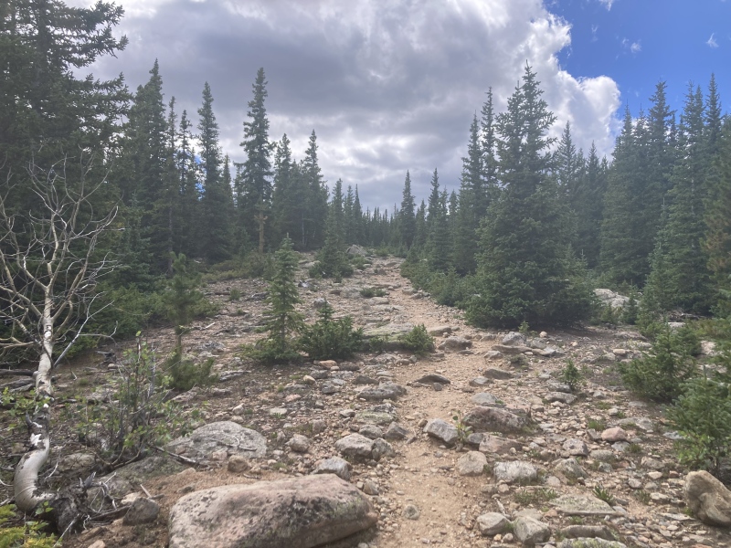
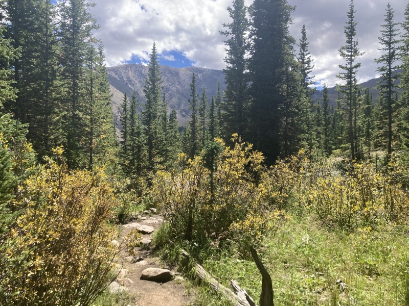
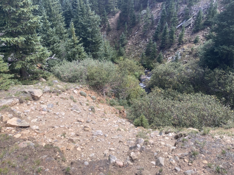
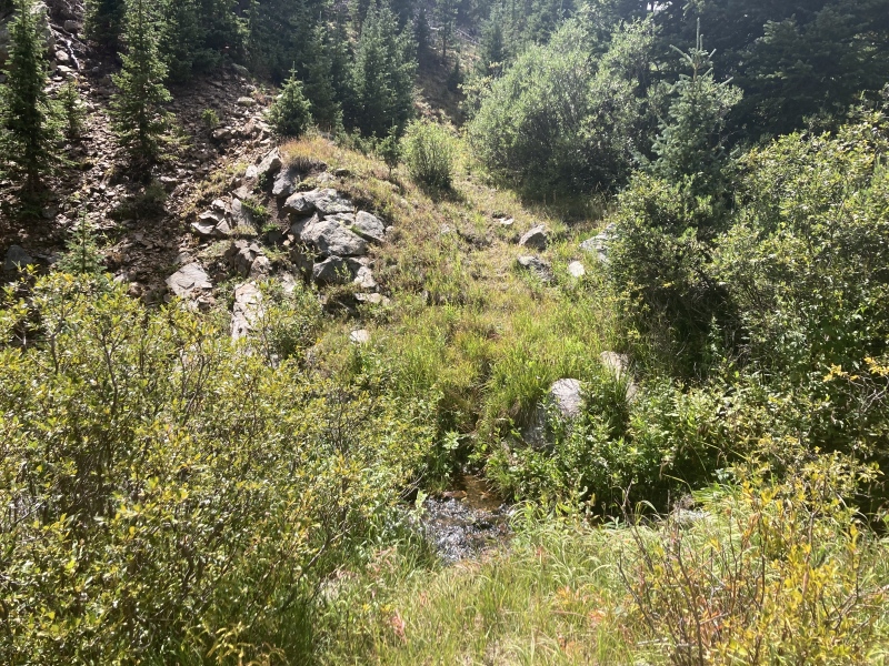
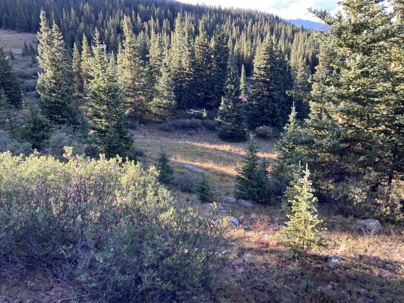
At about 3.5 mi in the trail opens up to a small meadow immediately on the left and a clear view of Point 12988 in front. This is just before the trail turns up into the upper west basin through some willows. Here’s where the routefinding got a bit specific as I looked for the willow-free creek crossing I saw on satellite. 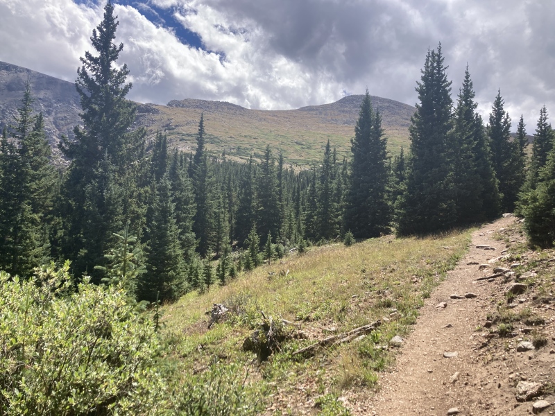
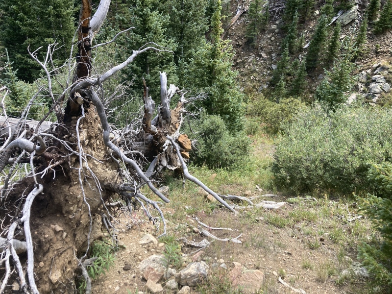
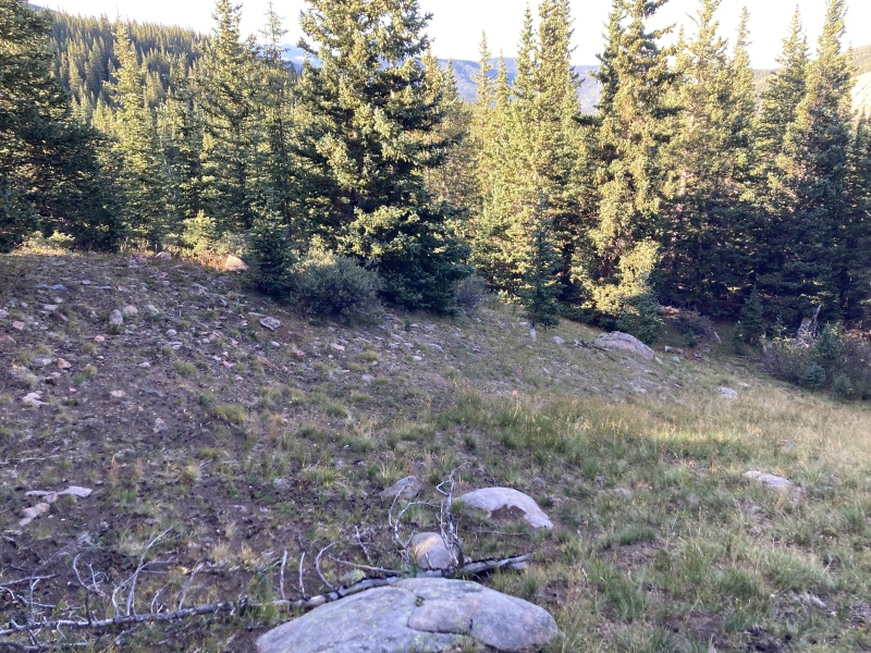
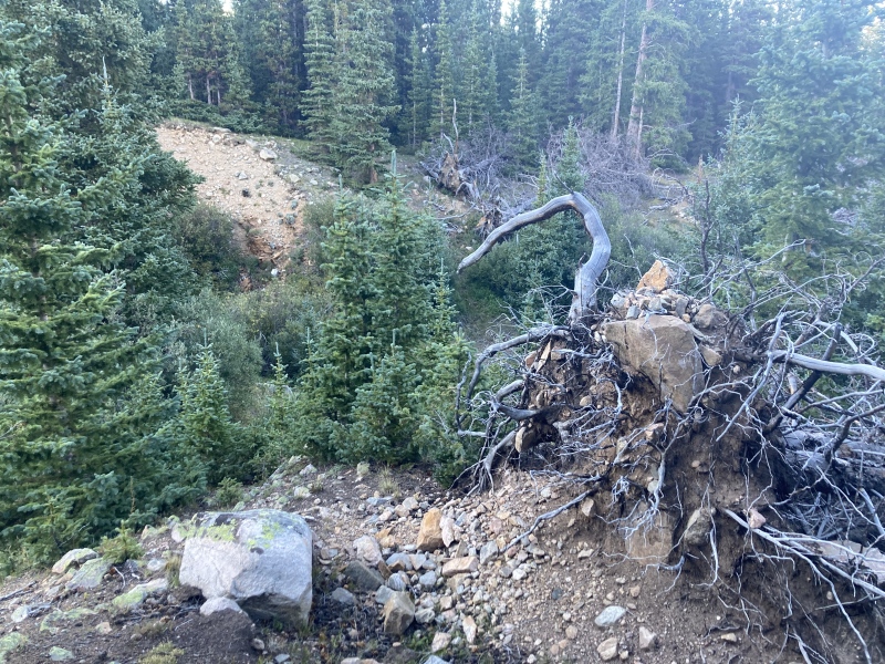
I left the trail at the meadow and made a bearing towards Pt 12988. I passed through a small band of trees until I reached the creek where the view of the basin and Pt 12988 opened up again. To my left I noticed a large eroded crater in my side of the bank. I continued around the crater to its left and saw some fallen blowdown trees, figuring that's what caused the depression in the first place. From there a wide, willow-bashing-free path down to the creek opened up in front of me and continued up the other side. 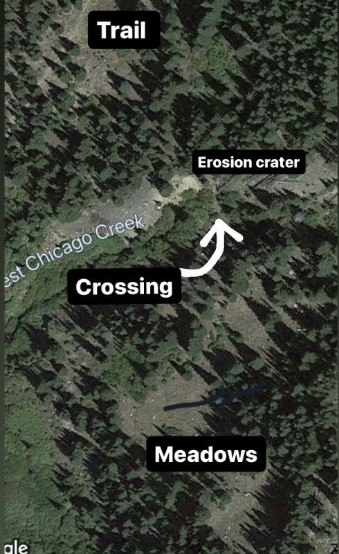
The main plan from the other side of the creek up to Pt 12988 was pretty straightforward: stick somewhat close to the ridge to offer some good views of Gray Wolf and aim for the flat saddle area visible just below Pt 12988. After the crossing I continued on a faint game trail up the hill where it led to a series of meadows. The meadows soon opened up to Pt 12988's open northerly slopes. From there I followed a fairly well-worn game trail that meandered around obstacles like short meadow bushes and minor rock deposits and then disappeared into the tundra. Nothing really gave me too much trouble as I trudged up the slope, although I made plenty of zig-zags to make it easier on my muscles. It's a solid 1500 ft elevation gain from the creek to Pt 12988. 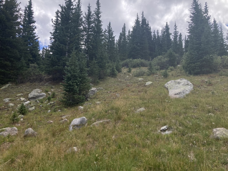
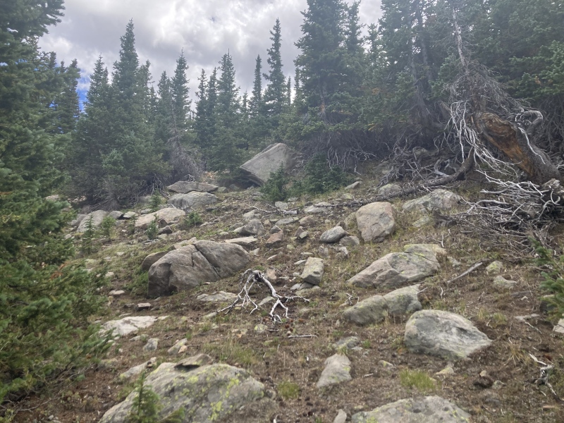
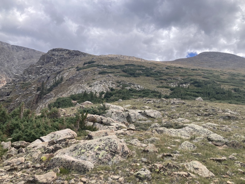
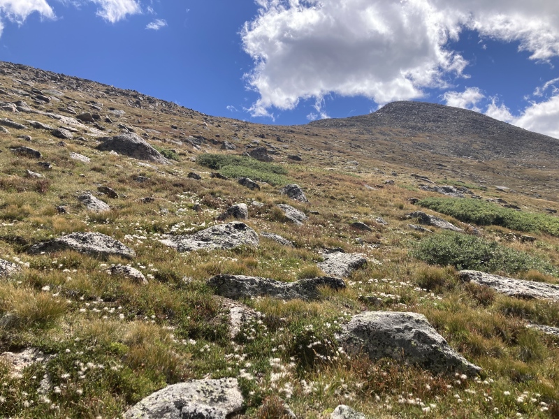
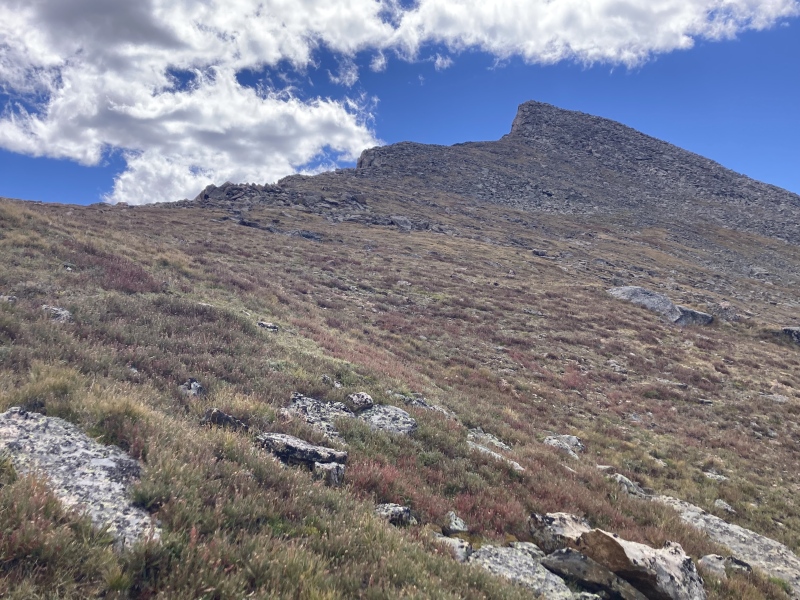
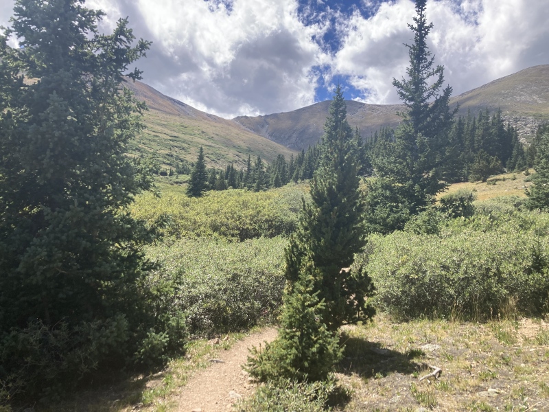
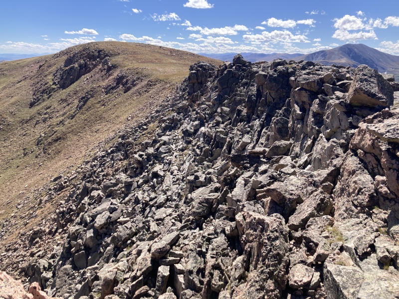
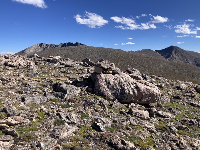
I stopped for a break at the saddle which overlooks the upper east Hells Hole basin. This definitely had the best view of Gray Wolf's lacerated west face. I noticed a trailrunner down below me in the basin navigating the willows. I wondered if he was coming down from Gray Wolf or some crazier objective like Evans. The rocky crest of Pt 12988 gave me some pause from here--this was going to involve a bit more scrambling than I saw from satellite maps or even the trail junction below. The longer I looked at it, though, the easier it seemed, and when I actually arrived at the base of the scramble it didn't look any harder than Class 2+ & easy Class 3.
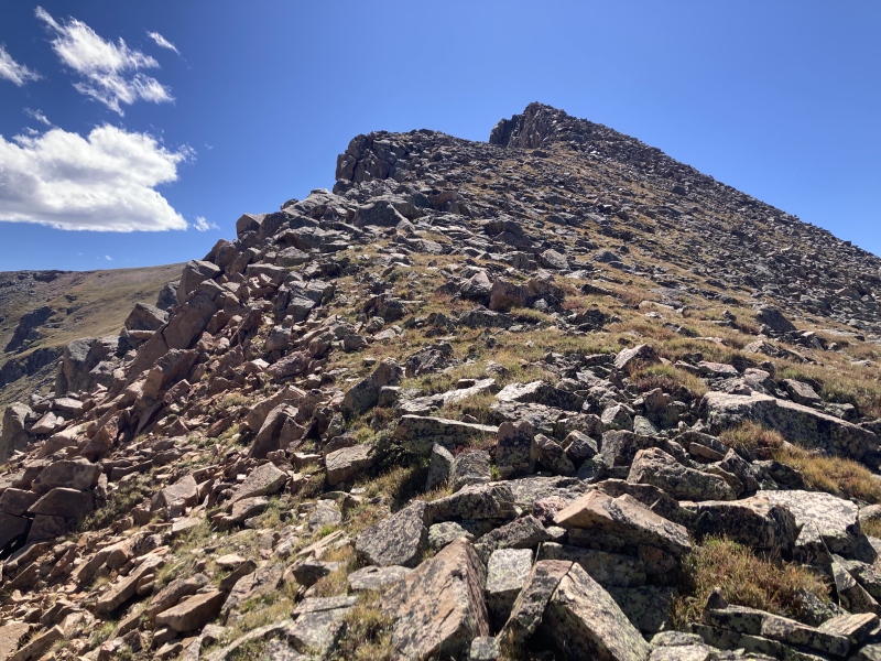
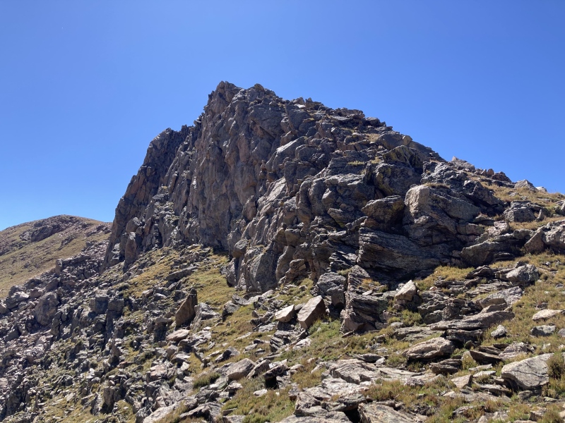
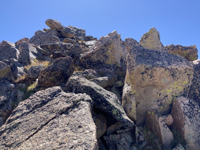
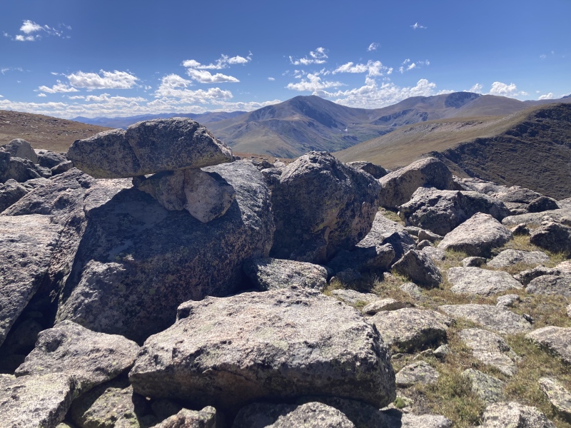
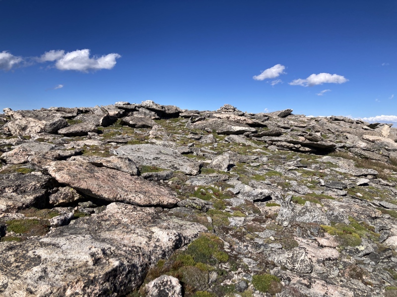
The scrambling was a lot of fun! It was mostly large, sedan-sized boulders interlocked together or dug into the ground. It reminded me a lot of the boulders up near Bierstadt's summit or along Evans west ridge--large, grippy, and lots of fun movements available. None of the boulders I encountered gave me any surprises for being loose. There were a few that looked like they could possibly tip off-balance if I put my weight on them but turned out fine and some smaller obviously unsettled rocks that did move when I stepped on them. Soon the rocky area returned to tundra grasses as I continued towards Pt 12988's true summit. Here the route was obvious enough: continue around Hells Hole rim and ascend Gray Wolf's southwest slopes to the summit. The view of Bierstadt & the Sawtooth from here really stole the show. I think this side of the Sawtooth ridge with its stunning sheer cliffs goes underappreciated. I had no trouble seeing the standard trail up to Bierstadt either--it seems like it's gotten way more traffic since Quandary took on parking permits and Decalibron was closed earlier this year. 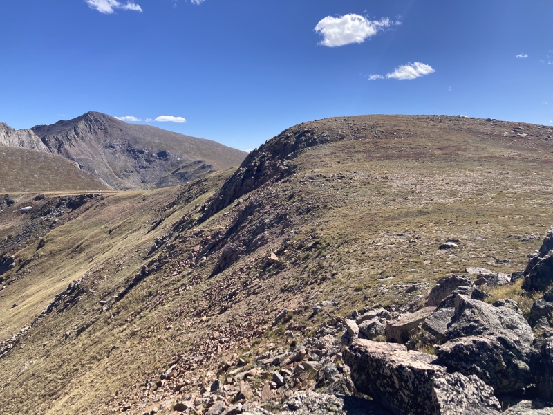
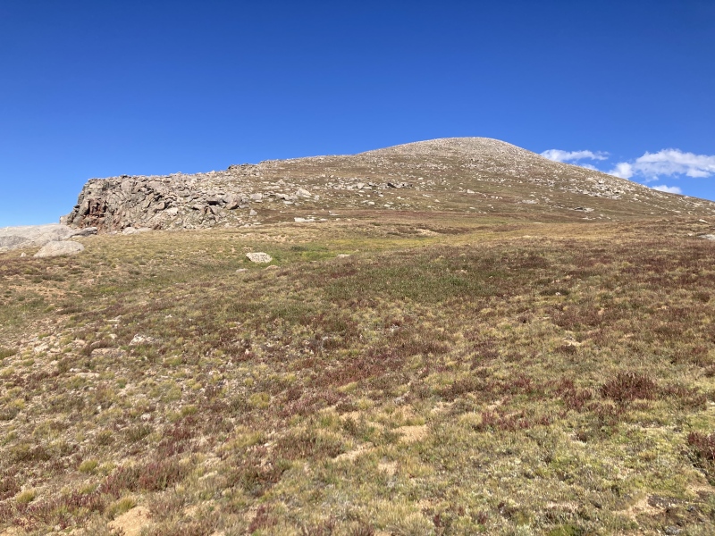
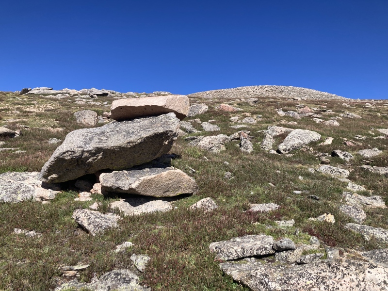
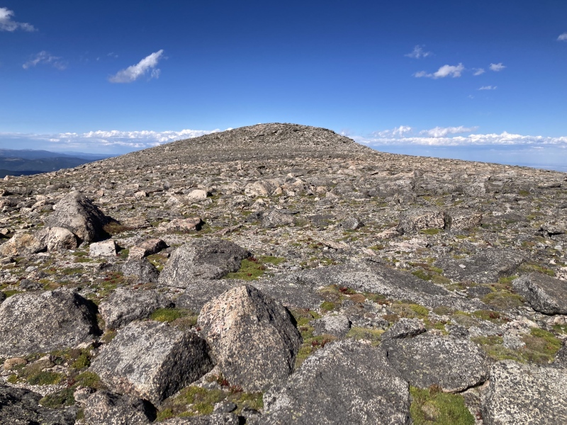
A chilly wind started picking up more as I made my way up Gray Wolf's slopes. I'm sure the flats above Scott Gomer creek allow the winds to rocket through. Unfortunately I forgot/sort of intentionally left my jacket at home since 4 days before when I did Sniktau it was just dead weight on that sunny, windless day. I was really feeling the apparent transition from summer to fall today! At least the full afternoon sun tempered the wind's cold nip just enough to make it bearable and it provided a bit of a tailwind as I ascended. I treaded over flat rocks, sandy strips, and thick grassy clumps until I finally made it to the summit plateau. I didn't waste any time making my way over to the true summit at this more frigid elevation and took cover behind the summit cairn. 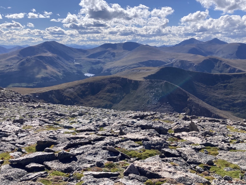
I only spent less than a minute on the summit--I knew I had a ways to go still above treeline and wanted to get down out of the wind before the sun set. Descending Gray Wolf, rounding the Hells Hole rim again, and reascending Pt 12988 was uneventful. I did notice a tiny grove of willows in a low marshy depression along the rim--these were definitely the highest willows I've ever seen! 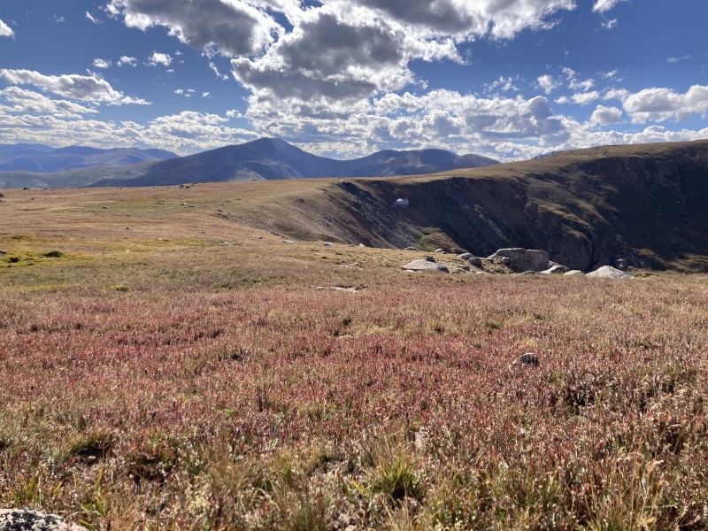

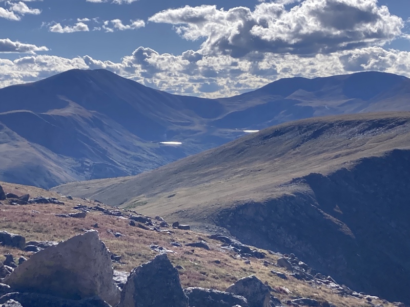
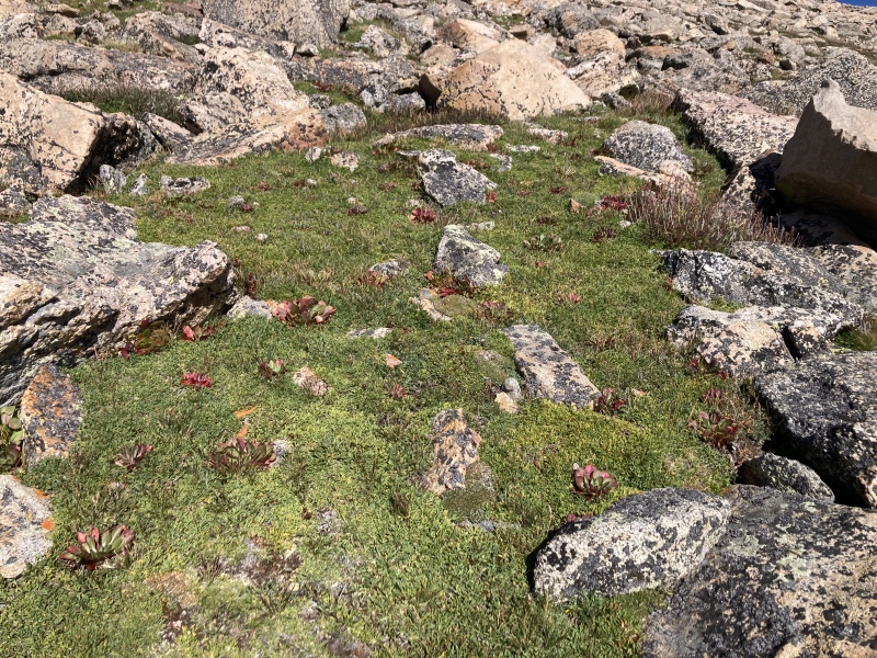
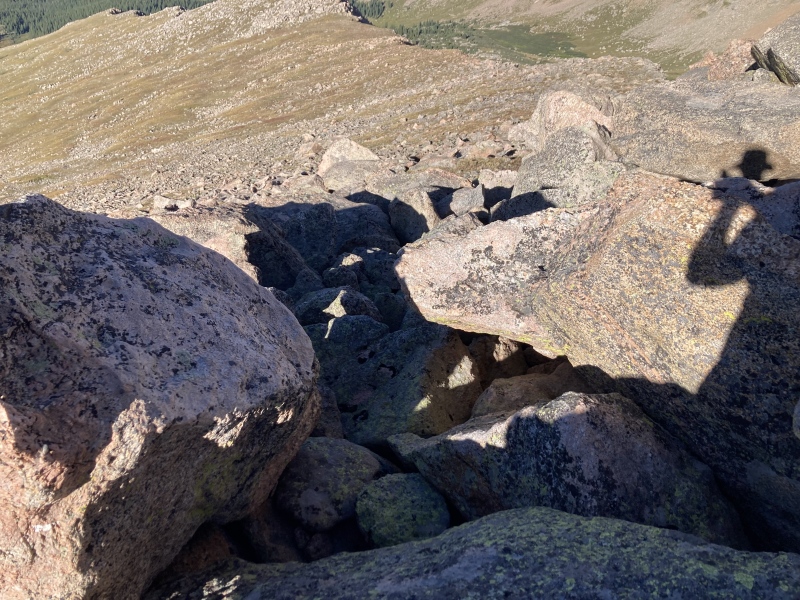
When I got to the rockier crest of Pt 12988 this time I wanted to try to find a Class 2+ line contouring around to the N side. I was successful for the flatter sections on top, but once the slope started getting steeper on the descent I had to resort to Class 3 moves. Sticking to Class 2+ still might be possible if you followed bands of flat grass/dirt in between the rocks, but having to lower yourself down the boulders using Class 3 moves seems inevitable. However, it looked completely feasible to contour the grassy slope below the rocks and ascend/descend the saddle between Pt 12988 & Pt 12959 at the southern tip of the upper west basin to keep it Class 2. 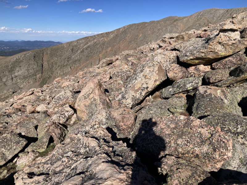
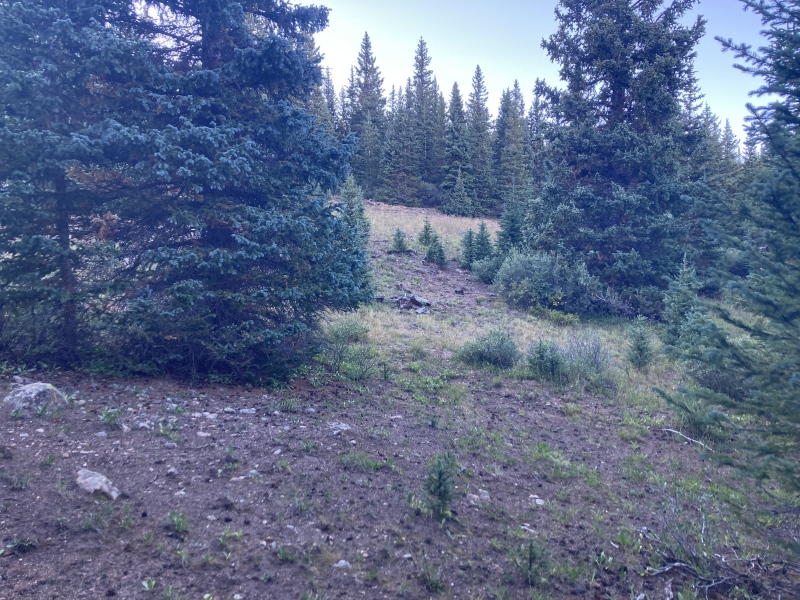
Once I finished with the boulder crawl and arrived back on alpine turf I needed to orient towards the next objective: a light-colored meadow on the lower ridge with some scraggly pines. Below this meadow lay the creek crossing and the way back to the trail. 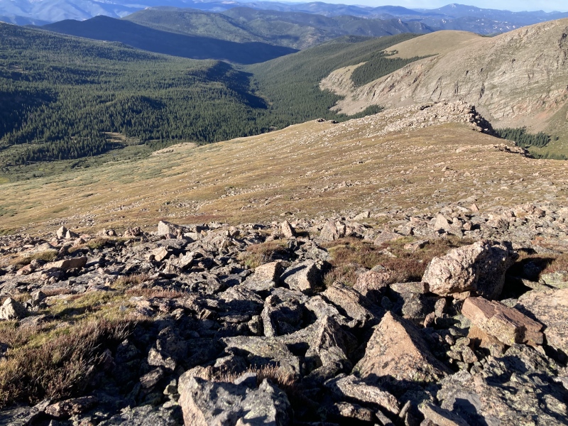
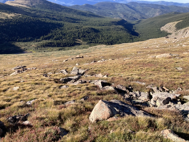
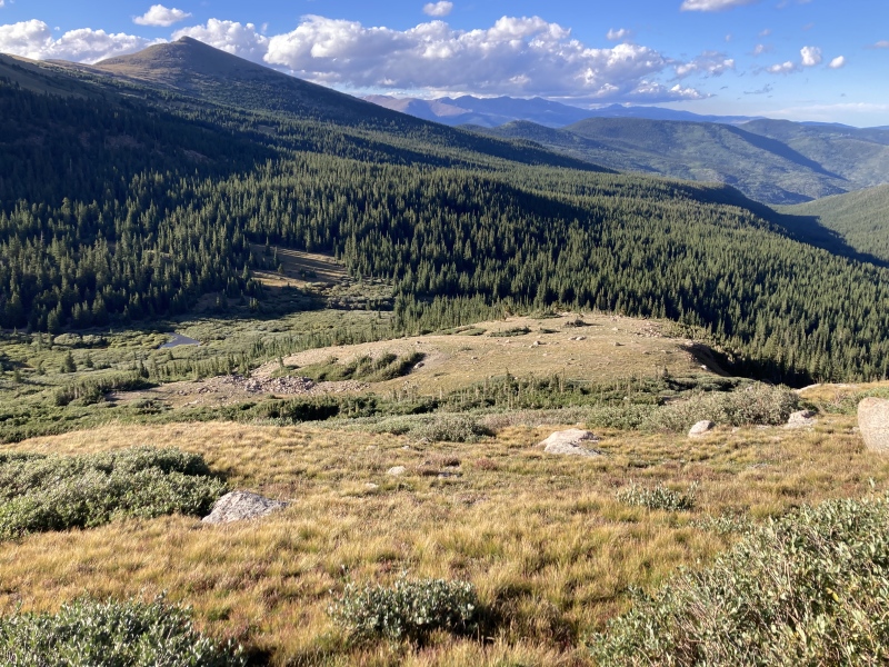
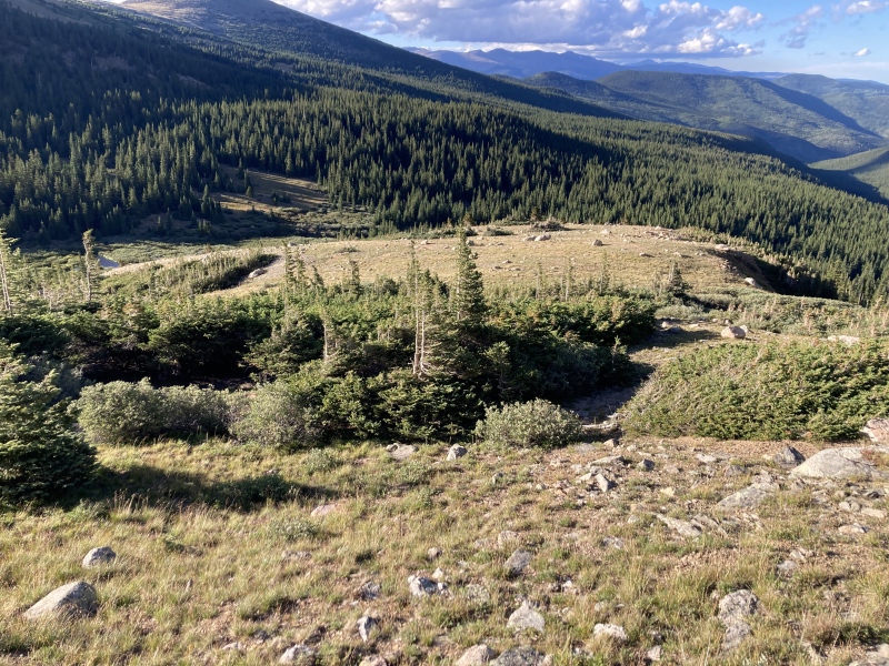
Once at the meadow I rediscovered the game trails I followed on the ascent here. There's a great photo op of some cliffs off Pt 12988 & Gray Wolf on the right side of the meadow. I continued descending through the lower meadows until I heard the sound of the creek and broke through the pines. I reached some more blowdown trees on this side of the creek that I had passed just after I had forded the creek on the ascent. From there it wasn't hard to spot the eroded area across the creek and descend to the creek crossing. 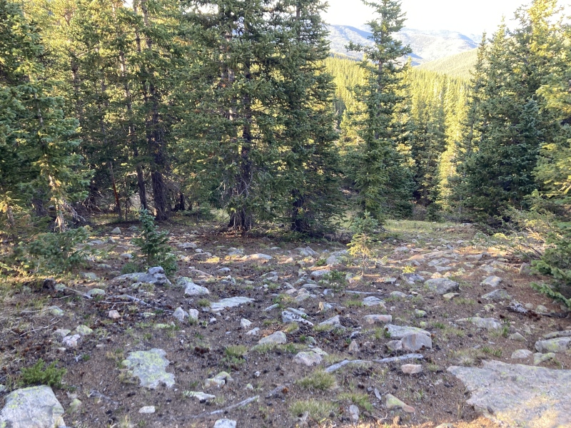
I stopped to fill my water bladder at the creek and enjoyed seeing the small cascades there in the waning light. After ascending the embankment, I passed through the trees behind the erosion crater to rejoin the last meadow where the original official trail passed through. Finally the routefinding was done for the day! 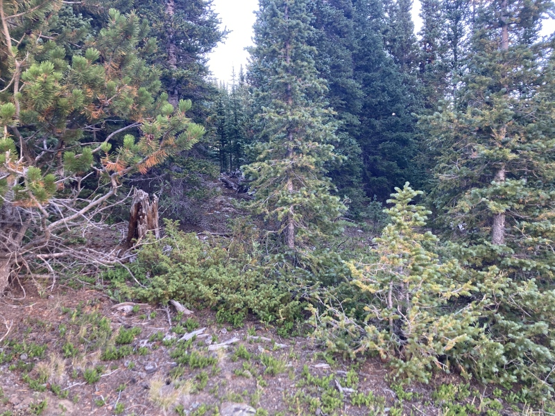
I really enjoy this more intellectual process of planning out routes using topo & satellite then fine-tuning details with my feet on the ground, but at the end of a long day it's nice to have a path I can mindlessly follow back to the trailhead. I was relieved to be back in the shelter of the forest and mild temperatures below treeline. I could notice the ups in the trail more than I noticed them as downs on the ascent but all of the significant gain was already done. The winds continued rushing over the Sugarloaf Peak ridge to the west and soaring through the treetops. The gusts sounded like they had a certain width and vector through the evergreen needles, like long dragons swooping down the wooded slopes into the depths of the valley below. The Mt Evans Wilderness boundary marked close to the halfway point along the 3.5 mi back to the TH. It was hard not to slip into a fugue state walking through the darkening forest below sunset-painted clouds. The spacious aspens whispered their thousand tiny secrets, and the blighted leaves crackled over their fallen brethren. The smell of rotting leaves was another reminder, this one much more subtle than the icy breeze from before, that fall was just around the corner. There's a few interesting attractions along the trail, namely some campgrounds, clearings with views, and a couple swampy areas that might hold moose. There's some social trails that venture down by the creek near the first part of the trail as well. I quickly stopped at a few of these turn-offs I hadn't visited on the way up and finally made it back to my car just after I had to pull out my headlamp. I really loved this day out. This was one of those days in the mountains that left me feeling more rejuvenated than tired even after a longer mileage route. It helped that the trail through the forest wasn't particularly grueling, for one, but something about it this time made it more easily communal. Maybe it's that today's breeze made the forest feel that much more animated, or perhaps it was a cycle of receiving peace from this arboreal sanctuary and returning thankfulness, only to be met with more acceptance and tranquility. I'm also glad that I got to really "see" the mountain today just as I felt that the wilderness with its refreshing presence "saw" me in turn. So I'd really recommend this route if you're looking to see Gray Wolf with its mauled flanks and want some fun scrambling on its lesser neighbor. The large aspen grove along the trail would make for a real treat during the changing of the leaves--it felt like something that should be of Kenosha Pass fame. I should note as well that I passed a couple parties of hunters with tags for bighorn sheep in the upper basin--consider wearing bright clothing when it's this season. I'm really looking forward to visiting this trail again--next time I might consider ascending Gray Wolf's NW ridge as the rock didn't seem too bad near the summit and per user CHeimCO's report there were plenty of game trails along the ridge that led back towards the TH. GPS route is approximate: Thumbnails for uploaded photos (click to open slideshow): ")
")
")
")
")
")
")
")
")
")
")
")
")
")
")
")
")
")
")
")
")
")
")
")
")
")
")
")
")
")
")
")
")
")
")
")
")
")
")
")
")
")
")
")
")
")
")
")
")
")
|
| Comments or Questions | |||||||||
|---|---|---|---|---|---|---|---|---|---|
|
Caution: The information contained in this report may not be accurate and should not be the only resource used in preparation for your climb. Failure to have the necessary experience, physical conditioning, supplies or equipment can result in injury or death. 14ers.com and the author(s) of this report provide no warranties, either express or implied, that the information provided is accurate or reliable. By using the information provided, you agree to indemnify and hold harmless 14ers.com and the report author(s) with respect to any claims and demands against them, including any attorney fees and expenses. Please read the 14ers.com Safety and Disclaimer pages for more information.
Please respect private property: 14ers.com supports the rights of private landowners to determine how and by whom their land will be used. In Colorado, it is your responsibility to determine if land is private and to obtain the appropriate permission before entering the property.


