Download Agreement, Release, and Acknowledgement of Risk:
You (the person requesting this file download) fully understand mountain climbing ("Activity") involves risks and dangers of serious bodily injury, including permanent disability, paralysis, and death ("Risks") and you fully accept and assume all such risks and all responsibility for losses, costs, and damages you incur as a result of your participation in this Activity.
You acknowledge that information in the file you have chosen to download may not be accurate and may contain errors. You agree to assume all risks when using this information and agree to release and discharge 14ers.com, 14ers Inc. and the author(s) of such information (collectively, the "Released Parties").
You hereby discharge the Released Parties from all damages, actions, claims and liabilities of any nature, specifically including, but not limited to, damages, actions, claims and liabilities arising from or related to the negligence of the Released Parties. You further agree to indemnify, hold harmless and defend 14ers.com, 14ers Inc. and each of the other Released Parties from and against any loss, damage, liability and expense, including costs and attorney fees, incurred by 14ers.com, 14ers Inc. or any of the other Released Parties as a result of you using information provided on the 14ers.com or 14ers Inc. websites.
You have read this agreement, fully understand its terms and intend it to be a complete and unconditional release of all liability to the greatest extent allowed by law and agree that if any portion of this agreement is held to be invalid the balance, notwithstanding, shall continue in full force and effect.
By clicking "OK" you agree to these terms. If you DO NOT agree, click "Cancel"...
Point 13517A, Point 13,472B, and Huron loop from Clohesy Lake with Ian
I wanted to add this report of point 13,517A and the new LiDAR ranked 13er next to Mount Huron, point 13,472B, to add a bit of beta on a nice class 2+ max route to link these two peaks from the Lake Clohesy side. Most of the reports on this site link 13,517A with Pear Peak, but there isn't a lot of information yet on the link up with 13,517A and the new LiDAR ranked peak. Credit to the route is due the Cooney's as I found this route on their wonderful 13er website, but I felt I could add some info including some photos and a GPX file/map for others in the future looking to possibly link these two peaks in a nice outing.
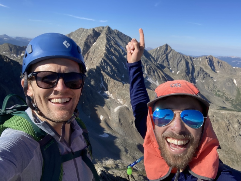
For this outing I teamed up with Ian. One thing I have really enjoyed about the 13er quest over the years has been bumping into people with very similar summit bagging passions to mine on random outings. I had met Ian earlier in the year near Silverton on the top of Grand Turk. I joked with him at the time that he and his two friends had just spoiled a streak I had running of sharing no 13ers summits with anyone other than someone in my party (I think I was up to about 80 straight 13ers without sharing a summit with a stranger). We linked up for a bit on the hike over to Sultan and learned quickly that we were both on a quest to potentially summit the Colorado 13ers. Ian has been an animal and really is tackling the list quickly. After this random meet up, we connected on this website with the hope to do a few peaks together on our quests and got out for a wonderful day on Mount Daly a few weeks earlier. On this day we had hoped to possibly give Clark Peak and point 13,060 a go but the weather forecast was for a monsoonal surge with storms starting right at noon so we elected for a shorter option. When considering shorter alternative options, I realized Ian only had point 13,472B left to finish off the Sawatch 13ers so I pitched the idea of these two peaks with a Huron add on from Clohesy. Ian loves the Clohesy area, and I had never been, so we altered plans to tackle these peaks with a major bonus of it being Ian's Sawatch 13er finisher!
We met early at the Sheep Gulch Trailhead and I jumped in his stock Tacoma for the drive into Clohesy. The stream crossings weren't an issue at this time of year but much to our surprise the initial hurdle on the road right out of Clear Creek is very impressive. After considering bashing the truck up this step we ultimately decided to park and keep Ian's truck intact. This hurdle on the road really seems to require an impressive 4x4 vehicle or the willingness to potentially damage whatever vehicle you take. There is evidence of the remnants of the underside of vehicles in this area. So, we altered plans and parked at Clear Creek instead. Therefore, we started the morning with a cool ford of the creek. This was going to add some significant mileage but worth it to not potentially damage his new truck. Fortunately, we were starting early a bit after 430 AM so had time before the noon storms started.
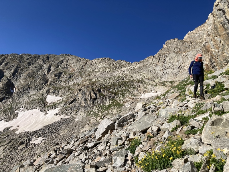
The hike into Clohesy is simple and the road is really mellow past the first 1/2 mile. The road really isn't that bad for driving other than the first step out of the creek and the first half mile but the walking was just fine as well. Once you reach Clohesy lake we stayed on the Missouri side of the lake on the trail until we bypassed the lake. The access to the upper basin between 13,517A and 13,472B is next to an avalanche path. There is a very wide initial avalanche path before Clohesy that seems like it would work as well but we used a narrow steep avalanche path a bit after Clohesy. The Cooney's used this narrow avalanche path as well. There is a lot of willows in this area and the bush whack initially is pretty solid across the stream. We quickly made our way into the trees on the left side of the avalanche path. 50 feet into the trees we were able avoid the willows of the avalanche path and had a very pleasant yet steep romp into the upper basin.
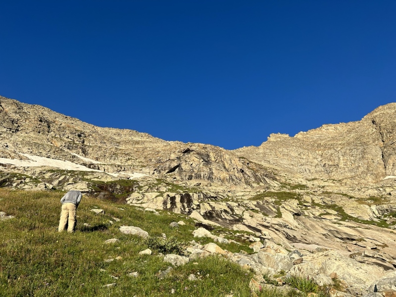
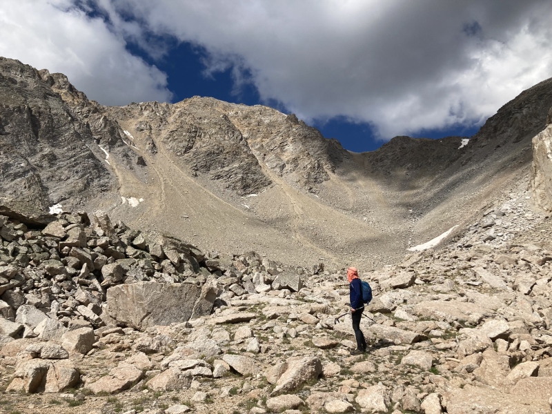
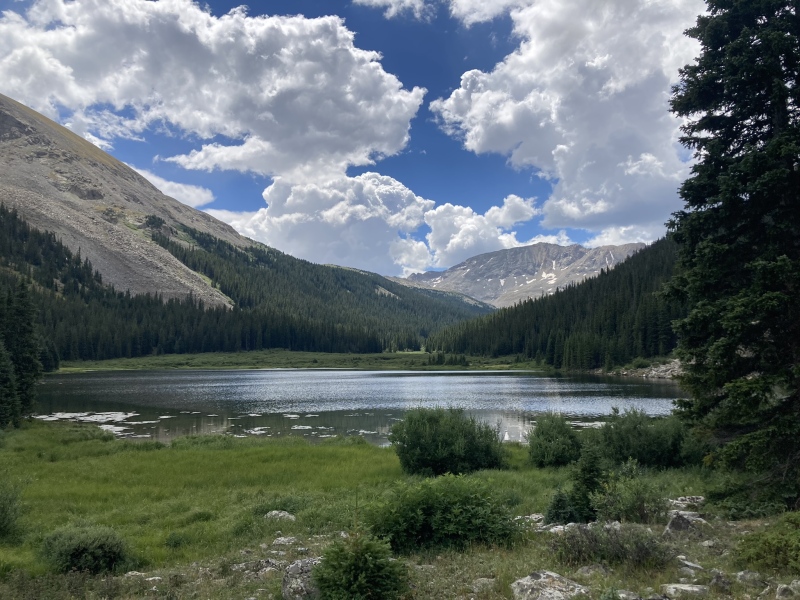
The upper basin is a beautiful spot and seems rarely visited.
Out of the trees in the upper beautiful basin, point 13,517 on left with point 13,472 on right
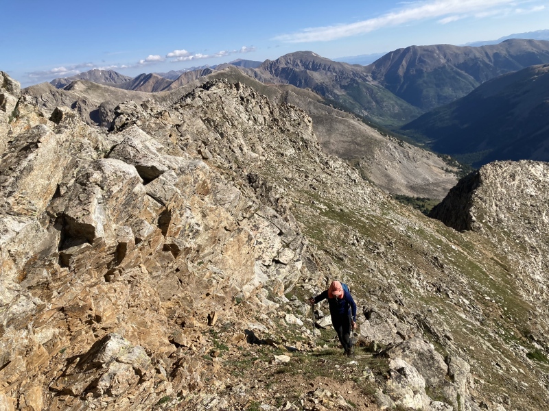
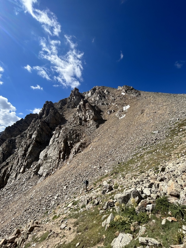
Once your reach here you trend up towards the saddle through some beautiful slabs mixed with grass. The theme of the day on this route if looking to avoid any significant climbing is that a grassy ledge will arrive just when you want it to before any difficult scrambling begins. Trend up towards the saddle as far as you can then it will be pretty obvious when upper cliffs start to block upward access and you start a leftward trending ascent towards 13,517 on grassy ledges mixed with some rocky slabs and gullies.
Trending up towards the saddle. Really more of a Gore like setting then typical Sawatch. It's really cool how much things change around the Apostles for a brief moment in the SawatchAscending travers on grassy ledges mixed with some very mild scrambling up towards 13,517. 13,472 in background
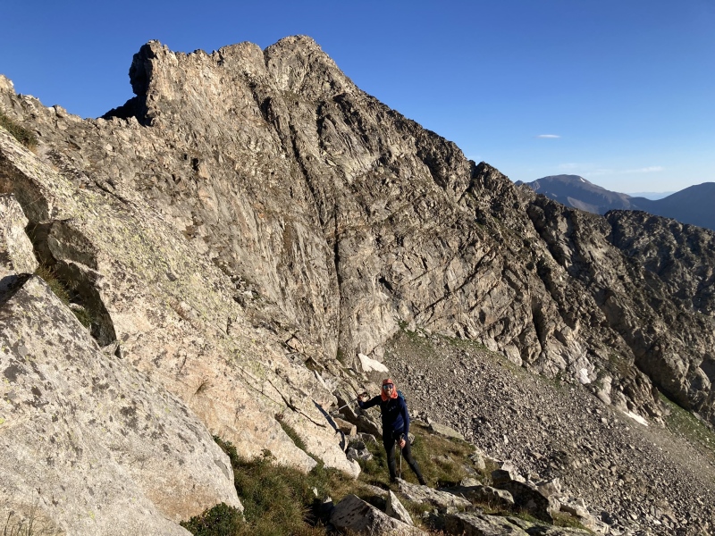
We kept an ascending traverse towards 13,517's summit. Every time it seems like it will increase in climbing difficulty, a easy gully or grassy ledge presents itself for relatively easy passage. I do think this can be kept at class 2+. Plenty of class 3 and above scrambling is all around if desired. As we trended up, we were eventually able to angle back slightly to the ridge then finish the climb on the ridge to the summit.
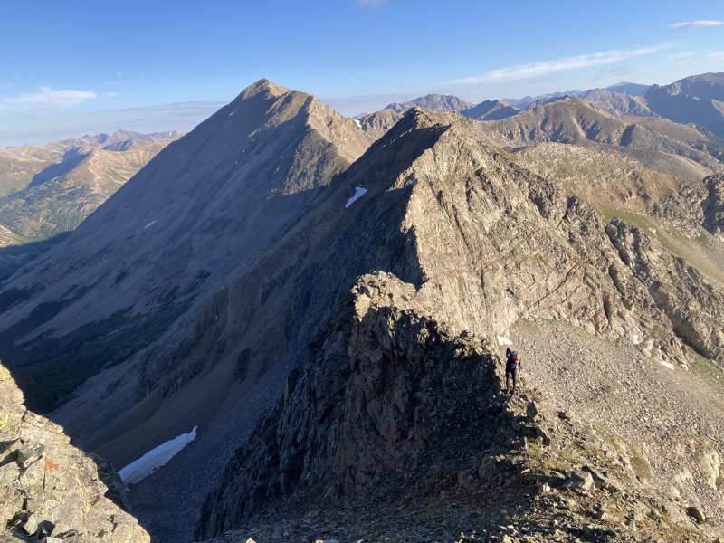
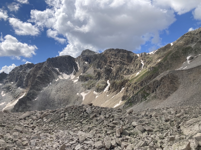
Final easy ridge to the summitSummit of 13,517 with a fantastic view of the ApostlesFinal Ridge of 13,517 with 13,472 and Huron in background. We elected to not take on this impressive connecting ridge and bypass difficulties by dropping back down around the rugged right ridge of 13,472 at the right of this photo
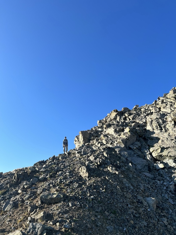
From 13572 the ridge to 13,472 is impressive. Mtnman200 has a report of a high grassy ledge traverse on this website that is worth a look. The grassy ledge can be seen on the above photo and is impressive cutting across the face with lots of air beneath it! We elected to bypass all difficulties by losing a few extra hundred feet around the obvious rugged right ridge of 13,472. Once around the rugged ridge at about 12,600ft of elevation you can round the corner and pretty much hike steep pleasant grass all the way to the summit of 13,472.
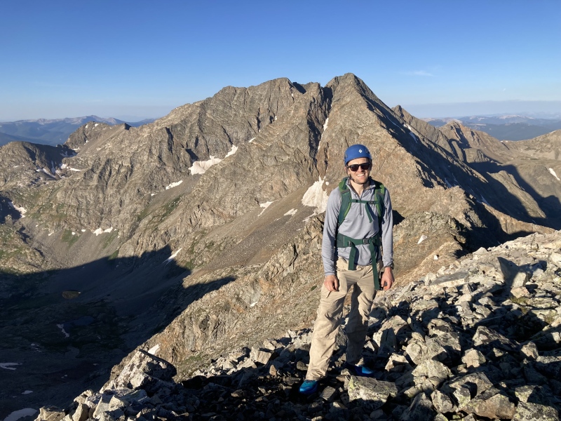
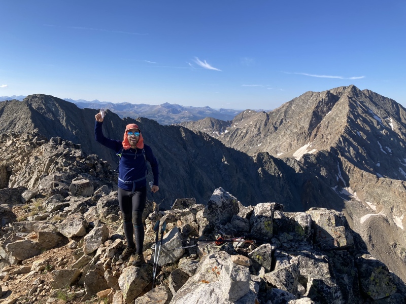
Ian rounding the rugged ridge of 13,472 in the upper basin. 13,517 with grassy ramps and rocky ledges in the backgroundThe final grassy ledge of 13,472 just before the summit. The entire climb of 13,472 from the upper basin can be kept on mostly grass.Ian on his Sawatch 13er finisher of 13,472 with 13,517 and the Apostles as the backdrop.Celebrating the Sawatch 13er finisher
After this we decided to take the South East ridge of Huron from 13,472. This is a nice walk up, we saw several goats en route, and we met our first people of the day on the summit of Huron. I had always wanted to see the Nolan's route up Huron from Clohesy lake, so we went down the standard route until the saddle and started to descend down towards Clohesy lake. It was interesting looking for cairns and trying to see how people best attack this section. We never really found a trail but cairns are everywhere in this section. Every time I am on a section of the Nolan's traverse, I am more and more impressed by anyone that can finish it. This section must be so difficult on the northbound trip. We eventually got down to Clohesy lake bypassing Lois Lake which has to be the smallest named lake I have been to. From Clohesy lake we had a pleasant walk back down to the truck as lightening and storms started around us at 1130.
On the decent from HuronLooking back up at the saddle and Nolan Route Decent off of HuronPoint 13,472 from high in the basin Clohesy Lake after decent with Peak Peak in the background
Final stats on the day ended up at 13.86 miles with 5,394 feet of gain. This could really be cut down to a very quick day with a stout 4x4 vehicle and if not doing Huron. I really enjoyed this route. It was in a very rugged area of the Sawatch but never difficult and just a really enjoyable day overall. It was very cool to be so close to the Apostles. Hope this helps some in the future considering linking these peaks.
My GPS Tracks on Google Maps (made from a .GPX file upload):
That's the trip report I have long looked for! For a long time already, I've wanted to connect 13,517B, 13,472A, Huron, and the 13ers north or Huron in one grand loop coming at 13,517B from the west. I can't seem to find anything about the west ridge of 13,517B, and it's been difficult to find much about the ridge between 13,517B, 13,472A, and Huron. It's nice to see this piece fully filled in finally :-)
Marmot72 - it really was a great day out and I agree in the heart of the Sawatch the peaks really take a change for a brief moment and you feel like you've drop into the Gore instead.
bangerth - glad the report was helpful. I added huron to the peaks climbed part of the report, for some reason I left that out as I was focused on writing up the beta on the 13ers but adding on Huron was very pleasant and really added to the loop I thought.
Caution: The information contained in this report may not be accurate and should not be the only resource used in preparation for your climb. Failure to have the necessary experience, physical conditioning, supplies or equipment can result in injury or death. 14ers.com and the author(s) of this report provide no warranties, either express or implied, that the information provided is accurate or reliable. By using the information provided, you agree to indemnify and hold harmless 14ers.com and the report author(s) with respect to any claims and demands against them, including any attorney fees and expenses. Please read the 14ers.com Safety and Disclaimer pages for more information.
Please respect private property: 14ers.com supports the rights of private landowners to determine how and by whom their land will be used. In Colorado, it is your responsibility to determine if land is private and to obtain the appropriate permission before entering the property.

")
")
")
")
")
")
")
")
")
")
")
")
")
")
")


