Download Agreement, Release, and Acknowledgement of Risk:
You (the person requesting this file download) fully understand mountain climbing ("Activity") involves risks and dangers of serious bodily injury, including permanent disability, paralysis, and death ("Risks") and you fully accept and assume all such risks and all responsibility for losses, costs, and damages you incur as a result of your participation in this Activity.
You acknowledge that information in the file you have chosen to download may not be accurate and may contain errors. You agree to assume all risks when using this information and agree to release and discharge 14ers.com, 14ers Inc. and the author(s) of such information (collectively, the "Released Parties").
You hereby discharge the Released Parties from all damages, actions, claims and liabilities of any nature, specifically including, but not limited to, damages, actions, claims and liabilities arising from or related to the negligence of the Released Parties. You further agree to indemnify, hold harmless and defend 14ers.com, 14ers Inc. and each of the other Released Parties from and against any loss, damage, liability and expense, including costs and attorney fees, incurred by 14ers.com, 14ers Inc. or any of the other Released Parties as a result of you using information provided on the 14ers.com or 14ers Inc. websites.
You have read this agreement, fully understand its terms and intend it to be a complete and unconditional release of all liability to the greatest extent allowed by law and agree that if any portion of this agreement is held to be invalid the balance, notwithstanding, shall continue in full force and effect.
By clicking "OK" you agree to these terms. If you DO NOT agree, click "Cancel"...
Route: E Partner South Ridge -> Partner Traverse -> W Partner S ridge/slopes descent
Trailhead: Pitkin
Distance: 13ish miles (gps track goes wonky on steep terrain)
Gain: 5800
Difficulty: 5.4 (optional), 5.easy (mandatory)
Brandon and I had been trying all summer to link up for a climb. But life can get in the way, and between babies and marriages and honeymoons and family visits, we each had our own things going on this summer. Thankfully, before the warm months drifted away, our schedules aligned and we were able to get out finally. During our research, we've been eyeing prospective ridgelines in the Gores. This weekend, the Partners called our names.
Full disclosure: we went into this climb with essentially no beta. We knew it went sans rope (or sin ropa, as Brandon said, though that might mean something else) for the adept scrambler, but beyond that, the ins and outs of the route were a mystery. Throughout the day, we certainly appreciated the "choose your own adventure-ness" this afforded us, but that likely means that our variations aren't the only way (or even the best way) to tackle this ridge. Regardless, it worked for us!
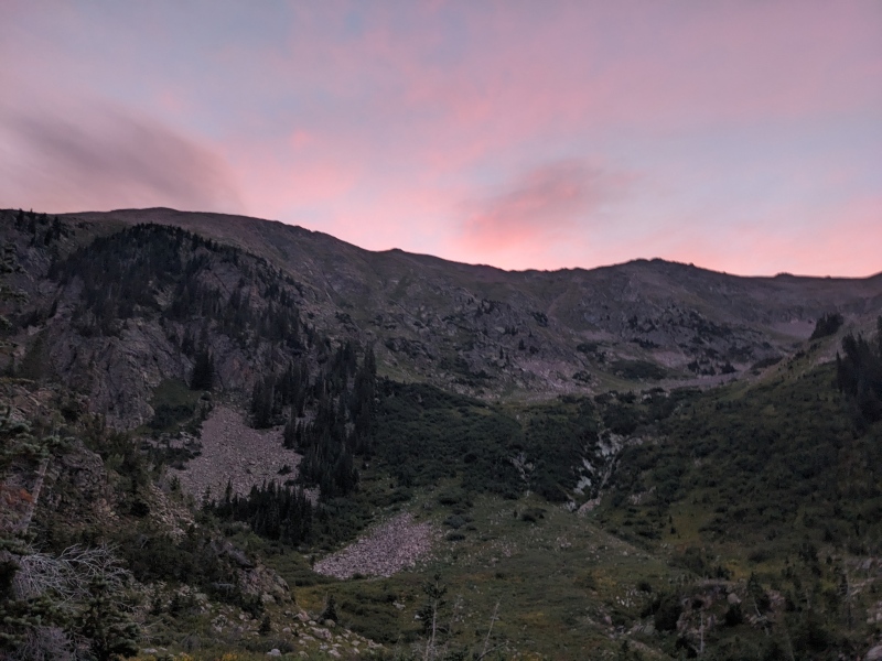
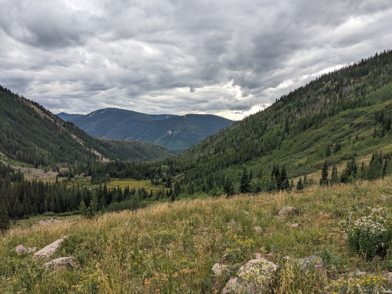
2:03 AM alarm. Why? Because 2:00 is way too early and 2:05 is way too late. I woke up, made coffee, picked up my bag, and promptly dumped my coffee on my sock. Made more coffee. That 2:00 alarm is looking like the right call now. I managed to not spill the second cup of coffee and drove through Evergreen to meet Brandon at the I70 park n ride. One of the best things about the Gores is the short drive. We pulled in to the Pitkin trailhead at 4:20, geared up, and hit the familiar Pitkin Lake trail by 4:30.
I've primarily hiked alone this summer, as I've found that the further down the 13er list one gets, the harder it is to find people with common goals. God bless the "down for anything" people, like Brandon. When hiking solo, I tend to dread the approaches below treeline and in the dark. They're lonely, claustrophobic, and every boulder and downed tree is a bear wanting to eat me. But with a partner, the approaches fly by. There's no time to be paranoid about the shadows. We're too busy catching up on life and chatting about climbs past, present, and future; and before we know it light has arisen and headlamps are off.
Let there be light!
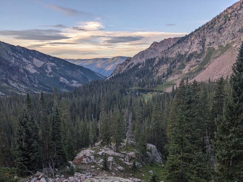
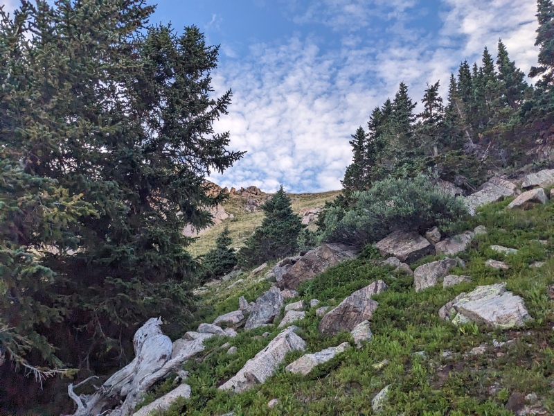
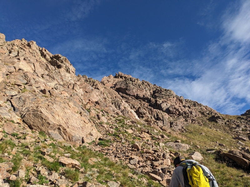
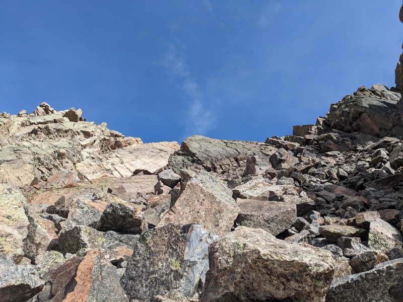
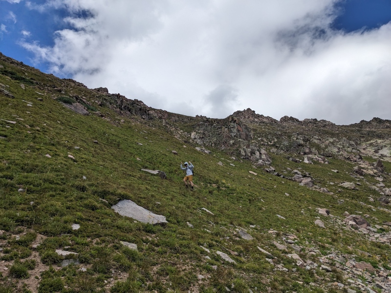
Our route veered off the industrious Pitkin Lake trail well before the lake, at a spot where the trail makes a left turn to avoid some cliffs. As we learned on the descent, perhaps a better route would be to stay on the trail until a meadow right before the upper bench where the lake is, or even go nearly to the lake and ascend a grassy slope up to the high ridge, but we didn't know what we didn't know, and undertook a steep bushwhack from the base of E Partner's south ridge. Our ascent consisted of weaving through trees up steep slopes, either grass or talus-y dirt. Learn from us and go a bit more to the west of the ridge before trying to ascend. Oh well, it went!
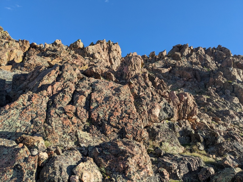
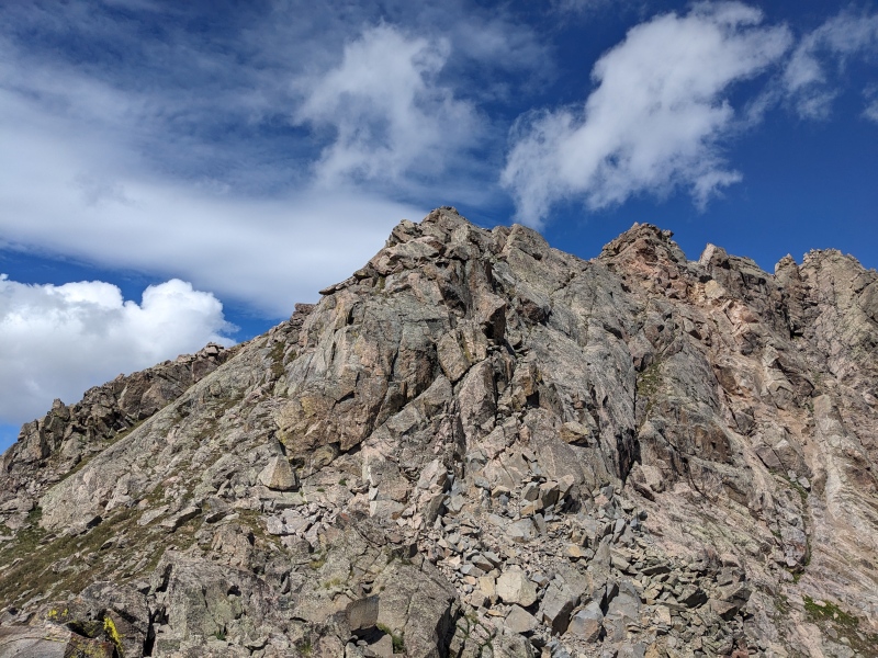
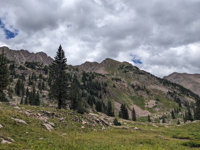
Low on the S ridge of E Partner. Sky putting on a show
Taken on descent. We ascended somewhere near the skyline on the right. It's better to stay well left of the ridge and link up the grassy sections. Or go further up the trail and ascend the western aspect.
Ridge to Outpost. We thought about it for a bit...
Typical conditions heading up E Partner. We're a bit west of the S ridge.
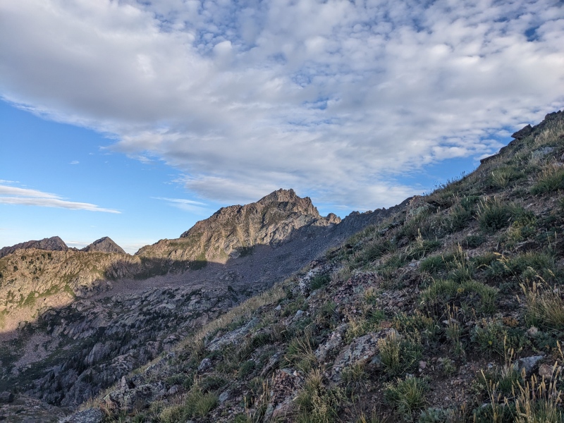
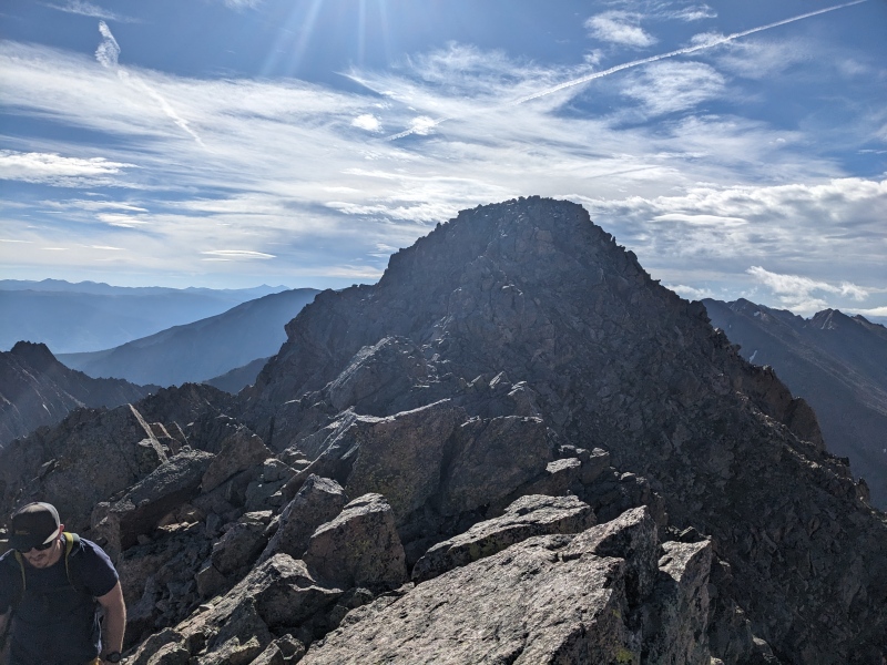
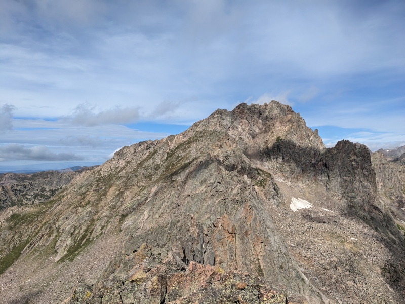
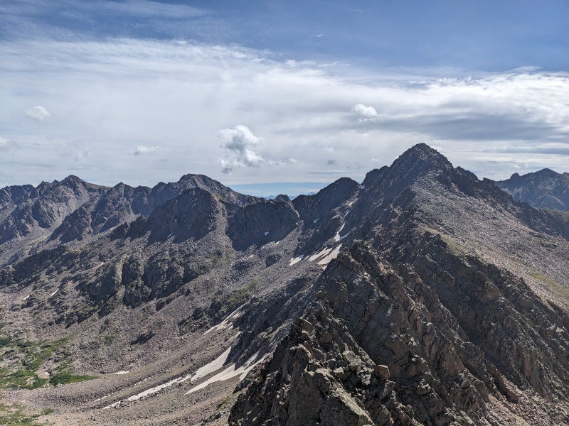
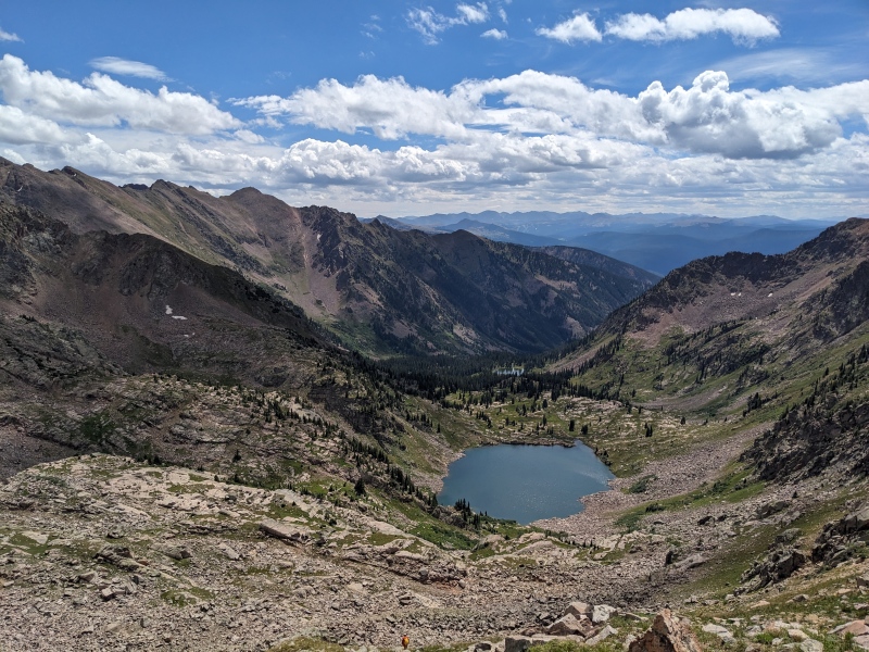
After fighting through boulders, scratchy shoulder-height trees, and stupid-ass thistles, we learned our lesson and traversed straight left. We hit an open grassy slope, lamented we could have dodged most of the bushwhacking if we'd have just ascended this the whole way, and scooted up to the ridge. Our next five hours appeared before us, as the jagged ridgeline of the Partners cirque came into view. It's one of those views that words can't adequately describe.
Oh look a grassy gully maybe we should try that instead of smashing our shins into rocks and trees
A wild West Partner has appeared!
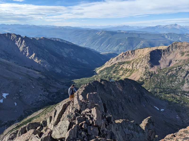
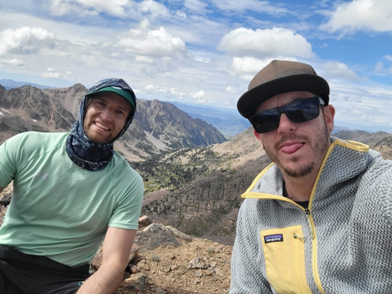
Hero shot 1 of 17000 we took on this hike (this one featuring me, a well-balanced helmet on my backpack, and E Partner)
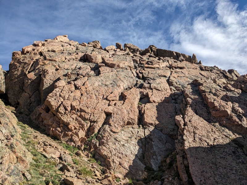
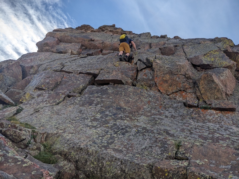
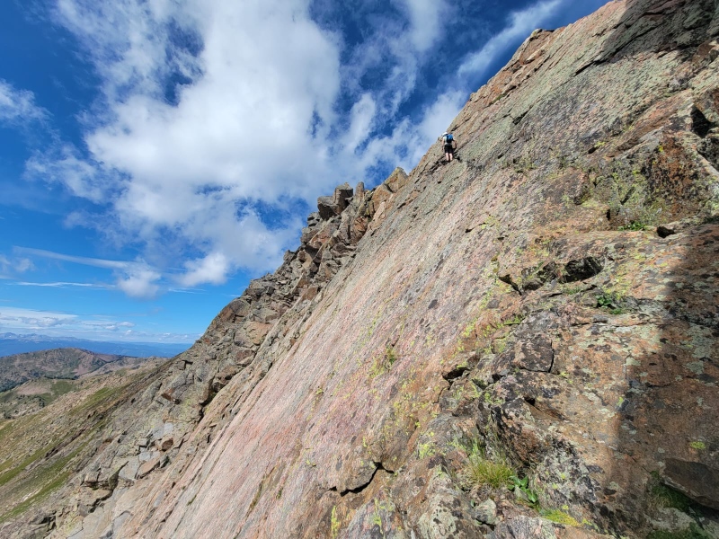
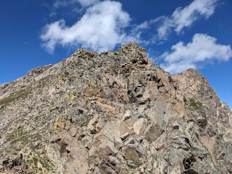
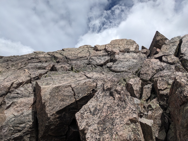
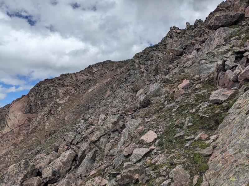
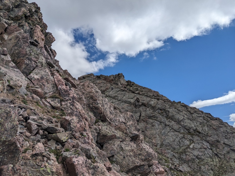
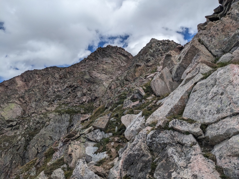
Upon surmounting the grassy slopes of the lower south ridge, the scrambling began in earnest. The day featured so much scrambling that details blend together, but the south ridge of E Partner began with a rock ridge scramble, then contoured upward on blocky terrain before tundra led us to the upper difficulties. We skirted a section of the upper ridge to reach a slabby, fractured face, which we climbed directly. I took a weakness that went at 5.4, while Brandon found what looked to be a bit harder line at the bottom before traversing right of my line and working his way up. These were probably the hardest few moves of the day, though this face could be avoided to the east via a third class line. After topping out on this face, a few more minutes of scrambling led to the summit of East Partner.
Hero shot for Brandon. More to come
Blocking scrambling on the south ridge
Skirted the upper slopes to access the face in front of us. Could probably stay ridge proper too but we reaaaaally wanted to sidehill the steep, loose, wet scree under the lingering snow field.
Blocky face we ascended. I took the shadowed corner middle right and the crack above it, Brandon went all over the place
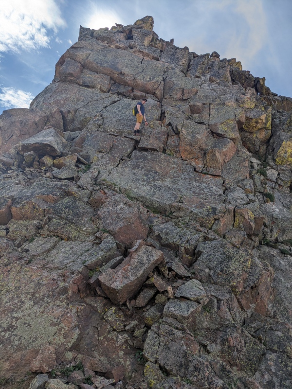
Brandon finding his way. Really shows the steepness of this face
Brandon heading toward the summit
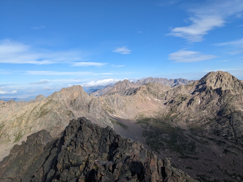
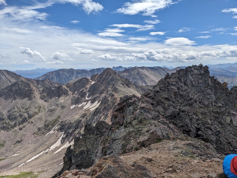
A lot of people talk about what peak has the best views. I'm sure there's a lot of peaks in a lot of ranges that have a claim, but the peaks of the central Gores have as valid of a claim as any. The entire snaking main ridgeline of the Gores was visible, from Eagle's Nest all the way to the southern peaks. The Slate Lake peaks looked close enough to touch.
Summit views. Z mid left in the back, X front and center. Usable pass (aptly named) on right
Summit views. W Partner left-middle, with Rockinghorse ridge, the ass-end of Ripsaw, and Peak Q
We didn't linger too long on E Partner, as the meat of the day was before us. We scrambled west off the summit and quickly encountered a short notch, perhaps 10 feet deep, that required a low fifth downclimb. As with many of the difficult moves on the route, it wasn't too bad if you're six feet or taller, but shorter people would need some ingenuity.
First tricky downclimb. Step one: be tall. Step two: don't be short
Brandon (tall) dispatching the vertical downclimb
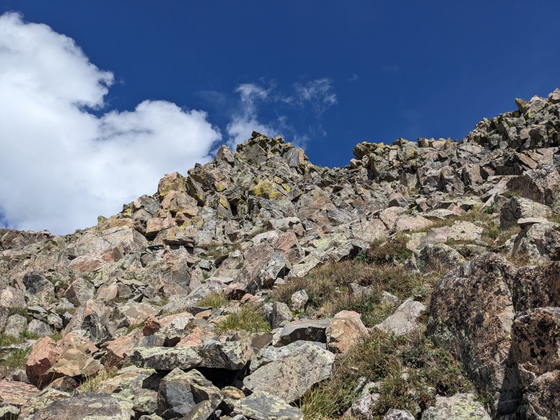
The next section of ridge was consistent 3rd/4th class scrambling trending downward toward the saddle. Much of our route was ridge proper, though occasional forays onto the northern or southern aspects were executed. After a while, the scrambling led to a grassy saddle, and the exposure and difficulty eased momentarily.
Looking back at the initial descent off E Partner
Randomly cairns! Always nice to know you're not completely in Narnia
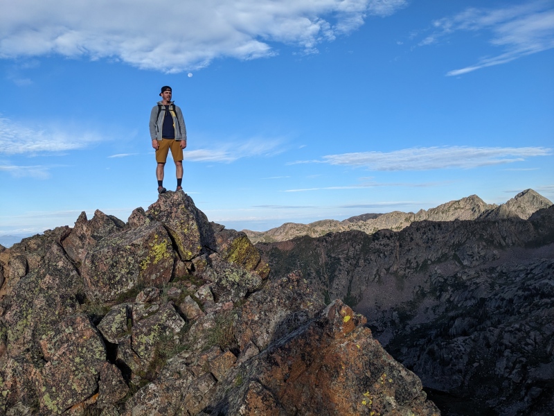
Hero shot of me, #58
Grassy saddle. Eye of the hurricane, if you will
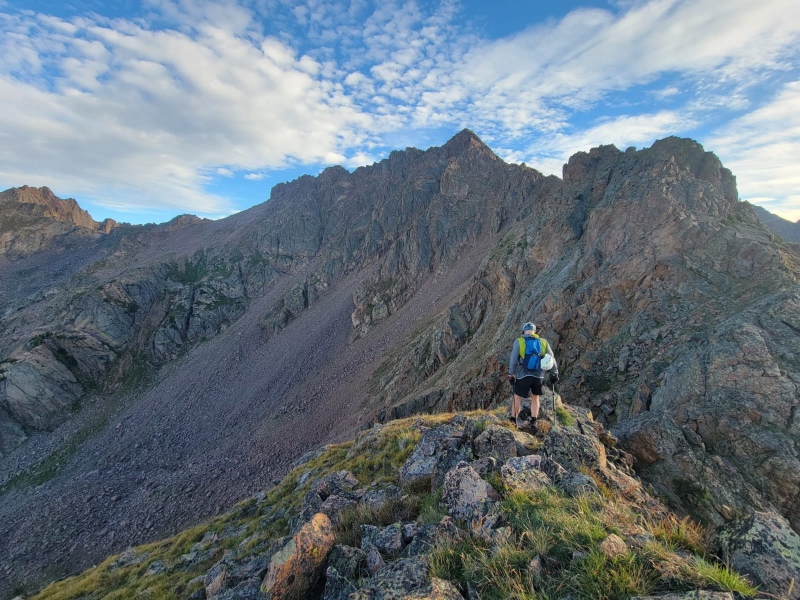
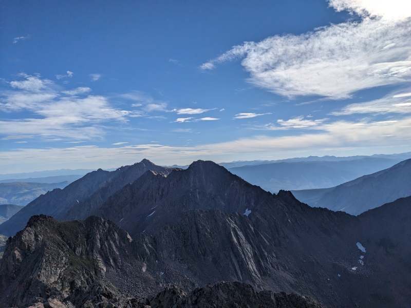
Looking ahead to W Partner. W Partner leans away from the basin, as if trying to avoid a bad smell to the south
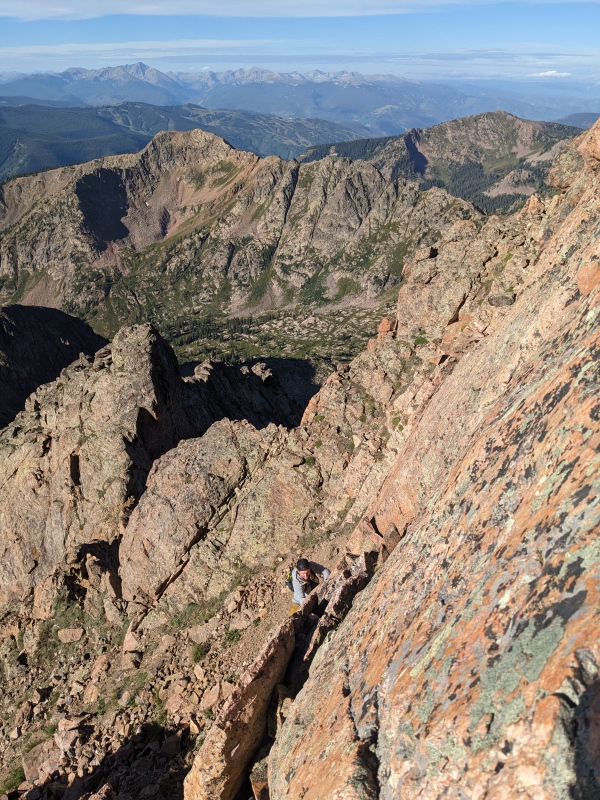
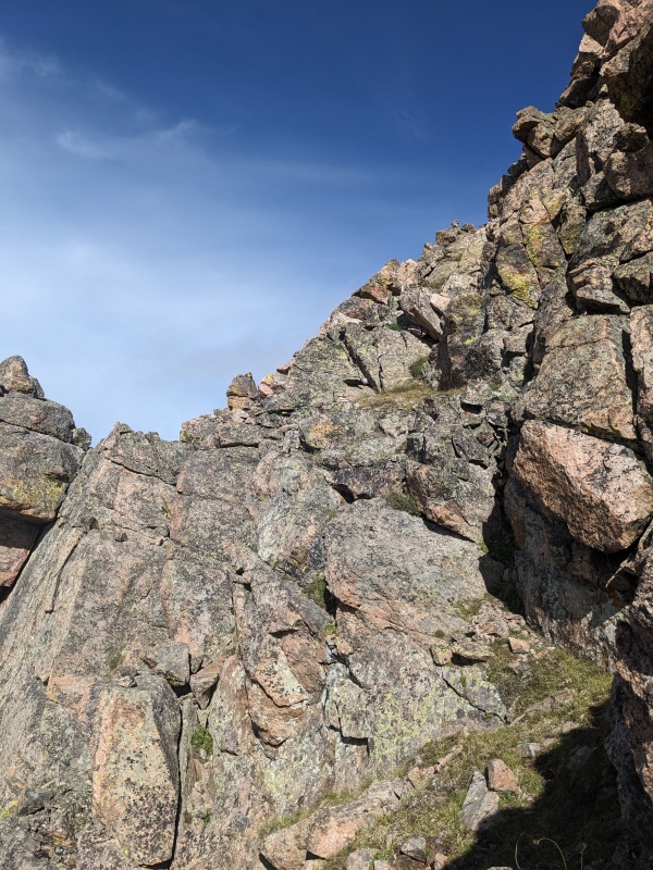
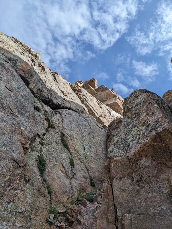
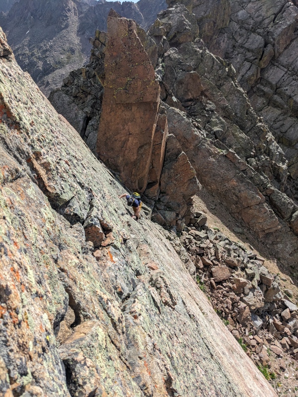
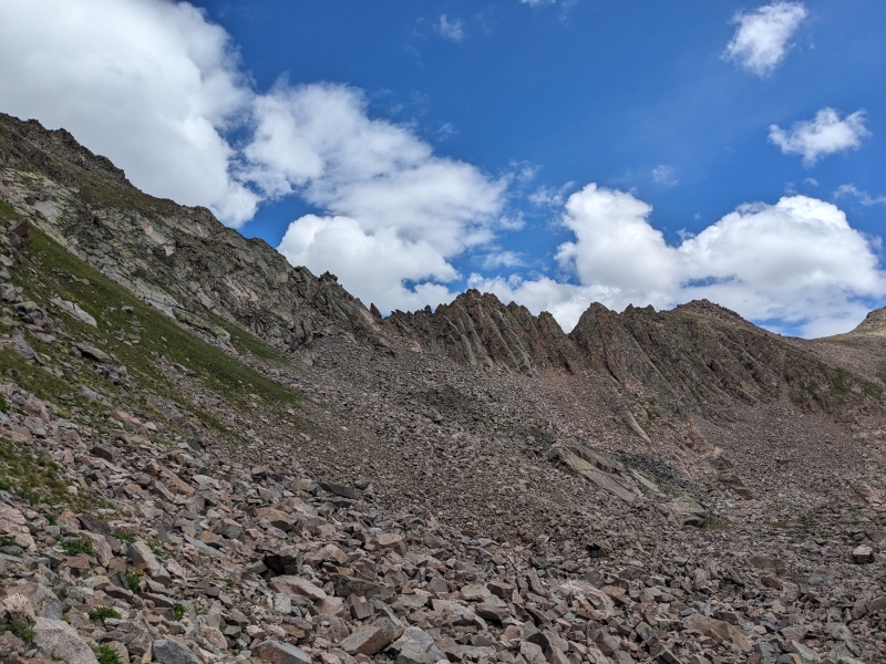
The next section of ridge consisted of a number of towers. It was never clear at the base whether the tower would connect to the next, or whether it would cliff out. We found both. The descent off of one of the first towers was a low 5th fractured slab. I know some people rappel this section, but we found the downclimb manageable.
Brandon's behind on the slab downclimb
A full look at the slab downclimb and the weaknesses we exploited.
The tower right after the downclimb was steep, grassy, and blocky. However, upon reaching the top, I found an exposed knife edge that seemingly led to nothing. I scrambled out to the end of the knife edge, but didn't see any clear way to reach the saddle with the next tower. Instead, we pieced together some loose ledges on the south side and dropped into a gully below the saddle.
From this gully, it wasn't clear whether or not a climb out of the saddle to the next tower was possible. The wall was sheer rock and very steep. Our options were to climb up to the saddle and try, or descend the gully another 75 feet and go around the base of the cliffs. We elected for the latter. After descending, we peeked up at the next possible ascent point (next picture). It probably went at low-mid 5th, but we were concerned that once on the top, we would cliff out again and have no way forward without downclimbing the 5th class face. Rather than take the risk, we elected to circumvent the next couple hundred feet of cliffs around their base, then took the next viable option to regain the ridge: a talusy/slabby slope, probably 3rd class. Having no beta on the ridge hurt us here (no idea still if that section of ridge goes), but our workaround is definitely the most intuitive way.
Looking up at a possible climb to regain the ridge....sure it goes, but if it cliffed and we had to downclimb it? nahhhhhhh
Talus and slab slope to regain the ridge.
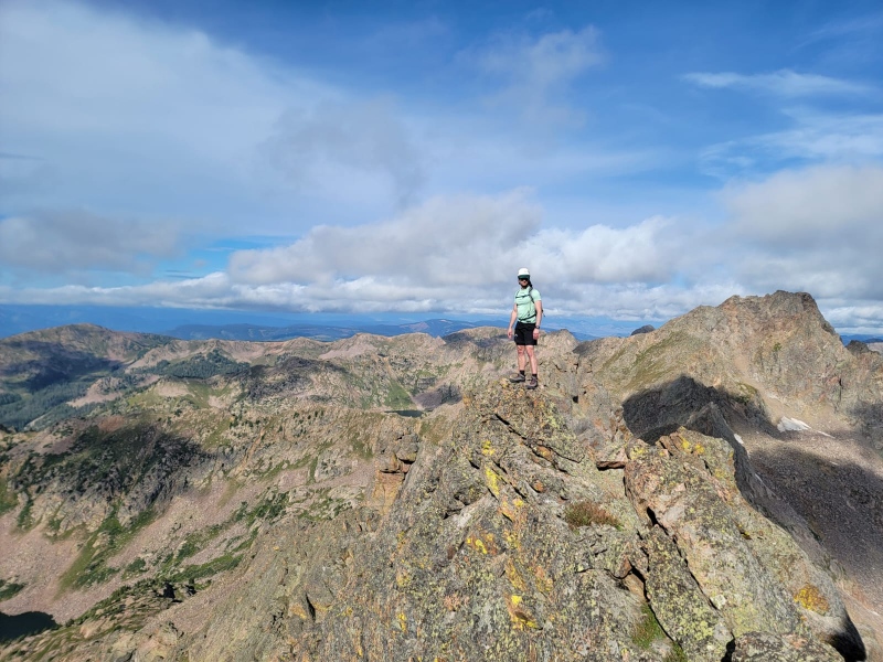
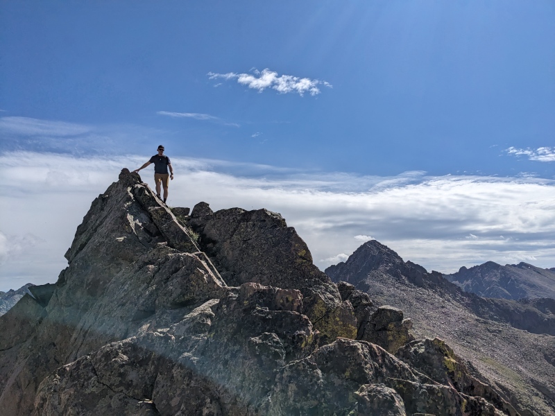
We regained the ridge right at the saddle before the slab ledge traverse, which is one of the only things I remember from reading trip reports about this route months ago. Pictures of this section look terrifying, but it ended up being wildly fun. The ledge is about a shoe's width wide and is solid. As long as one isn't exposure-averse or have a particularly left-leaning weight distribution problem, this was a blast and not difficult. The whole section is probably 75 feet long.
Me on the slab traverse
Wide enough!
Brandon tackling the traverse. It is a long way down. Can probably dodge this section below the slab
Looking back on the ridge. We skirted a section in the middle of the ridge down to the right in this pic
After the slabs, the exposure relented and the terrain became blockier. There were no more downs, fortunately. Just ups. We clambered upward on the slopes and the ridge, traversed one last knife edge, and began the final push up the false summit of W Partner. As we neared the false summit, we spied a group of two coming directly up the south ridge of W Partner, which were the first people we'd seen all day that weren't microscopically far away.
Up! Much easier climbing than the last couple of hours.
As if there weren't enough hero shots
3rd class going up
Last section up to the false summit. S ridge on the left skyline.
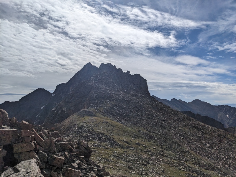
Just below the false summit, we found yet another slabby face to climb. Short, but fun. Topping this face revealed there was a bit more scrambling to go, which we did. Topping that next point revealed that this also was not the true summit, but another falsey! Fortunately, the true summit was just a minute or two away. We scrambled over and sat on the summit of West Partner, about two and a half hours after leaving East. The traverse was more time-consuming than expected, but was undoubtedly one of the best in the state. We soaked in the summit glory for a while, talking with our new friends, alternating between shivering and sweating, depending on the current sun/cloud relationship.
Slabby face below false summit
Real summit! Looking back on false summit and E Partner
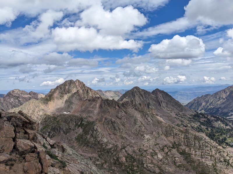
Slate Lake peaks. Q prominent on the left, with R to the right.
Chyeah boy
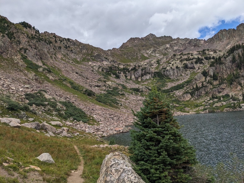
Satisfied with the day and unsatisfied with the IT band twinges I was feeling, we nixed any thoughts of running the ridge to Outpost. We elected to drop below the ridgecrest off of the true summit and sidehill our way to the south ridge. In hindsight, we should have dropped a bit further a bit quicker, but we were able to skip repeating the difficulties past where the south ridge and Partner traverse meet. We continued skirting around ridge difficulties to the west until we found a suitable slope back into the Pitkin Lake drainage. A series of hidden cliffs separate the upper lake from the main lake, but after one misfire, we found a decent route to skier's right that brought us back to the main lake. The better descent route would be to stay on the ridge between W Partner and Outpost until above the main lake, then descend a grassy gully straight down. Or, one could take our route, but stay higher and further right than we did in the upper basin, which would avoid the cliffs and reveal grass and talus down to Pitkin Lake.
The low route from the summit.
Avoiding the high route. One of the other climbers is visible dead center. She was too cool for lame workarounds.
Looking back at the low route around much of the upper difficulties.
Pitkin Lake drainage. If you drop here, stay far right, as there's hidden cliffs across most of the basin.
Brandon's thoughts on poles
A look at the center of the Partner Traverse. We shot down the gully on the right middle, skipped the middle spire, and went up the gully on the left middle. From this view, not encouraging that it goes sans rope and gear
Back on trail at Pitkin Lake, looking at upper basin and W Partner false summit. Note the cliffs
Alternate ascent route up E Partner: skip the treed ridge on right (which we took up) and leave the trail around here to link up the grassy gullies. Or, possibly better, follow the trail above the next slope to near the lake, then climb the grassy slope directly with almost no bushwhacking.
Once on the trail, we flew downward, excited to be able to move quickly again. The weather held for us, save for 15 seconds of light drizzle, and we powered forward with a 3/4 walk, 1/4 jog to the cars. We talked about how today could not have gone more perfectly, the merits of spending $400 on a tent, and where on earth a couple hiking down in front of us could have gone. We were gaining on them, and then suddenly they just teleported (found them eventually, but hot damn they were motoring). We arrived at the car with a round trip time of 10 hours 45 minutes.
Pitkin looking stunning
This ended up being one of my favorite days ever. Everything went largely according to plan, the weather cooperated, and the route lived up to the hype. There are a lot of different type of ridge runs, all with their own merits, but in terms of pure ruggedness, difficulty while still being scrambleable, and jagged aesthetics, this one stands at the top.
My GPS Tracks on Google Maps (made from a .GPX file upload):
This is a really good trip report on the Partner Traverse and prompts some comments from me. The ridge to Outpost in #46 is part of the Outpost traverse with the curving east ridge in #39. The shoe wide #24, slab traverse #3, is a classic scramble stretch of rock in the Gore Range. There is not an option to go right or over as I have investigated both and descending sort of lessens the traverse as a bypass. If it comes down to remembering only two moments in the Gore Range for me the Partner slab traverse is one of them. The spire in #23 marks Might Pass as does the same spire in the middle of #9. And just when you think you are done on West Partner as the report mentions there is that false summit to get over.
And speaking of West Partner in #29 most will only see the summit of a mountain. But to the far right is the big buttress (shaded) of West Partner Point, a saddle and then a right skyline ridge. I do not believe the skyline ridge (east) has been climbed itself or combined with the buttress. I have climbed to the saddle (opposite side of view) on steep snow and traversed level from the saddle on the upper south face (facing) of the buttress and then climbed to the tiny visible summit block. Also, the remaining snow patch in the same photo covers the southeast face in springtime and is a fine snow climb by way of Might Pass.
For one thing, I woke up after 5am for both XYZ and Partners ;) - no need for a 2am start.
Secondly, we only had to do the approach once.
With prolly close to 100 tent days in the last 10 years, the price per night is not too high
@yaktoleft13 - We did the Partner Traverse a few weekends back and did the same route overall. The section of the ridge you skipped goes and is definitely worth going back for. Some of the most solid, fun, and exposed scrambling I've been on. Definitely nerve-wracking on some of the low 5th climbs, but it all went. I was planning on posting a TR (eventually)... may still post a supplemental one to detail the route through the crux.
I believe the knife edge you went out onto is "crux" of the route. You have to stem your feet out and do some canyoneering moves to get down... allegedly 5.3. It's about 50/50 when it comes to using a rope or not there... we didn't.
A fun variation if you decide to go back for the crux section - instead of taking the ledge across the face, ascend to the ridge above it and scramble the arete. Lots of exposure, but solid and a lot fun. Nice work :)
Good to know! It wasn't immediately obvious and I didn't explore for many than a few seconds. One of the few routes I could see repeating so appreciate the beta!
Caution: The information contained in this report may not be accurate and should not be the only resource used in preparation for your climb. Failure to have the necessary experience, physical conditioning, supplies or equipment can result in injury or death. 14ers.com and the author(s) of this report provide no warranties, either express or implied, that the information provided is accurate or reliable. By using the information provided, you agree to indemnify and hold harmless 14ers.com and the report author(s) with respect to any claims and demands against them, including any attorney fees and expenses. Please read the 14ers.com Safety and Disclaimer pages for more information.
Please respect private property: 14ers.com supports the rights of private landowners to determine how and by whom their land will be used. In Colorado, it is your responsibility to determine if land is private and to obtain the appropriate permission before entering the property.


")
")
")
")
")
")
")
")
")
")
")
")
")
")
")
")
")
")
")
")
")
")
")
")
")
")
")
")
")
")
")
")
")
")
")
")
")
")
")
")
")
")
")
")
")
")
")
")


