| Report Type | Full |
| Peak(s) |
Mt. Sniktau - 13,239 feet |
| Date Posted | 09/13/2023 |
| Date Climbed | 08/31/2023 |
| Author | the_hare |
| Secret of Sniktau: Kearney Gulch & NE Ridge |
|---|
|
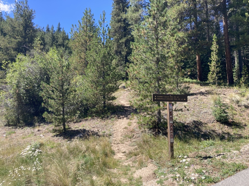
Mt. Sniktau via Kearney Gulch & Northeast Ridge from Bakerville Distance: 7.5 mi 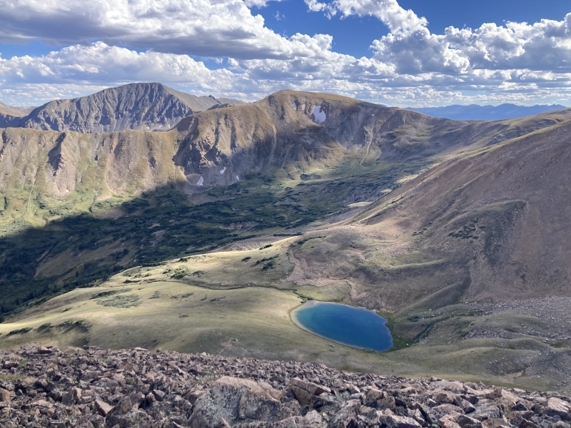
Sniktau: one of the the Front Range 13ers' easiest routes and a great taste to high alpine hiking elements in general. After I completed Grays and Torreys from Loveland Pass a couple winters ago (the 14er accomplishment I feel most proud of so far!), however, I felt like I had already seen all I could from the Loveland pass area. The distance and gain of Sniktau's standard route from the pass wasn't quite enough to get me to venture back on I-70 either. I wondered if I could find some fresh scenery for a Sniktau summit and noticed a trail going up Kearney Gulch to the mountain's southeast. It seemed like this could easily connect to the Loveland pass ridge near Cupid Peak or Sniktau's NE ridge. 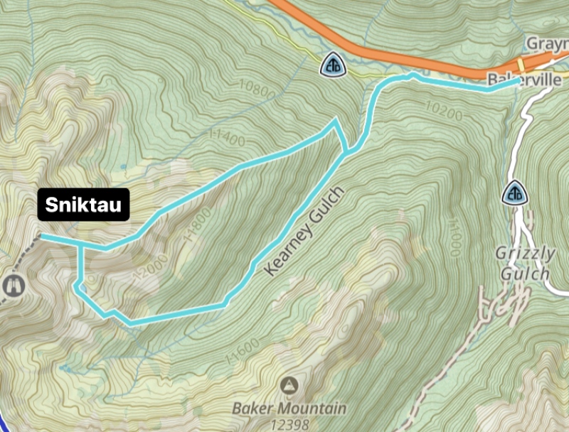
I tried looking online and asking on here if anyone had explored the Kearney Gulch area. The only detailed information I could find for the gulch was, of all things, a ghost story. Apparently an 1892 article in the Denver Farm and Field told of some Irish silver miners who witnessed supernatural apparitions in the gulch: a swamp monster made of black muck and ferns and finely-dressed man straight out of Phantom of the Opera. The Irish miners' insistence on these phenomena was enough to drive their fellow American miners out of the gulch, not so much because they believed them but out of exasperation with their stories. Well, now I have to go up there and see for myself! I decided to plot out a route that started up Kearney Gulch and then traversed to Sniktau's NE ridge. After summiting I returned down the NE ridge a bit until I rejoined a grassy saddle where I descended to the alpine lake just below Sniktau. I took game trails from there to arrive back on the Kearney Gulch trail. Although I didn't see any sign of Black Phillip or his marshy counterpart, I did discover a puzzling mystery of my own in the gulch. Overall I found it to be an incredible route with pleasant sights throughout! One plus of this route was that I didn't have to hike the whole thing! The first 0.7 mi is on a bike path from Bakerville to Loveland ski area. It's mostly flat to the Kearney Gulch trail turn-off with only 100 ft of gain. I brought my girlfriend's road bike for this section and locked it up to an aspen tree off the Kearney trail, shaving some good time off the start of my hike. 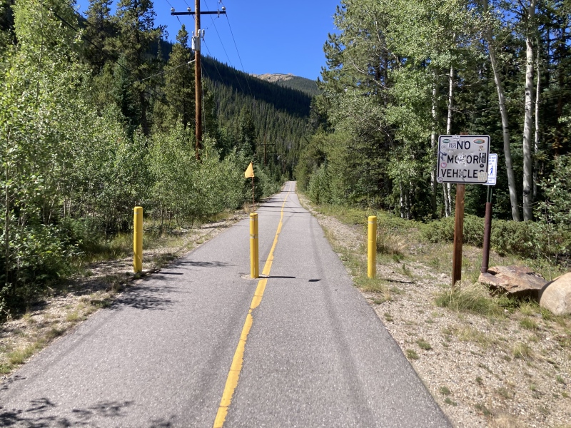
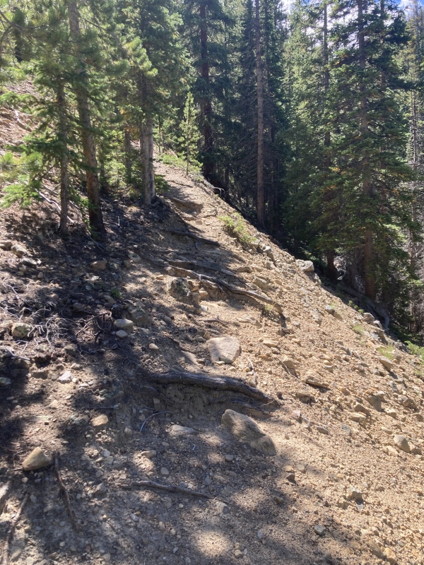
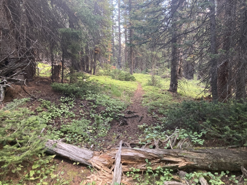
The trail up from the junction felt really pleasant. The forest was lush and the there were even some nice bridges across gurgling streams. It was apparent that the trail doesn't get a ton of use judging from the grass growing up through the dirt. The path soon inclines steeper into the gulch and turns into a calf-burner. One section over a steep drop-off was a bit loose and exposed so I took care to stay away from the edge. There's about 600 ft of gain in the first part of the trail until it starts flattening out. 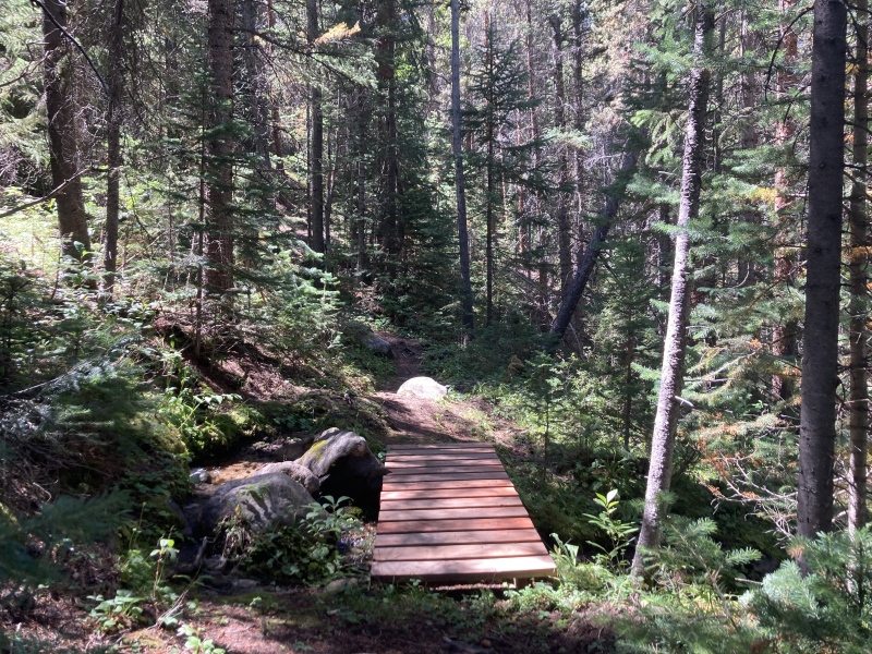
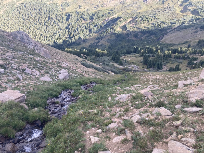
The main creek through the gulch thundered below me. I considered the steeper topo at the mouth of the gulch here and wondered if there were some waterfalls down there. I carefully ambled down the hillside to the creek bank to see some pretty impressive falls for Colorado standards. Unfortunately, the surrounding deadfall didn't really make for a decent picture and the slope was so loose and steep I don't think I'd recommend a visit anyway. However, there were some charming shallow cascades right off the trail once it leveled out a bit. 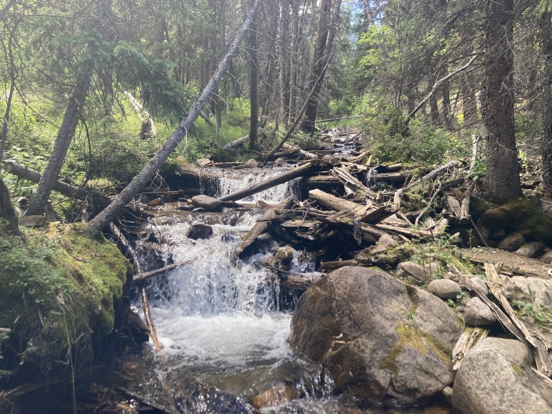
Soon I stumbled into a clearing where I found some puzzling structures. A large pile of wooden slabs over the creek constricted it to a trickle. Some beaver dam, I thought. I had seen plenty of what beavers do to trees along the waterways running through the Denver area. Looked a bit big for a beaver dam, though--the stack was taller than I was! I followed the creek a bit and counted 7 of these huge jumbles of wood. Upon closer inspection quite a few of the slats had square corners and were laid out parallel to each other. Did some beavers salvage the wood from a dilapidated mining shack somewhere near here to make these? None of the beams had nails in them, though. Not knowing what else to think, I settled on beaver mansions as my hypothesis until I found some more clues back at the trailhead sign. 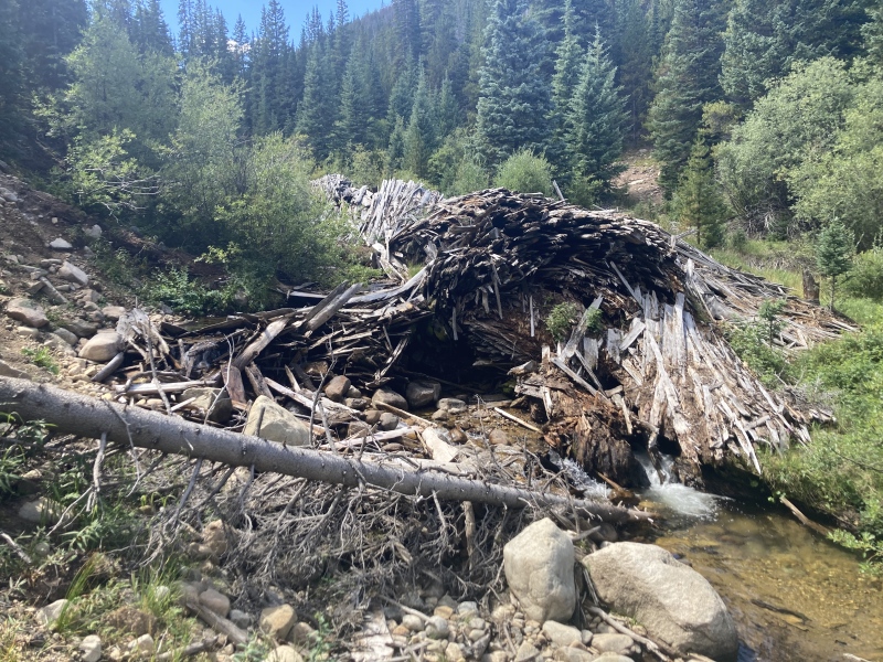
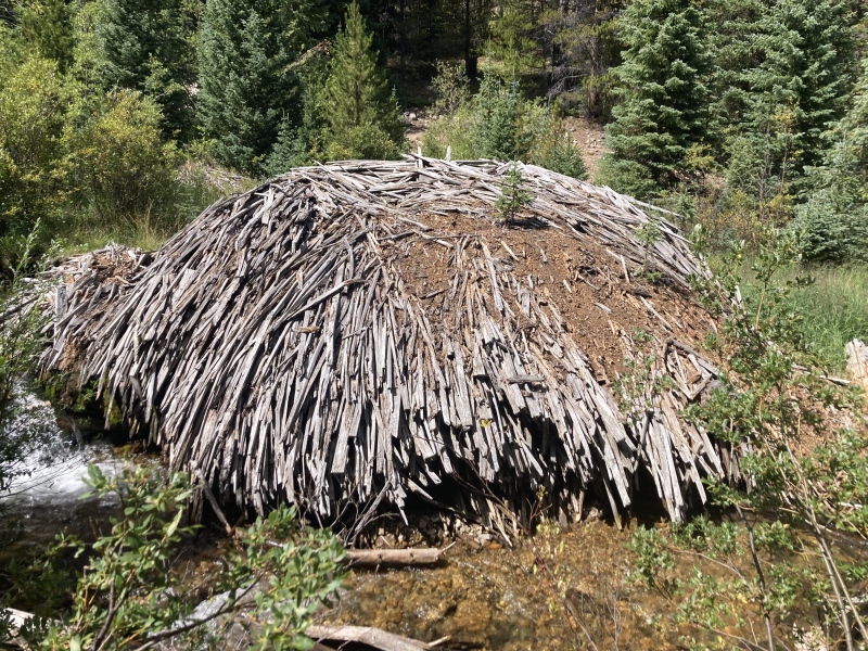
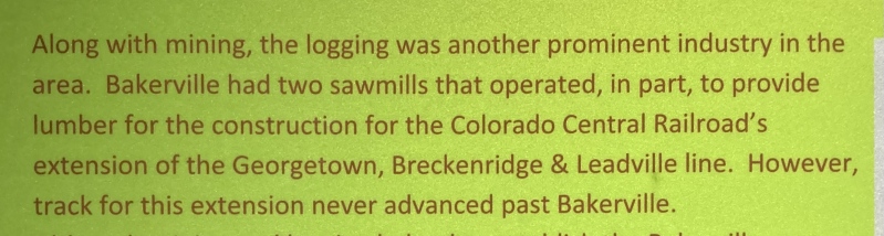
Something clicked when I read the trailhead sign upon my return. Miners weren't the only settlers working in the area--there were logging mills too. With this history in mind it seems like all of that wood was processed by a mill in the gulch for the railroad past Bakerville. Perhaps the mill got the memo that the extension was halted too late after they had already cut a bunch of wood, and for some reason didn't find any more use for it. It was unthinkable for me before to consider that all of that wood was harvested and just left to waste, but that seems like the most likely explanation given the human-cut slats and, of course, lack of beavers or a beaver pond. 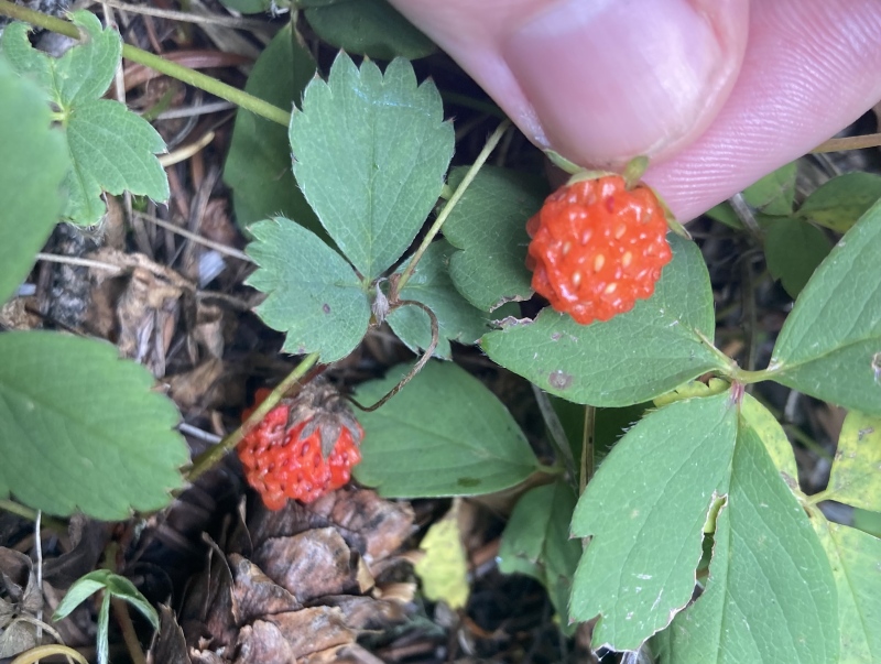
After taking some time to investigate the area further and being rewarded with wild strawberries and red blackberries it was time to keep moving. I needed to cross the creek in order to get to Sniktau's NE ridge. I found one crossing spot with stepping stones and logs placed across a shallow pool in front of the first wood pile but these proved to be a bit unstable. There's plenty of other fording points in the wood pile area using rocks, wood beams & dirt islands in the creek. I continued heading upstream to get around some riparian brush between me and the ridge proper. The other side of the creek features some camp sites and quite a variety of large rusted artifacts near the trail. 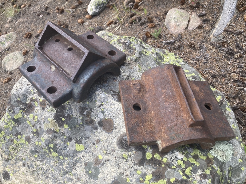
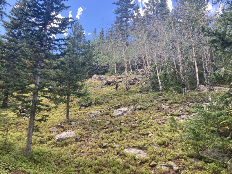
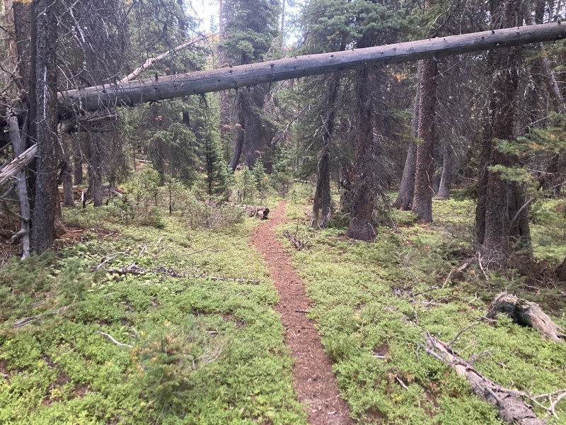
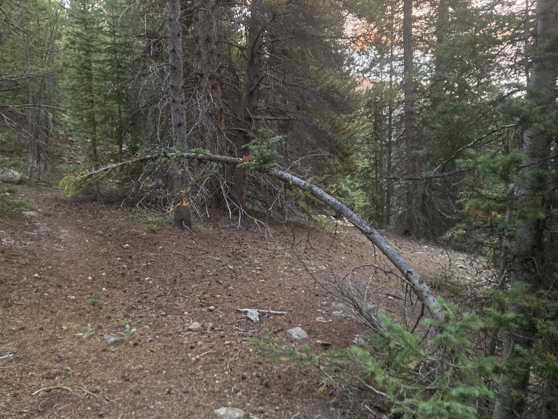
Soon I arrived at a skinny tree bent across the path. From here I headed north/northwest to contour up and around Sniktau's NE ridge until I reached the ridge proper. I followed what seemed to be a faint game trail that grew more distinct as I ascended. I was pleased with the underbrush conditions once I reached the wide and spacious ridge proper--the only real understory plant was some carpeting kinnikinnick and there wasn't too much deadfall. 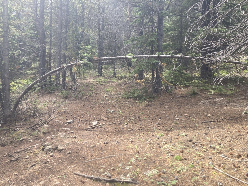
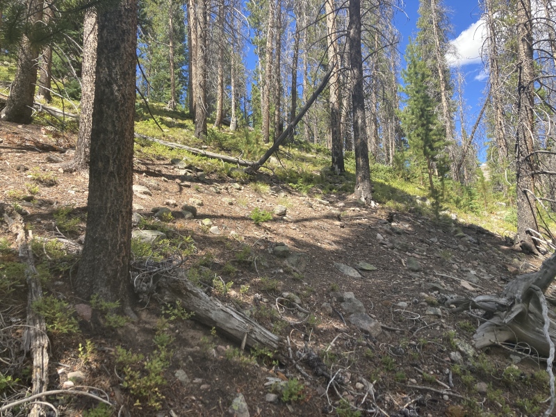
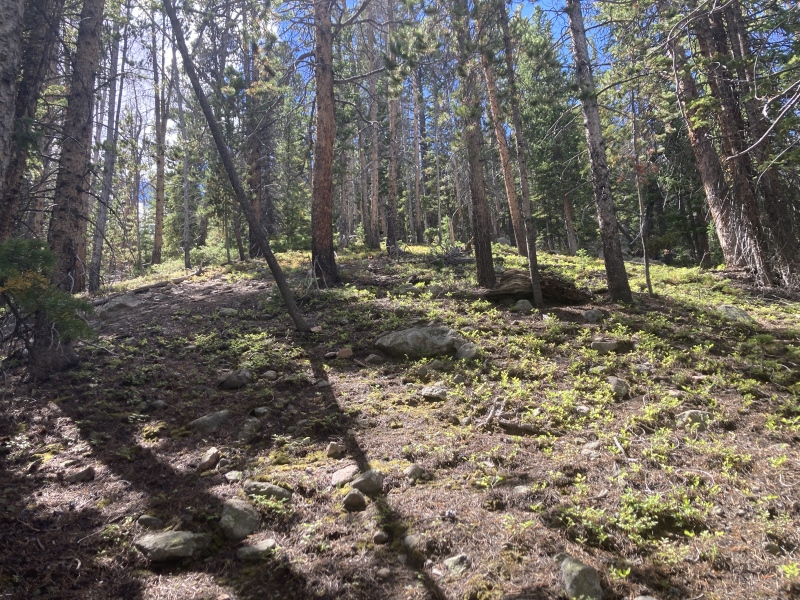
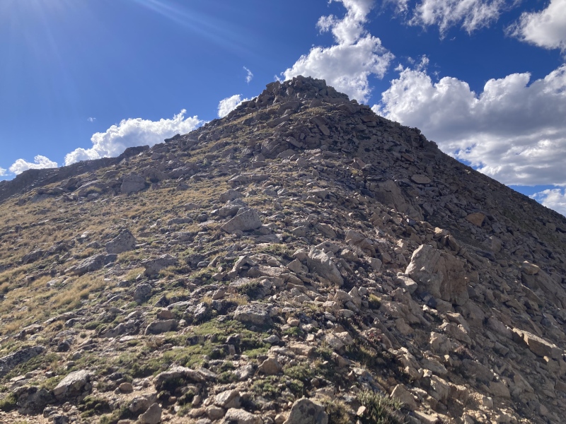
I continued my way up once atop the ridge. It was a bit steep for the most part but the underbrush still held up well and my forested surroundings were enjoyable. I wound through a lodgepole maze, passed a small patch of hardy aspens, and discovered an enchanting, enclosed grove of large trees perfect for a short rest. As the ridge narrowed I caught glimpses of Torreys' mighty face to the southeast. I crossed over a ton of game trails that passed up and over the ridge and one slender human-cut ski trail that continued on downhill to the northwest. This was where most of the legwork went, the ascent up the ridge until the slope lessens above treeline is a 1300 ft gain. 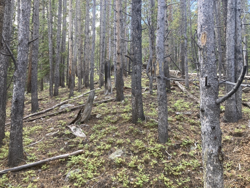
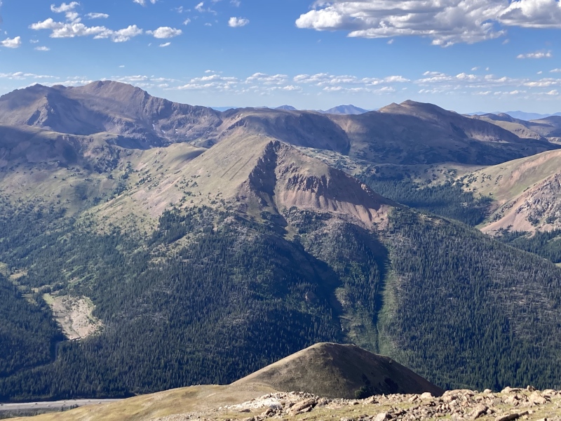
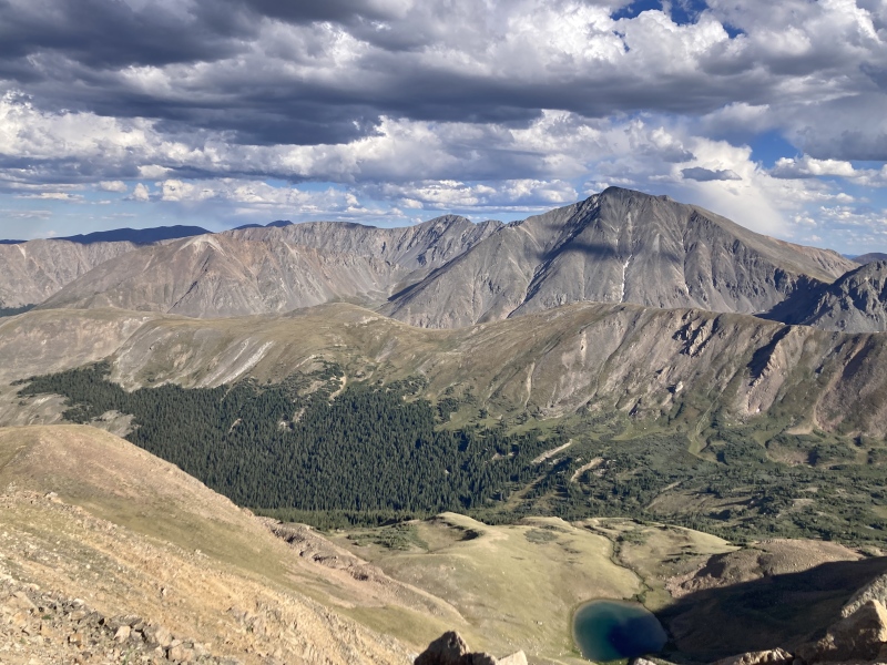
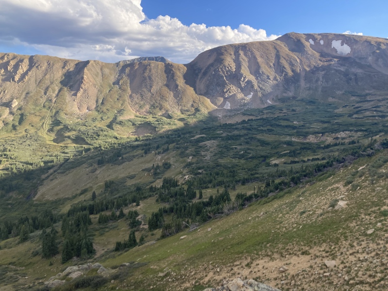
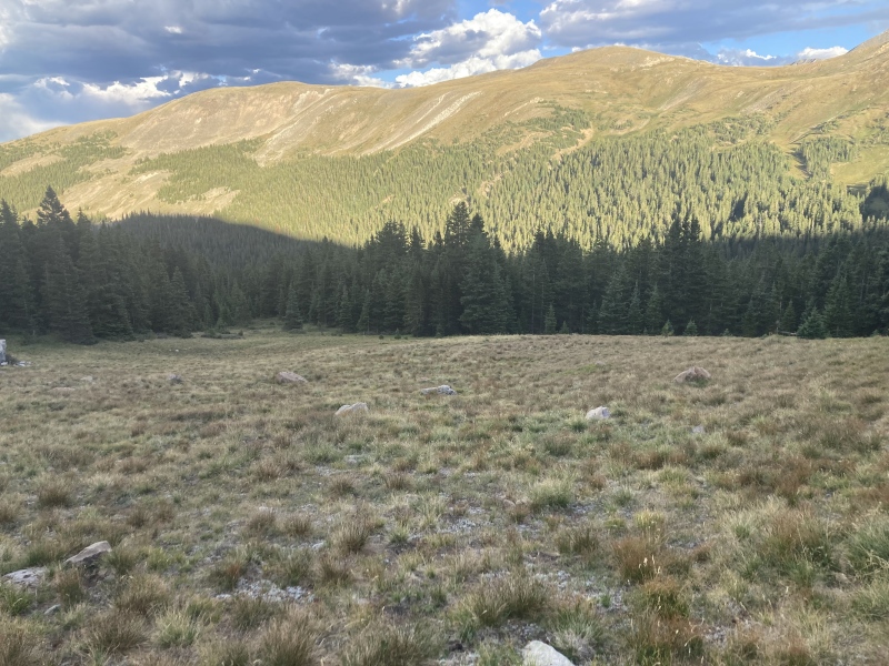
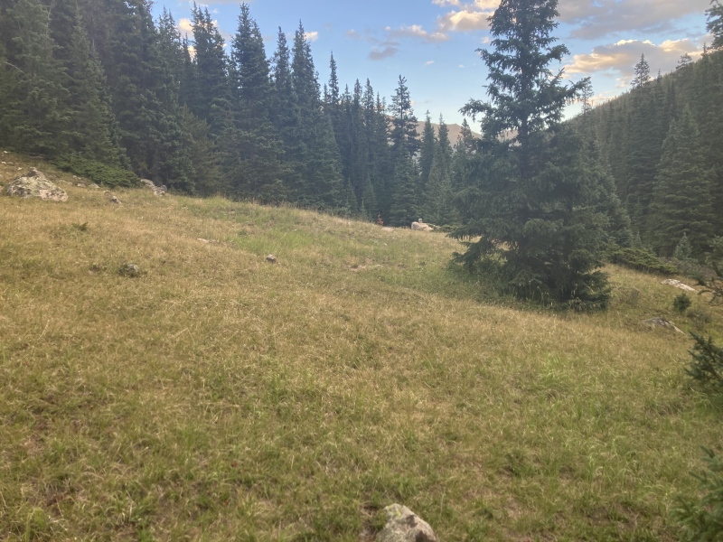
After a while I broke through the trees to open tundra. I was greeted by spectacular views of Torreys and the rest of Stevens Gulch towering behind Kearney Gulch below. The slope eased up a bit here but I had to watch my step more to avoid large clumps of tundra grass and soft, loose sand. 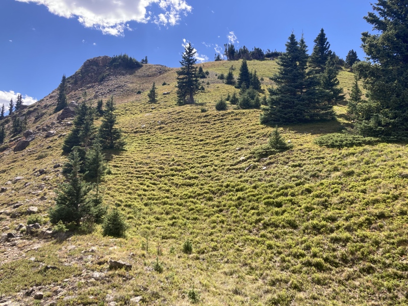
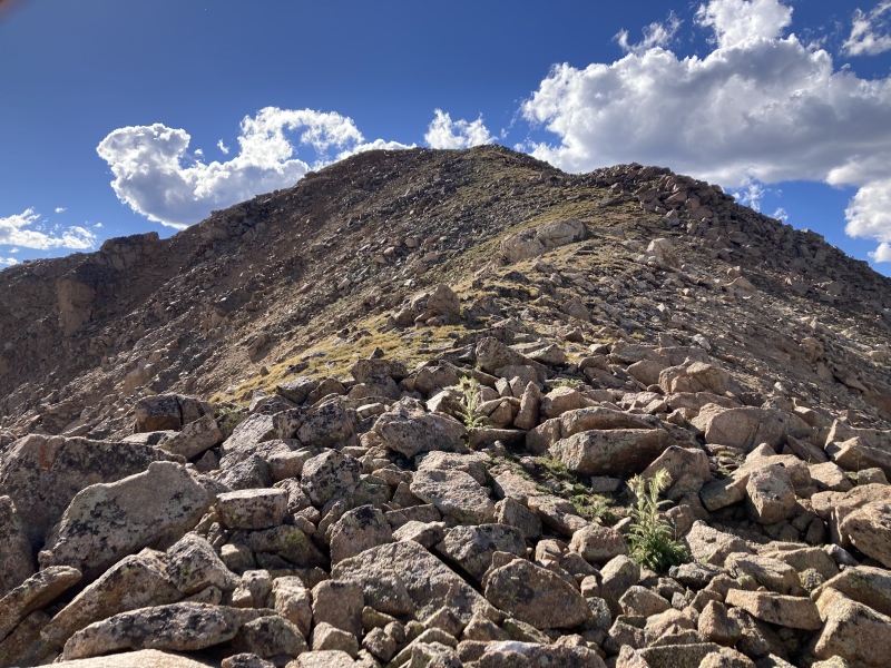
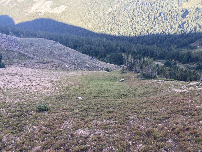
After a couple rolling hills on the upper ridge it finally flattened out so that I could see Sniktau's summit. The area here around 12,200 ft was wide open and provided panoramic views. I noted one shallow, grassy indentation in the ridge to be a nice camp spot and sure enough found some old rusted tins there. I continued up and over the last swells in the ridge since the eroded slopes on the side seemed too loose to cut across. There's only 1000 ft of gain left to go from this flat section. 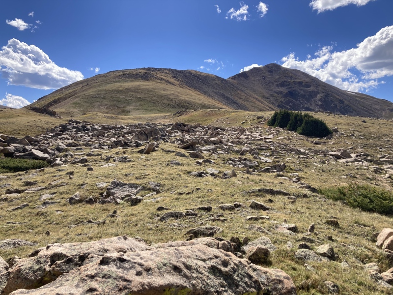

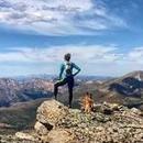
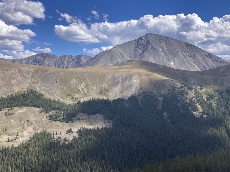
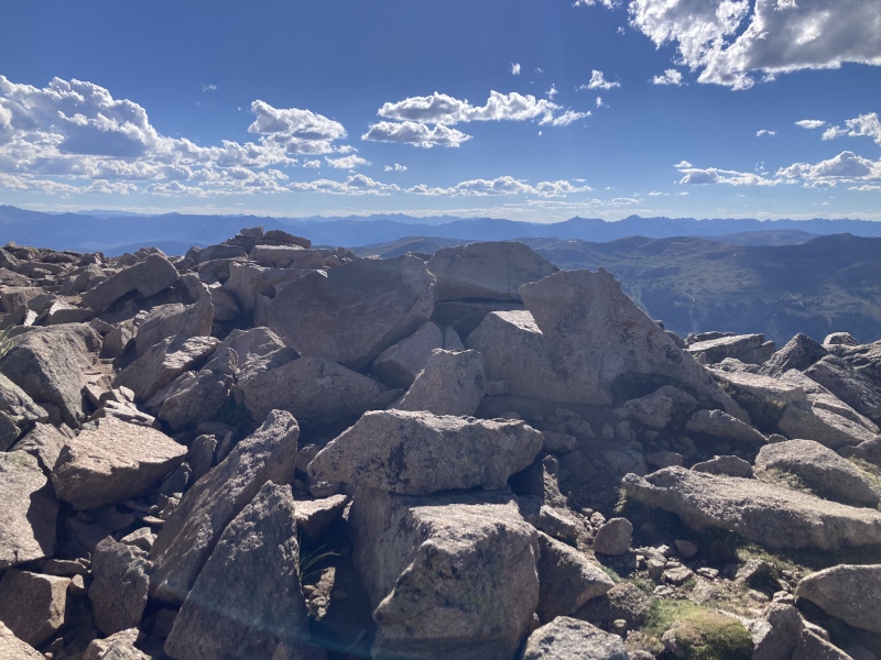
On top of the last bump before the summit I had some pretty spectacular views of the lake below and Sniktau's 13er neighbors across Kearney Gulch. I found what looked to be an old built-up wind shelter there as well. Along the way up here I noticed some rocky outcroppings on Sniktau's final summit ridge that appeared less daunting as I approached. There was a little Class 3 fun to be had on a couple sections up these rocks but everything could be skirted at Class 2 to the left. Soon enough I was standing on top of Sniktau, feeling accomplished that this route worked out at least halfway so far! The weather had been fantastic--very little wind with some cloud cover to help cool the hot afternoon and deliver dramatic shadows over surrounding mountain features. 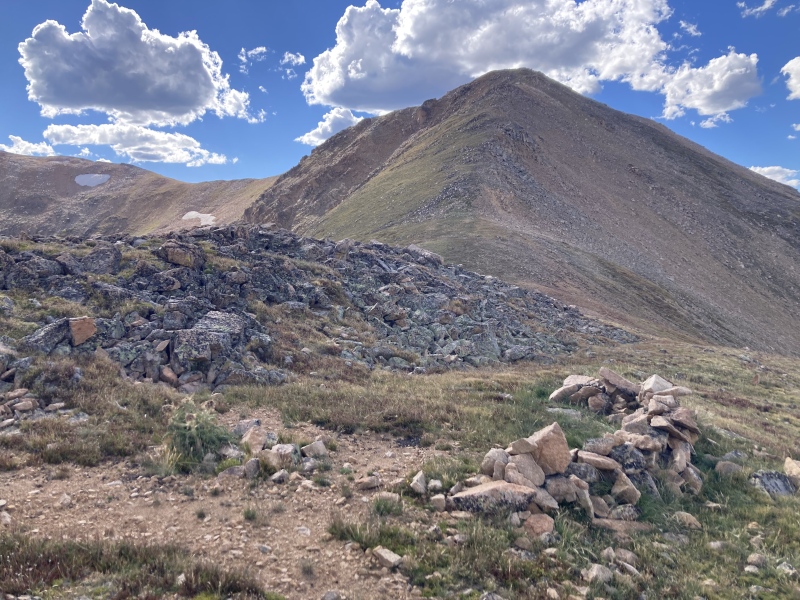
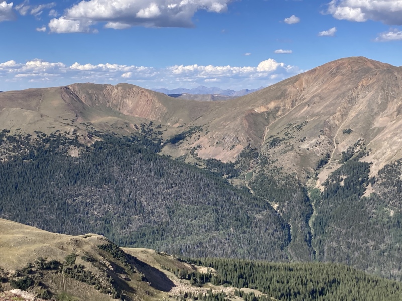
The grassy saddle between the 12,800 ft bump and Sniktau's summit ridge caught my eye. I was originally planning on descending the standard route down Sniktau and circling around towards Cupid to reach the far end of Kearney Gulch. That seemed much farther away in person than I felt like I had daylight for, however, and the willows in the upper gulch seemed much less navigable than they did on satellite. It looked like I could have a much easier time reconnecting with the upper Kearney Gulch trail from the lake below. It would be a nice stop to filter water and check out another cool alpine feature anyway! 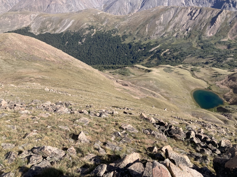
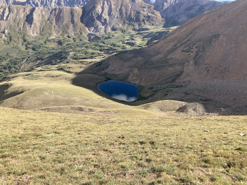
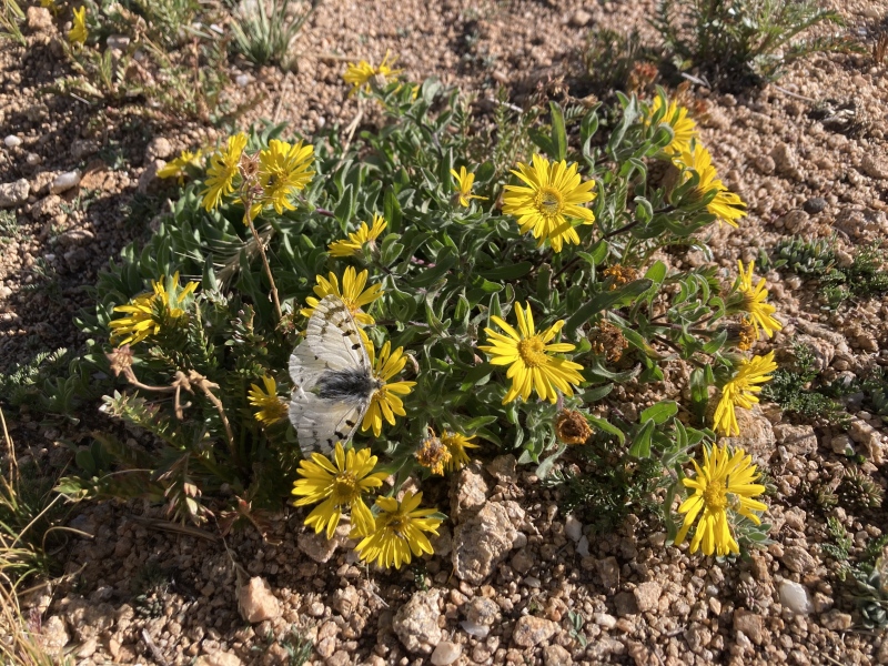
I enjoyed a nice rest at the lake and meandered to the far side to take some reflective shots of the perfectly-positioned Torreys across the surface. It was getting a bit late in the season for wildflowers but they were still hanging on up here, saw star gentians and queen's crown among a few others. I circled around to the lower side of the lake where a stream flowed out to filter water. Now it was time to figure out the rest of the descent. I knew the Kearney Gulch trail continued alongside the creek and ended a ways up the gulch. I just needed to traverse the gulch lengthwise and depth-wise to meet back up with it. I continued following the stream and wondered if I could use it to easily navigate to the creek in the gulch below; however, once the view opened up I saw the lower stream was surrounded by willows. I traversed north across the stream and discovered a promising gentle slope that led towards treeline, no willows in sight. 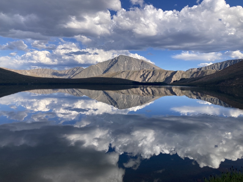
The slope merged into a sandy gully with a distinguished game trail. I followed this down until I reached another faint trail sidehilling along the gulch. This broke into an open meadow where I saw the trail continue down the gulch but back up the slope to the ridge. I broke off from here and descended the meadow to the trees. 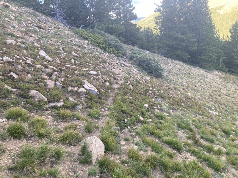
At the bottom of the meadow I stumbled into yet another game trail descending further into the forest. This began a pattern that continued until I finally stumbled upon the actual trail. The gulch was completely flush with game trails--I would sidehill along one until it met some obstacle like a marshy runoff or a bunch of deadfall, then I would descend elevation down the slope until I ran into yet another game trail. It seemed like there was a new game trail every 15 feet or so along the slope. Eventually I came to the creek but didn't see anything that looked like a wide, more official trail. A bit disappointed, I decided to keep following what I thought was a game trail at the bottom of the gulch and figured I could keep bushwhacking back to wood piles all the same. The game trail and underbrush maze hadn't been difficult to navigate so far, but I was just hoping for the assurance and ease of a planned trail to take me back. 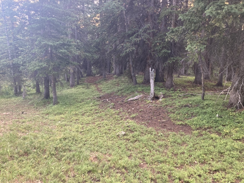
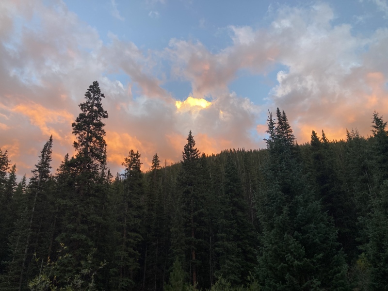
While plodding along the trail at the bottom of the gulch I saw some deadfall that had been recently sawed through--I guess I found the official trail after all! There were so many game trails that had just as much wear as this one that I could hardly tell at first. Well, that was a relief--I only had a little over 1.5 mi to go on this trail before I could get back to my bike. After a while I met back up with the skinny bent tree I had seen when I first started up the ridge. I crossed the creek at the wood piles just as the setting sun lit ablaze the cottonball clouds above. The thick forest at the mouth of the gulch shuttered out the last of the remaining light so I had to find my bike by flashlight. 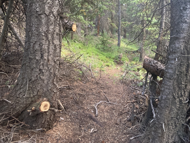
The ride back made me glad that I brought my bike. The sharp hill just before the Kearney trail turn-off rocketed me back to my car and made that 0.7 mi go by in what felt like a minute! Ultimately, I didn't encounter any devils or monsters in the gulch, just some odd abandoned history and incredible sights and areas all along the route. I'm happy to have discovered Sniktau's secrets on this side of the mountain, hopefully this report helps others to uncover them too! P.S.: If you've ever wondered what kind of name is Sniktau, apparently it was the pen name of 1870s Clear Creek county journalist Edwin H. N. Patterson. He likely took it up after another journalist W. F. Watkins reversed the letters in his name to create his pen name "Sniktaw," yet Patterson insisted that the moniker was given to him by Native Americans. He corresponded briefly with Edgar Allan Poe to collaborate on a new magazine--all the more fitting for a mountain with a history of macabre stories! GPX route is approximate: Thumbnails for uploaded photos (click to open slideshow): ")
")
")
")
")
")
")
")
")
")
")
")
")
")
")
")
")
")
")
")
")
")
")
")
")
")
")
")
")
")
")
")
")
")
")
")
")
")
")
")
")
")
")
")
|
| Comments or Questions | ||||||||||||||||||
|---|---|---|---|---|---|---|---|---|---|---|---|---|---|---|---|---|---|---|
|
Caution: The information contained in this report may not be accurate and should not be the only resource used in preparation for your climb. Failure to have the necessary experience, physical conditioning, supplies or equipment can result in injury or death. 14ers.com and the author(s) of this report provide no warranties, either express or implied, that the information provided is accurate or reliable. By using the information provided, you agree to indemnify and hold harmless 14ers.com and the report author(s) with respect to any claims and demands against them, including any attorney fees and expenses. Please read the 14ers.com Safety and Disclaimer pages for more information.
Please respect private property: 14ers.com supports the rights of private landowners to determine how and by whom their land will be used. In Colorado, it is your responsibility to determine if land is private and to obtain the appropriate permission before entering the property.