| Report Type | Full |
| Peak(s) |
Holy Cross Ridge - 13,850 feet Mt. of the Holy Cross - 14,007 feet Unnamed 13253 - 13,253 feet Notch Mountain - 13,243 feet |
| Date Posted | 08/30/2023 |
| Date Climbed | 08/29/2023 |
| Author | alcar |
| Tour de Bowl of Tears Basin |
|---|
|
Mount of the Holy Cross is such an iconic peak in Colorado. For months, snow inside the deeply inset Cross Couloir contrasts the dark rock and can be seen from many other iconic peaks and high points to the East. Skiing the Cross is on my bucket list, but this day was just about bagging peaks. The standard route looked fun, but I'm always looking for extra credit and decided on Halo Ridge. In Roach's books, he adds the variation of summiting Notch Mountain first, calling it "the big one." It adds some spiciness to the route taking it from easy Class 2 to hard Class 2 with plenty of Class 3-5 options. Thanks to 13erRetriever for the good beta and gpx file for traversing the notch easily. Because this was my first solo 14er (excluding the last 1k feet of Missouri I did w/o my brother) I wanted to be well prepared and cautious. I'd been scoping out this route for a few weeks now and saw the perfect weather window. I checked the weather forecast and saw no precipitation or high winds predicted. I left the Denver Metro area around 9 PM to get some restless sleep in my car before setting out in the morning. After a 15-minute closure at the tunnel and an otherwise painless drive, I reached the Halfmoon-Tigiwon Trailhead around midnight. A few hours of sleep later I woke up at 4 AM to throw on an extra layer, eat/drink as much as I could, and get started up the trail. Normally for this long of a hike, I would have started earlier but with the crux of the route so early on I wanted good light to scout my route through the notch. I was on trail and hiking Halfmoon Pass just after 4:30. I reached Halfmoon Pass around 5:15 as twilight was just starting. At first, I missed the trail up to Notch Mountain but after checking Caltopo I was able to find it pretty easily. The trail was a little hard to follow in the dark and I lost a bit of time trying to follow it. It was still easier than talus hopping so I tried my hardest to stay on it. At one point I heard some loud noises in the distance. I looked up to see dozens of eyes reflecting off the light of my headlamp. I spooked a large group of deer and they were running through the rocks and willows away from me. They scared me just as much and after hitting my only trekking pole on a rock to make noise, the tip of my pole broke off and bounced down the hill. I stuffed the tip in the open end of the pole hoping it would last the rest of the day. It did! 
As point 12,743 nears, the trail gets harder and harder to follow. The trail cuts to the left (South) before the top of this point. I talus hopped to the top of the rocky point then traversed the ridge for a bit before dropping back down to the "trail". 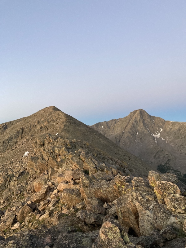

The rest of the route to the top of Notch Mountain was uneventful. The rock was pretty sturdy but like most of the Rockies, you can never trust one rock too much. I made it to the top of Notch Mountain around 6:50. I found it was easier to descend from the summit to the notch on some eastern grassy ledges but I'm sure there's more than one easy way down. 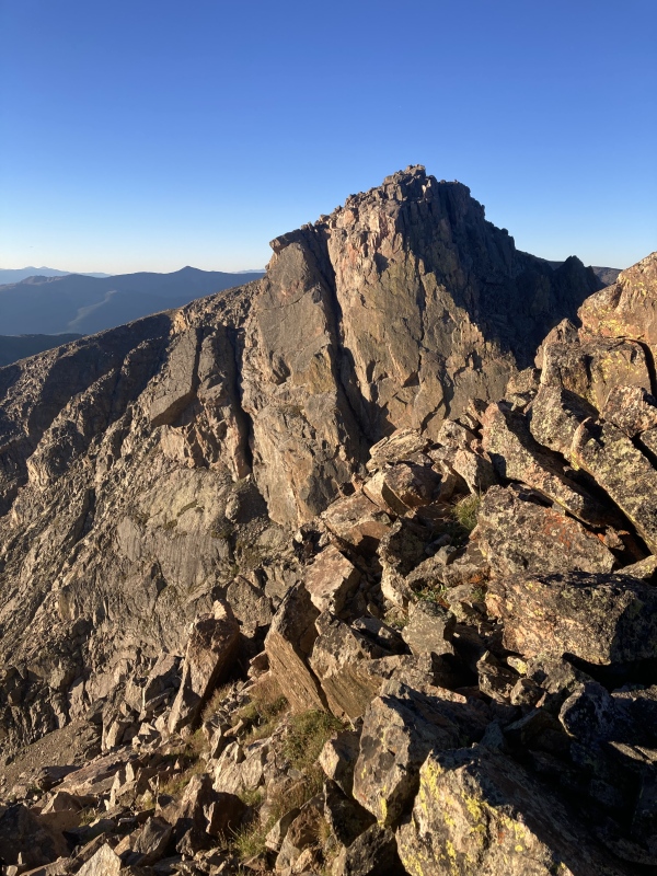
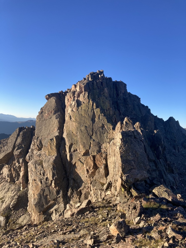
I traversed through the notch on the west side. The first gully looked like it went class 3 from below but the higher I got the harder it looked. I looked at the gpx file I had and saw they had been 100' or so lower. Reluctantly I downclimbed thinking to myself, "it might be in my skill level, but not in my comfort level." Especially solo I didn't want to press my luck. I got back on track and checked my course more often. Eventually, I got to the Class 2 talus and quickly made it to the top of Notch Mountain's southern summit at 7:30. 

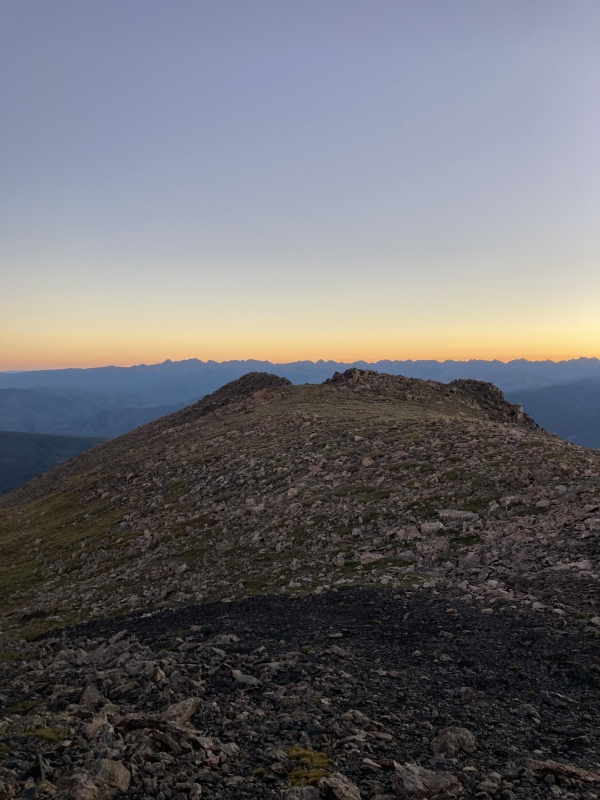
The rest of the way is the normal Halo Ridge route. I reached the top of UN 13,248 around 8 and descended part way to the saddle before having my first long (>2 min) break of the day 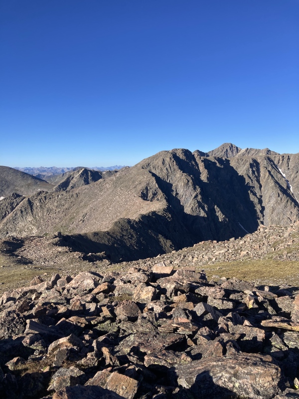
The crux of the standard Halo Ridge route is the climb from the saddle to UN 13,373. The steepness made it more physically exerting than anything to me. I think it was the slowest I went all day. I reached the unranked summit around 9 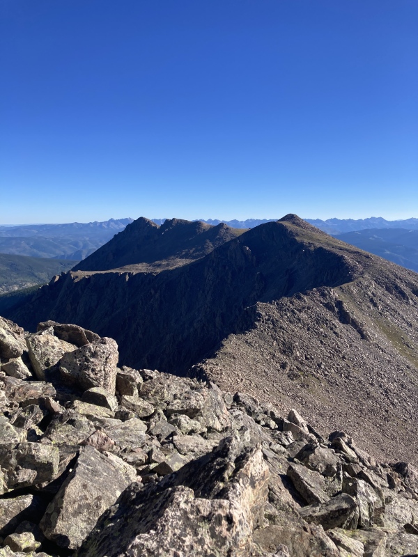
The saddle from here to Holy Cross Ridge was a nice grassy mellow slope that my feet needed. I could feel a few hotspots, but left moleskin in the car and Leukotape at home. I was miles of talus away from the car either way and decided a few blisters were worth two centennials. The views of Tuhare Lakes and the lower Holy Cross Ridge peaks were incredible. Even this late into the season some couloirs held enough snow to intrigue me. 
I reached the top of Holy Cross Ridge at 10 and after very little contemplation I decided I did not want to go over to UN 13,768 and back with my bad feet. I dropped 350' or so to the saddle between Mt of the Holy Cross. A few hundred feet up the ridge I saw one of the large cairns of the standard North Ridge route. For the first time since the group of deer startled me, I saw a moving creature bigger than a pika. I saw a few people heading up the standard route as I made it up the final climb. I reached the top of my 20th 14er and 24th Centennial, Mount of the Holy Cross, at 11. I chatted with the 5 or so people up top and ate my summit sandwich. 
After 30 mins up top, I decided it was time to head down. I wasn't excited about the 970-foot climb up Halfmoon Pass on the way back, but my feet were excited to get back on a real trail. The rockwork on the North Ridge route is amazing. After 5+ hours of walking on loose, sometimes very large rocks, I greatly appreciated the trail builders on my trip down. I reached East Cross Creek around 12:45. With enough water to make it to the car I headed up Halfmoon Pass and stopped in the shade whenever I needed a rest. No wind or clouds made heat exhaustion a real hazard. 
After I made it to the top of the pass I only stopped once. About a half mile from the car I stopped to grab 10 empty Jim Beam Honey shooters and a little bit of other trash someone else left on the way up (or down?). I'm still puzzled as to who left them there and why. I reached the trailhead again at 2:18.
Strava recorded me at 13.2 miles and 6700 vertical feet. Not a bad day for a Tuesday. Thumbnails for uploaded photos (click to open slideshow): ")
")
")
")
")
")
")
")
")
")
")
")
")
")
|
| Comments or Questions | ||||||
|---|---|---|---|---|---|---|
|
Caution: The information contained in this report may not be accurate and should not be the only resource used in preparation for your climb. Failure to have the necessary experience, physical conditioning, supplies or equipment can result in injury or death. 14ers.com and the author(s) of this report provide no warranties, either express or implied, that the information provided is accurate or reliable. By using the information provided, you agree to indemnify and hold harmless 14ers.com and the report author(s) with respect to any claims and demands against them, including any attorney fees and expenses. Please read the 14ers.com Safety and Disclaimer pages for more information.
Please respect private property: 14ers.com supports the rights of private landowners to determine how and by whom their land will be used. In Colorado, it is your responsibility to determine if land is private and to obtain the appropriate permission before entering the property.


