Download Agreement, Release, and Acknowledgement of Risk:
You (the person requesting this file download) fully understand mountain climbing ("Activity") involves risks and dangers of serious bodily injury, including permanent disability, paralysis, and death ("Risks") and you fully accept and assume all such risks and all responsibility for losses, costs, and damages you incur as a result of your participation in this Activity.
You acknowledge that information in the file you have chosen to download may not be accurate and may contain errors. You agree to assume all risks when using this information and agree to release and discharge 14ers.com, 14ers Inc. and the author(s) of such information (collectively, the "Released Parties").
You hereby discharge the Released Parties from all damages, actions, claims and liabilities of any nature, specifically including, but not limited to, damages, actions, claims and liabilities arising from or related to the negligence of the Released Parties. You further agree to indemnify, hold harmless and defend 14ers.com, 14ers Inc. and each of the other Released Parties from and against any loss, damage, liability and expense, including costs and attorney fees, incurred by 14ers.com, 14ers Inc. or any of the other Released Parties as a result of you using information provided on the 14ers.com or 14ers Inc. websites.
You have read this agreement, fully understand its terms and intend it to be a complete and unconditional release of all liability to the greatest extent allowed by law and agree that if any portion of this agreement is held to be invalid the balance, notwithstanding, shall continue in full force and effect.
By clicking "OK" you agree to these terms. If you DO NOT agree, click "Cancel"...
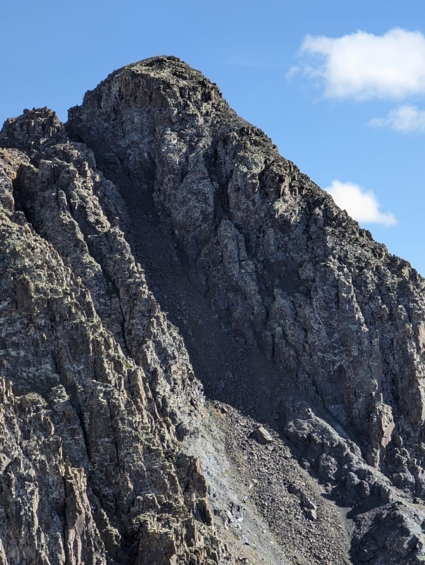
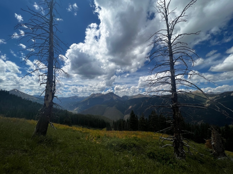
Storm Peak has a reputation as quite the big bad outside of Silverton, Kiefer and I hiked East Storm from Velocity Basin a few weeks ago, and Storm certainly looked menacing looming over the basin. The ridge between East Storm and Storm does not go, so even though we could see the summit cairn so close, we had to make a separate trip for Storm Peak.
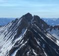
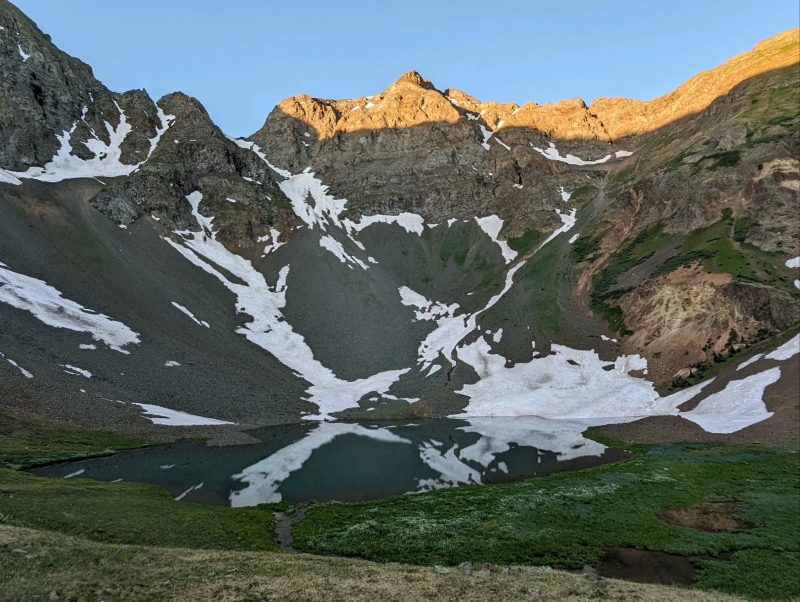
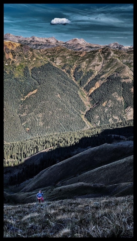
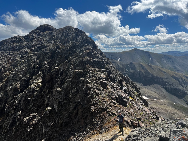
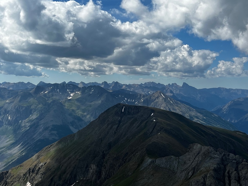
Storm Peak Illuminated in the morning light over Velocity Basin (Taken during our hike of East Storm)Storm Peak (left) and a view of our entire route as seen from the Summit of Overlook Point (13,005)
After reading trip reports for Storm Peak, every trip report mentioned climbing a nasty steep scree gully from Boulder Gulch Trail… NO THANK YOU. There had to be a better way.
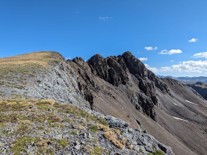
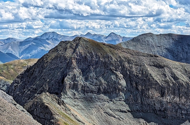
The "Oh Hell No" Gully that most trip reports mention using to gain the summit of Storm Peak, taken from along the towers on the ridge
I thought about the option of climbing the Grande Couloir in the spring, but we didn’t want to wait another 9 months to summit such a cool looking peak. FINALLY I located a trip report on Lists of John where Bob Burd made a loop by ascending the “god awful pile of choss swimming uphill” scree gully but had descended down Hancock Gulch, meeting a road at 11,200’. I found a GPX track where Whiley had ascended and descended Storm that way as well. Jackpot!
This trip report serves to provide a route description for our route that I feel was MUCH safer for a seasoned scrambler. Our route had 6 towers of class 2+ to 3 terrain, so make sure you are comfortable with this terrain before taking our route up. There was only one problem, our truck was held hostage another week due to paperwork delays and Hancock Gulch (San Juan County Road 70) is not Subaruable. To reach the Hancock Gulch Trailhead take county road 110 north out of Silverton towards Silverton mountain. County road 70 up Hancock Gulch leaves the road .9 miles after the pavement ends. The road climbs steeply straight up the hillside, before doglegging to the right to someone’s home. There is parking for 2 cars prior to the road doglegging right. You cannot turn around due to a closed gate, so stop here.
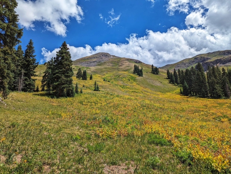
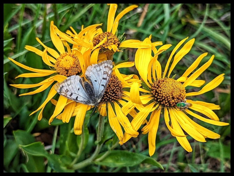
View of the route up from Hancock Gulch parking area. You want to stay left of the skunk cabbage and follow the far left grassy shoulder (in the trees in this pic) up to gain the grassy ridge/plateauSome Flowers and a Parnassus Butterfly
My birthday is 08/20 and right in the middle of monsoon season, Kiefer and I had planned a trip into Endlich Mesa, but when the shop called and said we could pick up our truck, I quickly changed plans. Storm Peak, and Kendall Peak from Silver Lake have been at the top of my list since last year, and we finally had the car to get to the trailheads for both. Let’s do those instead. Kendall Peak would be my actual birthday summit, as that day had the best weather for the longer hike, and Storm would kick off the weekend.
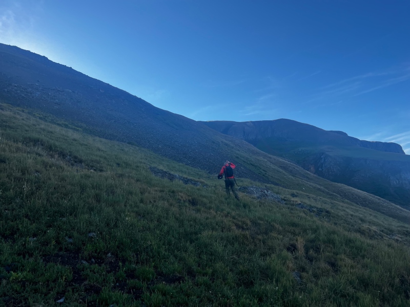
Once we reached the trailhead at ~11,300 in Hancock gulch we saw a trail switchbacking up the grassy slope, and started up the trail. The trail was short-lived, after leaving the trail the goal was to gain the grassy slope to the left of the skunk cabbage, and STEEPLY hike up the tundra to the ridge.
Kiefer on the tundra slope
We passed two mine tailing piles and then Kiefer smartly continued ascending a brief talus field that gained the mellower grassy plateau on the ridge. I saw a continuing grassy slope that gained the ridge higher and traversed below the talus pile to the left. 10/10 do not recommend. I ended up doing some fun class 3 scramble reminiscent of the upper part of “East Storm”. Oh well, once I joined Kiefer on the ridge I joked that I just wanted to get ready for the class 3 higher up on the mountain. I took Kiefer’s grass and talus route down, and can say it is MUCH preferable to my chossy gully route.
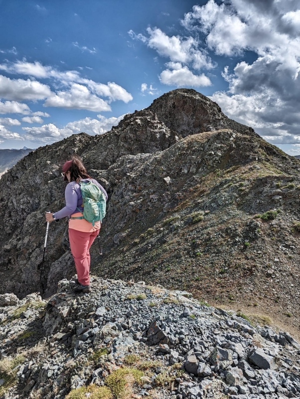
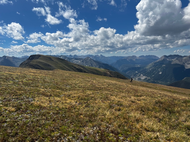
Topping out on the grassy ridge, after my route finding blunder... don't do this.The only mellow terrain the whole route is this ridge plateau to gain the summit ridge where you start the towers. The summit is the farthest point.
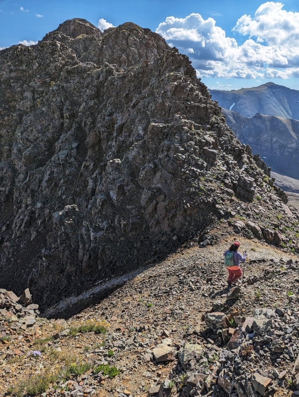
After gaining the grassy ridge plateau the travel was much easier and soon, we were taking a break on the last piece of tundra prior to beginning the traverse across the 6 towers to the summit.
Break time before starting the class 3 towers
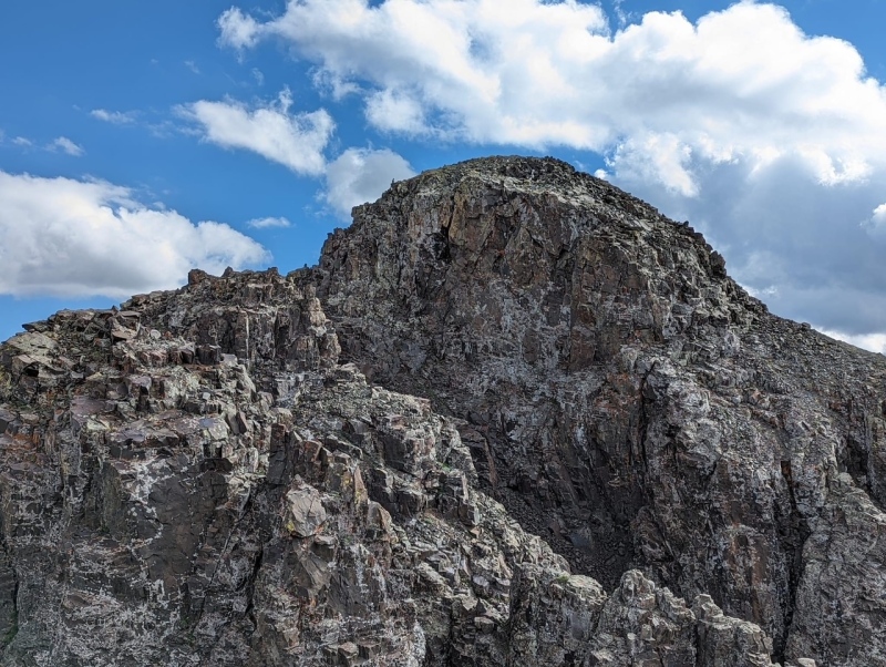
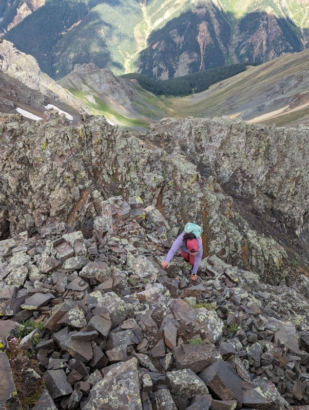
The towers were some of the most fun scrambling I have ever done. The first tower we traversed to the left, second to the right, and the 3rd tower we took head on. It was a steep class 3 scramble to climb it directly, though not overly exposed.
Surveying tower 1, go left easily around this one (Class 2)Kiefer on a small saddle between 2 and 3Me reaching the small saddle between 2 and 3Coming off 3 headed for 4
Tower 4 looked like it had overhanging rock on the other side, so on the way up we took a somewhat exposed traverse around the left side. A fall here would have quite possibly been your last. On the way back, we realized that tower 4 could also be climbed directly, and was much more fun and less exposed.
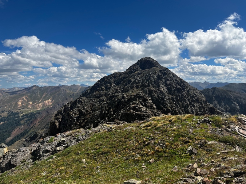
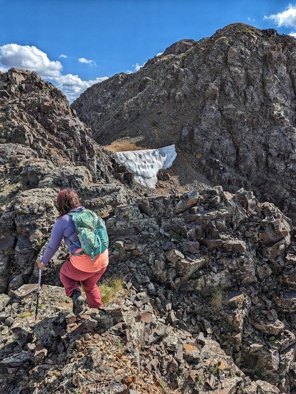
Close up of 5 and 6
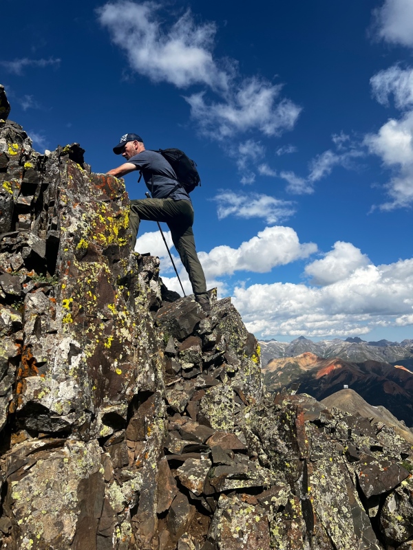
The 5th tower we also scrambled directly, with no real difficulty. Between tower 5 and 6 the ”god awful pile of choss” scree gully joins the ridge. Kiefer and I both looked down it and our reaction was a unified “oh hell no”. The final summit tower was also a steep class 3 scramble and upon reaching the top of the tower a few steps of class 2 talus had us on the summit proper.
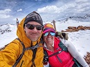
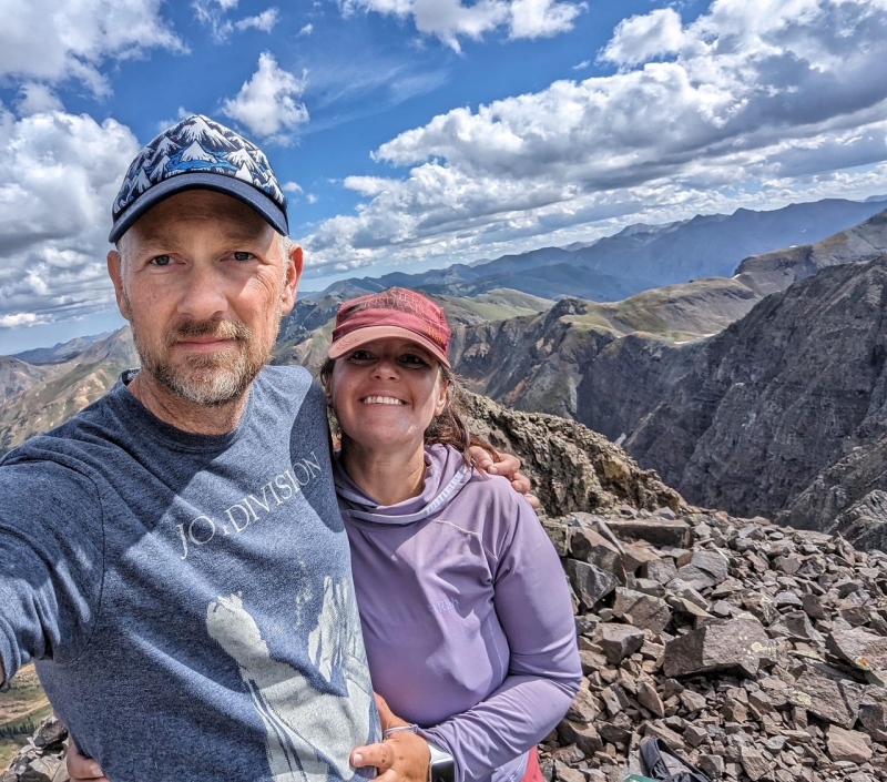
Summit Tower, Me making the final movesUs on the Summit of Storm Peak... ALL SMILES
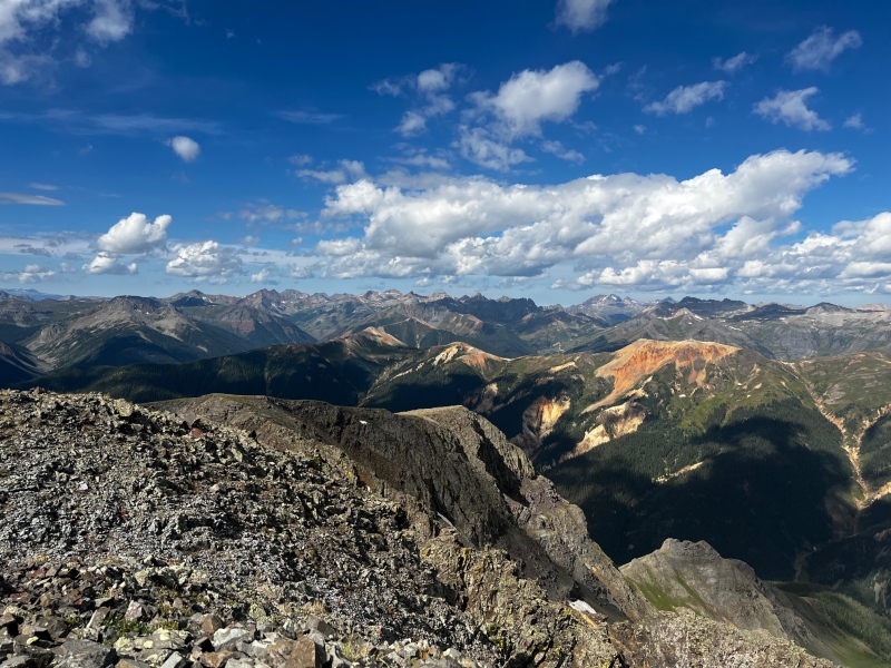
We both agreed that the class 3 terrain reminded us of Wilson Peak’s final summit scramble (times 6). There was loose rock on all the pitches, however there was plenty of solid rock to use for hand and foot holds that the loose rock was not of particular concern, however if you take this route, still test all your hand and foot holds, this is the San Juans after all. The summit has great views of the Wemi, and the surrounding San Juan Peaks
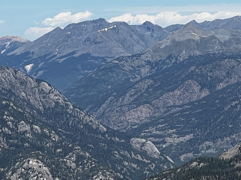
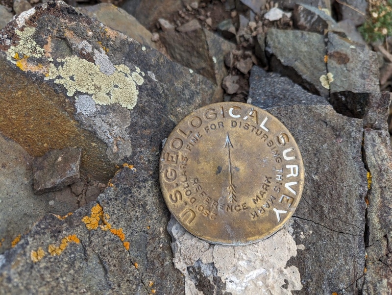
Summit BenchmarkView Towards Ice LakesWEMIEast Storm, you can see why the ridge does not go
We reversed our route for the descent, the descent across the 6 towers was equally as fun as the climb to the summit, and the descent down the grassy ridge was gorgeous with views all around us.
Kiefer scrambling back up 5 on the descentKiefer descending the still pleasant tundra prior to the steep slope just ahead of himThese two dead trees make a great reference point. The truck is just past the skunk cabbage down the slope by the pine trees.
Dropping down the tundra slope back to the truck on the road below was harder than the ascent. The steepness of that slope is no joke, so our quads were burning by the time we reached the truck. After reaching the truck we headed into Silverton for some wings and beers at Avalanche brewing.
I loved this mountain, I thought the scrambling over the towers was an absolute blast, and no scree to be found. I would highly recommend this route to anyone who is comfortable with sustained scrambling looking to summit Storm Peak ESPECIALLY over the dangerous loose gully route. If you are not comfortable scrambling, I would suggest working up to Storm Peak, and taking this route once you feel prepared. It is one of the more difficult peaks in the Silverton area, but can be an extremely enjoyable route if you have the skills to tackle the tower ridge.
My GPS Tracks on Google Maps (made from a .GPX file upload):
This was a great day! And major props for finding this route as opposed to the couloir of suck. A real thigh-burner to be sure, but so much more stable & fun.
I appreciate this beta after trying by the grand couloir this spring and turning back because the final ridge to the true summit from that side looked like certain death by Jenga.
Thanks for the beta. I tried Storm a few springs ago up the Grande and then across the snowfield on the south side. Then snow climbed the crap couloir. I turned around at the saddle below the last pitch because of snow and ice on the last section, I was also spent from snow climbing the wrong couloir earlier. Heading out tomorrow for round 2 via your route. Should be fun. Thanks for the info and GPX route.
Update:
Made it up this route today. Thanks again for the info, it helped.
@tweedie glad you made it up and the report helped!
Caution: The information contained in this report may not be accurate and should not be the only resource used in preparation for your climb. Failure to have the necessary experience, physical conditioning, supplies or equipment can result in injury or death. 14ers.com and the author(s) of this report provide no warranties, either express or implied, that the information provided is accurate or reliable. By using the information provided, you agree to indemnify and hold harmless 14ers.com and the report author(s) with respect to any claims and demands against them, including any attorney fees and expenses. Please read the 14ers.com Safety and Disclaimer pages for more information.
Please respect private property: 14ers.com supports the rights of private landowners to determine how and by whom their land will be used. In Colorado, it is your responsibility to determine if land is private and to obtain the appropriate permission before entering the property.
")
")
")
")
")
")
")
")
")
")
")
")
")
")
")
")
")
")
")
")
")
")
")
")
")
")
")
")
")