Download Agreement, Release, and Acknowledgement of Risk:
You (the person requesting this file download) fully understand mountain climbing ("Activity") involves risks and dangers of serious bodily injury, including permanent disability, paralysis, and death ("Risks") and you fully accept and assume all such risks and all responsibility for losses, costs, and damages you incur as a result of your participation in this Activity.
You acknowledge that information in the file you have chosen to download may not be accurate and may contain errors. You agree to assume all risks when using this information and agree to release and discharge 14ers.com, 14ers Inc. and the author(s) of such information (collectively, the "Released Parties").
You hereby discharge the Released Parties from all damages, actions, claims and liabilities of any nature, specifically including, but not limited to, damages, actions, claims and liabilities arising from or related to the negligence of the Released Parties. You further agree to indemnify, hold harmless and defend 14ers.com, 14ers Inc. and each of the other Released Parties from and against any loss, damage, liability and expense, including costs and attorney fees, incurred by 14ers.com, 14ers Inc. or any of the other Released Parties as a result of you using information provided on the 14ers.com or 14ers Inc. websites.
You have read this agreement, fully understand its terms and intend it to be a complete and unconditional release of all liability to the greatest extent allowed by law and agree that if any portion of this agreement is held to be invalid the balance, notwithstanding, shall continue in full force and effect.
By clicking "OK" you agree to these terms. If you DO NOT agree, click "Cancel"...
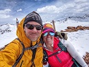
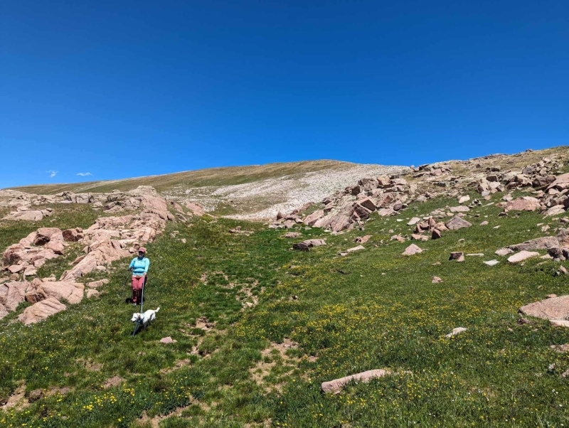
Overlook Point is one of Colorado’s newest 13ers, recent LiDAR surveys established its elevation at 13,005’ rather than the original elevation of 12,998 feet. From Highway 550, or from Purgatory ski area, Overlook Point is simply an unassuming long grassy ridge, and doesn’t look remotely exciting. However in my quest to summit all the ranked 13ers in the San Juan Mountain Range, I had read Mike’s (ChicagoTransplant) trip report of the Endlich Mesa group from Lime Mesa Trailhead. He tacked on Overlook Point and mentioned the views were absolutely amazing. Kiefer didn’t understand why I was so adamant about getting up this low and “boring” 13er but like our dog, Kaiah, with her sharkie toy, I was not letting this one go. There was only one continuous problem, our truck is still in the shop, and has been since May and the Lime Mesa Trailhead is high clearance 4x4 only.
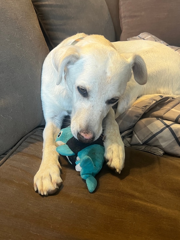
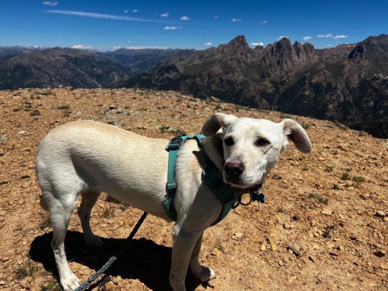
Kaiah and Sharkie
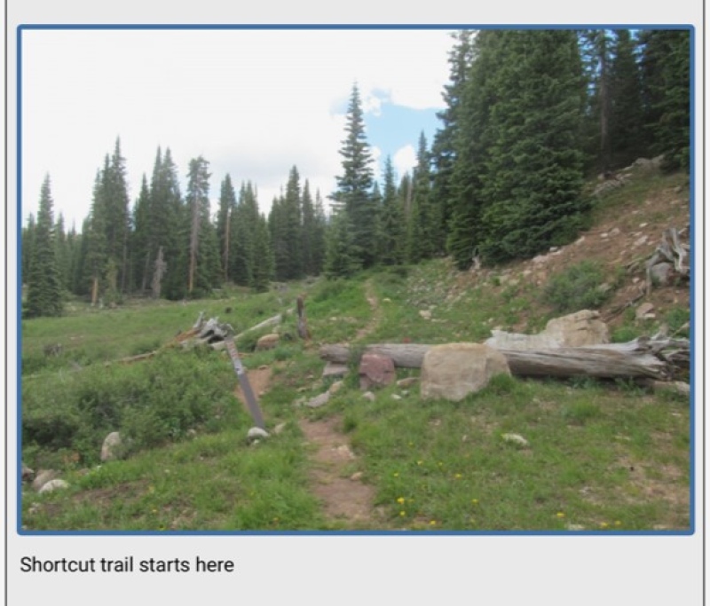
Mike’s trip report mentions a shortcut trail up to Lime Mesa, which allows rough 2WD access for the last 3 miles to the parking area at 10,900 feet and cuts off 2+ miles each way. I suggested to Kiefer that we head up to Lime Mesa and try to find the shortcut trail. Thanks to Mike’s report, we had no problems.
Shortcut Trail - Photo From ChicagoTransplant's report. Thank you Mike!
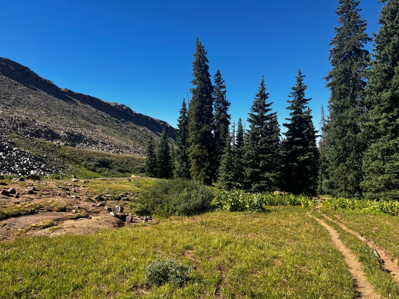
At first the trail was overgrown in spots and harder to follow, but eventually it became a well-established trail that met up with the Lime Mesa trail just to the north of Lime Mesa (12,093’) and Dollar Lake.
The trail was mellow and we made quick progress up towards Lime Mesa. Marmots and Pikas whistled and barked at us from the nearby cliffs. On the way back out Kiefer wanted to hike up Lime Mesa too, but it was not to happen.
Once we joined the Lime Mesa trail we turned left and headed north towards Overlook Point. The weather was perfect, and we were able to take our time and enjoy the expanding views around us.
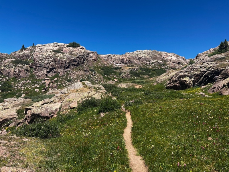
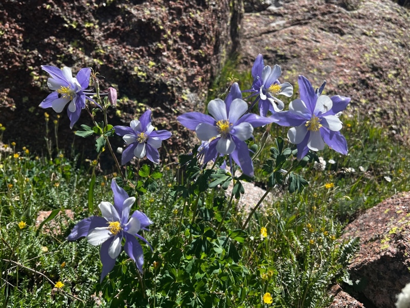
Looking back on Dollar Lake and the lower Lime Mesa Trail from where we joined it The Excellent Lime Mesa TrailBeautiful Columbine Along the trail
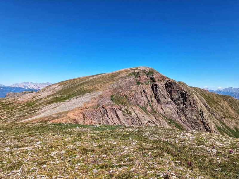
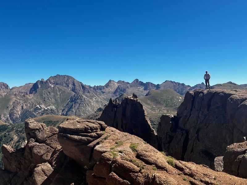
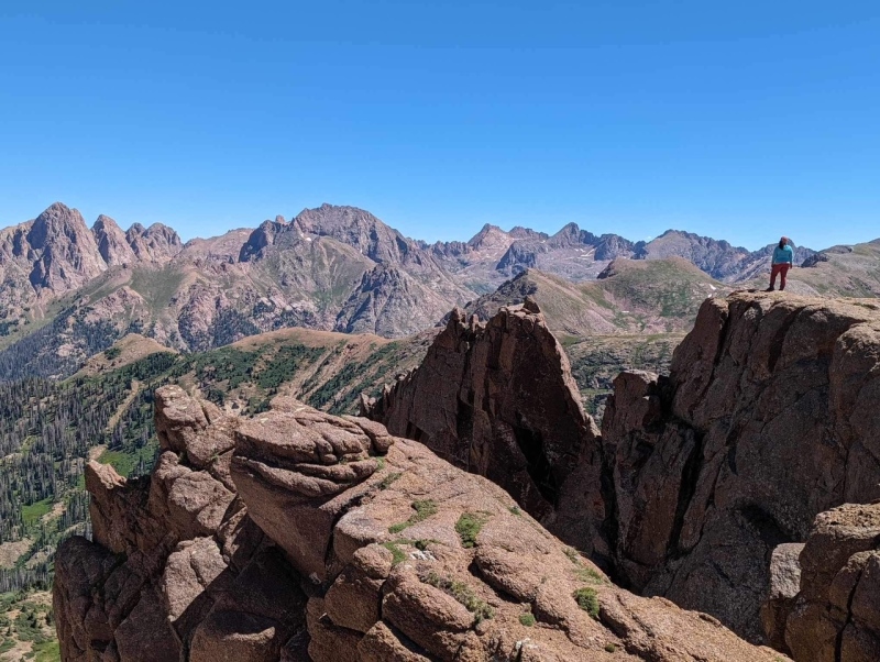
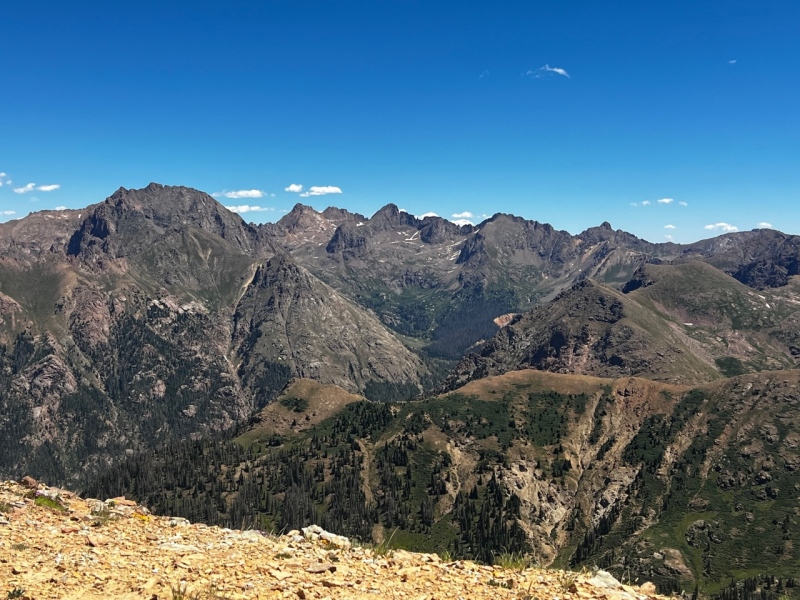
We followed the excellent and mellow trail to 12,400’ where we cut left up tundra slopes to gain the false summit of Overlook Point. This is NOT NECESSARY, and I do not recommend following this route. By gaining the false summit, we were able to take some pictures on a rocky outcropping with the Chicago Basin peaks behind us, and the views were incredible.
Kiefer on the rocky outcrop near the false summit - This is the only reason it is worth visiting, but still I would go around, the talus was that tippy
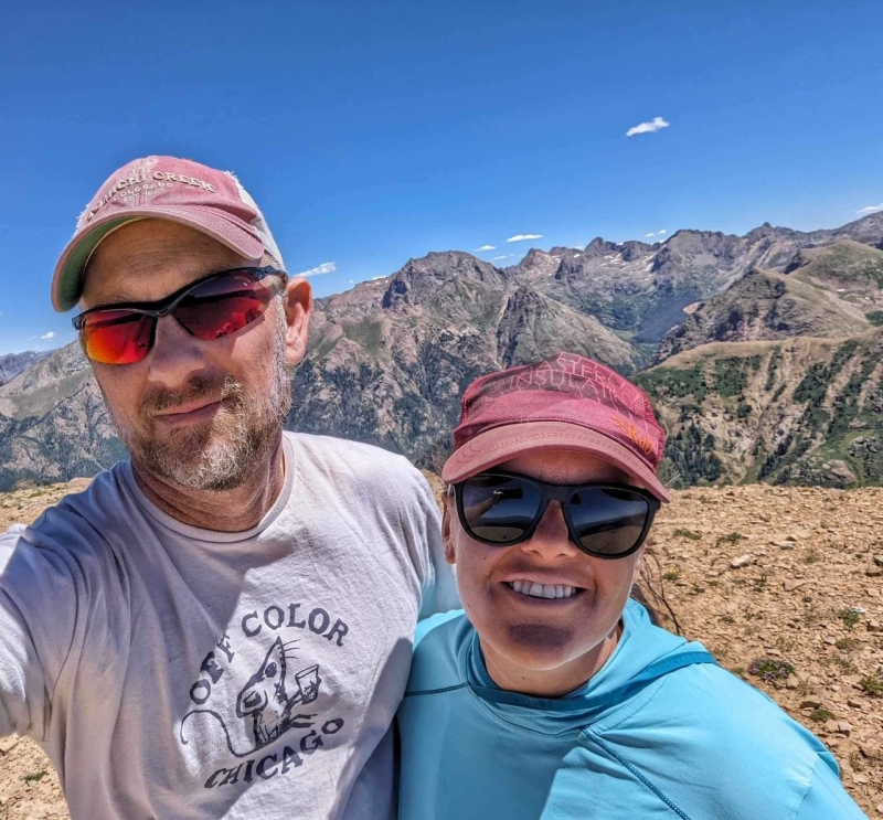
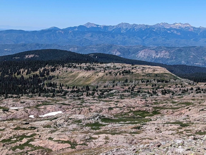
Me taking in the views from the outcroppingRuby Lake and Some 14ers
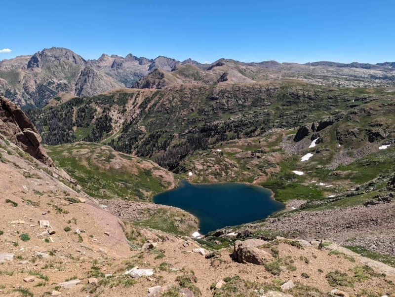
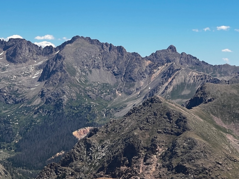
We were able to look down on Ruby Lake, and across the basin, Pigeon, Turret, Peak 15, Chicago Basin, Endlich Mesa, and Rio Grande Pyramid were standing tall. We stayed on the grassy ridge enjoying a snack and the views before we moved on to gain the true summit. The only peak I have hiked that rivals the views (so far) is Mt. Rhoda and the views of Vestal, Arrow, and the Trinities, etc.
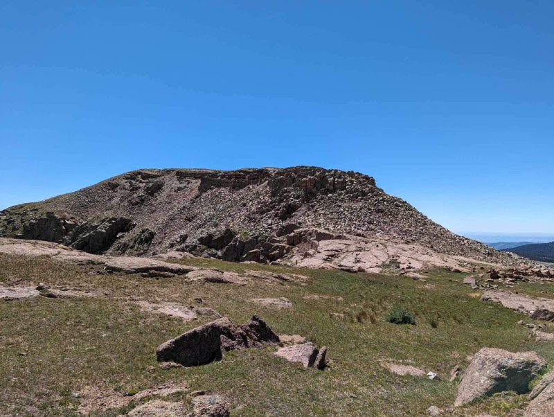
After soaking in the views, and with Kiefer now understanding why I was so hungry to hike this peak, we headed up and across some talus to the top of the false summit. This was still easy going. From the top of the false summit, we were presented with a talus slope to descend. The descent was maybe 100’ however everything moved, and there were large chasms between the rocks you would not want to fall into. At one point every microwave sized block around me was sliding. To add insult to injury, as we were tiptoeing down the very “portable” talus, we saw a faint trail in the meadow below us which skirted around the false summit all on lush tundra. I would highly recommend skirting the false summit.
The meadow below the peak was gorgeous, and there was no loose rock to be found. After crossing the tippy talus section, the remainder of the hike to the summit was all on tundra with a few rocky sections to cross. The summit was BEAUTIFUL. We were able to see our 2020 campsite in Chicago Basin below, and the waterfall feeding the creek we filled our water bottles in after summitting Jupiter Mtn, and on our return hike from Mt. Valois the next day. To this day, that is the best unfiltered/untreated water I have ever tasted.
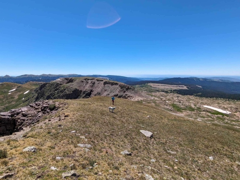
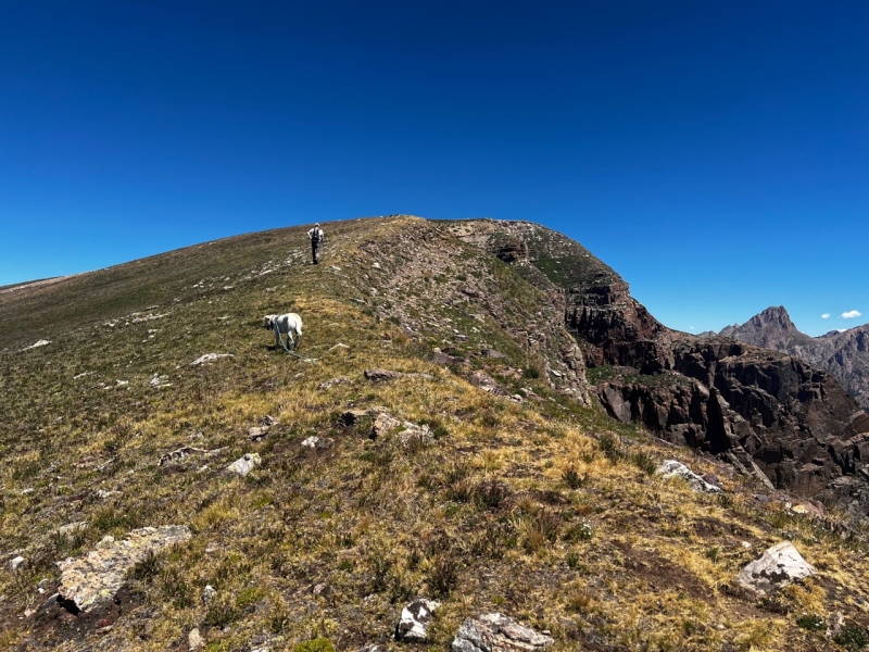
Kaiah and I headed up the true summitKiefer and Kaiah on the final summit ridge of Overlook PointUs on the Summit
Kaiah on the Summit, She was a bit tired from running up and down Tower Mtn the day before
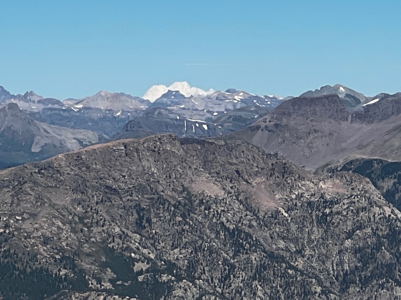
Jupiter Mtn, and Grizzly Peak (and the best water EVER below Jupiter)
Pigeon, Turret, Peak 15, Little Finger, Peak 16, The Index
Chicago Basin, we could see our campsite below the ridge of Eolus in the valley
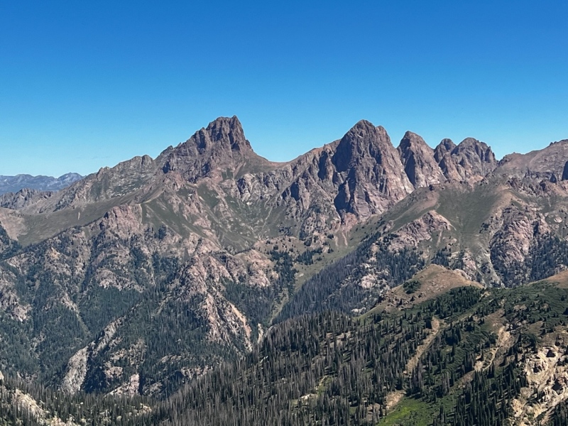
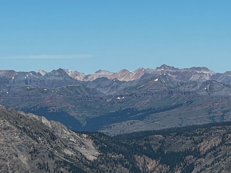
Teakettle and friendsViews! RyGuy please name these! Because I am 99% sure that is Vermilion
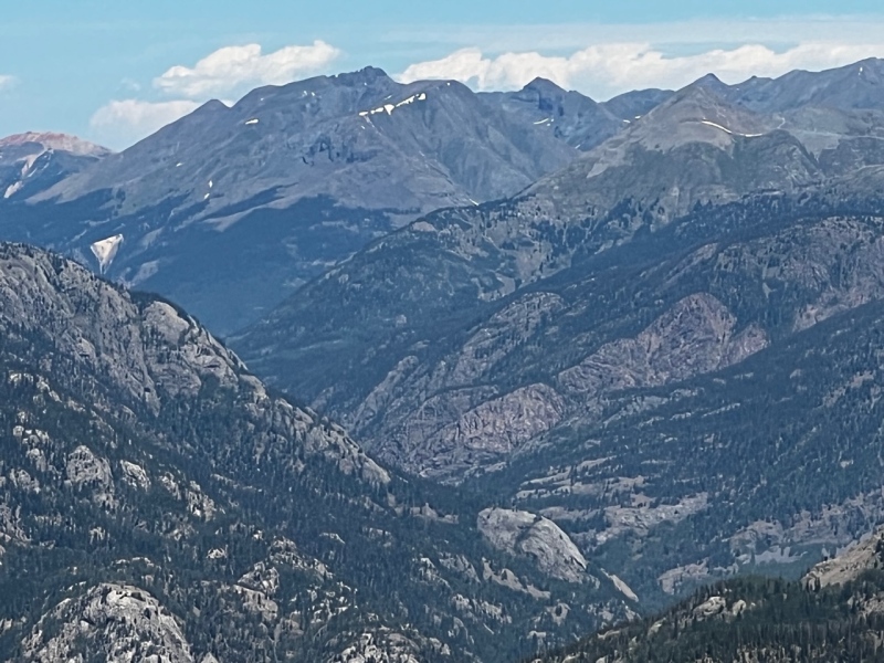
Storm Peak and friends behind Silverton
The La Platas in the Distance
After taking 20-30 minutes to soak in the incredible views we descended down the tundra slope from the summit to meet the faint game trail. We skirted the false summit and contoured back to the Lime Mesa Trail.
Headed down from the summit on tundra to meet the game trail Looking back on the false summit and the talus descent, we descended the right ridgeline, part of it also descended with us. This can be skirted to the right (on the way down, left on the way up) on cushy tundra.
We quickly descended the trail back toward the shortcut, and realized another detour was in order. We had Kaiah with us, and a herd of sheep with their guardian dogs had stopped to graze right at the trail junction with the shortcut trail. Rather than continuing on to summit Lime Mesa and return to the trail we descended more tundra to the right of the shortcut trail and met up with it lower down in the valley. We hiked back to the car and headed down the long dirt road back to Durango to end the day with some exciting errands.
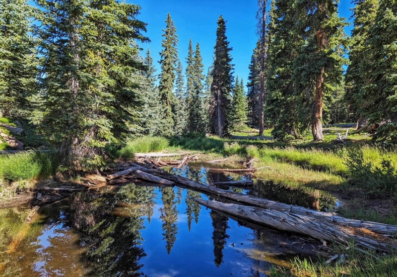
A little pond on the hike out down the shortcut trail, we watched some tadpoles, caddis flies, and water striders
With Overlook Point I have reached the quarter mark on my goal of summitting all of our home range 13ers, and I could not have asked for a prettier peak. Thank you to Mike for the amazing trip reports with beta on the shortcut trail and thank you to Kiefer for accompanying me on these sometimes obscure 13ers.
FYI – I forgot to turn on GAIA tracking until we were .5 mile from the car, so the GPX track is missing the first part of the hike on the way up.
My GPS Tracks on Google Maps (made from a .GPX file upload):
Whiley and I did this last year along with a couple of the nearby twelvers and absolutely loved it. For the Wemi it's as easy as it gets, but still has the joy and breathtaking views the Wemi is well known for. Glad to see you and the pup enjoyed it too!
Ben - yeah it was SUPER easy peasy but SO SO SO SO gorgeous. It was a special place for sure!
Caution: The information contained in this report may not be accurate and should not be the only resource used in preparation for your climb. Failure to have the necessary experience, physical conditioning, supplies or equipment can result in injury or death. 14ers.com and the author(s) of this report provide no warranties, either express or implied, that the information provided is accurate or reliable. By using the information provided, you agree to indemnify and hold harmless 14ers.com and the report author(s) with respect to any claims and demands against them, including any attorney fees and expenses. Please read the 14ers.com Safety and Disclaimer pages for more information.
Please respect private property: 14ers.com supports the rights of private landowners to determine how and by whom their land will be used. In Colorado, it is your responsibility to determine if land is private and to obtain the appropriate permission before entering the property.

")
")
")
")
")
")
")
")
")
")
")
")
")
")
")
")
")
")
")
")
")
")
")
")
")
")
")
")
")
")
")
")
")
")
")
")