| Report Type | Full |
| Peak(s) |
Missouri Mountain - 14,071 feet Emerald Peak - 13,916 feet Iowa Peak - 13,840 feet |
| Date Posted | 07/21/2023 |
| Date Climbed | 07/20/2023 |
| Author | frigidridge |
| Emerald+Iowa+Missouri Western Slope Loop |
|---|
|
~14 miles ~5200 vertical feet Starting from the Rockdale Trailhead at the start of the 4WD road. I've been saving Emerald for the possibility of being able to cross the river in my subaru to drive to Clohesy Lake to save the mileage, but I got tired of waiting and decided to forge the river and walk the road. The 4WD road to Clohesy Lake starts just a little bit west of the cabins near the main road. It goes down to the river where you'll forge downstream to find the other side. The river was about 18" deep, but the current was not too strong. The second river crossing (shortly after the first) is also about 18" deep and a shorter, more direct crossing. Bring an extra pair of dry socks to change into after you hit treeline (there are some other wet areas in between). The 4WD road ends at parking area, firepit and a gate. The lake is just a short walk past the gate. 
Around the lake is lovely forest area with several beautiful campsites around. From here is where The Loop starts essentially. I chose to do the loop counter-clockwise. This way my ascent would be more gradual except for the loose tallus/scree on Emerald which I preferred to take going uphill, and my decent off of Missouri would be steep and direct to the lake on a more defined trail. Depending on your preference either way works. After taking this picture I noticed a small trail to the left and I took it to get back to the main trail. I didn't realize at the time that doing this would cause me to miss the Missouri West slope junction so FYI if you are looking to go up the western slope of Missouri from here you'll want to backtrack east on the wide trail from here and find the main trail again that goes south. Or if you take the small defined trail around the east side of the lake from here like me once you intersect back with the main trail you'll have to go north on it a little to find that junction. The junction up the west slopes will begin to steeply ascend and switchback up through the forest that is directly east of the lake. I took the main trail that continues south and gradually up until you hit this little amphitheater: 
From here you still haven't seen any of the mountain friends you've planned to do today! From here you turn east up the gradual, grassy slopes and try to stay on one of the social trails. Eventually your friends come into view to the Northwest: 
This was my favorite part of the hike. I just love the grassy rolling alpine hills. It fills me with frolicking spirit. 
At the top of these hills there's a nice pass, and you begin to mentally prepare for Emerald's southwest slope scree fun: 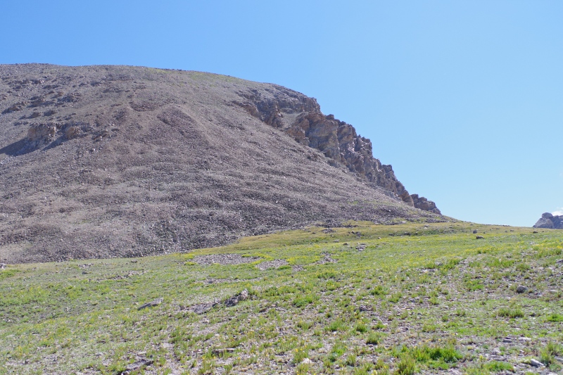
The slope is loose. You have the option of squishy dirt scree or slightly more solid rock scree. Going up I stuck to as much as the solid rock as I could. If you chose carefully it won't give way under you most of the time. The dirt scree would be frustrating trying to ascend, but it might actually be kind of a cushy decent, but it does get a little hard and steep about 3/4 of the way up. Once you make it up this bit Emerald is pretty much in the bag. 
The Summit Marmot on Emerald will ask for a food toll but, don't feed the marmot. 
If anyone cares, the summit register at Emerald has a broken top, and there is only a non-working pen inside. (Iowa and Missouri have no register as I saw). 
You'll find descending Emerald to the east to be the way to go to get down to the Emerald-Iowa saddle. There is a social trail this way that makes it not bad at all. The hike from here to Iowa and then to Missouri felt like trogging but I was sleepy. There isn't much to this traverse except the extra vert. 
After Missouri you get to take its high ridgeline north that intersects with Missouri's Eastern slope trail. 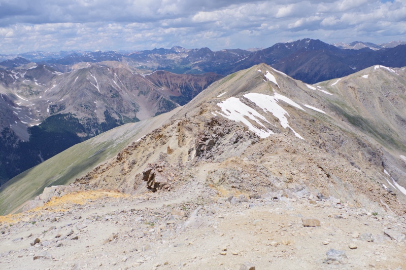
After hitting that mini peak at the other end of the ridgeline trail (seen in the photo) you take a left and will descend that steep ridgeline you can see to the west. On this ridgeline the skies decided to pelt me with sharp little graupel that hurt my face skin :(. Then - despite inclement weather not being in the forecast and besides, it was too windy for a storm to build up - I heard thunder out around Ice mountain and decided Missouri wanted me off quickly. I was talking a little smack about these mountains while hiking them because I was tired and grumpy and hadn't had caffeine this morning so, they probably heard me. I didn't mean it. Anyway lightning in the mountains is serious and I descended to treeline so quickly my knees hurt and my legs turned to floppy rubber. When I made it down to the lake I collapsed under a tree and tried to take a lil nap. Of course, the sun came back out and it never did rain. This hike was a little rough for me as I hadn't been out doing vert for quite a while, and I felt low on electrolytes and forgot to bring enough food. Anyway I slogged back down the road and that didn't quite feel like forever. The river crossing was refreshing at the end and I was able to revive myself with candy and caffeine in Leadville. Thumbnails for uploaded photos (click to open slideshow): ")
")
")
")
")
")
")
")
")
")
|
| Comments or Questions |
|---|
|
|
Caution: The information contained in this report may not be accurate and should not be the only resource used in preparation for your climb. Failure to have the necessary experience, physical conditioning, supplies or equipment can result in injury or death. 14ers.com and the author(s) of this report provide no warranties, either express or implied, that the information provided is accurate or reliable. By using the information provided, you agree to indemnify and hold harmless 14ers.com and the report author(s) with respect to any claims and demands against them, including any attorney fees and expenses. Please read the 14ers.com Safety and Disclaimer pages for more information.
Please respect private property: 14ers.com supports the rights of private landowners to determine how and by whom their land will be used. In Colorado, it is your responsibility to determine if land is private and to obtain the appropriate permission before entering the property.


