Download Agreement, Release, and Acknowledgement of Risk:
You (the person requesting this file download) fully understand mountain climbing ("Activity") involves risks and dangers of serious bodily injury, including permanent disability, paralysis, and death ("Risks") and you fully accept and assume all such risks and all responsibility for losses, costs, and damages you incur as a result of your participation in this Activity.
You acknowledge that information in the file you have chosen to download may not be accurate and may contain errors. You agree to assume all risks when using this information and agree to release and discharge 14ers.com, 14ers Inc. and the author(s) of such information (collectively, the "Released Parties").
You hereby discharge the Released Parties from all damages, actions, claims and liabilities of any nature, specifically including, but not limited to, damages, actions, claims and liabilities arising from or related to the negligence of the Released Parties. You further agree to indemnify, hold harmless and defend 14ers.com, 14ers Inc. and each of the other Released Parties from and against any loss, damage, liability and expense, including costs and attorney fees, incurred by 14ers.com, 14ers Inc. or any of the other Released Parties as a result of you using information provided on the 14ers.com or 14ers Inc. websites.
You have read this agreement, fully understand its terms and intend it to be a complete and unconditional release of all liability to the greatest extent allowed by law and agree that if any portion of this agreement is held to be invalid the balance, notwithstanding, shall continue in full force and effect.
By clicking "OK" you agree to these terms. If you DO NOT agree, click "Cancel"...
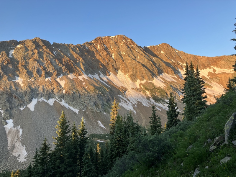
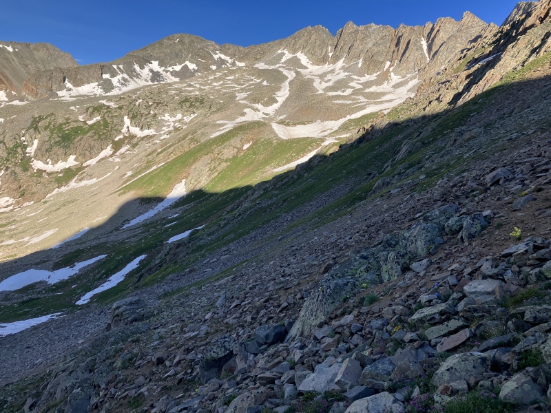
After a rest day putzing around Silverton, I headed up the Mineral Creek road to climb V 10 and Grizzly peak. This particular route was inspired by an earlier trip this year by SupraNilEst, Amy "blazintoes", Boggy B, and Vera. V 10 seems to have gained a large amount of infamy so I set out to see what all the fuss was about. At about 6, I began to make my way up an old mining road to the V 9 - 13302 saddle that overlooks Hope Lake. I was treated to some nice alpenglow on Rolling Mountain which overlooked most of the trip. (Buckle up for pictures of Rolling from every angle).
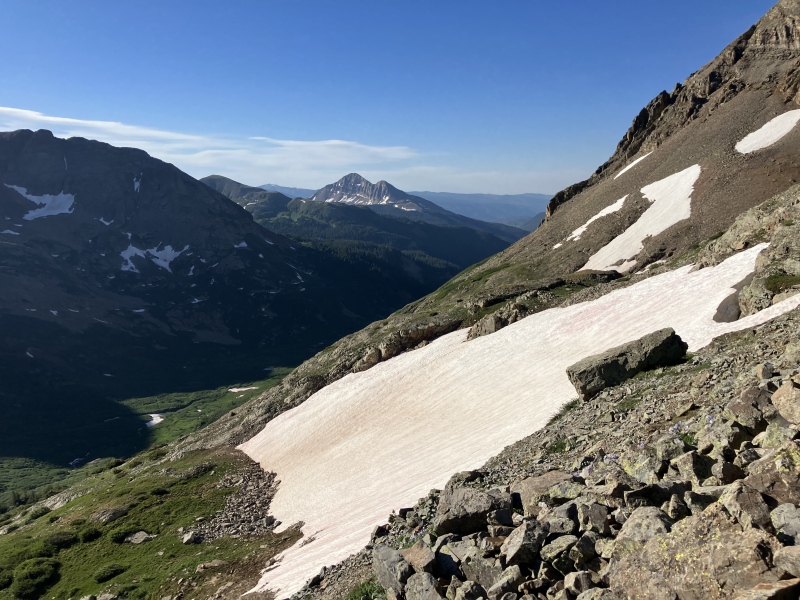
Morning Light on Rolling MountainNearing the V 9 - 13302 saddleSan Miguel from the V 9 - 13302 saddle
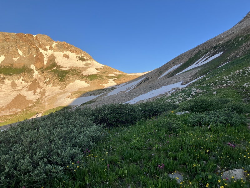
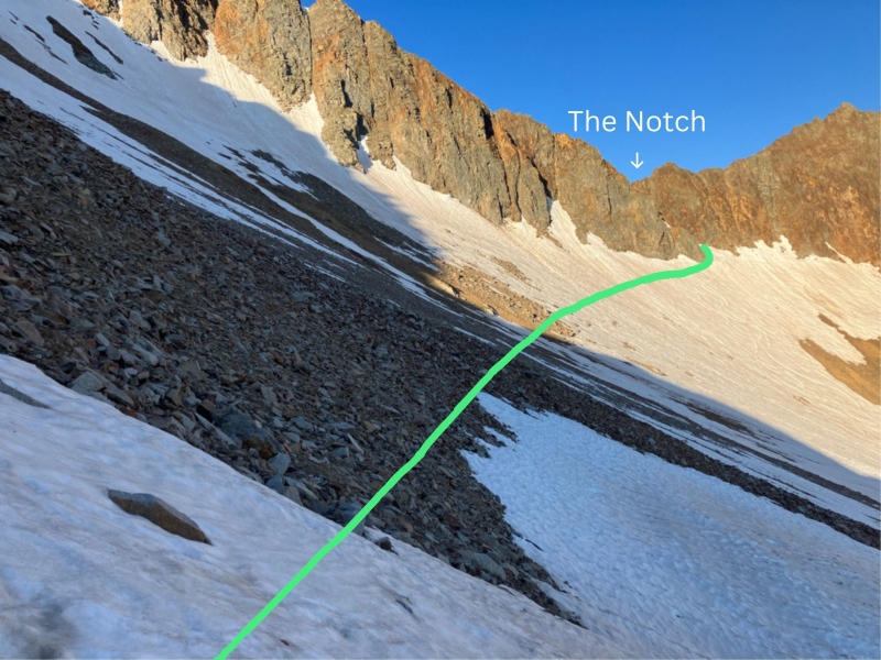
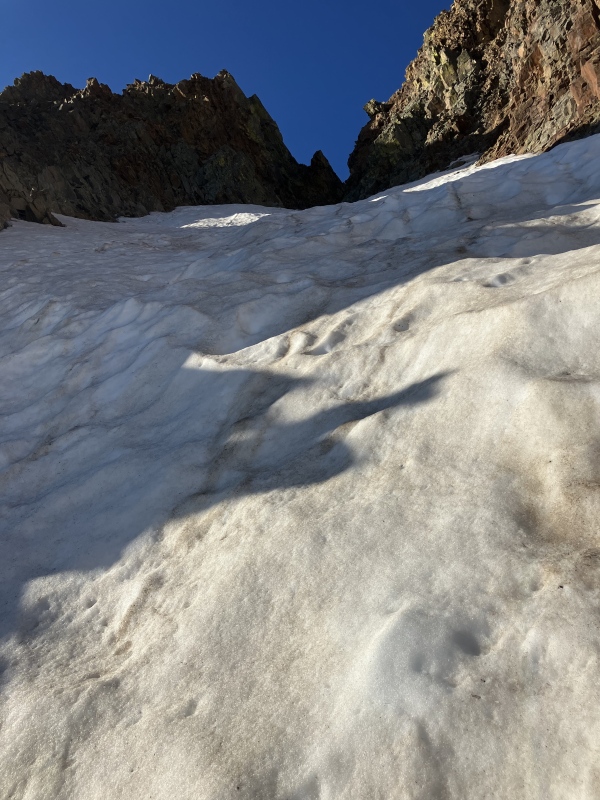
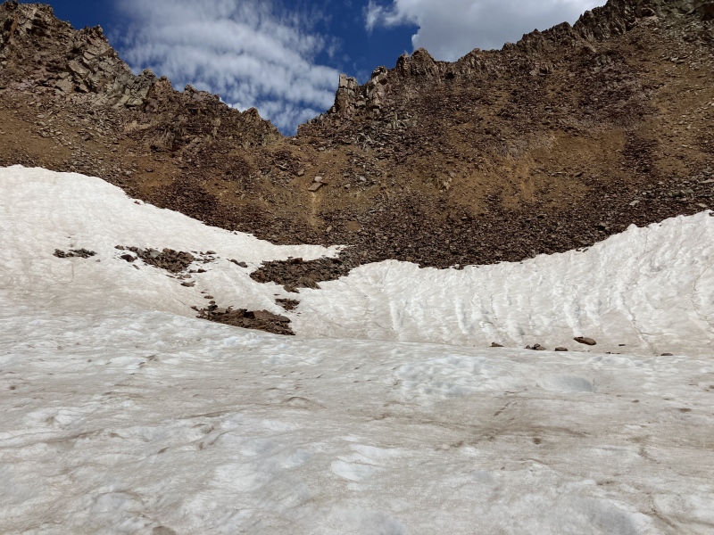
Once at the V 9 - 13302 saddle, I made my way across the scree and snow to the V 9 - San Miguel saddle. This saddle is a neat little notch that drops you into the Columbine Creek Basin. The snow was a strange level of soft that made it too hard to traverse without traction, but too soft for crampons to lend much help. This was certainly the most annoying part of the day.
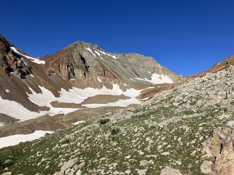
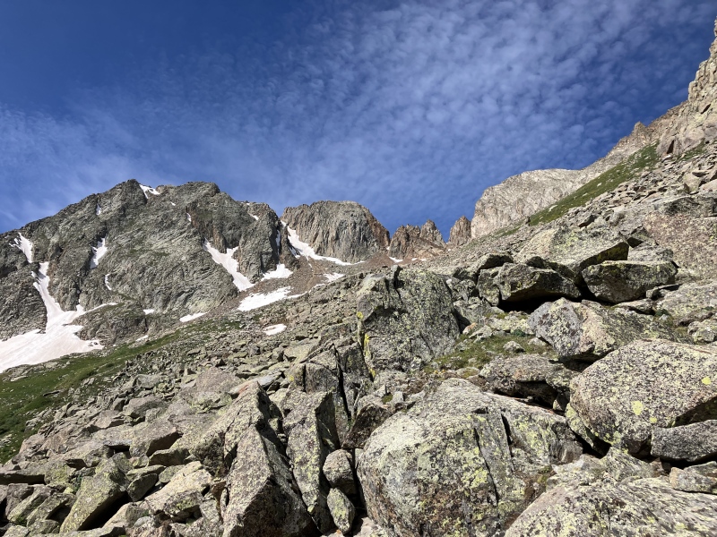
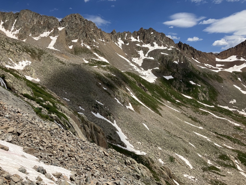
Route to the V 9 - San Miguel saddle/notchApproaching the V 9 - San Miguel saddleFirst look at Grizzly and V 10
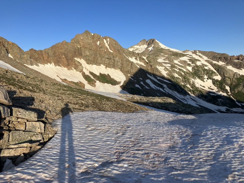
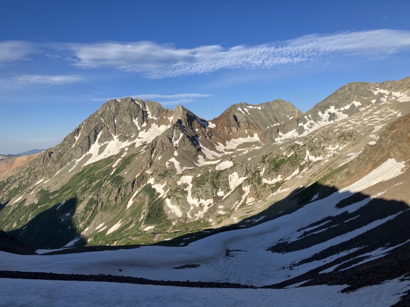
Once I had climbed through the notch, I decided to try and traverse high in the basin to try and save as much elevation as possible. This turned out to be incredibly nice side-hilling on grass and stable scree. After about 30 minutes, I rounded the corner into the V 10 basin and climbed up to the start of the V 10 climb.
The grassy slopes that I traversed to V 10V 10 reappears
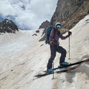
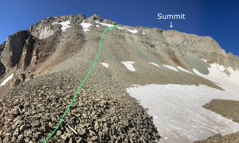
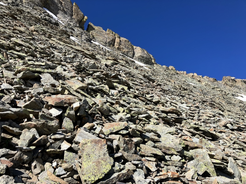
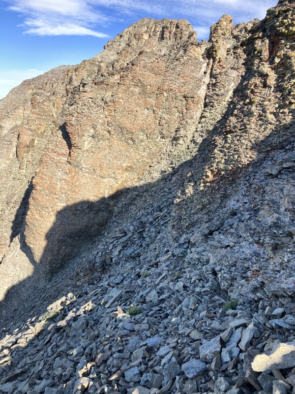
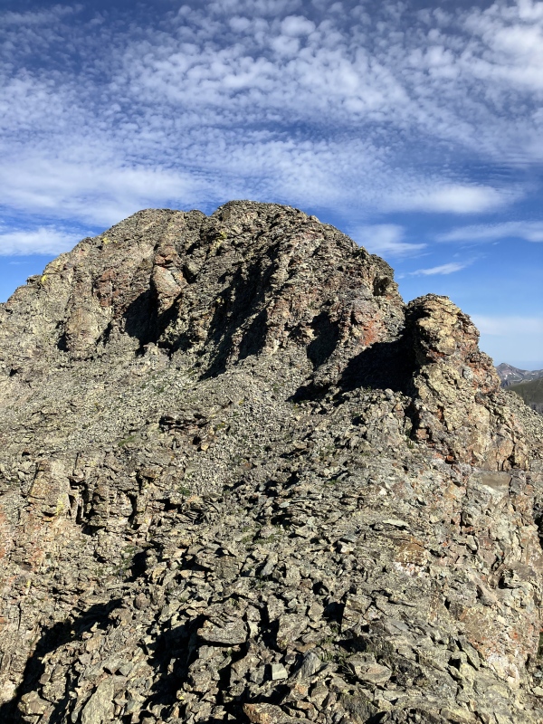
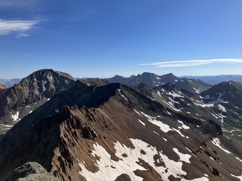
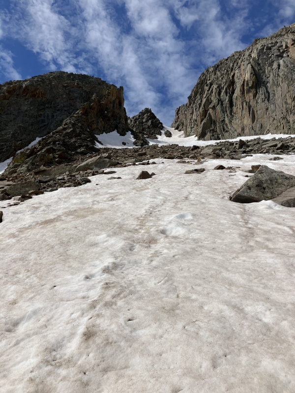
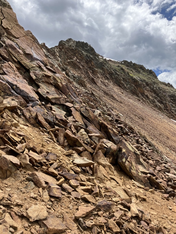
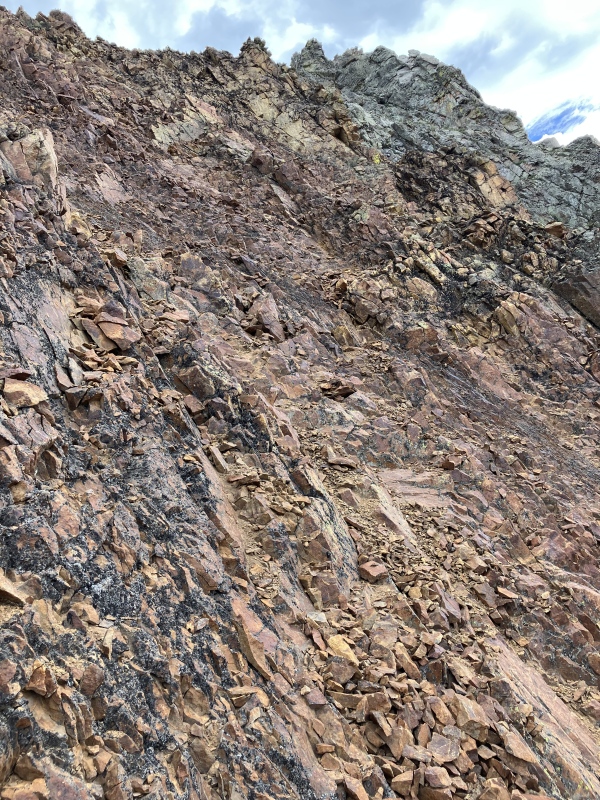
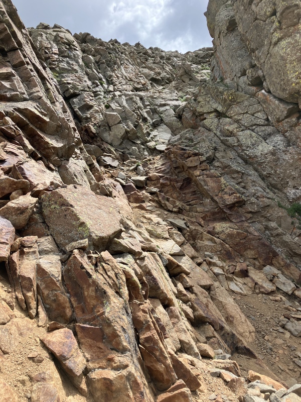
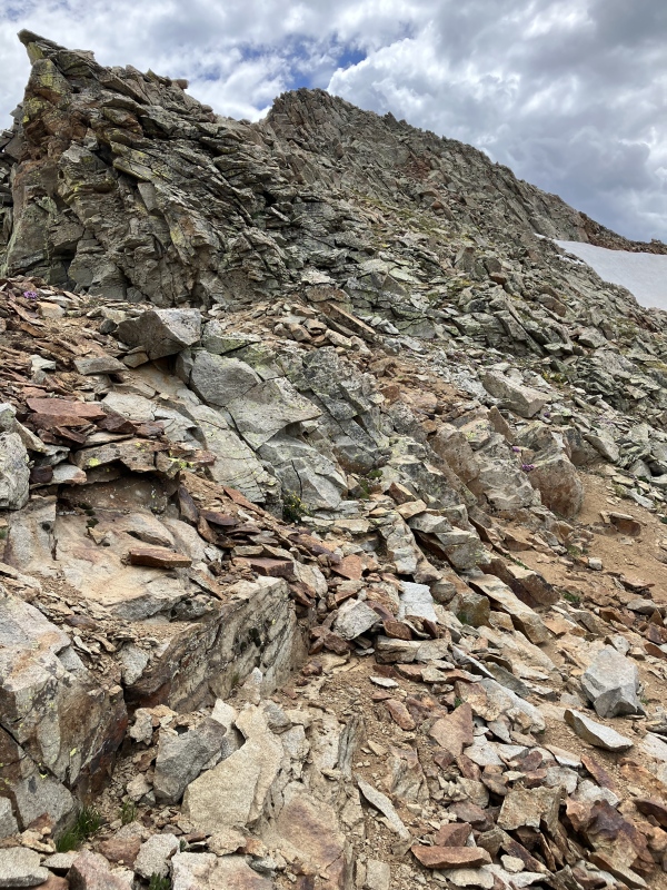
After donning a helmet, I began to climb up the loose side of V 10. This was fairly straightforward. As I neared the crest of the ridge, I began to traverse to the West a smidge. Once on the ridge, I tried to stick to it as much as possible with 2 or 3 quick drops to the south to bypass some notches. There were also little cairns along the way. I would say that this was mostly class 2 with 5ish moves of class 3 and wasn't all that exposed IMO. The summit offered some fantastic views of the surrounding peaks!
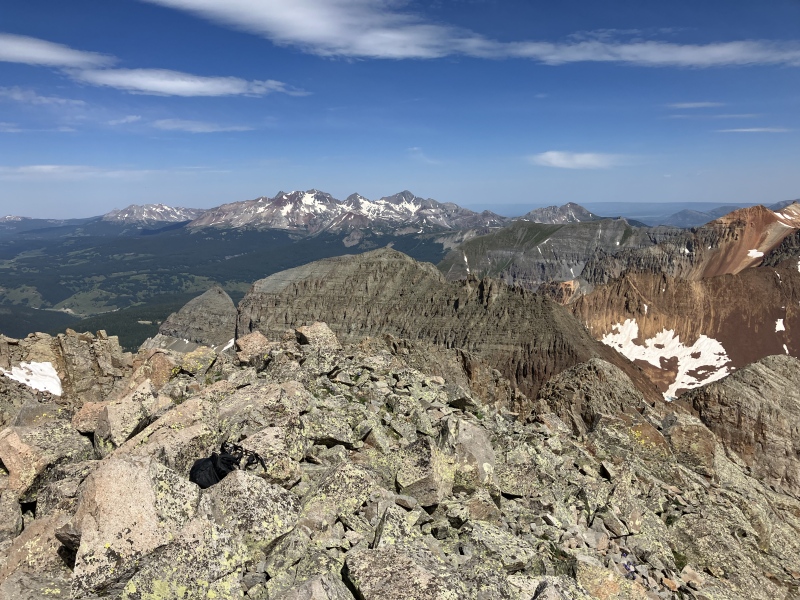
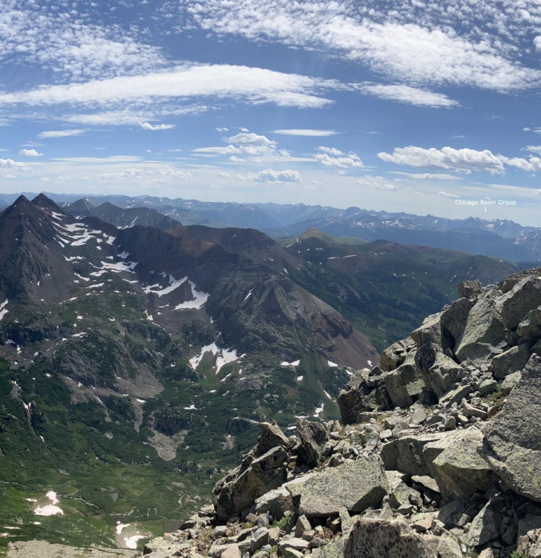
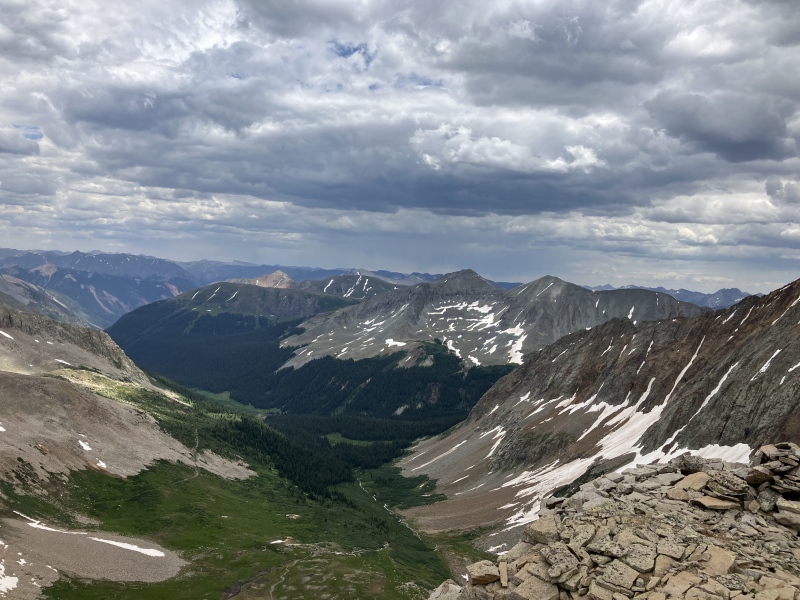
Approximate route up V 10Almost to the ridgeLooking down the ridge of V 10Ridge excitementFinal summit block!San Miguel and the Ice Lakes 13ers from V 10Grizzly from V 10
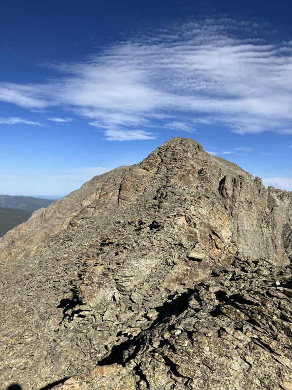
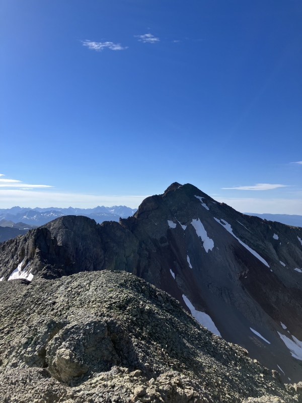
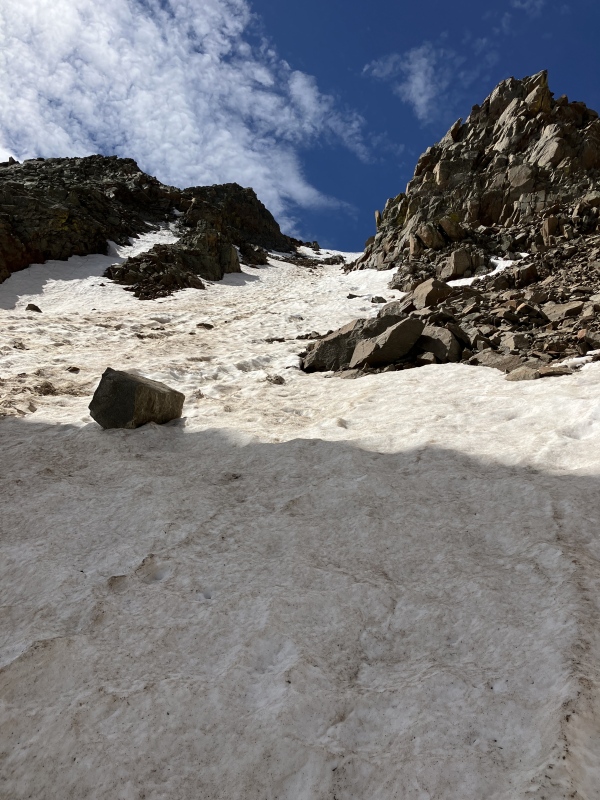
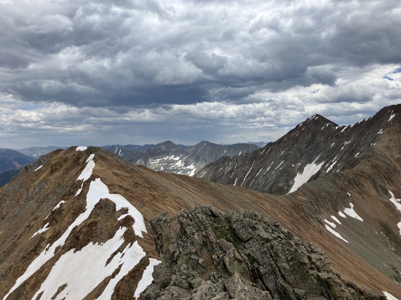
After enjoying the summit, I retraced my steps and dropped back down and around the corner to climb up Grizzly's north couloirs. This was fairly pleasant as the route went from grass and dirt to large scree to snow. At this point in the day, the snow had softened sufficiently to lead itself to nice climbing. Once again, the summit yielded an awesome view of practically the entire western portion of the San Juans. In fact, I could see 13 of the 14 San Juan 14ers!
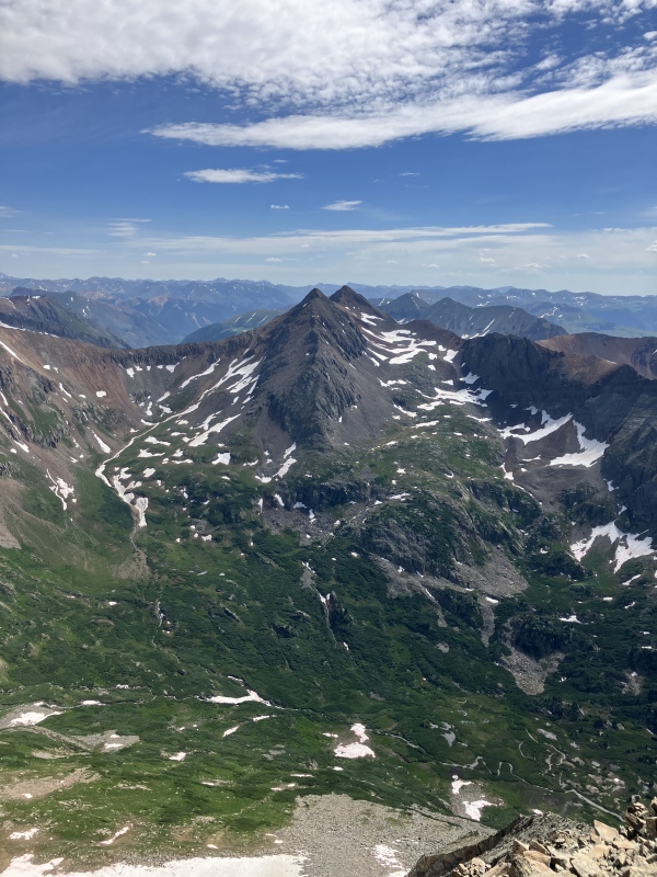
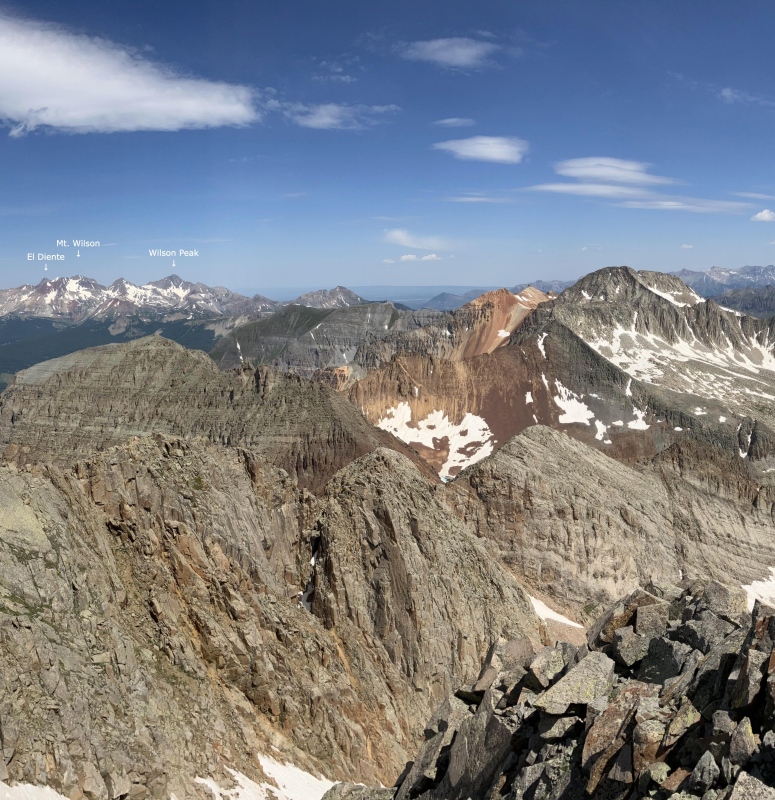
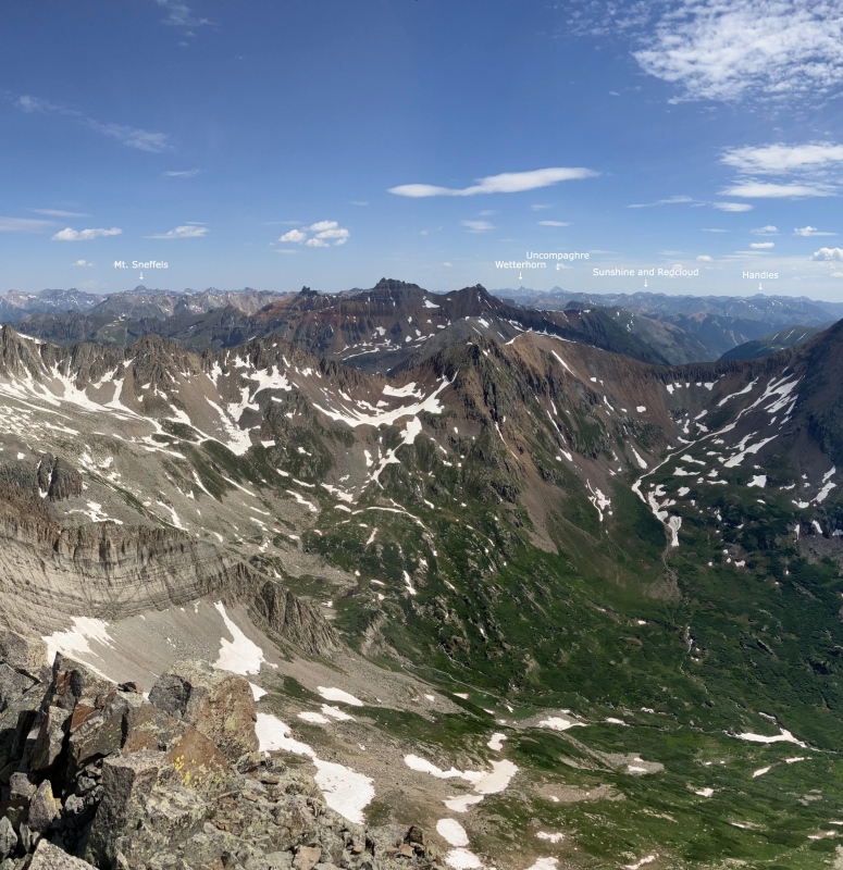
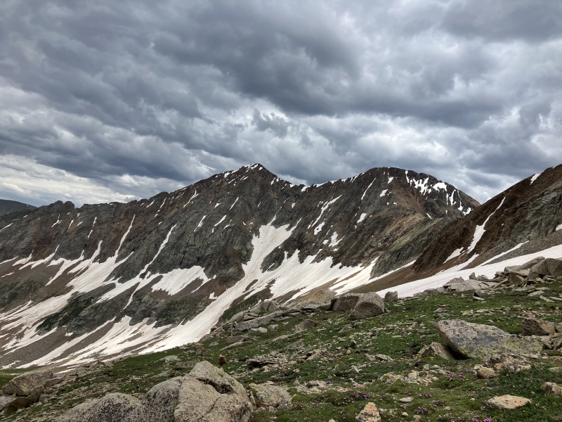
Rounding the corner to head up GrizzlyCrux of the V 10 - Grizzly connectionGrizzly reappearsUp the couloirFinal pushV 10 and the San Miguels from GrizzlyRolling Mountain from GrizzlyAll 13 14ers I could see from my perch. (Part 1)All 13 14ers I could see from my perch. (Part 2)All 13 14ers I could see from my perch. (Part 3)
I descended Grizzly and began to traverse back to the notch. This was rather uneventful.
Vermilion framed in the San Miguel - V 9 saddleFIXMEReturn to the V 9 - San Miguel saddle
Once at the saddle, I made a last-second decision to get back to the V 9 - 13302 saddle by just going over V 9 which I had climbed a week prior. I had been eyeing the west face all day and it looked like it went. Additionally, I was rather tired of going sideways and was eager to climb up. I traversed just below the ridge along loose class 3 slabs until reaching a gully that took me to the top of the west summit of V 9. Once there, I made the easy traverse to the true summit.
Ridge up to V 9 from the saddleLoose class 3 for daysFinal gully to the west summit of V 9West V 9 summit appearsV 9's true summit and Rolling Mountain from the west summitTwin Sisters from V 9
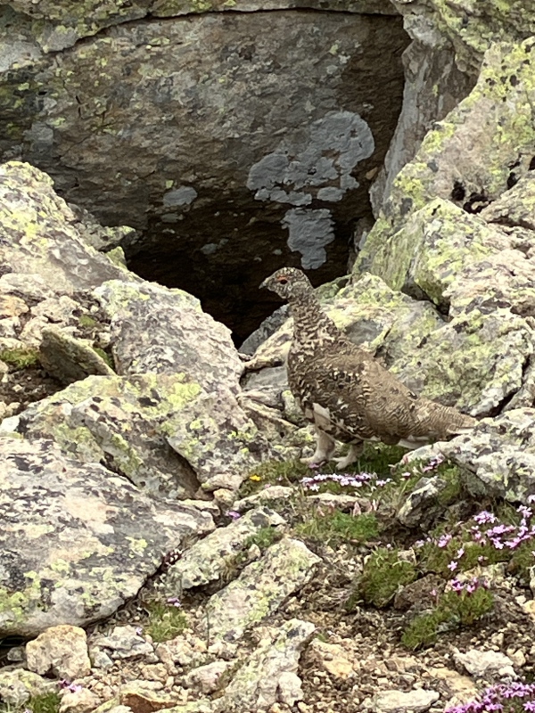
After summiting V 9, the sky started looking a little less friendly so I descended the V 9 standard route loose dirt down to the saddle, startling a ptarmigan along the way. From here, I simply headed back down the road to my car.
A ptarmigan being all sneakyRolling Mountian looking moody
Overall, this was an incredibly pleasant way to get to remote V 10 and Grizzly while avoiding the rough Cascade Divide Road and any annoying bushwacking. It also isn't a super wild day gain or mileage-wise. Including the V 9 addition, my trip was ~6000 ft. of gain and 12.5 miles. One could also link V 9 and Rolling Mountain for a 4-peak day! So, similar to the Middle Cimarrons, was V 10 the infamous maneater that it often gets described as? Nah. Can it still eat your lunch if you're not careful and an experienced scrambler? Definitely. Maybe a summer's worth of San Juan scrambles just recalibrates what "loose" means to a person. Also, I should mention that I'm 6'2" so lots of tricky moves tend to be less wild for me. V 10, Grizzly, and V 9 are just super cool peaks too so I rather enjoyed myself and would recommend this route to those who might want to climb these mountains in the future.
My GPS Tracks on Google Maps (made from a .GPX file upload):
V10 earns its reputation by the south side traverse around the difficulties on the eastern half of its east ridge. The north slopes is a sweetheart by comparison and will probably (should) become the standard route. The other way seems to have been the route commonly followed for years and is the way I first experienced it--not quite pure, unadulterated terror but definitely a standout among choss piles.
Nice job, and hopefully this TR helps steer folks clear of that mess.
I did V10 from the north as well, we came through the V9-Rolling Saddle via South Mineral, starting at the Bandora Mine and hiking the Hope Lake trail before leaving it. Some class 3 around the saddle with V9, but in general from your pics I think our route was easier? We returned via the Rico-Silverton trail.
I agree the north slope is not terrible, but still pretty loose and tedious. We hit the ridge too early and didn't see a good route and my GF at the time turned back while I went on traversing to find a better break in the ridge that worked and found an even better one on my way down. We were going to climb Grizzly too by wrapping around the east and south down low but weather moved in and we just went over Rico-Silverton trail and out.
"V 10" was actually somewhat congenial with snow. As for the approach, ours/the one in this TR wasn't bad on snow, but I imagine it'd kind of suck dry. CT's mention of the "V 9"/Rolling saddle is one I've heard others use, but in true, full dry conditions I'd even recommend the saddle south of Rolling ("V 9"'s saddle being north of Rolling). It looks lower angle and likely wouldn't contain any difficulties at all. Haven't done it though, so can't say that that's absolutely the case. I did try approaching "V 10" via Cascade Creek with Whiley last year and it is a doozy. If you love giraffe-height willows that's the approach for you, but we bailed on that nonsense. Whatever the case it does seem like the north side of "V 10" is best. Sure it's steep choss but it's not steep death-defying scary choss.
I love that basin between Rolling and Grizzly-V10. Yes a maze of willows, but remote & serene. I took v9 from bandora mine rd and went over that south saddle both ways. Deadpan on the west side and some annoying crumbly cliffs on the east side. Not hard; just tedious.
and Im using your tracks from the same approach, but adding a few others along the way. Great work!! Looks like fun!!
Caution: The information contained in this report may not be accurate and should not be the only resource used in preparation for your climb. Failure to have the necessary experience, physical conditioning, supplies or equipment can result in injury or death. 14ers.com and the author(s) of this report provide no warranties, either express or implied, that the information provided is accurate or reliable. By using the information provided, you agree to indemnify and hold harmless 14ers.com and the report author(s) with respect to any claims and demands against them, including any attorney fees and expenses. Please read the 14ers.com Safety and Disclaimer pages for more information.
Please respect private property: 14ers.com supports the rights of private landowners to determine how and by whom their land will be used. In Colorado, it is your responsibility to determine if land is private and to obtain the appropriate permission before entering the property.


")
")
")
")