| Report Type | Full |
| Peak(s) |
Truro Peak - 13,298 feet "West Truro" - 13,149 feet Unnamed 13102 - 13,102 feet "Tabor Peak" - 13,282 feet "Tellurium Peak" - 13,311 feet "West Tellurium" - 13,078 feet |
| Date Posted | 07/20/2023 |
| Date Climbed | 07/17/2023 |
| Author | yaktoleft13 |
| Trullurium Six-Pack |
|---|
|
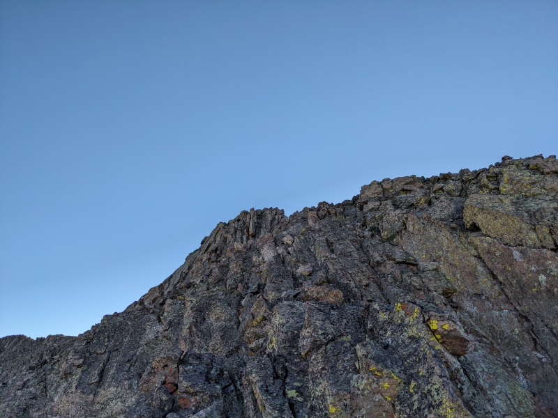
Trailhead: Tabor Creek Mileage: ~21 Gain: ~8100 Class: 3 Time: 14 1/2 hours First, some backstory. My wife and I had our first child, a daughter, back in April. Life is different. Incredible, but different. I still have lots of very early wakeups, but instead of driving to a trailhead, I'm staggering downstairs and sleepily feeding her. I'm still up at 2 AM every Saturday morning. Some things change, some things don't. One of the things that did change is my free time and priorities. Sure, the mountains are still there and I seize every opportunity I can to get out there, but those opportunities are once or twice a month, rather than once or twice a week like prior years. I've had to mourn the loss of freedom, but I'm adapting, and it's worth it. Plus, maybe she'll be a mountain monster someday. Whatever she wants, of course, but one can hope! With limited mountain days, I've challenged myself to squeeze every drop out of the days I do get. This means longer days, more peaks, lengthier mileage, bigger gain, and more ambitious linkups. I've also wanted to focus on areas that are inaccessible in winter, which led me to eye some of my remaining peaks off Independence Pass: the Truro/Tellurium clusters. The group consists of six peaks (well, more really two groups of three), but due to the topography, they are usually climbed separately. However, to maximize my day and minimize the number of times I have to drive Lincoln Creek Road, I wanted to find a way to combine the groups. I found no beta, but photos and maps seemed to show a descent into Tabor Creek drainage could work successfully, if not soul-crushingly. I figured it would be worth it to give it a look, and if need be, I could bail at one of several locations. My attempt to create the perfect hiking partner has thus far yielded a 3 month old who has shown only a tenuous ability to hold her head up, zero core strength, non-functional legs for walking, and a tendency to wahhh when even the slightest thing doesn't go her way (which is not ideal in a partner), so I was better off on my own for this one. I headed out Sunday afternoon up and over Independence Pass and turned onto Lincoln Creek Road. After a short distance, I found my way impeded by a Nissan Sentra, hellbent on rattling its way as far up the road as it could. I, of course, was not headed to a campsite, but the driver of that vehicle didn't know that and probably thought they were racing me for a precious dispersed campsite, so they elected to block my path at 3 MPH rather than let me pass. Being stuck behind a Sentra on a backcountry road has to be one of the inner circles of my personal hell. They finally secured a spot at the last dispersed camp site on the road, and I was at long last unencumbered on my way to the trailhead. I was the only car there and crashed in the back of the 4Runner for a fitful night of sleep. The alarm buzzed at 3:30 and I was on the road hiking by 4. The Truro group was up first, and while typically climbed as a relatively short day from further up the road, the Tabor Creek trailhead served as a good location to balance my approach and descent. That meant 4 miles of road walking to get to the usual parking area. The road is relatively flat, so with little effort I reached the Portal campground well before it began to get light. I encountered a group with a roaring 4:45 AM fire, either enjoying a late night or an early morning (my money's on late night). Resisting the urge to ask if they had any marshmallows left, I continued up the road, eventually reaching the turnoff spot as the sun (and one surly porcupine) arose. 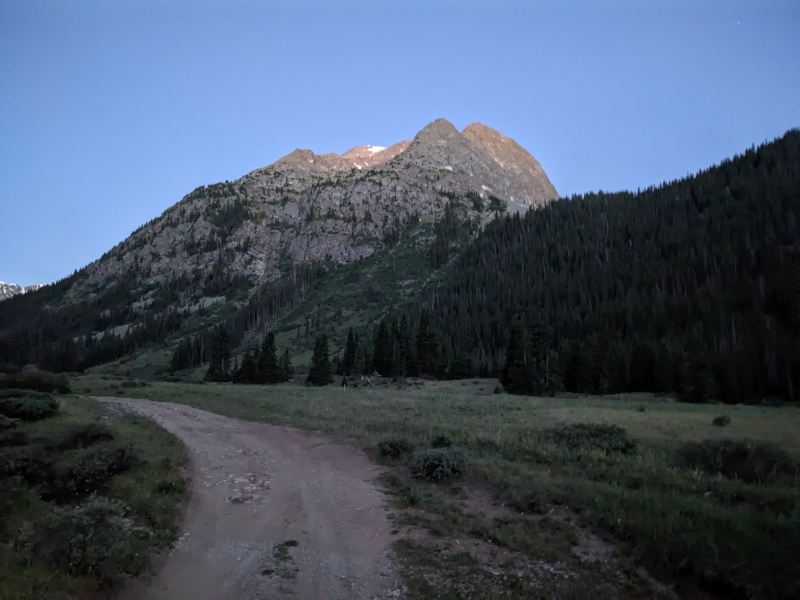
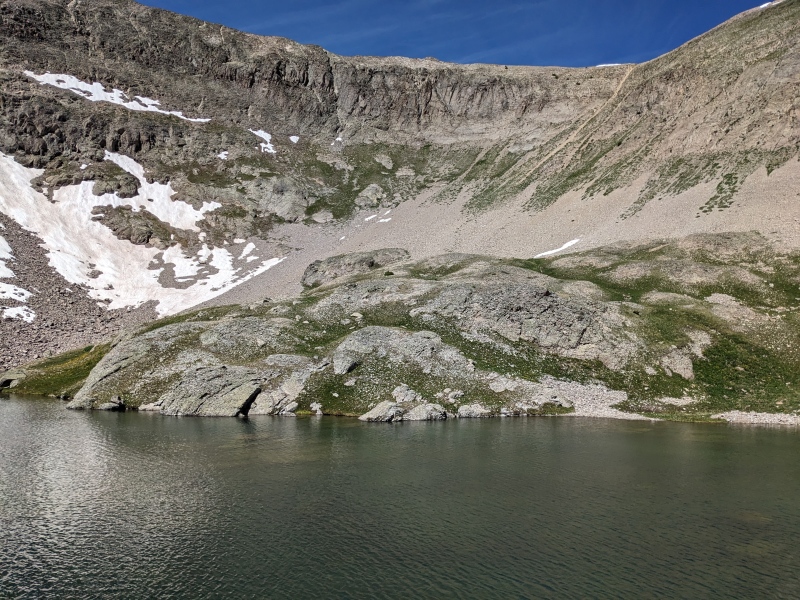
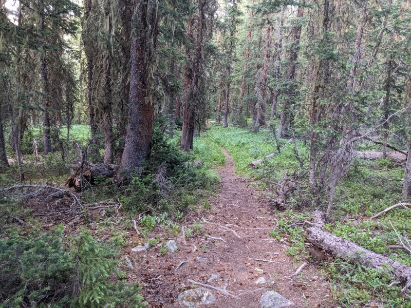
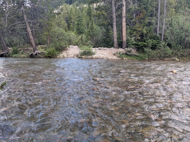
The first order of business after leaving the road is crossing Lincoln Creek. I didn't look super hard for a rock-hoppable crossing, but happened upon a crossing with a rock/sand bar in the middle that seemed shallow enough. I took off my shoes/socks and waded the creek at just below knee height. From there, I pushed upward through the forest, which was thicker and had more deadfall than I would have preferred. It was still navigable, and about a third of the way up I encountered a trail that I followed sporadically. At times, the trail was blocked by deadfall, but by heading up, I always found it again. Near the top of the slope, the trail strengthened and deposited me in a high meadow below Truro Lake. 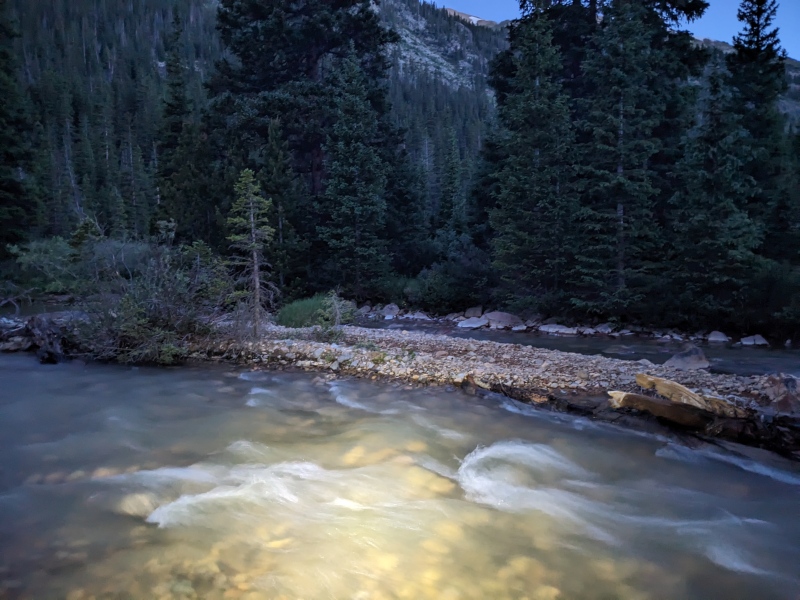

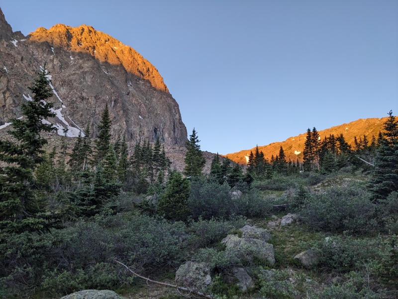
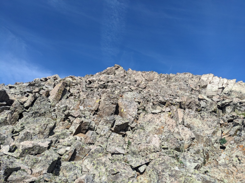
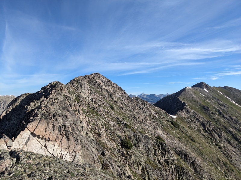
After scaring away a solitary deer, I traveled around the east side of the lake and found the ascent gully to reach Truro's west ridge. The gully itself was still holding snow, so I elected to climb the relatively stable rib to the right of it, which was dry. Once on the saddle, a hundred feet of tundra gave way to some scrambling. The ridge proper looked like it went fine, but I went a few feet left of the ridge and climbed easy third class to reach the short summit pitch, and the first peak of the day was mine! 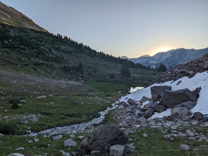
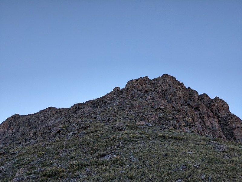
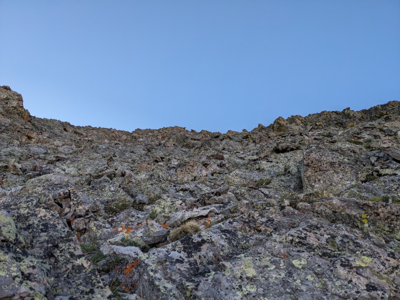
One peak down and feeling good! I backtracked to the saddle and stared down the gnarly ridge going to W Truro. I typically am one to try to stick to ridgelines when possible, but FotM said to get off the ridge, so I got the hell off the ridge! From the saddle, I went around the towers to the south side, following the base of the cliffs, which trended down, then gradually gained elevation. Finding the correct gully to go up wasn't difficult. It was a very clearly defined gully and was the last feasible ascent route before the summit. I turned right and climbed the loose gully, which unbeknownst to me was the first of many a loose slope I'd suffer today. 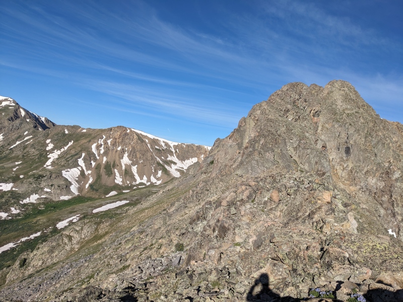
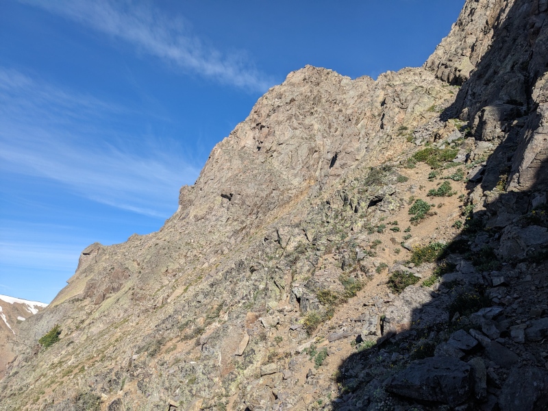
Once at the top of the gully, a down/up/down/up on loose scree appeared, along with with two snowfields. The first snowfield was at the bottom of the first down, but mercifully had steps in it from a determined mountain goat. Those proved very useful and I crossed without incident. The further snowfield looked steeper, and though I was carrying an ice ax, the 35 seconds it would take to remove it from my pack and put my pack back on seemed like a dealbreaker. Instead, I looked for an alternate route. I wondered if the rocks above and to the left of the first "up" led to the summit, and after brief exploration, they did! And they were also easy third class. I dispatched the short scramble and stood on summit number two! 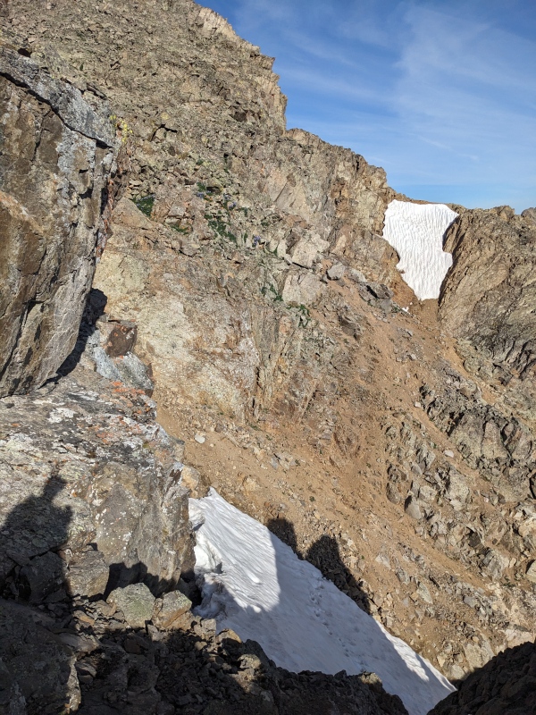
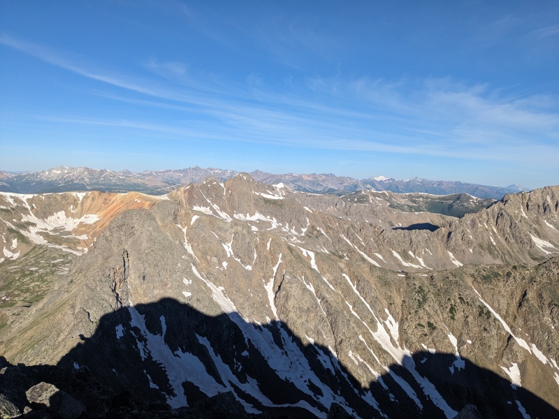
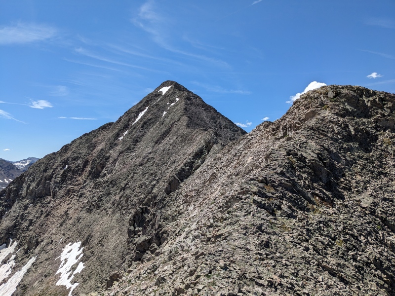
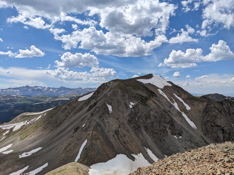
A quick note on nutrition: my plan for the day was to eat something on top of every summit to make sure I didn't bonk during the hike. More on the success of that later, but the MVP of the hike was half a family sized bag of Ruffles cheddar and sour cream chips I shoved in my bag last-minute. Often times eating consistently while on a hike is a chore, but something about those salty, oily chips hit the spot. At every summit I reached, I spent the first 2 minutes shoving handfuls of them into my mouth, while my gels and designer bars went ignored. They may not be peak nutrition, but anything is better than nothing, and those were at least something! I set off from the summit of W Truro toward 13090, happy to have what some report to be the technical crux behind me. The ridge looked super long, but at least some prior hikers completed it quicker than Truro to W Truro. I quickly found that the ridge consisted primarily of class 2+/easy third scrambling and would not be as uneventful as I had hoped. Most of the ridge was more tedious than fun, but nothing was very difficult. A distinct high point in the ridge marked the midway point. After scrambling past it on the ridge, I eventually dropped under the ridge to the east to a grassy slope, which deposited me on the summit ridge. 13090's grassy summit soon appeared, and peak number three was in the books! Halfway done, but as Michael Scott would say, in a much more real sense, I was nowhere close to halfway done. 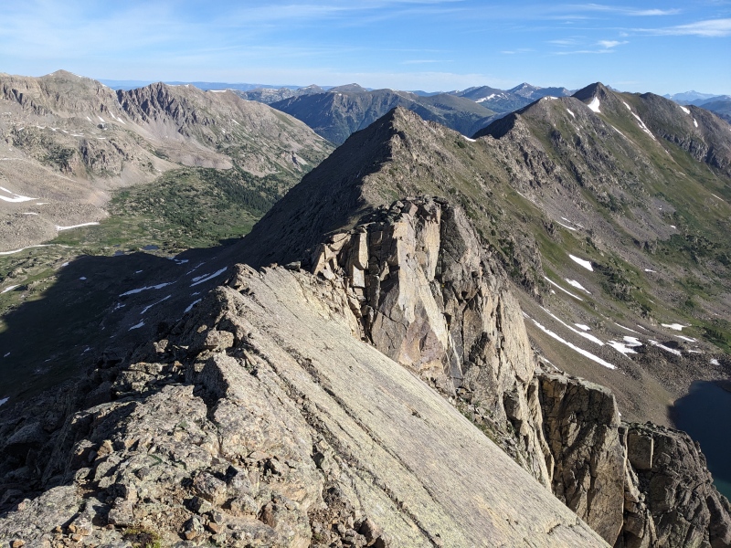
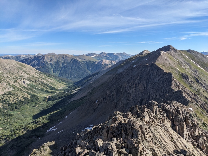

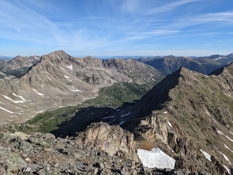
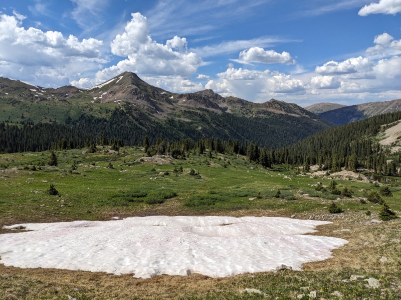
The biggest unknown of the route for me was whether the west slopes of 13090 would be gentle enough to grant easy access to Tabor Creek basin. Fortunately, they did. I went a few hundred feet north off the summit of 13090 and found a steep but grassy/scree-y slope leading down to the basin. The descent was loose at times, and while I had to stop at the bottom to empty rocks out of my shoes for the first of five times on the day, it went quickly, and less than 30 minutes after being on the summit of 13090, I was at the bottom of the basin at 11500. Some mild willow bashing was needed near the bottom, but that's the fun part, right? 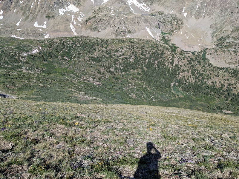
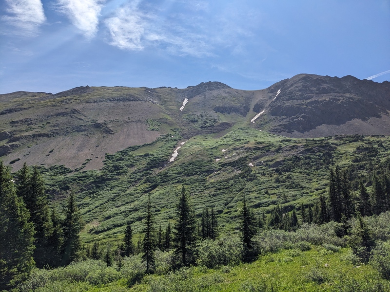
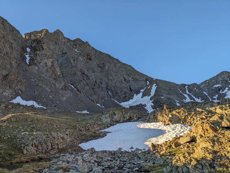
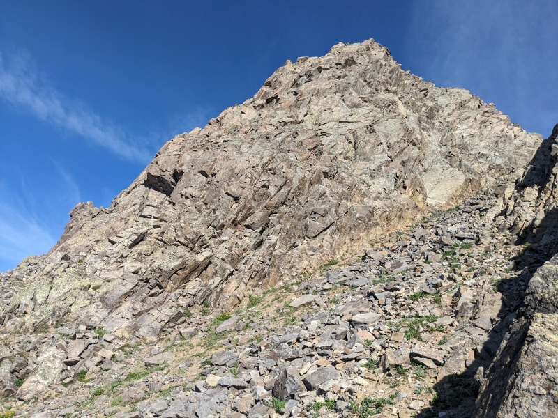
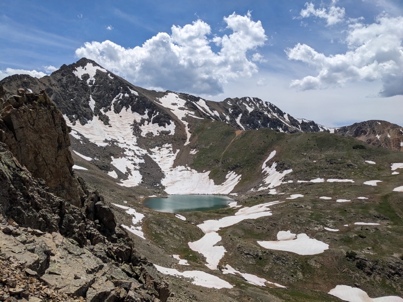
Now, 1700 feet right back up! I should mention that it was an oppressively hot day, and never did I feel the heat's wrath as powerfully as I did below treeline in Tabor Creek's drainage. The humidity of the willows and foliage amplified the heat, and my mouth became a level of dry that no amounts of water could quench. I climbed up the 800 feet to the lake and located my ascent route to the north ridge of Tabor, a narrow gully that provided the only break in the rocky cliffs guarding the north ridge. I was surprised to find the only other person I'd see all day, a hiker who'd brought a pole to the lake to fish. After exchanging pleasantries, I began the grind up the loose talus that led to the yellow scree-covered gully. It was on this ascent that I started to bonk. My pace slowed to a crawl, or so it felt. Every step was laborious, and once to the gully, the scree slid under me whenever I moved my feet. It was the kind of scree that has talus on it, but even the talus is loose because it's not connected to the mountain; it's just resting on top of more scree. This type of terrain is what is permanently etched in my mind when I think of this route. I tried climbing the sides of the gully rather than the middle, and while slightly better, it still was rough. Did I mention it was hot? Tabor Creek was a major bailout option too, and thoughts of calling it quits danced in my mind. I convinced myself to put one foot in front of the other, and eventually I topped out on the ridge. A ridge walk and easy third class scramble led to the top of Tabor Peak, peak number four. I texted my wife that I was attempting unsuccessfully not to bonk, and she told me to eat food and drink water. Oh yeah, that might help! I pounded some ruffles and a powercrunch bar and felt the life start to come back. I realized that perhaps my strategy of eating on every summit isn't ideal if the summits were 2+ hours apart, as 13090 and Tabor were. Lesson learned. 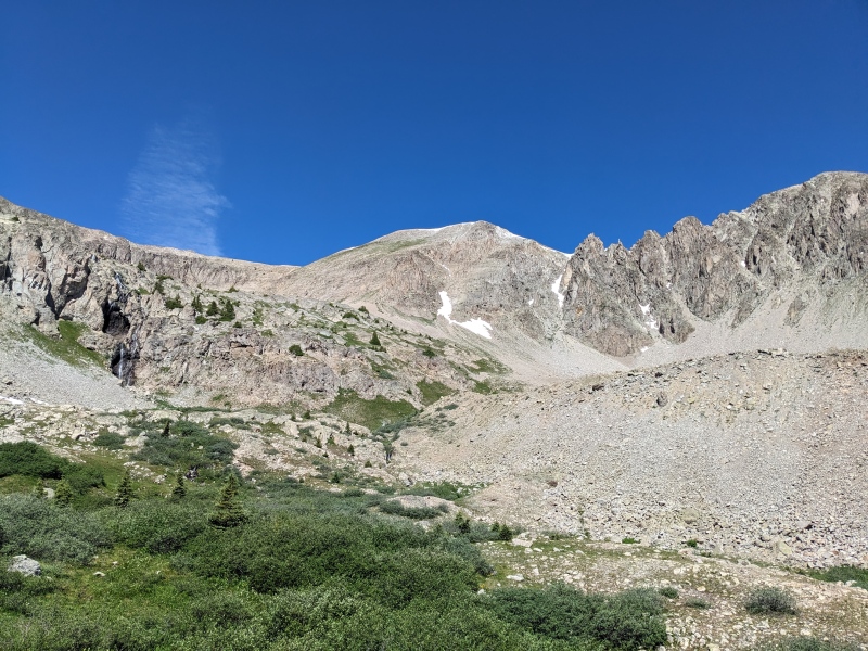
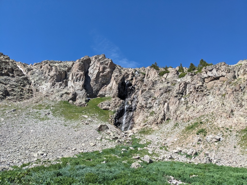
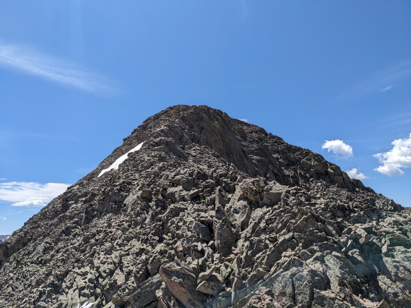
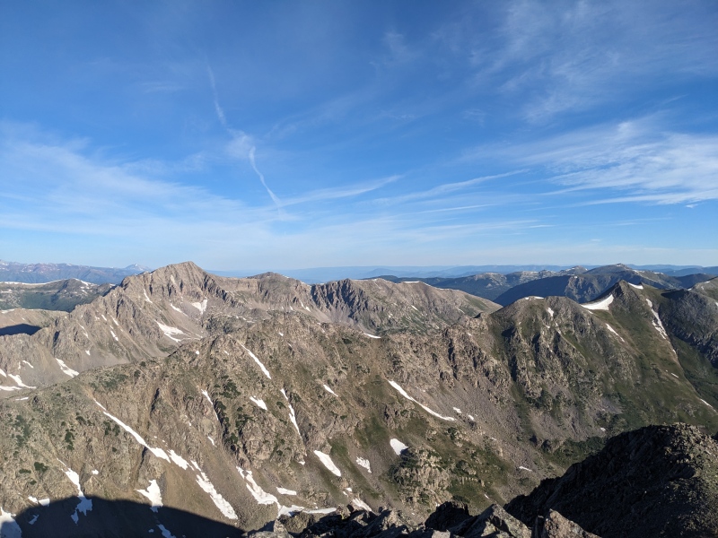
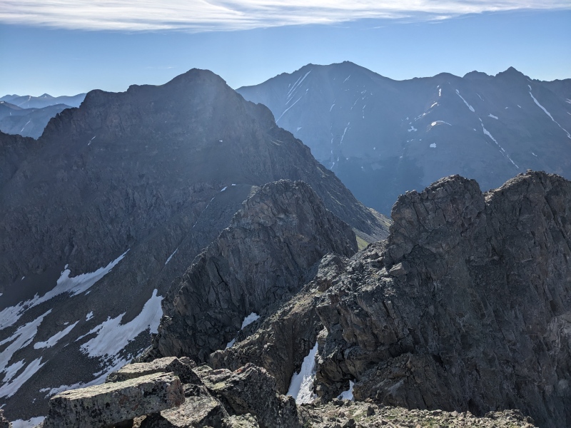
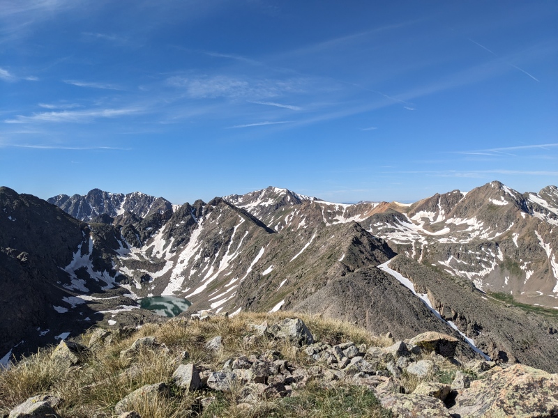
From the summit of Tabor, I had dreams of attempting the ridge to Tellurium, which appears to go but most people circumvent. Unfortunately, after nearly 6000 feet of gain and still working through a bonk, I felt in no condition to explore the ridge. I eyed it from all angles and I think it likely goes at 3rd/4th class, but if the ridge did cliff out and I had to backtrack to the summit of Tabor, that likely would have been a day-ender for my tired body. So I elected for the safe, boring option: descend the way I came up, traverse under the difficulties, use a low point in the ridge to cross into the next basin, and take easy slopes to the summit of Tellurium. Maybe I'll go back for the ridge someday, maybe not. Reversing the ascent route of Tabor was much quicker, but equally nasty. The gully was just firm enough that it didn't provide a good scree ski, but still loose enough to fill my shoes with rocks again. I made it to the lake, where the fish were still in danger from my new acquaintance, and stopped to refill water and dump the rocks from my shoes again. I headed south from the lake on a bench around 12300 on sidehilling but relatively easy terrain, aiming for the low point in the ridge. It was a time-consuming section, but finding the correct gully to reach the low point of the ridge proved intuitive, and after fighting more scree I crested the ridge to reach the next basin, Brooklyn basin. 
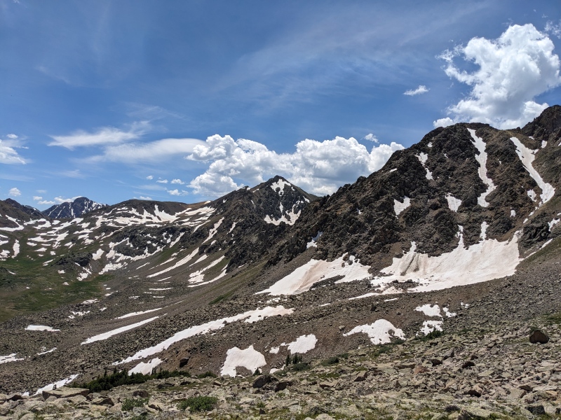
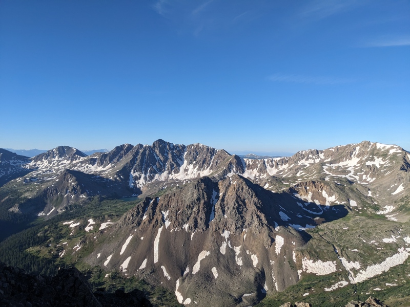
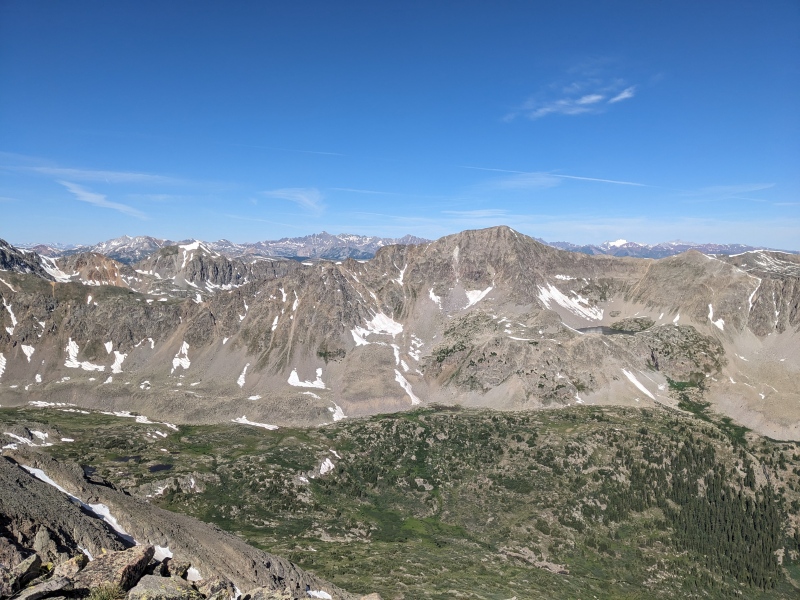
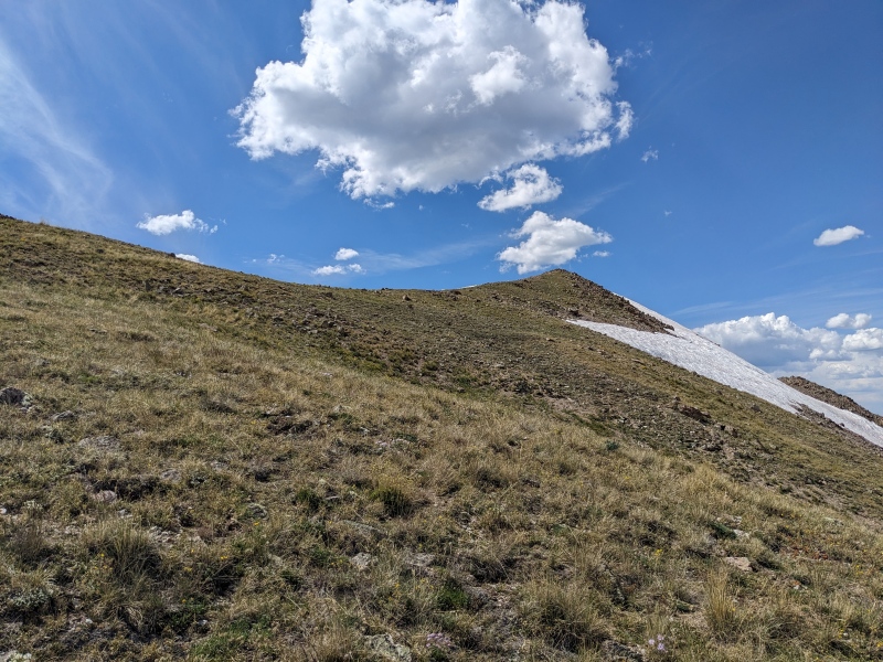
Once at the top of the notch in the ridge, a true scree ski refilled my shoes with rocks and brought me to the bottom of the basin. All that remained was a gentle 1100 foot climb up a grassy shoulder to Tellurium's west ridge, then a short hike to the top. A honey stinger gummy packet inspired my tired legs to push onward, and I surprisingly speedily summitted Tellurium, peak number five! This one felt good, as it meant all of the unknowns and hard parts were behind me. I celebrated with more Ruffles. 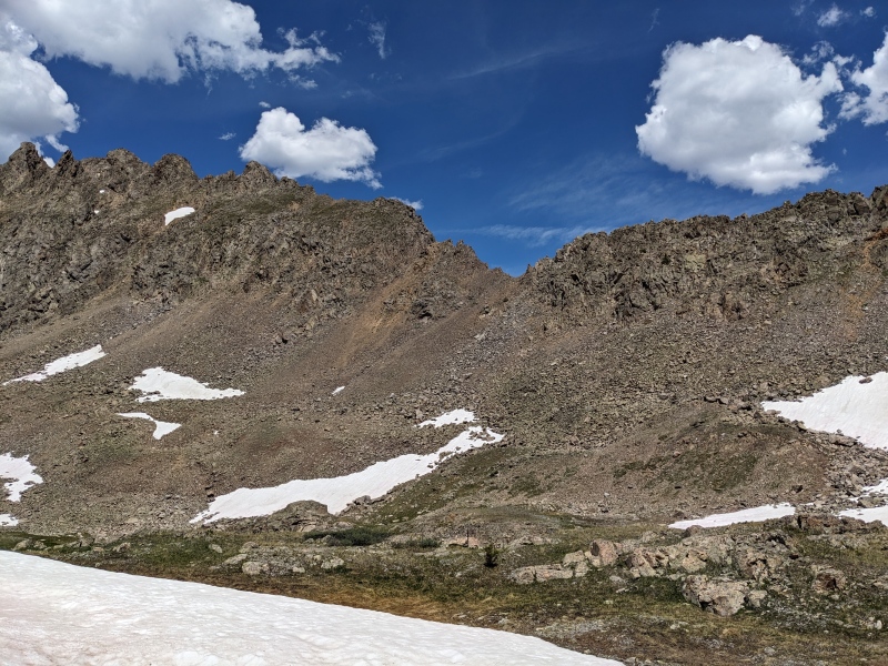
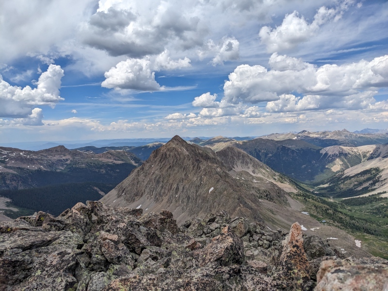
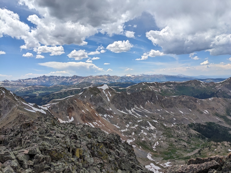
The route to W Tellurium sadly had more ups and downs than I wanted (two more, to be exact). The ridge up and down the first point had some mild scrambling, whereas the second point had less. A short rocky descent and I was at the base of W Tellurium, staring at my last uphill of the day. I meandered around a couple of rocky outcroppings and trekked up the last grassy section to the summit of W Tellurium, the last summit of the day! I ate the last of the Ruffles, fired off a couple of texts, and finally set off downhill for the last time. 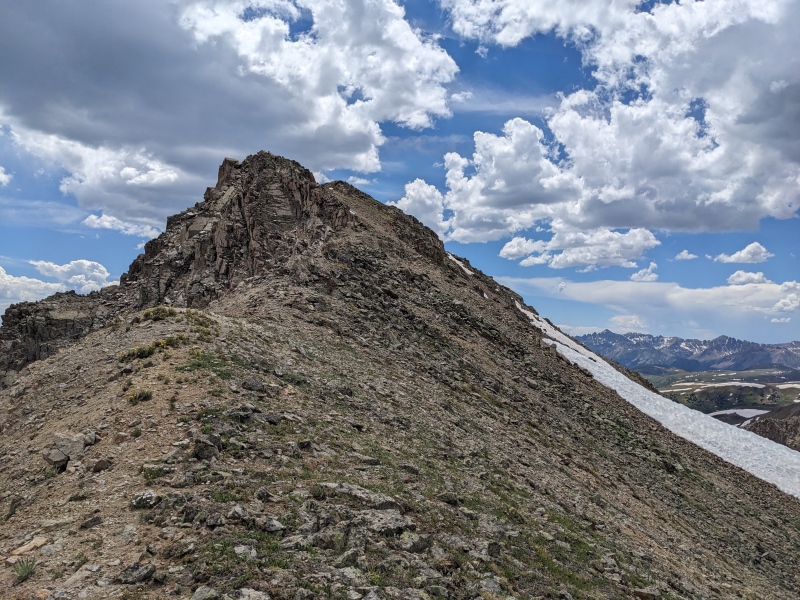

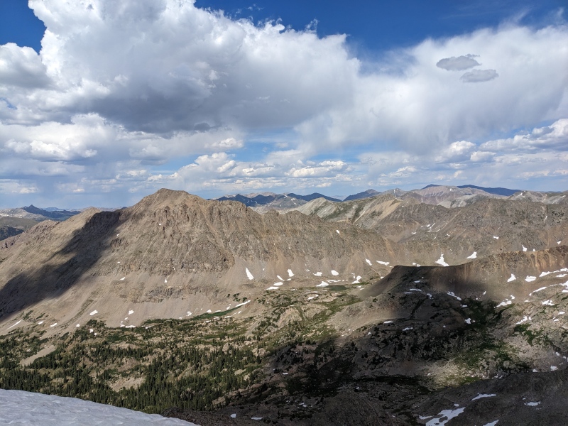
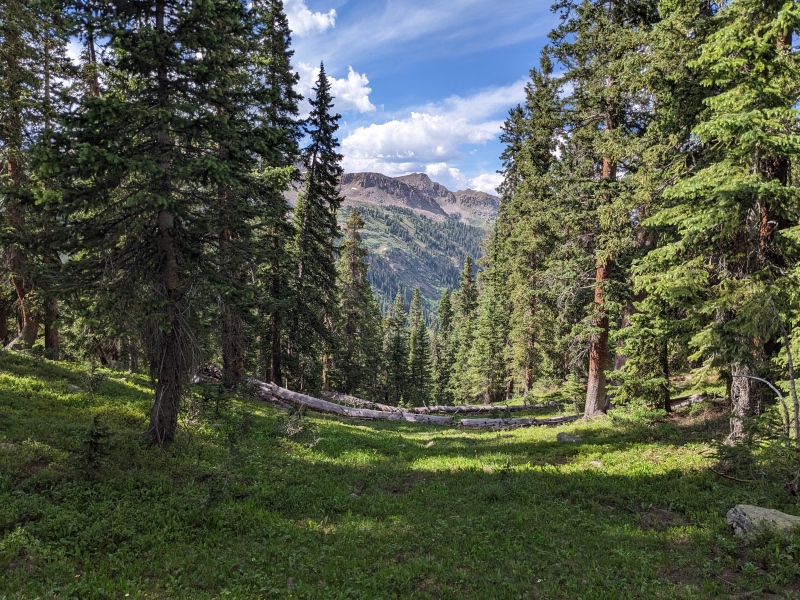
I elected to use the New York Basin descent outlined in eskermo's report, as it sounded better than a bushwhack down Brooklyn Basin. I descended the west ridge of W Tellurium to the first saddle, then dropped down a short snowfield into the grassy basin. There were lots of marshes and ponds in the area, but the descent angle was gentle and there were no cliffs, so travel was fast. Below treeline, the forest was much more open than the bushwhack to the Truros, and I was able speed downward despite there being no trail in the upper basin. 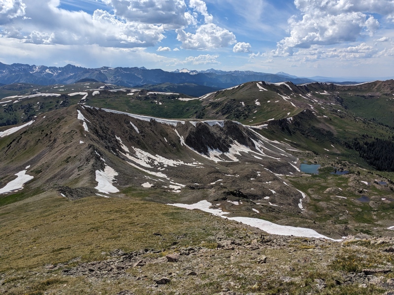
I was aiming for a trail that Gaia showed on the map called the NY Creek trail. I came to the spot on my app where my location intersected the trail....no trail. I figured it just wasn't strong enough yet and I'd find it a bit further down the basin. I went down the basin further...no trail. I wandered left, right, up, down...no trail. But there were willows. Gaia insisted there was a trail through the willows, but all I ever found was willows and marsh. Eventually, I gave up looking for the trail and went path of least resistance. Problem was, the choices were still either willows or marsh. I chose marsh, but even that resulted in a lot of willow bashing and wet feet. After about a half mile, I finally happened upon a meadow, providing a respite from the suckfest. A few steps into the meadow, and what did I find? A trail! But not a trail heading down the basin, as one would expect. No, this trail was perpendicular to the basin and the creek. I figured that any trail was better than what I was currently doing, so I followed it toward the creek. Immediately it crossed the creek, so I did too. And as soon as I did, I found THE trail, the fabled trail, strong as can be, on the opposite side of the creek that Gaia indicated. Argh! Better late than never. The trail stayed strong and rapidly increased my pace. I followed it until I reached the aqueduct service road, turned right, and followed that for almost 2 miles to the Tabor Creek trail. A quarter of a mile later I was splashing across Lincoln Creek, 50 feet from my car. 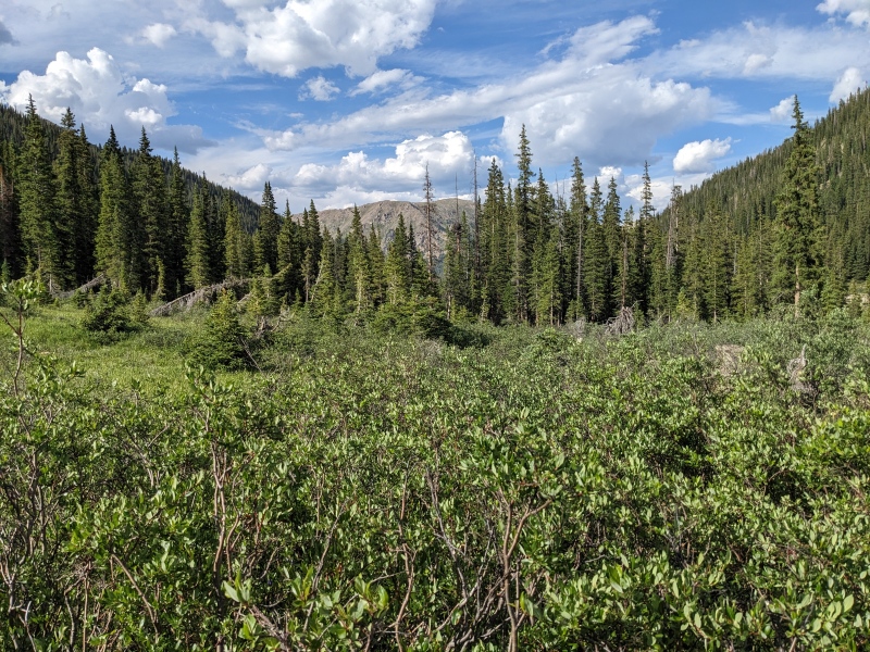
My goal with this day was to see challenge myself and to see if I could link up these six peaks in one go. Mission accomplished on both fronts! I'm not sure combining them is any easier than just doing them separately on the same day (Truros from upper Lincoln Creek Rd, Telluriums from Tabor Creek TH), but it certainly was cooler and more aesthetic. At the end of the day, I was just grateful for the opportunity to play in the mountains and the success I had. And maybe someday, I'll have a new little hiking partner to keep me company. Thumbnails for uploaded photos (click to open slideshow): ")
")
")
")
")
")
")
")
")
")
")
")
")
")
")
")
")
")
")
")
")
")
")
")
")
")
")
")
")
")
")
")
")
")
")
")
")
")
")
")
")
")
")
")
")
")
")
")
")
|
| Comments or Questions | |||||||||||||||||||||
|---|---|---|---|---|---|---|---|---|---|---|---|---|---|---|---|---|---|---|---|---|---|
|
Caution: The information contained in this report may not be accurate and should not be the only resource used in preparation for your climb. Failure to have the necessary experience, physical conditioning, supplies or equipment can result in injury or death. 14ers.com and the author(s) of this report provide no warranties, either express or implied, that the information provided is accurate or reliable. By using the information provided, you agree to indemnify and hold harmless 14ers.com and the report author(s) with respect to any claims and demands against them, including any attorney fees and expenses. Please read the 14ers.com Safety and Disclaimer pages for more information.
Please respect private property: 14ers.com supports the rights of private landowners to determine how and by whom their land will be used. In Colorado, it is your responsibility to determine if land is private and to obtain the appropriate permission before entering the property.