Download Agreement, Release, and Acknowledgement of Risk:
You (the person requesting this file download) fully understand mountain climbing ("Activity") involves risks and dangers of serious bodily injury, including permanent disability, paralysis, and death ("Risks") and you fully accept and assume all such risks and all responsibility for losses, costs, and damages you incur as a result of your participation in this Activity.
You acknowledge that information in the file you have chosen to download may not be accurate and may contain errors. You agree to assume all risks when using this information and agree to release and discharge 14ers.com, 14ers Inc. and the author(s) of such information (collectively, the "Released Parties").
You hereby discharge the Released Parties from all damages, actions, claims and liabilities of any nature, specifically including, but not limited to, damages, actions, claims and liabilities arising from or related to the negligence of the Released Parties. You further agree to indemnify, hold harmless and defend 14ers.com, 14ers Inc. and each of the other Released Parties from and against any loss, damage, liability and expense, including costs and attorney fees, incurred by 14ers.com, 14ers Inc. or any of the other Released Parties as a result of you using information provided on the 14ers.com or 14ers Inc. websites.
You have read this agreement, fully understand its terms and intend it to be a complete and unconditional release of all liability to the greatest extent allowed by law and agree that if any portion of this agreement is held to be invalid the balance, notwithstanding, shall continue in full force and effect.
By clicking "OK" you agree to these terms. If you DO NOT agree, click "Cancel"...
After rolling up Friday night, Dad and I met up with Don around 4:30, and we started running from his apartment at about 4:45. It was about 1 mile to the trailhead from his place in Frisco. As soon as we started running I knew I was in trouble. I looked to my left: My Dad, varsity soccer player at School of Mines in his day, still a fast runner. I look to my right; Don, All American cross country runner placing top 8 in college nationally, still does huge runs at sub 5 min miles. Then there is me. I rock climb. I hike. I occasionally mountain bike. I ski a lot. But I never run. Oh, and in case things were still looking ok, I had (still have) a badly injured IT band and I should have been doing anything but running.
We were doing the Tenmile Traverse, a linkup that starts in Frisco and ends in Breckenridge, summiting Royal Mountain, Mt. Victoria, and Peak 1 through Peak 10. Only 5 of the twelve peaks have the magic 300 feet of prominence, but ten of them rise above 12,500 feet, including 3 rising over 13,000. The initial peaks are graced with trails, the latter coated in tundra, but the ridge from Tenmile Peak to Peak 4 offers some of the best scrambling in the Tenmile.
Tons of beta and great TRs already exist on this site and others for this traverse, so I do not feel that it is necessary to outline every turn and feature, but I will describe our experience, drop my favorite pictures, and give some insight into the scrambly portion of the traverse from Peak 1 to Peak 4, most specifically, The Dragon's Back Variation, which I highly recommend to anyone who enjoys a good scramble or wants to work on their comfort with exposure.
The trail up Royal Mountain is relentlessly steep, with loose gravel and slippery tree roots. This was great news for me because it meant the others couldn't run. From the standard TH, we reached the summit of Royal Mountain after about 35 minutes.
Royal Mountain around dawn.
The trail up Mt. Victoria is a little better than that up Royal, but it is still really steep and densely forested until 11,500 feet where treeline nears, the trail becomes more gentle, and the views really open up. The wildflowers were really nice through here, too. The switchbacks up Peak one start quickly and climb to 12,100 feet with occasional sections of class 1+ talus. After several pitches of less steep ridge, the upper ramparts reared just as we enjoyed the sunrise.
Coming into the upper ramparts. This is the end of the "trail hiking" for a while
From here, a gully on the right side bypasses all difficulties. I have read multiple accounts of this being class 3. I fear those climbers may have been off route because it was steep but really just class 1+. After regaining the ridge crest to bypass some snowfields, we reached the summit of Peak 1 at 6:45, two hours from Don's apartment, a little less from the TH. We stopped to put on sunscreen and have a snack, then got on our way.
Peak 1
We descended towards Peak 2 directly on the ridge crest. There looked to be some class 1+ grass on the left, but we opted for the more enjoyable class 2 boulders.
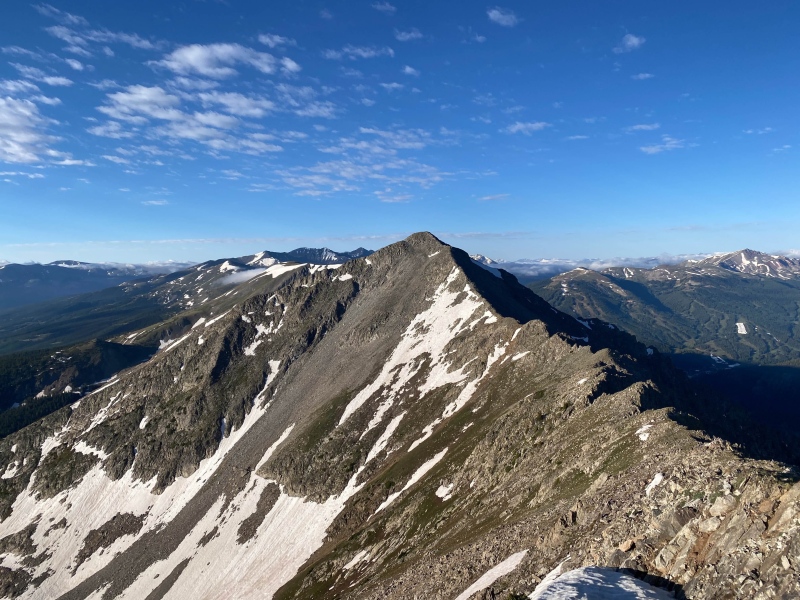
Looking to Peak 2/ Tenmile Peak
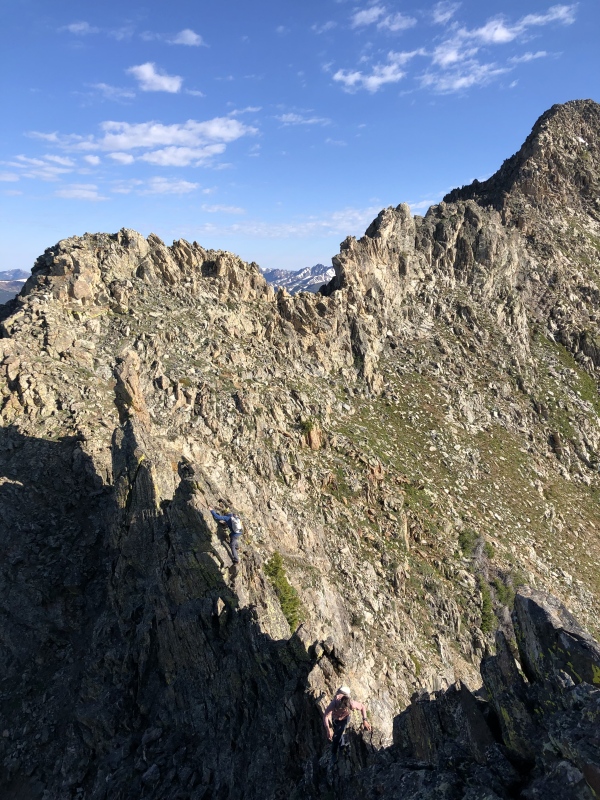
The ridge getting up Tenmile Peak offered the first scrambling of the day, though it was quite gratuitous. Class 2 boulders formed the best side of the ridge, but snow mingled amongst the rocks and the ridge went at class 2+ with a couple brief moves of 3rd. It took us about 15 minutes from Peak 1 to Tenmile Peak, where we saw two groups of ptarmigan and many little pikas and marmots. The first 250 feet off the summit go at class 2 directly on the ridge crest. we then bypassed the first large gendarme on the right side. We wanted to stay on the ridge crest but the choice between 5.moderate on questionable rock and cruiser class 2 was an easy one.
regaining the ridge after the first gendarme bypass.
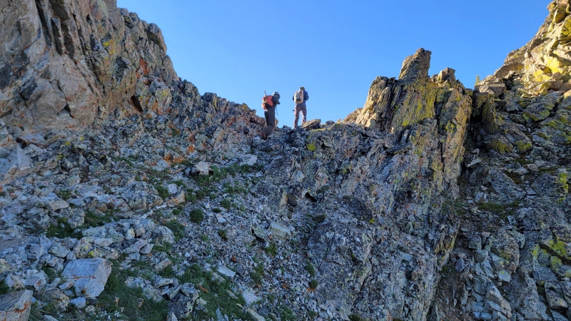
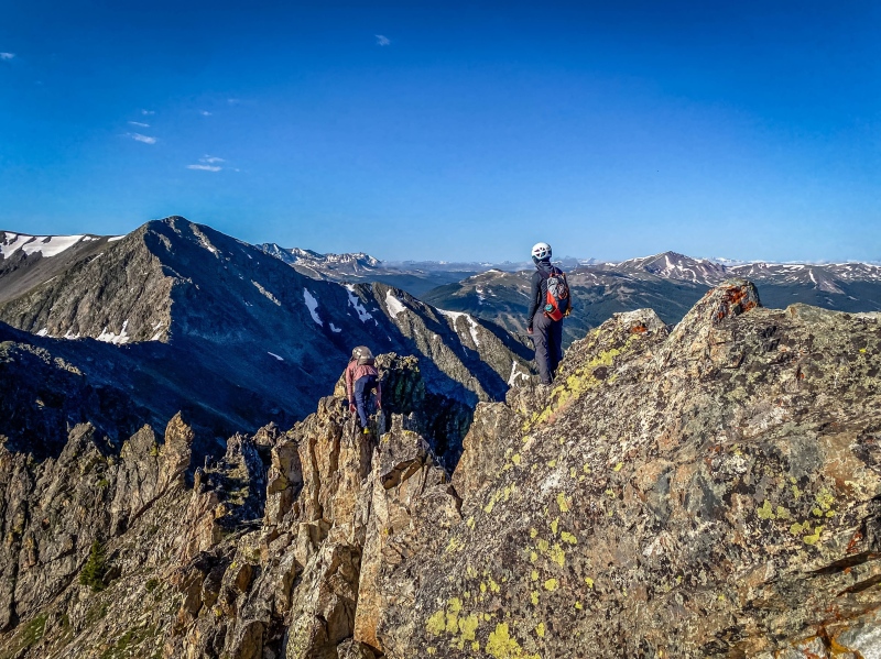
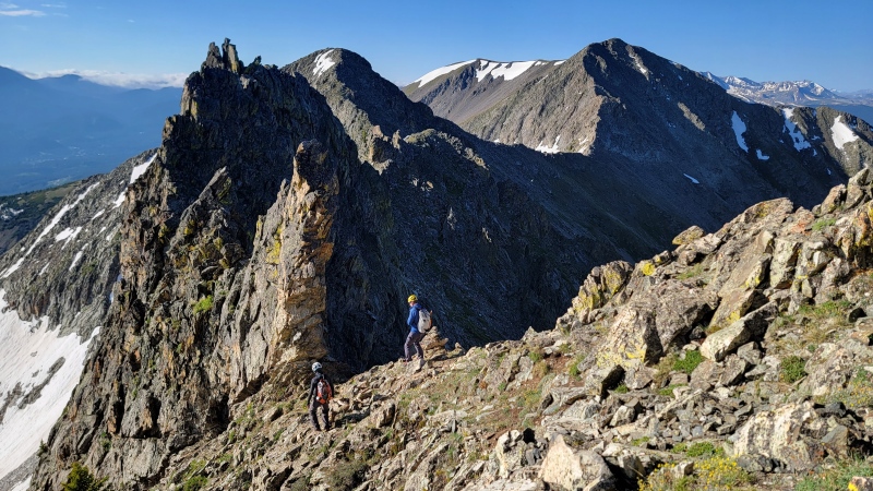
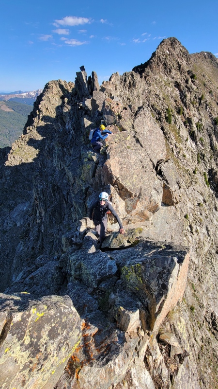
The second tower we ascended directly on easy class 3 blocks. I believe this is what some people are calling "Peak 2.5". The next 200 feet of descending offered the first quality scrambling of the day, with easy 3rd class options on the left, but we stayed right on the ridge for some stable and pleasant class 3 mixed with class 4. As the ridge approaches a small saddle, a final obstacle presents itself. The lower route becomes easy class 2 for a time, while the ridge crest narrows to a dramatic coxcomb. It is very reminiscent of the Eolus Catwalk, although less exposed. It dead ends in a sharp drop. Don down climbed it directly, rating it at 5.2, while I backtracked 30 feet and found a 3rd class option off the east side. Either way, we reached the saddle between "Peak 2.5" and "The Dragon". From here, many parties opt to bypass the Dragon on the west side, following class 2 talus. Although expedient, this bypasses the best part of the day.
Fun climbing off of "Peak 2.5" with peak 4 in the distance
Starting the coxcomb after a 4th class down climb.
Below: Don on the end of the coxcomb
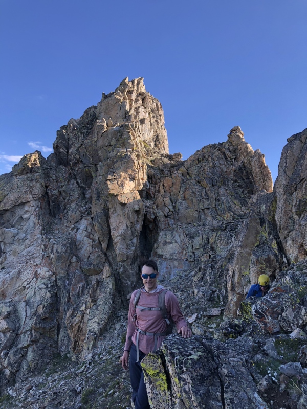
At the base of the dragon, drop right for the class two bypass
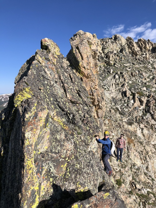
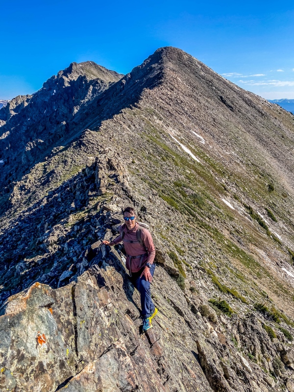
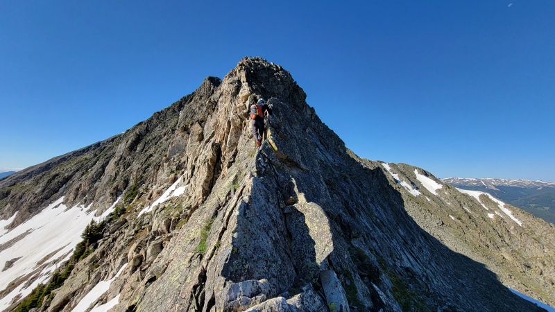
From the small saddle, we opted to climb the Dragon's Back Variation, climbing directly over the Dragon rather than bypassing it. We didn't know if we wanted to attempt it, but it turned out to be the best scrambling of the day.
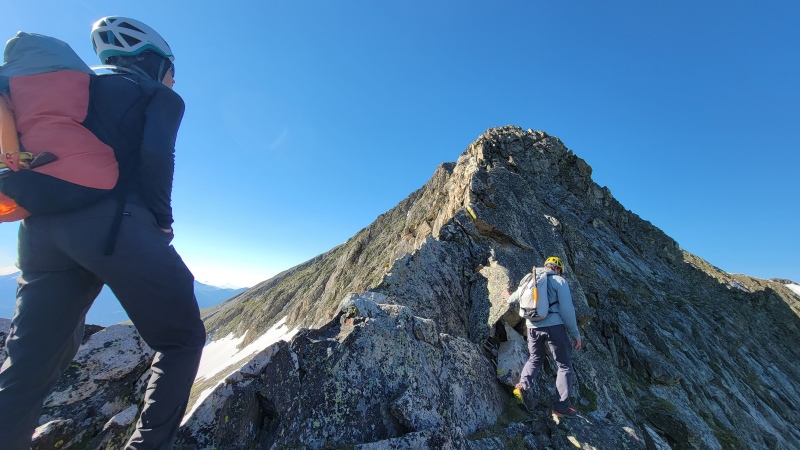
It started with a short 4th class traverse on the left side to gain the spine.
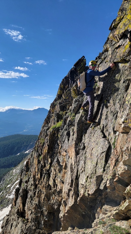
Looking back as Dad follows me up
Another view of Dad on the initial climb.
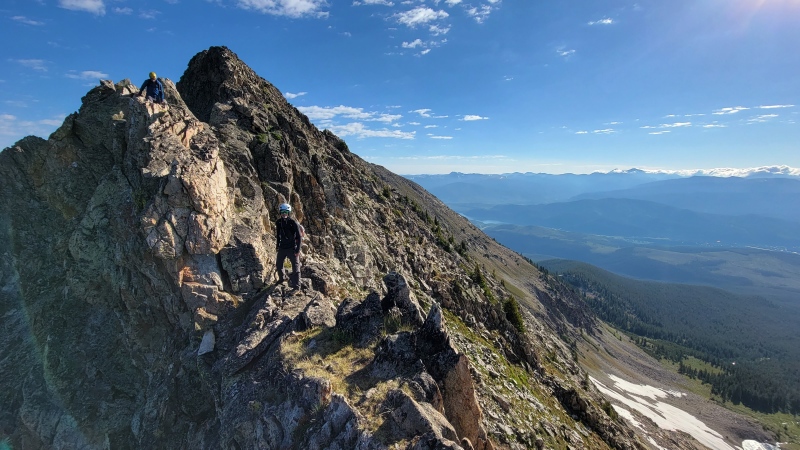
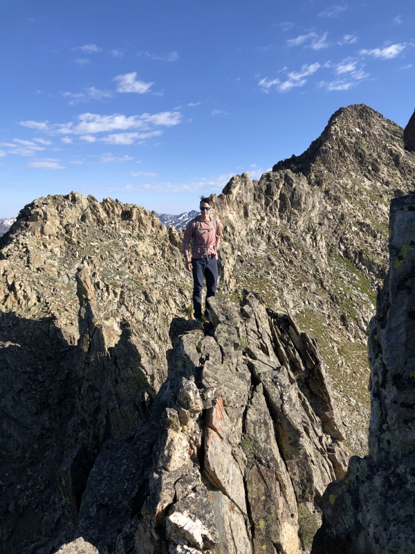
From here, a short but loose 4th class down climb was the first crux, followed by an easier section of dramatic catwalks and blocky 3rd class to a large split block, from which several more 4th class moves on or just right of the ridge crest lead to the crux, a very brief but airy 5.0 down climb with good hands but tricky feet. Tough for short climbers. Beyond here, more 3rd and fourth class lead to a series of down climbs and a short west side talus traverse to reach the saddle with Peak 3. Few ridges I have been on are so confirmative to direct-crest climbing with so few options to either side. Delightfully exposed, wicked steep, and absolutely exquisite.
Don on a Catwalk
Me at the large, split block
Looking back at Don and Dad. Dad is on the first crux here.
Myself and Dad with the crux 5.0 move between us. Split rock visible behind us
traversing back to the ridge crest after the two final down climbs (pictured; first in sun (class 3+), second in shade (class 3-))
Some quick class 2 brought us to the summit of Peak 3 where we took another break. We then dropped down 200 feet of easy class 2 to the saddle with peak 4. From here, the last portion of scrambling lead 450 feet up to the summit. Loose class 2 junk was always an option to the right for anyone who hates fun, but the ridge crest went the whole way with a couple good knives, one 4th class pitch on solid rock, and mostly cruiser class 2+ and easy 3rd.
Dad bypassing a knife. I did no such thing,.
Don on a nice section of the ridge
Easier than Cap, but still a blast!
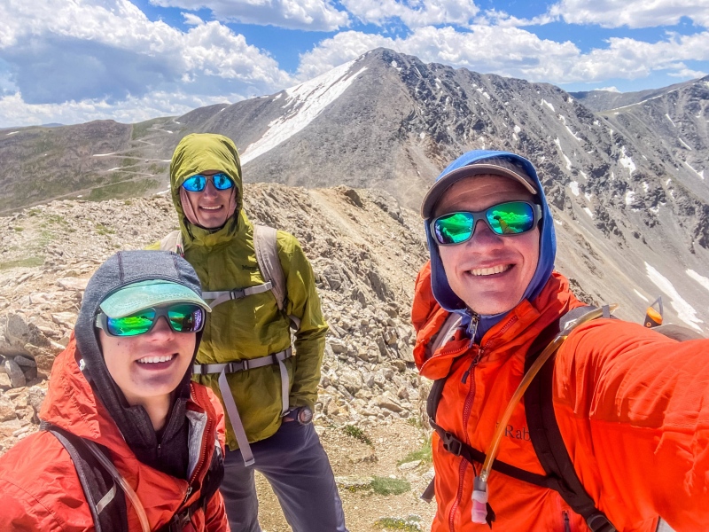
We reached Peak 4 after about 45 minutes from Tenmile Peak, about 3 hours and 20 minutes from the TH.
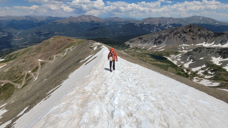
From peak 4, a very sad view. I want more scrambling!
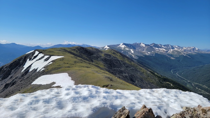
Once we hit the tundra, Don took off running, but with my IT band I decided to walk. dad was kind enough to hang out with me. Peak 5 is super quick, but then the descent to the CDT kind of dragged on. the hardest part of the day for me was getting up and over peak 6, but then we had a snack and I felt better. the saddle between Peak 6 and Peak 7 is the low point between Peak 1 and peak 10, so climbing up to 7 then 8 sucks with almost 1,000 vertical feet. The ridge from peak 4 to peak 8 is 4 miles of boring tundra. It is gorgeous but drags on.
Tired on peak 8. 9, 10, Crystal, and Pacific in the background.
Peak 8 to peak 9 is super long, dropping 600 feet then reascending 800 over a frustrating 2 miles of ridge. We had 40+ mph wind here which sucked the energy out of us. Morale was low, but the end was growing near.
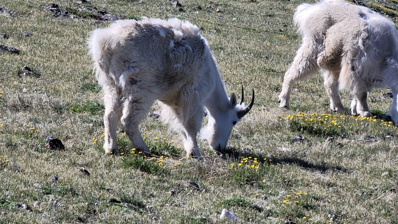
Locals
Peak 9! One left
Ok, so if you have read any TR's on this, you know that trying to ascend Peak 10 directly will result in a slow and painful death by hopelessly loose talus. We climbed it without problem in high wind. It is very stable, I don't know what people think the problem is.
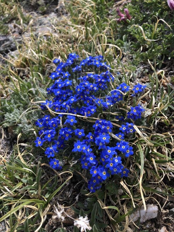
Forget-me-nots
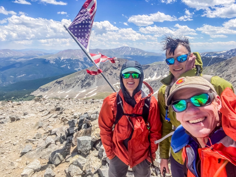
Final summit! Yipee
the only snow patch of the day was descending the east ridge off of peak 10. We did not use tools or traction.
No traction needed
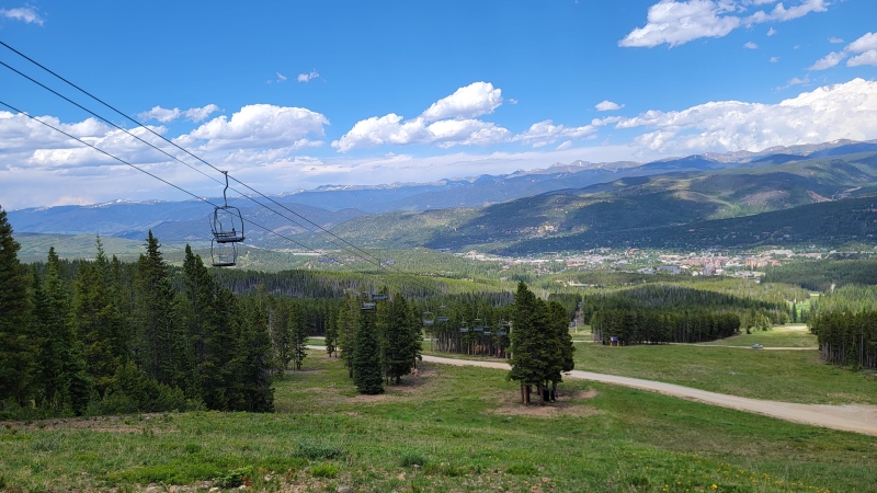
As we descended, I quickly found myself unable to keep up, as fast movement is only possible going downhill if you can bend your leg. I limped out, each step more excruciating than the last. 6 miles from Peak 10 to town, over 7 if you follow the road instead of cutting down the runs. We caught a bus to the main Transfer center, then hopped onto the Frisco bus. the whole ride back we enjoyed magnificent views of our 12 summits.
We had plans to climb something in the Gores on Sunday, but I could no longer bend my leg by the time we got back. A combination of hot tub and ice got the swelling down enough for me to operate the clutch on the drive home, but I knew the road to recovery wasn't't going to be easy, and with a two week Wind River trip coming up, I need to figure this out, and fast. If anyone has any tips, favorite stretches, etc. I am all ears. The thing hurts.
Walking down Breck. "Ow. Ow. Ow. Wait up! Ow."
Final thoughts: Really a fun traverse until peak 4, then kinda of long and boring. My recommendation would be to follow the route we took over Peak 1, accross the Dragon's Back, and then from Peak 5 take the CDT back to Frisco. This eliminates the need for a shuttle, skips the boring and loose parts of the traverse, and makes for a nice 13 mile day, where none of the ridges best features are missed. If you have never done the whole thing though, it is worth doing once for the aesthetic of climbing Peaks 1-10.
Thumbnails for uploaded photos (click to open slideshow):
I have had IT band problems in the past and mostly gotten over them (fingers crossed). It is likely person-to-person dependent, so you may have a completely different case, but mine stemmed from muscle strength imbalance and lack of engagement of the glute muscle and over-relying on the quad muscle. This led to tension and stress on the IT band, causing pain around the outside of the knee. I was diagnosed at PT and given some specific strength training and form/technique tips that fixed my issues over the course of a few months. This was 5 years ago and I have not had significant issues since then, minor flare ups from overuse. In terms of a solution for the upcoming Wind River trip (awesome btw), I would do lots of stretching and foam rolling to loosen it up. For me, trekking poles made the problem way worse and I have almost entirely stopped using them, others swear by them, again person to person. For a long term solution, I would recommend seeing a PT over internet advice. Best of luck!
Is a good recommendation. Exactly what I did years ago. I was trying to do the whole traverse, but got chased off the ridge by an approaching storm. So, I dropped down to the CT and made my way back to the TH at I-70. You're right about the boring part after PK 4, so I wasn't complaining about having to abandon my plans. Sometimes it can be tough hanging out with the old man! Nice job on that!
I don't use poles either. I think it hinders the development of balance by relying too much on them for your balance. I've seen too many people fall when poles slip. Nasty falls too. I only use them in the winter when balance can be tricky.
Ive had IT band issues in the past myself. For me I believe it was using the outside of my feet too much during exercise as confirmed by a gait analysis with a PT. Relearning to activate my arch and big toe with big toe dominate calf raises and a MOBO board have been exceptionally helpful. Yin yoga side body opening stretches, lat stretches, and pigeon pose / piriformis stretches helped as well. Hope the PT appointment goes well!
Caution: The information contained in this report may not be accurate and should not be the only resource used in preparation for your climb. Failure to have the necessary experience, physical conditioning, supplies or equipment can result in injury or death. 14ers.com and the author(s) of this report provide no warranties, either express or implied, that the information provided is accurate or reliable. By using the information provided, you agree to indemnify and hold harmless 14ers.com and the report author(s) with respect to any claims and demands against them, including any attorney fees and expenses. Please read the 14ers.com Safety and Disclaimer pages for more information.
Please respect private property: 14ers.com supports the rights of private landowners to determine how and by whom their land will be used. In Colorado, it is your responsibility to determine if land is private and to obtain the appropriate permission before entering the property.


")
")
")
")
")
")
")
")
")
")
")
")
")
")
")
")
")
")
")
")
")
")
")
")
")
")
")
")
")
")
")