| Report Type | Full |
| Peak(s) |
Mt. Columbia - 14,075 feet |
| Date Posted | 07/10/2023 |
| Date Climbed | 07/08/2023 |
| Author | MidsizeAl |
| No Elk (or People) on Three Elk Creek |
|---|
|
Columbia's East Ridge
As I continue to check peaks off of my list, I've become increasingly interested in taking the trail less traveled. As is often mentioned here, the standard route is the standard route for a reason, and using non-standard routes usually adds mileage and vertical gain, more challenging route-finding, and the planning is often more involved. The trade-off, of course, is solitude and adventure on busy peaks. But still, I've begun to view these added "costs" as benefits themselves. With Columbia still on my list, and having recently climbed Harvard from N. Cottonwood Creek last fall, I started digging around for some alternative options. And wouldn't you know it, on Columbia, there are quite a few! I read a couple of reports about the SE Ridge, and some others about Frenchman Creek, both of which seemed kind of fun, but after flipping through Roach's book, I came across his entry for the East Ridge from Three Elk Creek, which he described as the "Cardinal Colorado Climb". There weren't any GPX tracks I could find, and though I found a couple of reports on here that describe this route, they are sparse and infrequent. I was instantly sold. Still, I thought, I could make this even more interesting. I plotted a rough route on CalTopo that started from the Harvard Lakes TH, hopped on the Colorado Trail, jumped onto the Three Elk Creek Trail near Harvard Lakes, up into the basin, up the East Ridge, and then down the standard route, forming a nice loop. It would mean some road walking at the end, but only a mile-and-a-half or so. Plus, if the off-trail ascent route wasn't great, I knew I'd have (relatively) easy trail the whole way back. As an important added bonus, I saw that there was a vault toilet up the road from the TH, a luxury that N. Cottonwood, Three Elk, and Frenchman Creeks all seemed to lack. 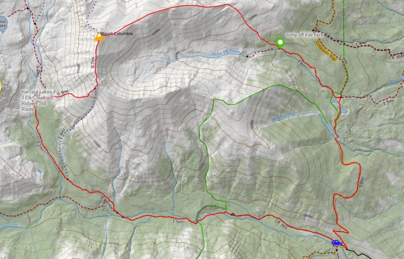
My partner and I left Fort Collins and headed for Buena Vista around 6:30PM on Friday and arrived at the Harvard Lakes TH at 10ish. There were still plenty of spots to park, so I found a nice level area and set up the back of the trusty ol' Subie. The instant I opened the door of the car, hundreds of tiny winged insects and mosquitos flooded in, which led to a frenzy of flailing arms and subsequent bug carcasses smeared on the headliner. Thank goodness we packed the Picaridin Lotion, because I knew this spelled trouble. The alarm went off at 3AM, and after choking down some peanut butter bagels (always a challenge at this hour), we were on the trail at 4AM. Just as I had expected, the bug situation was grim. As the only light-bearing subjects in the dark, we were open for business to all moths, mosquitos, and gnats, and they were thrilled. 
After ascending the first steep couple of switchbacks of this segment of the CO Trail, it flattened out for the next couple of miles as it contours around Columbia's SE Ridge and, before we knew it, we were at Harvard Lakes. It was incredibly still. There was a low layer of clouds above us, which made for a very moody morning. 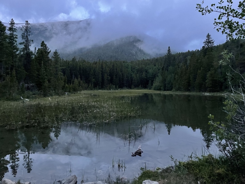
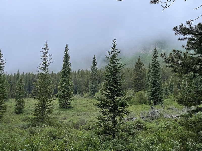
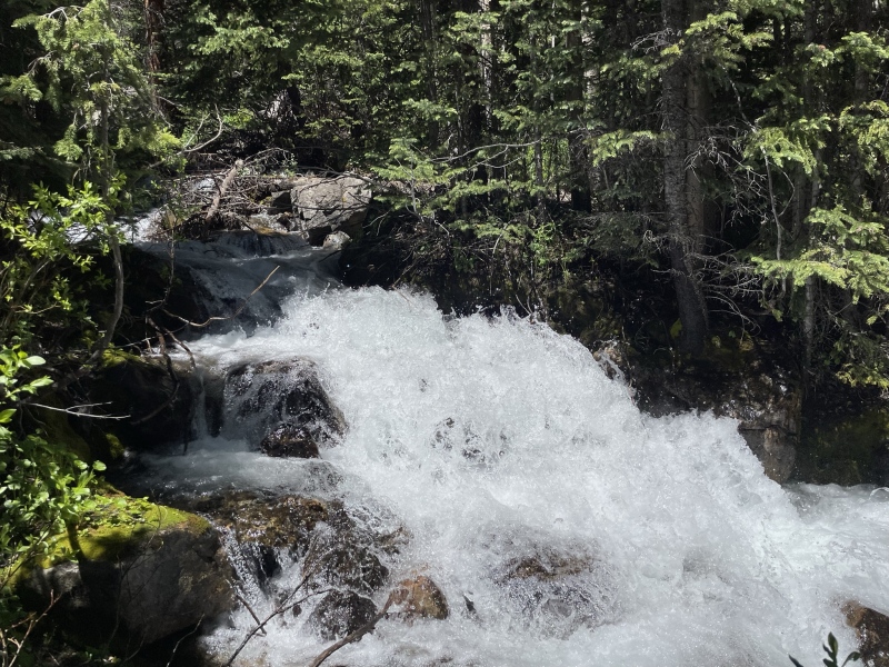
We headed up the Three Elk Creek trail, which was clearly seldom-used. There were a few horseshoe prints, but I didn't spot a single boot or trail-runner tread, and the forest had begun to reclaim the trail in spots. Three Elk Creek was roaring loudly. The trail crosses it a few times on some conveniently-placed logs. The one in the picture below was neat to spot, since it is also pictured in another TR from 2013 from user DavidLeVan. The fallen bridge has decomposed less than I would have expected in 10-years! 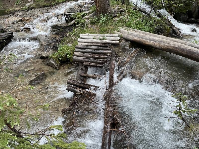
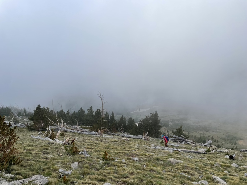
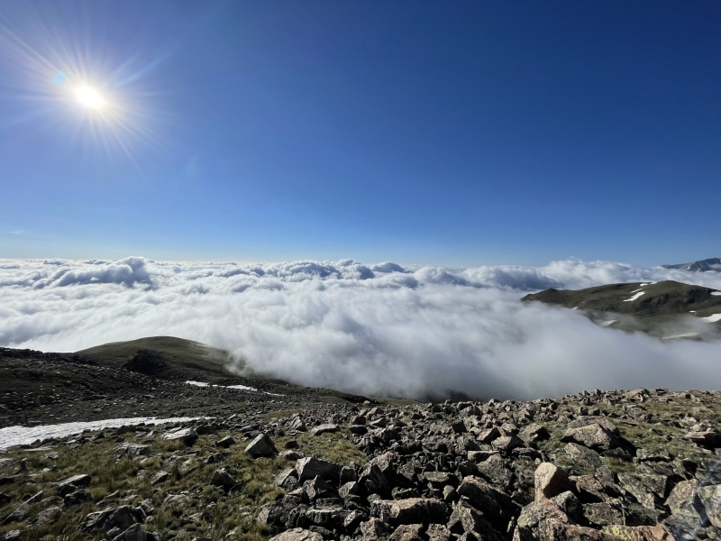
I had read from several reports that an early ascent of the ridge is better than a later one, because the slope becomes steeper and looser the further one hikes into the basin. I had plotted a spot to split from the trail in CalTopo, which looked pretty gentle, and also would hopefully not be a bushwhack-y nightmare. On satellite imagery, the forest looks like it thins here, but when we reached it, it became clear that this was not the case. What appeared to be open spots in the forest were actually just leafless groves of aspen trees in the satellite pictures, which were much denser than I anticipated. Additionally, we were now on the south side of the creek, and needed to cross it to gain the ridge. We stuck close to the creek to find an opportune crossing, and eventually came upon a decomposing log that had been placed by someone before us. It looked uncomfortably flexible, but it better than nothing. I marked the spot with a GPS waypoint for the return trip, and quickly hopped across. My partner followed, but the log wasn't having it. It snapped and dropped her squarely in the creek. She was not happy. At least it was reasonably warm! The clouds began to break to our west, bathing the upper basin in sunlight, the first we had seen all day. Bizarrely, the clouds seemed to roll in and out of the basin, occasionally hanging in the upper bowl, before retreating again like waves on a beach. For reference, the two pictures below were taken only 4-minutes apart! 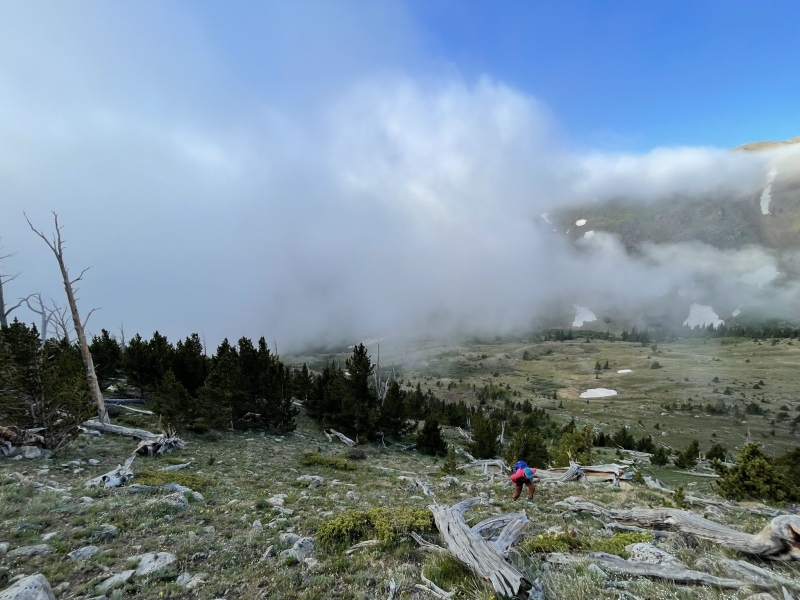
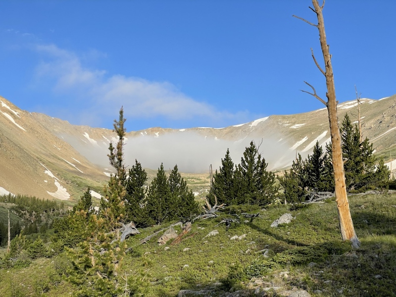
I started to get excited, because it seemed like we might be in for a cool inversion, which I've never had the privilege of experiencing from above. We spotted a place that skirted most of the dense trees to the West and headed up the ridge. It was steeper than the above pictures suggest, but we gained the ridge in a short amount of time. We were greeted by one of the most incredible sights I've yet experienced; a thick inversion to the East and to the South as far as the eye could see. Watching the sea of clouds roll and flow beneath us with blue skies above was an unforgettable treat. 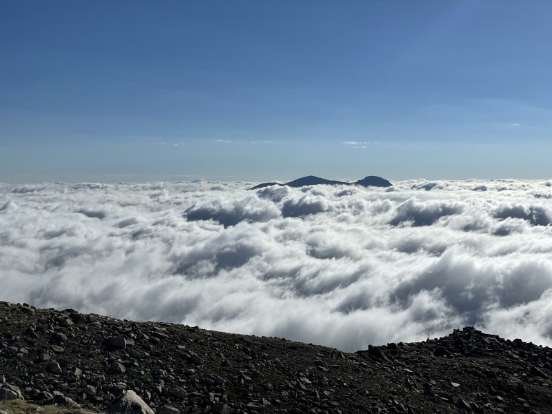
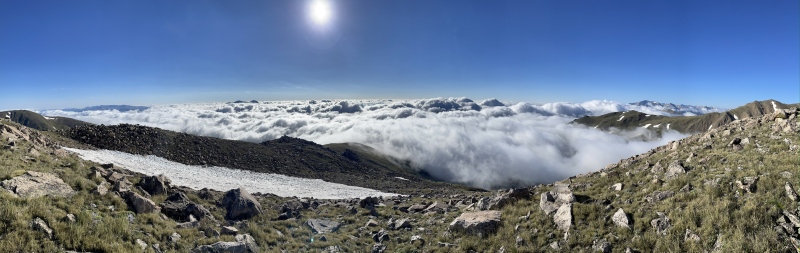
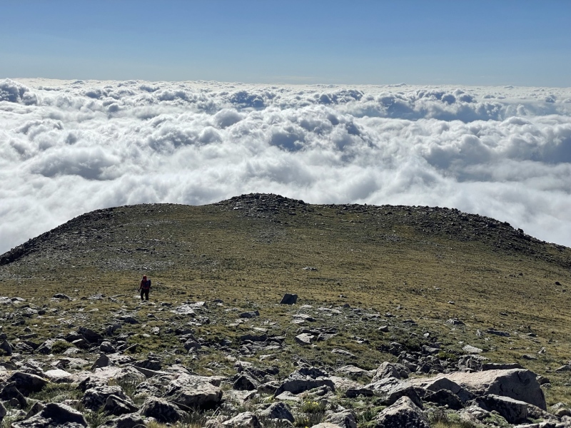
The East Ridge itself was relatively gently, interspersed with grassy tundra and the occasional patch of (mostly stable) talus. There were an impressive number of wildflowers on the ridge, so much so that the air hung thick with their fragrance. The talus on the climb to PT 13,492' was littered with spiders. We did our best to leave their intricate webs undisturbed, somewhat jealous of their lofty homes. It's always amazing to me that such delicate life can endure and thrive in such extreme environments. 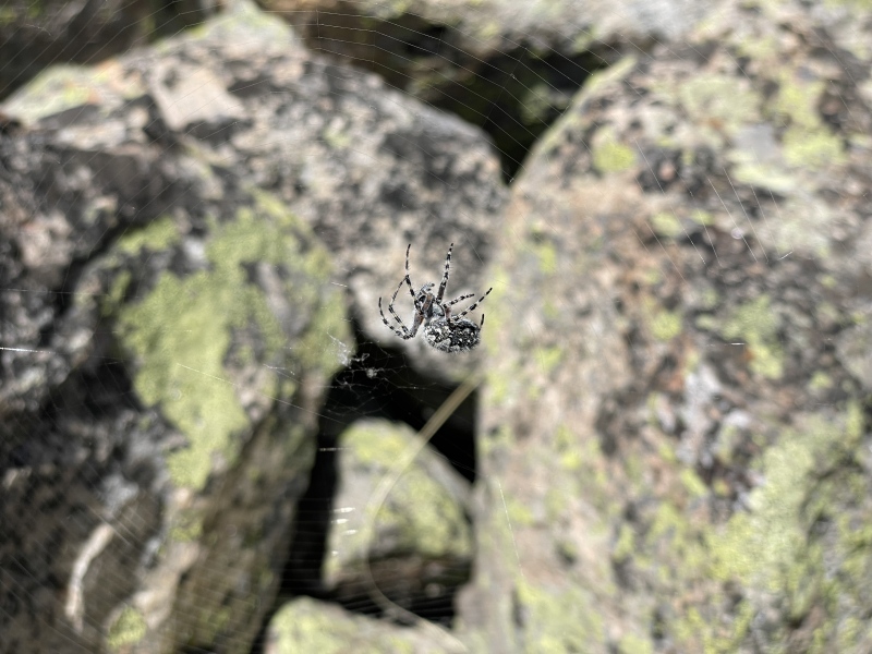
We made short work of the false summits; I was aware of them before we set out, so they weren't much of a bother. The final pitch to the summit of Columbia contained a patchy snowfield, which was unfortunately very soft when we reached it. It was an annoying, albeit short-lived, swim to the top. 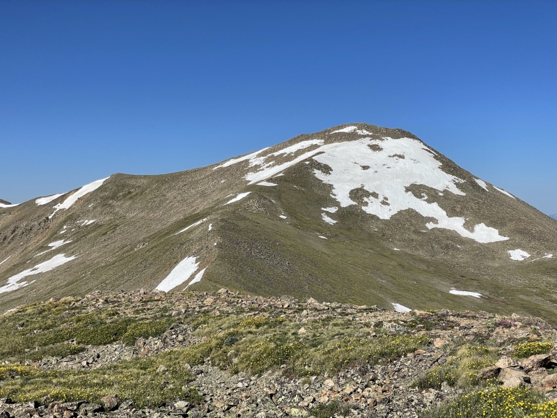
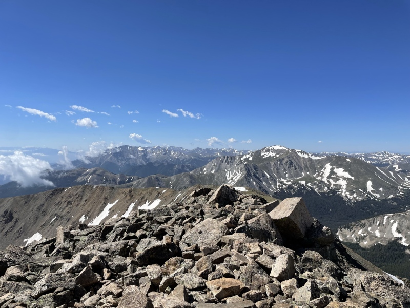
The views of Harvard and the rest of Horn Fork Basin were jaw-dropping. There were quite a few other people on the summit when we arrived, which we had expected, but it was still jarring given that we had been in pure solitude since we had left the car. We didn't linger very long. We agreed that the privacy of our ascent route was far more enjoyable than the thought of descending the rest of the loop, so we decided to just return the way we came. 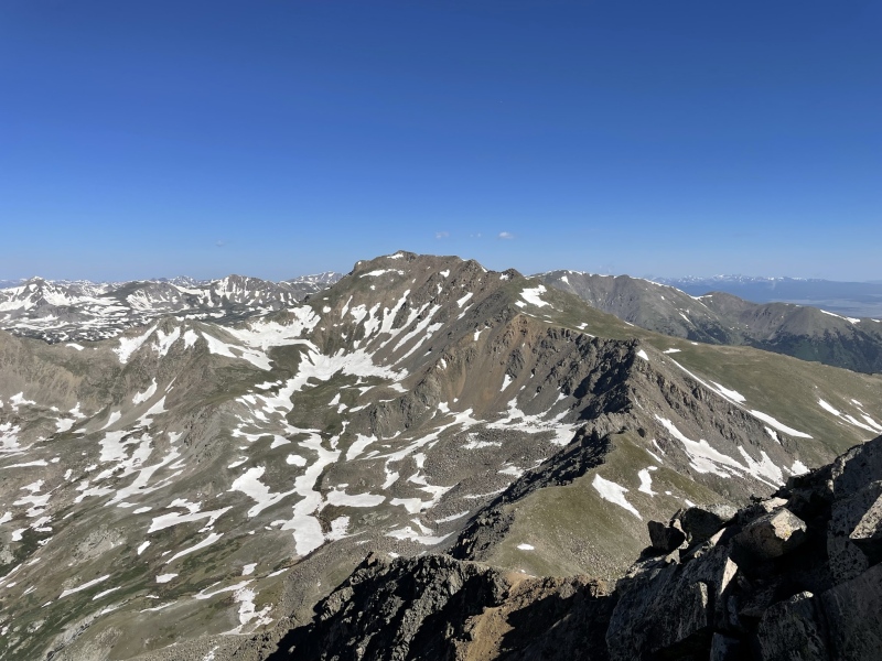
The clouds had mostly dispersed to the South and to the East, so it was nice to finally see some views of the upper Sangres, Pikes Peak, and Buena Vista below. The trip back down the ridge was relatively short-lived, but had more talus than I had remembered. I was probably just too busy gawking at the clouds on the way up to notice. I spotted a nice long couloir that was still filled in and ran ~1,200' back down into the basin, which was miiiiighty tempting, but I did not have an axe for the glissade, and didn't want to tempt fate. 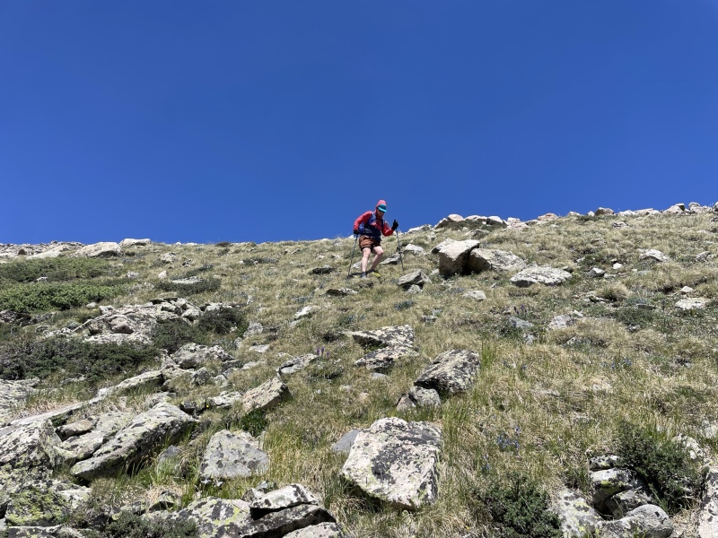
Just above treeline, I felt a tickle on my leg, then on my other leg. I looked down and saw that a cloud of mosquitos had descended onto me. I shouted a few expletives, threw open my pack, and doused myself with the Picaridin lotion (I must have used nearly half of the bottle). It deterred, but did not stop the blood-thirsty malaria-monsters. The entire way back down to the car, they looked for every spot I missed, trying to land on my forehead, my eyelids, my cheeks, and my back. I hate mosquitos, and there were more on this route than any I have experienced before. Knowing that we no longer had a useable log to cross Three Elk Creek where we had this morning, I started scoping out some other options. We headed further south, and were lucky enough to find a shallow crossing, and then some bits of trail. The descent route took us through the Enchanted Forest of 10,000,000 Mosquitos, which had several other upper branches of the creek that needed to be crossed (though much smaller). There was also some deadfall and game trails through this section, making things a little more confusing. All the same, I would recommend this route over the one we chose in the morning. 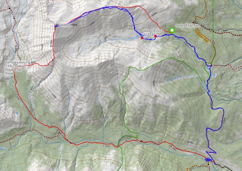
It was a hot, buggy, though overall uneventful return trip to the trailhead. Overall, this was a fantastic route that I would gladly repeat. Was it the "Cardinal Colorado Climb"? I have many other favorites that come to mind, but it certainly gets a place near the top in the Sawatch. It would be interesting to try this from the Three Elk Trailhead, or even from the Frenchman Creek side. I would also try a descent of the SE Ridge back into the basin for another fun option next time. Columbia may not be the most interesting Sawatch 14er, but it offers so many options, and, with some creativity, it can be a blast! Thumbnails for uploaded photos (click to open slideshow): ")
")
")
")
")
")
")
")
")
")
")
")
")
")
")
")
")
")
")
|
| Comments or Questions | ||||||
|---|---|---|---|---|---|---|
|
Caution: The information contained in this report may not be accurate and should not be the only resource used in preparation for your climb. Failure to have the necessary experience, physical conditioning, supplies or equipment can result in injury or death. 14ers.com and the author(s) of this report provide no warranties, either express or implied, that the information provided is accurate or reliable. By using the information provided, you agree to indemnify and hold harmless 14ers.com and the report author(s) with respect to any claims and demands against them, including any attorney fees and expenses. Please read the 14ers.com Safety and Disclaimer pages for more information.
Please respect private property: 14ers.com supports the rights of private landowners to determine how and by whom their land will be used. In Colorado, it is your responsibility to determine if land is private and to obtain the appropriate permission before entering the property.


