Download Agreement, Release, and Acknowledgement of Risk:
You (the person requesting this file download) fully understand mountain climbing ("Activity") involves risks and dangers of serious bodily injury, including permanent disability, paralysis, and death ("Risks") and you fully accept and assume all such risks and all responsibility for losses, costs, and damages you incur as a result of your participation in this Activity.
You acknowledge that information in the file you have chosen to download may not be accurate and may contain errors. You agree to assume all risks when using this information and agree to release and discharge 14ers.com, 14ers Inc. and the author(s) of such information (collectively, the "Released Parties").
You hereby discharge the Released Parties from all damages, actions, claims and liabilities of any nature, specifically including, but not limited to, damages, actions, claims and liabilities arising from or related to the negligence of the Released Parties. You further agree to indemnify, hold harmless and defend 14ers.com, 14ers Inc. and each of the other Released Parties from and against any loss, damage, liability and expense, including costs and attorney fees, incurred by 14ers.com, 14ers Inc. or any of the other Released Parties as a result of you using information provided on the 14ers.com or 14ers Inc. websites.
You have read this agreement, fully understand its terms and intend it to be a complete and unconditional release of all liability to the greatest extent allowed by law and agree that if any portion of this agreement is held to be invalid the balance, notwithstanding, shall continue in full force and effect.
By clicking "OK" you agree to these terms. If you DO NOT agree, click "Cancel"...
Hear ye, hear ye, I have here a report from Deadman Creek, a seldom traveled drainage on the western side of the central Sangre De Cristo mountains. I have always heard that "dead men tell no tales", but alas, I am feeling like spilling a few of the beans after our trip into uncharted waters this fine weekend. Not too many, but just enough. May a weary 14er forum traveler or two find these ramblings moderately intriguing and venture off into the realm of the Deadman on their own.
*Special thanks to Ross who scouted out this drainage several times beforehand so that we had at least some idea of the beatdown we were signing up for*
I arrived at Ross' house in Crestone around 945PM after the typical 'leaving Denver on hwy 285 after work on a Friday' BS. The sleep math was not working out favorably in my head, so I decided to ignore it. Quick game plan chat and off to bed. At least the TH is only 10 minutes away....
"I knew it was going to be a long day when we left the TH at 315AM and immediately started walking downhill in deep sand" - Steve, at some point later in the day.
Group, depicted here, after a 150ft descent in deep sand immediately after leaving the gate
The Sangres are an epic mountain range, and I think I'm fully on the "West Side, Best Side" bandwagon. I like the aesthetics of climbing from the bottom of the San Luis Valley, straight the eff up to the rugged summits. Reminds me of the eastern Sierra. Its hard to put my finger exactly on it, but there's something special about it that you don't get when climbing the Sangres from the east side, not that the east side is a bad choice either. Maybe its the pure joy of bushwhacking on "trail" fragments through mosquito infested drainages after stumbling through the desert in the dark, but maybe that's just me, who knows?
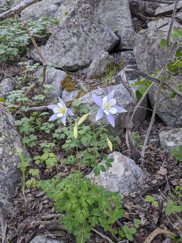
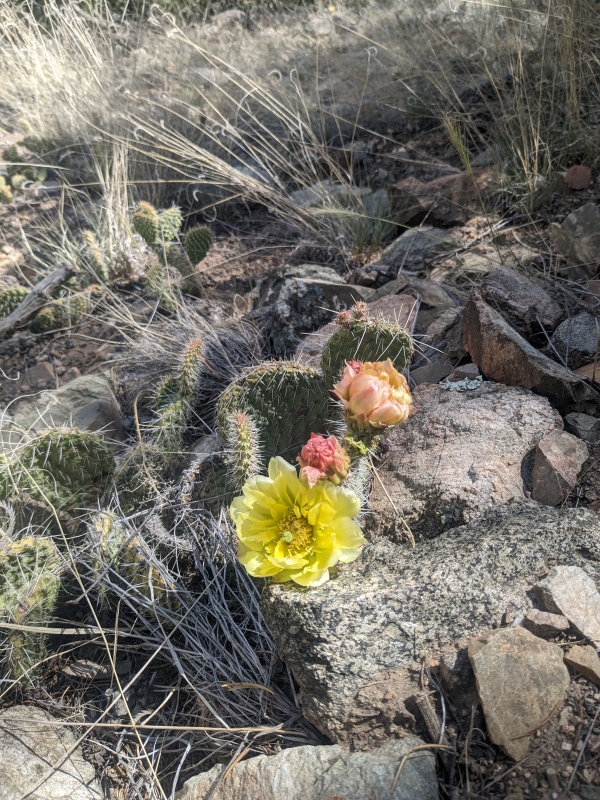
Typical morning views, falling into a rose bush
Particularly for the Cleveland group, a west side approach seems like it would be a great way to do it, but all reports on this site (and others we searched out) come in from Music Pass/Sand Creek Lakes. However, the summit register on Dead Man Peak had a single entry from someone that climbed it via Deadman Creek in 2018. The Cleveland group would require a perfect weather day from Music Pass because after summitting Dead Man Peak/UN13384, one would have to reclimb approximately 2 miles over a ranked peak, a LiDAR demoted peak (296' new, 301' map prominence), and then another unranked, unnamed 13er on moderate terrain before finally being able to escape to lower elevation from weather. This all happening after already putting in the neighborhood of 8 miles and 6k of vertical to get yourself all the way out there. There are no other escapes/shortcuts back to the east side. A somewhat risky proposition ending with a likely uncomfortable bivy if significant weather came in. However, to contrast, coming in from the west side, escape options are also very limited as they involve either some spicy downclimbing back into Deadman creek, a mega bushwhack down Sand Creek, or a bushwhack down Pole Creek through private property. Hmm, I'm not really selling this. Either way, we wanted to come in from the west because Ross basically lives at the TH and he had scouted the approach and deemed it "acceptable".
Typical morning terrain/view.
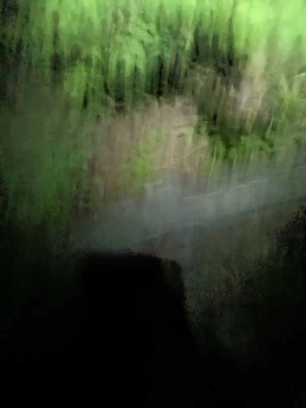
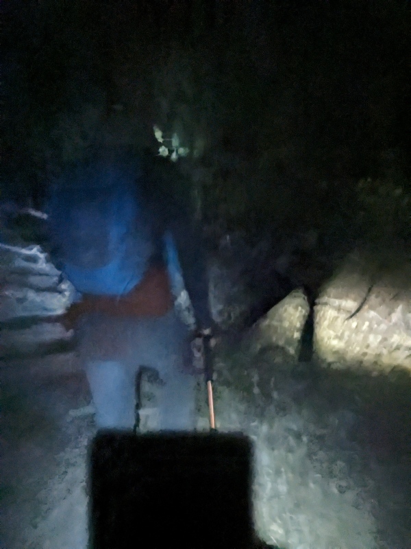
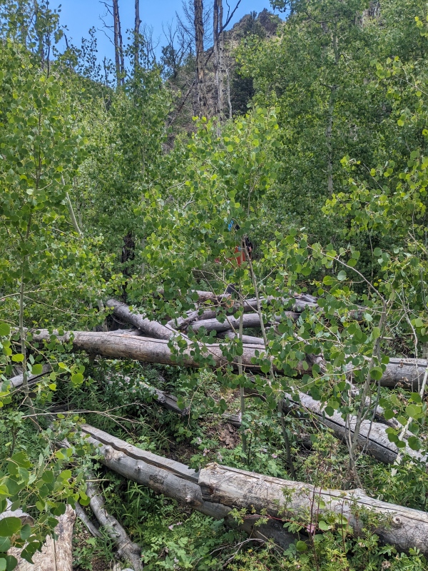
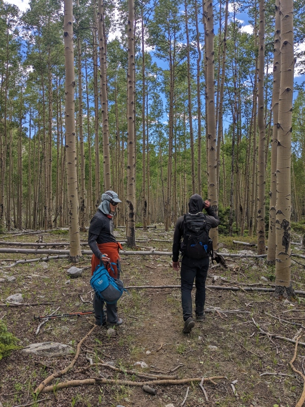
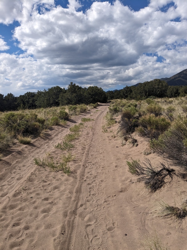
Anywho, we set off from the Liberty Gate at 3:13AM with light packs and a singular goal to get handed a beatdown in the next 12 hours. After about 2 miles at a light downhill/flat grade on the sandy, closed road, we hooked a left up an unsigned trail towards the mountains. We missed the turnoff in the dark, but its really not a big deal because the trail was patchy to begin with anyways. If you hit a major creek/drainage on the Liberty Road, you've gone too far, just hook a left and follow the drainage up until you find something resembling a trail. For a majority of the Deadman trail, you parallel above Deadman creek on the north side. We crossed the creek to the south side and then quickly back to the north side just one time, probably about 1-1.5 miles after turning off the Liberty road. Forest service maps indicate the trail actually spends a fair amount of time on the south side of the creek, we did not. Maps are overrated. In the dark, and also coming back down in the light of day, this trail was overgrown and difficult to follow when down closer to the creek and in the thicker bush. Decent when higher above the creek. About average for west side drainage trails in my experience. Not a full-on bushwhack, but don't expect to be moving at your trail pace either. The deadfall was pretty bad for miles 1.5-3 after leaving the road, photos show typical conditions. At one point, we walked on downed trees 4 feet above the trail for about 30-40 feet, taking the high road literally.
Climbing on top of deadfall in the morning.Climbing on top of deadfall in the afternoon. Goes at Class 3+. Unprotectable with anything but a pink Tricam Evo. Ground fall guaranteed, racking yourself likely, tread carefully
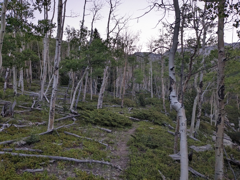
After about 2.5 miles from the road turnoff, the bushwhack eased, the canyon walls widened, and we progressed farther into the upper reaches of Deadman creek. The "trail" was still thin, but much easier to follow at a faster clip. Photos show typical terrain. There were some decent places to camp periodically from miles 4.5-7.5 from the TH if you really want to subject yourself to the musings of the Dead Man.
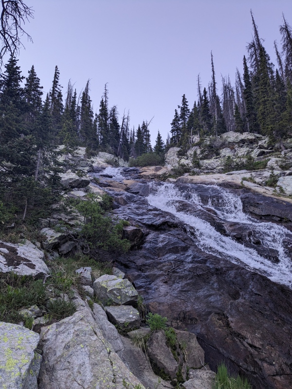
More typical terrain and light trail higher up Deadman creek.noiceCascading water slide coming down out of Deadman Lakes
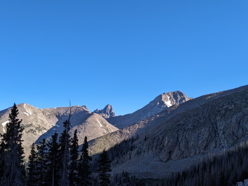
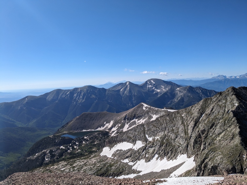
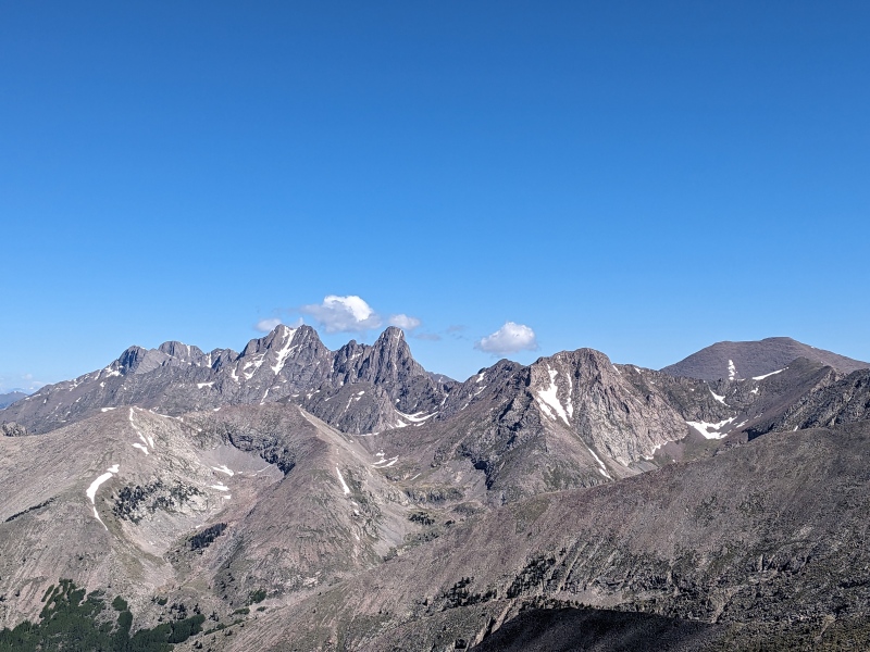
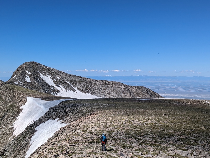
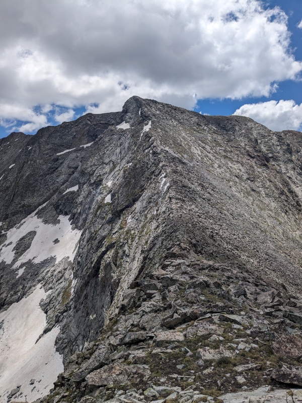
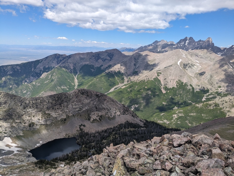
About 6.5 miles into our day, we lost the trail entirely and just continued eastward farther up into the drainage. Speed increased because we weren't wasting time trying to follow the trail. Where Deadman creek forks, we filtered some water and prepared to bushwhack to the southeast to gain UN13401's north ridge. Following some game trails and a few massive cairns, we worked our way up nearly to the lower of the Deadman Lakes. Another water fill-up, as we'd be high up on ridges for the next 4 hours, then we were off, gaining significant elevation up the north ridge of 13401. Some fun slab scrambling and some decent class 2 talus hopping got us to 13401's summit rather quickly after leaving the vegetation behind. About 9 miles, 6k gained in about 7 hours, we reached our first summit of the day. Incredible views of the Crestones, Pico, and the Blanca group. Perfect weather, hardly a cloud in the sky. Summit register was in a cracked glass jar. Someone left a replacement tiny glass jar, so I shoved the paper into there. I left the broken jar because the shattered glass looked like it would shred my pack and end up creating more waste.
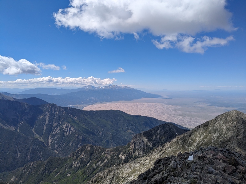
Needle poking out. Pico also making an appearanceLooking up North Ridge of 13401Looking down the north ridge and deep down into Deadman drainage and the SLVSW ridge of Tijeras. In a brief moment of good judgement (gotta take those rarities when they come), we decided to not go for Tijeras, as this ridge looked extra spicy and we couldn't find any beta on it. It would turn this loop into a mega day if it goesCool lake nestled into the east of Cleveland.
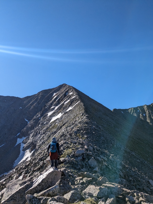
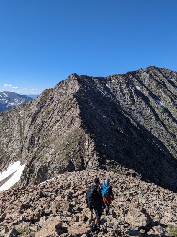
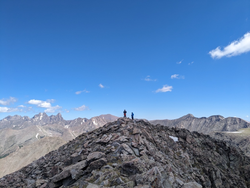
The ridge to Cleveland proved to be our favorite part of the day. We stayed ridge direct the whole way and felt it went at a comfortable class 3. The rock quality was excellent and there were some really fun little catwalks mixed in there with some sizable exposure. A beautiful little scramble. 40 minutes later, we stood atop Cleveland and could see Ross' house 6000 feet below us. More water and snacks, and we were on our way to 13384.
Sizing up Cleveland's ridge, so much fun!One of many catwalks on the Cleveland ridge, exposure higher than it looks in photoFinal push to Cleveland.Great vantage point for some classic 14ers and 13ers
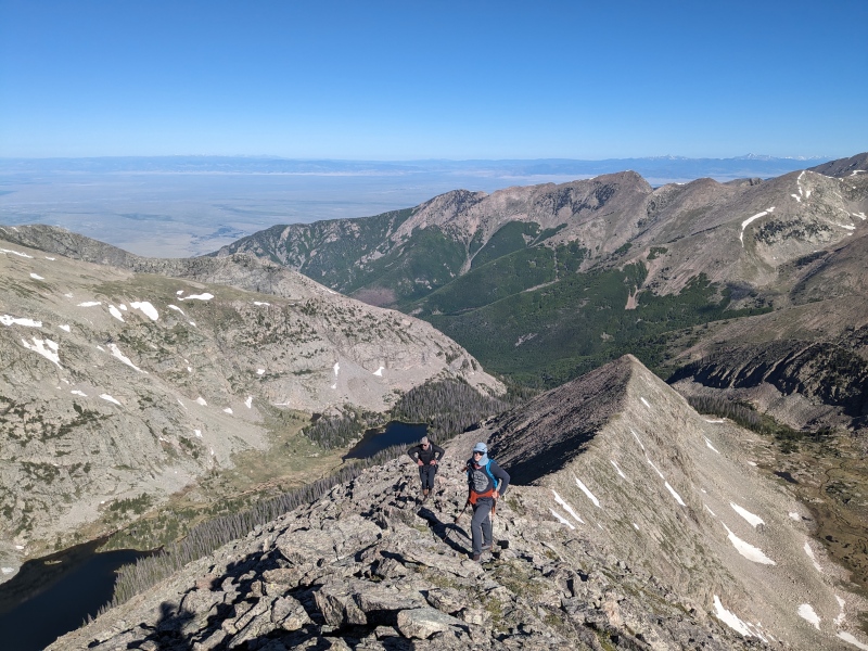
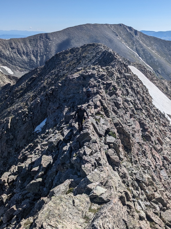
Some more fun little scrambles, class 2+, we made our way to the mini Bear's Playground. Some have been calling this "punting green" I think, but I feel "Koala Bear's Playground" is more apt given the similarities to Bear's Playground to the north. More enjoyable class 2+ scrambling ridge direct brought us to the top of UN13384. Some locals and the summit register have unofficially named this peak "Liberty Peak" FYI. Beautiful views in all directions, particularly towards the sand dunes. We reversed course and headed back to the Koala playground and made our way to our 4th, shortest, and final peak of the day, Dead Man Peak.
Steve charging across the Koala Playground to 13384Sand Dunes shot with Blanca massif from 13384Looking back
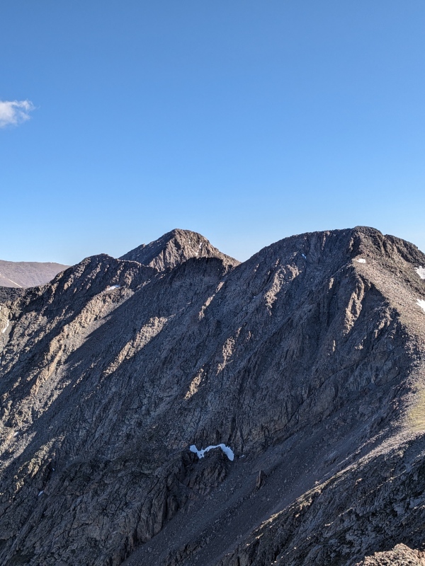
Another enjoyable class 2+ scramble ushered us to the top of Dead Man Peak, legs getting heavier each time. Extreme exposure on the climber's right side down into Deadman basin provided a little extra thrill. At this point, I finished off my water and ate a bunch of food, as we knew that we had a sporty 9 miles, 6k descent back to the car. Only this time, it was going to be hot and absolutely infested with mosquitoes.
Looking back at the massive cliffs coming down from playgroundCrestone group and staring our descent back down into Deadman
We took the north ridge down Dead Man Peak, which was a mix of stable and shift, shitty talus. We dropped off the ridge to the west before reaching its cliffy terminus. It felt good to be back on the forest floor and out of the rocks after such a long day. We filled up some water at the nearest stream (about 11.5k) and were already inundated with mosquitos, now fully realizing the fun descent we had in front of us. We donned our mosquito fighting gear of bug spray (totally ineffective), sun hoodies (moderately effective), headphones (effective), and cannabis (extremely effective) and were off. We had more light duty bushwhacking to get down the Deadman creek following some game trails which went pretty quickly. Side note, I've seen others noting heavy mosquito activity at Willow Creek (KC/Challenger) this year. Three days after this outing we descended Willow in the afternoon and the mosquitoes there were not even in the same league as Deadman, child's play, not even close.
Power Saving Mode Engaged. If you zoom in you can see and hear the swarming mosquitoes
After reaching the Deadman Creek Trail, we entered Power Saving Mode. Which basically entails moving as fast as possible this late in the day, stopping for nothing, uttering no words, with a singular mission; make it back to the car. You know its been a long day when you have to go on Power Saving mode 7 miles from the car. The mosquitoes were relentless and the sun was hot, making the bushwhack much less enjoyable than the excitement we felt during it on the way up in the morning. The swarming was bad enough that just a single swing of your arms would net you a solid 5-10 kills. I probably ate 25 just from accidentally breathing them in.
We eventually made it back down to the desert where the bugs were less bad, and we just had to tackle the sandy road back to the car. It was hot, but not as bad as I thought it would be, and the last 2 miles went quickly. The last 100ft climb up to the parking lot was killer, but it meant we were close.
Some nice little views to power you through the desertTypical Liberty Road conditions. Uphill in the sand both ways
What an epic day and what a great way to climb some of the more remote Sangre 13ers. It seemed from the register sign-ins that this was many people's Sangre finisher group, and what a good set to end on. I ended with 20.2 miles, 7.6k vert, in about 13 hours on my Garmin watch. Although, I did a quick quarter mile double-back towards the end to ensure I crossed the 7.5k vert threshold, gotta pad those stats. This route was conducive to light packs and filtering water as you go. It was also my first trip of the summer without my heavy ski gear, which made it even that much better. I ended up drinking 5-6L (it was hot af out there), but never carried more than 1.5L in my pack. This saved a lot of energy and was definitely the move. It was pretty terrible having to stop and grab water on the way down while getting ravaged by skeeters, but still well worth it.
The goal going into the weekend was "Sangre Beatdown", and we definitely accomplished just that, couldn't be happier. Here's a little route beta for the community, buckle up and get after it
Thumbnails for uploaded photos (click to open slideshow):
GPX: Aye, a GPX file does exist, hidden in the depths of the 14ers.com library, use at will. In all seriousness, it probably won't help more than just drawing in a route lol
Aspens: Incredible aspen forest, hardly any pine trees. Our crew will likely be up there in the fall from some unfinished business
East side: I'm not convinced the west side is easier than the east side, both require over 16 miles and 7k to do in a day trip. One has reclimbing, the other involves battling the DeadMan, its a pick your beatdown scenario.
Steve, I am ready for the call for Sangre Beat Down Round 2.
Thanks so much for the beta. I am convinced this slice of the Sangres is something special. I've climbed Milwaukee and Music two weekends in a row and have my eyes on Pico Aislado now.
Caution: The information contained in this report may not be accurate and should not be the only resource used in preparation for your climb. Failure to have the necessary experience, physical conditioning, supplies or equipment can result in injury or death. 14ers.com and the author(s) of this report provide no warranties, either express or implied, that the information provided is accurate or reliable. By using the information provided, you agree to indemnify and hold harmless 14ers.com and the report author(s) with respect to any claims and demands against them, including any attorney fees and expenses. Please read the 14ers.com Safety and Disclaimer pages for more information.
Please respect private property: 14ers.com supports the rights of private landowners to determine how and by whom their land will be used. In Colorado, it is your responsibility to determine if land is private and to obtain the appropriate permission before entering the property.


")
")
")
")
")
")
")
")
")
")
")
")
")
")
")
")
")
")
")
")
")
")
")
")
")
")
")
")
")
")
")
")
")
")
")