Download Agreement, Release, and Acknowledgement of Risk:
You (the person requesting this file download) fully understand mountain climbing ("Activity") involves risks and dangers of serious bodily injury, including permanent disability, paralysis, and death ("Risks") and you fully accept and assume all such risks and all responsibility for losses, costs, and damages you incur as a result of your participation in this Activity.
You acknowledge that information in the file you have chosen to download may not be accurate and may contain errors. You agree to assume all risks when using this information and agree to release and discharge 14ers.com, 14ers Inc. and the author(s) of such information (collectively, the "Released Parties").
You hereby discharge the Released Parties from all damages, actions, claims and liabilities of any nature, specifically including, but not limited to, damages, actions, claims and liabilities arising from or related to the negligence of the Released Parties. You further agree to indemnify, hold harmless and defend 14ers.com, 14ers Inc. and each of the other Released Parties from and against any loss, damage, liability and expense, including costs and attorney fees, incurred by 14ers.com, 14ers Inc. or any of the other Released Parties as a result of you using information provided on the 14ers.com or 14ers Inc. websites.
You have read this agreement, fully understand its terms and intend it to be a complete and unconditional release of all liability to the greatest extent allowed by law and agree that if any portion of this agreement is held to be invalid the balance, notwithstanding, shall continue in full force and effect.
By clicking "OK" you agree to these terms. If you DO NOT agree, click "Cancel"...
The Totally Unnecessary Unneeded Unwarranted Great Elk Sawatch Traverse Hike Very Long Walk
The Totally Unnecessary Unneeded Unwarranted Great Elk Sawatch Traverse Hike Very-Long Walk
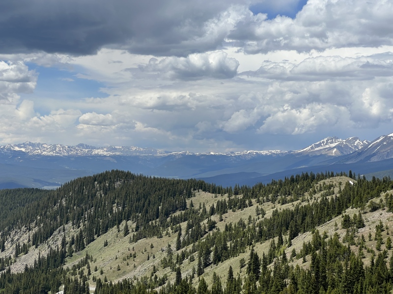
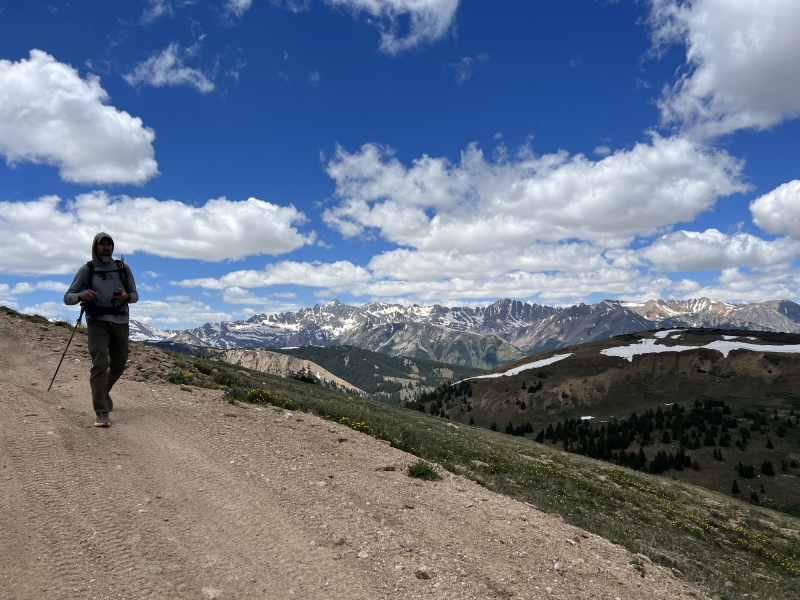
The route seen from Cottonwood Pass
First: Yes, Taylor A (Elk) and W. Tellurium (Sawatch) is correct. It goes.
Second and more importantly! Brad declared we hold both the FKT and SKT for this route. No, we have not googled to see if anyone else has done it. We will hold this unsanctioned and unverified title until proven otherwise. (and maybe even after) It's ours, baby! It's ours!
Feb 2023: "Hey Brad, if you ever want to do something dumb, just for the doing..." Brad: "Sounds fun."
When you study topo maps too long, you get ideas. Dumb ideas.
While looking at peaks to include in a Crested Butte peak project my wife and I are working on, I noticed the the Elk and Sawatch ranges kind of connect. No huge valleys or rivers in between them. But an actual high altitude ridge of ups and downs. I was guessing about a 20 mile loop would do it. West Tellurium looks to be the farthest west Sawatch peak. Taylor is one of the farthest east Elk peaks... but it also connects unlike the other two easterly peaks.
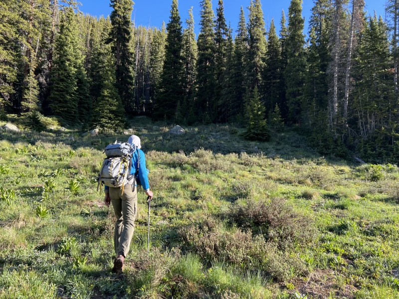
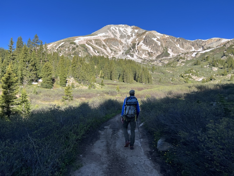
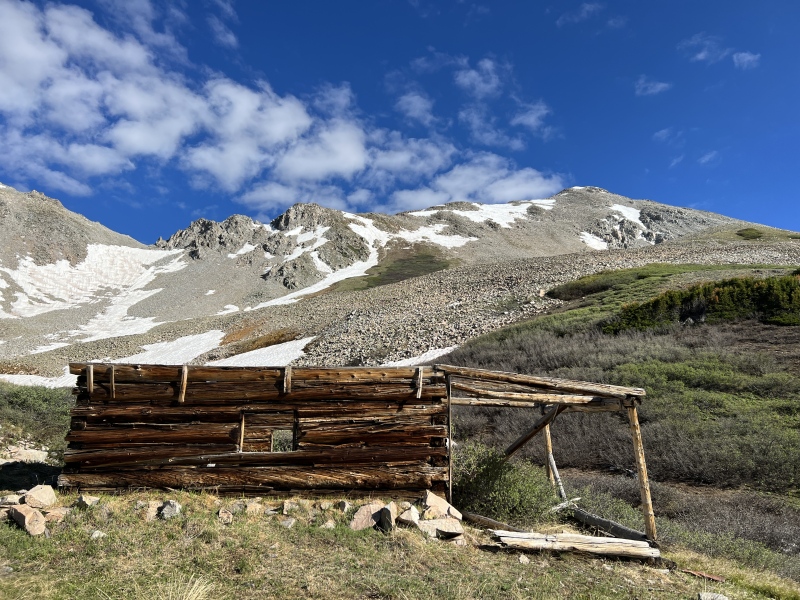
Going straight up from the THTaylor seen from the forest service roadCabinCabin below Taylor and the slope upThe slope to the ridgeA little bit of snow
My Fourth of July weekend plans got totally changed last minute. I knew Brad was wanting to get out. He suggested something in the Sangres, but the weather forecast didn't look very good.
I brought up our discussion from February. The weather near Taylor Reservoir looked great. With a few back-and-forth text messages we made plans for the very unnecessary route. After all, he needed some miles up high for a run in Fairplay he had entered the following weekend.
Because of my previous plans, I had Friday off, so I went up CR 742 that afternoon to find a place to camp. And as luck would have it, I got the site across the road from the Bowman Creek Trail... our exit point. Perfect. (But man, there are a hell of a lot of OHVs on the road kicking up dust.) Brad had commitments on Friday night, so he pulled in about 6:40 on Saturday morning. I finished breakfast and we drove up the road the last 3 miles to the TH.
So we didn't make this a true hiking loop, that really would have been unnecessary. Why walk the road, when you can drive it?
Castle looking sharp!Star is snowyTilton and Italian peaks
We parked at the end of 742, the TH, about 7:15 a.m., and quickly realized this wasn't going to be easy. The creek was running high, as all of them are this year. I was about take off my boots, and Brad said, "Isn't the peak on this side of the creek?" Why, yes it is. A quick look at the map showed several creek crossings for this trail. Yikes.
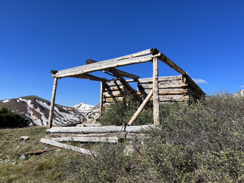
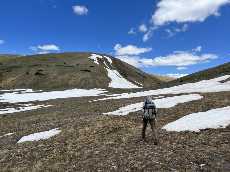
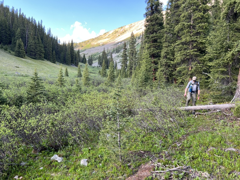
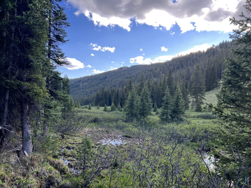
We turned around and bushwhacked straight up hill on the treed slope. There was a road we could hit that would lead to our destination. (Maybe FR 761?) That was a hard start to the day. But once on the old road we made good time. Saw two fresh piles of bear scat along the way. We left the road near where I thought other Trip Reports suggested, near 11,800. We went up a short ways and found an old log cabin. Took off layers. Snacks. Sunscreen. And uphill again.
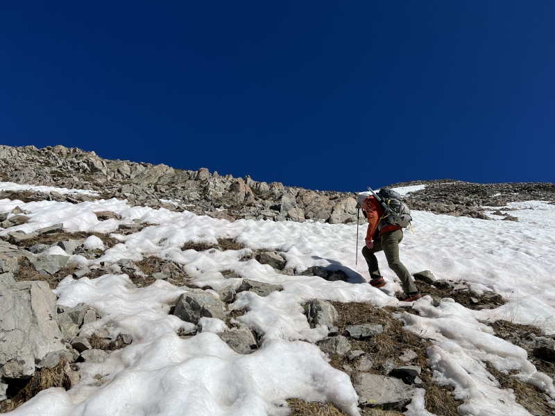
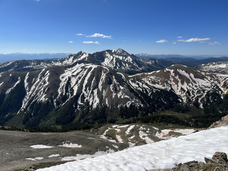
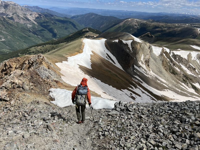
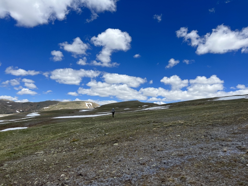
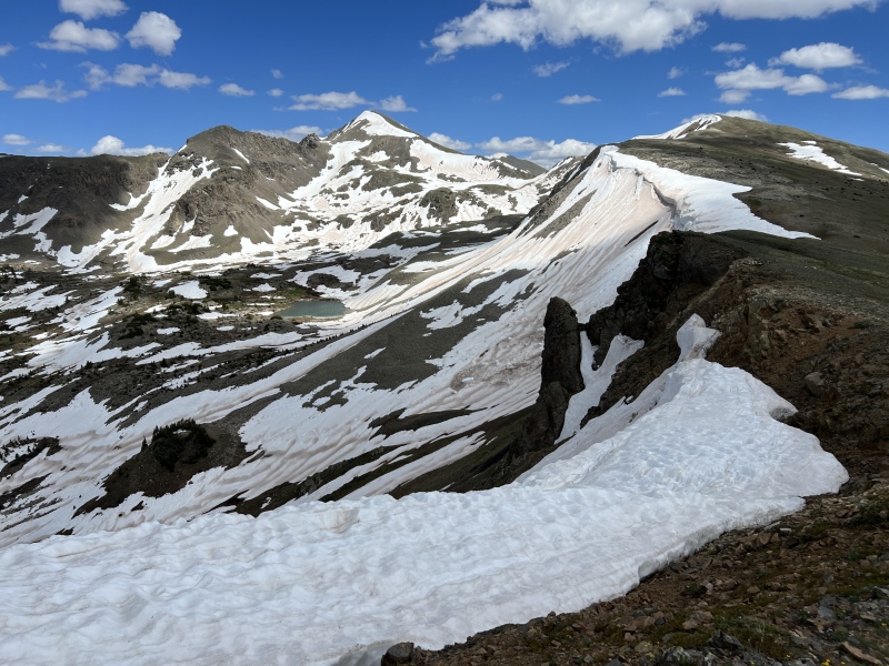
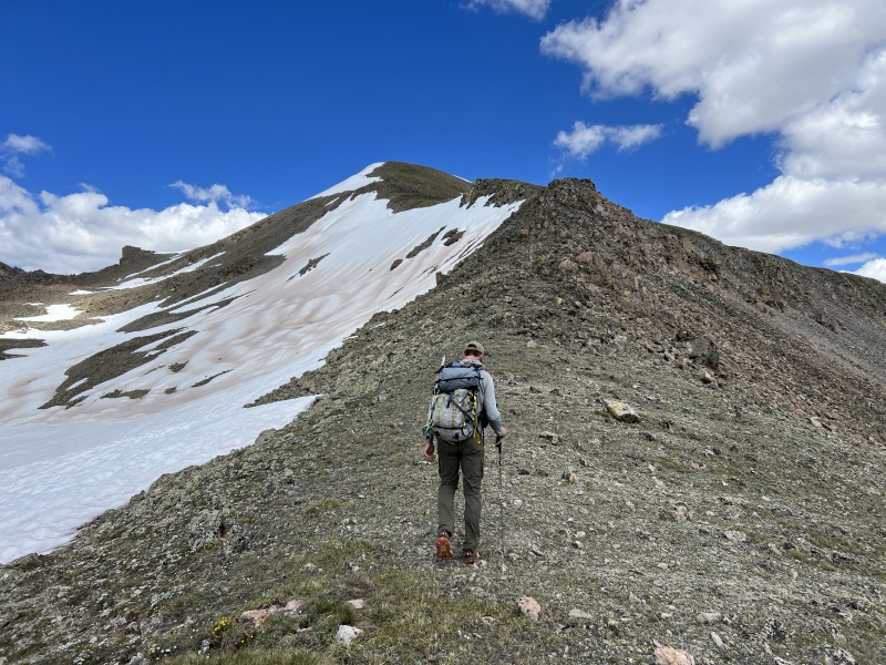
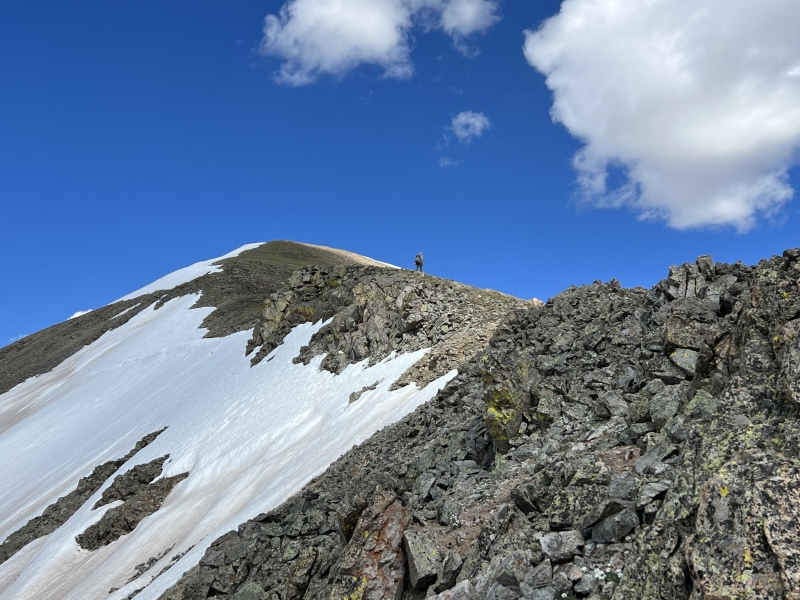
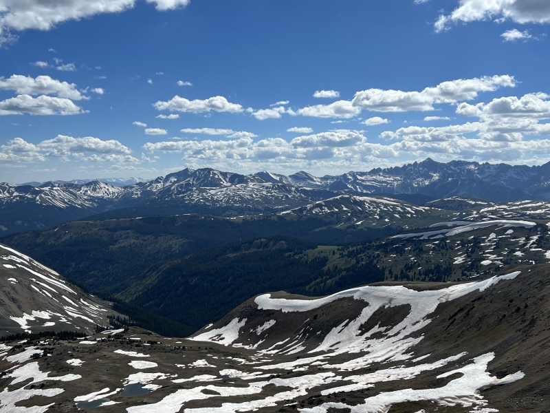
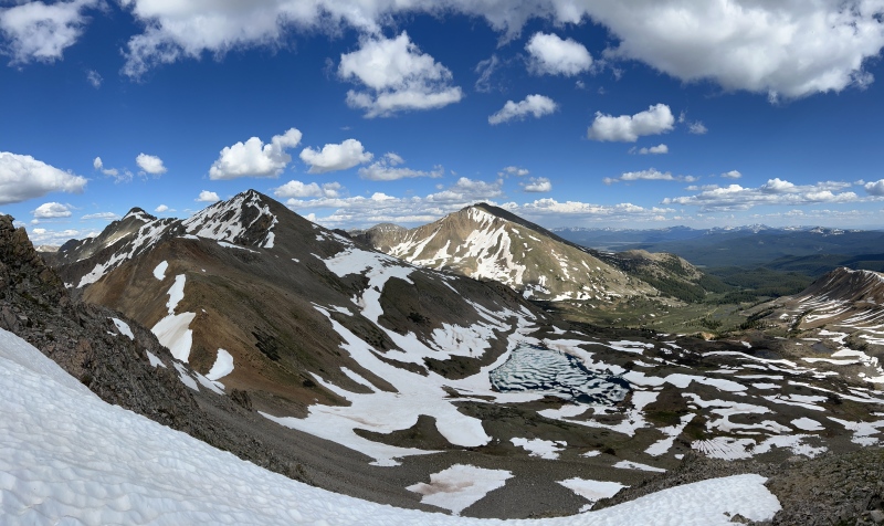
We walked over a rocky slope to reach a grassy slope to reach more rocks and then the ridge near 12,900. (About 9:30 a.m.)
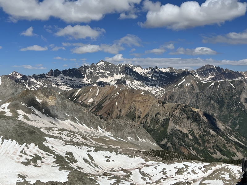
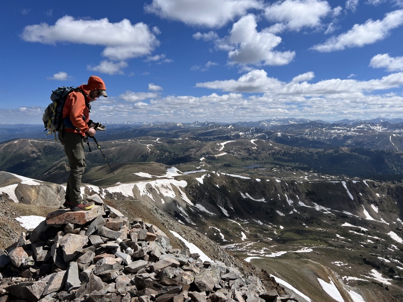
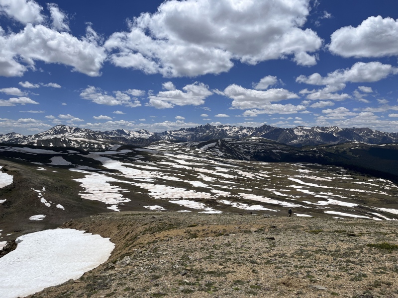
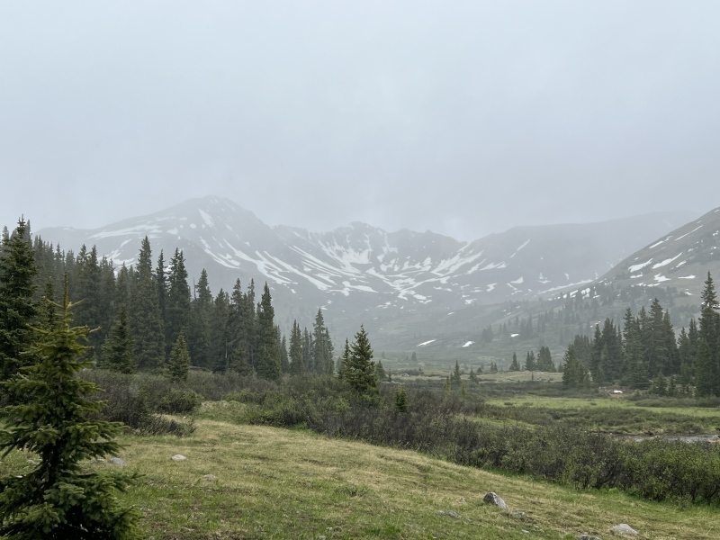
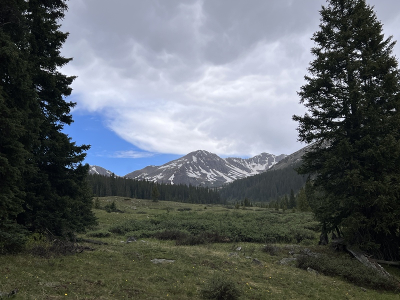
Amazing views. So much snow, so much white. I love this time of year up high. The contrast of the white snow against the different shades of rock and the green grass.
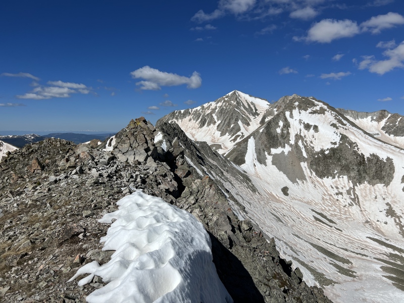
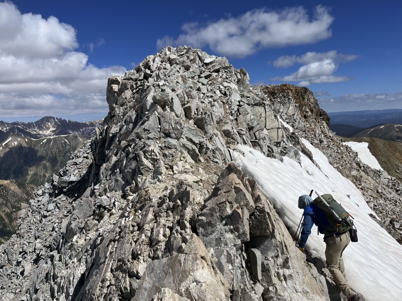
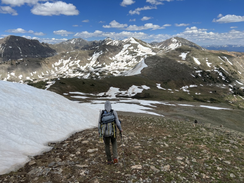
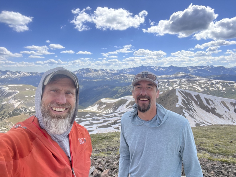
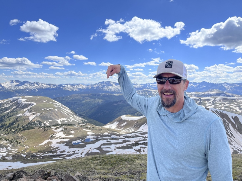
The ridge from here to the summit, I'd call Class 2 scrambling. Mostly just a pile of rocks, but an occasional hand-hold was nice for balance or for moving up. We reached the summit at 10:18 a.m. We took some photos and looked at our route. West Tellurium was a long way away. But what the hell, that's why we were doing this.
(FYI... Taylor needs a new summit registry container. The screw top on this was is broken.)
On the ridgeGoing up the ridge to the "false summit"Summit on the leftNear the summitSummit with routeSummit Selfie with our route to the SawatchWest Tellurium is in the center of the photoStar and Castle and...
I'll tell you now, Taylor was my first peak of the year. I haven't done a peak since November when Brad and I did Bel/Ox. (That day went from fun to miserable.) I was feeling the elevation this morning, which gave me concern for the rest of the day. Had a slight headache.
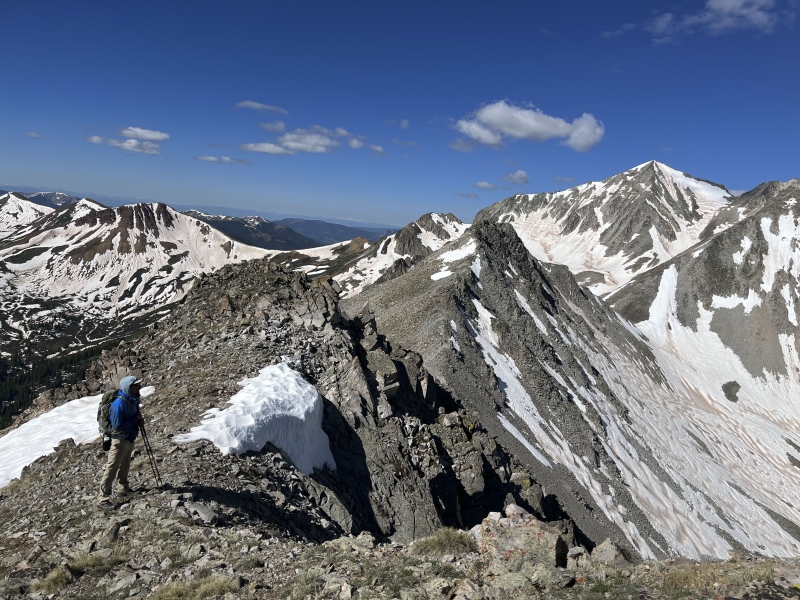
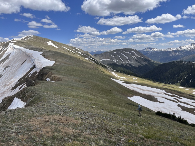
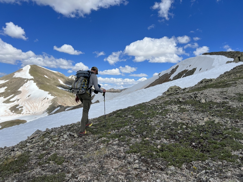
With a long walk ahead of us, we didn't stay on the summit long. Going down the north ridge was a little harder than coming up. I'd say it moved into Class 3, but that might have been because some route options were covered in snow. We brought our ice axes and spikes, but never used them.
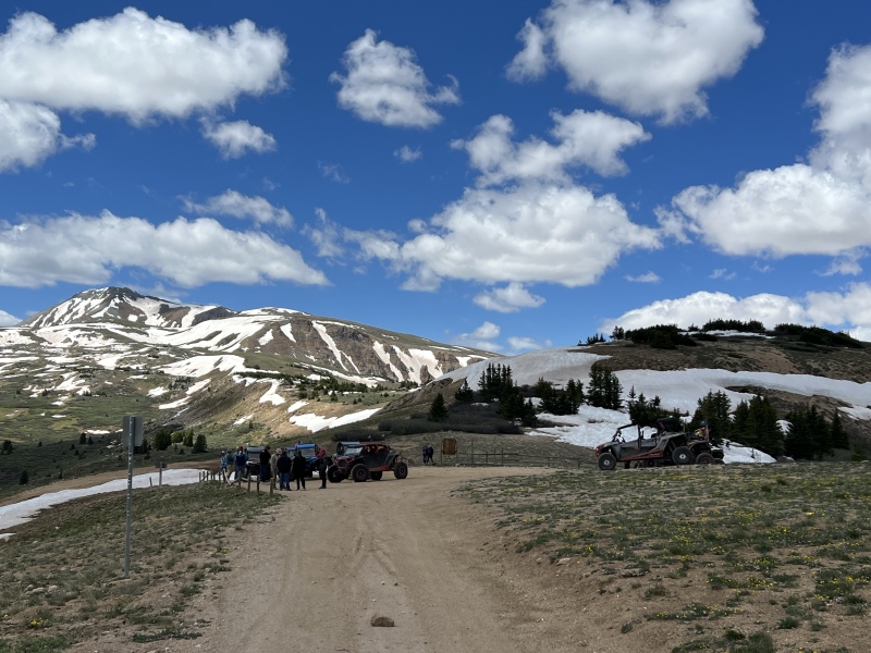
Once off Taylor, there were a few steeper sections that we were wondering about. Not concerned, but just knew they could be holding snow. We found easy paths down, sometimes on some snow. The walking was so easy, I ate my pizza as we went. We made it to Taylor Pass around noon. And wouldn't you know it, about a dozen OHVs were there. The folks up there kind of looked at us funny. Like where the hell did you come from and where are you going? We also saw a trail runner and cyclist on the road there too.
Going down TalyorComing down Taylor, a little rocky area with a hard move or twoThe route to the SawatchOn routeLooking back at TaylorTaylor Pass
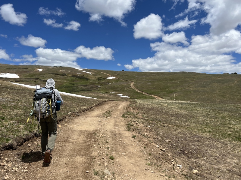
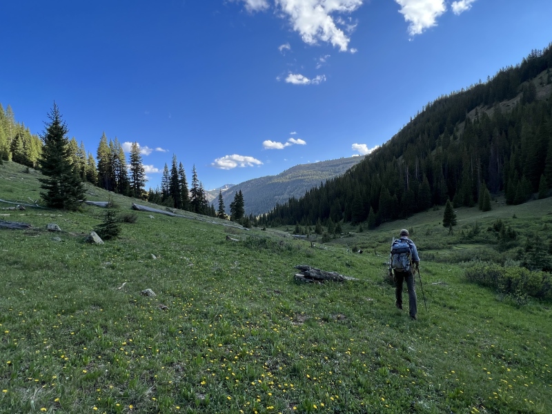
On we went knowing we still had a long way to go. Brad was familiar with this area as he had done several 12ers here. We walked the road that wandered toward Gold Hill and Goodwin Greene Hut.
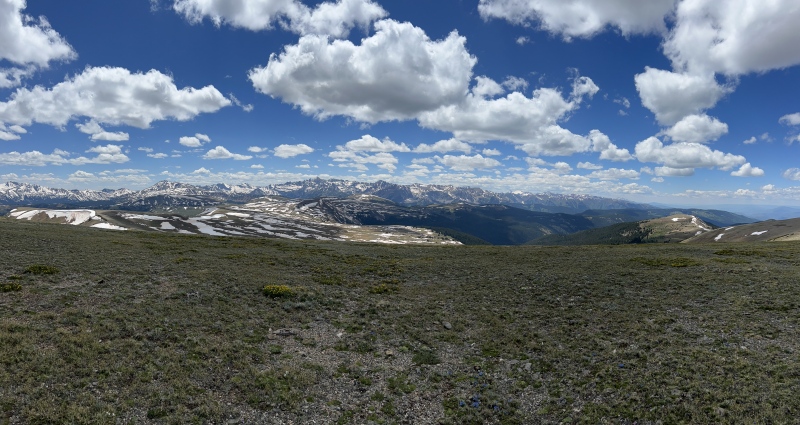
Now, I'm not going to say I have some kind of supernatural sense, but I could feel us leaving the Elk Range. It was like walking through a change in air pressure, a hint of tingling in my toes. Ok, maybe not. We had no idea where the ranges changed from one to the other. It wasn't until we got home and looked at Bill's map layers did we figure it out. And it seems they don't actually touch, there is just a big void between them, kind of like the land we were walking on. Near the Greene Hut we went cross country again. By no means is this area desolate, but there isn't much up there. Grasses. Not many flowers. And long stretching views.
My motivation dropped. My legs were tired. I was trying to figure our where to walk to shorten the distance instead of following the ever-changing ridge line. Brad started moving a little left. Why? Then I realized we had a major 'up' to go over. That sucked my energy before I even start it. I went right to see if we could bypass it. It didn't look good. So up we went. Ugh.
Turns out it is a 'soft-ranked' 12er, Point 12,714. I didn't care then. And I don't care now.
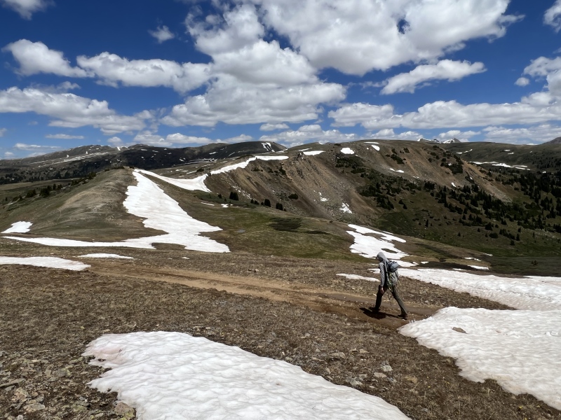
And we're walking...And we're walking...And we're walking...And we're walking...Well, someone must have had a bad day during the winter to leave this snow mobile stranded. I thought we might have an easy way across on this tundra.Looking back at the Elks. What a view! (and we're walking...)Walking some more with a pretty cool backdrop"All" the ElksAnd we're walking some more... and what's that bump?'soft-ranked' 12er, Point 12,714
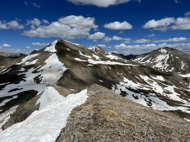
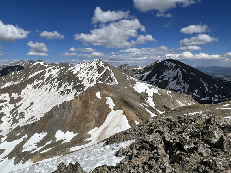
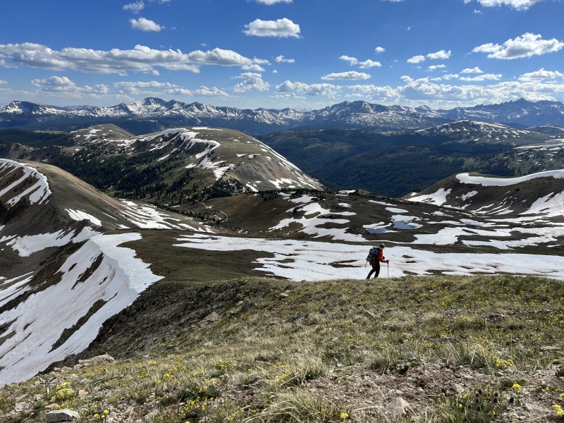
But on top of this bump, we finally got the sense we were closer to W. Tellurium then to Taylor. My spirits chirped up. We could see our route to the summit. Just one more bump to go.
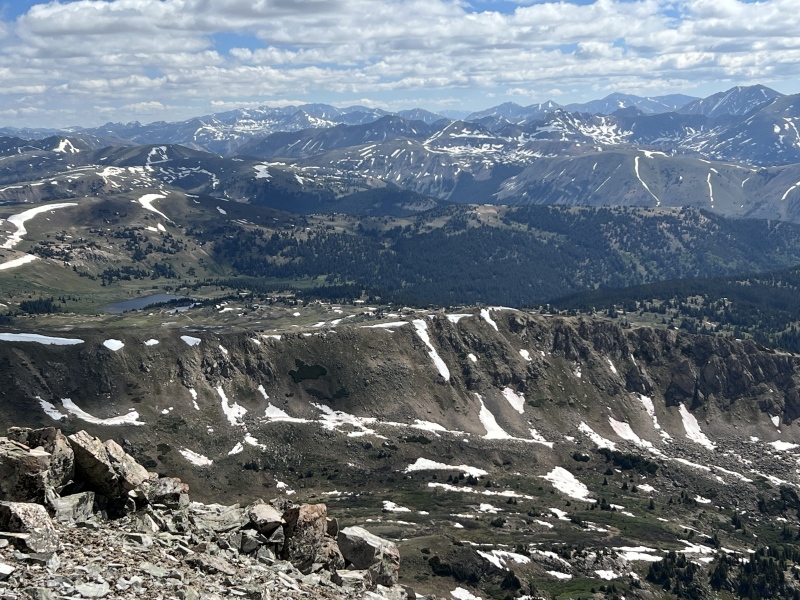
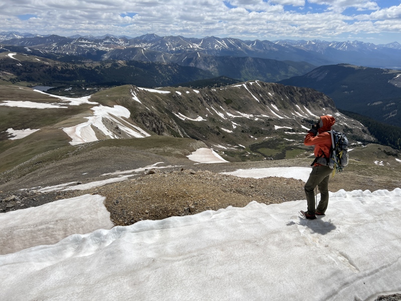
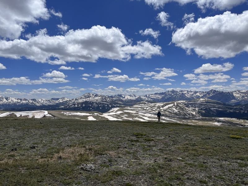
As we went down and started our way back up, we could look down into the New York Basin on the left and the Bowman Basin on the right. The views got better as we could see the remaining snow up high in the Sawatch Range.
As we turned south I looked back at that 12er. From this vantage point I could see a route below it, which did drop in elevation, but the gain was probably less than doing the bump. I mentioned this to Brad. He just shook his head at me. "You said this was an unnecessary hike, so we have to do all the unnecessary stuff." That pretty much summed up the day.
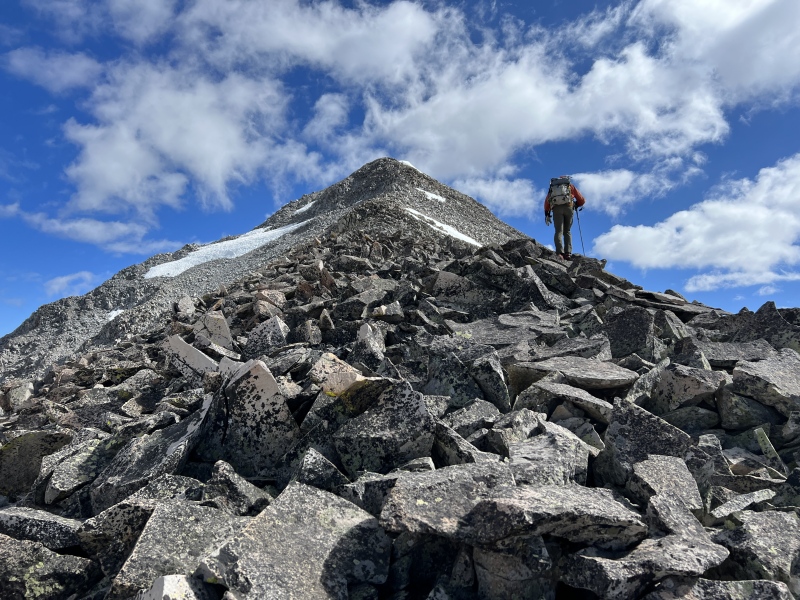
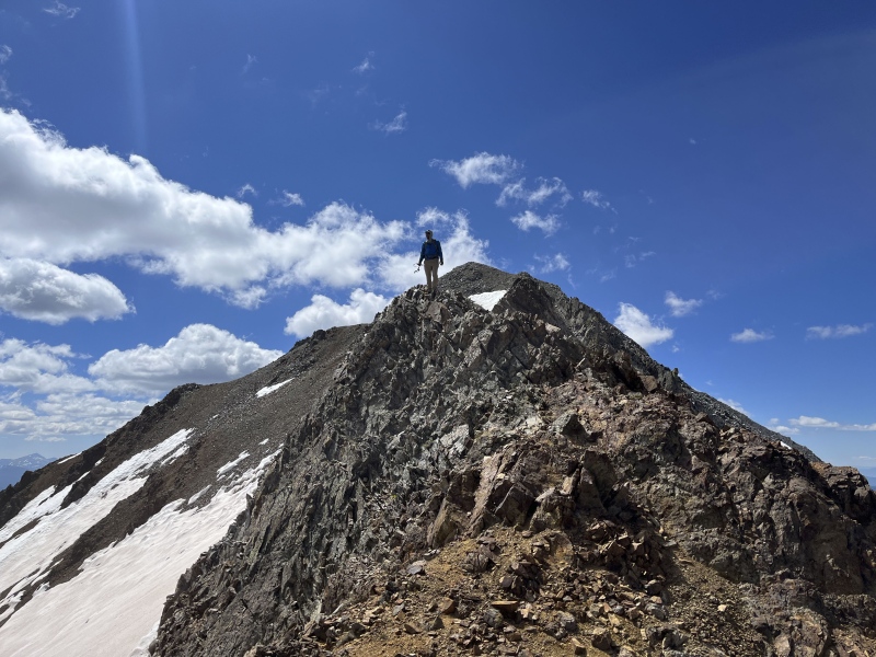
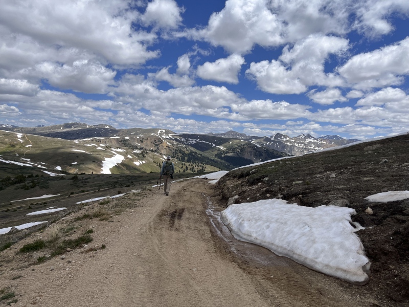
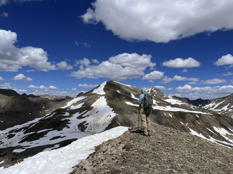
Next, the slope up Pt. 12,710, which I guess isn't ranked or soft-ranked, wasn't as draining as I suspected it would be. We were getting close, and that knowledge kept me going. This slope's north face had plenty of snow and a huge cornice. Near the summit, Brad walked around it. But I went to the top, unnecessarily. We took a moment to check out the route to the saddle. There were a few rocky spots, typical Class 2 slope. We paused at the saddle. The start of the West Tellurium ridge was rocky, the "hardest" terrain since coming off Taylor. Maybe a Class 3 move here or there, but nothing sustained and almost entirely C2.
Off the rocks, it turned into a grassy and dirt slope to the rock pile on top. We hit the summit about 4:40 p.m., about seven hours after Taylor and nearly nine and half hours into our day.
Coming down the 12er, destination aheadLooking back at the 12erGoing up Pt 12,710New York Creek Lake? with W. Tellurium and Pt 12,710Almost to the top of 12,710W TelluriumAlmost there!
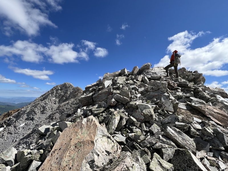
The unnecessary traverse was done! We did it. I surprisingly felt pretty good. We accomplished something kind of fun, something different. Something that really didn't need to be done. But what the hell. "Do things, just for the doing." Robert W. Service. This probably isn't even a real traverse, just a long walk. But we totally enjoyed the time on the summit knowing we accomplished "something."
I took a look over to Tellurium and I knew that wasn't going to happen today. My legs were OK, but another down and up didn't sound fun at all.
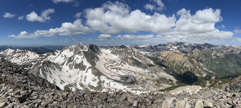
The views of these snowy Sawatch peaks were awesome. They didn't compare to the Castle group of the Elks, but these Sawatch peaks are rugged and beautiful and worthy of our admiration.
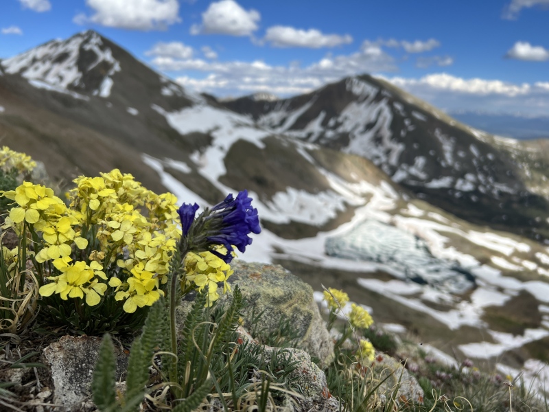
We dropped off the south ridge of W. Tellurium. The views of Ptarmigan Lake and Tellurium drainage were sweet. Lots of patchy snow and ice still in the lake. The exit strategy was to head into the little basin below W. Tellurium and then cross over into the Bowman creek drainage.
And wouldn't you know it, Brad suggested we hit one more ranked 12er. Obviously that was gratuitously unnecessary. And we skipped it. The small basin was wet with snow melt. We followed a trail above a 4x4 / mine road toward Bowman. The slope down to Bowman was heavily treed but easy, until it wasn't. It got steeper. Then it got wet. As we neared the Bowman Creek and the trail, it got real wet, very marshy. And from here the route sucked. Muckity Muck, black mud and standing water. Oh, and willows. We found the Bowman Trail. We lost the Bowman Trail. We found game trails. We found the real trail. We stepped in ankle deep mud. It wasn't pleasant.
From the 12,710 - W. Tell saddleW. Tell ridgeUnnecessary summit selfiePointing out TaylorWe started over there in the ElksLooking at Tellurium with Truro and Petroleum
A couple miles later, I could see our camp. About 12 hours and 35 minutes total for the day, with 18 miles behind us. I suggested that Brad run the three miles to his car to prepare for his run the next weekend. He didn't like that idea.
We dropped some gear, and got in my Suburban to go get Brad's 4Runner. Had a dog chase us down from a group of campers and run with us for about 100 yards. Back at camp we set up for dinner and made shredded beef tacos. I think they were delicious. But then again Eddie Murphy taught us... "what is that, a Ritz?"
So the Totally Unnecessary Unneeded Unwarranted Great Elk Sawatch Traverse Hike Very-Long Walk was complete. We own the fastest time and slowest time. Go forth and repeat as needed.
Going down W. TelluriumFlowers with Ptarmigan Lake belowTellurium Creek BasinNear Bowman Creek - bushwhackingNear Bowman Creek - muddy and wetAlmost outNear the Bowman TH and our camping spot across the way
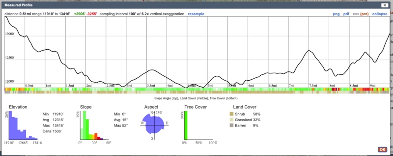
Estimated profile from Taylor to W. Tellurium
On Sunday, we went for Tellurium.
The first two miles of the Tellurium Creek road is shit. It's all rocks and boulders. We both agreed it was one of the worst roads we have driven on in a long time. We got about 1.5 miles in and had to park the 4Runner. There were two pointy boulders in a creek crossing we decided the 4Runner couldn't cross without damage. Just couldn't figure an angle in the narrow stretch to make it work. We walked up the road, crossed three creeks barefoot and watched the sky turn blue to gray. It started sprinkling, then raining. I hit the InReach for a weather forecast: clear skies, 0% chance of precipitation. We bailed. Thirty minutes later the sky above Tellurium was blue. So, a six mile walk to stretch the legs after a big day on Saturday.
RainyNot so rainy
Also: Just for the FYI.... Tellurium is a chemical element with the symbol Te and atomic number 52. It is a brittle, mildly toxic, rare, silver-white metalloid.
My GPS Tracks on Google Maps (made from a .GPX file upload):
Possibly the only thing necessary 7/3/2023 11:32am
about this whole day was point 12,714. Think how happy youll be when LiDAR 3.0 kicks in and says that baby is ranked! Or maybe the age-old 300 foot rule will get changed to 250 feet of prominence. The view from there of our starting and ending points was sweet. Thanks for the invite?
Thanks for sharing, looks like a good way to spend time above treeline!
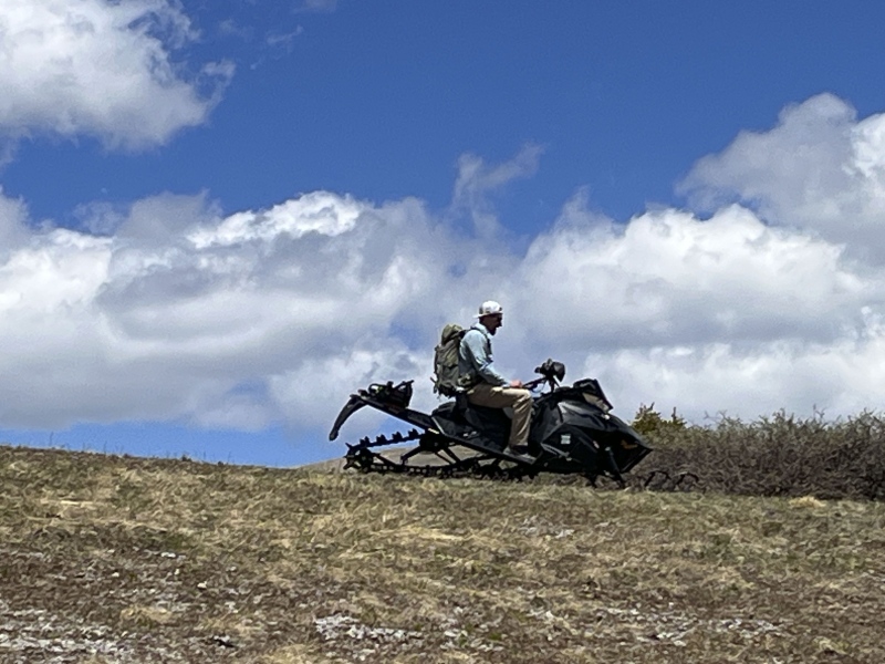
I get the same from the ATV/4x4 crowd all the time. On top of American Flag Peak the two heavily perfumed Texas ladies sitting in their ATV dumbfoundedly asked us "Y'all WALKED up here?", we didn't have the heart to tell them we had already climbed 2 other mountains and started at the 2WD trailhead. I also notice the ones in your photo are within 10' of their rides, that is par for the course lol!
I've also done this route! But with the caveat that I started from the Aspen side. I was able to drive up Taylor Pass to near the top before a bit of snow decided my starting point. Being October (years ago) my day included much ankle to mid-shin deep snow (this is how I feel okay doing less vert than you two!). I started with West T first as I wanted to get most of my miles out of the way early & hopefully let some of the snow melt off of Taylor. The concept of linking 2 ranges makes for some fun time in the mountains (I did Wheeler-Clinton-McNamee-Traver years ago also). I really liked your line about feeling the ranges transition from Elk to Sawatch (I swear I felt it too!). Great reading your report - fond memories!
Caution: The information contained in this report may not be accurate and should not be the only resource used in preparation for your climb. Failure to have the necessary experience, physical conditioning, supplies or equipment can result in injury or death. 14ers.com and the author(s) of this report provide no warranties, either express or implied, that the information provided is accurate or reliable. By using the information provided, you agree to indemnify and hold harmless 14ers.com and the report author(s) with respect to any claims and demands against them, including any attorney fees and expenses. Please read the 14ers.com Safety and Disclaimer pages for more information.
Please respect private property: 14ers.com supports the rights of private landowners to determine how and by whom their land will be used. In Colorado, it is your responsibility to determine if land is private and to obtain the appropriate permission before entering the property.


")
")
")
")
")
")
")
")
")
")
")
")
")
")
")
")
")
")
")
")
")
")
")
")
")
")
")
")
")
")
")
")
")
")
")
")
")
")
")
")
")
")
")
")
")
")
")
")
")
")


