Download Agreement, Release, and Acknowledgement of Risk:
You (the person requesting this file download) fully understand mountain climbing ("Activity") involves risks and dangers of serious bodily injury, including permanent disability, paralysis, and death ("Risks") and you fully accept and assume all such risks and all responsibility for losses, costs, and damages you incur as a result of your participation in this Activity.
You acknowledge that information in the file you have chosen to download may not be accurate and may contain errors. You agree to assume all risks when using this information and agree to release and discharge 14ers.com, 14ers Inc. and the author(s) of such information (collectively, the "Released Parties").
You hereby discharge the Released Parties from all damages, actions, claims and liabilities of any nature, specifically including, but not limited to, damages, actions, claims and liabilities arising from or related to the negligence of the Released Parties. You further agree to indemnify, hold harmless and defend 14ers.com, 14ers Inc. and each of the other Released Parties from and against any loss, damage, liability and expense, including costs and attorney fees, incurred by 14ers.com, 14ers Inc. or any of the other Released Parties as a result of you using information provided on the 14ers.com or 14ers Inc. websites.
You have read this agreement, fully understand its terms and intend it to be a complete and unconditional release of all liability to the greatest extent allowed by law and agree that if any portion of this agreement is held to be invalid the balance, notwithstanding, shall continue in full force and effect.
By clicking "OK" you agree to these terms. If you DO NOT agree, click "Cancel"...
I would like to preface this trip report by saying that I strongly advise against anyone taking Organ Mountain’s West Ridge to connect with San Luis Peak. The route involves descending, traversing, and ascending nasty, loose, and exposed third class gullies. I read other trip reports and grossly underestimated just how treacherous this route was. This route is downright dangerous.
Have you ever had one of those days in the mountains where it feels like everything that could go wrong does go wrong? This felt like one of those days. I’m not one to believe in omens but cracking my windshield 30 minutes into the 5-hour drive to the trailhead turned out to be foreboding of how this entire hike would go.
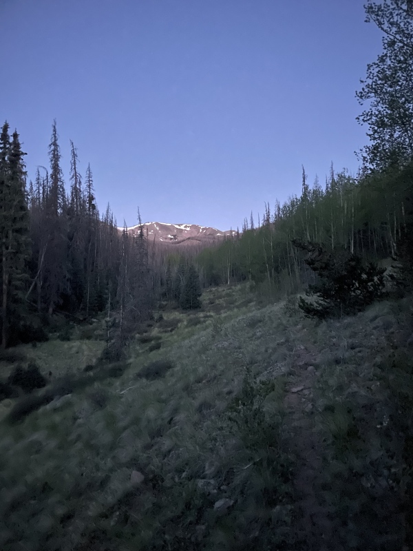
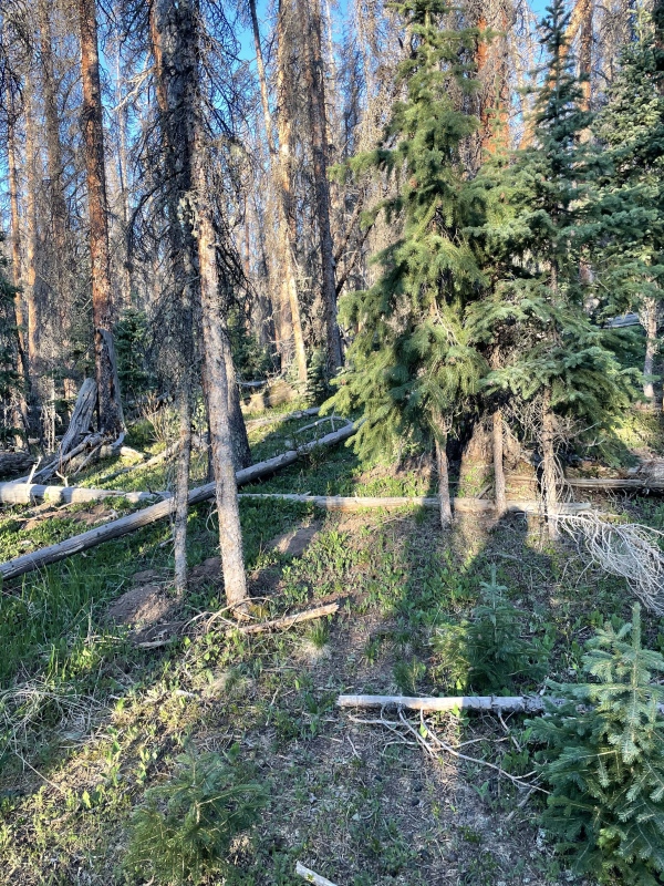
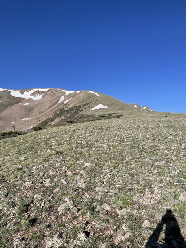
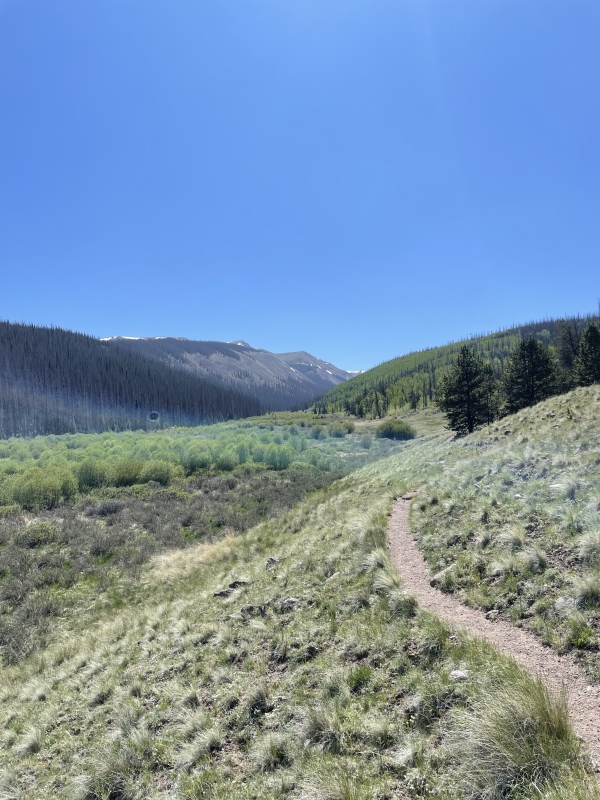
My partner and I began our hike at roughly 4:15 am from the Eddiesville South Trailhead with the intention to hit Organ>San Luis>Baldy Alto>Stewart. There was plenty of parking and the pit toilet was very clean and stocked with TP. We briefly followed the CDT to the start of the Canon Hondo drainage/trail. We turned right at the stream and began to follow it up the drainage. There wasn’t much of a trail initially, so we just followed along the stream. We bushwhacked for maybe 1/2 mile before finding a pretty decent trail. The beetles have taken an enormous toll on the forest in this area, and the trail was frequently interrupted by deadfall. We occasionally lost the trail while navigating the deadfall and after about another mile the trail disappeared entirely. The rest of the hike to tree line consisted of bushwacking along the stream and navigating seemingly endless deadfall. In addition to the deadfall, the forest floor is covered in small thorny plants that you need to be constantly on the watch for. It took much more time and energy than expected to travel the ~4 miles and 1,500 feet up to treeline. We were incredibly relieved when we finally gained the ridge above treeline.
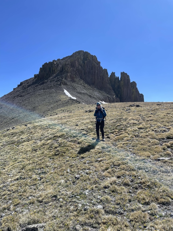
First glimpse of Organ off in the distance.It looked like this most of the way up to tree line.
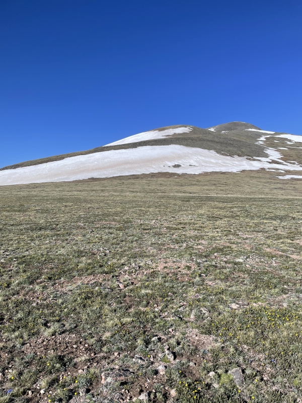
The remainder of the hike up to Organ’s summit was smooth sailing. The ridge consists of mostly grassy tundra with some brief rockier sections. There were some small snow field to cross, but they were brief and nicely frozen. The route is almost entirely melted out. It isn’t until you reach the summit that you get a view of Organ’s dramatic west side. The stark contrast between the east sides rolling hills and the west sides sheer cliffs and spires is beautiful.
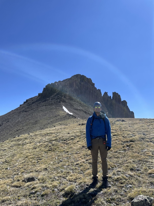
View shortly after gaining the ridge, smooth sailing from here.More easy ridge walking, the summit can be seen in the distance.
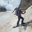
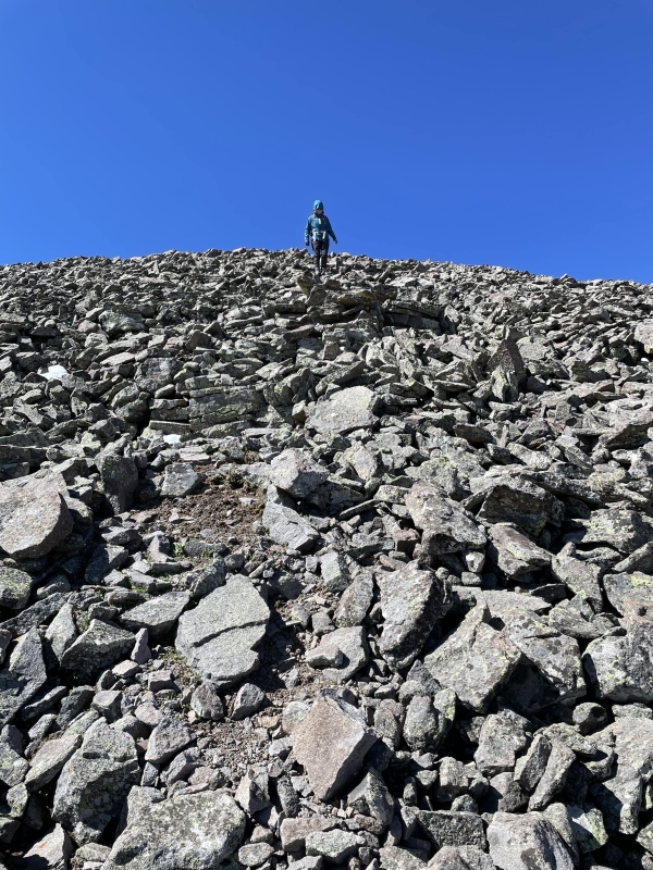
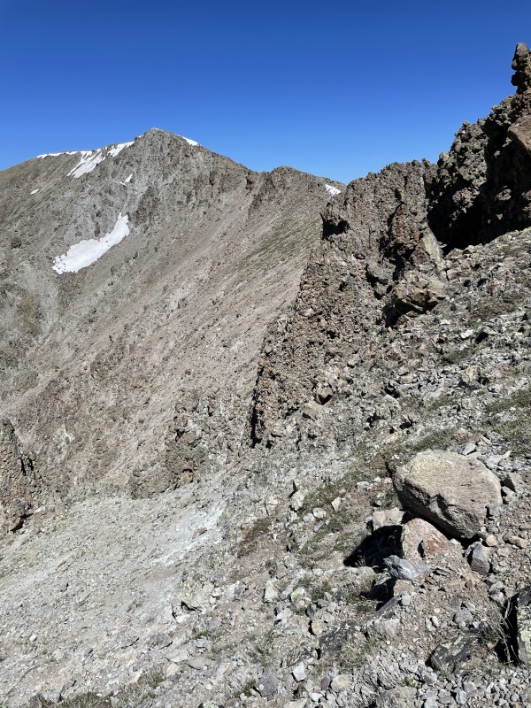
We descended the boulder field north from Organ towards the saddle with a subsummit of Organ. If you head a little east before descending this boulder field the slope is noticeably shallower. Once we were almost at the saddle, we began the traverse west across the boulder field towards the flat grassy area to Organ’s west. The boulder field isn’t too bad at the start but gets progressively worse the further you go. The angle gets steeper, rock gets looser, and the feeling of exposure increases. This traverse is manageable, but not particularly pleasant.
Annie descending the boulder field.Boulder field you must traverse across, this shows the easier part before the slope steepens.
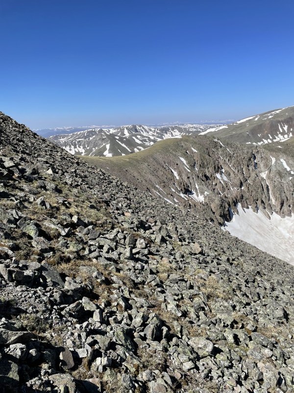
Looking back at Organ’s west face from this flat grassy area was one of the best views of the day, it is breathtaking. The crux of the route comes directly after this. There is a large notch in the ridge that requires you to drop into a gully on the south to bypass the notch. There are multiple gullies in this area, and they are all treacherous. Each gully offers an assortment of loose rock with consequential exposure. It is incredibly difficult to tell from above which gully you need to take. Unfortunately, I didn’t get very good pictures of this section as I was too preoccupied figuring out our best move. I had a GPX file to reference and my partner and I entered what I believed was the correct gully. About 100’ down the gully I checked my gps again and my pin had jumped, indicating we were likely in the wrong gully. We decided to proceed a bit further down our current gully to see if there was a way to proceed. We wound up pretty cliffed out. There appeared to be a 4th or 5th class route down to the base of the notch. We took a moment to rest and come up with a plan. I had looked down what I now know was the correct gully earlier, and it was even steeper and likely just as loose as the gully we had already done battle with. We were both already feeling unsafe and exhausted after spending way too much time in those damn gullies and we made the decision to backtrack to Organ.
Annie on the flat grassy area while we were still enjoying ourselves.One of my last smiles of the day.I didn't get great pictures of the crux but this shows some of what the terrain is like.
After all the bushwhacking and trail finding from the morning, we opted to drop into the Stewart Creek valley. We traversed back across Organ until the slope eased up enough for us to drop into the valley. We descended another shitty loose gully for a few hundred feet and finally the gully turned to grass. We continued to follow the valley down towards the main San Luis trail. We were debating continuing another 2,000 feet up to San Luis once we gained the main trail. Unfortunately, the bad luck wasn’t quite over for my partner. Having all the difficult terrain behind us we had relaxed a bit. I crossed a short snowfield and then hopped across a few rocks immediately after the snowfield. My partner followed behind. She crossed the snow and took a few steps on the rock and slipped, hard. She lost her footing with her wet boots on a loose rock. She slammed onto a pile of rocks. It was unclear if she was seriously injured but after a brief rest, she said she was ok to proceed. We would later find out that she had a baseball/softball sized deep black bruise on her ass. She must have taken a rock directly to the ass, she’s still hurting from that one.
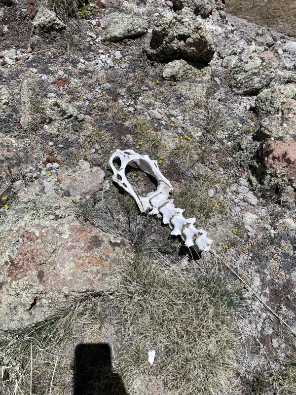
Saw this skull on the way down into the valley.
Fortunately, the rest of the hike went smoothly. We got to the base of the valley and found an easy place to cross Stewart Creek. We climbed the creek bank and our feet were blessed with a class 1 dirt trail. The relief we felt in that moment was palpable. We still had about four miles of hiking to get back to the car, but it was easy-going. I won’t go into too much detail because it is just the standard route on San Luis. The trail is mostly clear with a handful of sections with some deadfall that had to be climbed around.
Looking back towards Organ/San Luis near the start of Stewart Creek trail.
The day didn’t go as planned, but fortunately we made it back safely and still managed to summit one peak. This hike turned out to be far more difficult/dangerous than I had expected. We will be back for what should be a much simpler jaunt of San Luis, Baldy Alto, and Stewart.
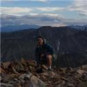
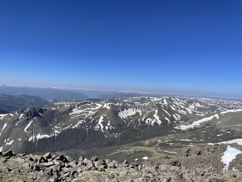
Summit view looking south from Organ.
Thumbnails for uploaded photos (click to open slideshow):
Very early in my 14er climbing days, I set out with the same route intentions, with a dog no less. We got to that notch and noped so hard, so down the south side kitty litter scree all the way to the valley floor to climb another slope up to San Luis. That was when I learned the San Juan volcanic rock isn't quite the same as what I was used too. Good on you for writing this report so others may learn from your mistakes, wish I had thought to put one up and save you the trouble
Thank you for the kind words, those gullies are questionable for humans, certainly no place for a dog! Glad you two made it out of there safely. This hike was a good reminder of where I stand compared to the mountains.
In 2013, my sons and I climbed San Luis Peak and then attempted to traverse from the San Luis - Organ saddle to Organ Mountain via its west ridge. At some point, we reached an ugly gap in the ridge that would have required a sketchy downclimb on crumbling rock. That's when we bailed out. Glad you got down safely...
I'm planning a trip and this information is very helpful, thank you for posting!
Caution: The information contained in this report may not be accurate and should not be the only resource used in preparation for your climb. Failure to have the necessary experience, physical conditioning, supplies or equipment can result in injury or death. 14ers.com and the author(s) of this report provide no warranties, either express or implied, that the information provided is accurate or reliable. By using the information provided, you agree to indemnify and hold harmless 14ers.com and the report author(s) with respect to any claims and demands against them, including any attorney fees and expenses. Please read the 14ers.com Safety and Disclaimer pages for more information.
Please respect private property: 14ers.com supports the rights of private landowners to determine how and by whom their land will be used. In Colorado, it is your responsibility to determine if land is private and to obtain the appropriate permission before entering the property.
")
")
")
")
")
")
")
")
")
")
")
")
")
")
")
")
")
")
")
")
")
")
")
")
")
")
")