Download Agreement, Release, and Acknowledgement of Risk:
You (the person requesting this file download) fully understand mountain climbing ("Activity") involves risks and dangers of serious bodily injury, including permanent disability, paralysis, and death ("Risks") and you fully accept and assume all such risks and all responsibility for losses, costs, and damages you incur as a result of your participation in this Activity.
You acknowledge that information in the file you have chosen to download may not be accurate and may contain errors. You agree to assume all risks when using this information and agree to release and discharge 14ers.com, 14ers Inc. and the author(s) of such information (collectively, the "Released Parties").
You hereby discharge the Released Parties from all damages, actions, claims and liabilities of any nature, specifically including, but not limited to, damages, actions, claims and liabilities arising from or related to the negligence of the Released Parties. You further agree to indemnify, hold harmless and defend 14ers.com, 14ers Inc. and each of the other Released Parties from and against any loss, damage, liability and expense, including costs and attorney fees, incurred by 14ers.com, 14ers Inc. or any of the other Released Parties as a result of you using information provided on the 14ers.com or 14ers Inc. websites.
You have read this agreement, fully understand its terms and intend it to be a complete and unconditional release of all liability to the greatest extent allowed by law and agree that if any portion of this agreement is held to be invalid the balance, notwithstanding, shall continue in full force and effect.
By clicking "OK" you agree to these terms. If you DO NOT agree, click "Cancel"...
Metallica and AC/DC are two of my least favorite bands in the respective genres of music they belong in, but these two songs were playing in my head most of the day. Luckily these two peaks I enjoyed much much more… buh dah dah dah dah duh dayuh THUN-DER!
Like any great plan, it started with Sarah asking me if I wanted to do Lightning Pyramid (PT 13,722), the now "unranked" (based on LIDAR) little sibling of the Pyramid group. I have had it's big sibling, Thunder on my radar for this season since I am trying to close out my centennial peaks by next spring. I always love a link up so I told Sarah I could be convinced if we could add on a traverse to Thunder, which she had already summited once before on her journey to finishing the cents. When she agreed to the traverse, that was all the convincing I needed to send it since the forecast was looking great for Monday.
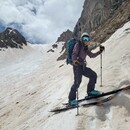
We met up at Red Hill commuter lot at 2 AM and were off to the Maroon Lake trailhead an hour away. While this may be the most popular trailhead in Colorado, we were the only looneys pulling in at 3 AM on this particular Monday. Based on previous conditions reports we were hoping there would be enough snow to justify bringing skis up, I was hoping, to Len Shoemaker basin. So we loaded skis and boots onto our bags and set off in trail runners following the all too familiar trail to Crater Lake. The full moon was the night before and it was illuminating everything enough to create clear outlines of the familiar peaks like the Bells, and providing enough light that even though both our headlights were low on batteries we could see everything just fine. We were up at Crater Lake in 45 minutes, and just after the last campsite turn off we started to hit snow, so in the darkness I suggested maybe we could skin up on the west side of the basin hoping for continuous snow. This hope was short lived as we hit a rock moraine quickly, then another one, so I gave up on skis all together and suggested we stash them in the woods and just switched back to trail runners since the snow was super supportive and comfy shoes are nice. This process wasted a lot of time, so I was glad we started so early, since as we made it to the creek crossing the sun was coming up. The GPX file Sarah had from her last trip had showed her crossing before the South Maroon split off, but it was earlier in the season and I think maybe they found a snow bridge, I thought further up the basin there was a log crossing in avy debris but didn't quite go far enough before we gave up and just waded the raging creek at 5:30 AM. From the east side of the creek we switched over to boots and crampons and started heading towards the gullies we needed to work our way through the cliffs. The gully from Sarah's last trip had a water fall in it and the snow was not continuous so I suggested we head farther south down the basin in search of a nice continuous snow gully. On our way up to the gullys I looked back at the creek and saw all the logs and avy debris that I knew would make a bridge for the way back across the creek.
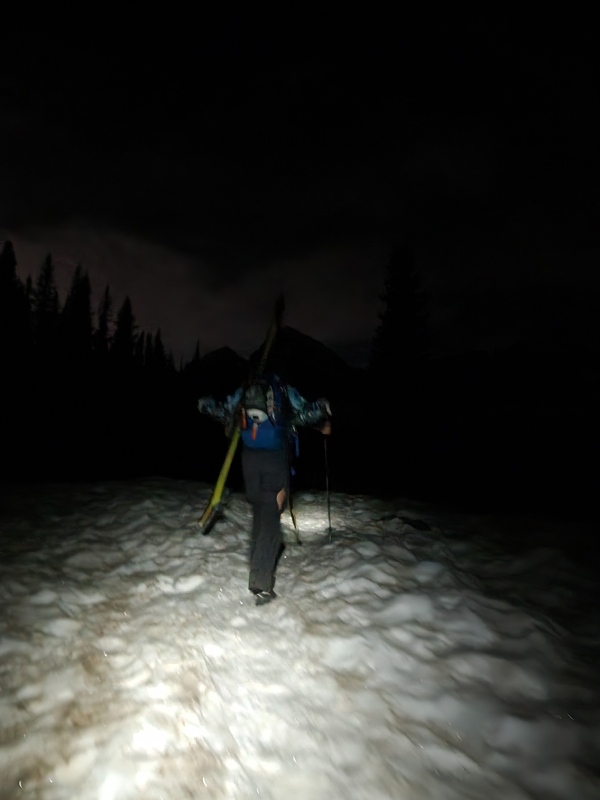
Hiking thru darkness with skis on my back, must be June. Photo by Sarah
Sarah's GPX said they went up here but the waterfall said not today, we continued further south
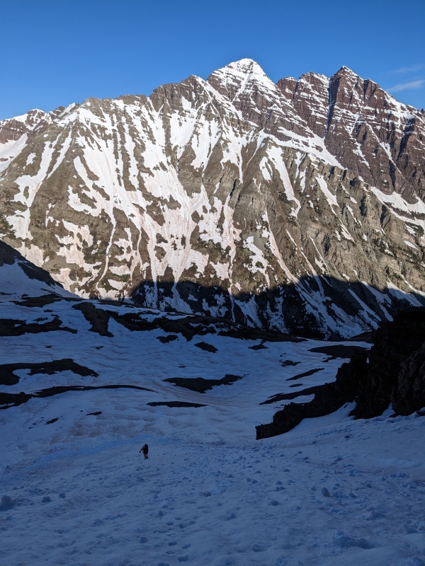
Thunder Pyramid during the early hours
Lightning Bolt in the middle of the rock face, that's the way up!
Sarah with the Bells in the background
"The middle" gully is the one we chose to climb and it was developing a small crevasse as the snow separated from the rocks at the top out, but luckily I was able to climb around this on the right hand side onto dirt and rock, we continued up on snow weaving back and forth through the cliffs rock bands following the gullys till we reached LS basin and got the first proper look at Lightning Bolt couloir, which was to be our path up Lightning Pyramid. We grabbed a quick snack before starting up the couloir, which is around 35-40 degrees on the apron but gets much steeper for the middle section, especially near the choke, which is a large boulder. The snow at the bottom was a mix of soft new snow, wet slide debris and the bed surface of old snow which was practically bullet proof in places. About half way to the choke the snow gets steeper, to around 45-50 degrees and I wanted to front point but the snow would often take 3-4 good kicks before it made a big enough step to feel secure, which really slowed down progress and makes the legs tired. I ended up switching to side stepping in several places to give my legs a rest, until I reached the crux point of the choke. Here I used both my ice axe and whippet, since the pitch gets pretty steep for about 10-15 feet, and climbed up the climbers right side, as a runnel full of small rocks made climbing on the left side feel less secure. Above this crux at near 12850 ft the snow stays pretty steep for another 100 or so feet of vertical before it tapers back off towards 40 degrees near the top as the couloir opens back up into a larger funnel. We followed snow as high as it went on the left side, to around 13250 feet where snow thinned out and turned into loose rocks. I did spy a more continuous snow line to around 13,600 but the climb out of the couloir onto the hanging snow field was looking pretty steep so I chose just stay in the more standard line. We went up the loose rocks about a hundred more feet before we started traversing towards the summit of Lightning just below the ridge to bypass a small cliff band, before gaining the ridge proper. From here it's all class 2+ walking on the ridge proper to the summit on mostly dry rock with a little snow. We made the summit around 9:30, 6 hours after starting out this morning. As I walked down the ridge, after taking pictures and signing the summit register, I thought about how we were going to navigate the ridge to Thunder Pyramid.
Heading up the Apron
As we got to the saddle of LP and TP, which is also the top out of the full lightning bolt couloir, we discussed our plan for the ridge. The snow field on the east side of the ridge, that leads to the gully was in, but the top out on that climb looks very steep and I knew the snow wouldn't be supportive on the east face by this time of day, so the only other option was to try to scramble the crest of the ridge avoiding snow. This I knew was tricky with loose rock everywhere, and exposed class 4 and 5 climbing. We switched to trail runners at the saddle and got moving around 10:30 AM with the sky still looking clear around us, but clouds forming far to the west and small storm pockets over the southern Sawatch. At first the scrambling on the east side was pretty easy and very fun, navigating the bands with occasional class 4 moves and a lot of class 3, reminiscent of the summit block of Pyramid just down the ridge. We past a section that was perfectly level 2 feet wide with a small raised portion guarding the 600ft sheer drop to the west side, which I can only assume OSHA installed after an incident.
This is the diagram I am referencing with the line colors
The start of the ridge, with the fun and easy class 3
OSHA approved guard rail installed, Lightning summit ridge in the background
View up close of the east side
Me scrambling just about to reach the grayish rock that marks the end of the blue line (PC: Sarah)
we crossed the thin snow patch directly in front of me to bypass the crumbling steep nose, probably less than 10 steps in snow, above that we reached the gray rock
From here we climbed up more class 3 and 4 till reaching the first steep nose section, which we were able to bypass on the east side using the rock for hand holds while plunging our feet into the snow field for about 10 steps (blue line). From here the rock changed from the familiar maroon color to a more gray tone which was actually surprisingly solid for the area, which was welcome as the climbing transitioned to more consistent class 4 above this point till the next sheer nose, all this climbing remained on the east side just above snow line (pink line). Once we were on top of the 2nd steep nose the rock changed back to the familiar maroon rock and it's equally familiar poor quality for the 3rd steep nose section. This climbing was harder going at 4th or 5th class and we climbed straight up the crest of the ridge (red line) to reach the super nice bypass ledge (green line) I had spied on topo while researching this ridge and had scoped out from Lightning earlier. We checked for viable scrambling along the ledge to keep following the ridge but in this area everything we touched seemed to move as we located a chimney, too narrow to stem with a pack on and all the other holds moved. With the exposure being a 300 ft cliff we backed off and checked out this ledge, which OSHA has yet to install a guard rail on, but it is a comfortable 3 feet wide in most places even if it is covered in loose rocks, and it only had one small patch of snow to bypass. As we wrapped around on the west side of the ledge we got our first views of what faced us on the north side of this large tower that guards the ridge from "easy scrambling".
Sarah climbing the 3rd steep nose, marked with a red line on the diagram above, this was some of the hardest climbing on the worst rock we did
once we got to the ledge we attempted to regain the ridge using a chimney to the left of Sarah, all the rocks on the right side moved... fun fun!
Actually, we will take the ledge, marked in green, the chimney we were attempting is just around the corner from the little snow patch in the sun
OSHA hasn't gotten them to install hand rails here...yet (PC: Sarah)
Hey that's a pretty cool ledge if I do say so myself (PC: Sarah)
Unsuprisingly, it was more ledges with serious exposure and class 4+ moves on loose rock (red line second picture). We went up 3 or so levels of this before calling it quits on the scrambling, since I had seen a good way to bypass the rest of the rock on snow, and switched back to boots and crampons. A welcome sense of security after about an hour of hard, exposed moves on loose rocks with heavy packs. Following the snow (pink line picture 2), moved us quickly around a fair amount more scrambling to the ridge, with just one challenging move through the visible rock band part way up the snow field. Once in the ridge the scrambling was a very easy but exposed class 2+ and soon we were at the top of the standard route people climb up using the "white gully". The clouds and the storm were still giving us space and from here I was super stoked to make this summit happen, so I climbed along the ridge and around the summit block to the west side where a large cairn was built and followed the path of least resistance up from there and along the ridge north to the highest point. There were a few class 3 and maybe one class 4 moves before the summit but nothing as loose or exposed as before so it all felt relatively easy. Once Sarah made the summit, shortly after me, we took our pictures and signed the register before beginning our descent.
Diagram 2, the red is the 3 tiers we scrambled at class 4 maybe 5, Pink on snow and green was cruiser 2+ back to the standard route
Looking back at Lightning from somewhere on the traverse
Woah, thats Thunder Pyramid summit block and we are on the standard route now!
I must be getting close now, thats a cairn!
The summit, with Pyramid in the background
Sarah, reaching the summit!
Pyramid Peak, I cant believe people scramble that ridge!
I guess there are some 14ers in this picture, South Maroon, North Maroon, Snowmass and Capitol (L-R) plus a bunch of cool 13ers and even a ski line or 2
Cathedral, Conundrum, Castle on the distant ridge and Hunter, Keefe, Hilliard and PT-13537 in front (L-R) yeah, the views are okay here
Right off the summit, is the aptly named summit direct branch of the couloir and it had snow up to 13,900 ft or so, compared to the standard branches 13,600 ish ft. I was pretty sick of walking around on rocks in my ski boots, so I asked Sarah if she would be interested in down climbing the direct since it was right below us and she said why not, so I took out my axe and started face in down climbing it. You know it's been a long day on steep terrain when looking down a 55+ degree narrow couloir starts looking moderate to you, luckily the snow was amazingly supportive and a swift single kick was making perfect little steps as I led us down the 350 feet of steep steep snow. After the first 350 feet, the snow had softened up a fair amount and joins in to the standard route shortly after and from here we were able to plunge step and Glissade down, being very careful not to gain too much speed since the line ends in a cliff about 1200 feet below where we were. As we got down to the bottom of the snow we exited to the skiers left and followed a path back to the snow, and then back to our route up from 9 hours earlier. On the way out we were able to cross on the avy debris and quickly get back to the West Maroon trail where we stopped for 30 minutes to snack and just enjoy the now perfectly clear skies, and the beautiful place we were in before our long hot hike out, with skis on our packs we didn't really use. At least the snow was pretty much supportive the entire way out and my trail runners are comfy!
Strapping in for the downclimb (PC: Sarah)
Steepest snow all day, Sarah downclimbing
First brown Ptarmigans of the year, I guess summer might happen eventually
Looking back up at Thunder and Lightning after we crossed the creek to West Maroon trail and ate all the snacks
The looks and questions from the tourists on the way out were keeping us amused and we were laughing to ourselves as we headed out. Sarah made me stop to take the classic tourist photo of "the deadly Bells" down at Maroon Lake before we made it back to her Jeep 13 hours after we started that morning.
The Deadly Bells, bet you've literally never seen a picture like this before (PC: Sarah)
The snow climbs of either of these two routes are a challenge in themselves, and linking these two peaks along the ridge is up there with some of the rowdiest ridge scrambles I have ever done. Looking at Pyramid and knowing people scramble that whole ridge to Thunder Pyramid left me absolutely shocked at the total baddies that have linked this whole ridge before. Anyways thanks for reading and hopefully this helps some people, who want to link LP-TP with late season snow climbs and a dry ridge while there is unsafe snow on the east face gully route.
Thumbnails for uploaded photos (click to open slideshow):
... just for saying Metallica sucks. The fact that they're the biggest of the Big Four of Thrash is embarrassing. Slayer, Megadeth, and Anthrax are all better, and I don't even like Anthrax much (Exodus is a far better fourth contender in my opinion). Also cool report!
I figured you'd appreciate that Metallica reference, ride the lightning is one of their better efforts but it's still painful to listen too after a while. You think your gonna link both these when you do it, or you just gonna climb both coulies separately? Scrambling wasn't too bad but wasn't too confidence inspiring either. Just glad to maximize all 2 peaks in a day.
I haven't decided yet. I love snow climbing so much, and hate having legs that aren't sore so much, that I might drop and do both couloirs. 'Tis the season anyway, why waste all that good snow climbing crummy rock instead? Besides, I plan on doing these dry with Whiley and doing the traverse then, no need to do it twice.
Lightning Pyramid is definitely worth climbing even if it's no longer ranked and links up nicely with Thunder Pyramid. Some of your photos (5, 6, 24) showed more exposure than I remember, so maybe I wasn't paying attention at the time.
I think since we stayed ridge proper mostly, instead of traversing lower on the east side due to the snow, the exposure was higher. All the high exposure was on the west side of the ridge, with the super high exposure being the photos you pointed out.
Hey there I was wondering if you could share with me the gpx file from this route as it looks slamming and I am having difficulty finding fit on the 14ers website. Thank you very much. If you have it could you send it to me via email at jameshestand69@gmail.com
TP high on cent list, LP ridge over looks so rowdy! sick report and climb
Caution: The information contained in this report may not be accurate and should not be the only resource used in preparation for your climb. Failure to have the necessary experience, physical conditioning, supplies or equipment can result in injury or death. 14ers.com and the author(s) of this report provide no warranties, either express or implied, that the information provided is accurate or reliable. By using the information provided, you agree to indemnify and hold harmless 14ers.com and the report author(s) with respect to any claims and demands against them, including any attorney fees and expenses. Please read the 14ers.com Safety and Disclaimer pages for more information.
Please respect private property: 14ers.com supports the rights of private landowners to determine how and by whom their land will be used. In Colorado, it is your responsibility to determine if land is private and to obtain the appropriate permission before entering the property.


")
")
")
")
")
")
")
")
")
")
")
")
")
")
")
")
")
")
")
")
")
")
")
")
")
")
")
")
")
")
")
")
")
")
")
")
")
")
")
")
")
")
")
")
")